Search
« Previous | 1 - 50 of 2,534 | Next »
Search Results
-
Knowledge of how stream habitats change over time in natural and human-influenced ecosystems at large, regional scales is currently limited. A historical stream survey (1934-1945) was compared to current ...
Citation -
Abstract -- Fishery managers are commonly tasked with the basic question "Will the contemporary habitat above a barrier support the fish populations that historically resided in the watershed?" Managers ...
Citation -
3. [Article] Historical changes in anadromous fish habitat in the Upper Grande Ronde River, Oregon, 1941-1990
The U.S. Bureau of Fisheries (now National Marine Fisheries Service) conducted stream habitat surveys in the Upper Grande Ronde River Basin in 1941. This survey was part of an extensive inventory of stream ...Citation -
4. [Article] Methods for Stream Habitat Surveys: Aquatic Inventories Project Information Reports 2007-01
Abstract -- The Aquatic Inventories Project is designed to provide quantitative information on habitat condition for streams throughout Oregon. This information is used to provide basic information for ...Citation -
5. [Article] Stream Habitat Conditions in Western Oregon 2005 Monitoring Report Report Number: OPSW-ODFW-2007-5
Abstract -- Monitoring programs under the Oregon Plan for Salmon and Watersheds were designed to assess the status and trend in fish populations and aquatic habitat in Oregon’s coastal basins. Although ...Citation -
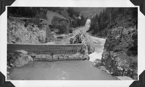
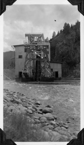
6. [Image] Sunbean Dam
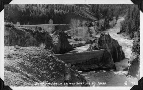 Sunbeam Dam on the Salmon River in Idaho, close to US 93
Citation -
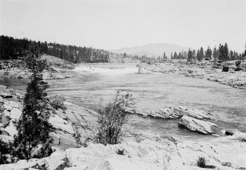
7. [Image] Stream survey
-
Abstract -- A variety of methods have been used to estimate the number of spring/summer Chinook salmon returning to spawn in Northeast Oregon streams. However, little quantitative information has been ...
Citation -
9. [Article] Historical Vegetation of Three Salmon-Bearing Watersheds in the Interior Columbia River Basin
Land use practices can be a contributing factor to environmental degradation and have been the focus of many ecological studies. One aspect that is less addressed is land use history and the effects that ...Citation -
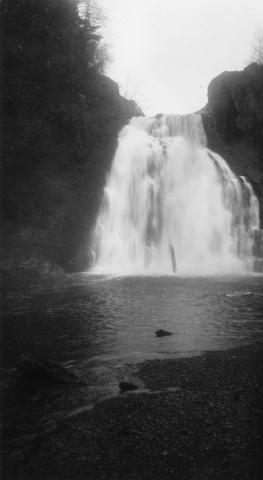
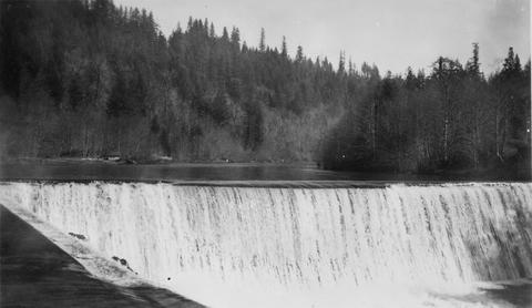
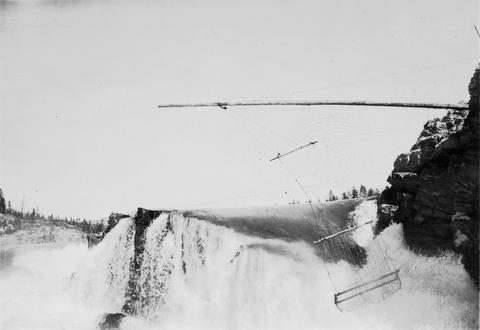
10. [Image] Salt Creek Falls
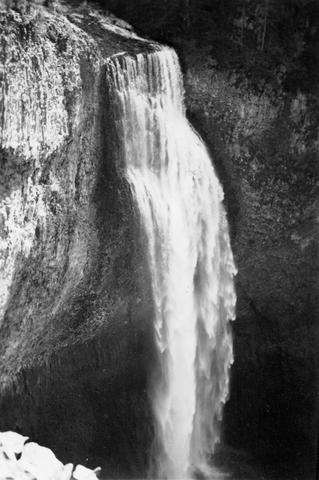 285 foot falls on Salt Creek, tributary to Middle Fork Willamette River;1937-09-10
Citation -
11. [Image] Salt Creek Falls
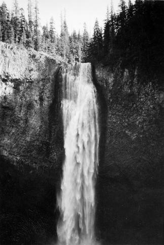 285 foot falls on Salt Creek, tributary to Middle Fork Willamette River;1937-09-10
Citation -
13. [Article] The influence of contemporary forest harvesting on summer stream temperatures in headwater streams of Hinkle Creek, Oregon
Stream temperature is a water quality parameter that directly influences the quality of aquatic habitat, particularly for cold-water species such as Pacific salmonids. Forest harvesting adjacent to a stream ...Citation -
14. [Article] Distribution and juvenile ecology of bull trout (Salvelinus confluentus) in the Cascade Mountains
Distribution and juvenile habitat use of bull trout (Salvelinus confluentus) were surveyed in selected areas of the Upper Willamette, Deschutes, upper Yakima, and upper Cedar River basins in Oregon and Washington ...Citation -
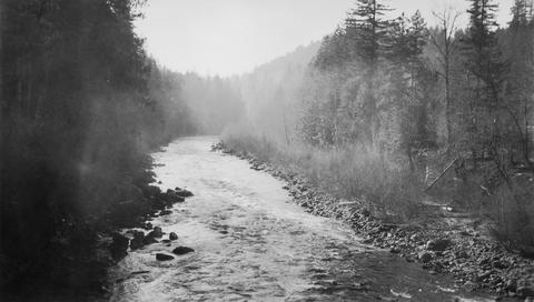
In the late 1970s, approximately 400 miles of streams were inventoried by the Prineville District of the Bureau of Land Management for in-stream and riparian condition. During the summer of 1994, the riparian ...
Citation -
16. [Article] The Impact of Fine Sediment on Stream Macroinvertebrates in Urban and Rural Oregon Streams
Urbanization, often characterized by high impervious surface area, can result in excessive inputs of fine sediments into urban streams. Excessive fine sediments can blanket the stream bed filling the interstitial ...Citation -
17. [Article] Upper Nehelam Habitat Assessments 2005
Abstract -- Project staff utilized the ODFW Aquatic Inventory protocol to assess habitat in selected small, medium, and large sized streams in the Upper Nehalem basin. In addition, the project personnel ...Citation -
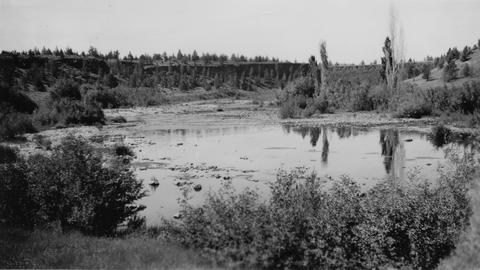
18. [Article] Upper Nehelam Habitat Assessments - Winter 2006 & 2007
Abstract -- Project staff utilized the ODFW Aquatic Inventory protocol to assess habitat in selected small, medium, and large sized streams in the Upper Nehalem basin. In addition, the project personnel ...Citation -
19. [Image] Boat survey
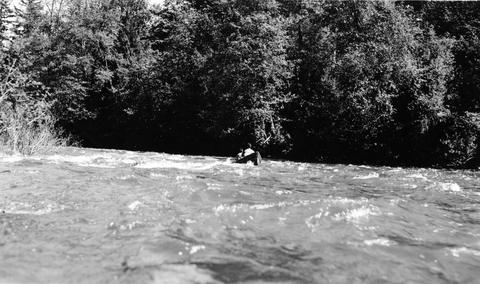 Boat survey on Coast Fork Willamette River near Saginaw, Oregon;1938-06
Citation -
20. [Image] Sunbean Dam
 Upstream side of the Sunbeam Dam. Yankee Fork enters on left from beneath bridge
Citation -
21. [Article] Hydrologic integration of forest roads with stream networks in two basins, western Cascades, Oregon
This study assessed how logging-access roads may have contributed to observed historical increases in peak discharges associated with small and large logged basins in the western Cascades of Oregon. The ...Citation -
Abstract -- This is a progress report on the lake and stream survey being conducted on the Mt. Hood National Forest. The survey is being carried on under the joint cooperative agreement between the U.S. ...
Citation -
23. [Article] Luckiamute Rapid Bio-Assessment
Abstract -- The 2011 Rapid Bio-Assessment inventory of the Luckiamute Watershed was a replicate inventory that attempted to target the most productive salmonid habitats in the basin. This was the fourth ...Citation -
The Natural Resources Division (NRD) of the Confederated Tribes of Grand Ronde (CTGR), in cooperation with the Bureau of Indian Affairs (BIA), proposes the regeneration harvest and commercial thinning ...
Citation -
25. [Article] Potential Impacts of Climate Change on Flood-Induced Travel Disruptions: A Case Study of Portland, Oregon, USA
This study investigated potential impacts of climate change on travel disruption resulting from road closures in two urban watersheds in the Portland, Oregon, metropolitan area. We used ensemble climate ...Citation -
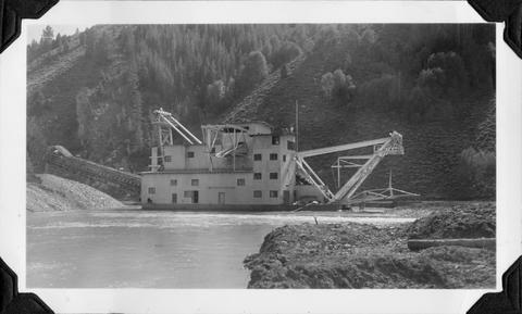
26. [Image] Yankee Fork Dredge
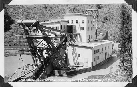 Gold dredge on Yankee Fork of Salmon River It was the largest dredge in Idaho Dredge was reputed to be recovering $10,000 in flour gold each week
Citation -
27. [Image] Snagging for chinook salmon
 Indian snagging for chinook salmon at Kettle Falls
Citation -
28. [Image] Upper Kettle Falls on the Columbia River
-
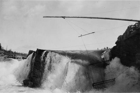
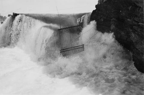
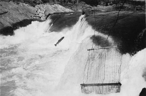
29. [Image] Jump trap at Kettle Falls
 Photo showing "jump trap" at Kettle Falls
Citation -
30. [Image] Fishing for whitefish
 Fishing for whitefish on the Columbia River at Kettle Falls
Citation -
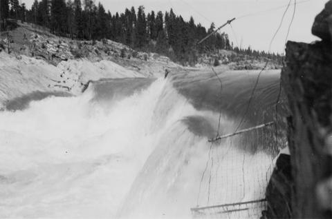
32. [Image] Indian jump trap
 Indian "jump-trap" on Kettle Falls for steelhead and salmon
Citation -
33. [Image] Youngs River near Astoria, Oregon
-
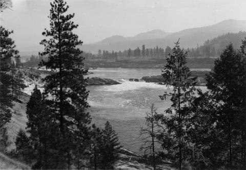
34. [Image] Kettle Falls on the Columbia River
-
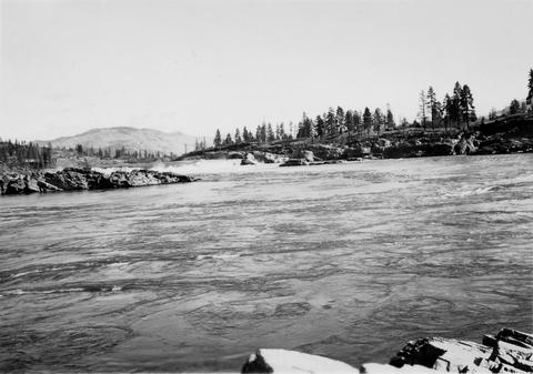
35. [Image] Upper Kettle Falls on the Columbia River
-
36. [Image] Jump trap at Kettle Falls
-
37. [Image] Jump trap at Kettle Falls
-
38. [Image] Jump trap at Kettle Falls
-
39. [Image] Grande Ronde River
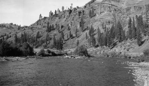 Looking upstream from bridge at Palmer Junction, Oregon
Citation -
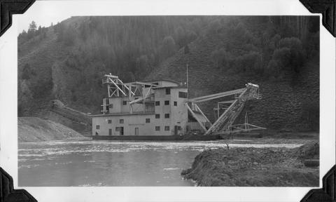
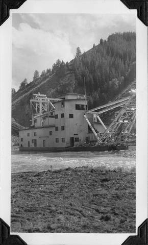
40. [Image] Yankee Fork Dredge
 Gold dredge on Yankee Fork of Salmon River It was the largest dredge in Idaho Dredge was reputed to be recovering $10,000 in flour gold each week
Citation -
41. [Image] Yankee Fork Dredge
 Gold dredge on Yankee Fork of Salmon River It was the largest dredge in Idaho Dredge was reputed to be recovering $10,000 in flour gold each week
Citation -
42. [Image] Yankee Fork Dredge
 Gold dredge on Yankee Fork of Salmon River It was the largest dredge in Idaho Dredge was reputed to be recovering $10,000 in flour gold each week
Citation -
43. [Image] Marmot Dam on the Sandy River
-
44. [Image] Steelhead jumping the jump trap
 Steelhead jumping the jump trap against Kettle Falls on the Columbia River
Citation -
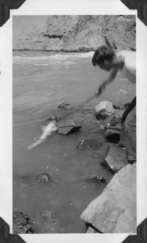
45. [Image] Boys fishing
 Landing a 29 1/2" male chinook salmon at Sunbeam Dam on the Salmon River
Citation -
46. [Image] Snagging chinook salmon
 Hauling 38 1/2 inch female chinook salmon from pool below Sunbeam Dam with gaff Fish had been hooked by snagging
Citation -
47. [Image] Yankee Fork Dredge
 Gold dredge on Yankee Fork of Salmon River It was the largest dredge in Idaho Dredge was reputed to be recovering $10,000 in flour gold each week
Citation -
48. [Image] Jump trap at Kettle Falls
 Jump trap at Kettle Falls for steelhead and salmon
Citation -
49. [Image] Entrance of fish ladder on Marmot Dam
-
50. [Image] Boys with salmon
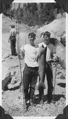 38 1/2" female chinook salmon, caught by snagging at Sunbeam Dam
Citation