Search
« Previous | 1 - 100 of 1,838 | Next »
Search Results
-
Adsorptive bubble-separation processes are used to remove adsorptive contaminants from wastewater. A mathematical model was developed for the adsorptive bubble separation processes in a countercurrent ...
Citation -
A method has been developed for the continuous automated monitoring of cardiac output in adult rainbow trout. Average cardiac output measured under control conditions and varied environmental conditions ...
Citation -
3. [Article] Thesis Appendices.zip
-
Water-source and ice-maker heat pumps share many characteristics. However, each presents different technical difficulties that have prevented them from being used more widely. In a water-source heat pump ...
Citation -
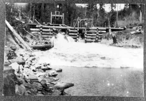
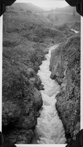
5. [Image] Log dam with water flowing through
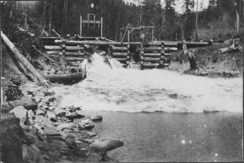 Log dam with water flowing through
Citation -
6. [Article] Numerical computation of free surface water flow
The present thesis is a report of investigations on a model for computing the water flow in the wave tank of the OSU Wave Laboratory. A wave board, established at one end of the 100 m long, 4 m wide and ...Citation -
August 3, 1908
Citation -
8. [Article] Estimating water flow rates
Declared out of print December 2009. Facts and recommendations in this publication may no longer be valid. Please look for up-to-date information in the OSU Extension Catalog: http://extension.oregonst...Citation -
9. [Article] Investigations into the Regional and Local Timescale Variations of Subglacial Drainage Networks
Subglacial water plays an important role in the regulation of an ice sheet's mass balance. It may be the dominant control on the velocities of ice streams and outlet glaciers on scales of months to millennia. ...Citation -
11. [Article] Statistical Analysis for Groundwater / Surface Water Interaction at a Drinking Water Well
Drinking water at a certain groundwater well is located at the confluence of a north fork and south fork of a major river. Data was collected to determine if the well is under direct influence by surface ...Citation -
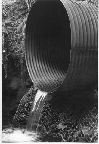
12. [Image] Culvert with small water flow
-
13. [Image] Log dam with water flowing through
-
14. [Image] WCPA 170E-12
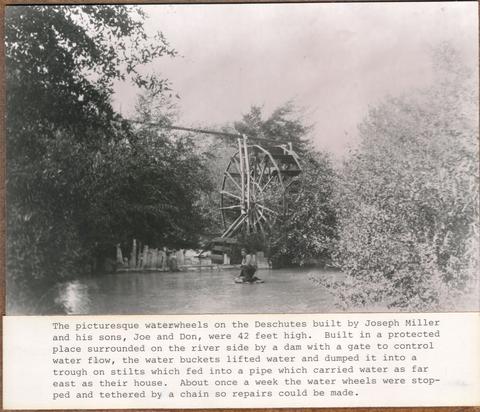 The picturesque waterwheels on the Deschutes built by Joseph Miller and his sons, Joe and Don, were 42 feet high. Built in a protected place surrounded on the river side by a dam with a gate to control ...
Citation -
15. [Article] Effects of estuarine circulation patterns and stress on the migratory behavior of juvenile salmonids (Oncorhynchus sp.)
For the first objective of this thesis, we attempt to understand the role of water flow and directionality in determining steelhead (Oncorhynchus mykiss) and spring/summer and fall Chinook (O. tschawytscha) ...Citation -
16. [Article] Impact of microbial growth on water flow and solute transport in unsaturated porous media
This is the publisher’s final pdf. The published article is copyrighted by American Geophysical Union and can be found at: http://sites.agu.org/.Citation -
17. [Article] Report on "Yaquina River" : Investigation sponsored by Oregon State Fish Commission, July, 1936
Reports on potential sites for a salmon hatchery on the Yaquina River. "Each tributary has been carefully studied and special attention given to those creeks on which possible hatchery sites were found. ...Citation -
18. [Article] Friction losses for water flowing in non-circular ducts
Friction factors were measured for water flowing in ducts made up of two rods held between two flat plates. Three rod diameters of 0.50, 1.00 and 1.50 inches were used. The spacings between rods varied ...Citation -
19. [Image] Scenes on the Umatilla River; PH036_5737
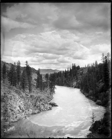 An outside photograph of what has been identified as the Umatilla River in Oregon. The river flows between two embankments of fir trees. The right embankment contains a high density of fir trees, and ...
Citation -
20. [Article] Incipient boiling and burnout heat flux for subcooled water flowing in annuli containing heated concentric wires
Incipient boiling and burnout heat fluxes were studied for sub-cooled forced convection annular flow. Small wires varying from 0.010 to 0.020 inch in diameter were used as the inner core of the annulus and ...Citation -
21. [Image] Gerber Dam - leaks from construction joints
KP-2215-R2 - Klamath Project, Gerber Dam. Downstream face of spillway showing leaks from construction joints and water flowing along downstream face of dam. California Projects; July 14, 1953; Photo by ...Citation -
Abstract -- Rickreall Creek is a 4th order tributary of the Willamette River in Polk County, Oregon (Mattson and Gallagher 2001). Previous fish sampling had indicated a high percentage of exotic fishes ...
Citation -
23. [Image] LANGELL VALLEY DIVISION - North Canal
KP-2599-R2-Klamath Project, LANGELL VALLEY DIVISION - North Canal. Looking northwest at Station 451. Emulsion and water flowing in empty canal; April 27, 1961; Photo by K.J. GreeneCitation -
24. [Image] Gerber Dam
CN-12-201-542NA Klamath Project. View of water flowing over Gerber spillway at 60 cfs from area below left abutment; May 22, 1975; USBR photo by A. L. BardalCitation -
25. [Article] Observations of Fish and Shrimp Behavior in Ocean Shrimp (Pandalus jordani) Trawls, Information Reports 2003-03
Abstract -- Underwater video observations of ocean shrimp (Panda/us jordani) and fish inside shrimp trawls and interacting with bycatch reduction devices (BRDs) were summarized. Ocean shrimp behavior inside ...Citation -
26. [Article] Water rights and summer stream conditions
-
The work upon which this publication is based was supported in part by funds provided by the Office of Water Research and Technology, U.S. Dept. of the Interior, Washington D.C., as authorized by the Water ...
Citation -
29. [Article] Spatial patterns in land use and water quality in the Tillamook Bay Watershed : a GIS mapping project
No publishing date on piece.Citation -
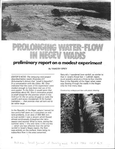
33. [Image] Prolonging water-flow in Negev Wadis
-
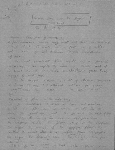
34. [Image] Water Flow in the Negev Riverbeds
-
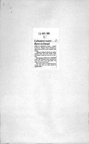
36. [Image] Lebanese Water Flows to Israel
-
37. [Article] Squaw Creek Monitoring Project #97-211
Abstract -- The project included watershed education of 400 students; water quality monitoring of water flow, temperature, dissolved oxygen, bacteria, and macro-invertebrates; riparian surveys; fish surveys; ...Citation -
42. [Article] A physical description of the Salmon River estuary
A student report for a Civil Engineering 572 class, this document is an extensive description of the Salmon River estuary, including water flow, quality, predictions for the estuary’s future, and numerous ...Citation -
43. [Image] The main business district (the "loop"), Chicago
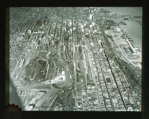 Looking north, from 20th Street to beyond Randolph Street. The Chicago Drainage Canal, its source in Lake Michigan and its north and south branches are well shown. Water flows from Lake Michigan through ...
Citation -
44. [Image] 500 ft. below great north glacier in early P.M. when water flows heavier - Cascade N. F.
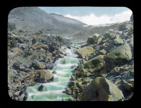 Some of the glacial streams have dry channels in the early morning but as the ice begins to melt the stream grows until by evening it is a regular torrent. The glacier can be seen in the background.
Citation -
45. [Image] Canyon near mouth of Klickitat River
 The water flow is about 782 feet per second
Citation -
Data collected from the Fern Lake watershed between 1958 and 1971 include measurements of the rate of flow of water into the lake through a single inlet stream. The objective of the work presented here ...
Citation -
47. [Article] Water Flow through Temperate Glaciers
Understanding water movement through a glacier is fundamental to several critical issues in glaciology, including glacier dynamics, glacier-induced floods, and the prediction of runoff from glacierized ...Citation -
48. [Article] Sedimentologic changes in the deposits of an evolving lahar-flood in 2006, Hood River Basin, Mount Hood, Oregon
Over a span of six days from November 2nd -- 7th, 2006 approximately 43 cm of precipitation fell over the Hood River Basin in Oregon. A lahar was initiated on the Eliot Branch of the Middle Fork Hood River ...Citation -
Experiments were carried out to study the movement of water and halide anions in perched water tables or saturated zones in the soil and upper rock mantle of eight different experimental sites located on ...
Citation -
50. [Article] Tracing Pacific water in the North Atlantic Ocean
copyrighted by American Geophysical UnionCitation -
This is a report of data and observations gathered during the Lower Deschutes Flow Study. The authors describe the area’s geography, topography, and geology. The work covers Deschutes River stream discharges ...
Citation -
52. [Article] Automated water balance procedure for large-scale experimental databases based on soil moisture
Based on the determination of the zero-flux plane, a water balance procedure for large-scale experimental databases was automated to estimate the soil water balance based on soil water content distribution ...Citation -
Copyrighted by American Geophysical Union.
Citation -
P12-201-4540NA Klamath Project, OR-CA. Plant E Outlet Transition Bridge -- Water flowing from base of the left retaining wall at Plant E. Flow was a by-product of jetting operations for Plant E west ...
Citation -
55. [Article] A new multisource and high-frequency approach to measuring δ²H and δ¹⁸O in hydrological field studies
This is the publisher’s final pdf. The published article is copyrighted by American Geophysical Union and can be found at: http://onlinelibrary.wiley.com/journal/10.1002/%28ISSN%291944-7973.Citation -
56. [Article] The development of a hydrological model of the Walla Walla Basin using Integrated Water Flow Model
The Walla Walla basin lies in an arid region of Eastern Washington and Oregon. A large portion of the area is devoted to agricultural production, relying on irrigation water diverted from the Walla Walla ...Citation -
P12-201-4441 NA Klamath Project, OR-CA. Center Canal Flume--View of outlet transition south wall after corntractor forces stopped source of water flow. Visquene was laid next to the outlet transition ...
Citation -
58. [Image] CLEAR LAKE- Ground Fracture - Southwest Shore, Section 16, T. 46 N., R. 7 E., M.D.M. - D. E.
KP-2502-R2- Klamath Project- CLEAR LAKE- Ground Fracture - Southwest Shore, Section 16, T. 46 N., R. 7 E., M.D.M. - D. E. Close-up of the water inlet to the fracture showing how the water flows to the ...Citation -
P12-201-4568NA Klamath Project, OR-CA. Ady Canal -- Siphon hydrostatic test -- Plant FF. Water in CMP was held at head of 10" using 192 GMP Homelite pump regulated by means of valve on downstream side ...
Citation -
P12-201-4438 NA Klamath Project, OR-CA. Center Canal Flume--View of flume south wall near pile cap where water exited after piping along fllume wall. This water flowed into the void adjacent to the outlet ...
Citation -
CONIFER simulates water, carbon, and energy dynamics of a coniferous forest. The model consists of 29 nonlinear difference equations. Driving variables include air temperature, dew point temperature, ...
Citation -
KP-2585-R2-Klamath Project - TULE LAKE DIVISION, SUMP 2, Specifications DC-5307, R-Canal. Looking downstream from Station 37+07 of the R-Canal. Water flowing at the check at Station 37+36; January 18, ...
Citation -
63. [Image] Gerber Dam
CN-12-201-533NA Klamath Project. View from right abutment of Gerber Dam, showing water flowing over spillway into plunge pool at base of Dam, 60 cfs.; May 22, 1975; USBR photo by A. L. BardalCitation -
64. [Image] Gerber Dam
CN-12-201-534NA Klamath Project. View of water flowing over spillway into plunge pool at base of Gerber Dam, from right side of plunge pool; May 22, 1975; USBR photo by A. L. BardalCitation -
65. [Image] Gerber Dam
CN-12-201-535NA Klamath Project. View of water flowing over spillway into plunge pool at base of Gerber Dam, from right side of plunge pool; May 22, 1975; USBR photo by A. L. BardalCitation -
66. [Image] Gerber Dam
CN-12-201-536NA Klamath Project. View of water flowing over spillway into plunge pool at base of Dam, from area below left abutment; May 22, 1975; USBR photo by A. L. BardalCitation -
67. [Image] Gerber Dam
CN-12-201-537NA Klamath Project. View of water flowing over spillway into plunge pool at base of Dam, from area below left abutment; May 22, 1975; USBR photo by A. L. BardalCitation -
68. [Image] Gerber Dam
CN-12-201-543NA Klamath Project. View from Dam crest of water flow over Gerber spillway from left side. Spill was 60 cfs.; May 22, 1975; USBR photo by A. L. BardalCitation -
69. [Image] Sealing, Repair and Modification of Gerber Dam -Specs. 200C-888 - Dante Engineers & Contractors
CN-12-201-578NA Klamath Project - Oregon-California. View of downstream face of Gerber Dam. Note new footbridge in foreground. Note water flowing over rock weir which was constructed under this specification ...Citation -
The objective of this paper is to describe the design of a real-time system to control two hydroelectric power plants by a digital computer. The two controlling relations are stated as the continuity of ...
Citation -
The noble crayfish fishery in the Ljungan river system in Sweden has been subjected to two major shocks; hydropower development in the 1970s, which reduced water flow throughout the system with attendant ...
Citation -
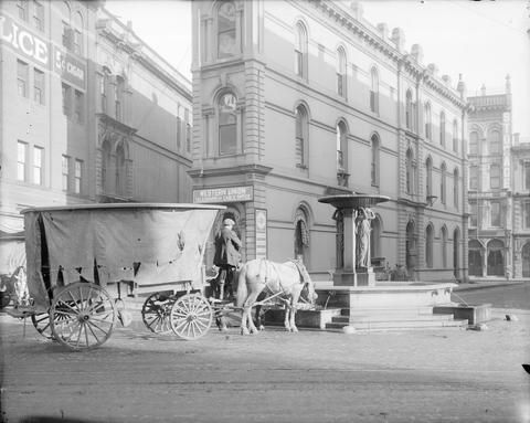 A horse-drawn wagon and driver situated in front of a fountain identified as the Skidmore Fountain. Two horses harnessed to the wagon drink from the fountain as the driver looks on. He is dressed in a ...
Citation -
73. [Article] Sedimentation within the Cocos Gap, Panama Basin
The Cocos Gap is a deeper portion, or saddle, of the Cocos Ridge and forms part of the western boundary of the Panama Basing It is probably typical of saddles within most submarine ridges, In order to ...Citation -
Changes in the concentrations of dissolved ammonia (NH4+1), nitrate (NO3-1), organic nitrogen (DON) were monitored along ground water flow paths to determine the importance of the ground water system to ...
Citation -
The gravel aquifer of the Oregon side of Walla Walla River Basin has a strong hydrologic connection to surface water through a series of springs, unlined irrigation canals, the Walla Walla River, numerous ...
Citation -
76. [Article] Change in Hydraulic Conductivity of Expansive Soils
Swelling soils cause millions of dollars of damage to buildings every year in the Unites States alone. One essential piece to understanding these soils is to understand how water moves through them. Hydraulic ...Citation -
77. [Article] Conservation of Mass in a Piping Network
Using returnable bottles within a brewery setting can lower costs associated with purchasing new bottles as well as reduce the energy associated with recycling glass bottles. A commercial dishwasher was ...Citation -
A cooling tower system was built and fouling resistances were studied for cooling water flowing over a heated tubular surface. The cooling water studied was formulated in an effort to match industrial cooling ...
Citation -
79. [Article] Design and testing of intrustive conductivity probes for the measurement of two-phase flow parameters
This thesis examines two techniques for measuring two-phase flow parameters in an air/water system using intrusive conductivity probes. Specifically, the theoretical derivation for measuring void fraction ...Citation -
A video explaining estuarine flow concepts was produced for a target audience of high school students in physics and earth science classes. This honors thesis explains the video production and concepts ...
Citation -
81. [Article] Analysis and numerical simulation of the ground water system at the Bonneville navigation lock site, Oregon
As part of the new navigation lock for Bonneville Dam a new water source for the Bonneville Fish Hatchery must be supplied. The hatchery is located on the Oregon side of the Columbia River downstream of ...Citation -
Locations of subglacial lakes discovered under fast-moving West Antarctic ice streams tend to be associated with topographic features of the subglacial bed or with areas that have strong variations in ...
Citation -
83. [Article] Interactions between microbial dynamics, water flow, and solute transport in unsaturated porous media
Bioremediation in the vadose zone is unpredictable because of poor understanding of factors influencing microbial growth in this environment. A lab-scale experimental system was developed to examine, noninvasively, interactions ...Citation -
The following report Introduces a documentation scheme for flow oriented ecosystem models and shows its application to a carbon-water model developed within the coniferous biome. This documentation scheme has ...
Citation -
Water source heat pumps are increasingly being used for residential and commercial space heating. Typically, these heat pumps are capable of both heating and cooling, and historically the design emphasis has ...
Citation -
87. [Article] Pudding River Watershed Assessment, 2006
Abstract -- Northeast of Salem, five large streams flow west out of the Cascade Mountains to join the Pudding River as it meanders north across the broad Willamette Valley and to its confluence with the ...Citation -
The objective of this study was to develop a numerical model for the movement and fate of chlorinated phenols in groundwater. In the first part, a numerical model for several different equilibrium and ...
Citation -
89. [Article] Sub-regional detention siting : a methodology using GIS
The Mt. Scott watershed in northern Clackamas County, Oregon is an urban watershed that lies inside the Portland metropolitan urban growth boundary. Urbanization of the watershed began in the early 1970s ...Citation -
This is the publisher's version of record. The original submission is copyrighted by Cambridge University Press and can be found here: http://www.tos.org/
Citation -
This is the publisher’s final pdf. The published article is copyrighted by Cambridge University Press and can be found at: http://www.cambridge.org/home/home/item5655304/?site_locale=en_US.
Citation -
93. [Article] Turbulent Kinetic Energy Dissipation in Barrow Canyon
This is the publisher’s final pdf. The published article is copyrighted by the American Meteorological Society and can be found at: http://www.ametsoc.org/pubs/journals/jpo/index.html.Citation -
94. [Article] Physical parameters as tracers of Columbia River water
Hydrographic and bathythermograph data taken off the Oregon coast during a two week period in August of 1969 were analyzed to determine if heat content and mixed layer depth may be used as indicators of ...Citation -
95. [Article] Hydrothermal fluid circulation through the sediment of Crater Lake, Oregon: Pore water and heat flow constraints
Copyrighted by American Geophysical Union.Citation -
Three factors were found to be significantly correlated with the fluctuations and trends in silver salmon production in Oregon. Logging was found to adversely affect the runs of salmon in later years. ...
Citation -
Abstract -- The Watershed Restoration Summaries were developed by local watershed councils and other stakeholders to help identify priorities for restoring fish and wildlife habitat and water quality throughout ...
Citation -
98. [Article] Conifer : a model of carbon and water flow through a coniferous forest : revised documentation
CONIFER simulates water, carbon, and energy dynamics of a coniferous forest. The model consists of 29 nonlinear difference equations. Measured driving variables include air temperature, dew point temperature, ...Citation -
Momentum transfer in an annular duct with upward gas-Iiquid flow was studied under the condition that the liquid flowed as a film only on the inner core of the annulus, the outer wall remaining dry. Previous ...
Citation -
100. [Image] Hydraulic mining near Talent
Men, women, children watching hydraulic mining; water flowing from wooden flume to left; water gushing from nozzle attached to long pipeline; children standing on pile of rock rubble (tailings) in center ...Citation