Search
« Previous | 1 - 100 of 114 | Next »
Search Results
-
1. [Article] The response of atmospheric nitrous oxide to climate variations during the last glacial period
To the best of our knowledge, one or more authors of this paper were federal employees when contributing to this work. This is the publisher’s final pdf. The published article is copyrighted by the American ...Citation -
This is the publisher’s final pdf. The published article is copyrighted by the American Geophysical Union and can be found at: http://www.agu.org/journals/gl/.
Citation -
3. [Image] Terminal Moraines
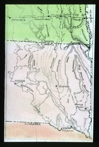 Image Description from historic lecture booklet: "The thick drift accumulated beneath the end of a valley glacier, or beneath the edge of an ice sheet, is a terminal moraine. At each halt of the receding ...
Citation -
4. [Article] A 37,000-year record of paleomagnetic and environmental magnetic variability from Burial Lake, Arctic Alaska
Burial Lake sediments from the Noatak Basin in the northwest Brooks Range of Arctic Alaska (68.43°N, 159.17°W, 21.5 m water depth) provide the oldest continuous lacustrine record of paleo-environmental ...Citation -
5. [Article] Postglacial Transient Dynamics of Olympic Peninsula Forests: Comparing Predictions and Observations
Interpreting particular climatic drivers of local and regional vegetation change from paleoecological records is complex. I explicitly simulated vegetation change from the late-Glacial period to the present ...Citation -
6. [Image] Glacial Period
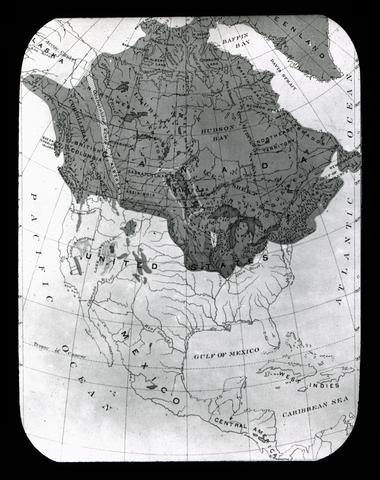 Image Description from historic lecture booklet: "The land waste and the land surfaces of the United States often resemble those found in a region of present glaciers. This is so widely true as to show ...
Citation -
A coupled climate-carbon cycle model and ice core CO2 data from the last glacial period are used to explore the impact of changes in ocean circulation on atmospheric CO2 concentrations on millennial time ...
Citation -
Physical-biological interactions in the Southern Ocean were investigated using remote sensing data from several different satellite sensors. Satellite sea surface temperature data were used to study the ...
Citation -
9. [Article] Atmospheric CO₂ and climate from 65 to 30 ka B.P.
This is the publisher’s final pdf. The published article is copyrighted by the American Geophysical Union and can be found at: http://www.agu.org/journals/gl/.Citation -
10. [Article] Terrigenous Fe input and biogenic sedimentation in the glacial and interglacial equatorial Pacific Ocean
Many ocean regions important to the global carbon budget, including the equatorial Pacific Ocean, have low chlorophyll concentrations despite high levels of conventional nutrients. Iron may instead by ...Citation -
11. [Article] Late Cenozoic Climate, Ice-sheet and Earth-surface Evolution Derived from Terrestrial and Marine Sedimentary Archives
The goals of this dissertation are centered on understanding changes in Earth surface and climate systems through the use of geologic proxies as records of past changes in these systems. Specifically, ...Citation -
Earth's climate and the concentrations of the atmospheric greenhouse gases carbon dioxide (CO2) and nitrous oxide (N2O) varied strongly on millennial timescales during past glacial periods. Large and rapid ...
Citation -
Calcium carbonate percentages at five Ceara Rise sites were estimated at 1- to 2-k.y. intervals over the past 5 m.y., using reflectance spectroscopy and magnetic susceptibility proxies. From these estimates ...
Citation -
14. [Article] Southern Ocean control of glacial AMOC stability and Dansgaard-Oeschger interstadial duration
Access to this item has been restricted by repository administrators at the request of the publisher until June 30, 2016.Citation -
15. [Article] On the origin and timing of rapid changes in atmospheric methane during the Last Glacial Period
This is the publisher’s final pdf. The published article is copyrighted by the American Geophysical Union and can be found at: http://www.agu.org/journals/gb/index.shtml.Citation -
16. [Article] Model of late Pleistocene-Holocene variations in rate of sediment accumulation : Panama Basin, eastern equatorial Pacific
The assumption of constant quartz accumulation for the deep-sea sediment core Y69-106P, taken in the Panama Basin, has been used to date the core and construct a sedimentation rate versus time curve for ...Citation -
17. [Article] The use of foraminiferal uranium/calcium ratios as an indicator of changes in seawater uranium content
We examine the utility of the uranium (U) content of planktonic foraminifera tests as an indicator of past changes in seawater U content. The U/Ca ratio in foraminifera from Atlantic and Caribbean cores ...Citation -
The three studies that comprise this dissertation seek to answer significant questions in paleoclimatology through unconventional applications of ice core greenhouse gas data. These studies involve different ...
Citation -
This is the publisher’s final pdf. The published article is copyrighted by the American Geophysical Union and can be found at: http://www.agu.org/journals/jgr/.
Citation -
20. [Article] A new mechanism for Dansgaard-Oeschger cycles
This is the publisher’s final pdf. The published article is copyrighted by American Geophysical UnionAmerican Geophysical Union and can be found at: http://publications.agu.org/journals/.Citation -
21. [Article] Silicic acid biogeochemistry in the Gulf of California: Insights from sedimentary Si isotopes
This is the publisher’s final pdf. The published article is copyrighted by American Geophysical Union and can be found at: [link to journal].Citation -
22. [Article] Glacial to holocene watermass and continental weathering reconstructions from the Southeast Pacific
Sediments of the central Chile margin record changes in ocean circulation and continental erosion associated with large–scale climate change. Here Antarctic– influenced Southern Ocean currents flow equatorward, ...Citation -
23. [Article] Cosmogenic ¹°Be chronology for the last deglaciation of the southern Scandinavian Ice Sheet
The goal of this dissertation is to develop a chronology of the retreat of the southern margin of the Scandinavian Ice Sheet (SIS) during the late Pleistocene using surface exposure dating with cosmogenic ...Citation -
24. [Article] Paleo-oceanography of the Gulf of California based on silicoflagellates from marine varved sediments
Plankton and surface sediment samples from the Gulf of California were analyzed to determine the present geographic distribution of silicoflagellate species in this area. Variations in the composition ...Citation -
The mesic forests distributed within the Rocky Mountains of northern Idaho are unique because many species contained within the forest are separated from their main distribution along the Pacific Northwest ...
Citation -
26. [Article] Past climate variability in southwestern Oregon and relationships with regional and hemispheric climate
This dissertation presents the results of three studies that assessed climate variability on short and long timescales in western United States. The growth of carbonate formations in caves (speleothems) ...Citation -
27. [Article] Holocene vegetation and fire history of the floristically diverse Klamath Mountains, northern California, USA
xiv, 227 p. : ill. (some col.) A print copy of this title is available through the UO Libraries under the call numbers: KNIGHT QE720.2.K53 B75 2008Citation -
To the best of our knowledge, one or more authors of this paper were federal employees when contributing to this work. This is the publisher’s final pdf. The published article is copyrighted by Macmillan ...
Citation -
29. [Article] Relative timing and variability of atmospheric methane and GISP2 oxygen isotopes between 68 and 86 ka
This is the publisher’s final pdf. The published article is copyrighted by the American Geophysical Union and can be found at: http://www.agu.org/journals/gb/index.shtml.Citation -
To the best of our knowledge, one or more authors of this paper were federal employees when contributing to this work. This is the publisher’s final pdf. The published article is copyrighted by the Nature ...
Citation -
31. [Article] The WAIS Divide deep ice core WD2014 chronology - Part 2: Annual-layer counting (0-31 ka BP)
This is the publisher’s final pdf. The published article is copyrighted by the author(s) and published by Copernicus Publications on behalf of the European Geosciences Union. The published article can ...Citation -
This research documents the Holocene glacial history of Mount Hood, Cascade Mountains, Oregon by analyzing a set of three lateral moraines abutting Eliot Glacier, the largest glacier on the mountain. This ...
Citation -
The Olympic Peninsula, Washington, USA, currently holds 184 alpine glaciers larger than 0.01 km² and their combined area is 30.2 ± 0.95km². Only four glaciers are >1km² and 120 of the others are -¹ (1900–80) ...
Citation -
Landforms sculpted by mass movements comprise much of the landscape in the Middle Santiam study area. Bedrock in the area is mostly basalt and andesite flows and varied volcaniclastic rocks of the Little ...
Citation -
ill.; "July 1985."; "Final report on National Science Foundation Grant DEB-8109813"-- Cover; Includes offprints of several project-related publications by the authors; Includes bibliographical referen...
Citation -
36. [Article] Abrupt deglacial climate changes in the North Pacific and implications for climate tipping points
Paleoclimate archives have revealed abrupt climate events that are superimposed on more gradual climate changes throughout the last glacial and deglacial periods. The underlying causes of such rapid climate ...Citation -
Imprint from transmittal sheet; Distributed to depository libraries in microfiche; Shipping list no.: 97-0071-M; One ill. on 1 folded leaf in pocket; Includes bibliographical references
Citation -
Abstract Quigley, Thomas M.; Arbelbide, Sylvia J., tech. eds. 1997. An assessment of ecosystem components in the interior Columbia basin and portions of the Klamath and Great Basins: volume 2. Gen. Tech. ...
Citation -
TABLE OF CONTENTS PART I INTRODUCTION 18 - 11 History and ethnology 18 Irrigated area table 19 Cultural geography 19 General physiographic features 262e . .3 Physiographic areas and farming 1d CLIMATE ...
Citation -
40. [Article] Basal temperature evolution of North American ice sheets and implications for the 100-kyr cycle
This is the publisher’s final pdf. The published article is copyrighted by the American Geophysical Union and can be found at: http://www.agu.org/journals/gl/.Citation -
41. [Article] Hydrologic Response to Extreme Warm and Cold Summers in the McMurdo Dry Valleys, East Antarctica
The meteorological characteristics and hydrological response of an extreme warm, and cold summer in the McMurdo Dry Valleys are compared. The driver behind the warmer summer conditions was the occurrence ...Citation -
42. [Article] Cenozoic biogenic silica sedimentation in the Antarctic Ocean, based on two deep sea drilling project sites
The Antarctic Ocean during the Cenozoic experienced four periods of increased surface productivity: the Middle Eocene; the beginning of the Miocene; the Middle Miocene; and near the Miocene-Pliocene boundary. ...Citation -
Approximately 5,500 years ago a discreet period of wetter and cooler environmental conditions prevailed across the southern Columbia Plateau. This period was marked by the first prominent episodes of erosion ...
Citation -
44. [Article] The changing glaciers of Mt. Hood, Oregon and Mt. Rainier, Washington : implications for periglacial debris flows
Mountain glaciers are receding worldwide with numerous consequences including changing hydrology and geomorphology. This study focuses on changes in glacier area on Mt. Hood, Oregon and Mt. Rainier, Washington ...Citation -
High-resolution records of δ¹⁸0 and relative abundances of planktonic foraminifers were generated for ODP Leg 138 Site 846 for the past 800 k.y., with an average sampling interval of 3.6 k.y. The time ...
Citation -
46. [Article] Increased dissolved terrestrial input to the coastal ocean during the last deglaciation
Copyrighted by American Geophysical Union.Citation -
47. [Article] Sediment storage and delivery on Holocene glacial timescales, Granite Creek, southern Alaska
Sediment storage in and release from the Granite Creek catchment over Holocene timescales is modulated by the fluctuations of Tana Glacier, which periodically blocks the outlet of Granite Creek. Little ...Citation -
48. [Article] The Holocene History of Nares Strait: Transition from Glacial Bay to Arctic-Atlantic Throughflow
This is the publisher's version of record. The original submission is copyrighted by Oceanography Society and can be found here: http://www.tos.org/Citation -
49. [Article] Thorium-230 normalized particle flux and sediment focusing in the Panama Basin region during the last 30,000 years
Copyright 2007 by the American Geophysical UnionCitation -
Multiproxy geologic records of δ18O and Mg/Ca in fossil foraminifera from sediments under the Eastern Pacific Warm Pool (EPWP) region west of Central America document variations in upper ocean temperature, ...
Citation -
Over 10,000 feet of marine and nonmarine Late Cretaceous sedimentary rocks are exposed within a 110 square mile area in northeastern Teton County, Wyoming. An additional 1400 feet of nonmarine Paleocene ...
Citation -
52. [Article] Palynological Perspectives on Younger Dryas to Early Holocene Human Ecology at Paisley Caves, Oregon
The Younger Dryas climatic event is a global phenomenon associated with a 1,000 year return to glacial conditions during the late Pleistocene period between 12,800 and 11,500 cal BP. Because of its significant ...Citation -
53. [Article] Structure and stratigraphy of the Sheep Mountain area, Centennial Range, Montana-Idaho
The thesis area includes 44 square miles of the Centennial Range in Beaverhead County, Montana, and Clark County, Idaho. The rocks exposed in the area range in age from Precambrian to Recent and have been ...Citation -
54. [Article] Late Quaternary sedimentation and geologic history of the North Willamette Valley, Oregon
Late Quaternary sediments in the Willamette Valley, Oregon, include a unit of chiefly silt and fine sand, the Willamette Silt Formation. Previous workers have (1) Assigned the Willamette Silt different ...Citation -
The objective of this research is to determine the correlation of lacustrine micro-fossils in Lake Tanganyika to changes in climate and lake levels during the Late Pleistocene and Early Holocene. Lake ...
Citation -
This study utilizes a multidisciplinary research approach integrating the sciences of archaeology, geology, pedology and paleoclimatology. Deeply stratified and radiocarbon dated sedimentary sequences ...
Citation -
The thesis area consists of 65 square miles located in the southeastern part of Meagher County, Montana. Ranging in age from Precambrian to Quaternary, the strata exposed in the area have a total thickness ...
Citation -
58. [Article] Stratigraphy and structure of part of the southern Madison Range, Madison and Gallatin Counties, Montana
The thesis area consists of 42 square miles located in Madison and Gallatin counties, Montana, in the southern part of the Madison Range. The strata exposed in the area range in age from Precambrian to ...Citation -
59. [Article] Calcium carbonate, organic carbon, and quartz in hemipelagic sediments off Oregon : a preliminary investigation
An analysis of the amounts of calcium carbonate, organic carbon, quartz, and the rates of sediment accumulation in hemipelagic sediments off Oregon has revealed that the accumulation rates of the total sediment, ...Citation -
60. [Article] Variable relationship between accumulation and temperature in West Antarctica for the past 31,000 years
Access to this item has been restricted by repository administrators at the request of the publisher until October 28, 2016.Citation -
61. [Article] Simulating past, present, and future changes in ENSO : a model evaluation and data-model comparison
This thesis presents the results of a formal evaluation of a new AOGCM, GENMOM, demonstrating its ability to simulate present-day climate and ENSO dynamics. The model is applied to simulate climate for ...Citation -
This is the publisher’s final pdf. The published article is copyrighted by the author(s) and published by Elsevier. The published article can be found at: http://www.journals.elsevier.com/quaternary-sc...
Citation -
A stable-isotope stratigraphy at Site 846 (tropical Pacific, 3°06'S, 90°49'W, 3307 m water depth), based on the benthic foraminifers Cibicides wuellerstorfi and Uvigerina peregrina, yields a high-resolution ...
Citation -
The exchange of carbon on earth is one of the fundamental processes that sustains life and regulates climate. Since the onset of the Industrial Revolution, the burning of fossil fuels and anthropogenic ...
Citation -
65. [Article] Climate Change Impacts on Precipitation Extremes over the Columbia River Basin Based on Downscaled CMIP5 Climate Scenarios
Hydro-climate extreme analysis helps understanding the process of spatio-temporal variation of extreme events due to climate change, and it is an important aspect in designing hydrological structures, ...Citation -
Lupinus lepidus (Fabaceae) contains many morphologically divergent varieties and was restricted in its range during the last period of glaciation. A combination of phylogenetic (with the trnDT and LEGCYC1A ...
Citation -
Little Ice Age (LIA) deposits are recognized on Mt. Tbielsen, southern Oregon Cascades (43° 9' N, 122° 3' W), based on particle morphology and relative position. The initial advance, Lathrop 1, created ...
Citation -
Paleoclimate records from glacial Indian and Pacific oceans sediments document millennial-scale fluctuations of subsurface dissolved oxygen levels and denitrification coherent with North Atlantic temperature ...
Citation -
Columbia Glacier, Alaska’s most rapidly retreating body of ice, provides a compelling insight into the fragile state of tidewater glaciers worldwide. Catastrophic retreat of the glacier’s terminal ice ...
Citation -
This is the publisher’s final pdf. The published article is copyrighted by the author(s) and published by Copernicus Publications on behalf of the European Geosciences Union. The published article can ...
Citation -
Mount Shasta, the southernmost stratovolcano in the Cascade Range (41.4°N) has frequently produced lahars of various magnitudes during the last 10,000 yr. These include large flows of eruptive origin, ...
Citation -
Throughout the Holocene, appreciable changes in bathymetry are hypothesized to have resulted in large changes to tidal datums in coastal and estuarine areas. An understanding of tidal change is an important ...
Citation -
Although plant remains, such as opal phytolith and charcoal analyses, have been used since the beginning of the 20th century to reconstruct past environments by ecologists and botanists, only recently ...
Citation -
74. [Article] Stratigraphy of the silurian and devonian rocks, Northwestern Pend Oreille County, Washington
Silurian and Devonian rocks are exposed for approximately 8 square kilometers inthe KootenayArc structural province of northeastem Washington. These Middle Paleozoic rocks overlie the Upper Cambrian Metaline ...Citation -
Paleoclimate records from glacial Indian and Pacific oceans sediments document millennial-scale fluctuations of subsurface dissolved oxygen levels and denitrification coherent with North Atlantic temperature ...
Citation -
76. [Article] Stratigraphy and structure of the Greenstone Mountain area, Beaverhead County, Montana
The Greenstone Mountain area, which includes the Utopia mining district, is located in the foothills of the Pioneer Range, Beaverhead County, Montana. Approximately 12, 600 feet of Paleozoic and Mesozoic ...Citation -
This dissertation explores one overarching question relevant to the paleoclimate of the latest Pleistocene glacial cycle (approximately the last 130,000 years): “How did spatial and temporal evolution ...
Citation -
Abstract -- Bull trout have been adversely affected by many land, water, and fisheries management activities throughout the range of the species. Degraded and fragmented habitat and negative interactions with ...
Citation -
79. [Article] Present-day and future contributions of glacier melt to the Upper Middle Fork Hood River : implications for water management
Glaciers are effective reservoirs because they moderate variations in runoff and supply reliable flow during drought periods. Thus, there needs to be a clear understanding of the influence of glacier runoff ...Citation -
80. [Article] Hood River Bull Trout Abundance, Life History, and Habitat Connectivity, 2007 Progress Reports 2007
Abstract -- Hood River bull trout are thought to exist as two independent reproductive units (USFWS 2004), known as local populations (Rieman and McIntyre 1995). The Clear Branch local population is isolated ...Citation -
81. [Article] Benthic foraminifer stable isotope record from Site 849 (0 - 5 Ma) : local and global climate changes
Benthic foraminifer and δ¹³C data from Site 849, on the west flank of the East Pacific Rise (0°11'N, 110°3l'W; 3851 m), give relatively continuous records of deep Pacific Ocean stable isotope variations ...Citation -
82. [Article] Systematics of the salamander genus Dicamptodon strauch (Amphibia:Caudata:Ambystomatidae)
Dicamptodon is the single, extant genus of the ambystomatid subfamily Dicamptodontinae. Two species, D. ensatus (Eschscholtz) and D. copei Nussbaum are recognized. D. ensatus is found in the forested, ...Citation -
The forest alpine tundra ecotone (FTE, also known as alpine treeline or subalpine parkland), is a conspicuous feature of mountain landscapes throughout the world. Climate change-driven increases in temperature ...
Citation -
84. [Article] Man and the land : an ecological history of fire and grazing on eastern Oregon rangelands
Ecological and historical information are combined in examining the environmental influence of fire and grazing on rangelands in eastern Oregon through time. Competitive relationships between herbaceous ...Citation -
Harlequin ducks (Histrionicus histrionicus) were observed during the summers of 1979 and 1980 in Sawmill Bay, northeast Prince William Sound, Alaska. Harlequins were associated with a short, medium gradient, non-glacial ...
Citation -
The Breitenbush Hot Springs area lies on the boundary of folded middle to late Tertiary Western Cascade rocks and younger High Cascade rocks. Within the mapped area the Western Cascade rocks are represented ...
Citation -
87. [Article] Spatial and Temporal Variability of Glacier Melt in the McMurdo Dry Valleys, Antarctica
In the McMurdo Dry Valleys, Victoria Land, East Antarctica, melting of glacial ice is the primary source of water to streams, lakes, and associated ecosystems. To better understand meltwater production, ...Citation -
88. [Article] The geology of part of the Snake River Canyon and adjacent areas in Northeastern Oregon and Western Idaho
The mapped area lies between the Wallowa Mountains of northeastern Oregon and the Seven Devils Mountains of western Idaho. Part of the Snake River canyon is included. A composite stratigraphic section ...Citation -
89. [Article] Application of Paleoenvironmental Data for Testing Climate Models and Understanding Past and Future Climate Variations
Paleo data-model comparison is the process of comparing output from model simulations of past periods with paleoenvironmental data. It enables us to understand both the paleoclimate mechanism and responses ...Citation -
90. [Article] The fluvial response to glacial-interglacial climate change in the Pacific Northwest, USA
This research focuses on the development of new techniques to explore terrestrial-ocean climate linkages along the Pacific Northwest-northeast Pacific Ocean margin. This is done by investigating river ...Citation -
The central part of the Bayhorse Mining District is located in the Salmon River Mountains in north-central Idaho between the towns of Challis and Clayton. The area is underlain by metasedimentary rocks ...
Citation -
92. [Article] The Deschutes Formation-- High Cascade transition in the Whitewater River area, Jefferson County, Oregon
The Whitewater River area is located directly east of Mt. Jefferson in the Cascades of central Oregon. Approximately 90 mi2 (230 km2) were mapped (scale 1/24,000) and four new K-Ar ages and 151 major element ...Citation -
167, iii p.; xix pl. (incl. 2 maps); Geology by J.S. Diller; Petrography by H.B. Patton; 35.00S
Citation -
Sedimentary records from the North Atlantic, instrumental in the development of modern paleo-geomagnetic concepts, show a highly variable field even during times of constant polarity. Yet, our understanding ...
Citation -
Quigley, Thomas M.; Arbelbide, Sylvia J., tech. eds. 1997. An assessment of ecosystem components in the interior Columbia basin and portions of the Klamath and Great Basins: volume 1. Gen. Tech. Rep. PNW-GTR-405. ...
Citation -
96. [Image] The trout and salmon of the Pacific coast
This article is an overview of the variety of trout and salmon that are found in Oregon and Washington states.Citation -
Abstract The objectives of this two-year study (1998-1999) were to document distribution, abundance, age class structure, recruitment success, and habitat use by all life history stages of shortnose and ...
Citation -
Only portions of issues of The Water Report are available in the Klamath Waters Digital Library. See the full report at http://www.thewaterreport.com/
Citation -
100. [Image] EPA 314 clean lakes program: phase I diagnostic/feasibility project: Upper Klamath Lake, Oregon
SUMMARY PROBLEM DEFINITION Upper Klamath Lake, a 90,000 acre body of water located in south-central Oregon, is eutrophic and has reached a stage where summer algal and macrophyte productivity causes ...Citation