Search
« Previous | 801 - 900 of 2,534 | Next »
Search Results
-
801. [Image] Irrigation Dam
 Irrigation dam on Crooked Creek. There is no fish ladder present
Citation -
802. [Image] Stratified sandstone on Coal Creek
 Stratified sandstone Coal Creek, a tributary to the Columbia River
Citation -
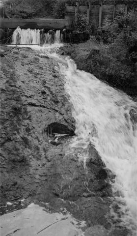
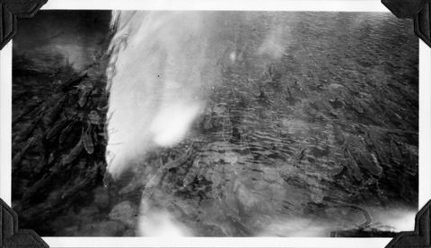
804. [Image] Falls in Tualatin River
 Falls in Tualatin River 3-4 miles above Cherry Grove, Oregon; 1940-09-15 From Album 1 page 39
Citation -
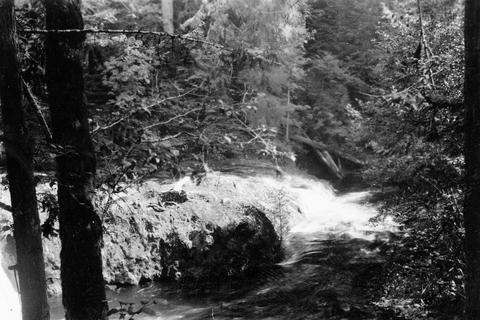
805. [Image] Sulphur Creek Falls
 Downstream view from horse bridge at head end of falls
Citation -
806. [Image] Sulphur Creek bedrock chute
 12 ft impassable bedrock chute short distance above highway bridge This is topped by a 6 ft dam
Citation -
807. [Image] Intake at Leaburg Power Plant
 Intake of Leaburg Power Plant on the McKenzie River; 1938-06
Citation -
808. [Image] Chinook salmon-River Mill
 Chinook- River Mill tail-race, Clackamas River, Oregon; 1938-06-28
Citation -
809. [Image] Niggerhead Creek (Yellowjacket Creek)
 Passable falls and cascades on Niggerhead Creek
Citation -
810. [Image] Chinook below River Mill Power plant
 Chinook below River Mill Power house on the Clackamas River; 1938-06
Citation -
811. [Image] Salmon Creek Falls
 Salmon Creek Falls;1937-09
Citation -
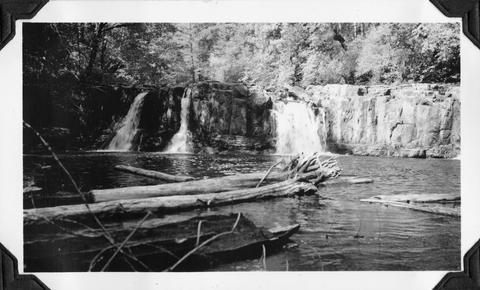
812. [Image] Tamolitch Falls
 Tamolitch Falls on the McKenzie River during high water stage The falls are 40 feet high;1937-06-26
Citation -
813. [Image] Gardiner Dam
 Gardner [sic] Dam viewed from bridge Gardner [sic] Dam is located on the North Santiam River; 1940-08-08
Citation -
814. [Image] Gardiner Ditch
 Gardner [sic] Ditch 100 yards above the headgate, facing upstream; 1940-08-08
Citation -
815. [Image] Wildwood Falls
 Wildwood Falls on Row River Oregon, with a six foot jump in foreground;1938-05-28
Citation -
816. [Image] Narrow falls on Winberry Creek
 Narrow falls over bedrock ledge on Winberry Creek, tributary to Big Fall Creek, Oregon;1937-06
Citation -
817. [Image] Falls on Portland Creek
 Falls on Portland Creek, tributary to Big Fall Creek-six foot jump at low point;1937-06
Citation -
818. [Image] Swift Creek
 Swift Creek, tributary to Middle Fork Willamette River;1938-07
Citation -
819. [Image] Small storage dam
 Small storage dam on the Tualatin River, located 3 miles above the mouth It is 3 feet high but the downstream apron makes passage difficult; 1937-06-24
Citation -
820. [Image] Swift Creek
 Swift Creek, tributary to Middle Fork Willamette River;1938-07
Citation -
821. [Image] Irrigation Dam
 Irrigation dam on Crooked Creek. There is no fish ladder present
Citation -
822. [Image] Collecting chinook eggs
 Collecting eggs by slitting the belly of ripe female chinook salmon at the Middle Santiam Salmon Hatchery near Foster, Oregon; Archie Anderson and assistant;1940-09-25 From Album 1 page 7
Citation -
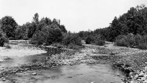
823. [Image] South Santiam riffle
 Riffle on the South Santiam River about 2 1/2 miles below Crabtree Bridge All stones were heavily coated with brownish-green slime and persistent foam piled up in backwaters and floated down the river;Paper ...
Citation -
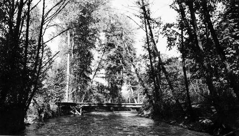
824. [Image] North and South Channel
 North Channel and South Channel facing upstream from bridge in Stayton, Oregon;1940-08-09
Citation -
825. [Image] North and South Channel
 North Channel and South Channel facing upstream from bridge in Stayton, Oregon;1940-08-09
Citation -
826. [Image] North and South Channel
 North Channel and South Channel facing upstream from bridge in Stayton, Oregon;1940-08-09
Citation -
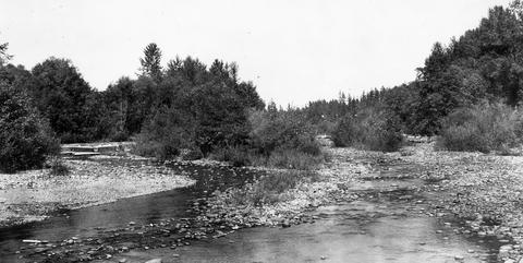
827. [Image] South Santiam River, Oregon
 South Santiam River, Oregon Riffle about 2 1/2 miles below Crabtree Bridge All stones were heavily coated with brownish-green slime and persistent foam piled up in backwaters and floated down the rive...
Citation -
828. [Image] Salem Ditch
 Salem Ditch looking upstream from headgate;1940-08-08
Citation -
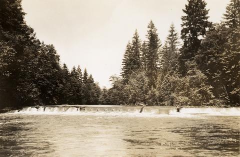
829. [Image] Mill City dam
 Mill City dam located on the North Santiam River in Oregon; 1938
Citation -
830. [Image] Quartzville Creek
 Quartzville Creek, tributary of Middle Santiam River, Oregon;1938
Citation -
831. [Image] Gardiner Dam
 Gardner [sic] Dam from the bridge on the North Santiam River;1940-08-08
Citation -
833. [Image] River Mill Power plant
 Chinook in tail-race at the River Mill Power Plant on the Clackamas River; 1938-06
Citation -
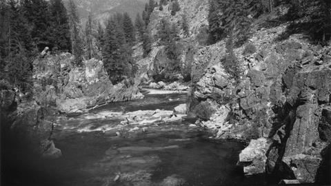
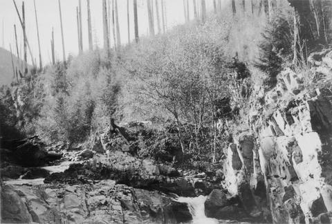
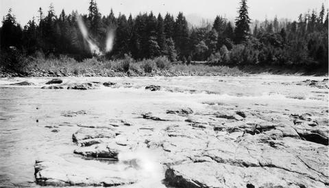
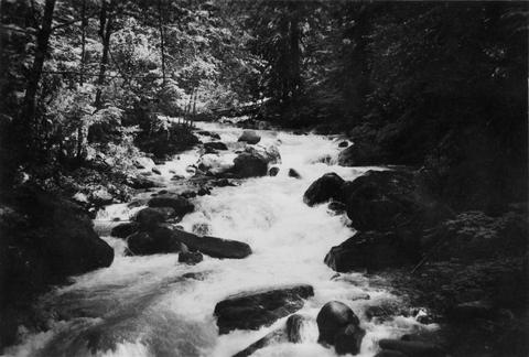
834. [Image] Upper Blue River
 Photo is characteristic of big pools and bedrock banks found on the upper Blue River, a tributary of the McKenzie River;1937-08-17
Citation -
835. [Image] Rack across McKenzie River
 Rack across the McKenzie River above Eugene, Oregon (near Hendricks Bridge);1938-06
Citation -
836. [Image] Salem Ditch dam
 Salem Ditch dam taken from lower Gardner (sic) Dam;1940-08-08
Citation -
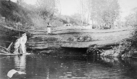
837. [Image] Scio Dam fish ladder
 Poor fish ladder on Scio Dam on Thomas Creek, tributary to South Santiam River, Oregon; 1940-09-18
Citation -
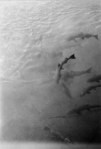
838. [Image] Chinook salmon
 A thousand chinook salmon in holding pool at Foster Fish Hatchery located on the South Santiam River, Oregon;1940-08-14
Citation -
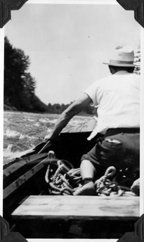
839. [Image] Bryant in Boat
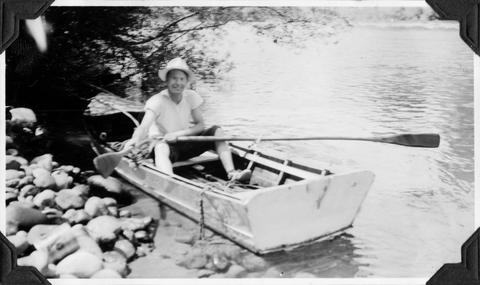 Bryant in boat which went from Mill City to Mehama, Oregon on the North Santiam River; 1940-08-07 Photograph from Album 1 page 47
Citation -
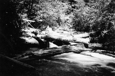
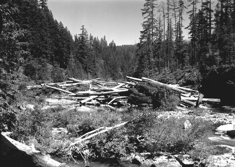
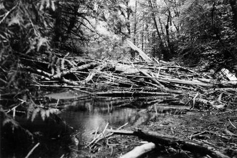
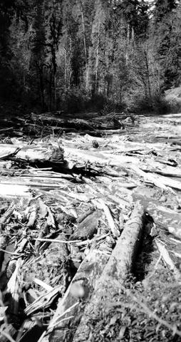
840. [Image] Impassable log jam
 Impassable log jam above Dollar, Oregon, on the Calapooia River; 1941-10-02 Photograph from Album 1 page 46
Citation -
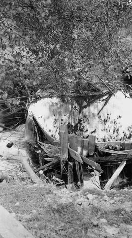
842. [Image] Galloway Ditch siphon
 Siphon for Galloway Ditch [Canal] flowing "under" Mann Creek. At high water when the irrigation dam below is out this siphon with its concrete apron forms a considerable barrier for steelheads and sal...
Citation -
843. [Image] Shooting a rapid
 Shooting a rapid with Bryant in the bow of boat on the North Santiam River, Oregon; 1940-08-06 Photograph from Album 1 page 47
Citation -
844. [Image] Logpond spillway
 Outlet from log pond near Dollar, Oregon, on Calapooia River; 1941-10-02 Photograph from Album 1 page 46
Citation -
845. [Image] Thick undergrowth
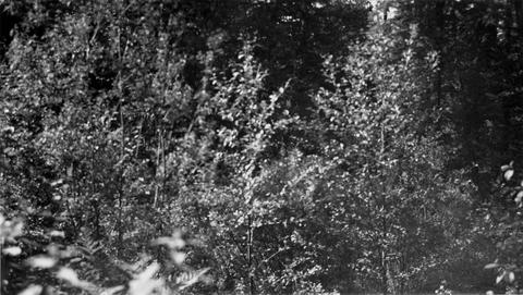 Photo shows thick undergrowth on possible site for rearing pond on property of Mr Will R Lewis just below his trout pond. The trout pond takes off from stream running from Bull Run Reservoir which is the ...
Citation -
846. [Image] Dam on Indian Creek
 Dam on Indian Creek, forming water supply reservoir for the city of Elgin, Oregon
Citation -
847. [Image] Indian Creek camp site
 Camp site on Indian Creek, Idaho. Good fishing but hard to get in and out
Citation -
848. [Image] Mouth of Bear Canyon Creek
 Mouth of Bear Canyon Creek where it flows into Tilton River. It is impassable to fish
Citation -
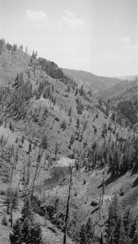
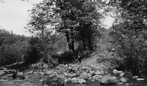
849. [Image] Valley below Cabin Creek
 Portion of river valley below Cabin Creek that shows broad benches which sometimes occur on slip-off slopes
Citation -
850. [Image] Unloading logs
 Unloading logs into pond near Dollar, Oregon, on the Calapooia River; 1941-10-02 Photograph from Album 1 page 45
Citation -
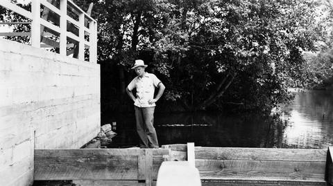
851. [Image] Pack string on the trail
 Hendrick is the packer in the photo
Citation -
852. [Image] Fish ladder
-
853. [Image] Marking fish
 Marking fish, Delph Creek tributary of Eagle Creek; 1938-04
Citation -
854. [Image] Eagle Creek flood wash
 Eagle Creek, Clackamas River, flood Washington bank cutting log jams in lower section; 1938-06
Citation -
855. [Image] Delph Creek debris jam
 Impassable debris jam on the upstream side; Delph Creek, Eagle Creek, Clackamas River; 1938-06
Citation -
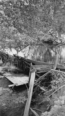
856. [Image] Old dam on Crooked Creek
 Old dam-Crooked Creek just above first forks--left branch facing upstream. There is no ladder and the dam should be removed
Citation -
857. [Image] Elkhorn Creek
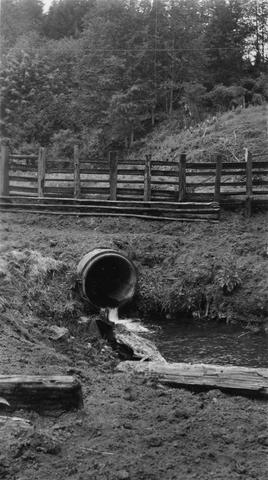 Elkhorn Creek is a tributary of Wilson Creek. Very few salmon can get through culvert during high water.. Culvert is on the farm of VS Kesterson.
Citation -
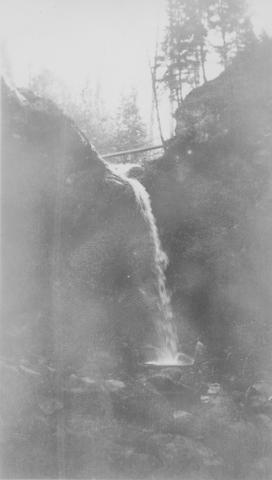
858. [Image] Adams Creek falls
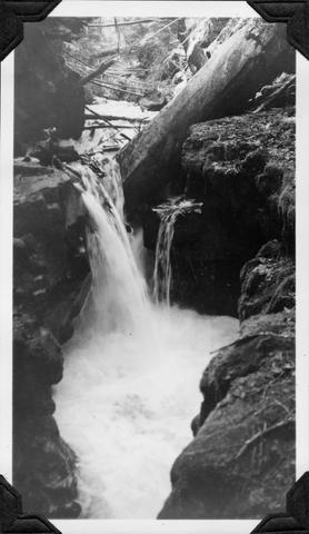 15 ft falls in box canyon on Adams Creek, 1/4 mile above the mouth
Citation -
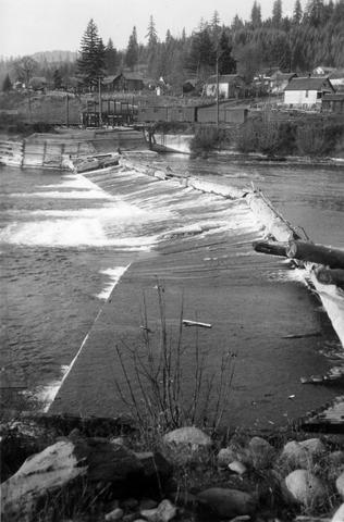
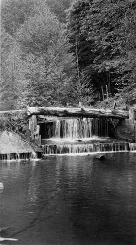
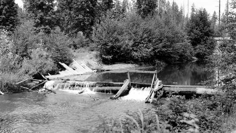
859. [Image] Downstream from Hartman Dam
 Looking downstream from Hartman Dam on Butte Creek; 1940-09-22
Citation -
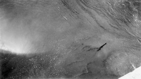
860. [Image] Chinooks on Riffle at Lois Mill
 Chinook salmon on riffle at the Lois Mill on the Molalla River; 1941-09-16
Citation -
861. [Image] Abiqua Dam
 Abiqua Dam near Silverton, Oregon; 1940-09-08
Citation -
862. [Image] Upper dam above Stayton
 Upper dam above Stayton, Oregon, on the North Santiam River;1940-08-08
Citation -
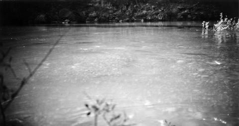
863. [Image] Silver Creek
 Silver Creek near Salem, Oregon; 1938
Citation -
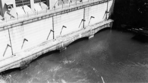
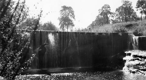
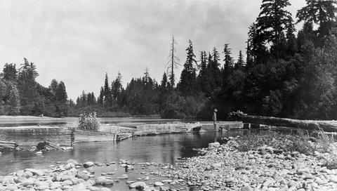
864. [Image] Spillway and fishway
 Spillway and fishway with government locks in the background on the Yamhill River near Lafayette, Oregon; 1940-09-26 From Album 1 page 41
Citation -
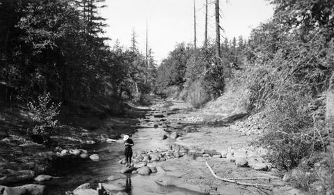
865. [Image] Buck Hollow Creek
 Buck Hollow Creek, tributary to Deschutes River. View upstream from bridge at mouth
Citation -
866. [Image] Silver Creek
 Silver Creek near Salem, Oregon; 1938
Citation -
867. [Image] Spring chinooks
 1000 spring chinook salmon in holding pool at Middle Santiam Salmon Hatchery;1940-08-14 Photograph from Album 1 page 48
Citation -
868. [Image] Small storage dam
 Small storage dam on the Tualatin River, located 3 miles above the mouth It is 3 feet high but the downstream apron makes passage difficult; 1937-06-24
Citation -
869. [Image] Fish ladder near Carlton, Oregon
-
870. [Image] Big log jam
 Big log jam above Dollar, Oregon, on the Calapooia River It is impassable;1941-10-02
Citation -
871. [Image] Mill dam in Long Tom River
 Mill dam in Long Tom River above Noti, Oregon Impassable at present water;1938
Citation -
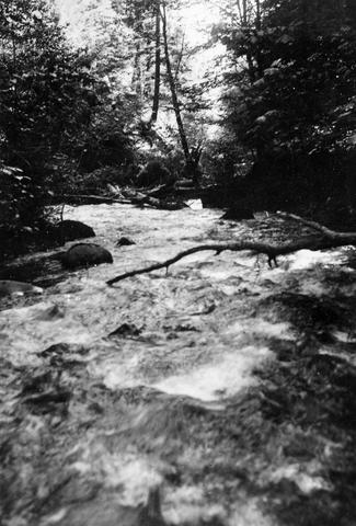
872. [Image] Bedrock cascade
 Bedrock cascade located on the North Santiam River in Oregon between Mill City and Mehama; 1940-08-07
Citation -
873. [Image] Will R Lewis's fish pond
 Will R Lewis's fish pond located on outlet stream from Bull Run Reservoir on Sandy River System
Citation -
874. [Image] Mouth of Gordon Creek
 Rearing pond site at mouth of Gordon Creek, tributary to Sandy River. Shows height of pond site above stream level
Citation -
875. [Image] Will R Lewis's fish pond
 Will R Lewis's fish pond located on outlet stream from Bull Run Reservoir on the Sandy River System
Citation -
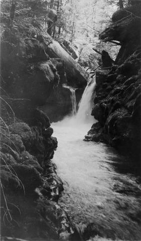
877. [Image] Greenhorn Creek falls
 Greenhorn Creek falls, a tributary to the Cispus River
Citation -
878. [Image] Lake Creek
 Lake Creek, outlet of Packwood Lake showing characteristic cascades
Citation -
879. [Image] Adams Creek falls
 15 foot falls in box canyon 1/4 miles above mouth of Adams Creek, a tributary of Cispus River
Citation -
880. [Image] Waterfall on lower Grays River
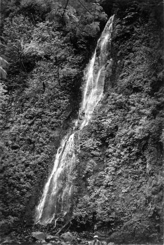 Falls down canyon wall on lower Grays River The falls are 150 feet high. Photo shows typically canyonous nature of stream banks. F Jobes is standing in lower center
Citation -
881. [Article] Status of Winter Rearing Habitat In Four Coho Population Units, 2007 Report Number: OPSW-ODFW-2008-7
Abstract -- In a recent assessment of coastal coho salmon by the Oregon Department of Fish and Wildlife (2005), the authors concluded that productivity in 21 of 21 coastal coho populations was limited ...Citation -
882. [Article] MidCoast A - Rapid Bio-assessment 1998 Midcoast
Abstract -- Snorkel surveys were conducted in five midcoast watersheds that included the Yachats, Alsea, Yaquina, Siletz, and Salmon Rivers. These surveys were commissioned by the Midcoast Watershed Council, ...Citation -
This investigation explored how the magnitude, style, and frequency of channel adjustments vary spatially and over time within a 5th-order mountain watershed. Historical data sets, including repeated cross ...
Citation -
Typescript of a two-part presentation commemorating a half-century of documenting Oregon's architectural heritage through the Historic American Building Survey. Consists of "Part I, The American Institute ...
Citation -
885. [Article] An Evaluation of Data Collected by Middle School and College-Level Students in Stream Channel Geomorphic Assessment
This project tested the accuracy and repeatability of geomorphic stream channel assessments conducted by two different middle school classes from the Walt Morey Middle School in Troutdale, OR and college ...Citation -
To the best of our knowledge, one or more authors of this paper were federal employees when contributing to this work. This is the publisher’s final pdf. The article is copyrighted by Northeast Forestry ...
Citation -
This report on departmental activities describes "physical stream and lake surveys, spawning fish surveys and individual investigations of particular human activities which might affeot the well being ...
Citation -
888. [Article] A physical and chemical characterization of stream water draining three Oregon Coast Range catchments
Few studies have examined both long-term and fine-scale spatial variations in water quality of small streams in the Pacific Northwest. As such, a case study was conducted to determine if current physical ...Citation -
889. [Article] 2004-2005 Hatchery Fish Carcass Placement in Oregon Streams
Abstract -- The purpose of this document is to track the placement of salmon carcasses in streams. Fish carcass placement is commonly believed to replace some of the nutrients historically available to ...Citation -
890. [Article] 2005-2006 Hatchery Fish Carcass Placement in Oregon Streams
Abstract -- The purpose of this document is to track the placement of salmon carcasses in streams. Fish carcass placement replaces some of the nutrients historically available to fish from decaying carcasses ...Citation -
891. [Article] 2006-2007 Hatchery Fish Carcass Placement in Oregon Streams
Abstract -- The purpose of this document is to track the placement of salmon carcasses in streams. Fish carcass placement replaces some of the nutrients historically available to fish from decaying carcasses ...Citation -
892. [Article] 2008-2009 Hatchery Fish Carcass Placement in Oregon Streams
Abstract -- The pupose of this document is to track the placement of salmon carcasses in streams. Fish carcass placement is commonly believed to replace some of the nutrients historically available to ...Citation -
893. [Article] Summary Report: Bald Mountain Creek-Bear Creek (Elk River) Juvenile Snorkel Survey, August 2011
Abstract -- A rapid bio-assessment juvenile snorkel survey of Bald Mtn occurred in Augutst 2011 on approximately 0.67 miles of stream, and pools were snorkeled on Bear Creek to determine presence/absence. ...Citation -
This document provides the methods and summary of continued surveys on spawning Chinook and Coho salmon in coastal streams of Oregon for 1950-1976.
Citation -
895. [Article] Surveys of fish species and habitat in Wilsonville streams
This archived document is maintained by the Oregon State Library as part of the Oregon Documents Depository Program. It is for informational purposes and may not be suitable for legal purposes.Citation -
896. [Article] Public Perceptions of Bioremediation at INEEL (Fall 2002)
Contains an SPSS data set, survey instrument, codebook, and sample report.Citation -
897. [Article] PeaceHealth Center for Senior Health Caregiver Study 2
Contains code book, survey instrument, an SPSS data set, and a sample report.Citation -
898. [Article] PeaceHealth Center for Senior Health Caregiver Study 3
Contains code book, a survey instrument, a sample report, and an SPSS data set.Citation -
899. [Article] PeaceHealth Center for Senior Health Caregiver Study 4
Contains code book, a survey instrument, a sample report, and an SPSS data set.Citation