Search
« Previous | 501 - 600 of 2,534 | Next »
Search Results
-
501. [Image] Loading fish boxes on seine skiff
-
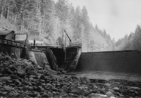
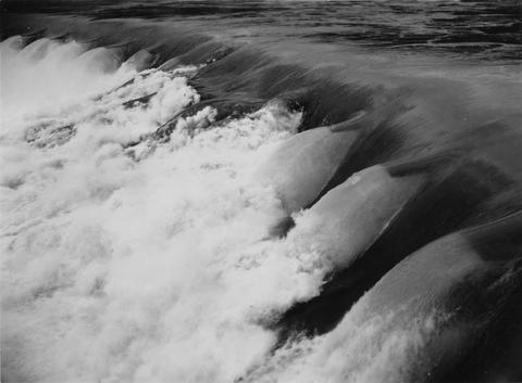
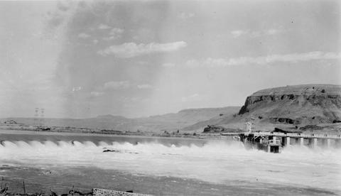
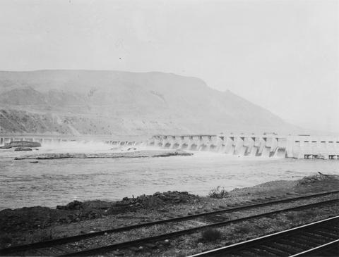
502. [Image] Rock Island Dam
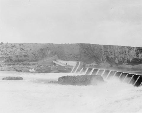 Rock Island Dam on the Columbia River
Citation -
503. [Image] Columbia River at Puget Island
-
504. [Image] North end of Alturas Lake, Idaho
-
505. [Image] Cattle near Sawtooth Mountains
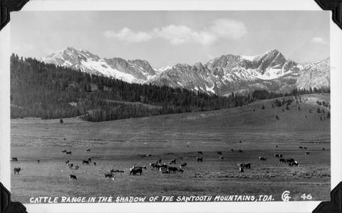 Cattle range in the shadow of the Sawtooth Mountains, Idaho
Citation -
506. [Image] Big Sandy River at Sleepy Hollow
-
507. [Image] Fishing boats
 One-man gill net boat with power roller and two man stern picker boat
Citation -
508. [Image] Fishing boats
 One-man gill net boat with power roller and two-man stern picker boat
Citation -
509. [Image] Gill net and boat in Ilwaco
-
510. [Image] Crayfish in live box
 Cray fish in live box near Linnton, Oregon, on the Willamette River
Citation -
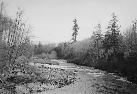
511. [Image] Tilton River 5 miles above mouth
-
512. [Image] Chinooks in brail
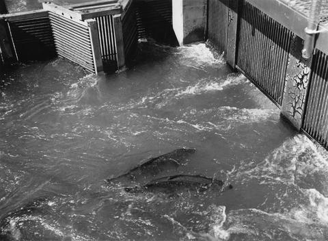 Chinooks in brail at Rock Island Dam
Citation -
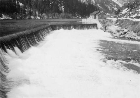
513. [Image] Tumwater Dam on Wenatchee River
-
514. [Image] Rock Island Dam
 Rock Island Dam on the Columbia River
Citation -
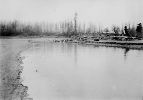
515. [Image] Big Sandy Channel looking upstream
-
516. [Image] Big Sandy Channel
-
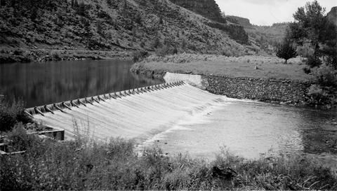
517. [Image] Completed weir on the Tucannon River
-
518. [Image] Tucannon River
 Tucannon River near station number fifteen
Citation -
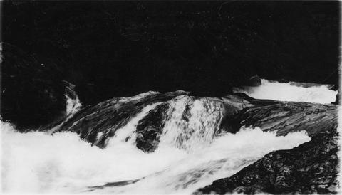
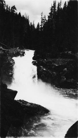
519. [Image] Falls on Ohanapecosh River
-
520. [Image] Wyman, Frey and Bryant
 Ed Wyman, Frey, and Bryant just after completing Green River pack trip
Citation -
521. [Image] Completed weir on the Tucannon River
-
522. [Image] Diversion Dam
-
523. [Image] Mt Jefferson from plateau west of Cove
-
524. [Image] Spawning area on Tucannon River
 Spawning Area above station number fourteen on the Tucannon River
Citation -
525. [Image] "Buckshot" and mistress
-
526. [Image] Umatilla National Forest Godman Spring road
-
527. [Image] Tucannon River weir near Starbuck, Washington
-
528. [Image] Columbia River near Chelan, Washington
-
529. [Image] Headgates on Taylor Ditch
-
530. [Image] Chinook salmon in trap near Sand Island
-
531. [Image] Rotary screen in Taylor ditch
-
532. [Image] Boise, Idaho area map
-
533. [Image] Challis, Idaho
-
534. [Image] Hendricks and Dean Chandler
 Mildred and Ward (Slim) Hendrick, Dean Chandler and Mike Hendrick
Citation -
536. [Image] Wild mountain sheep
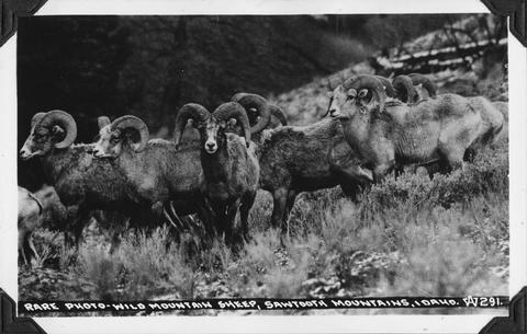 Rare photo of wild mountain sheep in the Sawtooth Mountains, Idaho
Citation -
537. [Image] Middle Fork Salmon River map
-
538. [Image] Old Reservation Ditch
 Headgates and "grizzly" on Old Reservation Ditch
Citation -
539. [Image] Little Sandy dam
-
540. [Image] Little Sandy dam
-
541. [Image] Headgates on Snipe and Allen ditch
 There are no screens on this ditch
Citation -
542. [Image] East Fork Salmon River
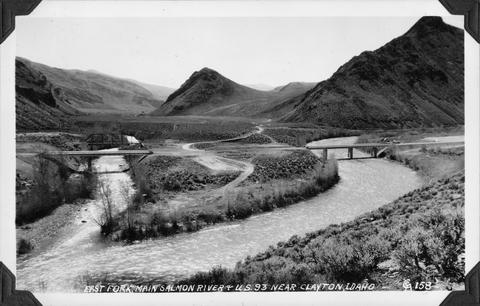 Photo taken near US 93 close to Clayton, Idaho
Citation -
543. [Image] Hauling in seine
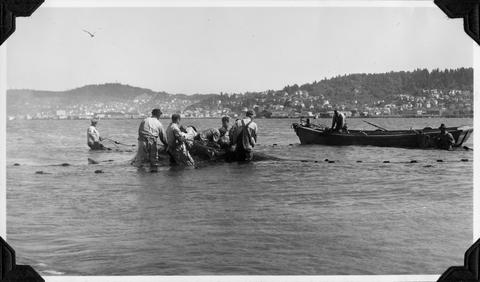 Seining for Salmon on Van Dusen Sands near Astoria, Oregon
Citation -
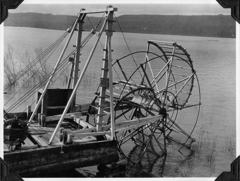
544. [Image] Scow fish wheel on the Columbia River
-
545. [Image] Ward Hendrick family and Dean Chandler
 Ward (Slim) Hendrick, Mildred and Mike Hendrick Dean Chandler holding Timothy Tugmutton
Citation -
546. [Image] Emigrant Hill
 Emigrant Hill on the Old Oregon Trail near Pendleton, Oregon
Citation -
547. [Image] Catherine Creek diversion dam
 Diversion dam for flour mill at Union, Oregon
Citation -
548. [Image] Racking fishing net from truck
 Racking net from truck near Ilwaco, Washington
Citation -
550. [Image] Racking fishing net
 Racking net from trucks near Ilwaco (Washington)
Citation -
551. [Image] Moving fishing net
 Trucking net from blue-stone tank to racks near Ilwaco, Washington
Citation -
552. [Image] Turkeys on Lee Jones Farm
 Turkeys on the Lee Jones farm near Molalla, Oregon; 1940-09-06
Citation -
553. [Image] Big Redfish Lake, Idaho
-
554. [Image] Grande Ronde River
 Grande Ronde River near Troy, Oregon
Citation -
555. [Image] Upper falls on upper Ohanofrecork
-
556. [Image] Sandy River diversion dam before repair
-
557. [Image] Rock Island Dam
-
558. [Image] Fish hatchery dam above Union, Oregon
-
559. [Image] Monahan Creek falls
-
560. [Image] Monahan Creek falls
-
561. [Image] Lewiston Dam weir
-
562. [Image] Rock Island Dam
-
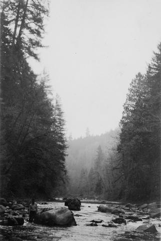
563. [Image] Dense, damp vegetation along Tilton River
-
564. [Image] Entiat River weir
 Weir under construction during Spring 1939
Citation -
565. [Image] Racking net from trucks
-
566. [Image] Racking net from truck near Ilwaco, Washington
-
567. [Image] Upper portion of Abernathy Creek
 Upper portion of Abernathy Creek showing burned off area which left erosion and destruction
Citation -
568. [Image] Pile trap on Sand Island
-
569. [Image] Rock Island Dam
 Rock Island Dam on the Columbia River
Citation -
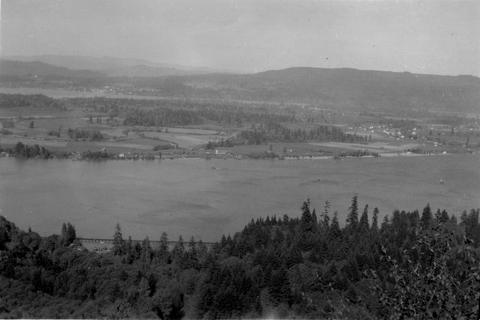
570. [Image] View of Columbia River
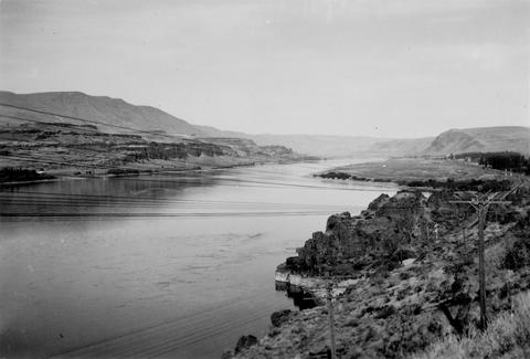 Looking up the Columbia River from the Oregon side near Bigg's Ferry
Citation -
571. [Image] Mending gill nets in Ilwaco
-
573. [Image] Two-man stern picker gill net boat
-
574. [Image] Rock Island Dam north trap
-
575. [Image] Loading fish truck
 Left trap at Rock Island Dam
Citation -
Copyrighted by American Geophysical Union.
Citation -
This is the author's peer-reviewed final draft as accepted by the publisher. The final version is copyrighted by Elsevier and can be found at the Forest Ecology and Management website: http://www.elsev...
Citation -
578. [Article] Large wood restoration Cedar Creek Siletz River Basin 2009
Abstract -- A large wood restoration project was completed along approximately seven miles of Cedar Cr (tributary to the lower Siletz River). 460 pieces of wood were placed in the stream. Wood was placed ...Citation -
579. [Article] Effects of beaver on streams, streamside habitat, and coho salmon fry populations in two coastal Oregon streams
The effects of beaver (Castor canadensis) on stream morphology, riparian zones, and coho salmon (Oncorhynchus kisutch) fry in Cape and Cummins Creeks, Oregon, were examined using stream surveys, vegetation ...Citation -
580. [Article] Necanicum Habitat Assessment Project: Juvenile Coho Winter Habitat Priorities for Large Wood Placement and Fish Passage Barriers
Abstract -- ODFW Aquatic Inventory protocol was used to assess habitat in selected streams (57 km total) in the Necanicum River basin. Snorkel surveys were conducted to assess juvenile salmonid distribution ...Citation -
581. [Article] Annual trends in abundance and frequency for juvenile coho in the Oregon Coast Coho ESU
Abstract -- PDF Document with reference to North, Mid and Mid-South and Umpqua coastal streams. Snorkel years from 1998 to 2006 and shows information of the annual trend in abundance and frequency metrics ...Citation -
582. [Article] Annual trends in abundance and frequency metrics for juvenile steelhead in the Oregon Coast Steelhead DPS
Abstract -- PDF Document with reference to North, Mid and Mid-South and Umpqua coastal streams. Snorkel years from 2002 to 2006 and shows information from the annual trend in abundance and frequency metrics ...Citation -
Dimensions of paper map: 37" x 37.5".
Citation -
This product is for informational purposes and may not have been prepared for, or be suitable for legal, engineering, or surveying purposes. Users of this information should review or consult the primary ...
Citation -
This product is for informational purposes and may not have been prepared for, or be suitable for legal, engineering, or surveying purposes. Users of this information should review or consult the primary ...
Citation -
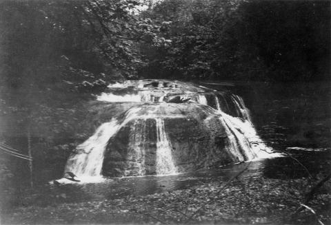
586. [Image] Falls on Cat Creek
 Falls on Cat Creek, tributary to the Cispus River, 1/4 mile above the mouth. Lower falls is 4 feet high and the upper falls is 10 feet high
Citation -
587. [Image] Impassable bedrock chute
 Impassable bedrock chute on North Fork Cispus River near Timonium Creek. Drops 25 feet in 60 feet. There are no pools
Citation -
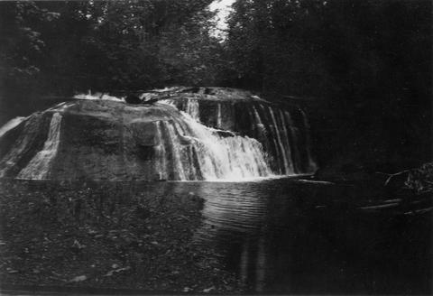
588. [Image] Timonium Creek falls
 75 foot series of falls on Timonium Creek near its confluence with the North Fork of the Cispus River. Indicates terrific flood stages
Citation -
589. [Image] Dam near Cottage Grove
 Dam near Cottage Grove, Oregon, on the Coast Fork Willamette River;1938-06-20
Citation -
590. [Image] Dam on Roaring Creek
-
591. [Image] Obstruction on Coast Fork Willamette
 Obstruction on Coast Fork Willamette River Ladder has broken down;1938-06
Citation -
592. [Image] Salem Ditch dam
 Dam in Salem Ditch which is part of the North Santiam River system;1940-08-09
Citation -
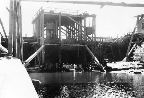
593. [Image] Dam site above Mayflower Creek
 Dam site above Mayflower Creek on the North Santiam River in Oregon; 1940-08-12
Citation -
594. [Image] Dam site above Mayflower Creek
 Dam site above Mayflower Creek on the North Santiam River in Oregon; 1940-08-12
Citation -
595. [Image] Foot of Cazadero Dam
 Chinook salmon at foot of Cazadero Dam on Clackamas River; 1940-08-23
Citation -
596. [Image] Mill Creek mill dam
 Mill Creek mill dam Mill Creek is a tributary to the Mohawk River;1938-06-20
Citation -
597. [Image] Cedar Creek Falls
 Powerflume, fish-ladder and mill at high-water stage on Cedar Creek Falls
Citation -
598. [Image] Cedar Creek Falls
 Cedar Creek Falls at high-water stage near Hall, Washington
Citation -
599. [Image] Warm Springs Creek
 Warm Springs Creek tributary to Loon Creek, Idaho. Box canyon shown a short distance above Mahoney Creek confluence
Citation -
600. [Image] Muddy Fork of Cispus River
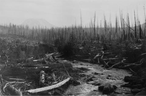 Muddy Fork of Cispus River which flows at 10 seconds per foot and is 20 feet wide. Mt Adams is in left background [Print is reversed]
Citation