Search
Search Results
-
"GAO-05-211"; "April 2005"
Citation Citation
- Title:
- Endangered species : Fish and Wildlife Service generally focuses recovery funding on high priority species, but needs to periodically assess its funding decisions : report to the Chairman, Committee on Resources, House of Representatives
- Author:
- U.S. Fish and Wildlife Service
- Year:
- 2005
"GAO-05-211"; "April 2005"
-
2852. [Image] Lower Klamath River instream flow study : scoping evaluation for the Yurok Indian Reservation
ABSTRACT The U.S. Fish and Wildlife Service, Lower Columbia River Fishery Resource Office was funded by Bureau of Indian Affairs to conduct an instream flow assessment for the lower Klamath River within ...Citation Citation
- Title:
- Lower Klamath River instream flow study : scoping evaluation for the Yurok Indian Reservation
- Author:
- Anglin, Donald R
- Year:
- 1994, 2007, 2006
ABSTRACT The U.S. Fish and Wildlife Service, Lower Columbia River Fishery Resource Office was funded by Bureau of Indian Affairs to conduct an instream flow assessment for the lower Klamath River within the Yurok Indian Reservation in northern California using the Instream Flow Incremental Methodology (IFIM). Specific study tasks consisted of developing an explicit statement of purpose, definition of the study area and target species, assembly and evaluation of hydrologic, water quality, and physical data as well as biological and fish habitat information. A reconnaissance survey of the proposed study area was also conducted. The purpose for conducting the proposed flow study was the Yurok Tribe's desire to protect the Klamath basin water supply for the production of anadromous fish. The ultimate goal was to protect, restore, and enhance the anadromous fishery resources on the Reservation and in the basin as a whole. The study area was defined as the lower Klamath River and tributaries from the confluence with the Trinity River downstream to the area of tidal influence. Although the mainstem Klamath only was proposed for flow studies, the tributaries were included in the study area as a result of their hydrologic and biological relevance. Target species were identified as chinook salmon {Oncorhynchus tshawytscha), coho salmon (0. kisutch), steelhead trout (0. mykiss) , green sturgeon {Acipenser medirostris) , eulachon (Thaleichthys pacificus) , and Pacific lamprey (Lampetra tridentata) . Assembly and evaluation of relevant information was accomplished from results of a public scoping meeting and the review of a large volume of both published and file reports as well as numerous personal communications. Hydrology of the lower Klamath River is affected by U.S. Bureau of Reclamation projects in both the upper Klamath and upper Trinity subbasins. Several hydroelectric projects in the upper Klamath subbasin affect flow patterns, and agricultural activities in the upper Klamath subbasin and tributaries and the Central Valley Project in the upper Trinity subbasin have reduced water yield from the basin. Water quality concerns were identified as elevated water temperatures and nutrient levels resulting from land use activities throughout the basin. Hydrologic and water quality impacts are partially mitigated in the lower Klamath by tributary inflow throughout the basin. The physical environment in the basin has been altered by land use practices and several major flood events. Alterations include loss of riparian vegetation and stream channel stability, loss of soil moisture storage capacity and infiltration potential, debris slides and logjams resulting in migration barriers, reduced supply of large woody debris for recruitment into the stream channel, and sedimentation of spawning and rearing habitat. Fish habitat in most lower Klamath tributaries has been surveyed and deficiencies as well as good quality habitat have been described. Significant production potential exists in most tributaries, however much restoration work needs to be completed to realize the potential. Habitat characteristics for the mainstem Klamath have not been described. Life history and production data are presented for target species and a brief review of sources for suitability criteria is presented. Harvest management and escapement for naturally spawning fall chinook salmon were reviewed from 1978 through 1993. Escapement has varied over the years but a general downward trend in naturally spawning fall chinook can be observed, particularly in recent years. Escapement goals for the Klamath basin varied from 115,000 in 1978 to an "emergency" floor of 27,000 in 1992. Actual escapement of naturally spawning adult fall chinook varied from a high of 113,000 in 1986 to a low of 11,600 in 1991. Escapement in 1978 totalled 58,500 and preliminary estimates of escapement in 1993 were 21,000 naturally spawning adults. Factors affecting production and subsequent stock size and escapement included variable ocean survival, degraded freshwater habitat conditions, the recent six-year drought, releases of large numbers of hatchery juveniles, and harvest management methodologies that have failed to adequately match harvest to predicted stock size. Differential harvest rates for Klamath and Trinity subbasin fall chinook have also complicated attempts to structure the harvest. Field reconnaisance surveys were conducted in spring and summer 1993 for the proposed mainstem Klamath study area. Two distinct river segments were identified based on macrohabitat characteristics. Microhabitat was classified within each river segment and mapped on USGS quadrangle maps. Cross section identification was postponed pending the decision to move forward with the flow study. Following the scoping tasks described above, conclusions and recommendations were developed. No information was reviewed that indicated the need for an instream flow study in the lower Klamath River. The two basic problems affecting anadromous fish production are degraded freshwater habitat and chronic underescapement. Coordination and planning for instream flow studies on a basin-wide scale was recommended. Biological data gaps were identified which need to be addressed before an instream flow study can be completed for the lower Klamath. Suitability criteria for habitat analysis also need to be identified. Habitat restoration and protection and proper management of anadromous fishery resources were identified as the highest priorities to begin restoration of anadromous stocks. Specific recommendations for habitat restoration included watershed and riparian zone restoration, barrier removal, instream habitat inventory, restoration, and monitoring, estuary studies, and description of streamflow characteristics for lower Klamath tributaries. Recommended fishery resource studies included collection of basic life history data, monitoring for adult escapement and juvenile production, description of estuary usage, effects of hatchery programs on both adult and juvenile wild fish, evaluation of the accelerated stocking program, and refinement of harvest management methodologies to achieve appropriate escapement of naturally spawning stocks into all subbasins.
-
Recreational use and economic impact of the Salt Caves segment of the Klamath River have been consistently understated. Various citizens and the local press have suggested about 2,000 people use this ...
Citation Citation
- Title:
- Economic assessment of the Klamath as a wild and scenic river
- Author:
- Ward, John G.
- Year:
- 1987, 2004
Recreational use and economic impact of the Salt Caves segment of the Klamath River have been consistently understated. Various citizens and the local press have suggested about 2,000 people use this segment each year for rafting and an equal number for fishing. Representatives of Resource Management Inc. and various public officials and citizens have estimated annual revenues from the Salt Caves segment of the Klamath River at "less than $4 00,000" to "$500,000 per year". In the interest of building a broader discussion base, the following preliminary economic assessment of the Klamath River canyon has been developed. Background data and estimates are developed for rafting, fishing, and hunting. It is hoped this analysis will help support a more relevant Economic, Social, Environmental, and Energy consequences statement in the Klamath County Comprehensive Plan. Results of the economic assessment for 1986 are summarized below. River use is nearly double the reported levels, and the economic impact of the Salt Caves segment of the Klamath River is over $2.5 million annually. The river now supports 98 jobs through direct, indirect and induced effects, half of them in Oregon. Another 3 00 jobs are partially supported when Oregon and California rafting firms use the river.
-
2854. [Image] Progress report for investigations on Blue Creek, fiscal year 1992, Blue Creek, California
PROGRESS REPORT FOR INVESTIGATIONS ON BLUE CREEK FT 1992 ABSTRACT The U.S. Fish and Wildlife Service, Coastal California Fishery Resource Office in Arcata, California, was funded to investigate chinook ...Citation Citation
- Title:
- Progress report for investigations on Blue Creek, fiscal year 1992, Blue Creek, California
- Author:
- Chan, Jeffrey R. ; Longenbaugh, Matthew H.
- Year:
- 1994, 2005
PROGRESS REPORT FOR INVESTIGATIONS ON BLUE CREEK FT 1992 ABSTRACT The U.S. Fish and Wildlife Service, Coastal California Fishery Resource Office in Arcata, California, was funded to investigate chinook salmon roncorhvnchus tshawvtschav spavming use, juvenile salmonid emigration, and characterize stream habitats in Blue Creek, a tributary to' the Klamath River; California. Investigations began in October 1988, with this reporting period covering October 1991 through September 1992. Adult chinook spawner escapement was addressed by surveys of redds, live fish and carcasses, and by radioteleiretry. Spawner numbers were v?ry low, with only 22 redds observed in fall 1991/winter 1992. The peak count of adult Chinook was 97 fish in early November. Radiotelemetry of migrating spawners (n?8) was used to locate remote spawning areas. Emigrating juvenile Chinook salmon, steelhead trout 10. mvkissV/ coho salmon (fi. kisutchl. and coastal cutthroat trout (g. clarltiV were trapped at river kilometer (rkm) 3.35 with a rotary screw trap (screw trap). The trapping period extended from April to July for a total of 75 trapping nights. Screw trap catches totaled 10,688 chinook, 1,388 steelhead, 99 coho and 10 cutthroat. Peak Chinook emigration occurred during the week of May 17, which is consistent with the past 3 years of monitoring. A juvenile weir was operated 58 nights, and caught a total of 9,166 chinook, 1,196 steelhead, 127 coho and 1 cutthroat. The index of abundance for emigrating chinook during the 1992 juvenile trapping period was 49,590. Sixty-five percent of the juvenile chinook caught during the trapping season were marked with coded wire tags (n-12,687) and released back into Blue Creek at rkm 3.3. Mean water temperatures varied from 6.3 to 18.6 XI and stream flows ranged from 43 to 2178 eft (1.3 to 61.7 m3/?) during the Fiscal Year (FY) 1992 study season.
-
2855. [Image] Klamath River water quality and acoustic Doppler current profiler data from Link River Dam to Keno Dam, 2007
Klamath River Water Quality and Acoustic Doppler Current Profiler Data from Link River Dam to Keno Dam, 2007 By Annett B. Sullivan, Michael L. Deas, Jessica Asbill, Julie D. Kirshtein, Kenna Butler, Roy ...Citation Citation
- Title:
- Klamath River water quality and acoustic Doppler current profiler data from Link River Dam to Keno Dam, 2007
- Author:
- Sullivan, Annett B. (Annett Brigitte), 1970-
- Year:
- 2008
Klamath River Water Quality and Acoustic Doppler Current Profiler Data from Link River Dam to Keno Dam, 2007 By Annett B. Sullivan, Michael L. Deas, Jessica Asbill, Julie D. Kirshtein, Kenna Butler, Roy E. Wellman, Marc A. Stewart, and Jennifer Vaughn Abstract In 2007, the U.S. Geological Survey, Watercourse Engineering, and Bureau of Reclamation began a project to construct and calibrate a water quality and hydrodynamic model of the 21-mile reach of the Klamath River from Link River Dam to Keno Dam. To provide a basis for this work, data collection and experimental work were planned for 2007 and 2008. This report documents sampling and analytical methods and presents data from the first year of work. To determine water velocities and discharge, a series of cross-sectional acoustic Doppler current profiler (ADCP) measurements were made on the mainstem and four canals on May 30 and September 19, 2007. Water quality was sampled weekly at five mainstem sites and five tributaries from early April through early November, 2007. Constituents reported here include field parameters (water temperature, pH, dissolved oxygen concentration, specific conductance); total nitrogen and phosphorus; particulate carbon and nitrogen; filtered orthophosphate, nitrite, nitrite plus nitrate, ammonia, organic carbon, iron, silica, and alkalinity; specific UV absorbance at 254 nm; phytoplankton and zooplankton enumeration and species identification; and bacterial abundance and morphological subgroups. The ADCP measurements conducted in good weather conditions in May showed that four major canals accounted for most changes in discharge along the mainstem on that day. Direction of velocity at measured locations was fairly homogeneous across the channel, while velocities were generally lowest near the bottom, and highest near surface, ranging from 0.0 to 0.8 ft/s. Measurements in September, made in windy conditions, raised questions about the effect of wind on flow. Most nutrient and carbon concentrations were lowest in spring, increased and remained elevated in summer, and decreased in fall. Dissolved nitrite plus nitrate and nitrite had a different seasonal cycle and were below detection or at low concentration in summer. Many nutrient and carbon concentrations were similar at the top and bottom of the water column, though ammonia and particulate carbon showed more variability in summer. Averaged over the season, particulate carbon and particulate nitrogen decreased in the downstream direction, while ammonia and orthophosphate concentrations increased in the downstream direction. At most sites, bacteria, phytoplankton, and zooplankton populations reached their maximums in summer. Large bacterial cells made up most of the bacteria biovolume, though cocci were the most numerous bacteria type. The cocci were smaller than the filter pore sizes used to separate dissolved from particulate matter in this study. Phytoplankton biovolumes were dominated by the blue-green alga Aphanizomenonflos aquae most of the sampling season, though a spring diatom bloom occurred. Phytoplankton biovolumes were generally highest at the upstream Link River and Railroad Bridge sites and decreased in the downstream direction. Zooplankton populations were dominated by copepods in early spring, and by cladocerans and rotifers in summer, with rotifers more common farther downstream. l
-
This report presents information on biogeography and broad-scale ecology (macroecology) of selected fungi, lichens, bryophytes, vascular plants, invertebrates, and vertebrates of the interior Columbia ...
Citation Citation
- Title:
- Macroecology, paleoecology, and ecological integrity of terrestrial species and communities of the interior Columbia River basin and northern portions of the Klamath and Great Basins
- Author:
- U.S. Department of Agriculture. Forest Service. Pacific Northwest Research Station; U.S.Department of the Interior. Bureau of Land Management.
- Year:
- 1998, 2006, 2005
This report presents information on biogeography and broad-scale ecology (macroecology) of selected fungi, lichens, bryophytes, vascular plants, invertebrates, and vertebrates of the interior Columbia River basin and adjacent areas. Rare plants include many endemics associated with local conditions. Potential plant and invertebrate bioindicators are identified. Species ecological functions differ among communities and variously affect ecosystem diversity and productivity. Species of alpine and subalpine communities are identified that may be at risk from climate change. Maps of terrestrial ecological integrity are presented. Keywords: Macroecology, paleoecology, ecological integrity, terrestrial communities, ecosystems, wildlife, fungi, lichens, bryophytes, vascular plants, invertebrates, arthropods, mollusks, amphibians, reptiles, birds, mammals, endemism, interior Columbia River basin, Klamath Basin, Great Basin.
-
2857. [Image] Endangered species: difficult choices
IB10072 08-26-04 Endangered Species: Difficult Choices SUMMARY The 108th Congress is considering various proposals to amend the Endangered Species Act of 1973 (ESA). Major issues in recent years ...Citation Citation
- Title:
- Endangered species: difficult choices
- Author:
- Buck, Eugene H; Corn, M. Lynne (Mary Lynne), 1946-; Baldwin, Pamela
- Year:
- 2004, 2008, 2005
IB10072 08-26-04 Endangered Species: Difficult Choices SUMMARY The 108th Congress is considering various proposals to amend the Endangered Species Act of 1973 (ESA). Major issues in recent years have included changing the role of science in decision-making, changing the role of critical habitat, reducing conflicts with Department of Defense activities, incorporating further protection for property owners, and increasing protection of listed species, among others. In addition, many have advocated including significant changes to ESA regulations made during the Clinton Administration in the law itself. The ESA has been one of the more contentious environmental laws. This may stem from its strict substantive provisions, which can affect the use of both federal and non-federal lands and resources. Under the ESA, certain species of plants and animals (both vertebrate and invertebrate) are listed as "endangered" or "threatened" according to assessments of their risk of extinction. Once a species is listed, powerful legal tools are available to aid its recovery and protect its habitat. The ESA may also be controversial because dwindling species are usually harbingers of resource scarcity: the most common cause of listing species is habitat loss. Recent efforts in the House would modify ESA provisions that designate critical habitat, and that provide for scientific peer review. The authorization for spending under the ESA expired on October 1, 1992. The prohibitions and requirements of the ESA remain in force, even in the absence of an authorization, and funds have been appropriated to imple- ment the administrative provisions of the ESA in each subsequent fiscal year. In the 108th Congress, two bills (H.R. 1662 and H.R. 2933) have been reported that would, respectively, address issues concerning scientific peer review and critical habitat. These bills may be brought to the House floor in September. Earlier, P.L. 108-108 (Interior appropriations) provided $265 million for FY2004 for programs related to endangered species. P.L. 108-136 (Defense authorization) included an ESA amendment to direct that critical habitat not be designated on military lands under certain conditions when Integrated Natural Resources Management Plans are in effect. P.L. 108-137 (Energy and Water appropriations) prohibited use of FY2004 or earlier funds to reduce water deliveries under existing contracts for ESA compliance for the silvery minnow on the Middle Rio Grande River unless water is obtained from a willing seller or lessor. The act also established an executive committee to oversee the Collaborative Program associated with this situation. P.L. 108-148 (Healthy Forests Act) authorized hazardous fuels reduction projects on BLM and national forest lands including those containing listed species habitat; directed establishment of a healthy forests reserve program to promote recovery of listed species; and directed the Secretary of the Interior to provide assurances to landowners whose enrollment in the healthy forests reserve program results in new conservation benefits for ESA-listed species.
-
The study examines two species of sucker,the shortnose sucker(chasmistes brevirostrix), and the Lost River sucker,(deltisties luxatus) that inhabit Upper Klamath Lake and the effects of chronic toxicity ...
Citation Citation
- Title:
- Chronic toxicity of low dissolved oxygen concentrations, elevated pH, and elevated ammonia concentrations to lost river suckers (deltistes luxatus), and swimming performance of lost river suckers at various temperatures.
- Author:
- Meyer, Joseph S.
- Year:
- 2000, 2007, 2006
The study examines two species of sucker,the shortnose sucker(chasmistes brevirostrix), and the Lost River sucker,(deltisties luxatus) that inhabit Upper Klamath Lake and the effects of chronic toxicity and temperature changes. The study examines two species of sucker,the shortnose sucker(chasmistes brevirostrix), and the Lost River sucker,(deltisties luxatus) that inhabit Upper Klamath Lake and the effects of chronic toxicity and temperature changes.
-
2859. [Image] Larval ecology of shortnose and Lost River suckers in the lower Williamson River and Upper Klamath Lake
One chapter of a seven chapter annual report from 1999 examining ecological issues regarding the shortnose and Lost River sucker populations in Upper Klamath Lake and Williamson River.Citation Citation
- Title:
- Larval ecology of shortnose and Lost River suckers in the lower Williamson River and Upper Klamath Lake
- Author:
- Oregon Cooperative Wildlife Research Unit
- Year:
- 2000, 2005
One chapter of a seven chapter annual report from 1999 examining ecological issues regarding the shortnose and Lost River sucker populations in Upper Klamath Lake and Williamson River.
-
Executive Summary The jawless lampreys are remnants of the oldest vertebrates in the world. Oregon has somewhere between eight and a dozen species of these primitive fishes. Their taxonomy is obscure ...
Citation Citation
- Title:
- Oregon lampreys : natural history, status, and analysis of management issues
- Author:
- Kostow, Kathryn
- Year:
- 2002, 2008, 2005
Executive Summary The jawless lampreys are remnants of the oldest vertebrates in the world. Oregon has somewhere between eight and a dozen species of these primitive fishes. Their taxonomy is obscure because different species tend to look very similar through most of their life cycle, and they have not been well-studied in Oregon. Lampreys occur in the Columbia Basin, including the lower Snake River, along the Oregon coast, in the upper Klamath Basin, and in Goose Lake Basin in southeastern Oregon. They all begin life in fresh water where juveniles burrow into silt and filter feed on algae. As some species approach adulthood they migrate to the ocean or to lakes where they briefly become ecto-parasites, feeding on other live fishes by attaching to them with sucker disc mouths. Other species remain non-parasitic. In addition to some enigmatic species identities, we generally have very little information about the detailed distributions, life histories and basic biology of lampreys. Lampreys became a conservation concern in the early 1990s when tribal co-managers and some Oregon Department of Fish and Wildlife (ODFW) staff noted that populations of Pacific Lampreys, Lampetra tridentata, were apparently declining to perilously low numbers. Pacific Lampreys were listed as an Oregon State sensitive species in 1993 and were given further legal protected status by the state in 1997 (OAR 635-044-0130). Lamprey status is difficult to assess for several reasons: 1) Most observations of lampreys in fresh water are of juveniles and it is difficult to tell the various species apart, even to the extent that the various species are currently clearly designated; 2) Data on lamprey is only collected incidental to monitoring of salmonids. The design and efficiency of the data collection effort is not always adequate for lampreys; and 3) We have very few historic data sets for lampreys. Therefore we often cannot determine how the abundances and distributions we see now compare with those in the past. The limited data that we have suggests that lampreys have declined through many parts of their ranges. The most precipitous declines appear to be in the upper Columbia and Snake basins where we have some historic data from mainstem dam counts. Pacific Lampreys have declined to only about 200 adults annually passing the Snake River dams. We also have evidence of declines of Pacific Lampreys in the lower Columbia and on the Oregon coast, although our data is quite limited. We have little to no information about any of the other species of lampreys. We are not even sure whether some of the recognized species, like the River Lamprey (L. ayresi), is still present in Oregon. This paper concludes with a Problem Analysis for Oregon lampreys. Our biggest problem is poor information, ranging from not knowing basic species identity to having inefficient or no systematic monitoring of lamprey abundance and distribution. ODFW continued an annual harvest on Pacific Lamprey in the Willamette Basin in 2001, but we lack the necessary information to assess the affects of the harvest on the population. Major habitat problems that affect lampreys include upstream passage over artificial barriers, a need for lamprey-friendly screening of water diversions, and urban and agricultural development of low-gradient flood plain habitats.
-
11p.; ill.; Caption title; Includes bibliographical references (p.11)
Citation Citation
- Title:
- Upper Klamath basin nutrient-loading study: estimate of wind-induced resuspension of bed sediment during periods of low lake elevation
- Author:
- Laenen, Antonius; LeTourneau, A.P.
- Year:
- 1996, 2006, 2005
11p.; ill.; Caption title; Includes bibliographical references (p.11)
-
Range, areas of concentrated activity, and dispersal characteristics for juvenile Steller sea lions Eumetopias jubatus in the endangered western population (west of 144° W in the Gulf of Alaska) are poorly ...
Citation Citation
- Title:
- Range-use estimation and encounter probability for juvenile Steller sea lions (Eumetopias jubatus) in the Prince William Sound-Kenai Fjords region of Alaska
- Author:
- Meck, Stephen R.
Range, areas of concentrated activity, and dispersal characteristics for juvenile Steller sea lions Eumetopias jubatus in the endangered western population (west of 144° W in the Gulf of Alaska) are poorly understood. This study quantified space use by analyzing post-release telemetric tracking data from satellite transmitters externally attached to n = 65 juvenile (12-25 months; 72.5 to 197.6 kg) Steller sea lions (SSLs) captured in Prince William Sound (60°38'N -147°8'W) or Resurrection Bay (60°2'N -149°22'W), Alaska, from 2003-2011. The analysis divided the sample population into 3 separate groups to quantify differences in distribution and movement. These groups included sex, the season when collected, and the release type (free ranging animals which were released immediately at the site of capture, and transient juveniles which were kept in captivity for up to 12 weeks as part of a larger ongoing research program). Range-use was first estimated by using the minimum convex polygon (MCP) approach, and then followed with a probabilistic kernel density estimation (KDE) to evaluate both individual and group utilization distributions (UDs). The LCV method was chosen as the smoothing algorithm for the KDE analysis as it provided biologically meaningful results pertaining to areas of concentrated activity (generally, haulout locations). The average distance traveled by study juveniles was 2,131 ± 424 km. The animals mass at release (F[subscript 1, 63] = 1.17, p = 0.28) and age (F[subscript 1, 63] = 0.033, p = 0.86) were not significant predictors of travel distance. Initial MCP results indicated the total area encompassed by all study SSLs was 92,017 km², excluding land mass. This area was heavily influenced by the only individual that crossed over the 144°W Meridian, the dividing line between the two distinct population segments. Without this individual, the remainder of the population (n = 64) fell into an area of 58,898 km². The MCP area was highly variable, with a geometric average of 1,623.6 km². Only the groups differentiated by season displayed any significant difference in area size, with the Spring/Summer (SS) groups MCP area (Mdn = 869.7 km²) being significantly less than that of the Fall/Winter (FW) group (Mdn = 3,202.2 km²), U = 330, p = 0.012, r = -0.31. This result was not related to the length of time the tag transmitted (H(2) = 49.65, p = 0.527), nor to the number of location fixes (H(2) = 62.77, p = 0.449). The KDE UD was less variable, with 50% of the population within a range of 324-1,387 km2 (mean=690.6 km²). There were no significant differences in area use associated with sex or release type (seasonally adjusted U = 124, p = 0.205, r = -0.16 and U = 87, p = 0.285, r = -0.13, respectively). However, there were significant differences in seasonal area use: U = 328, p = 0.011, r = -0.31. There was no relationship between the UD area and the amount of time the tag remained deployed (H(2) = 45.30, p = 0.698). The kernel home range (defined as 95% of space use) represented about 52.1% of the MCP range use, with areas designated as "core" (areas where the sea lions spent fully 50% of their time) making up only about 6.27% of the entire MCP range and about 11.8% of the entire kernel home range. Area use was relatively limited – at the population level, there were a total of 6 core areas which comprised 479 km². Core areas spanned a distance of less than 200 km from the most western point at the Chiswell Islands (59°35'N -149°36'W) to the most eastern point at Glacier Island (60°54'N -147°6'W). The observed differences in area use between seasons suggest a disparity in how juvenile SSLs utilize space and distribute themselves over the course of the year. Due to their age, this variation is less likely due to reproductive considerations and may reflect localized depletion of prey near preferred haul-out sites and/or changes in predation risk. Currently, management of the endangered western and threatened eastern population segments of the Steller sea lion are largely based on population trends derived from aerial survey counts and terrestrial-based count data. The likelihood of individuals to be detected during aerial surveys, and resulting correction factors to calculate overall population size from counts of hauled-out animals remain unknown. A kernel density estimation (KDE) analysis was performed to delineate boundaries around surveyed haulout locations within Prince William Sound-Kenai Fjords (PWS-KF). To closely approximate the time in which population abundance counts are conducted, only sea lions tracked during the spring/summer (SS) months (May 10-August 10) were chosen (n = 35). A multiple state model was constructed treating the satellite location data, if it fell within a specified spatiotemporal context, as a re-encounter within a mark-recapture framework. Information to determine a dry state was obtained from the tags time-at-depth (TAD) histograms. To generate an overall terrestrial detection probability 1) The animal must have been within a KDE derived core-area that coincided with a surveyed haulout site 2) it must have been dry and 3) it must have provided at least one position during the summer months, from roughly 11:00 AM-5:00 PM AKDT. A total of 10 transition states were selected from the data. Nine states corresponded to specific surveyed land locations, with the 10th, an "at-sea" location (> 3 km from land) included as a proxy for foraging behavior. A MLogit constraint was used to aid interpretation of the multi-modal likelihood surface, and a systematic model selection process employed as outlined by Lebreton & Pradel (2002). At the individual level, the juveniles released in the spring/summer months (n = 35) had 85.3% of the surveyed haulouts within PWS-KF encompass KDE-derived core areas (defined as 50% of space use). There was no difference in the number of surveyed haulouts encompassed by core areas between sexes (F[subscript 1, 33] << 0.001, p = 0.98). For animals held captive for up to 12 weeks, 33.3% returned to the original capture site. The majority of encounter probabilities (p) fell between 0.42 and 0.78 for the selected haulouts within PWS, with the exceptions being Grotto Island and Aialik Cape, which were lower (between 0.00-0.17). The at-sea (foraging) encounter probability was 0.66 (± 1 S.E. range 0.55-0.77). Most dry state probabilities fell between 0.08-0.38, with Glacier Island higher at 0.52, ± 1 S.E. range 0.49-0.55. The combined detection probability for hauled-out animals (the product of at haul-out and dry state probabilities), fell mostly between 0.08-0.28, with a distinct group (which included Grotto Island, Aialik Cape, and Procession Rocks) having values that averaged 0.01, with a cumulative range of ≈ 0.00-0.02 (± 1 S.E.). Due to gaps present within the mark-recapture data, it was not possible to run a goodness-of-fit test to validate model fit. Therefore, actual errors probably slightly exceed the reported standard errors and provide an approximation of uncertainties. Overall, the combined detection probabilities represent an effort to combine satellite location and wet-dry state telemetry and a kernel density analysis to quantify the terrestrial detection probability of a marine mammal within a multistate modeling framework, with the ultimate goal of developing a correction factor to account for haulout behavior at each of the surveyed locations included in the study.
-
2863. [Image] The Endangered Species Act and the National Research Council's interim judgment in Klamath Basin
The controversial 2001 U.S. Fish and Wildlife Service water allocation decision in the Klamath Basin has been portrayed as an example of scientific guesswork operating under a flawed Endangered Species ...Citation Citation
- Title:
- The Endangered Species Act and the National Research Council's interim judgment in Klamath Basin
- Author:
- Cooperman, Michael S. ; Markle, Douglas F.
- Year:
- 2002, 2005
The controversial 2001 U.S. Fish and Wildlife Service water allocation decision in the Klamath Basin has been portrayed as an example of scientific guesswork operating under a flawed Endangered Species Act. This conclusion has been based on an interim National Research Council report, quickly prepared in late fall, 2001. We have reviewed several iterations of the NRC Interim Report as well as all Biological Opinions and management documents related to Klamath Basin suckers and provide an overview. The 2001 Biological Opinion and the Interim Report illustrate the lack of consensus typical of scientists in the early stages of exploring a complex system. Unfortunately, the decision created hardship for a small group of people and the lack of scientific consensus has politicized the debate. Politicians have assumed that the Interim Report has primacy in the scientific debate when, in fact, its speedy construction contributed to multiple errors that detract from its scientific usefulness. The NRC Interim Report has, instead, primarily served to deflect debate away from the needs of listed fishes to one about shortcomings in the Endangered Species Act. Although the process of science has been served by both the 2001 Biological Opinion and the Interim Report, both have shortcomings, and we see no justification for either side labeling the other's decisions or conclusions as "not sound science."
-
2864. [Image] Raising Upper Klamath Lake, appraisal study : draft.
Executive Summary This report documents an appraisal-level evaluation of raising Upper Klamath Lake in south-central Oregon. The lake is the State's largest freshwater lake and is a principal storage feature ...Citation Citation
- Title:
- Raising Upper Klamath Lake, appraisal study : draft.
- Author:
- U.S. Dept. of the Interior, Bureau of Reclamation
- Year:
- 2000, 2008, 2005
Executive Summary This report documents an appraisal-level evaluation of raising Upper Klamath Lake in south-central Oregon. The lake is the State's largest freshwater lake and is a principal storage feature of the Klamath Project. The Klamath Project provides water for irrigating approximately 240,000 acres in the Klamath Basin in south-central Oregon and northern California. The Klamath Project was authorized for construction in 1905, and work began shortly thereafter. In 1921, Link River Dam was constructed at the south end of the lake, near the city of Klamath Falls, to provide regulation of the lake. Background The listing of fish species as threatened or endangered, and the Federal responsibility to protect Tribal trust assets, have placed increasing demands on the limited water supply of the Klamath Project and reduced its flexibility to meet demands. There is an immediate need to increase water supplies and improve the timing of their availability to improve fish and wildlife habitat and water quality. The Bureau of Reclamation (Reclamation) began the Klamath Basin Water Supply Initiative (Initiative) in 1996 to identify options for increasing water supplies in the Klamath River Basin. The Initiative is a joint effort partnership of Reclamation, the Klamath River Compact Commission, the California Department of Water Resources, and the Oregon Water Resources Department. The Initiative identified 96 options for increasing water supplies and recommended 44 for further study, including raising Upper Klamath Lake. Options Evaluated The evaluation documented in this report considers increasing the maximum operating level of Upper Klamath Lake by 2 feet by raising Link River Dam. Two options are described: (1) raising existing levees around the lake to contain the lake within its current surface area and (2) allowing the lake to spread and flood adjacent lands. Option 1 constrains the higher water surface elevation to the current shoreline. Modifications would be provided to protect all existing land, roads, and structures surrounding the lake. A 2-foot-high parapet will be constructed on top of the dam to accommodate the higher water level. Major construction activities include: Raising Upper Klamath Lake ? Eight sections of new seawall, totaling 6.6 linear miles ? Modifying 14 sections of existing dikes with roads, totaling 44.3 linear miles ? Modifying 10 sections of existing dikes without roads, totaling 25.2 linear miles ? Two sections of new dikes with roads, totaling 1.9 linear miles ? Three sections of new dikes without roads, totaling 2.7 linear miles ? Armoring two sections of existing dikes, totaling 3.5 linear miles ? Raising one bridge and county and local roads at seven locations, totaling 1.3 miles of roads ? Raising 2.5 miles of a State highway ? Rehabilitating 126 private residences (relocating septic tanks, providing foundation drainage, and landscaping) ? Rehabilitating headworks and intake structures at 10 locations ? Relocating an existing boat dock The estimated cost of Option 1 is $125 million. Option 2 does not protect structures and property, but, instead, allows the lake to spread beyond the current shoreline and flood adjacent lands. Existing dikes will be breached, and existing roads that would otherwise be inundated will be raised. Either existing headworks and water intakes at various locations will be retrofitted for the higher water surface elevation, or the associated facility will be purchased. Link River Dam will be modified as in Option 1. Major construction activities include: ? Breaching (every % mile) 14 sections of existing dikes with roads, totaling 44.3 linear miles of dikes ? Breaching 10 sections of existing dikes without roads, totaling 25.3 linear miles of dikes ? Armoring 3.0 linear miles of an existing dike ? Raising one bridge and county and local roads at three locations, totaling 0.6 mile of roads Executive Summary ? Raising 2.5 miles of an existing State highway ? Rehabilitating headworks and intake structures at nine locations ? Relocating an existing boat dock The estimated cost of Option 2 is $129 million, including $113 million for the acquisition of private land and structures. Raising Upper Klamath Lake 2 feet will increase storage by approximately 170,000 acre-feet, or about 25 percent. Winter floodflows, which are presently spilled to the Klamath River and not available for project use, will be stored and made available to help meet water needs for endangered species, Tribal trust resources, agricultural contractors, and national wildlife refuges. Future operation of the enlarged lake will be contingent upon acquisition of appropriate rights to divert and store additional water in the lake and may require filing an application for the appropriation of additional water with the Oregon Water Resource Department. Costs associated with implementing either Option 1 or Option 2 are significant. In addition, implementing either option will have both positive and negative impacts on the natural and human environment. Recommendations Several engineering studies are recommended. These include: ? Estimating quantities, properties, and availability of embankment and riprap materials, and identifying their locations (quaries) ? Constructing a modified dike test section to assess construction methodology and performance of rockfill protection ? Using detailed aerial topography (maximum 1-foot contours) of the Upper Klamath Lake shoreline to better define existing features and required improvements ? Conducting a comprehensive survey of all shoreline structures to provide a better estimate of the work required and associated costs ? Inspecting existing dam gates and concrete bulk heads to determine if additional modifications are required for the higher reservoir water surface ? S-3 Raising Upper Klamath Lake ? Developing site-specific, cost-effective alternatives to the proposed shore protection features ? Identifying and securing suitable rights-of-way Recreation facilities need to be analyzed in more detail to determine impacts and associated protection, relocation, and modification costs. A user survey and appropriate mapping of all recreational facilities has been initiated to determine existing recreation use levels and assist in the analysis of potential impacts. A detailed hydrology study demonstrating that unappropriated water is available to fill the additional storage in Upper Klamath Lake is recommended. Better descriptions of area-elevation-capacity relationships and evaporation and transpiration losses will also be needed. The following environmental studies are recommended: ? Develop detailed topographic information for the entire lake and surrounding area to predict the extent of flooding and potential vegetation changes ? Develop topographic mapping in 1-foot increments to predict effects on wetland vegetation ? Determine potential streamflow changes below Link River Dam and potential benefits to threatened and endangered fishes ? Determine impacts to upland areas that would be inundated by the higher reservoir water surface elevations. The following economic studies are recommended: ? Determine all costs (e.g., planning, design, construction, mitigation, and operation, maintenance, and replacement) ? Determine benefit/cost Early development and implementation of a public involvement plan will be essential to a feasibility study. Various studies to identify and analyze social impacts and impacts to environmental justice, Tribal trust, and cultural resources are recommended. Opportunities to avoid or lessen adverse impacts will also need to be identified. S-4
-
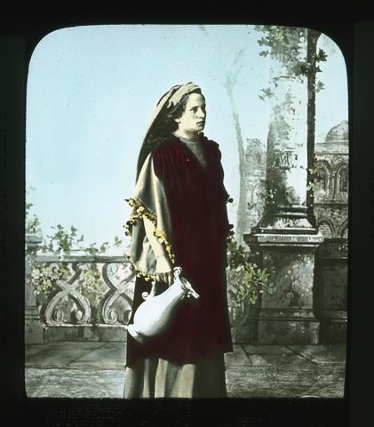
2865. [Image] Martha
 Maria Schwalb, too, had many an opportunity during the long summer, to show her housewife accomplishments. Nor was she unassisted by her humbler sister in these duties. The arrangements for entertaining ...
Citation Citation
- Title:
- Martha
Maria Schwalb, too, had many an opportunity during the long summer, to show her housewife accomplishments. Nor was she unassisted by her humbler sister in these duties. The arrangements for entertaining the crowds that came were in the hands of the central committee. This committee assigned travellers to the different hotels and homes. Lodgings cost from $1.00 to $2.50 per day according to location. The meals cost as much more. Here let one (Mrs. Elizabeth Hayhurst of Portland) who witnessed the portrayal of this great play in 1922 tell us some of her observations and experiences. "We left Munich Saturday afternoon on one of the many special trains for Oberammergau which is about a two hour journey by fast train. We went through a picturesque country, whose fir-clad hills reminded us very strongly of Oregon, while the numerous blue lakes and chalet-like houses partook of the characteristics of Switzerland. Soon we were in sight of the lovely Bavarian Alps, and entering the valley of the Ammer, beheld Oberammergau - a small village nestled at the foot of Kofel, a high mountain peak with precipitous sides whose crest is surmounted with a cross. Upon our arrival, we were put in the care of a porter, who was dressed in the quaint garb of the Bavarian peasant - short leather breeches, embroidered velvet jacket, and a peaked leather hat adorned with a feather of a wild fowl. We followed him to the home of our host - Hans Mayr, who had the role of "Pilate" in the play. Frau Mayr greeted us cordially, as she domiciled forty of us Americans seemingly without any effort whatsoever, and made us feel quite like we were her personal guests instead of playing ones. A walk about the village later brought forth many "Ohs and Ahs". Most of the houses are painted a soft green, gray or white, and on the outside walls of many are painted religious scenes, and on one house there was a canopy of ivy growing about a painted shrine to the Virgin. Everywhere there were shrines and on the banks of the clean, clear Ammer river was a splendid monument of the Crucifixion. After our simple but wholesome evening meal, many of us purchased copies of the play, and knowing no German, which is the original text, I obtained an English version, to familiarize myself with the lines I had journeyed so far to see and hear interpreted. The characters are selected by a committee that is elected by the whole community, and the villagers wait with breathless anticipation the announcement of the bestowal of the assignment, as often a near-tragedy is witnessed when one is deemed too old to continue in a famous role. Anton Lang has been the Christus for three consecutive decades but he will not be able to continue in the role, as the crucifixion scene where he is suspended on the cross for twenty minutes is a great physical strain. Frau Lang has never witnessed the crucifixion scene as given by her husband. On the day of the performance, Anton Lang remains at the auditorium all day - simple food being brought to him during the noon intermission when he rests. By profession, he is a potter. He is profound student of the life of Christ, and has made a pilgrimage to the Holy Land in order to portray the role. The bestowal of the role of the Christus is considered the highest honor within the power of the community as there is the character requisite as well as the acting one. That interest in the Play is lifelong can best be revealed by the interest of Johann Zwinck who was first a boy in the play, twice enacted the part of the disciple, Joh, and for three decades interpreted the role of Judas - said to be among the greatest of the Judases and in 1922 was the venerable Simon of Bethany, as well as understudy to the Judas. It is told of him that while he wished nothing to happen to Guida Mayr - the Judans of 1922, but Oh! how much he should like to just once again play the part of Judas, and when he was told that it would be difficult for him to make himself heard with so many of his teeth gone, he replied, "well, if I were sure of the chance, I would try in some way to gather together enough money to buy teeth". George Lang, the director of the play, is a young man of about thirty years. He was wounded in the late war and one hand is atrophied. He is their teacher in the wood carving school. Wood carving is the principal industry of the village and to that fact may be ascribed the artistic success of the play. The Villagers day by day experience the joy of creating beautiful objects. The robes have all been designed and made in the village from wonderful materials gotten mostly from the Orient. No make-up whatsoever is used, not even a wig is worn, another secret of the lovely hair one sees there everywhere. No married woman is given a speaking role, but an exception was made to the understudy of the Virgin Mary of 1922, who was the Virgin Mary of 1910, but who in the meantime has been wooed, wed, and widowed. Nine hundred five people have a part in the production of the play; there are 124 speaking roles; 50 musicians in the orchestra and 45 singers in the well-trained chorus. Seven hundred persons from mere tots of four to men and women of venerable years appear in the mob scene; 75 men are needed to collect the tickets and serve as doorkeepers and ushers, and remember at the same time thousands are being entertained in the homes of the villagers, as the few small hotels cannot begin to provide for the large number who come from all parts of the world to see the Marvelous Play of all time. The prices were established early in the year of 1922, and although the value of the mark declined many times in value before the season had hardly begun, there was no deviation from the established price of either the seats or the accomodations. Thus it was that eleven of the villagers journeyed to American to try to retrieve some of the deficit. Each summer a religious play is given which enables the selecting committee to know who is best adapted to the various roles, and each family hopes it may be represented in the famous characters and shapes its daily life to that end. We were awakened early Sunday morning by such peaceful sounds as the crowing of the cocks, lowing of the calves, tinkling of the bells of the cows as they were being driven through the village streets to the pasture, and the pealing of the chimes from the village's one church. Upon arising, we were greeted with frosted roofs and fences, which was a most welcome sight, as it foretold a clear day. We breakfasted at six-thirty, after which we were given our tickets to the open-air auditorium, as experience has shown that it simplifies matters to retain the tickets as long as possible to avoid all the useless mislayings and losings. The seats are distributed according to the household, the better homes secure the better seats for their guests. Our hostess very thoughtfully suggested our securing robes and cushions, which were provided for a small fee and made our stay in the open-air auditorium much more comfortable. As we went to the Play through the village streets, it seemed as though the whole world had come to Oberammergau. There were monks and nuns of the various orders, Hindoos from India, Syrians from the Near East, a Japanese and Chinese from the Far East, and very, very black people from Africa. We were requested to be in our seats at 7:45, and there we were, 4200 sitting, hundreds standing and scores kneeling, when at precisely eight o'clock the Chorus dressed in rich colorful robes advanced from the colonnades on either side of the stage and sang the opening number which is a prayer of thanks for their deliverance from the awful scourge in ages past and an appeal from the blessing of the presence of the Saviour always. Then the prologist in full, rich voice gave the following beautiful greeting which sounds the keynote of the whole play. "Welcome, welcome, to all, whom here the tender love Of the Saviour unites, mourning, to follow Him On His journey of suffering To the last resting place. Who from far and from near, all here have come today They all feel themselves now joined in brotherly love As disciples of one Lord Who has suffered death for all. Who gave Himself for us, with compassion and love Even to bitter death. To Him let us lift up Our gaze and our hearts too, With love unfeigned and gratitude. Up to Him let us lift all our thoughts and our souls, Pray with us - yea - with us pray, as the hour comes, When the dept of our sacred vow We pray to the supreme GOD". There are twenty-four tableaux and the function of the tableaux is to connect the incidents of the old testament that relate to the incidents of the last seven days of Christ. The dialogue begins with Christ's entry into Jerusalem, and our very souls were quickened as we beheld the face of Him who has beem so familiar to us through the very best of painting and sculpture. As the sad story unfolded, there were lovely pictures of indelible impress left upon our minds. The bleating of the sheep as they were freed from the pens and the flying of the doves over the audience, all added to the realism of the Temple scene. Then the beauty and the humility of Mary Magdalene as she wiped the feet of the Christus with her lovely long hair; the pathos and the tenderness of the leave-taking of the Christus of His mother in Bethany, and the Last Supper which is an animated counterpart of the Da Vinci painting. The play has progressed until the betrayal of the Christus by Judas in the Garden of Gethsamane when the Noon intermission is announced which is the first intermission of the morning. We were all enthralled as we wended our way quietly to our various place of abode for luncheon, which in many instances, is served by those appearing in the performance. At 1:15 we were again in our seats in eager anticipation of the continuance of the wonderful story of the Ages, as the shortening of days of September made it necessary to resume the Play at 1:30 in order to finish before nightfall. The lines of the Play have Judas reveal where the Christus is spending the night rather than an actual betrayal, and when Judas realized all to late what his telling has brought to the Christus, he is so filled with compassion that he receives our pity instead of our scorn. Scene after scene is portrayed until we are confronted with the realistic "Way of the Cross", and the Chorus, now dressed in black, sing a dirge-like refrain all through the Crucifixion Scene, which was too real and too sad for most of us. As the body was removed from the cross we thought at once of another famous painting "Rubens' Descent From the Cross" and during the rites of the last unction, another work of art came to our mind, Michael Angelo's marble masterpiece "Pieta" as Mary, the Mother, folded in her arms the beautiful body of the Christus. The Christ appeared for a moment to Mary Magdalene after the resurrection, and in a final tableau, we had a glimpse of the Ascension. The last chorus was sung--a glad, halleluiah one-- and the somber robes of mourning have been replaced by the first, bright, colorful ones, and the final curtain is drawn about five-thirty upon the marvelous Passion Play. It has filled our very souls with reverence and a prayer that the Great Sacrifice of Reconcilliation upon Golgotha may contribute to a world peace and a better understanding among the nations and within the nations until the whole world is imbued with the same unity and co-operation that makes possible the perfect rendering of this marvellous Play by the villagers of Oberammergau.
-
Cover title; At head of title: Department of the Interior, General Land Office
Citation -
2868. [Image] The Endangered Species Act (ESA) in the 109th Congress conflicting values and difficult choices
IB10144 04-22-05 The Endangered Species Act (ESA) in the 109th Congress: Conflicting Values and Difficult Choices SUMMARY The 109th Congress is likely to consider various proposals to amend the ...Citation Citation
- Title:
- The Endangered Species Act (ESA) in the 109th Congress conflicting values and difficult choices
- Author:
- Buck, Eugene H
- Year:
- 2006, 2008, 2005
IB10144 04-22-05 The Endangered Species Act (ESA) in the 109th Congress: Conflicting Values and Difficult Choices SUMMARY The 109th Congress is likely to consider various proposals to amend the Endangered Species Act of 1973 (ESA; P.L. 93-205; 16 U.S.C. ??1531-1543 ). Major issues in recent years have included changing the role of science in decision-making, modifying critical habitat procedures, reducing conflicts with Department of Defense activities, incorporating further protection and incentives for property owners, and increasing protection of listed species, among others. In addition, many have advocated enacting as law some ESA regulations promulgated during the Clinton Administration. The ESA has been one of the more contentious environmental laws. This may stem from its strict substantive provisions, which can affect the use of both federal and non-federal lands and resources. Under the ESA, species of plants and animals (both vertebrate and invertebrate) can be listed as endangered or threatened according to assessments of their risk of extinction. Once a species is listed, powerful legal tools are available to aid its recovery and protect its habitat. The ESA may also be controversial because dwindling species are usually harbingers of broader ecosystem decline: the most common cause of listing species is habitat loss. The authorization for spending under the ESA expired on October 1, 1992. The prohibitions and requirements of the ESA remain in force, even in the absence of an authorization, and funds have been appropriated to implement the administrative provisions of the ESA in each subsequent fiscal year. In the 108th Congress, two bills were reported by the House Committee on Resources, but not enacted, that would have amended the ESA to modify scientific peer review and critical habitat procedures. Interior appropriations measures funded Fish and Wildlife Service programs related to endangered species (P.L. 108-108 provided $265 million for FY2004; P.L. 108-447 provided $262 million for FY2005). P.L. 108-136 (Defense authorization) included an ESA amendment to direct that critical habitat not be designated on military lands under certain conditions when Integrated Natural Resources Management Plans are in effect. P.L. 108-137 (Energy and Water appropriations) prohibited use of FY2004 or earlier funds to reduce water deliveries under existing contracts for ESA compliance for the silvery minnow on the Middle Rio Grande River unless water is obtained from a willing seller or lessor; this prohibition appears to have been made permanent by ?205 of Div. C of P.L. 108-447. P.L. 108-148 (Healthy Forests Act) authorized hazardous fuels reduction projects on BLM and national forest lands, including those containing habitat for listed species; directed establishment of a healthy forests reserve program to promote recovery of listed species; and directed the Secretary of the Interior to provide property rights assurances to landowners enrolled in the healthy forests reserve program. Congressional Research Service ? The Library of Congress CRS
-
2869. [Image] Programmatic environmental assessment for Klamath Basin Ecosystem Restoration Office Projects, 2000-2010
Programmatic Environmental Assessment Summary This Environmental Assessment (EA) provides compliance with the National Environmental Policy Act (NEPA) for restoration actions undertaken by the US Fish ...Citation Citation
- Title:
- Programmatic environmental assessment for Klamath Basin Ecosystem Restoration Office Projects, 2000-2010
- Author:
- U.S. Fish and Wildlife Service. Klamath Basin Ecosystem Restoration Office.
- Year:
- 2000, 2005, 2004
Programmatic Environmental Assessment Summary This Environmental Assessment (EA) provides compliance with the National Environmental Policy Act (NEPA) for restoration actions undertaken by the US Fish & Wildlife Service's Klamath Basin Ecosystem Restoration Office (ERO) in Klamath Falls, Oregon. These restoration activities are needed due to the large-scale loss of wetland and riparian habitat and degraded water quality. The purpose of these restoration efforts is the improvement of conditions of the watershed with specific regard to habitat and water quality, resulting in, among other benefits, improved conditions for the endangered fish species (bull trout and Lost River and shortnose sucker) populations of the basin. The geographic scope of this EA is defined as the upper Klamath River basin, including the entire watershed from Irongate Dam upstream to the headwaters. This EA is intended to provide NEPA compliance for restoration projects conducted between the years 2000 and 2010. The ERO was established in 1993 to sponsor and assist with a variety of restoration activities in the Klamath Basin. The ERO funds and provides technical assistance to restoration projects involving private landholders, concerned groups, and other state, federal, and tribal agencies. Four alternatives are presented in this EA. The proposed alternative (Alternative 1) consists of a comprehensive program of ecosystem restoration, promoting projects in both riparian areas and in upland habitats. This would continue the current program in effect since 1994. NEPA compliance would primarily be carried out via a single, programmatic document saving time and funds. The Fish & Wildlife Service proposes to fund and administer the following projects types: Riparian Projects: (fencing for livestock management; native plant establishment & diversification; non-native plant removal/control; erosion control; contour re-establishment; impoundment removal; wildlife habitat improvements) Wetland Projects: (fencing; wetland restoration and enhancement; wildlife habitat improvements) Upland or Road Projects: (road abandonment, decommissioning, & obliteration; road drainage improvements and storm proofing, re-establishment of historic contours; silvicultural treatments; native plant establishment/diversification; non-native plant removal/control; fencing; landslide treatments; culvert/stream crossing upgrades; erosion control; wildlife habitat improvements). In-stream Projects: (habitat complexity and diversity improvements; hydrologic regime improvements; coarse woody debris supplementation; natural or artificial barrier removal, modification &/or creation; fish screens installation). Alternative 2 would concentrate restoration efforts only on riparian, instream, and wetland areas. Road projects would be conducted only within the riparian corridor, as defined. NEPA compliance would also be conducted programmatically. Alternative 3 would cease all restoration activities conducted and funded by the ERO in the Klamath Basin. This alternative would serve as a benchmark against which the effects of the restoration alternatives discussed above can be compared. Alternative 4, the "No Action" alternative, would continue current management policies with regard to NEPA compliance, providing compliance on a project by project basis requiring independent analysis for each project. The affected environment of the region is described in detail. The environment has been changed significantly since the 1890's due to logging, agriculture and urban development. An extensive system of dams, canals, and drainage structures has resulted in the conversion of approximately 80% of pre-settlement wetlands to agricultural uses. Riparian corridors have been similarly impacted, and upland forests regions have been affected by logging, road construction and other factors. These changes have contributed to problems with the water quality in the region, contributing to the listing of several fish species as threatened or endangered; loss of habitat has affected a large number of other species as well. The environmental effects of each alternative is analyzed. Some short term negative impacts could occur as a result of the projects authorized by both Alternative 1 and Alternative 2, but these would be strongly offset by the expected beneficial results to water quality and habitat conditions. Alternative 1 would be expected to have a greater overall effect on the environment than Alternative 2, since many of the underlying factors with which restoration efforts are concerned originate in upland conditions (i.e. sedimentation and hydrologic functionality). Alternative 3 would result in conditions remaining much as they are currently, although other programs and organizations are making efforts at restoration activities. The environmental impacts of individual projects anticipated under Alternative 4 would be generally the same as for similar projects under Alternative 1. The primary difference between the two alternatives would be the higher efficiency and improved cumulative analysis resulting from a programmatic approach as proposed in Alternative 1. Public participation in the NEPA process has been, and will continue to be, solicited and welcomed. Compliance with state and federal laws and regulations such as the Clean Water Act, National Historic Preservation Act, and the Endangered Species Act, as well as guidelines for contaminant surveys, will be carried out as detailed. While these projects are expected to play an important role in the restoration of the region, none of these alternatives are expected to have a significant impact when compared with the loss of wetland, riparian and upland habitats over the past century, impacts which do occur would be of a cumulatively beneficial nature. Other restoration efforts are being carried out in the area by other governmental and private groups, and it is expected that these combined efforts will achieve important beneficial results for the ecosystem.
-
2870. [Image] The South Portal Project : creating a sense of arrival
"Holistic planning for Lake Ewauna & the south entry to the City of Klamath Falls"Citation -
ill., photos; Cover title; "September, 1985."; Includes bibliographical references (p. 50-51)
Citation -
2872. [Image] Klamath Falls Resource Area resource management plan and environmental impact statement : final : Volume 3
Proposed resource management plan/final environmental impact statement for the Klamath Falls Resource AreaCitation Citation
- Title:
- Klamath Falls Resource Area resource management plan and environmental impact statement : final : Volume 3
- Author:
- United States. Bureau of Land Management. Klamath Falls Resource Area Office
- Year:
- 1994, 2005
Proposed resource management plan/final environmental impact statement for the Klamath Falls Resource Area
-
2873. [Image] Annual program summary 2004
Annual Program Summary and Monitoring Report - FY2004 Table of Contents ANNUAL PROGRAM SUMMARY 1.0 Introduction 3 2.0 Summary of Accomplishments 3 3.0 Budget and Employment 6 4.0 Land ...Citation Citation
- Title:
- Annual program summary 2004
- Author:
- United States. Bureau of Land Management. Klamath Falls Resource Area Office District
- Year:
- 2005
Annual Program Summary and Monitoring Report - FY2004 Table of Contents ANNUAL PROGRAM SUMMARY 1.0 Introduction 3 2.0 Summary of Accomplishments 3 3.0 Budget and Employment 6 4.0 Land Use Allocations within the Klamath Falls Resource Area 6 Late-Successional Reserves and Assessments 8 Matrix 8 5.0 Aquatic Conservation Strategy 9 Riparian Reserves 9 Watershed Analysis and Key Watersheds 9 Watershed Restoration 10 Roads 10 Riparian Habitat Enhancement 10 Stream Restoration 11 6.0 Air Quality 11 7.0 Water and Soils 11 Water - Project Implementation 11 Soils - Project Implementation 12 Water - Inventory and Monitoring 12 Soils -Inventory and Monitoring 13 State-listed Clean Water Act 303d Streams 13 RMP Best Management Practices 13 8.0 Terrestrial Species and Habitat Management 14 Survey and Manage Species 14 Threatened/Endangered Species 14 Northern Spotted Owl 14 Bald Eagle 14 Special Status Species-Animals 15 Peregrine Falcon 15 Yellow Rails 15 Bats 15 Northern Goshawk 15 Oregon Spotted Frog 15 Sage Grouse 16 vii Klamath Falls Resource Area Mollusks 16 Great Gray Owl 16 Special Status Species - Plants 16 Other Species of Concern 17 Neotropical Migratory Landbirds 17 Terrestrial Habitat Management 17 Nest Sites, Activity Centers, and Rookeries 17 Big Game Habitat 19 9.0 Aquatic Species and Habitat Management 19 Threatened/Endangered Species 19 Lost River and Shortnose Suckers 19 Bull Trout 20 Endangered Species Act Consultation 20 Aquatic Habitat Restoration 20 Klamath River Hydroelectric Facility Relicensing 21 10.0 Pathogen, Disease, and Pest Management 21 11.0 Weed Management 22 Inventories 22 Control 22 12.0 Special Areas/Management 23 Wild and Scenic Rivers 23 Wilderness 23 Areas of Critical Environmental Concern 23 Tunnel Creek Special Botanical Area 24 Klamath Canyon ACEC 24 Old Baldy Research Natural Area 24 Wood River Wetland ACEC 24 Environmental Education Areas 25 13.0 Cultural Resources 26 14.0 Visual Resources 26 15.0 Rural Interface Areas 26 16.0 Socioeconomic Conditions 27 Jobs-in-the-Woods 28 17.0 Environmental Justice 30 18.0 Recreation 30 Recreation Pipeline Restoration Funds 30 Recreation Projects 31 viii Annual Program Summary and Monitoring Report - FY2004 Recreation Fee Demonstration Project 31 Status of Recreation Plans 32 Volunteer Activities 32 Tourism 33 19.0 Forest Management and Timber Resources 33 Silvicultural Prescriptions 33 Timber Sale Planning 34 FY 2004 Timber Sale Accomplishments 34 Status of Sold & Awarded Klamath Falls RMP Timber Sales 35 Forest Development Activities 39 Stewardship Contracting 42 20.0 Special Forest Products 42 21.0 Energy and Minerals 43 22.0 Land Tenure Adjustments 44 23.0 Access and Rights-of-Way 45 24.0 Transportation and Roads 45 25.0 Hazardous Materials 46 26.0 Wildfire/Fuels Management 46 27.0 Law Enforcement 47 28.0 Rangeland Resources / Grazing Management 48 Fiscal Year 2004 Summary 49 Fiscal Years 1996-2004 Summary 50 Wild Horse Management 51 29.0 Cadastral Survey 52 30.0 Education and Outreach 52 31.0 Research 56 32.0 Coordination and Consultation 58 Federal Agencies 58 State of Oregon 58 Counties 59 Cities 59 Tribes 59 IX Klamath Falls Resource Area Watershed Councils 59 Chartered Advisory Groups 60 Other Local Coordination and Cooperation 61 33.0 National Environmental Policy Act Analysis and Documentation 63 NEPA documentation 63 Klamath Falls Resource Area Environmental Documentation 63 Protests and Appeals 63 34.0 Plan Evaluations 64 Third Year Evaluation 64 Eighth Year Evaluation 64 35.0 Plan Maintenance 65 36.0 Plan Amendments 72 Plan Revision 76 MONITORING REPORT Introduction 79 All Land Use Allocations 83 Late-Successional Reserves 86 Matrix 88 Riparian Reserves 92 Air Quality 95 Water and Soils 96 Terrestrial Species Habitat 101 Special Status and SEIS Special Attention Species Habitat 106 Aquatic Species Habitat 110 Noxious Weeds 112 Special Areas 113 Wild and Scenic Rivers 115 Cultural Resources Including American Indian Values 116 Visual Resources 118 Rural Interface Areas 119 Socioeconomic Conditions 120 Recreation 121 Forest Management and Timber Resources 121 Special Forest/Natural Products 122 Wildfire / Fuels Management 124 Rangeland Resources / Grazing Management 124 GLOSSARY/ACRONYMS 129 Annual Program Summary and Monitoring Report - FY2004 List of Tables Table 2.1 - Summary of Resource Management Actions, Directions, and Accomplishments 4 Table 2.1 - Summary of Resource Management Actions, Directions, and Accomplishments (Cont.).5 Table 3.1 - Resource Area Budget Fiscal Year 2004 6 Table 4.1 - Land Use Allocation 8 Table 5.1 - Watershed Analysis Schedule 10 Table 5.2-Watershed Analysis Status Fiscal Year 2004 10 Table 6.1 -Air Quality Management Fiscal Year 2004 11 Table 7.1 - Watershed Activity Fiscal Year 2004 12 Table 7.2 - KFRA Clean Water Act 303(d) Water Bodies 13 Table 8.1a - BLM /KFRA Special Status Species Designations Summary -Animals 18 Table 8.1b - BLM (KFRA) Special Status Species Designations Summary - Plants 18 Table 8.2 - Terrestrial Habitat Monitoring Fiscal Year 2004 18 Table 8.3 - Monitoring for Nest Sites, Activity Centers, Rookeries, Special Habitats 18 Table 9.1 -Aquatic Habitat/ Fish Passage Management Fiscal Year 2004 19 Table 11.1 - Managed Weed Species 20 Table 12.1 - Special Management Areas 25 Table 13.1 - Cultural Resources Management Fiscal Year 2004 26 Table 16.1 - Total Payments in Lieu of Taxes and Acres by County for FY 2004 28 Table 16.2 - O&C Payments To Counties FY 2004 29 Table 16.3 - Jobs in the Woods Program Fiscal Year 2004 29 Table 18.1 - Recreation Statistics Fiscal Year 2004 30 Table 18.2 - Recreation Fee Demonstration Project Fiscal Year 2004 32 Table 19.1 - Klamath Falls Timber Sale Volume (MBF) and Acres FY 2004 35 Table 19.2-Timber Volume Sold in FY 2004 36 Table 19.3 - Harvest Activity for FY 2004 36 Table 19.4 - Planned Timber Sales (FY 2005 & 2006) 36 Table 19.5 - Status of Sold and Awarded Timber Sales 37 Table 19.6 - Summary of Volume Sold 38 Table 19.7 -Volume and Acres Sold by Allocations 38 Table 19.8 - Timber Sales Sold by Harvest Types 38 Table 19.9 - Timber Sale Acres Sold by Age Class 39 Table 19.10 - Forest Development Activities 41 Table 20.1 - Special Forest Products Fiscal Year 2004 43 Table 21.1 - Energy and Minerals Management Fiscal Year 2004 44 Table 22.1 - Land Use Tenure Adjustments Fiscal Year 2004 45 Table 24.1 - Roads and Transportation Management Fiscal Year 2004 45 Table 25.1 - Hazardous Materials Management Fiscal Year 2004 46 Table 26.1 - Fire and Fuels Management Fiscal Year 2004 46 Table 27.1 - Law Enforcement Fiscal Year 2004 47 Table 28.1 - Range Resources Management Fiscal Year 2004 48 Table 29.1 -Cadastral Survey Summary Fiscal Year 2004 52 Table 30.1 - Environmental Education/Outreach Program Summary FY2004 54 Table 30.2 - Environmental Education/Outreach Special Events FY2004 55 Table 30.3 - Environmental Education/Outreach Programs & Tours FY 2004 56 Table 32.1 - Challenge Cost Share Fiscal Year 2004 62 XI Klamath Falls Resource Area Table 33.1 - NEPA Analyses and Documentation Fiscal Year 2004 64 Table 36.1 - Redefined Survey and Manage Categories 74 Table M.I - Projects Monitored FY 2004 80 Table M-2 - FY 2004 Implementation Monitoring Selection Categories 81 Table M-3 - Comparison of Projected vs. Actual Harvest Volume (MMBF)/Acres to Date 82 Table M-4 - Timber Sale Volume and Acres Offered (Entire Resource Area) 83 Table M-5 - Timber Sale Monitoring Summary 89 Table M-6 - Post Treatment Stand Characteristics for West Grenada Timber Sale - FY 2004 90 Table M-7 - Status of Watershed Analysis 98 List of Figures Figure 1 - General Location Map 2 Figure 2 - KFRA Land Allocations 7 Xll
-
2874. [Image] Surveying forest streams for fish use
Oregon Department of Forestry Forest Practices Section 2600 State Street Salem, OR 97310 Dl Fish 8 Wildlife Oregon Department of Fish and Wildlife Habitat Conservation Division P. O. Box 59 Portland, OR ...Citation Citation
- Title:
- Surveying forest streams for fish use
- Author:
- Oregon. Forest Practices Section; Oregon. Habitat Conservation Division
- Year:
- 1995, 2005, 2004
Oregon Department of Forestry Forest Practices Section 2600 State Street Salem, OR 97310 Dl Fish 8 Wildlife Oregon Department of Fish and Wildlife Habitat Conservation Division P. O. Box 59 Portland, OR 97207 Introduction Identifying Oregon streams that contain fish is an important part in carrying out the new Water Protection Rules. These rules aim to protect areas of benefi-cial uses, such as fish. First, however, the beneficial uses present in each forest stream must be correctly identified. At present, a large number of fish- bearing streams are not identified on stream classification maps. To correct this problem, the Oregon Department of Forestry ( ODF) and the Oregon Department of Fish and Wildlife ( ODFW) must complete comprehensive surveys to identify fish use on all non- federal forest streams in Oregon. This effort will require at least 3 to 5 years and a significant financial investment. Because many streams are not accurately classified, the new rules also tempo-rarily protect streams that are likely to contain fish. Under the rules, for example, if Stream A flows into a body of water known to contain fish, it is assumed that fish also are using Stream A, up to the point that a natural barrier blocks their way farther upstream ( see OAR 629- 57- 2100: ll( b) B). Once the survey efforts are complete, this interim rule will not be needed. Coordinated efforts by public agencies, landowners, and others to complete fish- presence surveys will assure that important fisheries resources are pro-tected in the most cost- effective way. Landowners or any interested party may collect stream- classification information so that the overall survey can be completed as quickly as possible. Many private forest landowners, in cooperation with Oregon Department of Fish and Wildlife, are now completing inventories of stream habitat conditions on their lands. In the future, these cooperative efforts may also include fish-presence surveys. This publication tells how to complete fish- presence surveys on forested streams. The guidelines cover: How to plan either " operation- specific" or " maximum upstream fish distribution" surveys The proper way to conduct surveys The proper time of year to conduct surveys Minimum efforts required in completing the surveys The legal requirements for completing the surveys How to provide information to Oregon Department of Forestry to update the stream classification maps The stream reclassification process Operation- specif ic surveys Maximum upstream distribution surveys Planning the survey There are two major types of survey: operation- specific surveys, and surveys to find the maximum upstream distribution of fish. Each type requires different planning and is conducted using different approaches. Operation- specific surveys are those to classify a stream only in the particular area of an operation. This kind of survey may not include efforts to determine the maximum upstream extent of fish use. An operation- specific survey takes minimal planning and coordination. However, it may be very inefficient in the long run because future activities in other areas of the stream may require additional surveys. An operation- specilk survey is very simple to complete. It starts at the down-stream end of the operation area and moves upstream either to the end of the operation area or to the end of fish distribution, whichever comes first. If the purpose of the survey is to prove no fish use, the surveyor must be sure to make at least the minimum effort required to find fish ( see the section on " Survey Effort" on page 10). This kind of survey is done on an entire stream reach or on multiple stream reaches rather than on a restricted portion of a stream. Often, all streams within a basin or reach are completely surveyed. In some cases, the surveys encompass entire ownerships or watersheds. The specific locations of planned operations are usually not the main factor in setting up this kind of survey but can help decide which areas to survey first. Surveys to find the maximum upstream extent of fish use may be the most efficient and cost- effective. Surveyors often cover a group of streams in one area at a time; therefore, travel time is minimized because, often, a group of streams can be easily reached by one common forest road. When travel time is less, the time spent actually completing surveys is greater. This kind of survey may require slightly more planning and coordination to assure efficiency and to minimize duplication of effort by adjacent landowners or by other public agencies, but overall this approach is more cost- effective than the operation-specific surveys. Surveying for the maximum upstream distribution of fish may take more plan-ning than an operation- specific survey, but it is still relatively simple. First, look at ODF Stream Classification Maps for the survey area to see the current extent of fish- use streams. Also note which streams are not classified at all. Next, decide where to start the survey. It may help your planning if you know the relationship between watershed basin area and fish use for your area. Contact the local ODFW office to find out whether these relationships have been established for streams in your area. The information predicts where fish use is " likely to end" and so will help you decide where to start your surveys. At this point, you also may want to consider operations that are planned for certain areas and decide to survey those areas first. After choosing a starting area, look at current road maps to find potential starting points for the survey ( see Figure 1). Look for access points ( such as road crossings) near the upper reaches of the stream. When possible, a survey should start near the highest accessible point in the watershed. If road access to the stream is limited, you may want to start the survey near the point at which the stream's classification size changes from " medium" to " small"; often this point is near the end of fish use ( see Figure 2, page 4). At the starting point, first sample upstream. If you find fish, continue the survey upstream until fish use ends. Be sure to continue sampling above the point at which fish use ends ( see " Survey Effort," page 10). If you make all the required efforts but do not find fish, then survey downstream from the original starting point until you find fish. When surveying downstream, it is important to walk on the streambank until you are ready to sample so that the water stays clear. Begin fish survey above road crossing Fish use extends at least this far Figure I . Selecting survey starting points in an area with a road crossing. Additional survey work may be required if the maximum distribution of fish seems to be affected by a road culvert. If the stream above the culvert has no fish, sample the pool immediately below the culvert. If you find fish in this pool or downstream near the culvert, the culvert is a possible barrier to fish passage. Describe the culvert and the stream on the survey form ( page 19). If you do not find fish in the pool below the culvert, continue the survey down-stream until you do see fish. Begin fish survey here \ \\ \ / I Fish use extends at least this far - - k I Figure 2. Selecting survey starting points, based on the stream- size classification, in an area without a road crossing. Surveys to find the maximum upstream distribution of fish may require sampling across several land ownerships. Be certain to get permission from other landowners before beginning the survey. Contacts with other landowners are also important to prevent a duplication of effort, because many landowners and agencies may be conducting fish- presence surveys. When figuring how many surveyors and how much time you'll need to com-plete surveys in your area, you may want to consider the Department of Forestry's experience. We found that sampling a township ( 36 square miles) required approximately 24 person- days in the Coast region, but an area the same size in the Blue Mountains required only 4 person- days. Survey methods The accuracy and reliability of survey results depend greatly on the methods used to conduct the survey. Methods range from simply looking in the stream ( visual observation) to more intensive and effective sampling with a backpack electroshocker. The method you choose depends on the availability of sam-pling equipment, the size of the stream, the flow and clarity of the water, and other factors. It is important to select a sampling method that is best for the type of survey and for the waters being sampled. If the sample method is not appropriate, the results of the survey will not be very useful. For example, just looking at a stream may tell you there are fish in it at that point, but it is not an acceptable way to find the maximum upstream extent of fish use. Surveys to show that fish are not present require more sampling and specialized equipment in order to provide reliable results. Whenever the survey uses methods other than an electroshocker, it's important to thoroughly explain on the survey report form the reasons for using the other methods. This is the simplest method; it involves only walking the stream to look for fish. It is best to wear polarized sunglasses to reduce glare from the water and to survey only when water conditions allow good visibility. It's also best to walk upstream so that you can " sneak up" on fish in pools. Fish often are near the upstream ends of pools waiting for food to drift toward them. Small fish, such as fry, often are in shallow water along the margin of the stream. Be very alert because fish usually will dart into cover when they detect any movement, especially in small headwater streams. It helps to toss bread crumbs, insects, small twigs, or bemes into the stream to entice the fish to leave cover. The visual method is best suited to small streams where pools aren't deep enough to prevent your seeing the fish. This method is also the least damaging to the fish because actual collection is not required. However, the value of survey results can be reduced by many factors such as cloudy water, surface glare on the water, overcast days ( reduced light), fish behavior, and even the surveyor's poor eyesight. For these reasons, this method is not effective for determining the maximum upstream limit of fish distribution, although it can be used to prove fish are in a certain reach of the stream. Snorkeling is a special method of visual observation that can work well in some situations. Snorkeling allows you to see underwater through a diving mask and breathing snorkel. This method can be used in larger waters where electroshockers are less successful, and it has been used to locate fry where other methods failed. Night snorkel surveys are particularly useful for observ-ing bull trout fry. Visual observation Hook and line Backpack electroshocker The hook- and- line method uses a rod and reel and relies on the feeding be-havior of the fish. In small streams, drop a baited hook into the deepest pools, where larger fish often are. Bait can include worms, single eggs, cheese, dry flies, or stream insects such as caddis larvae. Sample pools that have a lot of cover because those tend to support greater numbers of fish. As with the visual observation method, approach the pool cautiously to avoid alerting the fish. To minimize the risk of injuring or killing the fish, always use barbless hooks. The hook- and- line method can be used when conditions are not good for visual sampling; for example, when water is not clear, flow is high, or the day is overcast. This method may be the most effective for sampling some larger or deeper waters where visual and electroshocker methods can be ineffective. These waters include deep beaver ponds and large, steep streams where downstream barriers ( such as falls and very steep sections) keep fish out of the small tributaries. This method has limitations, though, depending on fish behavior and the life stage of the fish that are present. Fish may be reluctant to bite on cold days, or when the water is murky with sediment, or if the fish detect the surveyor's presence. Also, hook- and- line sampling is not effective if only fry are in the stream. This method also depends on the angling skills of the surveyor. As with the visual observation method, hook- and- line sampling may not be the best way to determine the maximum upstream distribution of fish in small streams, but often it can be used to find fish in larger waters. The most effective way to determine the upstream extent of fish is with a backpack electroshocker. Electroshocker sampling requires additional training and experience, though, to be effective and safe. A backpack electroshocker introduces an electric field into the stream that temporarily immobilizes fish. Stunned fish can be observed as they float in the water, or they can be captured in a small hand net for closer observation if necessary. As with other methods, it is best to work in an upstream direction, wear polarized glasses, and to approach the sampling site carefully to avoid alerting the fish. One person nets fish while another person operates the electroshocker. The netter should walk behind or beside the shocker to avoid alerting the fish. The electroshocker can be very effective for sampling in small streams even where brush or instream cover prevents most other sampling methods. In fact, an electroshocker is often most effective in areas with instream cover because fish usually concentrate in these locations. This method works in streams of various sizes but is less effective in larger streams and in deep pools, espe-cially large beaver ponds. Use electroshockers carefully to minimize killing fish. When properly adjusted and used, the electroshocker should stun the fish without killing them. The fish may escape if the current is set too low, but usually the surveyor will still see the fish and so be able to document fish presence. To sample effectively and minimize fish kill, set the electroshocker on the lowest practical voltage output and low- frequency currents ( low pulse rates). Before sampling, use a voltame-ter to test the electroshocker in a stream. If the voltameter is not available, it is a good idea to test the electroshocker in a stream that you know has fish before working in streams whose fish use you do not know. The test will tell you whether the equipment is working and the effects of using different settings. The surveyors' safety must be considered carefully before using this method. Electroshockers can injure or kill humans if not properly used. Surveyors should not use this method without proper training, including CPR training. Surveyors should work in crews of at least two. All surveyors should wear rubber waders and rubber gloves during stream shocking and never use dipnets with metallic handles; the nets should have wood or fiberglass handles. All members of an electroshocking crew should understand the proper operation procedures and potential dangers of this equipment. The effectiveness of electroshocker sampling depends on water conditions and on the skills of the electroshocker operator and the netter. The electroshocker method may not be so useful in high flows or in turbulent or murky water because the surveyors may not see immobilized fish. Another drawback to this method is that the electroshockers may not be widely available and can be expensive. However, with proper training and experience and under suitable survey conditions, this method is the best for accurately determining the maximum upstream extent of fish use. There may be situations where reliable results can be had by using methods not discussed here. For example, headwater beaver ponds may be effectively Other methods sampled by fishing for at least 48 hours with minnow traps baited with salmon eggs or commercial trout bait. Or, seine nets may be effective in beaver ponds or larger waters. If you are thinking about using these or other sampling methods, discuss it first with the departments of Fish and Wildlife and of Forestry. They will decide whether the proposed methods are appropriate and, if so, set the required minimum level of sample effort for the alternate method. A backpack electroshocker is the best way to get reliable information about the upstream extent of fish use or to prove a stream is m e N ( no fish use). Sur- Survey methods: vey data that document the presence of fish through other methods, such as a summary visual observation or hook- and- line, will always be used to classify streams as Type F as far up as the point of observation, even though the exact upstream extent of fish use may not be known. In some cases, methods other than an electroshocker may give reliable information about the maximum upstream distribution of fish. Examples include deep beaver ponds and large, steep streams in which barriers keep fish out of small upstream tributaries. In those cases, reliable results may be better obtained with hook- and- line sampling or with other methods. Whenever the survey is conducted by methods other than an electroshocker, the reasons for choosing the other method must be thor-oughly explained on the survey form. Timing the surveys Survey accuracy depends a lot on the time of year the survey is done and on stream conditions at that time. Since the purpose of the survey is to accurately document the presence or absence of fish, it is critical to do the survey when fish are expected to be using the upper reaches of a stream. This generally is near spawning times or soon after fry emerge, when stream flows are relatively high. A survey done during a low- flow period may not indicate the actual maximum upstream extent of fish use or accurately prove no fish use the stream. Fish may use the upper reaches of a stream for a limited time only, so fish- use surveys must be timed carefully. Surveys done at other than recommended times may not give a complete description of fish use. For example, if fish are found at other than the recommended survey times, the surveyed part of the stream can be classified as fish- bearing, but the maximum upstream extent of fish use may not be known. If fish are not found, that will not necessarily prove that the stream reach does not support fish use. Only if the survey is made at a time when fish are most likely to be there can the absence of fish be a reliable sign that no fish use that portion of the stream. Other factors can affect the reliability of the survey even if it is made at the proper time. Abnormal flows due to drought or extreme runoff could affect the distribution of fish or the sampling efficiency of the surveyor. So, it is best not only to do the sampling within the recommended time period but also when conditions are appropriate. In some cases, survey timing may not have much effect on the reliability of survey results. This could occur when factors other than seasonal flow patterns control the upstream extent of fish distribution. For example, streams that get most of their water from springs may not have seasonal flow variations, including summer flows low enough to control the upstream distribution of fish. Or, conditions other than low flow could be controlling distribution. For example, large, steep streams that have natural barriers such as falls and steep, impassable sections. In such cases, surveys taken outside the recommended time periods may yield reliable data. However, it is important to describe these conditions thoroughly on the survey forms to justify not following the recom-mended timing. See Table 1 for the recommended sampling periods for different regions of the state for normal water- flow years. Periods differ due to variations in stream flow patterns, fish species, and life- history traits of the species in the different areas. Contact the local ODFW office before sampling to find out the best time to survey the stream you are planning to sample. Table 1. General recommended time periods to sample streams, by geographic region, during nomull water- flow years. Please contact your local ODFW ofice before sampling in order to get specific timing recommendations for the stream you will be sampling. REGION of Recommended Georeaion Stream Survey Period WESTERNO REGON All Coast South Coast West Cascades Interior Siskiyou March 1 through May 3 1 EASTERONR EGON All except spring- fed April 1 East Cascades through June 30 Blue Mountains Spring- fed streams* Entire year * Spring- fed streams are streams that get most of their water Born groundwater sources and that have very minor seasonal variations in flow. Stream surveys must be done within certain time periods ( Table 1) if the purpose is to prove the stream does not contain fish or to document the maximum upstream extent of fish use. mming recommendations are based on normal water- flow years and may vary in some years. Contact the local ODFW office before sampling to get specific timing recommendations for the streams to be surveyed. Information gathered at other times of the year may be used to document fish presence but may not be reliable enough to establish upstream fish- use limits or to classify the stream as II) lpe N ( no fish use). Whenever the recommended survey timing is not used, it is important to explain the reasons on the survey form so that the data can be evaluated for reliability. ~ - ~ Survey timing: a summary Survey effort: a summary Survey effort The level of effort used to complete the survey also can affect the reliability of the survey results. If the level of effort or the amount of stream sampled is too little, it may be wrong to conclude that fish are not present. The following guidelines describe the minimum level of survey effort required to assure that the data are reliable. If the purpose of the survey is to show that no fish use the stream, the survey will be considered reliable only if it includes at least 50 yards of stream length md a minimum of six pools, each at least 1 foot deep, immediately upstream of the point at which the non- fish- bearing section begins. ( In some cases, the survey will have to cover much more than 50 yards of stream in order to also include the required six pools.) In addition, the survey must include sampling any beaver dam ponds in the upstream non- fish section. Surveyors are encouraged to exceed the minimum level of effort in order to be even more sure that fish are absent from a stream reach and that the maximum upstream extent of fish use has been found. A survey intended to show the absence of fish must sample at least 50 yards of stream distance and a minimum of six pools, each at least 1 foot deep, imme-diately upstream of the point at which fish use is believed to end. In addition, any beaver ponds upstream must be sampled as part of the survey. The require-ments for the methods used and the timing of the survey also must be met in order to document the absence of fish. Legal requirements In Oregon, the Department of Fish and Wildlife regulates the collection of fish for personal or scientific use. Generally, collection methods prohibited by the general angling regulations, such as electroshockers, traps, or nets, and collec-tions at times of the year when angling is closed will require a Scientific Collection Permit from the Oregon Department of Fish and Wildlife. Scientific Collection Permits can be issued to agencies, companies, or indi-viduals. Request an application from the Fish Division of the Oregon Depart-ment of Fish and Wildlife, P. O. Box 59, Portland, OR 97207; telephone ( 503) 229- 5410, extension 323. Submit the application at least 1 month before you plan to do the survey in order to be sure the permit can be issued in time. The application requests information about the collection method to be used, when and where collection will be made, and a summary of the proposed project. By law, surveyers must keep records of their collection activities and submit them to the Oregon Department of Fish and Wildlife. Surveys using the visual observation method ( including snorkeling) do not require any licenses or permits because fish are not physically collected. Sampling with the hook- and- line method during open fishing seasons requires only a valid angling license. However, Oregon resident landowners and their immediate families do not need angling licenses to fish on land they own and live on. In either case, the general ahgling regulations for the stream must be followed during hook- and- line sampling unless a Scientific Collection Permit is obtained. Additional restrictions on survey efforts may apply if the stream contains species that the state or federal government lists as sensitive, threatened, or endangered species. Please contact your local ODFW office to find out whether any of these species are likely to be in streams you plan to sample. Reporting survey results Give survey data to the local ODF district office so that district Stream Classi-fication Maps can be updated. On page 19 is a blank survey report form. It asks for information about the location of the stream; the methods, timing, and effort of the survey; the physical character of the stream; observations of fish and wildlife; and the presence of natural or human- created barriers to fish passage. complete one form for each stream reach where fish were ob-served or fish use was found to end. See Figure 3 ( page 12) for descriptions of some fish species common to $ mall, forested streams; these may help to identify fish seen during surveys. Detailed instructions for completing the survey form are on pages 14 through 18. Attach to the Fish Presence Survey Form a copy of the ODF Stream ClassM-cation Map for the surveyed area or, if that is not available, a copy of the 7.5 minute USGS topographic map for the area. Note the following information on the map. ( Examples of completed survey report forms and maps are on pages 21 through 30.) The area of the stream that was actually surveyed ( including the areas without fish) as part of the survey effort. Highlight in yellow the entire stream reach surveyed ( see examples on pages 25,28, and 30). The upper limit of fish use. Note this on the map by drawing a line across the stream and writing the letter F at that point. The name of the surveyor. The date the stream was surveyed. GENUS ONCORHYNCUS - PACIFIC SALMON IOENTIFICATION FEATURES OF JUVENILES Faint parr marks. extend little. if am: below latanl line. Lures SOCKEYE w GENUS ONCORHYNCUS- TROUT IDENTIFICATIOEI FUTURES OF JUVENILES pols in dorsal Teeth on of tongue Maxillary extend past rear margin on throat W - Of eye CUTTHROAT 5 - I 0 parr marks on ridge ahead of dorsal tongue astend & st rear mark on throat Y; V margin of eye STEELHEAD- RAINBOW Few or no spots i n tail Figure 3. Identification characteristics of some juvenile salmon and trout species that may be observed in forested streams. 3. Permission to enter private forest lands should be obtained from all land-owners before the surveys are conducted. 4. Fish- presence surveys should then be made according to the guidelines given in this publication. 5. The required survey information, recorded on the Fish Presence Survey Form and maps, should be given to the local ODF district office. 6. The ODF office will give copies of the completed survey forms and maps to the local office of the Oregon Department of Fish and Wildlife. 7. The Department of Forestry will review the information, usually in consul-tation with the Oregon Department of Fish and Wildlife, to determine whether the survey results are reliable. 8. Based on its assessment of data reliability, the Department of Forestry will make appropriate changes to the ODF Stream Classification Maps. 9. All affected landowners will be notified of the proposed stream classifica-tion changes, according to the notification rules ( OAR 629- 57- 2110( 2)). Instructions for completing the survey report form The following information should be reported on the Fish Presence Survey Form. These instructions are in the order that the information appears on the form. Complete one form for each stream reach or branch where fish were observed or fish use was found to end. This may require assigning codes to unnamed tributaries ( for example, " trib. a," " trib. b") so that survey data can be cross- referenced to the survey maps. Please refer to examples on pages 21 through 29. Surveyor Narne( s): The name of the person or persons responsible for con-ducting the survey and reporting the results. AgencyfCompany: The name of the agency or company that employs the surveyor ( if applicable). Landowner: The name of the landowner of the reach surveyed. Mailing Address and Phone: The address and phone number for the person responsible for the survey. Stream: The name of the stream as reported on the USGS or ODF Stream Classification Map for the area. If the stream is unnamed, report the stream as " unnamed" and list the tributary that it flows into (" Tributary to..."). Tributary to: The name of the main stream ( as reported on the USGS or ODF map) that the surveyed stream flows into. This is especially important if the surveyed stream is unnamed. Quad Map: The name of the USGS 7.5 minute topographic map that includes the reach of the stream surveyed. If the surveyed reach covers more than one quad map, report first the name of the map that shows the identified end- point of fish use and then give the other maps' names. Location: A legal description ( township, range, and section to at least the quarter section) of the location where fish use ends. Date Surveyed: The month, day, and year the fish survey was conducted. Survey Method: Check the box for the survey method used. If more than one method was used, check all that apply and note the most often used method in the comments section or in the form's margin. Survey Amount Above End of Fish Use: The length of stream reach that was surveyed immediately upstream of the identified end of fish use. Estimate ( in feet) the length surveyed, and give the number of pools sampled for fish in that section. A survey to prove the absence of fish must sample at least 50 yards of stream and at least six pools immediately upstream of the end of fish use. In addition, any upstream beaver ponds must also be sampled. Flow Level: The flow conditions at the time of the survey. Use the following categories of flow. Low: Ranges from a series of isolated pools to flowing across less than 75 percent of the average bankfull width. Moderate: Surface water is flowing across 75 to 90 percent of the average bankfull width. High: Surface water flowing across more than 90 percent of the average bankfull width. It is not recommended thatfih presence surveys be conducted at high jlows. Weather: The weather during most of the fish survey ( rainy, overcast, partly cloudy, sunny, snowy, etc.). Water Clarity: The water visibility during the survey. Use the following categories of water visibility. Clear: Visibility is good in pools, deep pools, and riffles. Moderate: Visibility is good only in riffles and shallow pools. Turbid: Visibility is poor in both riffles and pools. It is not recommended that fih presence surveys be conducted when water is turbid. Water Temperature ( optional): The temperature of the stream ( in degrees Farenheit) at the time of the survey. Fish observations Report the species and approximate size ranges of fish observed in the sur-veyed reach. Use Figure 3 ( page 12) as a guide to identifying some game fish species commonly found in small, forested streams. Use the following codes and instructions to complete this section. Species: Use the following names or codes to report fish observed during the survey. If you observe a species not listed here, such as Pacific lamprey, use its common name. Name Species Code Coho salmon Co Cutthroat trout Ct Rainbow troutfsteelhead Rb/ St Bull trout BUT Brook trout BT Unknown salmonid UnS Sizes: Report the size range of fish, in inches, by species. For example, the size range of coho observed could be reported as " 1- 4 inches." If you see several sizes of one species ( for example, some cutthroat trout in the " 1- to 2- inch range and others in the " 6- to 8- inch" range), list them separately. Aquatic wildlife The types of aquatic wildlife that may be observed include tailed frogs ( includ-ing juvenile " tadpoles"), Pacific giant salamanders, and Olympic salamanders. Species: Give the common name of the species, if known. If you don't know the species name, at least report observations by a general name such as " salamanders." Number: The number of aquatic wildlife in each species or group observed. Physical stream data Report the physical characteristics of the stream in the vicinity of the end- point of fish use. Report information separately for ( 1) the section immediately at and downstream of the end of fish use, and ( 2) the area upstream of the maximum extent of fish use. Following are specific instructions for collecting this information. Bankfull Channel Width: By eye, estimate the average width ( in feet) of the bankfull channel for the 100- foot sections above and below the end- point of fish use. The bankfull channel is the area that is scoured by water during average high flows. The edge of the bankfull channel can be identified by looking for changes in vegetation, in soils and litter characteristics, or in the shape of the bank. The bank often will abruptly change slope at the bankfull boundary. Vegetation at the boundary often changes from annual vegetation ( such as grasses) to more permanent vegetation such as trees and shrubs. Estimate the width across the channel between the edges of the bankfull level. Current Wetted Width: Visually estimate the average width ( in feet) of the channel that contains flow ( is wetted) at the time of the survey. Report the estimated averages for the 100- foot sections above and below the end of fish use. Channel Gradient: Measure the average stream gradient with a clinometer for the 100- foot sections above and below the end of fish use. me a piece of flagging at eye level on a branch or shrub, walk up or down the stream bank, and then use the clinometer to sight on the flagging while you are standing on the channel bottom. Read and report the percent gradient. ODF Stream Class Size: The stream size (" small," " medium," or " large") from the ODF Stream Classification Maps for the reaches immediately above and downstream of the end of fish use. Natural barriers This information is very important for understanding relationships between the presence of fish and the physical characteristics of the stream. Understanding these relationships can help determine where fish- presence surveys should be concentrated and help predict where fish are likely to occur if survey informa-tion is not yet available. Generally, natural barriers are permanent structures such as falls or vertical drops more than 8 to 10 feet high for salmon or steel-head or 4 feet high for trout. Log jams, drops over logs, beaver dams, or other organic structures generally are only temporary barriers to fish passage, but report them as well. If fish use ends at a natural barrier, such as a waterfall, bedrock chute or cascades, describe the conditions at the site. Include a description of: ( 1) the type of barrier, ( 2) the approximate height ( in feet), ( 3) the percentage of slope, ( 4) the length ( in feet) of the bedrock chute or cascades, and ( 5) any other conditions that may be limiting fish passage. If the potential barrier is a bedrock chute, note whether the bedrock contains pools or rough features ( such as rocks, boulders, or other breaks in the flow), or whether the water flows in an even, shallow pattern over the bedrock. Please note on the survey map the locations of any natural barriers encountered. If you encounter a natural barrier, also be sure to sample above this point because fish often are found above natural barriers. Road- crossing barriers This information also is very important for understanding relationships be-tween the presence of fish and the physical characteristics of the stream. Road-crossing barriers can alter the relationships. If fish use ends at a road- crossing barrier, such as a culvert, describe the conditions at the site. Describe the type of barrier and its measurements at the time of the survey such as ( 1) the diameter of the culvert, in inches, ( 2) the depth ( in inches) of water in the culvert, ( 3) the height ( in feet) of the jump ( drop) below the culvert or structure, ( 4) the depth ( in inches or feet) of the plunge pool below the culvert outfall, ( 5) the gradient or slope of the culvert, given as a percentage as read off a clinometer, ( 6) the length ( in feet) of the culvert, and ( 7) any other factors that could affect fish passage. Please note on the survey map the locations of any road- crossing barriers, even if they are not at the end- point of fish use. As with natural barriers, be sure also to sample above the site because fish often are found above road- crossing barriers. Other comments Any other comments or notations that you think may be pertinent to the fish survey. It helps to describe any notable habitat characteristics, for example " lots of instream wood," " very few pools in the reach," " heavy silt load in the stream." Use the reverse side of the form if necessary. FISH PRESENCE SURVEY FORM ATTACH A COPY OF THE 7.5 MINUTE ODF STREAM CLASS MAP Surveyor Name( s): Agency: Land Owner: Mailing Address: Phone: Date Surveyed: Stream: Tributary to: Quad Map: Location: T R Sec. Survey Method ( d): 0 Electroshocker 0 h & g 0 Visual Survey Above End of Fish Use: Distance ( feet) Number of Pools Flow Level ( d): 0 Low 17 Moderate High Weather: Water Temperature: Water Clarity ( d): Clear 17 Moderate 17 Turbid FISH OBSERVATIONS AQUATIC WILDLIFE PHYSICAL STREAM DATA If fish use ends at a natural barrier, describe the conditions that prevent upstream fish passage. If fish use ends at a road crossing, describe conditions that may prevent upstream fish passage. Other comments ( use reverse side if necessary): FISH PRESENCE SURVEY FORM ATTACH A COPY OF THE 7.5 MINUTE ODF STREAM CLASS MAP Surveyor Name( s): . be Sorveq , 3 Troo+, FI s h G n r u l l , I*? , S.; L. Agency: N/ C I Land Owner: k! 4~ 4f, l T; M ~ C C Mailing address:?.^. sox ~ g~,\ L L I M UF~ A \ ID~ R) jC? suo Phone: BSB- 5555 ate surveyed: A p ( ; i 2 8, ! ?? s I Stream: Un hawed , " Tr I b R!' Tributary to: lr3 F . 21 o k so- ~ r a& QuadMap: D\ A &\ dy Location: T 305 R 5 " L Sec. 30, sw/ sto Survey Method ( d): d~ lectroshocker Angling 0 Visual Survey Above End of Fish Use: Distance ( feet) I 86 ' Number of Pools Flow Level ( d): CI Low cd~ oderate High Weather: S owv Water Temperature: 7 O F I Water Clarity ( V): dclear Moderate I7 Turbid FISH OBSERVATIONS AQUATIC WILDLIFE Species I Snes 1 Spedes 1 Quant'ity 1 PHYSICAL STREAM DATA If fish use ends at a natural barrier, describe the conditions that prevent upstream fish passage. bk If fish use ends at a road crossing, describe conditions that may prevent upstream fish passage. prf+ Other comments ( use reverse side if necessary): f- 15 L wsz ewd 30 $& abov e f *; rd John50~ m ain\ ifi< ~ r o s s i n OH ~ f r e a ~ 7.% ~ 5t redw g d ~ e n f & ry s t u p abde + he a d 4' & sh use - p & f i a n 10%. 2 1 OREGON FISH PRESENCE SURVEY FORM ATTACH A COPY OF THE 7.5 MINUTE ODF STREAM CLASS MAP Fish & Wildlife Stream: ~) nr? euce, d " Tr t b, O " Tributary to: w F & n~ oq CC. Quad Map: old &\ A% Location: T 382 R 5E Sec.' 30, si/ Sw I Survey Method ( 4): ~ lectroshocker 0 Angling 0 Visual Survey Above End of Fish Use: Distance ( feet) 2 5' 0 Number of Pools 20 Flow Level ( d): 0 Low d ~ o d e r a t e High Weather: Lw+ Water Temperature: 6 0 F I Water Clarity ( d): dclear Cl Moderate Turbid FISH OBSERVATIONS AQUATIC WILDLIFE Species 1 Snes I! , Species Quantity If fish use ends at a natural bamer, desc ' be the conditions that prevent u stre m fish assage. Fid - 4s 4+ 2 S ' ~ r t i Lm* r? d\. A dJ @ cater also % 15& 5 ( ho& a. r. rp Q5 W F - buffis @ ere fouu\ d . opstr + ye If fish use ehs) at a roa d. crossmng, descnbe conhlons that may prevent upstream fish passage. Other comments ( use reverse side if necessary): w tfw+ were fbU 4 above % z 6 + of (~ la+ erf~ ll above fu 25fcof I sowe years. 22 fail s& i ro fish t@ f& probab/ y vp FISH PRESENCE SURVEY FORM ATTACH A COPY OF THE 7.5 MINUTE ODF STREAM CLASS MAP stream: V A ~ ~ ~ + SC~" T & ~ ributaryto: u. F. 3ehbtja14 Creek Quad Map: old - b a t d ~ Location: T 3 S 5 R 5 E Sec. Survey Method ( d): d~ lectroshocker 0 Anghng 0 Visual Survey Above End of Fish Use: Distance ( feet) a 2 5 Number of Pools 2 Flow Level ( d): 0 Low & oderate 0 High Weather: SvMwv Water Temperature: I Water Clarity ( d): d l e a r 0 Moderate 0 Turbid FISH OBSERVATIONS AQUATIC WILDLIFE - ... . .: : :....: ' ' . . . . . . A , , , .: . . . . , . . , .&& : ! Species ... . ..$ pedes Quantity PHYSICAL STREAM DATA If fish use ends at a natural barrier, describe the conditions that prevent upstream fish passage. M/ A If fish use ends at a road crossing, describe conditions that may prevent upstream fish passage. FISH PRESENCE SURVEY FORM ATTACH A COPY OF THE 7.5 MINUTE ODF STREAM CLASS MAP Stream: West h r k Aobrson Cr eeG Tributary to: Johnrow Cre~ k Quad Map: ( ~ ( 4Ith .\ Ay Location: T 385 R 5 E Sec. 2?,, 5E/ sLJ I Survey Method ( d): dlectroshocker 0 Angling Visual Survey Above End of Fish Use: Distance ( feet) 3 00 Number of Pools t% Flow Level ( V): 0 Low d ~ o d e r ae t High Weather: j , y~ I Water Temperature: 60" F= Water Clarity ( d): & ear Moderate Turbid FISH OBSERVATIONS AQ- U ATIC WILDLIFE t Spedes Quantity 1 I PHYSICAL STREAM DATA + IH n D CtsL 5h-* If fish use ends at a natural barrier, describe the conditions that prevent upstream fish passage. N I A If fish use ends t a roqj crossiy, describ~ concl~~ tohnats may prevent upstr am fish passa e. ~ hrvctr ert a no? pQ59 ~ c - r b LOWOJQ 4 u. 4 9 ) drop at * rut-/&. b l d a r p fn qr p aI . 7, slop is 6 70 , and w ( onp 7 % fu~ lv er+ 1s ~ chul~ ledb e replace4 t bi s Svmncr. Other comments ( use reverse s~ de~ fn ecessa ): Lower ~ t r c a - q r d r r & a & e + LC cd en. Sf- rm* bb; M Ieok 30a4, but + k shaln. dry up ;* SOW years. FISH PRESENCE SURVEY FORM ATTACH A COPY OF THE 7.5 MINUTE ODF STREAM CLASS MAP Mailing Address: ?. c, 3 2 , AJLO ~ L4- T o R 70 00 Phone: b40 - oool Date Surveyed: / Ha v 2 / cj? T I stream: ~ nnclcr- ed , " 7- r; b k " Tributary to: Lobs k c Creek Quad Map: BULL Lrceu Rtdqc Location: T 35 R 2W S ~ C . ~ ~ N € + 4 Survey Method ( d): ~ lectroshocker Angling 0 Visual Survey Above End of Fish Use: Distance ( feet) 300 Number of Pools I 57 Flow Level ( d): 0 Low rd~ oderate High Weather: 7k + lVL * wy Water Temperature: 6 O T-Water Clarity ( d): && ear Moderate Turbid FISH OBSERVATIONS AQUATIC WILDLlFE I , , , ' Species Sies Spedes Quantity If fish use ends, at a natural ba ' er, describe t e conditions that prevent upstream fish passage. The. LZ m c b r u f - ~ V~ L ry 54- p X e u e + he ed$+ t.* use. ~ k rlrcnu, RIIIVC ~ L I : : pain+ I S ~ 4 1 ~ g ~ r L ~ d eo5ve r bai( Lle r S, b+ + his ri- gf obnhi~ n o+ Q b r r r t c r. ' 7 If fish use ends at a road crossing, descn e conditions that may prevent upstream fish passage. U P Other comments ( use reverse side if necessary): N r 4.0r L r ~ s; Wj J bCqPn 5 u ru . + r + he L) wediunn - sws\ l size chaqc, F, sh U ~ CC ~ wJh c r t a d c c y t r ; b ~ + G~ d . ovt WLQ) ew- ker s LLII+. 26 FISH PRESENCE SURVEY FORM ATTACH A COPY OF THE 7.5 MINUTE ODF STREAM CLASS MAP Surveyor Name( s): 30 e Cadd i i , Bob hJvrnP1\ Agency: o ba~ ~ a'ndbwner: Lobsfec C r , ~ , , b c c Mailing Address: 7 D. ' 30K 2 , ~ J L pLet~ t , D R DO Phone: 8 YD- o 00 1 Date Surveyed: m4 I/ 2, i? 7- C I f Stream: / ) ~ ~ ~ ~ ek bS "" ~ c Tributaryto: L o b s t e r Lraek Quad Map: B V ' ~ Cr eek ??, d. ie Location: T 73 R 2 0 Sec. 3Y, ~ I. o AA. J G Survey Method ( d): d~ lectroshocker Angling 0 Visual Survey Above End of Fish Use: Distance ( feet) 2 5 0 Number of Pools / D Flow Level ( d): 0 Low d ~ o d e r a t e 0 High Weather: 94, & SU W\ I Water Temperature: 5- 7 " ?= Water Clarity ( d) : Wc1ea. r CI Moderate 0 Turbid FISH OBSERVATIONS AQUATIC WILDLIFE PHYSICAL STREAM DATA Species Sics Spedes If fish use ends at a natural barrier, describe the conditions that prevent upstream fish passage. Quantity If fish use ends at a road crossing, describe conditions that may prevent upstream fish passage. I I Other comments ( use reverse side if necessary): ~ h5ctre um WLS " r y ~ Lw iL tL ~ decy f- goo( r. @. la f is/., observe4 , Ty pr N ~ f . r e u ~ z . FISH PRESENCE SURVEY FORM ATTACH A COPY OF THE 7.5 MINUTE ODF STREAM CLASS MAP Surveyor Name( s): \ ce < . 3ab Tr cut Agency: u/ k2 Mailing ~ ddress: Z3R Rne St , b k n h( e dr ! OR ? d o 0 Phone: ZB?- 3333 Date Surveyed: stream: ~*- aweA Tributary to: c r & QuadMap: G l e w b ~ ~ e k Location: T \ 4 5 R 6 @ Sec. zS,, ~ 3t .+ S-Survey Method ( d): d~ lectroshocker Angling Visual Survey Above End of Fish Use: Distance ( feet) Number of Pools Q Flow Level ( d): 0 Low & oderate High Weather: C( ea c Water Temperature: 5?* F Water Clarity ( d): lW2ear 0 Moderate Turbid FISH OBSERVATIONS AQUATIC WILDLIFE Species Sizes Spedes Quantity PHYSICAL STREAM DATA If fish use ends at a natural barrier, describe the conditions that prevent upstream fish passage. U P If fish use ends at a road crossing, describe conditions that may prevent upstream fish passage.
-
One chapter of a seven chapter annual report from 1999 examining ecological issues regarding the shortnose and Lost River sucker populations in Upper Klamath Lake and Williamson River.
Citation Citation
- Title:
- Molecular evolution and ecology of Klamath Basin suckers. Part B - Evidence for a lethal homozyhous genotpe at the Ankyrin(g) locus in Klamath Basin suckers (Catostomidae)
- Author:
- Oregon Cooperative Wildlife Research Unit
- Year:
- 2000, 2005
One chapter of a seven chapter annual report from 1999 examining ecological issues regarding the shortnose and Lost River sucker populations in Upper Klamath Lake and Williamson River.
-
2876. [Image] Technical assistance and the Oregon Plan for Salmon and Watersheds: a statewide assessment by the Healthy Streams Partnership
"November 2002"; 66 p. in various paginations: ill., form -- Executive summary ([6]p.)Citation Citation
- Title:
- Technical assistance and the Oregon Plan for Salmon and Watersheds: a statewide assessment by the Healthy Streams Partnership
- Author:
- Healthy Streams Partnership
- Year:
- 2002, 2007, 2005
"November 2002"; 66 p. in various paginations: ill., form -- Executive summary ([6]p.)
-
FINAL ECONOMIC ANALYSIS OF CRITICAL HABITAT DESIGNATION FOR THE BULL TROUT September 2004 FINAL ECONOMIC ANALYSIS OF CRITICAL HABITAT DESIGNATION FOR THE BULL TROUT Prepared for: Division of Economics U. ...
Citation Citation
- Title:
- Final economic analysis of critical habitat designation for the bull trout
- Author:
- U.S. Fish and Wildlife Service
- Year:
- 2004, 2005
FINAL ECONOMIC ANALYSIS OF CRITICAL HABITAT DESIGNATION FOR THE BULL TROUT September 2004 FINAL ECONOMIC ANALYSIS OF CRITICAL HABITAT DESIGNATION FOR THE BULL TROUT Prepared for: Division of Economics U. S. Fish and Wildlife Service 4401 N. Fairfax Drive Arlington, VA 22203 Prepared by: Bioeconomics, Inc. 315 S. 4th E. Missoula, MT 59801 TABLE OF CONTENTS EXECUTIVE SUMMARY ES- 1 1 INTRODUCTION AND BACKGROUND 1- 1 1.1 Description of Species and Habitat 1- 2 1.2 Proposed Critical Habitat 1- 5 1.3 Framework and Methodology 1- 6 1.3.1 Types of Economic Effects Considered 1- 6 1.3.2 Defining the Baseline 1- 9 1.3.3 Direct Compliance Costs 1- 10 1.3.4 Indirect Costs 1- 10 1.3.5 Benefits 1- 14 1.3.6 Analytic Time Frame 1- 15 1.3.7 General Analytic Steps 1- 15 1.4 Information Sources 1- 16 2 RELEVANT BASELINE INFORMATION 2- 1 2.1 Socioeconomic Profile of the Critical Habitat Areas 2- 1 2.1.1 Population 2- 1 2.1.2 Land Ownership and Major Uses 2- 2 2.1.3 Employment 2- 12 2.1.4 Economic and Demographic Characteristics of the 74 Counties Containing Bull Trout Critical Habitat 2- 15 2.1.5. Tribes of the Columbia and Klamath Basins 2- 18 2.2 Baseline Elements 2- 21 2.2.1 Recovery Plan 2- 21 2.2.2 Overlap with Other Listed Species 2- 22 2.2.3 Federal and State Statutes and Regulations 2- 25 2.2.4 Summary Discussion of Impacts of Baseline Regulations on Economic Analysis 2- 40 2.2.5 Discussion: Impacts of Existing Fisheries Policies on Timber and Grazing Activities 2- 43 3 FORECASTED ECONOMIC IMPACTS 3- 1 3.1 Categories of Economic Impacts 3- 1 3.1.1 Section 7 Consultations 3- 2 3.1.2 Technical Assistance 3- 4 3.1.3 Project Modifications 3- 5 3.1.4 Distributional and Regional Economic Effects 3- 5 3.2 Consultation History for Bull Trout Since Listing 3- 7 3.2.1 Action Agencies and Activities Involved in Past Bull Trout Consultations 3- 7 3.2.2 Formal Section 7 Consultations History on Bull Trout Since Listing . 3- 13 3.2.3 Informal Section 7 Consultations History on Bull Trout 3- 15 3.3 Project Modifications 3- 16 3.3.1 Modifications to FHWA Bridge Projects 3- 16 3.3.2 Modifications to Grazing Permits 3- 17 3.3.3 Modifications to Timber Harvest 3- 18 3.3.4 Modifications to Mining Operations 3- 20 3.3.5 Modifications to Agricultural Irrigation Projects 3- 21 3.3.6 Modifications to Dams and Hydroelectric Projects 3- 24 3.3.7 Modifications to Forest Management and Road Maintenance Projects 3- 29 3.3.8 Activities Unlikely to Involve Significant Modification 3- 29 3.4 Projected Future Section 7 Consultations Involving the Bull Trout 3- 29 3.4.1 Projected Future Formal Section 7 Consultations 3- 33 3.4.2 Projected Future Informal Section 7 Consultations 3- 36 ESTIMATING THE CO- EXTENSIVE COSTS OF THE DESIGNATION 4- 1 4.1 Summary of Estimated Impacts 4- 2 4.1.1 Annual Administrative Costs of Consultation 4- 2 4.1.2 Costs Associated with Development of HCPs Within Proposed Bull Trout Critical Habitat 4- 3 4.1.3 Annual Bull Trout Project Modification Costs 4- 4 4.1.4 Proposed Critical Habitat Units Expected to Generate the Greatest Economic Impacts 4- 5 4.2 Discussion of Impacts by Action Agency 4- 6 4.2.1 Army Corps of Engineers 4- 7 4.2.2 Bureau of Land Management 4- 9 4.2.3 Bonneville Power Administration 4- 10 4.2.4 Bureau of Reclamation 4- 25 4.2.5 Federal Highway Administration 4- 29 4.2.6 Federal Energy Regulatory Commission 4- 31 4.2.7 U. S. Forest Service 4- 52 4.2.8 Other Action Agencies 4- 79 4.3 Potential Impacts on Small Entities 4- 79 4.3.1 Identifying Activities That May Involve Small Entities 4- 81 4.3.2 Costs Associated with Agriculture Water Diversions 4- 83 4.3.3 Hydroelectric Facility Re- licensing 4- 84 4.3.4 Mining 4- 87 4.4 Potential Impacts on the Energy Industry 4- 88 4.4.1 Evaluation of Whether the Designation will Result in a Reduction in Electricity Production in Excess of One Billion Kilowatt- Hours Per Year or in Excess of 500 Megawatts of Installed Capacity 4- 89 4.4.2 Evaluation of Whether the Designation will Result in an Increase in the Cost of Energy Production in Excess of One Percent 4- 91 APPENDIX A: Detailed Description of Critical Habitat Units A- l APPENDIX B: Ownership of Lands Adjacent to Proposed Critical Habitat Unit and Subunit B- l APPENDIX C: Overlap of Proposed Bull Trout Critical Habitat and Salmon and Steelhead Habitat C- l APPENDIX D: Listing of All Suggested Project Modifications Found in Formal Biological Opinions: By Activity Type D- l APPENDIX E: Length ( stream) and area ( lakes) of proposed designated bull trout critical habitat that is within U. S. Forest Service Land and Forest Service Wilderness Areas E- l APPENDIX F: Breakdown of Total Annual Estimated Costs by Proposed Critical Habitat Unit F- l EXECUTIVE SUMMARY 1. The purpose of this report is to identify and analyze the potential economic impacts associated with the designation of critical habitat for the Columbia River and Klamath River Distinct Population Segments ( DPSs) of bull trout ( Salvelinus confluentus), hereafter " bull trout." This report was prepared by Bioeconomics, Inc. of Missoula, Montana, for the U. S. Fish and Wildlife Service's ( the Service) Division of Economics. 2. Section 4( b)( 2) of the Endangered Species Act ( the Act) requires the Service to designate critical habitat on the basis of the best scientific data available, after taking into consideration the economic impact, and any other relevant impact, of specifying any particular area as critical habitat. The Service may exclude areas from critical habitat designation when the benefits of exclusion outweigh the benefits of including the areas within critical habitat, provided the exclusion will not result in extinction of the species. KEY FINDINGS Total costs associated with both listing and critical habitat designation for the bull trout are forecast to be $ 200 million to $ 260 million over the next ten years. Total costs associated with both listing and critical habitat designation for the bull trout within the proposed Klamath Distinct Population Segment are forecast to be $ 5.3 million to $ 7.3 million over the next ten years. Total costs associated with both listing and critical habitat designation for the bull trout within the proposed Columbia Distinct Population Segment are forecast to be $ 195 million to $ 253 million over the next ten years. Federal agencies are expected to bear 70 to 75 percent of these costs; private entities will incur the remaining 25 to 30 percent. Project modification costs account for as much as 63 percent of forecast costs. Administrative cost represent the remaining 37 percent. U. S. Forest Service and Army Corps of Engineer- related activities account for approximately 70 percent of forecast project modification costs. Activities experiencing the greatest costs include timber harvesting, irrigation diversions, and dam and reservoir operations. Dam and reservoir- related consultations, including power facility re- licensing, account for 42 percent of forecast project modification costs ( excluding the cost associated with reduced irrigation diversions). Timber harvest, irrigation diversions, habitat conservation plans, and mining account for 29 percent, 12 percent, eight percent, and three percent of forecast costs, respectively. In terms of river miles, approximately 18 percent of the total forecast costs are associated with one percent of the proposed designation, 25 percent with five percent of the proposed designation, and 45 percent with ten percent of the proposed designation. When expressed in terms of the expected cost per river mile, the two most costly units are the Willamette River Basin ( Unit 4) and the Malheur River Basin ( Unit 13). ES- 1 Framework for the Analysis 3. The primary purpose of this analysis is to estimate the economic impact associated with the designation of critical habitat for the bull trout. This information is intended to assist the Secretary in making decisions about whether the benefits of excluding particular areas from the designation outweigh the benefits of including those areas in the designation. 1 This economic analysis considers the economic efficiency effects that may result from the designation, including habitat protections that may be co- extensive with the listing of the species. It also addresses distribution of impacts, including an assessment of the potential effects on small entities and the energy industry. This information can be used by decision- makers to assess whether the effects of the designation might unduly burden a particular group or economic sector. 4. This analysis focuses on the direct and indirect costs of the rule. However, economic impacts to land use activities can exist in the absence of critical habitat. These impacts may result from, for example, local zoning laws, State and natural resource laws, and enforceable management plans and best management practices ( BMPs) applied by other State and Federal agencies. For example, as discussed in detail in this report, regional management plans, such as the Northwest Forest Plan, PACFISH and INFISH provide significant protection to bull trout and its habitat while imposing significant costs within the region. Economic impacts that result from these types of protections are not included in this assessment as they are considered to be part of the regulatory and policy " baseline." 5. The measurement of direct compliance costs focuses on the implementation of section 7 of the Act. This section requires Federal agencies to consult with the Service to ensure that any action authorized, funded, or carried out will not likely jeopardize the continued existence of any endangered or threatened species or result in the destruction or adverse modification of critical habitat. The administrative costs of these consultations, along with the costs of project modifications resulting from these consultations, represent the direct compliance costs of designating critical habitat. Importantly, this analysis does not differentiate between consultations that result from the listing of the species ( i. e., the jeopardy standard) and consultations that result from the presence of critical habitat ( i. e., the adverse modification standard). 6. The analysis examines activities taking place both within and adjacent to the proposed designation. It estimates impacts based on activities that are " reasonably foreseeable," including, but not limited to, activities that are currently authorized, permitted, or funded, or for which proposed plans are currently available to the public. Accordingly, the analysis bases estimates on activities that are likely to occur within a ten- year time frame, beginning on the day that the current proposed rule became available to the public ( November 30, 2002). The ten- year time frame was chosen for the analysis because, as the time horizon for an economic analysis is expanded, the assumptions on which the projected number of projects and cost impacts associated with those projects becomes increasingly 1 16U. S. C. § 1533( b)( 2). ES- 2 speculative. An exception to the 10 year analysis time horizon used in this analysis is for Federal Energy Regulatory Commission ( FERC) licenses, which are renewed for up to 50 years. Accordingly, this analysis estimates the annualized costs of the expected impacts associated with section 7 bull trout consultations involving FERC re- licensing over a 50 year time horizon. 7. The analysis is based on a wide range of information sources. Numerous individuals were contacted from the Service, as well as from the U. S. Forest Service ( USFS), Federal Highway Administration ( FHWA), Bureau of Land Management ( BLM), Army Corps of Engineers ( ACOE), Bureau of Reclamation ( BOR), Bonneville Power Administration ( BPA), Natural Resources Conservation Service ( NRCS), U. S. Environmental Protection Agency ( EPA), National Oceanic and Atmospheric Administration ( NOAA) and other Federal agencies. The analysis of the hydroelectric facilities and other dam structures in the region also relied in information from the Northwest Power and Conservation Council ( NWPCC), the Pacific Northwest Utility Coordinating Council as well as information from utilities owning dams in bull trout proposed critical habitat ( e. g., Avista Corporation ( Avista), Eugene Water and Electric Board, Pacificorp and Portland General Electric ( PGE)). Native American Tribes ( e. g., Confederated Salish and Kootenai Tribes), State agencies ( e. g., State Departments of Environmental Quality ( DEQ) and State Departments of Transportation ( DOTs)) and industry organizations ( e. g., American Forest Resource Council, American Farm Bureau and Northwest Mining Association) were also contacted, as were numerous individuals in the private sector on topics ranging from irrigation to forestry to bull trout conservation. Census Bureau and other Department of Commerce data was relied on to characterize the regional economy. 8. The bull trout was listed as a threatened species in 1998.2 Since that time, numerous Action agencies have participated in well over 200 formal consultations and thousands of informal consultations involving bull trout. The past consultation record was used as a starting point from which to predict future consultation activity. Action agencies provided additional information on likely changes in future consultation activity following designation of critical habitat. In some cases these agencies saw little change in future consultation levels. For example, FHWA projects are planned for many years in advance and bridge or road- related bull trout consultations are generally quite certain and foreseeable. In some cases ( e. g., mining activity, irrigation diversions) it was determined that the historical consultation record understated the potential level of future consultation activity for the species and adjustments to future predicted consultation levels were made. For dam and reservoir operations, a wide spectrum of information from agency representatives, as well as the actual FERC re- licensing schedules for privately operated hydropower facilities were used to augment historical consultation rates and develop future annual cost estimates associated with bull trout consultations on dam, reservoir and power- related activities. 2 This economic analysis applies only to the Columbia River and Klamath River DPSs of bull trout and is not a rangewide analysis. The rangewide listing of the bull trout occurred in 1999 and critical habitat will be proposed for the remainder of the range at a later date. ES- 3 Exhibit ES. l provides a summary of the wide range of activities that may be impacted by bull trout- related consultations. Exhibit ES. l PROJECTED ACTIVITIES AFFECTED BY BULL TROUT Action Agency Army Corps of Engineers Bureau of Land Management Bonneville Power Administration Bureau of Reclamation Federal Highway Commission Federal Energy Regulatory Commission U. S. Forest Service Other agencies, including NPS, BIA, U. S. Department of Agriculture ( USDA), U. S. Geological Survey ( USGS), U. S. Fish and Wildlife Service and NOAA Fisheries Activities Consulted on Dam and reservoir operations, streambank stabilization, dredging, bridge replacement, stream restoration. Forest management, grazing, timber harvest, resource maintenance and road construction, weed management, streambank stabilization, flood control projects. Federal Columbia River Power System ( FCRPS)- dam operation, fisheries restoration and augmentation, agricultural practices and irrigation systems. Dam and reservoir operations, irrigation diversions. Highway bridge replacement. Dam re- licensing and removal. Timber harvest, grazing, mining, resource maintenance and road construction, weed management, streambank stabilization, recreation, special use permits, watershed restoration, road decommissioning, irrigation diversions, culvert replacement, and prescribed fuel reduction programs. Assorted activities, primarily fisheries and stream and wetland restoration. Results of the Analysis 9. The economic impacts associated with the designation of critical habitat for the bull trout are expected to range from $ 200 million to $ 260 million over the next ten years ($ 20 million to $ 26 million per year). Federal agencies are expected to bear approximately 70 to 75 percent of the total costs of this designation. A significant portion of the land adjacent to the proposed designation is Federally owned ( 58 percent), 36 percent is under private ownership and the remainder is comprised of Tribal, State or local interests. Of the Federal lands, the majority is managed by the USFS ( 85 percent) and the BLM ( 12 percent). The remaining 25 to 30 percent of costs are expected to be borne by private entities. Exhibit ES. 2 shows the location of USFS and BLM managed land within the proposed designation. ES- 4 Exhibit ES. 2 ES- 5 10. In some cases, the cost associated with consultation is not borne by the Action agency, but passed onto other parties. For example, while farmers and ranchers do not consult on the operation of Federal irrigation impoundments, irrigators could be impacted by potential reductions in water deliveries to maintain instream flow during dry years. While the unit location of USFS- related water diversions is uncertain, it is likely to occur in the Salmon River ( Unit 16), Clark Fork ( Unit 2), Southwest Idaho River and Clearwater River ( Unit 15) Basins, as these units contain the largest portion of USFS managed lands. 11. Consultations that may involve private entities include those related to timber harvest, grazing, mining and power facility re- licensing. Some of the costs associated with these consultations, however, are expected to be borne directly by or passed onto the Federal government ( e. g., increased logging and yarding costs passed onto the USFS through lower stumpage bids for timber). Most of the forecast project modification costs resulting from designation ( 42 percent) are dam and reservoir related ( excluding USFS water diversions). These costs result from consultations on ACOE and BOR dams and reservoirs, BPA consultations on the FCRPS, and FERC re- licensing consultations. Exhibit ES. 3 illustrates the location of major dams within the proposed critical habitat. The remaining project modification costs are associated with timber harvest ( 29 percent), USFS- related water diversions ( 12 percent), habitat conservation plans ( eight percent), and placer gold mining ( three percent). Grazing, forest management, road and bridge construction and maintenance and other activities each account for less than two percent of forecast project modification costs. Exhibit ES. 4 provides the distribution of total costs by activity. 12. Costs can be expressed in terms of unit or river mile; both of these metrics are useful in describing economic impacts. 3 On a cost per unit basis the largest portion of forecast costs are expected to occur in Unit 4, the Willamette River Basin ( 18 percent). These costs are attributable to fish passage and temperature control projects and annual operating and maintenance and fish study costs at ACOE's facilities in the Upper Willamette River System ( Dexter, Lookout Point, Hills Creek and Blue River Dams). The next most costly unit is Unit 16, the Salmon River Basin ( 12 percent). Because this is the largest unit in terms of river miles and proportion of USFS managed land, and because future USFS activities are expected to generate approximately 70 percent of the consultation activity, this unit bears the greatest number of future bull trout- related consultations. Therefore, the administrative costs account for a large portion of the costs in this unit. Together, these two units account for 30 percent ( approximately $ 8.2 million) of forecast costs. The next three most costly units, Hells Canyon complex ( Unit 12) and the Clark Fork River ( Unit 2) and Malheur River ( Unit 13) Basins, each account for eight percent ( a unit cost range of approximately $ 2.1 million to $ 2.3 million) of forecast costs. In total, these five units account for almost 55 percent of forecast costs ( approximately $ 14.8 million). 3 Twelve of the units also contain more than 500,000 lake acres of critical habitat. These units account for approximately 55 percent of the potential economic impacts associated with the proposed designation ($ 15.4 million). The Clark Fork River Basin ( Unit 2) contains almost 60 percent of the lake acres ( more than 300,000 acres) and accounts for eight percent of the cost ( approximately $ 3 million). Because all 25 units contain river miles, the costs are expressed in terms of dollars per river mile for comparison. ES- 6 ES- 7 ES- 8 13. Project modifications or other restrictions that engender cost and revenue impacts involving commercial enterprises can have a subsequent detrimental effect on other sectors of the local economy, especially when the affected industry is central to the local economy. Industries within a geographic area are interdependent in the sense that they purchase output from other industries and sectors, while also supplying inputs to other businesses. Therefore, direct economic effects on a particular enterprise can affect regional output and employment in multiple industries. The extent to which regional economic impacts are realized depends largely on whether a significant number of projects are stopped or fundamentally altered. For example, impacts to the timber or grazing industries depend on whether required project modifications substantially reduce output within economic sectors below that which would be seen in the absence of the trout consultation. 14. Examination of BOs involving timber harvest and grazing show only small and sporadic reductions in either grazing opportunity or available timber harvest. Therefore, this analysis assumes that regional economic impacts associated with these activities will be unpredictable ( in terms of geographic location and timing) and small in the context of the overall economy of the Columbia River Basin. In the case of agricultural water diversions on Forest Service lands, regional economic impacts are not modeled due to uncertainty about the magnitude and potential location of impacts. 15. Exhibit ES- 5 highlights the relative contributions of each unit to total forecast costs. Exhibit ES- 6 then presents the unit cost by river mile. Considering the cost per river mile, the Willamette River ( Unit 4) and Malheur River ( Unit 13) Basins are the most costly units. Together these two units account for 25 percent of the costs ( approximately $ 7.0 million, annualized) over two percent of the proposed miles of the designation ( 451 miles). Overall, 10 percent of the river miles ( 1,910 miles) in eight units account for approximately 45 percent of the total costs ( approximately $ 12.5 million, annualized). 4 4 In terms of cost per lake acre, the Willamette River Basin is the most expensive unit ( Unit 4), followed by the Northeast Washington River ( Unit 22) and Upper Columbia River ( Unit 21) Basins. These three units account for approximately 25 percent of the cost ($ 6.8 million) and five percent of the river miles ( 1,020 miles) in the proposed designation. ES- 9 tn m W GO 16. Consideration of the regulatory baseline is particularly pertinent in the context of estimating economic costs attributable to section 7 for bull trout. Specifically, existing regulations such as the Federal Power Act ( FPA) and Wilderness Act of 1964, fisheries management directives ( Northwest Forest Plan, INFISH and PACFISH) and the presence of other listed species ( especially anadromous fish) provide for the protection of areas that could contribute to the recovery of bull trout and improve riparian habitat and water quality throughout the proposed designation. Thus, the costs of this designation is limited by the extent to which existing regulations already impose requirements on land use and resource management within the proposed designation. In addition, the cost estimates developed in this report reflect various allocations made throughout the analysis for projects benefitting more than one listed species. Since these allocations are important to the analysis, Exhibit ES. 7 describes how forecasted costs were allocated among bull trout and other listed species. Exhibit ES. 7 ALLOCATION OF ESTIMATED FUTURE PROJECT MODIFICATION COSTS Agency / Project ACOE - Upper Willamette River Dams and Reservoirs BPA - Federal Columbia River Power System FERC - re- licensing hydroelectric facilities USFS activities Allocation NOAA Fisheries and the Service are currently consulting on salmon, steelhead and bull trout in this proposed area. No clear allocation of costs can be made between these species, as most of the projects modifications would be sought under both the NOAA and Service consultations. Therefore, one- third of estimated costs are allocated to each species. This is likely to overstate the cost of bull trout conservation rather than understate it, since the primary driving force behind these project modifications is the salmon. While there is extensive discussion of the relative magnitude of potential bull trout versus salmon mitigation actions, because of the relatively modest project modification costs ( up to $ 400,000 associated with fishery studies) there is no allocation of costs to salmon. The estimation of section 7 bull trout costs associated with FERC re- licensing includes allocation of mitigation costs for specific dams to salmon, as well as to other aquatic species. As a result, a little more than 40 percent of total fishery-related costs are allocated to bull trout, and five percent specifically to bull trout section 7 consultation. While certain costs in the sample of timber consultations were allocated to other listed species ( e. g. grizzlies and cutthroat trout), there is no allocation of costs to anadromous species. Summary of Costs 17. Exhibit ES. 8 provides a detailed summary of the co- extensive costs of designation of critical habitat for the bull trout. These costs are presented on an annualized basis. A map of the watersheds that encompass each unit is provided in Exhibit ES. 9 to assist the reader in understanding the location and distribution of estimated costs. A detailed discussion of the estimated administrative and project modification costs by critical habitat unit is presented in the unit- by- unit summary section following Exhibit ES. 8. ES- 12 Exhibit ES. 8 SUMMARY OF SECTION 7 COSTS FOR THE BULL TROUT ( Annualized) Unit Unit 1 - Klamath River Basin Unit 2 - Clark Fork River Basin Unit 3 - Kootenai River Basin Unit 4 - Willamette River Basin Unit 5 - Hood River Basin Unit 6 - Deschutes River Basin Unit 7 - Odell Lake Unit 8 - John Day River Basin Unit 9 - Umatilla- Walla Walla River Basins Unit 10 - Grande Ronde River Basin Unit 11 - Imaha/ Snake River Basins Unit 12 - Hells Canyon Complex Unit 13 - Malheur River Basin Unit 14 - Coeur d'Alene Lake Basin Unit 15 - Clearwater River Basin Unit 16 - Salmon River Basin Unit 17 - Southwest Idaho River Basins Unit 18 - Little Lost River Basin Unit 19 - Lower Columbia River Basin Unit 20 - Middle Columbia River Basin Unit 21 - Upper Columbia River Basin Unit 22 - Northwest Washington River Basins Unit 23 - Snake River Basin in Washington Unit 24 - Columbia River Basin Unit 25 - Snake River Basin Multiple unit or unknown a Estimated Range of Cost ($ l, 000fs) $ 529 to $ 733 $ 1,321 to $ 2,192 $ 328 to $ 402 $ 4,497 to $ 4,891 $ 328 to $ 413 $ 430 to $ 719 $ 51 to $ 56 $ 446 to $ 600 $ 98 to $ 211 $ 467 to $ 580 $ 559 to $ 605 $ 1,939 to $ 2,338 $ 2,006 to $ 2,095 $ 429 to $ 693 $ 995 to $ 1,676 $ 2,059 to $ 3,319 $ 1,004 to $ 1,867 $ 150 to $ 176 $ 385 to $ 494 $ 391 to $ 494 $ 196 to $ 505 $ 965 to $ 1,397 $ 230 to $ 287 $ 243 to $ 504 $ 135 $ 1,303 Notes: These estimates include all section 7 costs, including those co- extensive with the listing and designation of critical habitat for the bull trout. Costs are reported in 2003 dollars. A more detailed presentation of these costs is provided in Appendix F. a Miscellaneous costs ($ 213,000 annually) and the costs associated with development of habitat conservation Dlans ($ 1,090,000 annuallv) have not been allocated to the unit level due to uncertainty as to their location. ES- 13 Exhibit ES- 9 ES- 14 Unit- bv- Unit Summary 18. The following discussion presents a unit- by- unit synopsis of the co- extensive costs of designation of critical habitat for the bull trout. Details on how these cost estimates were developed is provided in Section 4 of this report. 19. From an aggregate perspective, forecast project modification costs are dominated by dam related activities, totaling about 42 percent of all estimated costs. Typical costs include fish passage, changes in operations, habitat protection or restoration, and fishery studies at 36 FERC- licensed hydroelectric facilities and at more than 30 major Federal hydropower, irrigation and flood projects. The second largest category of costs is associated with timber harvest on Federal lands, representing about 29 percent of all estimated costs. These costs include harvest reduction, fishery study and monitoring costs, costs related to roads and culverts, and changes to log yarding systems. The remaining costs are split among a large number of activities including the development of habitat conservation plans, mining, agriculture and irrigation diversions, grazing, bridge construction and maintenance, and general forest management. Accordingly, the primary factor driving the distribution of costs across units is the location of significant dam projects for power, irrigation, and flood control. This factor is highlighted in the following unit- by- unit discussion. The second most important factor is the occurrence of federally- owned acreage within a given unit, particularly the acreage of non- wilderness lands managed by the USFS. This factor drives both timber costs and administrative consultation costs. 20. A significant component of the total estimated cost of this designation are the administrative costs associated with conducting both formal and informal consultations on the species ( approximately 37 to 50 percent of total forecast bull trout- related costs). These costs accrue to the Service as well as to action agencies and the public. In some cases these administrative costs constitute a majority of the estimated costs for a unit, suggesting that there will be many activities consulted on but few resulting project modifications. 21. This discussion is presented on a unit by unit basis. A perspective on how the units compare, in both absolute terms and in terms of cost per river mile of proposed critical habitat, is provided in Exhibits ES- 6 and ES- 7. For purposes of this summary, proposed units with per mile costs ( after adjusting each unit's costs for its respective unoccupied habitat) forecast to be less than half of the proposed designation- wide average are described as having " relatively low costs." Units with per mile costs forecast to be between 50 percent and 200 percent ( i. e., twice) the designation- wide average costs are described as having " relatively moderate costs." Units with per- mile costs forecast to be greater than twice the designation- wide average costs are described as having " relatively high costs." Note that these descriptors are intended as a general guide, and refer to total cost only. Individual economic sectors and entities within a unit may bear disproportionate shares of these costs, as discussed in Section 4. 22. Unit 1: Klamath River Basin - The Klamath River Basin is located in south- central Oregon. Proposed critical habitat within this unit includes 475 km ( 295 mi) of streams and ES- 15 3,775 ha ( 9,327 ac) of lake habitat. The Klamath River Basin Unit is largely contained within Klamath County Oregon. The town of Klamath Falls is the largest community within the county. The Klamath River Basin Unit has a relatively high percentage of proposed critical habitat that is currently either unoccupied or of unknown occupancy ( 72 percent). Approximately 69 percent of the stream miles proposed for designation are within Federal land. 23. The Klamath River Basin Unit is a relatively moderate cost unit. Estimated total annual bull trout- related costs within this unit range between $ 529,000 and $ 733,000. These estimates include $ 425,000 per year in administrative costs. It is estimated that costs associated with consultations on timber harvest and agricultural irrigation withdrawals will constitute the large majority of potential future project modification costs in the unit ( estimated at between 73 percent and 87 percent of total annual project modification costs). These agricultural diversion- related costs are expected to result from reductions in available irrigation water. Other activities are individually estimated to each account for less than $ 15,000 dollars per year in project modification costs. 24. Unit 2: Clark Fork River Basin - The Clark Fork River Basin Unit is the largest unit within the proposed designation. This unit includes most of Western Montana and the Idaho panhandle. This Unit includes the Missoula and Bitterroot River Valleys in Western Montana, the Kalispell- Flathead Lake Region, and the Lake Pend Orielle Region of North Idaho. These areas contain many of the larger towns and communities within Western Montana and North Idaho. Approximately 54 percent of the proposed streams and 33 percent of proposed lakes in Clark Fork Unit are within Federal lands. There is no unoccupied habitat within the proposed Clark Fork Critical Habitat Unit. 25. Forecast total annual costs associated with the bull trout within this unit are between $ 1.3 million and $ 2.2 million. These estimates include $ 800,000 per year in administrative costs. In addition, a number of agencies and activities will incur significant annual project modification costs associated with the bull trout in this unit. Specifically, • Timber harvest activity is expected to generate the largest share of future project modification costs in this unit ($ 270,000 to $ 680,000 per year). These costs include harvest reduction, fishery study and monitoring costs, costs related to road and culverts, and changes to log yarding systems. • Costs associated with forecast project modifications to irrigation diversions within this unit range from zero to $ 280,000. These costs represent potential costs to agricultural producers associated with reductions in available irrigation water. 26. Other significant forecast project modification costs within this unit are associated with mining ( up to $ 100,000 annually, principally involving watershed assessment costs), FERC hydro re- licensing ($ 50,000 to $ 91,000 annually), and FHWA bridge and road work ($ 45,000 per year, generally involving constraints on in- stream work periods). Forecast FERC- related costs are associated with several major hydroelectric facilities within the unit, ES- 16 including Kerr Dam on the Flathead River and Thompson Falls Dam on the Clark Fork. Additionally, bull trout- related modifications on operation of the FCRPS have resulted in changes in operations at Hungry Horse Dam ( a BOR facility on the S. Fork of the Flathead) and Albeni Falls ( an ACOE facility that controls the level of Lake Pend Orielle). Bull trout study costs specific to the Clark Fork Unit and associated with FCRPS consultation are expected to cost up to $ 97,000 annually. 27. Although the proposed Clark Fork River Basin Critical Habitat Unit has significant forecast total annual costs, these costs should be viewed in light of the large size of this proposed unit. In fact, the Clark Fork Unit is forecast to be one of the lowest cost units, when expressed per river mile of habitat proposed for designation. 28. Unit 3: Kootenai River Basin - A short stretch of the Kootenai River lies in the U. S., looping down out of British Columbia. The Kootenai Unit thus comprises only the northwestern corner of Montana, including Libby Dam, and the northeastern tip of the Idaho panhandle. This unit is contained within two counties, Boundary County, Idaho and Lincoln County, Montana. Within this proposed critical habitat unit, approximately 53 percent of the rivers and streams proposed for designation are on Federal land. There is no unoccupied bull trout habitat within this unit. 29. The Kootenai River Unit is a relatively low- cost unit, in terms of forecast costs per river mile of habitat proposed for designation. Total forecast annual costs associated with the bull trout within this unit are between $ 328,000 and $ 402,000. Of this amount, the majority, approximately $ 290,000 annually, are forecast administrative costs. In addition, it is estimated that project modification costs within the Kootenai River Unit will total between $ 38,000 and $ 112,000 annually. Costs associated with timber harvest are expected to be the largest category of future project modification costs in this unit ($ 27,000 to $ 69,000 per year, including costs of harvest reduction, fishery study and monitoring costs, costs related to roads and culverts, and changes to log yarding systems). Costs resulting from modifications to agricultural irrigation diversions ( primarily reductions in irrigation withdrawals) could range from zero to $ 28,000. Other activities are individually estimated to each account for less than $ 5,000 per year in project modification costs. Bull trout- related modifications to operations of the FCRPS have resulted in changes in operations at Libby Dam. 30. Unit 4: Willamette River Basin - The Willamette River Basin Unit includes 337 km ( 209 mi) of stream and 1,600 ha ( 3,954 ac) of lake habitat in the McKenzie River and Middle Fork Willamette River subbasins of Western Oregon. The unit is located primarily within Lane County, but also extends into Linn County. The unit contains Eugene, Oregon and surrounding areas. Approximately 46 percent of the proposed waters within this unit are on Federal land and about 23 percent of the waters in the unit are currently either unoccupied by the bull trout or of unknown occupancy. 31. Forecast total annual costs associated with the bull trout within this unit are between $ 4.5 million and $ 4.9 million. Of this amount, approximately $ 125,000 are forecast ES- 17 administrative costs. Thus, most of the costs for this unit are associated with required project modifications. While project modification costs are forecast to be associated with timber harvest activities and agricultural diversions within this unit ( estimated between $ 22,000 and $ 55,000 annually), the vast majority of forecast costs are associated with dam and reservoir operations in the unit. 32. The ACOE is currently in consultation on 13 flood control facilities located in the Upper Willamette River system. Potential future costs of required modifications for bull trout will likely be driven by provisions for temperature control facilities at the Lookout Point, Hills Creek, and Blue River dams, and trap and haul passage at Lookout Point, Hills Creek, and possibly a fish ladder at Dexter Dam. It is estimated that these passage and temperature control modifications and operation at ACOE operated impoundments in the unit will cost between $ 4.3 and $ 4.5 million per year. It is further estimated that annual project modification costs associated with FERC re- licensing of hydroelectric facilities in the unit will cost between $ 70,000 and $ 144,000 annually. These costs are associated with several hydroelectric facilities operated by the City of Eugene: Trail Bridge and Carmen on the McKenzie River, and Blue River Dam. 33. The Willamette River Unit is the highest cost of the proposed units in terms of forecast cost per river mile of habitat proposed for designation ( greater than $ 20,000 per river mile, annually). These costs are associated with dam and reservoir modifications to ACOE projects. However, the ACOE is also consulting with NOAA Fisheries on the impacts of these facilities on chinook salmon and steelhead, these costs might occur even absent the bull trout. 34. Unit 5: Hood River Basin - The Hood River Unit lies entirely within Hood River County, Oregon and contains the communities of Hood River and The Dalles among a number of smaller towns. The Unit includes the mainstem Hood River and three major tributaries: the Clear Branch Hood River, West Fork Hood River, and East Fork Hood River. A relatively high 43 percent of the proposed habitat in the Hood River Unit is currently either unoccupied or of unknown occupancy. Overall, about 48 percent of the waters proposed for designation within this unit are located on Federal lands. 35. The Hood River Unit is a relatively moderate- cost unit, in terms of forecast costs per river mile of habitat proposed for designation. Forecast total annual costs associated with the bull trout within this unit are between $ 328,000 and $ 413,000. Of this amount, a substantial portion are forecast administrative costs ( approximately $ 282,000). The remainder of the forecast costs are associated with required project modifications. Costs associated with FERC re- licensing of hydroelectric facilities ($ 24,000 to $ 67,000) and timber harvest on USFS lands ($ 16,000 to $ 40,000 per year) are expected to be the most significant categories of future project modification costs in the unit. FERC licensed facilities include Powerdale on the Hood River. Agricultural irrigation diversions in the unit could experience up to $ 16,000 in annual project modification costs. Other activities are individually estimated to account for less than $ 5,000 per year in project modification costs. ES- 18 36. Unit 6: Deschutes River Basin - The Deschutes River Basin Unit in central Oregon contains two critical habitat subunits: the lower Deschutes and the upper Deschutes, separated by Big Falls, an impassible barrier on the Deschutes River. The Lower Deschutes critical habitat subunit is in Wasco, Sherman, Jefferson, Deschutes, and Crook Counties. The Upper Deschutes River critical habitat subunit is located in Deschutes, Crook, and Klamath counties. Approximately 801 km ( 498 mi) of stream habitat in the Deschutes River basin is proposed for critical habitat designation. Overall, a relatively high 37 percent of the proposed habitat within the Deschutes River Unit is unoccupied. The entire upper Deschutes River Critical Habitat subunit is currently unoccupied by the species. A relatively low portion ( 35 percent) of the waters proposed for designation within this unit are on Federal land. This unit also has a substantial amount of Tribal land ( 23 percent of proposed waters). 37. The Deschutes River Unit is a relatively low- cost unit, in terms of forecast costs per river mile of habitat proposed for designation. It is forecast that total annual costs associated with the bull trout within this unit will be between $ 431,000 and $ 719,000. A relatively small portion of this amount, approximately $ 102,000 annually, are forecast administrative costs. The vast majority of these costs are associated with required project modifications. Specifically, costs associated with operation of BOR irrigation impoundments ($ 159,000 annually, largely associated with fishery studies), FERC re- licensing of hydroelectric facilities, ($ 106,000 to $ 280,000) and timber harvest on USFS lands ($ 42,000 to $ 105,000 per year resulting from reduced harvest, fishery studies, road and culvert costs, and changes in yarding systems) are expected to be the most significant categories of future project modification costs in this unit. The BOR- related costs are for studies at Crane Prairie and Wickiup Reservoirs on the Upper Deschutes River. Since both of these reservoirs are in the currently unoccupied Upper Deschutes subunit, dam and reservoir modifications are not reasonably foreseeable. Projected FERC re- licensing costs are for bull trout studies and passage at the Pelton- Round Butte Project on the Deschutes River. Agricultural irrigation diversion project modification costs associated with potential reductions in irrigation water availability could range from zero to $ 43,000 annually. Other activities are individually estimated to account for less than $ 15,000 dollars per year in project modification costs. 38. Unit 7: Odell Lake - The Odell Lake Unit in central Oregon lies entirely within the Deschutes National Forest in Deschutes and Klamath counties. This unit is the smallest of the proposed units within the designation. Total proposed critical habitat includes approximately 2,675 ha ( 6,611 ac) of lake habitat and 18.1 km ( 11.3 mi) of streams. There is no unoccupied habitat within this unit. 39. Total annual costs associated with the bull trout within the unit are forecast to be between $ 51,000 and $ 56,000. Of this amount, almost all ( approximately $ 50,000 annually) will be associated with the administrative costs of the consultation process. It is estimated that project modification costs within the Odell Lake Unit will total less than $ 5,000 annually. These project modification costs are forecast to be largely associated with USFS activities. ES- 19 40. Unit 8: John Day River Basin - The John Day River Basin Unit in eastern Oregon includes the North Fork, the Middle Fork, and mainstem portions of the John Day River and their tributary streams in Wheeler, Grant, and Umatilla counties. A total of 1,080 km ( 671 mi) of stream habitat is proposed for designation as critical habitat. Overall, 19 percent of the proposed areas within the John Day River Unit are currently unoccupied by the species. Approximately 54 percent of the waters proposed for designation within the John Day Unit are located on Federal land. 41. The John Day River Unit is a relatively low cost unit, in terms of forecast costs per river mile of habitat proposed for designation. Total annual costs associated with the bull trout within this unit are forecast to be between $ 446,000 and $ 600,000. Of this amount, a large portion, approximately $ 278,000 annually, will be made up of administrative costs. The remainder of the forecast costs are associated with required project modifications. Specifically, project modifications associated with timber harvest on USFS lands ($ 57,000 to $ 143,000 per year from reductions in harvest, fisheries studies, road and culvert costs, and changes in yarding systems) and placer mining on USFS lands ( up to $ 88,000 per year associated with requirements for and limitations on allowed stream crossing activity) are expected to generate the greatest share of project modification costs in this unit. Costs associated with agricultural irrigation diversion reductions could range from zero to $ 58,000 annually. Other activities are individually estimated to each account for less than $ 10,000 dollars per year in project modification costs. The John Day River Basin is one of two units identified in this study as a setting where bull trout related project modifications could have a significant impact on a small placer mining business, the other is the Hells Canyon Complex ( Unit 12). 42. Unit 9: Umatilla- Walla Walla River Basins - The Umatilla and Walla Walla Rivers Unit is located in northeastern Oregon and southeastern Washington. The unit includes 636 km ( 395 mi) of streams extending across portions of Umatilla, Union, and Wallowa counties in Oregon, and Walla Walla and Columbia counties in Washington. Overall, 17 percent of the proposed critical habitat within this unit is currently unoccupied by the species. A relatively low portion ( 32 percent) of the waters proposed for designation within the Umatilla- Walla Walla Unit are located on Federal land. 43. The Umatilla- Walla Walla River Unit is among the lowest cost units, in terms of consultation- related cost per river mile of habitat proposed for designation. It is estimated that total annual costs associated with the bull trout within this unit will be between $ 98,000 and $ 211,000. Of this amount, approximately $ 59,000 annually will be associated with the administrative costs of the consultation process and the remainder with required project modifications. Specifically, fisheries studies associated with FCRPS consultations could cost up to $ 43,000 annually. Project modification associated with timber harvest on USFS lands is expected to be another significant category of future costs in this unit ($ 26,000 to $ 65,000 per year). Agricultural irrigation diversions could experience up to $ 26,000 in annual project modification costs within this unit. Other activities are individually estimated to each account for less than $ 10,000 dollars per year in project modification costs. In addition to the consultation and project modification costs, the Walla Walla Drainage is in ES- 20 the final stages of developing a basin- wide habitat conservation plan to protect bull trout, among other species. The plan has cost approximately $ 4 million to develop, and it is expected an additional $ 1 million will be spent to complete the plan during the next year or two. 44. Unit 10: Grande Ronde River Basin - The Grande Ronde Unit extends across Union, Wallowa, and Umatilla counties in northeastern Oregon, and Asotin, Columbia, and Garfield counties in southeastern Washington. This unit includes the Grande Ronde River from its headwaters to the confluence with the Snake River and a number of its tributaries, the largest being the Wallowa River. Approximately 1,030 km ( 640 mi) of stream habitat in the Grande Ronde River basin is proposed for critical habitat designation. Overall, seven percent of the proposed critical habitat within the Grand Ronde River Unit is currently unoccupied by the species. Approximately 52 percent of the waters proposed for designation within this unit are located on Federal land. 45. The Grand Ronde River Unit is a low- cost unit, in terms of forecast costs per river mile of habitat proposed for designation. Forecast total annual costs associated with the bull trout within this unit will be between $ 467,000 and $ 580,000. Of this amount, the vast majority, approximately $ 417,000 annually, are forecast to be administrative costs. The remainder of the forecast costs are associated with required project modifications. Specifically, fisheries studies within the unit associated with FCRPS consultations could cost up to $ 19,000 annually. Timber harvest on USFS lands is expected to be another significant source of future project modification costs in this unit ($ 34,000 to $ 87,000 per year resulting from reduced harvest, fisheries studies, and road and culvert costs, and changes in yarding systems). Agricultural irrigation diversion costs could be up to $ 35,000. Other activities are individually estimated to each account for less than $ 10,000 dollars per year in project modification costs. 46. Unit 11: Imnaha/ Snake River Basins - The Imnaha/ Snake Unit extends across Wallowa, Baker, and Union counties in northeastern Oregon and Adams and Idaho counties in western Idaho. The unit contains approximately 306 km ( 190 mi) of proposed critical habitat. All of the proposed habitat within the Imnaha- Snake River Unit is currently occupied by the species. Approximately 51 percent of the waters proposed for designation within this unit are located on Federal land. 47. The Imnaha/ Snake River Unit is a moderate- cost unit, in terms of forecast costs per river mile of habitat proposed for designation. Forecast total annual costs associated with the bull trout within this unit are between $ 559,000 and $ 605,000. Of this amount, the large majority are made up of administrative costs ( approximately $ 544,000, annually). The remainder of the forecast costs are associated with required project modifications. Specifically, fishery studies within the unit associated with FCRPS consultations could cost up to $ 18,000 annually. Timber harvest activities on USFS lands are expected to be another significant category of future project modification costs ($ 10,000 to $ 26,000 per year). Agricultural irrigation diversion related project modification costs could range from zero ES- 21 to $ 11,000. Other activities are individually estimated to each account for less than $ 5,000 dollars per year in project modification costs. 48. Unit 12: Hells Canyon Complex - The Hells Canyon Complex Unit encompasses basins in Idaho and Oregon draining into the Snake River and its associated reservoirs, from Hells Canyon Dam upstream to the confluence of the Weiser River. The Hells Canyon Complex unit includes a total of approximately 1,000 km ( 621 mi) of streams proposed as critical habitat. A relatively high portion ( about 48 percent) of the proposed critical habitat within the Hells Canyon Complex Unit is currently unoccupied by the species. Approximately 47 percent of the waters proposed for designation within this unit are located on Federal land. 49. The Hells Canyon Complex Unit is a relatively moderate- cost unit, in terms of forecast costs per river mile of habitat proposed for designation. It is forecast that total annual costs associated with the bull trout within this unit will be between $ 1.9 million and $ 2.3 million. Of this amount, a majority are expected to be made up of administrative costs ( approximately $ 1.4 million, annually). In addition, significant categories of forecast project modification costs within this unit are associated with timber harvest on USFS lands ($ 92,000 to $ 233,000 per year resulting from reduced harvest, fishery studies, road and culvert costs, and changes in yarding systems), placer mining on USFS land ($ 69,000 associated with requirements for and limitations on allowed stream crossing activity), FERC hydroelectric re- licensing ($ 111,000 to $ 259,000), and BOR reservoir activities ($ 192,000 annually, primarily for study related costs). The BOR reservoirs in the unit include Phillips Reservoir and Thief Valley Reservoir; projected costs are for bull trout related studies. Major FERC- licensed hydroelectric facilities in the unit include Hells Canyon, Brownlee and Oxbow. Agricultural irrigation diversions could experience up to $ 95,000 in annual project modification costs within this unit. Other activities are individually estimated to each account for less than 20,000 dollars per year in project modification costs. The Hells Canyon complex is one of two units identified in this study as a setting where bull trout related project modifications could have a significant impact on a small placer mining business, the other is the John Day River Basin ( Unit 8). 50. Unit 13: Malheur River Basin - The Malheur Unit is in the Malheur River Basin in eastern Oregon, in Grant, Baker, Harney, and Malheur counties. A total of 389 km ( 241 mi) of streams and two reservoirs are proposed for critical habitat. About 25 percent of the proposed critical habitat within the Malheur River Unit is currently unoccupied by the species. Approximately 63 percent of the waters proposed for designation within the Malheur River Unit are located on Federal land. 51. The Malheur River Unit is the second highest cost unit, in terms of forecast costs per river mile of habitat proposed for designation. Forecast total annual costs associated with the bull trout within this unit are between $ 2.0 million and $ 2.1 million. Project modification costs make up a small portion of these costs, between $ 179,000 and $ 268,000 annually. The rest of the forecast costs are associated with administrative requirements. Major categories of forecast project modification costs within this unit are associated with ES- 22 timber harvest on USFS lands ($ 33,000 to $ 83,000 per year) and BOR reservoir activities ($ 133,000 annually). The BOR costs are for research as well as trap and haul fish passage that is ongoing at Beulah Reservoir on the Malheur River, and estimated research costs at Warm Springs Reservoir, which is currently unoccupied by bull trout. Possible reductions in agricultural irrigation diversions could cost from zero to $ 34,000 annually . Other activities are individually estimated to each account for less than $ 5,000 per year in project modification costs. 52. Unit 14: Coeur d'Alene Lake Basin - The Coeur d'Alene Lake Basin Unit in Idaho is broken into two subunits. The Coeur d'Alene Lake subunit lies within Kootenai, Shoshone, Benewah and Bonner counties. The St. Joe River subunit includes streams in Shoshone, Benewah, and Latah counties, Idaho. Thirty stream reaches or tributaries ( 677 km ( 421 mi)) and lakes comprising 12,727 ha ( 31,450 ac) of surface area are proposed as critical habitat within this unit. Of this, a relatively high portion ( 46 percent) is currently unoccupied by the species. Approximately 58 percent of the waters proposed for designation within this Unit are located on Federal land. 53. The Coeur d'Alene Lake Unit is relatively low cost unit, in terms of forecast costs per river mile of habitat proposed for designation. Forecast total annual costs associated with the bull trout within this unit are between $ 429,000 and $ 693,000. A large share of this amount, approximately $ 287,000 annually, is forecast to be made up of administrative costs. In addition, major categories of forecast project modification costs within the unit are associated with timber harvest on USFS lands ($ 97,000 to $ 245,000 per year resulting from reduced harvest, fishery studies, road and culvert costs, and changes in yarding systems), and FHWA bridge and road work ($ 23,000 associated with limitations on in- stream work periods). Modifications to agricultural irrigation diversions could result in costs from zero to $ 100,000. Other activities are individually estimated to each account for less than $ 10,000 dollars per year in project modification costs. 54. Unit 15: Clearwater River Basin - The Clearwater River Unit includes 3,063 km ( 1,904 mi) of streams and 6,722 ha ( 16,611 ac) of lakes proposed as critical habitat for bull trout in north- central Idaho. This large unit extends from the Snake River confluence at Lewiston on the west to headwaters in the Bitterroot Mountains along the Idaho/ Montana border on the east. About 13 percent of the proposed critical habitat within the Clearwater River Unit is currently unoccupied by the species. Approximately 78 percent of the waters proposed for designation within the Unit are located on Federal land. 55. Total forecast costs associated with consultation on bull trout within this unit are between $ 1.0 million and $ 1.7 million annually. Of this amount, approximately $ 572,000 is associated with administrative costs. In addition, major categories of forecast project modification costs within this unit are associated with timber harvest on USFS lands ($ 252,000 to $ 635,000 per year resulting from reduced harvest, fishery studies, road and culvert costs and changes in yarding systems), recreational suction mining on USFS land ($ 115,000 associated with reduced availability of stream access due to seasonal closures), highway bridge and road work ($ 25,000), and USFS management activities ($ 35,000 ES- 23 annually). Agricultural irrigation diversion project modification costs could range from zero up to $ 259,000 annually. These costs may result from reductions in irrigation deliveries. Other activities are individually estimated to each account for less than $ 15,000 dollars per year in project modification costs. 56. Although the proposed Clearwater River Basin Critical Habitat Unit is forecast to experience significant costs associated with the bull trout, these costs should be viewed in light of the large size of the proposed unit. In fact, the Clearwater Unit is one of the lowest cost of the proposed units, in terms of forecast costs per river mile of habitat proposed for designation. 57. Unit 16: Salmon River Basin - The Salmon River basin is a geographically large unit that extends across central Idaho from the Snake River to the Montana border. The critical habitat unit includes 7,688 km ( 4,777 mi) of streams extending across portions of Adams, Blaine, Custer, Idaho, Lemhi, Nez Perce, and Valley counties in Idaho. About six percent of the proposed critical habitat within the Salmon River Unit is currently unoccupied by the species. Approximately 86 percent of the waters proposed for designation within the Unit are located on Federal land. 58. Forecast total annual costs associated with the bull trout within this unit are between $ 2.1 million and $ 3.3 million. Of this amount, approximately $ 1.3 million is associated with administrative costs, with the rest made up of project modification costs. Major categories of forecast project modification costs are associated with timber harvest on USFS lands ($ 465,000 to $ 1.2 million per year resulting from reduced harvest, fishery studies, road and culvert costs and changes in yarding systems), highway bridge and road work ($ 57,000), and USFS general forest management activities ($ 65,000 annually). The cost of modifications to agricultural irrigation water deliveries could range from zero up to $ 479,000 annually. Costs associated with mining activities at Hecla Mining Company's Grouse Creek and Thompson Creek mines are estimated at $ 132,000 annually. Other activities are individually estimated to each account for less than $ 25,000 dollars per year in project modification costs. 59. Although the proposed Salmon River Basin Critical Habitat Unit has significant forecast costs associated with the bull trout, these costs should be viewed in light of the large size of the proposed unit. In fact, the Salmon River Unit is also one of the lowest cost of the proposed units, in terms of forecast costs per river mile of habitat proposed for designation. 60. Unit 17: Southwest Idaho River Basins - The Southwest Idaho Unit includes a total of approximately 2,792 km ( 1,735 mi) of streams in the Boise, Payette, and Weiser River basins. A number of southern Idaho counties are wholly or partially within this unit, including Ada, Adams, Boise, Camas, Canyon, Elmore, Gem, Payette, Valley, and Washington counties. The counties within the southern Idaho unit include both a significant portion of productive agricultural land as well as the largest population center in the state ( the Boise Valley). About 24 percent of the proposed critical habitat within the Southwest ES- 24 Idaho Unit is currently unoccupied by the species. Approximately 78 percent of the proposed streams and 66 percent of proposed lakes and reservoirs within the Southwest Idaho River Basins Unit are located on Federal land. 61. The Southwest Idaho River Basins Unit is a relatively low- cost unit, in terms of forecast costs per river mile of habitat proposed for designation. Forecast total annual costs associated with the bull trout within this unit are between $ 1.0 million and $ 1.9 million. Total administrative costs are forecast to be a relatively small portion of this total ($ 328,000 annually). The remainder of the forecast costs are expected to result from forecast project modifications. Specifically, project modification costs within this unit are forecast to be associated with timber harvest on USFS lands ($ 309,000 to $ 781,000 per year resulting from reduced harvest, fishery studies, road and culvert costs and changes in yarding systems) and BOR reservoir activities ($ 263,000 annually). Major BOR reservoirs in this unit include Anderson Ranch and Arrowrock Reservoirs on the Boise River, Cascade Reservoir on the North Fork Payette, and Deadwood Reservoir on the Payette River. Forecast project modification costs include bull trout life- cycle studies and monitoring at all the reservoirs, and trap and haul passage around the Boise River reservoirs. Costs associated with FERC relicensing at the Lucky Peak facility on the Boise River, and power facilities at the Cascade impoundment, are expected to cost between $ 31,000 and $ 58,000 annually. Modifications to agricultural irrigation diversions could range from zero to $ 318,000 annually. These costs could potentially be associated with reductions in irrigation water withdrawals. Other activities are individually estimated to each account for less than $ 30,000 dollars per year in project modification costs. 62. Unit 18: Little Lost River Basin - The Little Lost River Unit is within Butte, Custer, and Lemhi counties in east- central Idaho. Approximately 184.6 km ( 115.4 mi) of stream habitat in the Little Lost River Basin is proposed for critical habitat designation. About eight percent of the proposed critical habitat within the Little Lost River Unit is currently unoccupied by the species. Approximately 76 percent of the proposed streams within the Little Lost River Basin Unit are located on Federal land. 63. The Little Lost River Unit is forecast to be a relatively inexpensive unit compared to others in the designation, and is a moderate- cost unit in terms of forecast costs per river mile of habitat proposed for designation. It is estimated that total annual costs associated with the bull trout within this unit will be between $ 150,000 and $ 176,000. Of this amount, a large share, approximately $ 136,000 annually, is forecast to be comprised of administrative costs, with the remainder made up of project modification costs. The largest category of project modification costs within this unit is forecast to be associated with timber harvest on USFS lands ($ 10,000 to $ 24,000 per year). Project modifications to agricultural irrigation diversions could result in costs from zero to $ 10,000 annually. Other activities are individually estimated to each account for less than $ 5,000 dollars per year in project modification costs. 64. Unit 19: Lower Columbia River Basin - The Lower Columbia Unit consists of portions of the Lewis, White Salmon, and Klickitat Rivers, and associated tributaries in ES- 25 southwestern and south- central Washington. The unit extends across Clark, Cowlitz, Klickitat, Skamania, and Yakima counties. Approximately 340 km ( 210 mi) of streams and three reservoirs covering 5,054 ha ( 12,488 ac) are proposed for critical habitat designation. About 20 percent of the proposed critical habitat within the Lower Columbia River Unit is currently unoccupied by the species. A low portion ( 18 percent) of the proposed streams and 29 percent of the proposed lakes and reservoirs within the Lower Columbia River Basin Unit are located on Federal land. 65. When forecast total costs for this unit are viewed in light of its size, the Lower Columbia River Basins Unit is a moderate- cost unit, in terms of forecast cost per river mile of habitat proposed for designation. It is estimated that total annual costs associated with the bull trout within the unit will be between $ 385,000 to $ 494,000. Total administrative costs associated with the consultation process are estimated to be a relatively large fraction of these costs ($ 304,000 annually). In addition, project modification costs are forecast to be associated with FERC hydroelectric facility re- licensing activities ($ 67,000 to $ 153,000 annually). These FERC re- licensing costs are for the significant hydroelectric developments on the Lewis River, including Yale, Merwin, Swift No. 1, and Swift No. 2. These costs are projected to include study costs, trap and haul passage, and habitat acquisition. Swift No, 2 is one of two hydroelectric projects identified in this study where bull trout- related project modifications could have a significant impact on a small business; the other is Box Canyon in the Northeast Washington River Basin ( Unit 22). Other activities are individually estimated to each account for less than $ 10,000 dollars per year in project modification costs. 66. Unit 20: Middle Columbia River Basin - The Middle Columbia River unit encompasses the entire Yakima River basin located in south central Washington, draining approximately 15,900 square km ( 6,155 square mi). The basin occupies most of Yakima and Kittitas counties, about half of Benton County, and a small portion of Klickitat County. Approximately 846 km ( 529 mi) of stream habitat and 6,066 ha ( 14,986 ac) of lake and reservoir surface area are proposed as critical habitat within this unit. About 13 percent of the proposed critical habitat within the Middle Columbia River Unit is currently unoccupied by the species. Approximately 44 percent of the waters proposed for designation within the Middle Columbia River Basin Unit are located on Federal land. 67. The Middle Columbia River Unit is a relatively low- cost unit in terms of cost per stream mile. Forecast costs associated with the bull trout within this unit are between $ 391,000 and $ 494,000 annually. Of this amount, a very small portion, approximately $ 50,000 annually, will be associated with the administrative costs of the consultation process, while the remainder will be associated with project modifications. While there are projected to be project modification costs associated with timber harvest activities ( through consultation with the USFS; estimated to be between $ 36,000 and $ 91,000 annually), the majority of forecast costs for this unit are associated with dam and reservoir operations. The BOR operates a system of five dams in this basin ( Cle Elum Lake, Kachess Lake, Keechelus Lake, Tieton Dam, and Bumping Lake) which provide power and irrigation for this agriculturally important region. It is estimated that project modification costs ( periodic trap- ES- 26 and- haul passage to allow genetic interchange between isolated bull trout populations) at the BOR operated impoundments in the unit will cost approximately $ 290,000 per year. Other activities are individually estimated to account for a small portion of forecast annual project modification costs. 68. TheMiddle Columbia River Unit is a relatively low- cost unit in terms of cost per stream mile. 69. Unit 21: Upper Columbia River Basin - The Upper Columbia River Basin includes three subunits in central and northern Washington: the Wenatchee River subunit in Chelan County; the Entiat River subunit in Chelan County; and the Methow River subunit in Okanogan County. A total of 909.7 km ( 565.4 mi) of streams and 1,010 ha ( 2,497 ac) of lake surface area are proposed for critical habitat. About nine percent of the proposed critical habitat within the Upper Columbia River Unit is currently unoccupied by the species. Approximately 58 percent of the proposed streams and 41 percent of the proposed lakes and reservoirs within the Upper Columbia River Basin Unit are located on Federal land. 70. The Upper Columbia River Basins Unit is a low- cost unit, in terms of forecast cost per river mile of habitat proposed for designation. Forecast costs associated with the bull trout within this unit are between $ 196,000 to $ 505,000 annually. Total administrative costs associated with the consultation process are estimated to be $ 122,000, with the remainder of the forecast costs made up of project modification requirements. Major categories of forecast project modification costs within this unit are associated with FCRPS fisheries studies ( zero to $ 155,000 per year), and USFS timber harvest activities ($ 57,000 to $ 144,000 annually resulting from reduced harvest, fishery studies, road and culvert costs and changes in yarding systems). The FCRPS fisheries studies are for bull trout radio telemetry, snorkel and general monitoring study costs in the Entiat, Methow, and Wenatchee Rivers. In addition, modifications to agricultural irrigation diversions could result in costs from zero to $ 59,000 annually. Other activities are individually estimated to each account for less than $ 10,000 dollars per year in project modification costs. 71. Unit 22: Northeast Washington River Basins - The Northeast Washington unit includes bull trout above Chief Joseph Dam on the Columbia River. A total of 373.1 km ( 231.9 mi) of streams and 1,166 ha ( 2,880 ac) of lake surface area are proposed as critical habitat within this unit. A high proportion ( 54 percent) of the proposed critical habitat within the Northeast Washington River Basins Unit is currently unoccupied by the species, and approximately 58 percent of the proposed streams and reservoirs within this unit are located on Federal land. 72. The Northeast Washington River Basins Unit is forecast to be a relatively high- cost unit, in terms of forecast cost per river mile of habitat proposed for designation. Forecast costs associated with the bull trout within this unit are between $ 965,000 to $ 1.4 million annually. Total annual administrative costs are estimated to be a large share of these costs ($ 676,000), with the remainder associated with project modifications. A major category of ES- 27 annual project modification costs within this unit involves FERC hydroelectric facility re-licensing activities ( up to $ 540,000 annually). The estimated FERC re- licensing costs are related to two major hydroelectric facilities on the Pend Orielle River: Box Canyon and Boundary. The Box Canyon re- licensing terms are currently in continuing settlement negotiations, and likely costs specific to this facility are not currently available. However, a recent FERC environmental impact statement ( EIS) estimates that the present value of bull trout related project modifications ( including habitat acquisition) could total upwards of $ 60 million for this relatively small ( 60 MW) facility. Box Canyon is one of two hydroelectric projects identified in this study where bull trout- related project modifications could have a significant impact on a small business; the other is Swift No. 2 in the Lower Columbia River Basin ( Unit 19). Modifications to agricultural irrigation diversions could impose costs from zero to $ 46,000 annually. Other activities are individually estimated to each account for less than $ 10,000 dollars per year in project modification costs. 73. Unit 23: Snake River Basin in Washington - The Snake River Washington Unit includes two critical habitat subunits located in southeast Washington: the Tucannon River subunit located in Columbia and Garfield counties, and the Asotin Creek subunit within Garfield and Asotin counties. A total of 326 km ( 203 mi) of stream reaches are proposed as critical habitat within this unit. About 23 percent of the proposed critical habitat within the Snake River Basin in Washington Unit is currently unoccupied by the species. Approximately 52 percent of the proposed streams within the Snake River Basin Unit are located on Federal land. 74. The Snake River Basin Unit is a relatively low- cost unit, in terms of forecast cost per river mile of habitat proposed for designation. Forecast costs associated with the bull trout within the unit will be between $ 230,000 to $ 287,000. Total annual administrative costs associated with the bull trout are estimated to be a large portion of this total ($ 201,000). The major category of project modification costs within this unit is forecast to be associated with USFS timber harvest activities ($ 21,000 to $ 53,000 annually). Agricultural irrigation diversions could see up to $ 22,000 in annual project modification costs within this unit. Other activities are estimated to each account for less than $ 5,000 dollars per year in project modification costs. 75. Unit 24: Columbia River - This unit is located in the states of Oregon and Washington and includes Clatsop, Columbia, Multnomah, Hood River, Wasco, Sherman, Gilliam, Morrow, and Umatilla counties in Oregon and Pacific, Wahkiakum, Cowlitz, Clark, Skamania, Klickitat, Benton, Walla Walla, Franklin, Yakima, Grant, Kittitas, Chelan, Douglas, and Okanogan counties in Washington. All of this stretch of the Columbia River is currently considered occupied by the bull trout. A relatively low share of the land adjacent to the river in this unit is made up of Federally managed lands ( approximately 39 percent). 76. The Columbia River Unit is a relatively low- cost unit, in terms of forecast cost per river mile of habitat proposed for designation. Forecast total costs associated with the bull trout within this unit will be between $ 243,000 to $ 504,000 annually. Total annual ES- 28 administrative costs associated with this unit are relatively low ($ 50,000). The major category of annual project modification costs within the unit are forecast to be associated FERC hydroelectric facility re- licensing activities ( up to $ 362,000 annually). Major FERC-licensed hydroelectric projects on the mainstem Columbia River include Priest Rapids, Rocky Reach, and Wells. These very large facilities are operated by PUD's. Other activities are individually forecast to account for less than $ 15,000 dollars per year in project modification costs. 77. Unit 25: Snake River - The lower Snake River is located in Washington ( Franklin, Walla Walla, Columbia, Whitman, and Asotin counties) from its mouth to the confluence with the Clearwater River at the cities of Clarkston, Washington and Lewiston, Idaho. The Snake River forms the border between Washington and Idaho from Clarkston/ Lewiston upstream to the Oregon border. The Snake River forms the boundary between Idaho and Oregon from that point upstream to the limit of this critical habitat unit. This portion of the Snake River is within Nez Perce, Idaho, Adams, and Washington counties in Idaho, and Wallowa, Baker, and Malheur counties in Oregon. About 20 percent of the proposed critical habitat within the Snake River Unit is currently unoccupied by the species. Approximately 50 percent of the habitat proposed for designation within the Snake River Unit is located on Federal land. 78. The Snake River Unit is a relatively low- cost unit, in terms of forecast cost per river mile of habitat proposed for designation. Forecast costs associated with the bull trout within this unit are approximately $ 135,000. Administrative costs associated with the consultation process are estimated to be nearly all of that amount, or $ 125,000 annually. Small Business Effects 79. Under the Regulatory Flexibility Act ( RFA) ( as amended by the Small Business Regulatory Enforcement Fairness Act ( SBREFA) of 1996), whenever a Federal agency is required to publish a notice of rulemaking for any proposed or final rule, it must prepare and make available for public comment a regulatory flexibility analysis that describes the effect of the rule on small entities ( i. e., small businesses, small organizations, and small government jurisdictions). The following summarizes the potential effects of critical habitat designation on small entities: Reductions in contractual USFS water deliveries could significantly impact five ranching/ farming operations annually. However, the location of the reduction in water deliveries within the critical habitat designation is uncertain. Small hydroelectric producers in Washington, Oregon, Idaho and Montana could be affected by project modification costs at the time of facility re- licensing. Specifically, the resulting project modifications could have a significant economic impact on the financial operations of Cowlitz County public utility district ( PUD) ( Unit 19 - Lower Columbia River) and Pend Orielle County PUD ( Unit 22 - Northeast Washington River). ES- 29 • Section 7- related costs associated with instream work is expected to affect approximately 15 placer mines annually in the John Day River Basin ( Unit 8) and Hells Canyon Complex ( Unit 12). While the financial characteristics of these mining operations are unknown, this analysis assumes the economic effect will be significant for those operations that are impacted. Energy Industry Impacts 80. Pursuant to Executive Order No. 13211, Federal agencies are required to submit a summary of the potential effects of regulatory actions on the supply, distribution and use of energy. Two criteria are relevant to this analysis: 1) reductions in electricity production in excess of 1 billion kilowatt- hours per year or in excess of 500 megawatts ( MWs) of installed capacity and 2) increases in the cost of energy production in excess of one percent. The constraints placed on energy production within the region from compliance with bull trout section 7 consultations will not result in significant decreases in production or increases in energy costs within the region. Changes From Draft Economic Analysis 81. Information supplied though public comments to the Draft Economic Analysis along with additional information from Action agency and Service personnel on issues raised through public comment led to several changes to the analysis. This Final Economic Analysis contains the following significant changes from the draft report. 1) Additional information on Habitat Conservation Plans ( HCPs) currently under development within the proposed designation has been incorporated. Additional costs on the order of one million dollars annually have been added to the estimated costs reported. 2) The BOR supplied extensive comments on current and potential costs associated with consultation on its impoundments. Costs associated with potential project modifications to Yakima Drainage dams ( as well as for other BOR impoundments within the proposed designation) have been reduced in response to the new BOR information. 3) Information from Hecla Mining Company identified additional consultation- related costs for the Hecla Grouse Creek and Thompson Creek mines. These costs have been included in the section 4 discussion of USFS mining activity. 4) Information from USFS personnel from the Wallowa/ Whitman National Forest identified impacts associated with limitations on in- stream work windows for placer mining operations as baseline State of Oregon regulations that are independent of bull trout section 7 consultation. Estimated impacts to Oregon placer mining have been adjusted accordingly. ES- 30 5) Additionally, corrections to minor errors within the report, not impacting final cost estimates, have been made in response to public comments. Caveats to Economic Analysis 82. Exhibit ES. 10 presents the key assumptions of this economic analysis, as well as the potential direction and relative scale of bias introduced by the assumptions. 83. These caveats below describe factors that introduce uncertainty into the results of this analysis. ES. 10 CAVEATS TO THE ECONOMIC ANALYSIS Key Assumption Projected USFS timber harvest activity is based on recent regional history and ignores the declining long- term trend of the industry. USFS water diversion reductions occur annually and representative water costs reflect the high- end of water lease rates in Washington. Cost of USFS water diversion reductions and timber harvest project modifications are distributed across the units in proportion to USFS non- wilderness acreage. While this may have no effect on the total cost estimate, it may have an effect on the unit cost estimate. Total costs of providing technical assistance is expected to be small relative to other economic impacts; therefore, this analysis does not quantify the instances and costs of technical assistance efforts. Project modifications incorporating measures suggested by the Service and voluntarily agreed to by the applicant during the informal consultation process in order to minimize impact to the bull trout and/ or its habitat are not quantified in this analysis. Amortization of fishery- related capital investments are based on the life of the project rather than a shorter revenue recovery period. Changes in hydroelectric power revenues attributable to reductions in operational flexibility at Libby and Hungry Horse dams is not quantified Most of the project modification costs will either be borne directly by or passed onto the Federal government. The FPA, the Pacific Northwest Electric Power Planning and Conservation Act, and fisheries management directives ( Northwest Forest Plan, INFISH and PACFISH) provide baseline protection. Project modification costs allocated between bull trout and other listed species. Limited consultation with the NRCS is anticipated and based on a the record of past formal and informal consultation activity on the bull trout Effect on Cost Estimate + + +/- - - - - +/- +/- +/- - -: This assumption may result in an underestimate of real costs. + : This assumption may result in an overestimate of real costs. +/-: This assumption has an unknown effect on estimates. ES- 31 Estimated Cost of the Final Designation 84. The analysis contained in this report is consistent with the designation as described in the proposed rule; 5 however, the Service is expected to exclude some proposed areas of habitat to arrive at a final designation. The purpose of this section is to detail the expected changes to the proposed designation and show the implication of these changes on estimated consultation and project modification costs. 85. Exhibit ES. ll compares the spatial extent of the proposed and expected final designations for bull trout critical habitat for both river and stream miles and lake and reservoir acres. Overall, 1,925 miles of rivers and streams and approximately 55,000 acres of lakes and reservoirs are expected to be excluded from critical habitat in the final designation. The greatest reductions in critical habitat stream miles are expected to occur in the Deschutes River Unit ( 60.5 percent reduction), Hood River Unit ( 33.2 percent), Southwest Idaho River Basins Unit ( 32.8 percent), and the Hells Canyon Complex Unit ( 21.3 percent). Most of the reductions in lake and reservoir critical habitat acres are expected to occur in the Deschutes River, Southwest Idaho River Basins and Malheur River Units, all with more than a 70 percent reduction in designated lake and reservoir critical habitat compared to the original proposed designation. ExhibitES. il SUMMARY OF CHANGES IN BULL TROUT CRITICAL HABITAT FROM PROPOSED TO FINAL DESIGNATION Unit Unit 1 - Klamath River Basin Unit 2 - Clark Fork River Basin Unit 3 - Kootenai River Basin Unit 4 - Willamette River Basin Unit 5 - Hood River Basin Unit 6 - Deschutes River Basin Unit 7 - Odell Lake Unit 8 - John Day River Basin Unit 9 - Umatilla- Walla Walla River Basins Unit 10 - Grande Ronde River Basin Unit 11 - Imaha/ Snake River Basins Unit 12 - Hells Canyon Complex Unit 13 - Malheur River Basin Unit 14 - Coeur d'Alene Lake Basin Proposed Designation Stream Miles 296 3,372 368 200 103 439 15 639 396 644 191 599 233 403 Lake and Reservoir Acres 33,939 304,226 30,094 8,899 91 23,314 6,439 0 0 0 0 0 5,926 27,296 Final Designation Stream Miles 280 3,368 368 200 69 173 13 563 348 625 191 471 214 403 Lake and Reservoir Acres 33,939 304,225 30,094 8,899 91 3,407 6,439 0 0 0 0 0 1,769 27,296 5 U. S. Fish and Wildlife Service, Proposed Designation of Critical Habitat for the Klamath River and Columbia River Distinct Population Segments of Bull Trout, November 29, 2002 ( 67 FR 71235- 71284). ES- 32 Exhibit ES. ll SUMMARY OF CHANGES IN BULL TROUT CRITICAL HABITAT FROM PROPOSED TO FINAL DESIGNATION Unit Unit 15 - Clearwater River Basin Unit 16 - Salmon River Basin Unit 17 - Southwest Idaho River Basins Unit 18 - Little Lost River Basin Unit 19 - Lower Columbia River Basin Unit 20 - Middle Columbia River Basin Unit 21 - Upper Columbia River Basin Unit 22 - Northwest Washington River Basins Unit 23 - Snake River Basin in Washington Unit 24 - Columbia River Basin Unit 25 - Snake River Basin Total Proposed Designation Stream Miles 1,904 4,296 1,657 113 171 523 591 232 204 537 343 18,468 Lake and Reservoir Acres 16,610 3,683 41,307 0 12,078 14,987 2,553 1,279 0 0 0 532.724 Final Designation Stream Miles 1,655 3,835 1,114 110 145 519 578 232 189 537 343 16,543 Lake and Reservoir Acres 16,610 3,487 10,651 0 12,000 15,548 2,553 1,279 0 0 0 478,188 86. As noted, the costs reported in the body of this report are consistent with the proposed designation. Expected changes to the proposed designation and the impact of these exclusions on costs are summarized in Exhibit ES. 12, where estimates of annual section 7- related consultation costs for both the proposed and expected final bull trout critical habitat designations are shown. The expected changes to the final designation impacts estimated costs in two ways. 87. First, where future consultation and project modification costs were estimated for dams and reservoirs located within stream reaches that are expected to be excluded from the final critical habitat designation, the costs associated with these anticipated consultations are removed. Three critical habitat units have dams and reservoirs located on waters expected to be excluded in the final designation. The previously quantified costs associated with consultations on Lucky Peak and Cascade Dams and Reservoirs, and Warm Springs, Crane Prairie, and Wickiup Reservoirs have therefore been removed from the forecast total costs associated with the final critical habitat designation. Costs associated with consultations on Lucky Peak and Cascade Dams and Reservoirs have been removed from estimates for the Southwest Idaho River Basins Units, costs associated with consultation on Warm Springs Reservoir have been removed from estimates for the Malheur River Unit, and costs associated with consultations on Crane Prairie and Wickiup Reservoirs have been removed from estimates for the Deschutes River Unit. 88. Second, because the Service is expected to exclude areas of unknown occupancy from the final designation, the spatial extent of unoccupied habitat in each critical habitat ES- 33 unit is adjusted to reflect the expected final designation ( see Appendix F, Exhibit F. 11), and the forecast costs of the expected final designation reflect these changes. 89. Exhibit ES. 12 presents a summary of the annualized forecast total costs, by unit, likely to be associated with the final critical habitat designation over the next ten years. Overall, the removal of waters from the proposed to the expected final bull trout designation is expected to lower forecast section 7- related consultation and project modification costs by approximately $ 18 to $ 24 million over the next ten years ( nine percent). In six units where no changes in the proposed designation were made, there is no change in forecast costs. As a percentage of unit costs, the greatest reduction in forecast costs resulting from the exclusions is expected to occur in the Deschutes River Basin Unit, where forecast costs of the expected final designation are 43 to 55 percent of the costs originally forecast for the proposed designation. 90. The economic impacts associated with the final designation, discounted to present value using a rate of seven percent, are forecast to range from approximately $ 180 to $ 245 million over the next ten years, or $ 18.0 to $ 24.5 million annually. Total costs associated with the final designation for the Klamath Distinct Population Segment of bull trout are forecast to range from approximately $ 5 million to $ 7 million over the next ten years ($ 0.5 to 0.7 million annually), while costs associated with the final designation for the Columbia Distinct Population Segment of bull trout are forecast to range from approximately $ 175 million $ 235 million ($ 17.5 to $ 23.5 million annually). 91. These costs will be incurred primarily by Federal agencies responsible for section 7 consultations ( approximately 65 percent of forecast costs) and the Service ( approximately five to ten percent of forecast costs); private entities will incur the remaining 25 to 30 percent. Project modification costs account for as much as 50 to 60 percent of forecast costs, and administrative costs the remaining 40 to 50 percent. Dam and reservoir- related consultations, including power facility re- licensing, account for approximately 42 percent of forecast project modification costs ( excluding the cost associated with reduced irrigation diversions). Timber harvest, irrigation diversions, habitat conservation plans, and mining account for 20 percent, 12 percent, nine percent, and three percent of forecast project modification costs, respectively. 92. The main text of the report discusses impacts to small businesses expected under the rulemaking as proposed. Impacts to small businesses are primarily related to potential reductions in USFS water deliveries to farmers/ ranchers, project modifications triggered during hydroelectric facility re- licensing, and costs associated with activity restrictions for placer mining. Under the final designation, the reduction in small business impacts would parallel the extent to which these activities occur in habitat removed from the final designation and losses related to these activities reduced. ES- 34 Exhibit ES. 12 SUMMARY COMPARISON OF PROPOSED AND FINAL CRITICAL HABITAT DESIGNATION SECTION 7 COSTS FOR THE BULL TROUT ( Annualized $ l, 000fs) Unit Unit 1 - Klamath River Basin Unit 2 - Clark Fork River Basin Unit 3 - Kootenai River Basin Unit 4 - Willamette River Basin Unit 5 - Hood River Basin Unit 6 - Deschutes River Basin Unit 7 - Odell Lake Unit 8 - John Day River Basin Unit 9 - Umatilla- Walla Walla River Basins Unit 10 - Grande Ronde River Basin Unit 11 - Imaha/ Snake River Basins Unit 12 - Hells Canyon Complex Unit 13 - Malheur River Basin Unit 14 - Coeur d'Alene Lake Basin Unit 15 - Clearwater River Basin Unit 16 - Salmon River Basin Unit 17 - Southwest Idaho River Basins Unit 18 - Little Lost River Basin Unit 19 - Lower Columbia River Basin Unit 20 - Middle Columbia River Basin Unit 21 - Upper Columbia River Basin Unit 22 - Northwest Washington River Basins Unit 23 - Snake River Basin in Washington Unit 24 - Columbia River Basin Estimated Range of Cost Proposed Critical Habitat Designation Low Estimate $ 529 1,321 328 4,497 328 430 51 446 98 467 559 1,939 2,006 429 995 2,059 1,004 150 385 391 196 965 230 243 High Estimate $ 733 2,192 402 4,891 413 719 56 600 211 580 605 2,338 2,095 693 1,676 3,319 1,867 176 494 494 505 1,397 287 504 Estimated Range of Cost Final Critical Habitat Designation Low Estimate $ 507 1,321 328 3,463 248 195 51 411 81 444 559 1,443 1,792 279 881 1,942 698 144 308 376 178 663 177 243 High Estimate $ 703 2,192 402 3,766 312 401 56 553 175 551 605 1,740 1,874 450 1,483 3,130 1,348 169 396 475 460 959 221 504 ES- 35 Exhibit ES. 12 SUMMARY COMPARISON OF PROPOSED AND FINAL CRITICAL HABITAT DESIGNATION SECTION 7 COSTS FOR THE BULL TROUT ( Annualized $ l, 000fs) Unit Unit 25 - Snake River Basin Multiple unit or unknown a Estimated Range of Cost Proposed Critical Habitat Designation Low Estimate 135 1,303 High Estimate 135 1,303 Estimated Range of Cost Final Critical Habitat Designation Low Estimate 135 1,303 High Estimate 135 1,303 Notes: These estimates include all section 7 costs, including those co- extensive with the listing and designation of critical habitat for the bull trout. Costs are reported in 2003 dollars. a Miscellaneous costs ($ 213,000 annually) and the costs associated with development of HCP's ($ 1,090,000 annually) have not been allocated to the unit level due to uncertainty as to their location. ES- 36 INTRODUCTION AND BACKGROUND SECTION 1 93. In November 2002, the Service proposed to designate critical habitat for the Columbia River and Klamath River DPSs of bull trout ( Salvelinus confluentus), hereafter " bull trout." 6 The purpose of this report is to identify and analyze potential economic impacts associated with the proposed critical habitat designation. This report was prepared by Bioeconomics, Inc. of Missoula, Montana. 94. Section 4( b)( 2) of the Act requires the Service to designate critical habitat on the basis of the best scientific data available, after taking into consideration the economic impact, and any other relevant impact, of specifying any particular area as critical habitat. The Service may exclude areas from critical habitat designation when the benefits of exclusion outweigh the benefits of including the areas within critical habitat, provided the exclusion will not result in extinction of the species. 95. Under the listing of a species, section 7( a)( 2) of the Act requires Federal agencies to consult with the Service in order to ensure that activities they fund, authorize, permit, or carry out are not likely to jeopardize the continued existence of the species. The Service defines jeopardy as any action that would appreciably reduce the likelihood of both the survival and recovery of the species. For designated critical habitat, section 7( a)( 2) also requires Federal agencies to consult with the Service to ensure that activities they fund, authorize, permit, or carry out do not result in destruction or adverse modification of critical habitat. Adverse modification of critical habitat is currently construed as any direct or indirect alteration that appreciably diminishes the value of critical habitat for conservation of a listed species. 6 On January 26,2001, the Alliance for the Wild Rockies, Inc. and Friends of the Wild Swan, Inc. filed a lawsuit in the U. S. District Court of Oregon challenging the Service's failure to designate critical habitat for bull trout. The Service entered into a settlement agreement on January 14, 2002, which stipulated that the Service would make critical habitat determinations for five populations of bull trout ( Civil Case No: CV 01- 127- JO). The Service has proposed critical habitat for the Columbia River and Klamath River populations, which are the subject of this analysis. 1- 1 1.1 Description of Species and Habitat7 96. Bull trout { Salvelinus confluentus, family Salmonidae) is a char native to waters of western North America. The historic range of bull trout includes major river basins in the Pacific Northwest from about 41° north to 60° north latitude, extending south to the McCloud River in northern California and the Jarbidge River in Nevada, and north to the headwaters of the Yukon River in Northwest Territories, Canada. To the west, bull trout range includes Puget Sound, various coastal rivers of British Columbia, Canada, and southeast Alaska. Bull trout occur in portions of the Columbia River and Snake River basins, extending east to headwater streams in Montana and Idaho, and into Canada. Bull trout also occur in the Klamath River basin of south- central Oregon. East of the Continental Divide in Canada, the bull trout's range includes the headwaters of the Saskatchewan River in Alberta, and the MacKenzie River system in Alberta and British Columbia. 97. Bull trout were first described as Salmo spectabilis by Girard in 1856 from a specimen collected on the lower Columbia River near The Dalles, Oregon, and subsequently described under a number of names such as Salmo confluentus and Salvelinus malma. Bull trout and Dolly Varden ( Salvelinus malma) were previously considered a single species. However, in 1980, the American Fisheries Society formally recognized bull trout and Dolly Varden as separate species. Two of the most useful characteristics in separating the two species are the shape and size of the head. The head of bull trout is more broad and flat on top, unlike Dolly Varden. Bull trout have an elongated body and large mouth, with the maxilla ( jaw) extending beyond the eye and with well- developed teeth on both jaws and head of the vomer ( a bone in teleost fishes that form the front part of the roof of the mouth and often bears teeth). Bull trout have 11 dorsal fin rays, nine anal fin rays, and the caudal fin is slightly forked. Although they are often olive green to brown with paler sides, color is variable with locality and habitat. 98. Bull trout exhibit both resident and migratory life history strategies. Resident bull trout complete their entire life cycle in the tributary streams where they spawn and rear. Migratory bull trout spawn in tributary streams where juvenile fish rear from one to four years before migrating to either a larger river or lake, where they spend their adult life, returning to the tributary stream only to spawn. These migratory forms occur in areas where conditions allow for movement from upper watershed spawning streams to larger downstream waters that contain greater foraging opportunities. Bull trout that migrate to a downstream river are referred to as " fluvial" fish, while the term " adfluvial" is used to describe fish that migrate to a lake or reservoir. Resident and migratory forms may spawn in the same areas and either form can produce resident or migratory offspring. 7 Information on the bull trout and its habitat is taken from the U. S. Fish and Wildlife Service, Proposed Designation of Critical Habitat for the Klamath River and Columbia River Distinct Population Segments of Bull Trout, November 29, 2002 ( 67 FR 71235- 71284). 1- 2 99. The Klamath River population segment consists of bull trout in the Upper Klamath Lake, Sprague River, and Sycan River watersheds in Oregon. Historical records suggest that bull trout were once widely distributed and exhibited diverse life- history traits in the Klamath River basin. Currently, bull trout in this basin are non- migratory fish that are confined to headwater streams. The local populations that remain reside in an estimated 21 percent of the historic range of bull trout in the Klamath River basin, and they are isolated from one another. 100. The Columbia River population segment includes bull trout residing in portions of Oregon, Washington, Idaho, and Montana. The Bull Trout Draft Recovery Plan ( Draft Recovery Plan) ( Service 2002) identifies 22 recovery units within the Columbia River basin: the Willamette River ( upper tributaries including the McKenzie River), Lower Columbia River ( principally the Lewis, White Salmon, and Klickitat Rivers), Hood River, Deschutes River, Odell Lake, John Day River, Umatilla and Walla Walla Rivers, Middle Columbia River ( principally the Yakima River), Snake River ( including Asotin Creek and Tucannon River), Grande Ronde River, Clearwater River, Salmon River, Little Lost River, Imnaha River, Hells Canyon ( including Powder River), Malheur River, Southwest Idaho, Upper Columbia River ( principally the Wenatchee, Entiat, and Methow Rivers), Northeast Washington, Clark Fork River, Kootenai River, and Coeur d'Alene Lake. Bull trout are estimated to have once occupied about 60 percent of the Columbia River basin; they presently occur in approximately 45 percent of their historic range. Although still somewhat widely distributed in the Columbia River basin, bull trout occur in low numbers in many areas and populations are considered depressed or declining across much of their range. 101. Many factors have contributed to the decline of bull trout in the Columbia and Klamath River basins. However, several appear to be particularly significant: ( 1) fragmentation and isolation of local populations due to dams and water diversions that have eliminated habitat, altered water flow and temperature regimes, and impeded migratory movements; ( 2) degradation of spawning and rearing habitat in upper watershed areas, particularly alterations in sedimentation rates and water temperature resulting from past forest and rangeland management practices and intensive development of roads; and ( 3) the introduction and spread of non- native species, particularly brook trout ( Salvelinusfontinalis) and lake trout ( Salvelinus namaycush), which compete with bull trout for limited resources and, in the case of brook trout, hybridize with bull trout. 102. Bull trout have more specific habitat requirements than most other salmonids. Habitat components that influence bull trout distribution and abundance include water temperature, cover, channel form and stability, spawning and rearing substrate conditions, and migratory corridors. 103. Bull trout are found primarily in cold streams; water temperatures above 15° Celsius ( C) ( 59° Fahrenheit ( F)) are believed to limit bull trout distribution. Adult bull trout have been observed in large rivers throughout the Columbia River basin in water temperatures up to 20° C ( 68° F); however, there are documented steady and substantial declines in 1- 3 abundance in stream reaches where water temperature ranged from 15° to 20° C ( 59° to 68° F). In large rivers, bull trout are often observed " dipping" into the lower reaches of tributary streams, and it is suspected that cooler waters in these tributary mouths may provide important thermal refugia, allowing them to forage, migrate, and overwinter in waters that would otherwise be, at least seasonally, too warm. 104. Preferred spawning habitat consists of low- gradient stream reaches with loose, clean gravel, and water temperatures that range from 4° to 10° C ( 39° to 51° F). Such areas are often associated with cold- water springs or groundwater up- welling. Because bull trout eggs incubate about seven months in the gravel, they are especially vulnerable to fine sediments and water quality degradation. Increases in fine sediment appear to reduce egg survival and emergence. Juveniles are likely similarly affected, as they also live on or within the stream bed cobble. 105. Throughout their lives, bull trout require complex forms of cover, including large woody debris, undercut banks, boulders, and pools. Bull trout are opportunistic feeders, with food habits that are primarily a function of size and life- history strategy. Resident and juvenile migratory bull trout prey on terrestrial and aquatic insects, macro- zooplankton, and small fish. Adult migratory bull trout feed almost exclusively on other fish. 106. The ability to migrate is important to the persistence of bull trout. Maintaining the full complement of bull trout life history forms appears to be important for long- term population persistence in a dynamic and unpredictable environment. Migratory bull trout become much larger than resident fish in the more productive waters of larger streams and lakes, leading to increased reproductive potential. Migration also results in increased dispersion of the population which facilitates gene flow among local populations when individuals from different local populations interbreed, stray, or return to non- natal streams. Local populations that are extirpated by catastrophic events may also become re- established by bull trout migrants. 107. Introduced brook trout threaten bull trout through hybridization, competition, and possibly predation. Hybridization between brook trout and bull trout has been reported in Montana, Oregon, Washington, and Idaho. In addition, brook trout mature at an earlier age and have a higher reproductive rate than bull trout. This difference appears to favor brook trout over bull trout when they occur together, often leading to the decline or extirpation of bull trout. Brook trout also appear to adapt better to degraded habitat than bull trout and are more tolerant of high water temperatures. Non- native lake trout also negatively affect bull trout. In a study of 34 lakes in Montana, Alberta, and British Columbia, lake trout appeared to limit foraging opportunities and reduce the distribution and abundance of migratory bull trout in mountain lakes. 108. The Service determined the primary constituent elements of bull trout habitat from studies of their habitat requirements, life history characteristics, and population biology, as outlined above. These primary constituent elements are: 1- 4 Permanent water and associated substrate having low levels of contaminants such that normal reproduction, growth and survival are not inhibited; Water temperatures ranging from 2° to 15° C ( 37° to 59° F). Adequate thermal refugia may be necessary for persistence of bull trout if water temperatures commonly exceed this range. Specific temperatures within this range will vary depending on bull trout life history stage and form, geography, elevation, diurnal and seasonal variation, shade, such as that provided by riparian habitat, and local groundwater influence; • Complex stream channels with features such as woody debris, side channels, pools, and undercut banks to provide a variety of depths, velocities, and instream structures; • Substrates of sufficient amount, size, and composition to ensure success of egg and embryo overwinter survival, fry emergence, and young- of- the- year and juvenile survival. A minimal amount of fines less than 0.63 cm ( 0.25 in) in diameter and minimal substrate embeddedness are characteristic of these conditions; • A natural hydrograph, including high, low, peak, and base flows within historic ranges or, if regulated, a hydrograph that demonstrates the ability to support bull trout populations; • Springs, seeps, groundwater sources, and subsurface water connectivity to contribute to water quality and quantity; • Migratory corridors with minimal physical, biological or chemical barriers between spawning, rearing, overwintering, and foraging habitats, including intermittent or seasonal barriers induced by high water temperatures or low flows; • An abundant food base including terrestrial organisms of riparian origin, aquatic macroinvertebrates, and forage fish; and • Few or no predatory, interbreeding, or competitive non- native species present. An area need not include all of these elements to qualify for designation as critical habitat. 1.2 Proposed Critical Habitat 109. The areas proposed for designation as critical habitat for the bull trout provide one or more of the primary constituent elements described above. All of the proposed areas require special management considerations to ensure their contribution to the conservation of the bull trout. The critical habitat area consists of 18,469 river miles and 532,721 acres of lake and reservoir habitat within 25 units. While the lateral extent of proposed riverine 1- 5 critical habitat is the width of the stream channel defined by its bankfull elevation, the designation of critical habitat is expected to impact inland activity. How far inland the designation's effects extend is a more or less a site specific issue. For example, with regards to land- based activities such as timber sales or grazing practices, it is a matter of site specific physical processes such as sediment transport, the local topography, and the size of the drainage basin. Descriptions of each critical habitat unit are provided in Appendix A. 1.3 Framework and Methodology 110. The primary purpose of this analysis is to estimate the economic impact associated with the designation of critical habitat for bull trout. 8 This information is intended to assist the Secretary in making decisions about whether the benefits of excluding particular areas from the designation outweigh the benefits of including those areas in the designation. 9 In addition, this information allows the Service to address the requirements of Executive Orders 12866 and 13211, the RFA, as amended by the SBREFA. 10 111. This chapter provides the framework for this analysis. First, it defines the economic effects considered in the analysis. Second, it establishes the baseline against which these effects are measured. Third, it describes the measurement of direct compliance costs, which include costs associated with, and generated as a result of, section 7 consultations. Fourth, it identifies potential indirect economic effects of the rule resulting from ( 1) compliance with other parts of the Act potentially triggered by critical habitat, ( 2) compliance with other laws, and ( 3) time delays and regulatory uncertainty. Fifth, it discusses the need for an economic assessment of the benefits of critical habitat designation. Finally, the section concludes by discussing the time frame for the analysis and the general steps followed in the analysis. 1.3.1 Types of Economic Effects Considered 112. This economic analysis considers both the economic efficiency and distributional effects. For the purpose of this analysis, economic efficiency effects generally reflect the " opportunity costs" associated with the commitment of resources required to comply with the Act. For example, if the activities that can take place on a parcel of private land are limited as a result of a designation, and thus the market value of the land reduced, this reduction in value represents one measure of opportunity cost or change in economic efficiency. Similarly, the costs incurred by a Federal Action agency to consult with the Service under section 7 represent economic opportunity costs. 8 This analysis considers the effects of the regulatory action as proposed in the Federal Register on November 29, 2002 ( 67 FR 71236). M6U. S. C. § 1533( b)( 2). 10 Executive Order 12866, " Regulatory Planning and Review," September 30, 1993; Executive Order 13211, " Actions Concerning Regulations That Significantly Affect Energy Supply, Distribution, or Use," May 18, 2001; 5 U. S. C. § § 601 etseq; and Pub Law No. 104- 121. 1- 6 113. This analysis also addresses how the impacts are distributed, including an assessment of any local or regional economic impacts and the potential effects on small entities and the energy industry. This information can be used by decision- makers to assess whether the effects might unduly burden a particular group or economic sector. 114. For example, while the designation may have a relatively small impact when measured in terms of changes in economic efficiency, individuals employed in a particular sector of the economy in the geographic area of the designation may experience relatively greater effects. The difference between economic efficiency effects and distributional effects, as well as their application in this analysis, are discussed in greater detail below. Efficiency Effects 115. At the guidance of the OMB and in compliance with Executive Order 12866 " Regulatory Planning and Review," Federal agencies measure changes in economic efficiency in order to understand how society, as a whole, will be affected by a regulatory action. 11 In the context of this regulatory action, these efficiency effects represent the opportunity cost of resources used or benefits foregone by society as a result of critical habitat designation and other co- extensive regulations. 12 Economists generally characterize opportunity costs in terms of changes in producer and consumer surpluses in affected markets. 13 116. In some instances, compliance costs may provide a reasonable approximation for the efficiency effects associated with a regulatory action. For example, a landowner or manager may need to enter into a consultation with the Service to ensure that a particular activity will not adversely modify critical habitat. The effort required for the consultation represents an economic opportunity cost, because the landowner or manager's time and effort would have been spent in an alternative activity had the parcel not been included in the designation. When compliance activity is not expected to significantly affect markets — that is, not result in a shift in the quantity of a good or service provided at a given price, or in the quantity of a good or service demanded given a change in price ~ the measurement of compliance costs can provide a reasonable estimate of the change in economic efficiency. 11 Executive Order 12866, " Regulatory Planning and Review," September 30,1993; U. S. Office of Management and Budget, " Circular A- 4," September 17, 2003. 12 The term " co- extensive" is discussed in greater detail in Section 1.3.3. 13 For additional information on the definition of " surplus" and an explanation of consumer and producer surplus in the context of regulatory analysis, see Gramlich, Edward M, A Guide to Benefit- Cost Analysis ( 2nd Ed.), Prospect Heights, Illinois: Waveland Press, Inc., 1990; and U. S. EPA, Guidelines for Preparing Economic Analyses, EPA 240- R- 00- 003, September 2000, available at http:// yosemite. epa. gov/ ee/ epa/ eed. nsf/ webpages/ Guidelines. html. 1- 7 117. Where a designation is expected to significantly impact a market, it may be necessary to estimate changes in producer and consumer surpluses. For example, a designation that precludes the development of large areas of land may shift the price and quantity of housing supplied in a region. In this case, changes in economic efficiency can be measured by considering changes in producer and consumer surplus in the real estate market. 118. This analysis begins by measuring reasonably foreseeable compliance costs. As noted above, in some cases, compliance costs can provide a reasonable estimate of changes in economic efficiency. However, if the designation is expected to significantly impact markets, the analysis will consider potential changes in consumer and/ or producer surplus in affected markets. Distributional and Regional Economic Effects 119. Measurements of changes in economic efficiency focus on the net impact of the regulation, without consideration for how certain economic sectors or groups of people are affected. Thus, a discussion of efficiency effects alone may miss important distributional considerations concerning groups that may be disproportionately affected. OMB encourages Federal agencies to consider distributional effects separately from efficiency effects. 14 This analysis considers the potential for several types of distributional effects, including impacts on small entities; impacts on energy supply distribution and use; and regional economic impacts. It is important to note that these are fundamentally different measures of economic impact than efficiency effects, and thus cannot be added to or compared with estimates of changes in economic efficiency. Impacts on Small Entities and Energy Supply, Distribution and Use 120. This analysis considers how small entities, including small businesses, organizations, and governments, as defined by the RFA, might be affected by critical habitat designation and other co- extensive regulatory actions. 15 In addition, in response to Executive Order 13211 " Actions Concerning Regulations That Significantly Affect Energy Supply, Distribution, or Use," this analysis considers the impacts of critical habitat on the energy industry and its customers. 16 14 U. S. Office of Management and Budget, " Circular A- 4," September 17, 2003. 155U. S. C. § 60\ etseq. 16 Executive Order 13211, " Actions Concerning Regulations That Significantly Affect Energy Supply, Distribution, or Use," May 18, 2001. 1- 8 Regional Economic Effects 121. Regional economic impact analysis provides an assessment of the potential localized effects of critical habitat designation and other co- extensive regulations. Specifically, regional economic impact analysis produces a quantitative estimate of the potential magnitude of the initial change in the regional economy resulting from a regulatory action. Regional economic impacts are commonly measured using regional input/ output models. These models rely on multipliers that mathematically represent the relationship between a change in one sector of the economy ( e. g., hydroelectric power generation) and the effect of that change on economic output, income, or employment in other local industries ( e. g., manufacturers relying on the electricity generated). These economic data provide a quantitative estimate of the magnitude of shifts of jobs and revenues in the local economy. 122. The use of regional input/ output models can overstate the long- term impacts of a regulatory change. Most importantly, these models provide a static view of the economy of a region. That is, they measure the initial impact of a regulatory change on an economy but do not consider long- term adjustments that the economy will make in response to this change. For example, these models provide estimates of the number of jobs lost as a result of a regulatory change, but do not consider re- employment of these individuals over time. In addition, the flow of goods and services across the regional boundaries defined in the model may change as a result of the designation, compensating for a potential decrease in economic activity within the region. 123. Despite these and other limitations, in certain circumstances regional economic impact analysis may provide useful information about the scale and scope of localized impacts. It is important to remember that measures of regional economic effects generally reflect shifts in resource use rather than efficiency losses. These types of distributional effects, therefore, should be reported separately from efficiency effects ( i. e., not summed). In addition, measures of regional economic impact cannot be compared with estimates of efficiency effects. 1.3.2 Defining the Baseline 124. The purpose of this analysis is to measure the economic impact of compliance with the protections derived from the designation of critical habitat, including habitat protections that may be " co- extensive" with the listing of the species ( the term " co- extensive" is described in greater detail in the following section). Economic impacts to land use activities may exist in the absence of co- extensive protections. These impacts may result from, for example: • Local zoning laws; • State and natural resource laws; and 1- 9 • Enforceable management plans and BMPs applied by other State and Federal agencies. 125. Economic impacts that result from these types of protections are not included in this assessment; they are considered to be part of the " baseline." Existing laws, regulations, and policies are described in greater detail in Section 2.3 of this analysis. 1.3.3 Direct Compliance Costs 126. The measurement of direct compliance costs focuses on the implementation of section 7 of the Act. This section requires Federal agencies to consult with the Service to ensure that any action authorized, funded, or carried out will not likely jeopardize the continued existence of any endangered or threatened species or result in the destruction or adverse modification of critical habitat. The administrative costs of these consultations, along with the costs of project modifications resulting from these consultations, represent the direct compliance costs of designating critical habitat. 127. This analysis does not differentiate between consultations that result from the listing of the species ( i. e., the jeopardy standard) and consultations that result from the presence of critical habitat ( i. e., the adverse modification standard). Consultations resulting from the listing of the species, or project modifications meant specifically to protect the species as opposed to its habitat, may occur even in the absence of critical habitat. However, in 2001, the U. S. 10th Circuit Court of Appeals instructed the Service to conduct a full analysis of all of the economic impacts of critical habitat designation, regardless of whether those impacts are attributable co- extensively to other causes. 17 Given the similarity in regulatory definitions between the terms " jeopardy" and " adverse modification," in practice it can be difficult to pre- determine the standard that drives a section 7 consultation. Consequently, in an effort to ensure that this economic analysis complies with the instructions of the 10th Circuit as well as to ensure that no costs of the proposed designation are omitted, the potential effects associated with all section 7 impacts in or near proposed critical habitat are fully considered. In doing so, the analysis ensures that any critical habitat impacts that are co- extensive with the listing of the species are not overlooked. 1.3.4 Indirect Costs 128. A designation may
-
"April 1998"--P. [4] of cover; Includes bibliographical references (p. 57-66)
Citation Citation
- Title:
- Recovery plan for the native fishes of the Warner Basin and Alkali Subbasin : Warner sucker (threatened) Catostomus warnerensis, Hutton tui chub (threatened) Gila bicolor ssp. Foskett speckled dace (threatened) Rhinichthys osculus ssp
- Author:
- U.S. Fish and Wildlife Service. Oregon State Office
- Year:
- 1998, 2004
"April 1998"--P. [4] of cover; Includes bibliographical references (p. 57-66)
-
2879. [Image] Data from pumping and injection tests and chemical sampling in the geothermal aquifer at Klamath Falls,
DATA FROM PUMPING AND INJECTION TESTS AND CHEMICAL SAMPLING IN THE GEOTHERMAL AQUIFER AT KLAMATH FALLS, OREGON By S. M. Benson? , C. J. Janik ? , D. C. Longi , R. D. ...Citation Citation
- Title:
- Data from pumping and injection tests and chemical sampling in the geothermal aquifer at Klamath Falls,
- Author:
- Benson, S. M
- Year:
- 1984, 2007, 2005
DATA FROM PUMPING AND INJECTION TESTS AND CHEMICAL SAMPLING IN THE GEOTHERMAL AQUIFER AT KLAMATH FALLS, OREGON By S. M. Benson? , C. J. Janik ? , D. C. Longi , R. D. Solbaui- , P. J. Lienau^, G. G. Culver^, E. A. Sanmel-^, S. R. Swanson^, D. M. Hart-5/, Andrew Yeei/, A. F. White!', M. L. Stallard^, A. P. Brown^, M. C. Wheeler?', T. L. Winnett? , Grace Fong?', and G. B. ^' ABSTRACT A seven-week pumping and injection test in the geothermal aquifer at Klamath Falls, Oregon, in 1983 provided new information on hydraulic properties of the aquifer* The Open-File Data Report on the tests includes graphs of water levels measured in 50 wells, temperature measurement In 17 wells, daily air-temperatures in relation to discharge of thermal water from more than 70 pumped and artesian wells, tables of monthly mean air temperatures and estimates of discharges of thermal water during a normal year, and tables of chemical and isotopic analyses on samples from 12 wells. The water-level measurements reflect the effects of pumping, injection, and recovery over about 1*7 square miles of the hot-well area of Klamath Falls. The pumped well, City Well #1, and the injection well at the Klamath County Museum are components of a proposed District Heating Plan. The study was funded principally under contracts from the U.S. Department of Energy to the Lawrence Berkeley Laboratory, Stanford University, and the Oregon Institute of Technology, with coordination and chemical sampling provided under the Geothermal Research Program, U.S. Geological Survey. Support was received from the City of Klamath Falls, Klamath County Chamber of Commerce, Citizens for Responsible Geothermal Development, and many citizen volunteers. ? Lawrence Berkeley Laboratory, Berkeley, California 2/ ? U.S. Geological Survey, Menlo Park, California ? Energyman, Inc., Klamath Falls, Oregon 4/ ? Oregon Institute of Technology, Klamath Falls, Oregon ? Citizens for Responsible Geothermal Development, Klamath Falls, Oregon
-
2880. [Image] Final progress report for fisheries investigations on Blue Creek, tributary to Klamath River, northern California, FY 1993
FINAL PROGRESS REPORT FOR FISHERIES INVESTIGATIONS ON BLUE CREEK, TRIBUTARY TO K1AMATH RIVER, NORTHERN CALIFORNIA FY 1993 (October 1992 - September 1993) ABSTRACT The U.S. Fish and Wildlife Service, ...Citation Citation
- Title:
- Final progress report for fisheries investigations on Blue Creek, tributary to Klamath River, northern California, FY 1993
- Author:
- Longenbaugh, Matthew H.; Chan, Jeffrey R.
- Year:
- 1994, 2008, 2005
FINAL PROGRESS REPORT FOR FISHERIES INVESTIGATIONS ON BLUE CREEK, TRIBUTARY TO K1AMATH RIVER, NORTHERN CALIFORNIA FY 1993 (October 1992 - September 1993) ABSTRACT The U.S. Fish and Wildlife Service, Coastal California Fishery Resource Office (CCFRO) in Arcata, CA, was funded to investigate chinook salmon spawning use, juvenile salmonid emigration and characterize habitats in Blue Creek, Klamath Basin, CA. Investigations that began in October, 1988, have continued to date, with this reporting period covering Fiscal Year 1993 (FY 1993, October, 1992, through September, 1993). In addition, some information already presented in previous progress reports, FY 1989 - FY 1992, is summarized. In 1993, adult chinook spawner escapements were addressed by snorkel surveys of redds and carcasses. Spawner numbers were very low, with only 17 redds observed in fall/winter 1992-93. The peak count of adult chinook was 136 fish in early November. Emigrating juvenile s&lmonids were trapped at river kilometer (rkm) 3.35 with a screw trap and panel weir. The screw trapping period extended from April through July for a total of 91 trapping nights. Screw trap catches totaled 14,526 chinook, 912 steelhead and 69 coho. Chinook emigration was spread over the entire trapping period, with increases during mid-May, and from mid-June throughout July. A juvenile weir was operated 60 nights, and caught a total of 6,334 chinook, 992 steelhead, 49 coho salmon, and 0 juvenile cutthroat. The total index of production for emigrating chinook during the 1993 juvenile trapping period was 101,819. Chinook that were marked with coded-wire tags (n-12,299) were released, with other juvenile fish, into Blue Creek at rkm 3.3. Mean temperatures varied from 6.3 to 18.6 ?C and flows ranged from 0.91 cubic m/s (32 cubic feet/s) to 202.6 cubic m/s (7,160 cubic feet/s) during FY 1993. Extreme flows for FY 1993 were the lowest and highest observed by CCFRO since the project began in 1989, and lower than the previous low of the 13 years of record.
-
The Fish and Wildlife Service (Service) proposes to designate critical habitat for the Lost River sucker {Deltistes luxatus) and shortnose sucker [Chasmistes brevirostris), two species federally listed ...
Citation Citation
- Title:
- Federal Register - Endangered and Threatened Wildlife and Plants; Proposed Determination of Critical Habitat for Lost River Sucker and Shortnose Sucker
- Year:
- 1994, 2008, 2005
The Fish and Wildlife Service (Service) proposes to designate critical habitat for the Lost River sucker {Deltistes luxatus) and shortnose sucker [Chasmistes brevirostris), two species federally listed as endangered pursuant to the Endangered Species Act of 1973. as amended (Act). Both species are large, long-lived fish endemic to the Upper Klamath River Basin of Oregon and California. The proposed designation includes a total of approximately 182,400 hectares (456,000 acres) of stream, river, lake, and shoreline areas as critical habitat for the shortnose sucker and approximately 170,000 hectares (424,000 acres) of stream, river, lake, and shoreline areas as critical habitat for the Lost River sucker. This proposed critical habitat designation would result in additional review requirements under section 7 of the Act with regard to Federal agency actions. Section 4 of the Act requires the Service to consider economic costs and benefits prior to making a final decision on the size and scope of critical habitat
-
"September 8, 1999."
Citation -
We, the U.S. Fish and Wildlife Service (Service), designate critical habitat for the Klamath River and Columbia River populations of bull trout {Salvelinus confluentus) pursuant to the Endangered Species ...
Citation Citation
- Title:
- Federal Register - Endangered and Threatened Wildlife and Plants; Designation of Critical Habitat for the Klamath River and Columbia River Populations of Bull Trout
- Year:
- 2004, 2008, 2005
We, the U.S. Fish and Wildlife Service (Service), designate critical habitat for the Klamath River and Columbia River populations of bull trout {Salvelinus confluentus) pursuant to the Endangered Species Act of 1973, as amended (Act). For the Klamath River and Columbia River populations of bull trout, the critical habitat designation includes approximately 1,748 miles (mi) (2,813 kilometers (km)) of streams and 61,235 acres (ac) (24,781 hectares (ha)) of lakes and marshes. We solicited data and comments from the public on all aspects of the proposed rule, including data on economic and other impacts of the designation
-
2884. [Image] Genetic analysis of Klamath River green sturgeon (acipensar [i.e. acipenser] medirostris)
Abstract The utility of using isozyme analysis to study the stock structure among West Coast populations of green sturgeon (Acipenser medirostris) was assessed. Isozyme analysis was not determined ...Citation Citation
- Title:
- Genetic analysis of Klamath River green sturgeon (acipensar [i.e. acipenser] medirostris)
- Author:
- Mulligan, Helen
- Year:
- 2000, 2005
Abstract The utility of using isozyme analysis to study the stock structure among West Coast populations of green sturgeon (Acipenser medirostris) was assessed. Isozyme analysis was not determined to be an adequate method for assessing stock structure in green sturgeon for the following reasons: 1) the complex nature of isozyme expression 2) the relatively poor resolution of enzyme systems for our samples 3) the invasive nature of collecting tissue samples for isozyme analysis, which necessitates sacrificing the fish, precludes collection of samples from some rivers. The stomach contents of 23 green sturgeon collected from fish harvested in the Klamath River were analyzed. Only four stomachs contained identifiable food items, with the others containing food far too digested for identification, gravel, or no contents. Two stomachs contained the small gastropod, Olivellapyna, one stomach contained the carapace remains of a female Dungeness crab, Cancer magister, and one stomach contained the posterior portions of three ammocoetes, Lampetra tridentata. Preliminary analysis was conducted using mtDNA to assess the potential of using this technique for assessing the stock structure of green sturgeon. Although the Klamath River Fishery Restoration Program did not fund this analysis, the results are presented because this work was designed to yield complementary information to the isozyme study. No diagnostic differences were detected between samples collected from the Klamath River and the Columbia River estuary using Restriction Fragment Length Polymorphism analysis. Study results indicated that microsateliite DNA analyst might be the most appropriate current genetic technique for assessing the population structure of green sturgeon.
-
2885. [Image] The Klamath Basin sucker species complex
One chapter of a seven chapter annual report from 1999 examining ecological issues regarding the shortnose and Lost River sucker populations in Upper Klamath Lake and Williamson River.Citation Citation
- Title:
- The Klamath Basin sucker species complex
- Author:
- Oregon Cooperative Wildlife Research Unit
- Year:
- 2000, 2005
One chapter of a seven chapter annual report from 1999 examining ecological issues regarding the shortnose and Lost River sucker populations in Upper Klamath Lake and Williamson River.
-
PURPOSE, SCOPE AND METHODOLOGY A reconnaissance study was designed to collect, compile, and analyze data to determine if ground-water use would interfere with surface water sources near Big Bonanza Springs. ...
Citation Citation
- Title:
- Groundwater investigation of Bonanza Springs, Yonna, Poe and Langel valleys
- Author:
- Gorman, Kyle G.
- Year:
- 1994, 2004
PURPOSE, SCOPE AND METHODOLOGY A reconnaissance study was designed to collect, compile, and analyze data to determine if ground-water use would interfere with surface water sources near Big Bonanza Springs. The study was to last one year from July 1992 to June 1993. Periodic water level measurements and stream flow measurements have been made since June 1993, to create a more complete data set. Water level measurements in selected wells were made periodically to determine groundwater level fluctuations over time. A continuous water level recorder was installed in one well in September 1992 and is currently scheduled to run until spring 1994, when its status will be evaluated. The emphasis on work in the local area around Bonanza included monthly water level measurements, Lost River stream flow measurements, and Bonanza Springs weir measurements. This area has the highest concentration of wells, both domestic and irrigation, and is of particular interest because of the large aggregate discharge of groundwater in a short reach of the Lost River. To quantify the discharge of the Bonanza Springs, wading stream flow measurements were made above and below the section of the Lost River where groundwater is known to discharge. The difference between the two measurements was assumed to give the discharge of the springs in that reach. To correlate the overall flow of Bonanza Springs to the direct measurement of some of the discharge points, various-sized rectangular weirs were placed in the northern channel of the springs in the Big Bonanza Springs Park. The comparison could then be made by making sets of measurements at all locations in a single day. The total potential use was determined by summing the number of cubic feet per second (cfs) on the pending applications filed with OWRD for the appropriation of groundwater in the area within the study boundaries. This area coincides with the valley lowland areas. The total maximum rate of appropriation under terms of existing permits was determined by valley only in Langell Valley for the 1992 irrigation season. This was done by summing the individual rates in permits for irrigation, stock and domestic purposes, if any. This total included all issued permits and emergency drought permits exclusively from groundwater. Sample drill cuttings were collected from wells under construction during the study period within the study boundaries. The samples were examined in an effort to correlate geology defined in past studies with present knowledge. They were also used to conceptualize the subsurface geology. A video log of the well bore in which the continuous water level recorder was installed was done in early October 1992. Since this well was constructed prior to the requirement of a well drilling report, a video log of the rock types throughout the well bore was recorded. This information was important in evaluating static water level information also collected by the recorder.
-
In this Candidate Notice of Review (CNOR), we, the U.S. Fish and Wildlife Service (Service), present an updated list of plant and animal species native to the United States that we regard as candidates ...
Citation Citation
- Title:
- Federal Register - Endangered and Threatened Wildlife and Plants; Review of Native Species That are Candidates or Proposed for Listing as Endangered or Threatened
- Year:
- 2005, 2008
In this Candidate Notice of Review (CNOR), we, the U.S. Fish and Wildlife Service (Service), present an updated list of plant and animal species native to the United States that we regard as candidates or have proposed for addition to the Lists of Endangered and Threatened Wildlife and Plants under the Endangered Species Act of 1973, as amended. Identification of candidate species can assist environmental planning efforts by providing advance notice of potential listings, allowing resource managers to alleviate threats and thereby possibly remove the need to list species as endangered or threatened. Even if we subsequently list a candidate species, the early notice provided here could result in more options for species management and recovery by prompting candidate conservation measures to alleviate threats to the species. Additional material that we relied on is available in the Species Assessment and Listing Priority Assignment Forms (species assessment forms, previously called candidate forms) for each candidate species. We request additional status information that may be available for the 286 candidate species. We will consider this information in preparing listing documents and future revisions to the notice of review, as it will help us in monitoring changes in the status of candidate species and in management for conserving them. Previous Notices of Review The Act directed the Secretary of the Smithsonian Institution to prepare a report on endangered and threatened plant species, which was published as House Document No. 94-51
-
2888. [Image] An assessment of ecosystem components in the interior Columbia Basin and portions of the Klamath and Great Basins [volume 2]
Abstract Quigley, Thomas M.; Arbelbide, Sylvia J., tech. eds. 1997. An assessment of ecosystem components in the interior Columbia basin and portions of the Klamath and Great Basins: volume 2. Gen. Tech. ...Citation Citation
- Title:
- An assessment of ecosystem components in the interior Columbia Basin and portions of the Klamath and Great Basins [volume 2]
- Author:
- Quigley, Thomas Milton; Arbelbide, S. J. (Sylvia J.)
- Year:
- 1997, 2008, 2005
Abstract Quigley, Thomas M.; Arbelbide, Sylvia J., tech. eds. 1997. An assessment of ecosystem components in the interior Columbia basin and portions of the Klamath and Great Basins: volume 2. Gen. Tech. Rep. PNW-GTR-405. Portland, OR: U.S. Department of Agriculture, Forest Service, Pacific Northwest Research Station. 4 vol. (Quigley, Thomas M., tech. ed.; The Interior Columbia Basin Ecosystem Management Project: Scientific Assessment). The Assessment of Ecosystem Components in the Interior Columbia Basin and Portions of the Klamath and Great Basins provides detailed information about current conditions and trends for the biophysical and social systems within the Basin. This information can be used by land managers to develop broad land management goals and priorities and provides the context for decisions specific to smaller geographic areas. The Assessment area covers about 8 percent of the U.S. land area, 24 percent of the Nations National Forest System lands, 10 percent of the Nations BLM-administered lands, and contains about 1.2 percent of the Nations population. This results in a population density that is less than one-sixth of the U.S. average. The area has experienced recent, rapid population growth and generally has a robust, diverse economy. As compared to historic conditions, the terrestrial, aquatic, forest, and rangeland systems have undergone dramatic changes. Forested landscapes are more susceptible to fire, insect, and disease than under historic conditions. Rangelands are highly susceptible to noxious weed invasion. The disturbance regimes that operate on forest and rangeland have changed substantially, with lethal fires dominating many areas where non-lethal fires were the norm historically. Terrestrial habitats that have experienced the greatest decline include the native grassland, native shrubland, and old forest structures. There are areas within the Assessment area that have higher diversity than others. Aquatic systems are now more fragmented and isolated than historically and the introduction of non-native fish species has complicated current status of native fishes. Core habitat and population centers do remain as building blocks for restoration. Social and economic conditions within the Assessment area vary considerably, depending to a great extent on population, diversity of employment opportunities, and changing demographics. Those counties with the higher population densities and greater diversity of employment opportunities are generally more resilient to economic downturns. This Assessment provides a rich information base, including over 170 mapped themes with associated models and databases, from which future decisions can benefit. Keywords: Columbia basin, biophysical systems, social systems, ecosystem.
-
2889. [Image] Agreement with Indians of Klamath Reservation, Oregon
"Mr. Moody, of Oregon, from the Committee on Indian Affairs, submitted the following report, to accompany H.R. 8760"Citation -
-
2891. [Image] Water resources data. Oregon. Water Year 2002
PREFACEThe annual Oregon hydrologic data report is one of a series of annual reports that document hydrologic data gathered from the U.S. Geological Survey's surface- and ground-water data-collection networks ...Citation Citation
- Title:
- Water resources data. Oregon. Water Year 2002
- Author:
- Geological Survey (U.S.). Water Resources Division
- Year:
- 2002, 2004
PREFACEThe annual Oregon hydrologic data report is one of a series of annual reports that document hydrologic data gathered from the U.S. Geological Survey's surface- and ground-water data-collection networks in each State, Puerto Rico, and the Trust Territories. These records of streamflow, ground-water levels, and quality of water provide the hydrologic information needed by State, local and Federal agencies, and the private sector for developing and managing our Nation's land and water resources.The report is the culmination of a concerted effort by dedicated personnel of the U.S. Geological Survey who collected, compiled, analyzed, verified, and organized the data, and who edited and assembled the reports. In addition to the authors, who had primary responsibility for assuring that the information contained herein is accurate, complete, and adheres to Geological Survey policy and established guidelines, the following individuals contributed significantly to the collection, processing, and tabulation of the data:
-
-
2893. [Image] The trout and salmon of the Pacific coast
This article is an overview of the variety of trout and salmon that are found in Oregon and Washington states.Citation -
2894. [Image] Middle Klamath River sub-basin planning : final report
ABSTRACT Phase VI of the School-Based Klamath Restoration Project (319h) is a collaborative effort between seven Siskiyou County schools, the Siskiyou County Office of Education (SCOE), and the United ...Citation Citation
- Title:
- Middle Klamath River sub-basin planning : final report
- Author:
- Karuk Tribe of California, Dept. of Natural Resources
- Year:
- 2001, 2005
ABSTRACT Phase VI of the School-Based Klamath Restoration Project (319h) is a collaborative effort between seven Siskiyou County schools, the Siskiyou County Office of Education (SCOE), and the United States Fish and Wildlife Service (USFWS). The objectives of the project include: ? Expanding hands-on field science watershed education. ? Encouraging a sense of resource stewardship among students at all grade levels. ? Collecting quality data for inclusion in the 319h data base. ? Teaching applications of the scientific method. ? Providing on-going inservice training for teachers to increase the effectiveness of the project. Project tasks that were completed include acquisition and analysis of Klamath River Watershed Data, including river water temperatures, river cross sectional profiles and spawning ground surveys. Descriptions of methodology are included in the report. Many other watershed-related projects were undertaken by schools. In some cases the field data was collected and compiled by agency personnel. The spawning ground survey data collected by student volunteers was part of a project conducted by the California Department of Fish and Game and the U.S. Forest Service. Although a substantial amount of excellent work has been accomplished by the schools, the opportunity exists to improve the program at all levels. Increased field and technical support is needed to successfully integrate the goals of the project. Computer training for teachers and students is an essential component of the project, which would allow analysis of data and creation of web sites within classrooms. Data analysis and reporting is the critical component of the project that would provide students with a complete understanding of scientific research methodology. Providing a forum for communication between the 319h participants is another important area of the project that needs to be expanded. Travel time, mountainous topography, and intense winter storms can be barriers to travel in Siskiyou County. Communication helps to increase the level of standardization of data collection and transfer and gives teachers a chance to share successful ideas. Communication also sustains the positive momentum of the project, reinforcing the idea of working as a team towards establishing common goals for watershed education.
-
2895. [Image] The Endangered Species Act : a primer
-
2896. [Image] Klamath Basin GIS directory
The Klamath Basin Ecosystem Restoration Office (ERO) - Humboldt State University Geographic Information Systems Work Group (HSU-GIS Group) was established to support ERO's mission to develop an ecosystem ...Citation Citation
- Title:
- Klamath Basin GIS directory
- Year:
- 1995, 2005
The Klamath Basin Ecosystem Restoration Office (ERO) - Humboldt State University Geographic Information Systems Work Group (HSU-GIS Group) was established to support ERO's mission to develop an ecosystem restoration strategy for the Klamath Basin and the U.S. Fish & Wildlife Services responsibilities to the President's Forest Plan. Priorities for developing GIS seamless layers for the basin are established by ERO in consultation with bioregional cooperators : Fish & Wildlife Service-Klamath/Central Pacific Coastal Ecoregion, Forest Service - Regions 5 & 6, Bureau of Land Management- California & Oregon, Bureau of Mines, Bureau of Reclamation, U.S. Geological Survey, California & Oregon state agencies, tribal governments, and various other publics. Comprehensive seamless co-registered data layers are needed for bioregional research, planning and management. The needed GIS data layers include political & administrative boundaries; lithospheric,hydrographic & atmospheric elements; plant & animal community characteristics; socio-economic components; and descriptive landscape statistics including temporal dimensions. The ERO-HSU GIS Group's primary geographic domain is the 10.5 million acre Klamath Province as described in the President's Forest Plan for northern California & southern Oregon. The Province includes the Klamath -Trinity River hydrobasins as well as the Smith River watershed. While gathering and editing public domain data sets for the Klamath Province, the GIS Group has also compiled data layers for the larger Klamath Economic Zone which extends from the northern crest of the Rogue River watershed in Oregon southward to the southern crest of the Russian River watershed, just north of the San Francisco Bay area. The work of the ERO-HSU GIS Group is threefold: (1) development and dissemination of spatial analysis products with our first efforts directed at compiling existing information; (2) research on ecosystem assessment methodology; and (3) education & training of agency personnel and graduate students. The completed GIS layers and resulting map products are available upon request. By early 1996, an information dissemination mechanism will be in-place using the INTERNET as part of the National Spatial Data Infrastructure. The data development work is currently established at three scales: 1:100,000, 1:24,000 and 1:12,000. We have assembled small scale data layers (1:100,000) for the Klamath Province & the Klamath Economic Zone. In the near future, we will concentrate solely upon the more detailed GIS data layers at a medium scale (1:24,000), based on USGS 7.5 minute quadrangle maps. Subsequently, we will integrate stream habitat information at large scale
-
2897. [Image] Federal Register - Policy for Evaluation of Conservation Efforts When Making Listing Decisions
We, the Fish and Wildlife Service (FWS) and the National Marine Fisheries Service (NMFS) (the Services), announce a final policy for the evaluation of conservation efforts when making listing decisions ...Citation Citation
- Title:
- Federal Register - Policy for Evaluation of Conservation Efforts When Making Listing Decisions
- Year:
- 2003, 2008, 2005
We, the Fish and Wildlife Service (FWS) and the National Marine Fisheries Service (NMFS) (the Services), announce a final policy for the evaluation of conservation efforts when making listing decisions (PECE) under the Endangered Species Act of 1973, as amended (Act). While the Act requires us to take into account all conservation efforts being made to protect a species, the policy identifies criteria we will use in determining whether formalized conservation efforts that have yet to be implemented or to show effectiveness contribute to making listing a species as threatened or endangered unnecessary. The policy applies to conservation efforts identified in conservation agreements, conservation plans, management plans, or similar documents developed by Federal agencies, State and local governments, Tribal governments, businesses, organizations, and individuals
-
ABSTRACT These reports document recreation use and estimate carrying capacities for the Klamath River in northern California. The river section studied runs from Interstate 5 near Yreka to the town of ...
Citation Citation
- Title:
- Recreational use and carrying capacity for the Klamath River
- Author:
- Shelby, Bo
- Year:
- 1984, 2005
ABSTRACT These reports document recreation use and estimate carrying capacities for the Klamath River in northern California. The river section studied runs from Interstate 5 near Yreka to the town of Orleans, and includes the lower sections of the Scott and Salmon River tributaries. A major highway runs along the river throughout the study area, with numerous; access points. The study covers the summer river running season and the fall salmon/ steel head fishing season. Because of the differences in time periods and activities, the study was done in two separate parts, each with a separate report. This document combines the two. The summer season report is presented first, followed by the fall season report. Each of these is preceeded by its own table of contents, list of tables, and summary of findings, and each is followed by its own appendices. The reports are separated by a colored page for easy reference. Data were collected by sampling, observation, and counting as well as a user questionnaire. Th? study presents a detailed description of river sections and documents recreational use by location and activity type. Carrying capacities are estimated for both river running and fishing activities. Estimates include discussions of ecological, facility, physical, and social carrying capacities, distinguishing descriptive and evaluative components. Limiting factors vary, depending on the activity and location. The more developed setting and the variety of activities and capacities distinguishes this project from earlier river capacity studies.
-
Includes Klamath River Basin; Chiefly tables; Includes indexes; Prepared in cooperation with the states and other agencies
Citation Citation
- Title:
- Surface water-supply of the United States. pt. 11. Pacific slope basins in California
- Author:
- U.S. Dept. of the Interior, Geological Survey
- Year:
- 1910, 2008, 2005
Includes Klamath River Basin; Chiefly tables; Includes indexes; Prepared in cooperation with the states and other agencies