Search
Search Results
-
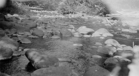
61. [Image] Boulders in stream
-
Abstract -- A partial list of lakes and streams of Oregon by county. Also contains lake surveys from the early 1930's. Describes lake and streams general shape, fish species, and location.
Citation -
 The purpose of this Columbia River Stream Survey has been to provide data for evaluation of each stream, or portion of stream, from the standpoint of its present and potential value in relation to the ...
Citation Citation
- Title:
- Survey of the Columbia River and its tributaries : Part 3
- Year:
- 1949
The purpose of this Columbia River Stream Survey has been to provide data for evaluation of each stream, or portion of stream, from the standpoint of its present and potential value in relation to the maintenance of the salmon resources of the Columbia River Two reports have been published to date, this being the third of the series This report deals with the streams in Area II Area II includes all tributaries entering the Columbia River on the south, or Oregon side, in the 204 miles from the mouth up to but not including the Deschutes River
-
64. [Article] Is the past present? Historical splash-dam mapping and stream disturbance detection in the Oregon Coastal Province
Severe scouring from splash damming was one of the earliest reported forms of widespread anthropogenic disturbance in streams of the Pacific Northwest, USA. Splash damming was a common method of log transport ...Citation Citation
- Title:
- Is the past present? Historical splash-dam mapping and stream disturbance detection in the Oregon Coastal Province
- Author:
- Miller, Rebecca R.
Severe scouring from splash damming was one of the earliest reported forms of widespread anthropogenic disturbance in streams of the Pacific Northwest, USA. Splash damming was a common method of log transport in western Oregon from the 1880s through the 1950s. Before being released in large freshets to downstream lumber mills, water and logs were stored in reservoirs behind splash dams. Further protocol called for dynamiting downstream obstacles such as large boulders and natural logjams. In recent literature, the legacy effect of historical splash damming is proposed as contributing to currently poor habitat conditions for lotic species, such as Pacific salmon (Oncorhynchus spp.), but this has never been formally evaluated at a regional scale. In this study, all known splash-dam sites and log drives in western Oregon were recorded in a geo-database and mapped in ArcGIS 9.3 at the 1:24,000 scale. Splash-dam sites were located through intense archival, historical aerial photograph and field searches. The final splash-dam map was overlaid with regionally available continuous and probabilistic stream surveys. After accounting for basin area and channel slope, in-channel variables were compared between reaches upstream and downstream of splash dams (within-basin analysis) and between reaches in splashed and not-splashed basins (among-basin analysis). Only data from sites located in a forested land cover and sedimentary rock type in the Oregon Coastal Province were analyzed. A significant difference (α = 0.1) was seen in either within- or among-basin analyses for each evaluated category of in-channel variable (geomorphology, substrates, pools, and channel complexity). Both analyses demonstrated significantly more bedrock and fewer deep pools in splashed reaches. In the among-basin analysis, three times fewer pieces of key large wood were found in splashed reaches (p = 0.07). Many of the in-channel variables that demonstrated significant differences are regarded as indicators of salmon habitat quality. This is the first regional study to document that splash-dam legacy effects still persist on evaluated stream reaches 50-130 years after the practice ceased. Further, I detected a splash-damming signal in widely used regional monitoring datasets, which suggests that legacy effects should be considered in future applications of these datasets. Splash-damming impacts are pervasive and persistent throughout the Oregon Coastal Province; consequently, extensive and intensive restoration measures may be necessary to accelerate recovery of certain stream habitat characteristics in streams where splash damming and log drives occurred. This study demonstrates the importance of including archival information in modern-day studies, and that history can account for significant variation in the stream environment.
-
65. [Article] AI - Fish Habitat Assessment in The Oregon Department of Forestry Tillamook Study Area
Abstract -- A collaborative project between the Oregon Department of Forestry (ODF) and the Oregon Department of Fish and Wildlife (ODFW) was initiated to synthesize aquatic habitat and fisheries information ...Citation Citation
- Title:
- AI - Fish Habitat Assessment in The Oregon Department of Forestry Tillamook Study Area
Abstract -- A collaborative project between the Oregon Department of Forestry (ODF) and the Oregon Department of Fish and Wildlife (ODFW) was initiated to synthesize aquatic habitat and fisheries information for the Tillamook drainage to assist in the development of operational management plans, stream habitat restoration projects, habitat conservation planning, and watershed analysis. The project summarizes the condition of stream habitat, the distribution and abundance of salmonid fishes, and the potential for restoration. The ODFW Aquatic Inventories Project has conducted stream habitat surveys as part of its basin survey project and habitat assessment project under the Oregon Plan for Salmon and Watersheds. The goal of these surveys was to document the status and trends of stream conditions in coastal drainages. These surveys in conjunction with fish distribution, fish presence, potential barriers to passage, and past restoration activities form the basis of the analyses.
-
66. [Article] AI - Fish Habitat Assessment in The Oregon Department of Forestry North Cascade Study Area
Abstract -- A collaborative project between the Oregon Department of Forestry (ODF) and the Oregon Department of Fish and Wildlife (ODFW) was initiated to synthesize aquatic habitat and fisheries information ...Citation Citation
- Title:
- AI - Fish Habitat Assessment in The Oregon Department of Forestry North Cascade Study Area
Abstract -- A collaborative project between the Oregon Department of Forestry (ODF) and the Oregon Department of Fish and Wildlife (ODFW) was initiated to synthesize aquatic habitat and fisheries information for the North Cascade management areas to assist in the development of operational management plans, stream habitat restoration projects, habitat conservation planning, and watershed analysis. The project summarizes the condition of stream habitat, the distribution and abundance of salmonid fishes, and the potential for restoration. The ODFW Aquatic Inventories Project has conducted stream habitat surveys as part of its basin survey project and habitat assessment project under the Oregon Plan for Salmon and Watersheds. The goal of these surveys was to document the status and trends of stream conditions in coastal drainages. These surveys in conjunction with fish distribution, fish presence, potential barriers to passage, and past restoration activities form the basis of the analyses.
-
67. [Article] AI - Fish Habitat Assessment in The Oregon Department of Forestry Lower Nehalem and Necanicum Study Area
Abstract -- A collaborative project between the Oregon Department of Forestry (ODF) and the Oregon Department of Fish and Wildlife (ODFW) was initiated to synthesize aquatic habitat and fisheries information ...Citation Citation
- Title:
- AI - Fish Habitat Assessment in The Oregon Department of Forestry Lower Nehalem and Necanicum Study Area
Abstract -- A collaborative project between the Oregon Department of Forestry (ODF) and the Oregon Department of Fish and Wildlife (ODFW) was initiated to synthesize aquatic habitat and fisheries information for the Lower Nehalem and Necanicum River drainages to assist in the development of operational management plans, stream habitat restoration projects, habitat conservation planning, and watershed analysis. The project summarizes the condition of stream habitat, the distribution and abundance of salmonid fishes, and the potential for restoration. The ODFW Aquatic Inventories Project has conducted stream habitat surveys as part of its basin survey project and habitat assessment project under the Oregon Plan for Salmon and Watersheds. The goal of these surveys was to document the status and trends of stream conditions in coastal drainages. These surveys in conjunction with fish distribution, fish presence, potential barriers to passage, and past restoration activities form the basis of the analyses.
-
Abstract -- A collaborative project between the Oregon Department of Forestry (ODF) and the Oregon Department of Fish and Wildlife (ODFW) was initiated to synt hesize aquatic habitat and fisheries information ...
Citation Citation
- Title:
- AI - Fish Habitat Assessment in The Oregon Department of Forestry Elliot Study Area
Abstract -- A collaborative project between the Oregon Department of Forestry (ODF) and the Oregon Department of Fish and Wildlife (ODFW) was initiated to synt hesize aquatic habitat and fisheries information for the Elliott State Forest study area, which includes portions of the Coos, Umpqua, and Tenmile Lake drainages, to assist in the development of operational management plans, stream habitat restoration projects, habitat conservation planning, and watershed analysis. The project summarizes the condition of stream habitat, the distribution and abundance of salmonid fishes, and the potential for restoration. The ODFW Aquatic Inventories Project has conducted stream habitat surveys as part of its basin survey project and habitat assessment project under the Oregon Plan for Salmon and Watersheds. The goal of these surveys was to document the status and trends of stream conditions in coastal drainages. These surveys in conjunction with fish distribution, fish abundance, potential barriers to passage, and past restoration activities form the basis of the analyses.
-
69. [Article] AI - Fish Habitat Assessment in The Oregon Department of Forestry Upper Nehalem and Clatskanie Study Area
Abstract -- A collaborative project between the Oregon Department of Forestry (ODF) and the Oregon Department of Fish and Wildlife (ODFW) was initiated to synthesize aquatic habitat and fisheries information ...Citation Citation
- Title:
- AI - Fish Habitat Assessment in The Oregon Department of Forestry Upper Nehalem and Clatskanie Study Area
Abstract -- A collaborative project between the Oregon Department of Forestry (ODF) and the Oregon Department of Fish and Wildlife (ODFW) was initiated to synthesize aquatic habitat and fisheries information for the upper Nehalem and Clatskanie River drainages to assist in the development of operational management plans, stream habitat restoration projects, habitat conservation planning, and watershed analysis. The project summarizes the condition of stream habitat, the distribution and abundance of salmonid fishes, and the potential for restoration. The ODFW Aquatic Inventories Project has conducted stream habitat surveys as part of its basin survey project and habitat assessment project under the Oregon Plan for Salmon and Watersheds. The goal of these surveys was to document the status and trends of stream conditions in coastal drainages. These surveys in conjunction with fish distribution, fish presence, potential barriers to passage, and past restoration activities form the basis of the analyses.
-
Abstract -- A collaborative project between the Oregon Department of Forestry (ODF) and the Oregon Department of Fish and Wildlife (ODFW) was initiated to synthesize aquatic habitat and fisheries information ...
Citation Citation
- Title:
- AI - Fish Habitat Assessment in The Oregon Department Of Forestry Miamii Study Area
Abstract -- A collaborative project between the Oregon Department of Forestry (ODF) and the Oregon Department of Fish and Wildlife (ODFW) was initiated to synthesize aquatic habitat and fisheries information for the Miami River drainage to assist in the development of operational management plans, stream habitat restoration projects, habitat conservation planning, and watershed analysis. The project summarizes the condition of stream habitat, the distribution and abundance of salmonid fishes, and the potential for restoration. The ODFW Aquatic Inventories Project has conducted stream habitat surveys as part of its basin survey project and habitat assessment project under the Oregon Plan for Salmon and Watersheds. The goal of these surveys was to document the status and trends of stream conditions in coastal drainages. These surveys in conjunction with fish distribution, fish presence, potential barriers to passage, and past restoration activities will be the basis of the analyses.
-
71. [Article] AI - Reference Site Selection and Survey Results 2000
Abstract -- The Oregon Department of Fish and Wildlife (ODFW) Aquatic Inventories Project conducts stream habitat surveys as part of the Oregon Plan for Salmon and Watersheds. The goal of these surveys ...Citation Citation
- Title:
- AI - Reference Site Selection and Survey Results 2000
Abstract -- The Oregon Department of Fish and Wildlife (ODFW) Aquatic Inventories Project conducts stream habitat surveys as part of the Oregon Plan for Salmon and Watersheds. The goal of these surveys is to document the status and trends of stream conditions that exist in coastal drainages of western Oregon. To better interpret landscape patterns in aquatic habitat character, the Aquatic Inventories Project has sought to improve the definition of a set of reference conditions from which to compare habitat survey sites. Over the past three years, the set of reference conditions used in analyses was selected from basin-wide habitat surveys conducted between 1992 and 1997. These conditions did not adequately represent the variety of stream sizes, geologic types, or ecoregions present in all coastal streams. The Aquatic Inventories Project selected a set of new reference survey locations that better represent reference conditions in coastal streams for a variety of ecoregions, geologic types, and basins. The reference sites selected for the year 2000 represented watershed areas with low impact from human activities such as roads, development, and forest management. Ideally, areas would have been selected that were completely free from human disturbance, but we concluded it was more important to represent a larger geographic range of conditions across the landscape.
-
72. [Article] Lake and Stream Survey Whitman National Forest
Abstract -- This is the second report of the conditions existing in the lakes and streams of the Whitman National Forest, Region 6. The first survey, conducted in the summer of 1938, and this survey, ...Citation Citation
- Title:
- Lake and Stream Survey Whitman National Forest
Abstract -- This is the second report of the conditions existing in the lakes and streams of the Whitman National Forest, Region 6. The first survey, conducted in the summer of 1938, and this survey, conducted in the summer of 1939, were under the supervision of the Whitman National Forest. The purpose was to determine the need for lake and stream improvements on the Whitman National Forest. To develop a practical stocking program. To determine whether or not present fishing regulations are satisfactory and to recommend such changes as seem advisable.
-
Abstract -- The objectives of the present survey of the upper waters of the South Fork of the Umpqua River were to: (1) develop practical and scientifically sound stocking policies; (2) determine the need ...
Citation Citation
- Title:
- Survey of the Waters of South Umpqua Ranger District, Umpqua National Forest, 1937
Abstract -- The objectives of the present survey of the upper waters of the South Fork of the Umpqua River were to: (1) develop practical and scientifically sound stocking policies; (2) determine the need for stream and lake improvements; and (3) obtain facts to assist in the settlement of the controversy with regard to the South Umpqua Falls. There has been continual demand by sportsmen that the South Umpqua Falls be supplied with fish ladders to permit safe ascent of sea-run species to spawning grounds above the falls. Study of this problem was undertaken as a definite part of the survey work described herein. The stream run and lake survey work was initiated by the Forest Service in cooperation with the U.S. Bureau of Fisheries during the summer of 1937. Emphasis was placed on the detailed studies relating to the physical and biological factors upon which it would be possible to recommend adequate stocking policies. No study of chemical conditions whatsoever was made for two reasons, first, lack of equipment prevented making gas analyses and, second, such studies seemed unnecessary by reason of the fact that there is no pollution present in the streams surveyed and all of them are well aerated, clean, rapid flowing mountain streams. Chemical conditions as shown by general observations were quite suitable and it is only whore natural or artificial pollutants occur in great abundance that chemical analyses would aid in determining tho basic effects of some of those fishes and their food organisms present in streams.
-
74. [Article] Curry Watersheds Partnerships 2014 Spawning Surveys
Abstract -- The Curry Watersheds Partnership (Curry SWCD and South Coast and Lower Rogue watershed councils) conducted salmon spawning surveys on 14 stream reaches in the winter of 2014-15. The surveys ...Citation Citation
- Title:
- Curry Watersheds Partnerships 2014 Spawning Surveys
Abstract -- The Curry Watersheds Partnership (Curry SWCD and South Coast and Lower Rogue watershed councils) conducted salmon spawning surveys on 14 stream reaches in the winter of 2014-15. The surveys took place on small streams that have been the focus of past and/or planned restoration projects, primarily aimed at coho. These surveys are not typically covered by ODFW, and prior to the spawning season the Curry Watersheds Partnership coordinated with ODFW to ensure there was no duplication of effort.
-
It has long been known that the presence of wood in rivers plays a vital biological and functional role and that a reciprocal relationship exists between woody material and the geomorphology of rivers. ...
Citation Citation
- Title:
- Fluvial Wood Presence and Dynamics over a Thirty Year Interval in Forested Watersheds
- Author:
- Atha, Jane
- Year:
- 2013
It has long been known that the presence of wood in rivers plays a vital biological and functional role and that a reciprocal relationship exists between woody material and the geomorphology of rivers. Fluvial wood studies, however, are rarely ongoing through time in order to ascertain long-term wood patterns within complete drainage networks. This dissertation addresses the temporal lag in fluvial wood patterns throughout four watersheds in the Oregon Coast Range by recreating a field dataset first collected in 1979 and then again in 1998. Statistical and spatial analysis of stream morphometric data at designated transects throughout the watersheds in addition to analysis of log step and log jam inventories provide insight into significant changes that have occurred over a thirty year interval at a multi-basin scale. These watersheds are located in areas that have been impacted by years of timber harvesting in the mid-twentieth century, however, clearcutting has been on the decline since the early 1980s. This research investigates the impacts that the legacy of clearcutting and subsequent afforestation has had on the abundance and volume of fluvial wood in the stream networks of these four watersheds. I digitized historical aerial imagery to determine the amounts of clearcutting in the basins over time. I integrated this variable with channel morphometric variables to assess predictors of wood abundance and volume through multiple regression analysis. Results show that the stream that has been the most affected by clearcutting has lower volumes of wood than measured in 1979 or 1998. Residence times of wood are short in these watersheds and wood abundance and volume was highly impacted by the debris flows that occurred during the Storm of 1996, prior to the 1998 data collection. There are statistically significant changes that have occurred in the stream morphology among the four watersheds. This dissertation also tests a method of detecting fluvial wood through airborne lidar analysis. This method provides an alternative to field surveys in areas of even the most extreme tree canopy cover.
-
Abstract -- The ODFW Oregon Conservation Strategy identified monitoring needs for 17 amphibian species native to the state of Oregon that are designated as “Strategy species”, or Species of Greatest Conservation ...
Citation Citation
- Title:
- 2008 Amphibian Distribution Surveys in Wadeable Streams and Ponds in Western and Southeast Oregon, Information Reports Number 2010-05
Abstract -- The ODFW Oregon Conservation Strategy identified monitoring needs for 17 amphibian species native to the state of Oregon that are designated as “Strategy species”, or Species of Greatest Conservation Need (per USFWS requirements for State Wildlife Action Plans). The distribution of many species of amphibians in western Oregon is sparsely documented (Oregon Conservation Strategy, page 27). Although a broad-scale survey for amphibian presence would provide important baseline information about amphibian species composition and distribution, most studies have focused on limited areas. The majority of Oregon’s amphibians rely on aquatic habitats at some point of their life, either for breeding and juvenile development or to inhabit as adults. Most aquatic amphibians breed from late winter to early summer, and adults frequently remain in or near their breeding sites into the summer. Most tadpoles and juvenile amphibians are also active in and occupy aquatic habitats during the summer. Ongoing aquatic habitat and fish surveys are opportunities to observe species and life stages (breeding adults, tadpoles and juveniles) that occupy aquatic or riparian habitats during the summer. One cost-effective approach is to combine amphibian surveys with existing aquatic habitat and fish surveys such as those conducted as part of the Oregon Plan for Salmon and Watersheds (OCSRI 1997). The Oregon Plan has been in place since 1997 and the monitoring component provides a survey framework for streams in the lower Columbia River and Oregon coast drainages. The sampling framework is also compatible with implementation of the aquatic components of the Conservation Strategy, as demonstrated by this study. This study describes the presence of amphibians in and along wadeable streams in coast and lower Columbia River drainages of Oregon, ponds and sloughs in the Willamette Valley, and selected streams in the Great Basin of southeast and central Oregon. As a component of monitoring under the Oregon Plan, the Aquatic Inventories Project (AIP) conducts aquatic habitat surveys at randomly selected and spatially balanced sites across all 1st through 4th order streams in coastal and lower Columbia River drainages. The purpose of the habitat surveys is to describe stream morphology, instream physical habitat, and riparian vegetation. Because the surveyors were already observing features within and alongside the stream channel, they were able to record observations of amphibians. The amphibian component was consistent with the survey protocol used by the US Geological Survey’s Amphibian Research and Monitoring Initiative (http://armi.usgs.gov/). The advantage of coupling an amphibian component with the OR Plan aquatic surveys was that it not only was an efficient use of resources, but more importantly, provided information using a statistically rigorous survey design across a broad geographic area. The Native Fish Investigations Project began a six year study in 2007 to document the distribution and abundance of redband trout in the Great Basin region of Eastern Oregon. The site selection procedure is comparable to the statistical standards as the Oregon Plan survey design. Amphibian data are also collected during three other survey projects, and although the site selection procedure does not conform to the same statistical standards as the Oregon Plan survey design, the projects offer a number of opportunities to collect amphibian occurrence information over a wide variety of habitats. The amphibian observations from these three projects are also included in this report. The three projects are as follows: • AIP conducts aquatic habitat surveys on selected streams throughout the state. • AIP conducts aquatic habitat surveys at stream habitat restoration projects in Western Oregon. • Native Fish Project conducts surveys of pond and slough sites for Oregon chub in the Willamette Valley. Due to the success of the 2006 and 2007 field studies, we continued our research during the summer of 2008 to improve our knowledge of distribution and community structure of amphibians. The summer 2008 surveys took place in 9 of Oregon’s 10 ecoregions (Figure 1) (Thorson et al. 2003). Ecoregions provide a framework for discussing amphibian distribution across the state because they are relatively large areas defined by distinctive geographic and ecological (flora and fauna) characteristics. The goals of our 2008 work were to: • Increase the consistency, efficiency and ability of habitat crews in identifying amphibians through improved training. • Increase knowledge of distribution, community structure, and habitat associations of amphibians in streams in: o Western Oregon coastal and lower Columbia drainages. o Ponds, sloughs and other off-channel aquatic habitats in the Willamette Valley. o Great Basin of eastern Oregon and selected streams in central Oregon. • Combine the 2008 observations with the 2006-07 results.
-
77. [Image] Surveying forest streams for fish use
Oregon Department of Forestry Forest Practices Section 2600 State Street Salem, OR 97310 Dl Fish 8 Wildlife Oregon Department of Fish and Wildlife Habitat Conservation Division P. O. Box 59 Portland, OR ...Citation Citation
- Title:
- Surveying forest streams for fish use
- Author:
- Oregon. Forest Practices Section; Oregon. Habitat Conservation Division
- Year:
- 1995, 2005, 2004
Oregon Department of Forestry Forest Practices Section 2600 State Street Salem, OR 97310 Dl Fish 8 Wildlife Oregon Department of Fish and Wildlife Habitat Conservation Division P. O. Box 59 Portland, OR 97207 Introduction Identifying Oregon streams that contain fish is an important part in carrying out the new Water Protection Rules. These rules aim to protect areas of benefi-cial uses, such as fish. First, however, the beneficial uses present in each forest stream must be correctly identified. At present, a large number of fish- bearing streams are not identified on stream classification maps. To correct this problem, the Oregon Department of Forestry ( ODF) and the Oregon Department of Fish and Wildlife ( ODFW) must complete comprehensive surveys to identify fish use on all non- federal forest streams in Oregon. This effort will require at least 3 to 5 years and a significant financial investment. Because many streams are not accurately classified, the new rules also tempo-rarily protect streams that are likely to contain fish. Under the rules, for example, if Stream A flows into a body of water known to contain fish, it is assumed that fish also are using Stream A, up to the point that a natural barrier blocks their way farther upstream ( see OAR 629- 57- 2100: ll( b) B). Once the survey efforts are complete, this interim rule will not be needed. Coordinated efforts by public agencies, landowners, and others to complete fish- presence surveys will assure that important fisheries resources are pro-tected in the most cost- effective way. Landowners or any interested party may collect stream- classification information so that the overall survey can be completed as quickly as possible. Many private forest landowners, in cooperation with Oregon Department of Fish and Wildlife, are now completing inventories of stream habitat conditions on their lands. In the future, these cooperative efforts may also include fish-presence surveys. This publication tells how to complete fish- presence surveys on forested streams. The guidelines cover: How to plan either " operation- specific" or " maximum upstream fish distribution" surveys The proper way to conduct surveys The proper time of year to conduct surveys Minimum efforts required in completing the surveys The legal requirements for completing the surveys How to provide information to Oregon Department of Forestry to update the stream classification maps The stream reclassification process Operation- specif ic surveys Maximum upstream distribution surveys Planning the survey There are two major types of survey: operation- specific surveys, and surveys to find the maximum upstream distribution of fish. Each type requires different planning and is conducted using different approaches. Operation- specific surveys are those to classify a stream only in the particular area of an operation. This kind of survey may not include efforts to determine the maximum upstream extent of fish use. An operation- specific survey takes minimal planning and coordination. However, it may be very inefficient in the long run because future activities in other areas of the stream may require additional surveys. An operation- specilk survey is very simple to complete. It starts at the down-stream end of the operation area and moves upstream either to the end of the operation area or to the end of fish distribution, whichever comes first. If the purpose of the survey is to prove no fish use, the surveyor must be sure to make at least the minimum effort required to find fish ( see the section on " Survey Effort" on page 10). This kind of survey is done on an entire stream reach or on multiple stream reaches rather than on a restricted portion of a stream. Often, all streams within a basin or reach are completely surveyed. In some cases, the surveys encompass entire ownerships or watersheds. The specific locations of planned operations are usually not the main factor in setting up this kind of survey but can help decide which areas to survey first. Surveys to find the maximum upstream extent of fish use may be the most efficient and cost- effective. Surveyors often cover a group of streams in one area at a time; therefore, travel time is minimized because, often, a group of streams can be easily reached by one common forest road. When travel time is less, the time spent actually completing surveys is greater. This kind of survey may require slightly more planning and coordination to assure efficiency and to minimize duplication of effort by adjacent landowners or by other public agencies, but overall this approach is more cost- effective than the operation-specific surveys. Surveying for the maximum upstream distribution of fish may take more plan-ning than an operation- specific survey, but it is still relatively simple. First, look at ODF Stream Classification Maps for the survey area to see the current extent of fish- use streams. Also note which streams are not classified at all. Next, decide where to start the survey. It may help your planning if you know the relationship between watershed basin area and fish use for your area. Contact the local ODFW office to find out whether these relationships have been established for streams in your area. The information predicts where fish use is " likely to end" and so will help you decide where to start your surveys. At this point, you also may want to consider operations that are planned for certain areas and decide to survey those areas first. After choosing a starting area, look at current road maps to find potential starting points for the survey ( see Figure 1). Look for access points ( such as road crossings) near the upper reaches of the stream. When possible, a survey should start near the highest accessible point in the watershed. If road access to the stream is limited, you may want to start the survey near the point at which the stream's classification size changes from " medium" to " small"; often this point is near the end of fish use ( see Figure 2, page 4). At the starting point, first sample upstream. If you find fish, continue the survey upstream until fish use ends. Be sure to continue sampling above the point at which fish use ends ( see " Survey Effort," page 10). If you make all the required efforts but do not find fish, then survey downstream from the original starting point until you find fish. When surveying downstream, it is important to walk on the streambank until you are ready to sample so that the water stays clear. Begin fish survey above road crossing Fish use extends at least this far Figure I . Selecting survey starting points in an area with a road crossing. Additional survey work may be required if the maximum distribution of fish seems to be affected by a road culvert. If the stream above the culvert has no fish, sample the pool immediately below the culvert. If you find fish in this pool or downstream near the culvert, the culvert is a possible barrier to fish passage. Describe the culvert and the stream on the survey form ( page 19). If you do not find fish in the pool below the culvert, continue the survey down-stream until you do see fish. Begin fish survey here \ \\ \ / I Fish use extends at least this far - - k I Figure 2. Selecting survey starting points, based on the stream- size classification, in an area without a road crossing. Surveys to find the maximum upstream distribution of fish may require sampling across several land ownerships. Be certain to get permission from other landowners before beginning the survey. Contacts with other landowners are also important to prevent a duplication of effort, because many landowners and agencies may be conducting fish- presence surveys. When figuring how many surveyors and how much time you'll need to com-plete surveys in your area, you may want to consider the Department of Forestry's experience. We found that sampling a township ( 36 square miles) required approximately 24 person- days in the Coast region, but an area the same size in the Blue Mountains required only 4 person- days. Survey methods The accuracy and reliability of survey results depend greatly on the methods used to conduct the survey. Methods range from simply looking in the stream ( visual observation) to more intensive and effective sampling with a backpack electroshocker. The method you choose depends on the availability of sam-pling equipment, the size of the stream, the flow and clarity of the water, and other factors. It is important to select a sampling method that is best for the type of survey and for the waters being sampled. If the sample method is not appropriate, the results of the survey will not be very useful. For example, just looking at a stream may tell you there are fish in it at that point, but it is not an acceptable way to find the maximum upstream extent of fish use. Surveys to show that fish are not present require more sampling and specialized equipment in order to provide reliable results. Whenever the survey uses methods other than an electroshocker, it's important to thoroughly explain on the survey report form the reasons for using the other methods. This is the simplest method; it involves only walking the stream to look for fish. It is best to wear polarized sunglasses to reduce glare from the water and to survey only when water conditions allow good visibility. It's also best to walk upstream so that you can " sneak up" on fish in pools. Fish often are near the upstream ends of pools waiting for food to drift toward them. Small fish, such as fry, often are in shallow water along the margin of the stream. Be very alert because fish usually will dart into cover when they detect any movement, especially in small headwater streams. It helps to toss bread crumbs, insects, small twigs, or bemes into the stream to entice the fish to leave cover. The visual method is best suited to small streams where pools aren't deep enough to prevent your seeing the fish. This method is also the least damaging to the fish because actual collection is not required. However, the value of survey results can be reduced by many factors such as cloudy water, surface glare on the water, overcast days ( reduced light), fish behavior, and even the surveyor's poor eyesight. For these reasons, this method is not effective for determining the maximum upstream limit of fish distribution, although it can be used to prove fish are in a certain reach of the stream. Snorkeling is a special method of visual observation that can work well in some situations. Snorkeling allows you to see underwater through a diving mask and breathing snorkel. This method can be used in larger waters where electroshockers are less successful, and it has been used to locate fry where other methods failed. Night snorkel surveys are particularly useful for observ-ing bull trout fry. Visual observation Hook and line Backpack electroshocker The hook- and- line method uses a rod and reel and relies on the feeding be-havior of the fish. In small streams, drop a baited hook into the deepest pools, where larger fish often are. Bait can include worms, single eggs, cheese, dry flies, or stream insects such as caddis larvae. Sample pools that have a lot of cover because those tend to support greater numbers of fish. As with the visual observation method, approach the pool cautiously to avoid alerting the fish. To minimize the risk of injuring or killing the fish, always use barbless hooks. The hook- and- line method can be used when conditions are not good for visual sampling; for example, when water is not clear, flow is high, or the day is overcast. This method may be the most effective for sampling some larger or deeper waters where visual and electroshocker methods can be ineffective. These waters include deep beaver ponds and large, steep streams where downstream barriers ( such as falls and very steep sections) keep fish out of the small tributaries. This method has limitations, though, depending on fish behavior and the life stage of the fish that are present. Fish may be reluctant to bite on cold days, or when the water is murky with sediment, or if the fish detect the surveyor's presence. Also, hook- and- line sampling is not effective if only fry are in the stream. This method also depends on the angling skills of the surveyor. As with the visual observation method, hook- and- line sampling may not be the best way to determine the maximum upstream distribution of fish in small streams, but often it can be used to find fish in larger waters. The most effective way to determine the upstream extent of fish is with a backpack electroshocker. Electroshocker sampling requires additional training and experience, though, to be effective and safe. A backpack electroshocker introduces an electric field into the stream that temporarily immobilizes fish. Stunned fish can be observed as they float in the water, or they can be captured in a small hand net for closer observation if necessary. As with other methods, it is best to work in an upstream direction, wear polarized glasses, and to approach the sampling site carefully to avoid alerting the fish. One person nets fish while another person operates the electroshocker. The netter should walk behind or beside the shocker to avoid alerting the fish. The electroshocker can be very effective for sampling in small streams even where brush or instream cover prevents most other sampling methods. In fact, an electroshocker is often most effective in areas with instream cover because fish usually concentrate in these locations. This method works in streams of various sizes but is less effective in larger streams and in deep pools, espe-cially large beaver ponds. Use electroshockers carefully to minimize killing fish. When properly adjusted and used, the electroshocker should stun the fish without killing them. The fish may escape if the current is set too low, but usually the surveyor will still see the fish and so be able to document fish presence. To sample effectively and minimize fish kill, set the electroshocker on the lowest practical voltage output and low- frequency currents ( low pulse rates). Before sampling, use a voltame-ter to test the electroshocker in a stream. If the voltameter is not available, it is a good idea to test the electroshocker in a stream that you know has fish before working in streams whose fish use you do not know. The test will tell you whether the equipment is working and the effects of using different settings. The surveyors' safety must be considered carefully before using this method. Electroshockers can injure or kill humans if not properly used. Surveyors should not use this method without proper training, including CPR training. Surveyors should work in crews of at least two. All surveyors should wear rubber waders and rubber gloves during stream shocking and never use dipnets with metallic handles; the nets should have wood or fiberglass handles. All members of an electroshocking crew should understand the proper operation procedures and potential dangers of this equipment. The effectiveness of electroshocker sampling depends on water conditions and on the skills of the electroshocker operator and the netter. The electroshocker method may not be so useful in high flows or in turbulent or murky water because the surveyors may not see immobilized fish. Another drawback to this method is that the electroshockers may not be widely available and can be expensive. However, with proper training and experience and under suitable survey conditions, this method is the best for accurately determining the maximum upstream extent of fish use. There may be situations where reliable results can be had by using methods not discussed here. For example, headwater beaver ponds may be effectively Other methods sampled by fishing for at least 48 hours with minnow traps baited with salmon eggs or commercial trout bait. Or, seine nets may be effective in beaver ponds or larger waters. If you are thinking about using these or other sampling methods, discuss it first with the departments of Fish and Wildlife and of Forestry. They will decide whether the proposed methods are appropriate and, if so, set the required minimum level of sample effort for the alternate method. A backpack electroshocker is the best way to get reliable information about the upstream extent of fish use or to prove a stream is m e N ( no fish use). Sur- Survey methods: vey data that document the presence of fish through other methods, such as a summary visual observation or hook- and- line, will always be used to classify streams as Type F as far up as the point of observation, even though the exact upstream extent of fish use may not be known. In some cases, methods other than an electroshocker may give reliable information about the maximum upstream distribution of fish. Examples include deep beaver ponds and large, steep streams in which barriers keep fish out of small upstream tributaries. In those cases, reliable results may be better obtained with hook- and- line sampling or with other methods. Whenever the survey is conducted by methods other than an electroshocker, the reasons for choosing the other method must be thor-oughly explained on the survey form. Timing the surveys Survey accuracy depends a lot on the time of year the survey is done and on stream conditions at that time. Since the purpose of the survey is to accurately document the presence or absence of fish, it is critical to do the survey when fish are expected to be using the upper reaches of a stream. This generally is near spawning times or soon after fry emerge, when stream flows are relatively high. A survey done during a low- flow period may not indicate the actual maximum upstream extent of fish use or accurately prove no fish use the stream. Fish may use the upper reaches of a stream for a limited time only, so fish- use surveys must be timed carefully. Surveys done at other than recommended times may not give a complete description of fish use. For example, if fish are found at other than the recommended survey times, the surveyed part of the stream can be classified as fish- bearing, but the maximum upstream extent of fish use may not be known. If fish are not found, that will not necessarily prove that the stream reach does not support fish use. Only if the survey is made at a time when fish are most likely to be there can the absence of fish be a reliable sign that no fish use that portion of the stream. Other factors can affect the reliability of the survey even if it is made at the proper time. Abnormal flows due to drought or extreme runoff could affect the distribution of fish or the sampling efficiency of the surveyor. So, it is best not only to do the sampling within the recommended time period but also when conditions are appropriate. In some cases, survey timing may not have much effect on the reliability of survey results. This could occur when factors other than seasonal flow patterns control the upstream extent of fish distribution. For example, streams that get most of their water from springs may not have seasonal flow variations, including summer flows low enough to control the upstream distribution of fish. Or, conditions other than low flow could be controlling distribution. For example, large, steep streams that have natural barriers such as falls and steep, impassable sections. In such cases, surveys taken outside the recommended time periods may yield reliable data. However, it is important to describe these conditions thoroughly on the survey forms to justify not following the recom-mended timing. See Table 1 for the recommended sampling periods for different regions of the state for normal water- flow years. Periods differ due to variations in stream flow patterns, fish species, and life- history traits of the species in the different areas. Contact the local ODFW office before sampling to find out the best time to survey the stream you are planning to sample. Table 1. General recommended time periods to sample streams, by geographic region, during nomull water- flow years. Please contact your local ODFW ofice before sampling in order to get specific timing recommendations for the stream you will be sampling. REGION of Recommended Georeaion Stream Survey Period WESTERNO REGON All Coast South Coast West Cascades Interior Siskiyou March 1 through May 3 1 EASTERONR EGON All except spring- fed April 1 East Cascades through June 30 Blue Mountains Spring- fed streams* Entire year * Spring- fed streams are streams that get most of their water Born groundwater sources and that have very minor seasonal variations in flow. Stream surveys must be done within certain time periods ( Table 1) if the purpose is to prove the stream does not contain fish or to document the maximum upstream extent of fish use. mming recommendations are based on normal water- flow years and may vary in some years. Contact the local ODFW office before sampling to get specific timing recommendations for the streams to be surveyed. Information gathered at other times of the year may be used to document fish presence but may not be reliable enough to establish upstream fish- use limits or to classify the stream as II) lpe N ( no fish use). Whenever the recommended survey timing is not used, it is important to explain the reasons on the survey form so that the data can be evaluated for reliability. ~ - ~ Survey timing: a summary Survey effort: a summary Survey effort The level of effort used to complete the survey also can affect the reliability of the survey results. If the level of effort or the amount of stream sampled is too little, it may be wrong to conclude that fish are not present. The following guidelines describe the minimum level of survey effort required to assure that the data are reliable. If the purpose of the survey is to show that no fish use the stream, the survey will be considered reliable only if it includes at least 50 yards of stream length md a minimum of six pools, each at least 1 foot deep, immediately upstream of the point at which the non- fish- bearing section begins. ( In some cases, the survey will have to cover much more than 50 yards of stream in order to also include the required six pools.) In addition, the survey must include sampling any beaver dam ponds in the upstream non- fish section. Surveyors are encouraged to exceed the minimum level of effort in order to be even more sure that fish are absent from a stream reach and that the maximum upstream extent of fish use has been found. A survey intended to show the absence of fish must sample at least 50 yards of stream distance and a minimum of six pools, each at least 1 foot deep, imme-diately upstream of the point at which fish use is believed to end. In addition, any beaver ponds upstream must be sampled as part of the survey. The require-ments for the methods used and the timing of the survey also must be met in order to document the absence of fish. Legal requirements In Oregon, the Department of Fish and Wildlife regulates the collection of fish for personal or scientific use. Generally, collection methods prohibited by the general angling regulations, such as electroshockers, traps, or nets, and collec-tions at times of the year when angling is closed will require a Scientific Collection Permit from the Oregon Department of Fish and Wildlife. Scientific Collection Permits can be issued to agencies, companies, or indi-viduals. Request an application from the Fish Division of the Oregon Depart-ment of Fish and Wildlife, P. O. Box 59, Portland, OR 97207; telephone ( 503) 229- 5410, extension 323. Submit the application at least 1 month before you plan to do the survey in order to be sure the permit can be issued in time. The application requests information about the collection method to be used, when and where collection will be made, and a summary of the proposed project. By law, surveyers must keep records of their collection activities and submit them to the Oregon Department of Fish and Wildlife. Surveys using the visual observation method ( including snorkeling) do not require any licenses or permits because fish are not physically collected. Sampling with the hook- and- line method during open fishing seasons requires only a valid angling license. However, Oregon resident landowners and their immediate families do not need angling licenses to fish on land they own and live on. In either case, the general ahgling regulations for the stream must be followed during hook- and- line sampling unless a Scientific Collection Permit is obtained. Additional restrictions on survey efforts may apply if the stream contains species that the state or federal government lists as sensitive, threatened, or endangered species. Please contact your local ODFW office to find out whether any of these species are likely to be in streams you plan to sample. Reporting survey results Give survey data to the local ODF district office so that district Stream Classi-fication Maps can be updated. On page 19 is a blank survey report form. It asks for information about the location of the stream; the methods, timing, and effort of the survey; the physical character of the stream; observations of fish and wildlife; and the presence of natural or human- created barriers to fish passage. complete one form for each stream reach where fish were ob-served or fish use was found to end. See Figure 3 ( page 12) for descriptions of some fish species common to $ mall, forested streams; these may help to identify fish seen during surveys. Detailed instructions for completing the survey form are on pages 14 through 18. Attach to the Fish Presence Survey Form a copy of the ODF Stream ClassM-cation Map for the surveyed area or, if that is not available, a copy of the 7.5 minute USGS topographic map for the area. Note the following information on the map. ( Examples of completed survey report forms and maps are on pages 21 through 30.) The area of the stream that was actually surveyed ( including the areas without fish) as part of the survey effort. Highlight in yellow the entire stream reach surveyed ( see examples on pages 25,28, and 30). The upper limit of fish use. Note this on the map by drawing a line across the stream and writing the letter F at that point. The name of the surveyor. The date the stream was surveyed. GENUS ONCORHYNCUS - PACIFIC SALMON IOENTIFICATION FEATURES OF JUVENILES Faint parr marks. extend little. if am: below latanl line. Lures SOCKEYE w GENUS ONCORHYNCUS- TROUT IDENTIFICATIOEI FUTURES OF JUVENILES pols in dorsal Teeth on of tongue Maxillary extend past rear margin on throat W - Of eye CUTTHROAT 5 - I 0 parr marks on ridge ahead of dorsal tongue astend & st rear mark on throat Y; V margin of eye STEELHEAD- RAINBOW Few or no spots i n tail Figure 3. Identification characteristics of some juvenile salmon and trout species that may be observed in forested streams. 3. Permission to enter private forest lands should be obtained from all land-owners before the surveys are conducted. 4. Fish- presence surveys should then be made according to the guidelines given in this publication. 5. The required survey information, recorded on the Fish Presence Survey Form and maps, should be given to the local ODF district office. 6. The ODF office will give copies of the completed survey forms and maps to the local office of the Oregon Department of Fish and Wildlife. 7. The Department of Forestry will review the information, usually in consul-tation with the Oregon Department of Fish and Wildlife, to determine whether the survey results are reliable. 8. Based on its assessment of data reliability, the Department of Forestry will make appropriate changes to the ODF Stream Classification Maps. 9. All affected landowners will be notified of the proposed stream classifica-tion changes, according to the notification rules ( OAR 629- 57- 2110( 2)). Instructions for completing the survey report form The following information should be reported on the Fish Presence Survey Form. These instructions are in the order that the information appears on the form. Complete one form for each stream reach or branch where fish were observed or fish use was found to end. This may require assigning codes to unnamed tributaries ( for example, " trib. a," " trib. b") so that survey data can be cross- referenced to the survey maps. Please refer to examples on pages 21 through 29. Surveyor Narne( s): The name of the person or persons responsible for con-ducting the survey and reporting the results. AgencyfCompany: The name of the agency or company that employs the surveyor ( if applicable). Landowner: The name of the landowner of the reach surveyed. Mailing Address and Phone: The address and phone number for the person responsible for the survey. Stream: The name of the stream as reported on the USGS or ODF Stream Classification Map for the area. If the stream is unnamed, report the stream as " unnamed" and list the tributary that it flows into (" Tributary to..."). Tributary to: The name of the main stream ( as reported on the USGS or ODF map) that the surveyed stream flows into. This is especially important if the surveyed stream is unnamed. Quad Map: The name of the USGS 7.5 minute topographic map that includes the reach of the stream surveyed. If the surveyed reach covers more than one quad map, report first the name of the map that shows the identified end- point of fish use and then give the other maps' names. Location: A legal description ( township, range, and section to at least the quarter section) of the location where fish use ends. Date Surveyed: The month, day, and year the fish survey was conducted. Survey Method: Check the box for the survey method used. If more than one method was used, check all that apply and note the most often used method in the comments section or in the form's margin. Survey Amount Above End of Fish Use: The length of stream reach that was surveyed immediately upstream of the identified end of fish use. Estimate ( in feet) the length surveyed, and give the number of pools sampled for fish in that section. A survey to prove the absence of fish must sample at least 50 yards of stream and at least six pools immediately upstream of the end of fish use. In addition, any upstream beaver ponds must also be sampled. Flow Level: The flow conditions at the time of the survey. Use the following categories of flow. Low: Ranges from a series of isolated pools to flowing across less than 75 percent of the average bankfull width. Moderate: Surface water is flowing across 75 to 90 percent of the average bankfull width. High: Surface water flowing across more than 90 percent of the average bankfull width. It is not recommended thatfih presence surveys be conducted at high jlows. Weather: The weather during most of the fish survey ( rainy, overcast, partly cloudy, sunny, snowy, etc.). Water Clarity: The water visibility during the survey. Use the following categories of water visibility. Clear: Visibility is good in pools, deep pools, and riffles. Moderate: Visibility is good only in riffles and shallow pools. Turbid: Visibility is poor in both riffles and pools. It is not recommended that fih presence surveys be conducted when water is turbid. Water Temperature ( optional): The temperature of the stream ( in degrees Farenheit) at the time of the survey. Fish observations Report the species and approximate size ranges of fish observed in the sur-veyed reach. Use Figure 3 ( page 12) as a guide to identifying some game fish species commonly found in small, forested streams. Use the following codes and instructions to complete this section. Species: Use the following names or codes to report fish observed during the survey. If you observe a species not listed here, such as Pacific lamprey, use its common name. Name Species Code Coho salmon Co Cutthroat trout Ct Rainbow troutfsteelhead Rb/ St Bull trout BUT Brook trout BT Unknown salmonid UnS Sizes: Report the size range of fish, in inches, by species. For example, the size range of coho observed could be reported as " 1- 4 inches." If you see several sizes of one species ( for example, some cutthroat trout in the " 1- to 2- inch range and others in the " 6- to 8- inch" range), list them separately. Aquatic wildlife The types of aquatic wildlife that may be observed include tailed frogs ( includ-ing juvenile " tadpoles"), Pacific giant salamanders, and Olympic salamanders. Species: Give the common name of the species, if known. If you don't know the species name, at least report observations by a general name such as " salamanders." Number: The number of aquatic wildlife in each species or group observed. Physical stream data Report the physical characteristics of the stream in the vicinity of the end- point of fish use. Report information separately for ( 1) the section immediately at and downstream of the end of fish use, and ( 2) the area upstream of the maximum extent of fish use. Following are specific instructions for collecting this information. Bankfull Channel Width: By eye, estimate the average width ( in feet) of the bankfull channel for the 100- foot sections above and below the end- point of fish use. The bankfull channel is the area that is scoured by water during average high flows. The edge of the bankfull channel can be identified by looking for changes in vegetation, in soils and litter characteristics, or in the shape of the bank. The bank often will abruptly change slope at the bankfull boundary. Vegetation at the boundary often changes from annual vegetation ( such as grasses) to more permanent vegetation such as trees and shrubs. Estimate the width across the channel between the edges of the bankfull level. Current Wetted Width: Visually estimate the average width ( in feet) of the channel that contains flow ( is wetted) at the time of the survey. Report the estimated averages for the 100- foot sections above and below the end of fish use. Channel Gradient: Measure the average stream gradient with a clinometer for the 100- foot sections above and below the end of fish use. me a piece of flagging at eye level on a branch or shrub, walk up or down the stream bank, and then use the clinometer to sight on the flagging while you are standing on the channel bottom. Read and report the percent gradient. ODF Stream Class Size: The stream size (" small," " medium," or " large") from the ODF Stream Classification Maps for the reaches immediately above and downstream of the end of fish use. Natural barriers This information is very important for understanding relationships between the presence of fish and the physical characteristics of the stream. Understanding these relationships can help determine where fish- presence surveys should be concentrated and help predict where fish are likely to occur if survey informa-tion is not yet available. Generally, natural barriers are permanent structures such as falls or vertical drops more than 8 to 10 feet high for salmon or steel-head or 4 feet high for trout. Log jams, drops over logs, beaver dams, or other organic structures generally are only temporary barriers to fish passage, but report them as well. If fish use ends at a natural barrier, such as a waterfall, bedrock chute or cascades, describe the conditions at the site. Include a description of: ( 1) the type of barrier, ( 2) the approximate height ( in feet), ( 3) the percentage of slope, ( 4) the length ( in feet) of the bedrock chute or cascades, and ( 5) any other conditions that may be limiting fish passage. If the potential barrier is a bedrock chute, note whether the bedrock contains pools or rough features ( such as rocks, boulders, or other breaks in the flow), or whether the water flows in an even, shallow pattern over the bedrock. Please note on the survey map the locations of any natural barriers encountered. If you encounter a natural barrier, also be sure to sample above this point because fish often are found above natural barriers. Road- crossing barriers This information also is very important for understanding relationships be-tween the presence of fish and the physical characteristics of the stream. Road-crossing barriers can alter the relationships. If fish use ends at a road- crossing barrier, such as a culvert, describe the conditions at the site. Describe the type of barrier and its measurements at the time of the survey such as ( 1) the diameter of the culvert, in inches, ( 2) the depth ( in inches) of water in the culvert, ( 3) the height ( in feet) of the jump ( drop) below the culvert or structure, ( 4) the depth ( in inches or feet) of the plunge pool below the culvert outfall, ( 5) the gradient or slope of the culvert, given as a percentage as read off a clinometer, ( 6) the length ( in feet) of the culvert, and ( 7) any other factors that could affect fish passage. Please note on the survey map the locations of any road- crossing barriers, even if they are not at the end- point of fish use. As with natural barriers, be sure also to sample above the site because fish often are found above road- crossing barriers. Other comments Any other comments or notations that you think may be pertinent to the fish survey. It helps to describe any notable habitat characteristics, for example " lots of instream wood," " very few pools in the reach," " heavy silt load in the stream." Use the reverse side of the form if necessary. FISH PRESENCE SURVEY FORM ATTACH A COPY OF THE 7.5 MINUTE ODF STREAM CLASS MAP Surveyor Name( s): Agency: Land Owner: Mailing Address: Phone: Date Surveyed: Stream: Tributary to: Quad Map: Location: T R Sec. Survey Method ( d): 0 Electroshocker 0 h & g 0 Visual Survey Above End of Fish Use: Distance ( feet) Number of Pools Flow Level ( d): 0 Low 17 Moderate High Weather: Water Temperature: Water Clarity ( d): Clear 17 Moderate 17 Turbid FISH OBSERVATIONS AQUATIC WILDLIFE PHYSICAL STREAM DATA If fish use ends at a natural barrier, describe the conditions that prevent upstream fish passage. If fish use ends at a road crossing, describe conditions that may prevent upstream fish passage. Other comments ( use reverse side if necessary): FISH PRESENCE SURVEY FORM ATTACH A COPY OF THE 7.5 MINUTE ODF STREAM CLASS MAP Surveyor Name( s): . be Sorveq , 3 Troo+, FI s h G n r u l l , I*? , S.; L. Agency: N/ C I Land Owner: k! 4~ 4f, l T; M ~ C C Mailing address:?.^. sox ~ g~,\ L L I M UF~ A \ ID~ R) jC? suo Phone: BSB- 5555 ate surveyed: A p ( ; i 2 8, ! ?? s I Stream: Un hawed , " Tr I b R!' Tributary to: lr3 F . 21 o k so- ~ r a& QuadMap: D\ A &\ dy Location: T 305 R 5 " L Sec. 30, sw/ sto Survey Method ( d): d~ lectroshocker Angling 0 Visual Survey Above End of Fish Use: Distance ( feet) I 86 ' Number of Pools Flow Level ( d): CI Low cd~ oderate High Weather: S owv Water Temperature: 7 O F I Water Clarity ( V): dclear Moderate I7 Turbid FISH OBSERVATIONS AQUATIC WILDLIFE Species I Snes 1 Spedes 1 Quant'ity 1 PHYSICAL STREAM DATA If fish use ends at a natural barrier, describe the conditions that prevent upstream fish passage. bk If fish use ends at a road crossing, describe conditions that may prevent upstream fish passage. prf+ Other comments ( use reverse side if necessary): f- 15 L wsz ewd 30 $& abov e f *; rd John50~ m ain\ ifi< ~ r o s s i n OH ~ f r e a ~ 7.% ~ 5t redw g d ~ e n f & ry s t u p abde + he a d 4' & sh use - p & f i a n 10%. 2 1 OREGON FISH PRESENCE SURVEY FORM ATTACH A COPY OF THE 7.5 MINUTE ODF STREAM CLASS MAP Fish & Wildlife Stream: ~) nr? euce, d " Tr t b, O " Tributary to: w F & n~ oq CC. Quad Map: old &\ A% Location: T 382 R 5E Sec.' 30, si/ Sw I Survey Method ( 4): ~ lectroshocker 0 Angling 0 Visual Survey Above End of Fish Use: Distance ( feet) 2 5' 0 Number of Pools 20 Flow Level ( d): 0 Low d ~ o d e r a t e High Weather: Lw+ Water Temperature: 6 0 F I Water Clarity ( d): dclear Cl Moderate Turbid FISH OBSERVATIONS AQUATIC WILDLIFE Species 1 Snes I! , Species Quantity If fish use ends at a natural bamer, desc ' be the conditions that prevent u stre m fish assage. Fid - 4s 4+ 2 S ' ~ r t i Lm* r? d\. A dJ @ cater also % 15& 5 ( ho& a. r. rp Q5 W F - buffis @ ere fouu\ d . opstr + ye If fish use ehs) at a roa d. crossmng, descnbe conhlons that may prevent upstream fish passage. Other comments ( use reverse side if necessary): w tfw+ were fbU 4 above % z 6 + of (~ la+ erf~ ll above fu 25fcof I sowe years. 22 fail s& i ro fish t@ f& probab/ y vp FISH PRESENCE SURVEY FORM ATTACH A COPY OF THE 7.5 MINUTE ODF STREAM CLASS MAP stream: V A ~ ~ ~ + SC~" T & ~ ributaryto: u. F. 3ehbtja14 Creek Quad Map: old - b a t d ~ Location: T 3 S 5 R 5 E Sec. Survey Method ( d): d~ lectroshocker 0 Anghng 0 Visual Survey Above End of Fish Use: Distance ( feet) a 2 5 Number of Pools 2 Flow Level ( d): 0 Low & oderate 0 High Weather: SvMwv Water Temperature: I Water Clarity ( d): d l e a r 0 Moderate 0 Turbid FISH OBSERVATIONS AQUATIC WILDLIFE - ... . .: : :....: ' ' . . . . . . A , , , .: . . . . , . . , .&& : ! Species ... . ..$ pedes Quantity PHYSICAL STREAM DATA If fish use ends at a natural barrier, describe the conditions that prevent upstream fish passage. M/ A If fish use ends at a road crossing, describe conditions that may prevent upstream fish passage. FISH PRESENCE SURVEY FORM ATTACH A COPY OF THE 7.5 MINUTE ODF STREAM CLASS MAP Stream: West h r k Aobrson Cr eeG Tributary to: Johnrow Cre~ k Quad Map: ( ~ ( 4Ith .\ Ay Location: T 385 R 5 E Sec. 2?,, 5E/ sLJ I Survey Method ( d): dlectroshocker 0 Angling Visual Survey Above End of Fish Use: Distance ( feet) 3 00 Number of Pools t% Flow Level ( V): 0 Low d ~ o d e r ae t High Weather: j , y~ I Water Temperature: 60" F= Water Clarity ( d): & ear Moderate Turbid FISH OBSERVATIONS AQ- U ATIC WILDLIFE t Spedes Quantity 1 I PHYSICAL STREAM DATA + IH n D CtsL 5h-* If fish use ends at a natural barrier, describe the conditions that prevent upstream fish passage. N I A If fish use ends t a roqj crossiy, describ~ concl~~ tohnats may prevent upstr am fish passa e. ~ hrvctr ert a no? pQ59 ~ c - r b LOWOJQ 4 u. 4 9 ) drop at * rut-/&. b l d a r p fn qr p aI . 7, slop is 6 70 , and w ( onp 7 % fu~ lv er+ 1s ~ chul~ ledb e replace4 t bi s Svmncr. Other comments ( use reverse s~ de~ fn ecessa ): Lower ~ t r c a - q r d r r & a & e + LC cd en. Sf- rm* bb; M Ieok 30a4, but + k shaln. dry up ;* SOW years. FISH PRESENCE SURVEY FORM ATTACH A COPY OF THE 7.5 MINUTE ODF STREAM CLASS MAP Mailing Address: ?. c, 3 2 , AJLO ~ L4- T o R 70 00 Phone: b40 - oool Date Surveyed: / Ha v 2 / cj? T I stream: ~ nnclcr- ed , " 7- r; b k " Tributary to: Lobs k c Creek Quad Map: BULL Lrceu Rtdqc Location: T 35 R 2W S ~ C . ~ ~ N € + 4 Survey Method ( d): ~ lectroshocker Angling 0 Visual Survey Above End of Fish Use: Distance ( feet) 300 Number of Pools I 57 Flow Level ( d): 0 Low rd~ oderate High Weather: 7k + lVL * wy Water Temperature: 6 O T-Water Clarity ( d): && ear Moderate Turbid FISH OBSERVATIONS AQUATIC WILDLlFE I , , , ' Species Sies Spedes Quantity If fish use ends, at a natural ba ' er, describe t e conditions that prevent upstream fish passage. The. LZ m c b r u f - ~ V~ L ry 54- p X e u e + he ed$+ t.* use. ~ k rlrcnu, RIIIVC ~ L I : : pain+ I S ~ 4 1 ~ g ~ r L ~ d eo5ve r bai( Lle r S, b+ + his ri- gf obnhi~ n o+ Q b r r r t c r. ' 7 If fish use ends at a road crossing, descn e conditions that may prevent upstream fish passage. U P Other comments ( use reverse side if necessary): N r 4.0r L r ~ s; Wj J bCqPn 5 u ru . + r + he L) wediunn - sws\ l size chaqc, F, sh U ~ CC ~ wJh c r t a d c c y t r ; b ~ + G~ d . ovt WLQ) ew- ker s LLII+. 26 FISH PRESENCE SURVEY FORM ATTACH A COPY OF THE 7.5 MINUTE ODF STREAM CLASS MAP Surveyor Name( s): 30 e Cadd i i , Bob hJvrnP1\ Agency: o ba~ ~ a'ndbwner: Lobsfec C r , ~ , , b c c Mailing Address: 7 D. ' 30K 2 , ~ J L pLet~ t , D R DO Phone: 8 YD- o 00 1 Date Surveyed: m4 I/ 2, i? 7- C I f Stream: / ) ~ ~ ~ ~ ek bS "" ~ c Tributaryto: L o b s t e r Lraek Quad Map: B V ' ~ Cr eek ??, d. ie Location: T 73 R 2 0 Sec. 3Y, ~ I. o AA. J G Survey Method ( d): d~ lectroshocker Angling 0 Visual Survey Above End of Fish Use: Distance ( feet) 2 5 0 Number of Pools / D Flow Level ( d): 0 Low d ~ o d e r a t e 0 High Weather: 94, & SU W\ I Water Temperature: 5- 7 " ?= Water Clarity ( d) : Wc1ea. r CI Moderate 0 Turbid FISH OBSERVATIONS AQUATIC WILDLIFE PHYSICAL STREAM DATA Species Sics Spedes If fish use ends at a natural barrier, describe the conditions that prevent upstream fish passage. Quantity If fish use ends at a road crossing, describe conditions that may prevent upstream fish passage. I I Other comments ( use reverse side if necessary): ~ h5ctre um WLS " r y ~ Lw iL tL ~ decy f- goo( r. @. la f is/., observe4 , Ty pr N ~ f . r e u ~ z . FISH PRESENCE SURVEY FORM ATTACH A COPY OF THE 7.5 MINUTE ODF STREAM CLASS MAP Surveyor Name( s): \ ce < . 3ab Tr cut Agency: u/ k2 Mailing ~ ddress: Z3R Rne St , b k n h( e dr ! OR ? d o 0 Phone: ZB?- 3333 Date Surveyed: stream: ~*- aweA Tributary to: c r & QuadMap: G l e w b ~ ~ e k Location: T \ 4 5 R 6 @ Sec. zS,, ~ 3t .+ S-Survey Method ( d): d~ lectroshocker Angling Visual Survey Above End of Fish Use: Distance ( feet) Number of Pools Q Flow Level ( d): 0 Low & oderate High Weather: C( ea c Water Temperature: 5?* F Water Clarity ( d): lW2ear 0 Moderate Turbid FISH OBSERVATIONS AQUATIC WILDLIFE Species Sizes Spedes Quantity PHYSICAL STREAM DATA If fish use ends at a natural barrier, describe the conditions that prevent upstream fish passage. U P If fish use ends at a road crossing, describe conditions that may prevent upstream fish passage.
-
This archived document is maintained by the Oregon State Library as part of the Oregon Documents Depository Program. It is for informational purposes and may not be suitable for legal purposes.
Citation Citation
- Title:
- Surveying Oregon's streams, a snapshot in time : Aquatic Inventory Project training materials and methods for stream habitat surveys
- Year:
- 1999
This archived document is maintained by the Oregon State Library as part of the Oregon Documents Depository Program. It is for informational purposes and may not be suitable for legal purposes.
-
79. [Article] Nature in chains : the effects of Thomas Jefferson’s rectangular survey on a Pacific Northwest landscape
Understanding the impact of humans on the environment has long been a topic of scholarly interest and debate. As environmental problems mount, accounts of historic ecological conditions and the factors ...Citation Citation
- Title:
- Nature in chains : the effects of Thomas Jefferson’s rectangular survey on a Pacific Northwest landscape
- Author:
- Schweickert, Tina K.
Understanding the impact of humans on the environment has long been a topic of scholarly interest and debate. As environmental problems mount, accounts of historic ecological conditions and the factors of change become increasingly useful. This study considers competing schools of interpretation about human impacts on ecological landscapes and develops a case study of one thirty-six square mile township in Oregon’s Waldo Hills. Built on evidence from 1851 surveyor notes, maps, journals, aerial photos, interviews, and contemporary environmental and ecological data, this study demonstrates a transformation from ecologically diverse ecosystems under the management of native peoples to ecologically depressed monoculture landscapes under industrialized agriculture. This thesis argues that the fundamental beliefs of human societies (i.e., worldviews) become expressed in the landscape. The nature-as-community view of the Kalapuya Indians resulted in a complex, curvilinear mosaic of prairie, savanna, and woodland. The individualized and rationalized view of the Euroamericans resulted in a simplified landscape of squared-off fields, channelized streams, and roads aligned to the survey grid. Thomas Jefferson’s rectangular survey, built on the ‘virtuous square’, is examined as a symbolic and tangible instrument of rapid expansion and exploitation across the American West. Understanding that worldviews become expressed in physical conditions may benefit those working to create sustainable futures; i.e., long-term and widespread ecological improvements will likely succeed only if society at large shares a fundamental belief in the value of healthy ecosystems.
-
Pool morphology was surveyed in 19 stream sections within the central Oregon Coast Range. Pool locations, sizes, spacings, numbers, and factors affecting pool formation were determined for each stream ...
Citation Citation
- Title:
- Factors influencing pool morphology in Oregon coastal streams
- Author:
- Stack, William Robert
Pool morphology was surveyed in 19 stream sections within the central Oregon Coast Range. Pool locations, sizes, spacings, numbers, and factors affecting pool formation were determined for each stream section. All sections were underlain by sedimentary rocks, had drainage areas ranging from 1.3 to 17.3 km², and had average water surface slopes from 0.5 to 5.6%. Stream sections were divided into two categories: (1) low timber harvest (<20% of watershed area harvested) and (2) high timber harvest (>45% of watershed area harvested). A "Rapid Bed Profile" (REP) technique was developed to measure residual pool characteristics in each stream section. The REP technique is a survey method that requires only thalweg depths and the average reach gradient. The technique was effective for classifying pools since it is objective, independent of flow, accurate, and time-efficient. Residual pool size characteristics (e.g., volume) for the low timber harvest stream sections were positively correlated to a power function of drainage area. Stream sections with beaver dams, especially those with at least 10% of their reach length in beaver-caused pools, typically had larger residual pools. Pool size characteristics for high timber harvest stream sections were not different from low timber harvest stream sections. The average spacing between residual pools was positively correlated to a power function of drainage area for the low timber harvest stream sections (a negative correlation was found between the number of pools and drainage area). High timber harvest stream sections may be associated with an increased spacing and a decreased number of pools for larger watersheds (i.e., greater than 8 km²). However, the potential effects of previous large storms, changes in timber management practices, and/or the small number of streams surveyed precluded a definitive conclusion. The frequency of occurrence of pool forming processes (e.g., plunge, deflection) was correlated with average water surface slope for the low timber harvest stream sections. The percentage of plunge and impoundment processes increased as water surface slope increased while the percentage of deflection and underflow processes decreased. Two high timber harvest streams had a higher percentage of plunge pools than expected based on the relationships established for the low timber harvest streams. The frequency of occurrence of wood and boulder pool forming elements was correlated with an index of stream power (drainage area times average water slope) for the low timber harvest stream sections. As the stream power index increased, the relative frequency of wood-formed pools decreased while boulder-formed pools increased. Wood and boulder combined, generally, made up 80% of the pool forming elements. The frequency of occurrence of pool forming elements was not different between low and high timber harvest stream sections.