Search
« Previous | 41 - 60 of 242 | Next »
Search Results
-
41. [Article] Late Pleistocene and Holocene glacier and climate change
This dissertation presents results from three studies that address major scientific questions in glacial geology and paleoclimatology for the late Pleistocene and Holocene using relatively new geochemical ...Citation -
In order to better understand the interactions between climate change, landscape erosion and sedimentation, a detailed study was conducted on Plio-Pleistocene non-marine deposits of the Palm Spring Group ...
Citation -
43. [Article] The Ore bin ; Vol. 28 No. 11 (November 1966)
Introduction -- Stratigraphy -- Pre-Tertiary rocks -- Umpqua Formation -- Tyee Formation -- Pre-Coaledo - Post-Tyee beds -- Coaledo Formation -- Bastendorff Formation -- Tunnel Point Formation -- Miocene ...Citation -
44. [Article] Surface and subsurface geology of the Santa Barbara-Goleta metropolitan area, Santa Barbara County, California
The Santa Barbara-Montecito and Goleta basins are structurally continuous fault-controlled Pleistocene basins containing up to 3000 feet (925 m) of marine Pleistocene Santa Barbara Formation which were ...Citation -
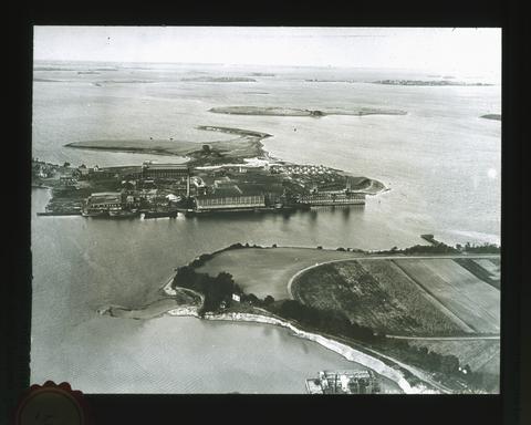 Drumlins, left when the great ice-sheet melted, are seen rising above the waters of the bay. In the Pleistocene epoch (the last geologic epoch before the present time) most of the northern and eastern ...
Citation -
This is an author's peer-reviewed final manuscript, as accepted by the publisher. The published article is copyrighted by Elsevier and can be found at: http://www.journals.elsevier.com/geomorphology/.
Citation -
Calcium carbonate percentages at five Ceara Rise sites were estimated at 1- to 2-k.y. intervals over the past 5 m.y., using reflectance spectroscopy and magnetic susceptibility proxies. From these estimates ...
Citation -
Copyrighted by American Geophysical Union.
Citation -
To the best of our knowledge, one or more authors of this paper were federal employees when contributing to this work. This is the publisher’s final pdf. The published article is copyrighted by the Geological ...
Citation -
In this thesis anomalous downcore shallowing of paleomagnetic inclinations is interpreted to be caused by sediment compaction. Thus, compaction-induced inclination shallowing may influence tectonic reconstructions ...
Citation -
51. [Article] Clay mineral origin and distribution on Astoria Fan
Clay minerals from sediment samples obtained on Astoria Fan were analyzed by X-ray diffraction. Clay minerals are defined for the purpose of this study as crystalline phyllosilicates less than two microns ...Citation -
Surface geology, seismic data, petroleum exploratory well data, and water well data have been used to analyze the structural and tectonic history of the southern Willamette Valley. Tertiary strata beneath ...
Citation -
A 3D seismic volume was acquired summer 2000 over the southern end of Hydrate Ridge (FIR), an anomalously shallow ridge 100 km offshore Newport, Oregon. The survey followed a succession of scientific expeditions ...
Citation -
Over 10,000 feet of marine and nonmarine Late Cretaceous sedimentary rocks are exposed within a 110 square mile area in northeastern Teton County, Wyoming. An additional 1400 feet of nonmarine Paleocene ...
Citation -
55. [Article] Geologic structure of the Upper Ojai Valley and Chaffee Canyon areas, Ventura County, California
The Upper Ojai Valley is a tectonic depression between opposing reverse faults, Its northern border is formed by the active, north-dipping San Cayetano fault with 6.0 km of dip-slip displacement in the ...Citation -
Within 40 square miles of the southeastern Wallowa Mountains, Oregon, eugeosynclinal Permian and Triassic formations comprising a section about 25,000 feet thick have been exposed by uplift and erosion ...
Citation -
The search for archaeological materials dating to 15,000 yr BP along the southern Oregon coast is a formidable task. Using ethnographic, theoretical, and archaeological data, landscape resources which ...
Citation -
Northeast Pacific Ocean sediments were analyzed to determine the past relationship between northeast Pacific sea surface conditions and the climate on the adjacent continent, the Pacific Northwest of North ...
Citation -
Copyright 1995 by the American Geophysical Union
Citation -
60. [Article] Stratigraphy and structure of the Greenstone Mountain area, Beaverhead County, Montana
The Greenstone Mountain area, which includes the Utopia mining district, is located in the foothills of the Pioneer Range, Beaverhead County, Montana. Approximately 12, 600 feet of Paleozoic and Mesozoic ...Citation