Search
You searched for:
Start Over
National vegetation classification
Remove constraint National vegetation classification
« Previous | 201 - 300 of 896 | Next »
Search Results
-
201. [Article] vol. 3 [Appendix VI] ocr.pdf
-
202. [Article] vol. 3 [Appendix V] ocr.pdf
-
203. [Article] vol. 3 [Appendix IV-A] ocr.pdf
-
204. [Article] vol. 3 [Appendix III] ocr.pdf
-
205. [Article] vol. 3 [Appendices I-II] ocr.pdf
-
206. [Article] Vol.2Chapter17F.pdf
-
207. [Article] Vol.2Chapters17G-17K.pdf
-
208. [Article] Vol.2Chapter 17C.pdf
-
209. [Article] Vol.2Chapters17D - 17E.pdf
-
210. [Article] Identification and characterization of forest communities and habitat types in and adjacent to the H. J. Andrews Experimental Forest
A total of 23 forest communities have been identified and characterized in a preliminary manner. Data used in formulating the classification had previously been collected on 300 reconnaissance plots located ...Citation -
211. [Article] Determination of coastal changes in Lincoln County, Oregon using aerial photographic interpretation
In order for proper land use planning to occur in coastal Lincoln County, Oregon, coastal erosion rates should be determined. This has been accomplished by identifying the location of the Lincoln County ...Citation -
212. [Article] The Oregon conservation strategy
The Oregon Conservation Strategy is an ambitious effort to synthesize the best available data, science, and knowledge into a broad vision and conceptual framework for long-term conservation of Oregon’s ...Citation -
There were 5,776 records during 1981-1986 observations, with 99% of these observations during Schrock's systematic 1982-1985 observations. He found 32 waterbird and 99 landbird species. 16% of the waterbird ...
Citation -
215. [Article] Pilot experiment of forest fertilization during an outbreak of the western spruce budworm in Northeastern Oregon
Mixed-conifer stands of grand fir (Abies grandis (Dougl. ex D. Don) Lindl., Douglas-fir (Pseudotsuga menziesii var. glauca (Beissn.) Franco), and ponderosa pine (Pinus ponderosa Dougl. ex Laws.) were fertilized ...Citation -
216. [Article] A contingent valuation study of the value of reducing fire hazards to old-growth forests in the Pacific Northwest
A contingent valuation methodology was applied to old-growth forests and critical habitat units for the Northern Spotted Owl in Oregon to esimate the economic value to the public in knowing that rare and ...Citation -
217. [Article] Synthesis of knowledge on the effects of fire and thinning treatments on understory vegetation in U.S. dry forests
Published September 2009. Reviewed December 2013. Facts and recommendations in this publication may no longer be valid. Please look for up-to-date information in the OSU Extension Catalog: http://exten...Citation -
218. [Article] Growth and yield of western larch under controlled levels of stocking in the Blue Mountains of Oregon
Repeated thinning to five growing-stock levels resulted in widely differing tree sizes and volumes per acre after 30 years. Largest trees but the least cubic-volume yield per acre were produced in the ...Citation -
The purpose of this research was to develop methods for using geographic information system (GIS) analysis and unsupervised classification of Global Vegetation Index (GVI) images to improve carbon budget ...
Citation -
Relationships between sagebrush-dominated plant communities and soil-site characteristics were examined on 372 relatively undisturbed rangeland sites of the Humboldt National Forest, in northeastern Nevada. ...
Citation -
Final amended report and data on ecological and physical characteristics at five high-quality “least disturbed” tidal wetland sites in four Oregon estuaries. Suggested citation: "Brophy, Laura; Cornu, ...
Citation -
Final amended report and data on ecological and physical characteristics at five high-quality “least disturbed” tidal wetland sites in four Oregon estuaries. Suggested citation: "Brophy, Laura; Cornu, ...
Citation -
223. [Article] Riparian Vegetation Assemblages and Associated Landscape Factors Across an Urbanizing Metropolitan Area
While diverse, native riparian vegetation provides important functions, it remains unclear to what extent these assemblages can persist in urban areas, and under what conditions. We characterized forested ...Citation -
In an effort to describe the plant communities and succession of the Oregon coastal grasslands, vegetation and environmental data were collected from 75 stands at 24 separate locations ranging from Cape ...
Citation -
225. [Article] Multivariate analysis of a tidal marsh ecosystem at Netarts Spit, Tillamook County, Oregon
Variability of plant species distributions, plant connunities, soil and hydrological factors in an area of the Netarts Spit tidal marsh are examined. The purpose is to advance general understanding of ...Citation -
226. [Article] Bull Trout (Salvelinus confluentus) Population and Habitat Survey in the McKenzie and Middle Fork Willamette Basins, 2001
Our study area includes the three McKenzie populations, and a reintroduced population in the Middle Fork Willamette and tributaries above Hills Creek Reservoir. We monitored bull trout populations in the ...Citation -
227. [Article] A conservation assessment of West Coast (USA) estuaries
A hierarchical classification system was developed for West Coast estuaries that identified three regions (based on climate, latitude, and oceanography) and four estuary types distinguished by the relative ...Citation -
In 1984-1986, Bayer made 171 and 67 waterbird censuses at West Pond and East Pond, respectively. From 1974 through June 1992, Bayer and others also made an additional 138 and 110 observations at West Pond ...
Citation -
229. [Article] Status of Oregon's Bull Trout. Distribution, Life History, Limiting Factors, Management Considerations, and Status
The purpose of this document is to summarize the best scientific information presently available for bull trout (Salvelimus confluentus) throughout Oregon and to review their historical and current status. ...Citation -
230. [Article] A Cross-sectional Study of US Rural Adults’ Consumption of Fruits and Vegetables: Do They Consume at Least Five Servings Daily?
Background: Rural residents are increasingly identified as being at greater risk for health disparities. These inequities may be related to health behaviors such as adequate fruits and vegetable consumption. ...Citation -
19 pp. Tables, appendix. Township 17 South, Ranges 20 and 21 East, and Township 18 South, Ranges 20 and 21 East. Captured August 12, 2008.
Citation -
233. [Article] Spatial and temporal distributions of western juniper in John Day Fossil Beds National Monument, Oregon
Post-settlement juniper expansion in the western states has been reported for decades, including western juniper (Juniperus occidentalis Hook ssp. occidentalis) woodlands in the northwestern states. A ...Citation -
ill.; "Field work was completed on August 15, 1936, and the office work connected with the survey done at the Berkeley office of the Branch of Forestry during the winter months." - P. 1.
Citation -
235. [Article] H.J. Andrews Experimental Forest reference stand system : establishment and use history
Nineteen l/4-hectare reference stands have been established in the central western Cascade Mountains of Oregon to represent widespread and important portions of the vegetation continuum. Their species ...Citation -
105 pp. Tables, maps, appendices, glossary, bibliography. Township 22 South, Range 16 East, Sections 26-28,33-35; Township 23 South, Range 15, Sections 12,13,24,25,36; and Township 23 South, Range 16 East, ...
Citation -
237. [Article] Aspen planning area vegetation management decision notice and finding of no significant impact
9 pp. T. 22 S., R. 16 E., Sections 26-28,33-35; T. 23 S., R. 15, Sections 12,13,24,25,36; and T. 23 S., R. 16 East, Sections 2-4,7-11,14-23,28-33. Captured May 18, 2007.Citation -
238. [Article] Bear Wallow Creek culvert
This pipe was installed in 2005 by Johnson Rock Products. The culvert has aluminized weir plates welded to the inside of the pipe at 10-foot intervals. The tributary on which this culvert was installed ...Citation -
239. [Article] Jack Creek culvert replacement
Two Rapid-Span bridges were installed on property owned by Donna Woolley. The total project cost was $130,000. The bridges have concrete running surfaces over two large I-beams.Citation -
240. [Article] Comparative effects of precommercial thinning, urea fertilizer, and red alder in a site 11, coast Douglas-fir plantation
The authors varied the number of red alder retained with 300 Douglas-fir per acre on a high-quality site in coastal Oregon. Alder densities of 0, 20, 40, and 80 per acre were tested. The authors' fifth ...Citation -
241. [Article] Measurement, modeling, and remote sensing of snow cover in areas of heterogeneous vegetation
Numerous studies have demonstrated that vegetation canopies affect snow accumulation and ablation processes. In addition, estimates of remotely sensed snow covered area can be biased by the presence of ...Citation -
This investigation on fire mosaics addressed several aspects: (1) quantifying the role of terrain variables in fire-related mortality and historical mean fire return interval (MFRI), (2) comparing post-burn ...
Citation -
243. [Article] Physical habitat classification for conservation planning in the Klamath Mountains region
I classified the environment of the Klamath Mountains region into physical habitat types using climate and soil variables and a geographic information system (GIS). I used principal components analysis ...Citation -
273 pp. Tables, appendices, maps, illus. T 6 S, R 41-43 E; T 7 S, R 42-43 E. Captured May 29, 2008.
Citation -
245. [Article] Bald Angel vegetation management decision notice/FONSI
19 pp. Tables. T 6 S, R 41-43E; T 7 S, R42-43E. Captured May 29, 2008.Citation -
246. [Article] Bald Angel vegetation management decision notice/FONSI
19 pp. Tables. T 6 S, R 41-43E; T 7 S, R42-43E. Captured May 29, 2008.Citation -
273 pp. Tables, appendices, maps, illus. T 6 S, R 41-43 E; T 7 S, R 42-43 E. Captured May 29, 2008.
Citation -
248. [Article] Reduction in growth of pole-sized Ponderosa pine related to a Pandora moth outbreak in central Oregon
A pandora moth (Coloradia pandora Blake) outbreak began in 1991 in a ponderosa pine (Pinus ponderosa Dougl. ex. Laws) spacing study area that also included scattered sugar pine (P. lambertiana Dougl). ...Citation -
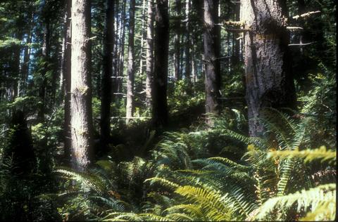
250. [Image] Forest vegetation
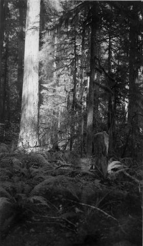 Typical vegetation of Columbia National Forest along Lower Cispus River, near Randle, Washington. Sword ferns, Oxalis, and trillium carpeting Columbia National Forest along lower Cispus River
Citation -
251. [Article] McCache vegetation management project decision notice, Forest Plan amendment, and finding of no significant impact
15 pp. Table. The project area is within Deschutes County, in townships 14 and 15 south, and ranges 8 and 9 east. Captured May 25, 2007.Citation -
This study aimed to connect habitat and landscape scale variation, through time and space, to wildlife population dynamics. I studied African buffalo (Syncerus caffer) group size according to habitat structure, ...
Citation -
253. [Article] Tower Fire ecosystem analysis forest vegetation report and forest vegetation BAER report
72 pp. Tables, figures, maps, references, appendix, illus. "Pre-fire forest types were very diverse, largely in response to a relatively steep elevational gradient ranging from 3,000 feet near the North ...Citation -
This is the publisher’s final pdf. The published article is copyrighted by Copernicus Publications and can be found at: [http://publications.copernicus.org/.
Citation -
The U.S. Fish and Wildlife Service's National Wetlands Inventory (NWI) was developed to map U.S. wetlands comprehensively, following the Cowardin classification system. Wetlands are mapped by the NWI using ...
Citation -
256. [Article] Woody riparian species patterns along northeast Oregon mountainous streams and the relationship to riparian capability
Woody riparian vegetation is an essential component of riparian ecosystems, responsible in part for the maintenance of functional ecological processes. The plant community composition and distribution ...Citation -
257. [Article] A plant association classification for McDonald-Dunn Forest
The purpose of this study was to develop a plant association classification for the mature coniferous forests of the McDonald and Paul M. Dunn Research Forests. A secondary objective was to quantify diversity ...Citation -
This report summarizes accomplishments of the McKenzie River Focus Watershed Council (MWC) in the areas of coordination and administration during Fiscal Year 2000. Coordination and administration consist ...
Citation -
Presented at The Oregon Water Conference, May 24-25, 2011, Corvallis, OR.
Citation -
307 pp. Tables, maps, charts, references, appendices. T.5S., R.27E., Sections 13, 2228, 3336; T.5S., R.28E., Sections 1820, 2832; T.6S., R.27E., Sections 14, 817, 2127, 3536; and T.6S., R.28E., Sections ...
Citation -
261. [Article] Wildcat fuels reduction and vegetation management project decision notice and finding of no significant impact
20 pp. T 5 S, R 27 E; T 5 S, R 28 E; T 6 S, R 27 E; and T 6 S, R 28 E. Captured March 16, 2009.Citation -
334 pp. Tables, figure, references, index, appendices. Maps included in Final Environmental Impact Statement (FEIS). Captured January 15, 2008.
Citation -
263. [Article] Sugar Creek campground vegetation management decision memo
4 pp. T 15 S, R 24 E, Section 35. Captured August 18, 2008.Citation -
Recent climatic warming trends and increases in the frequency and extent of wildfires have prompted much concern regarding the potential for rapid change in the structure and function of forested ecosystems ...
Citation -
Western Tasmania, Australia contains some of the highest levels of biological endemism of any temperate region in the world, including vegetation types that are conservation priorities: fire-sensitive ...
Citation -
266. [Article] Composition, distribution and succession of subalpine meadows in Mount Rainier National Park
In 1970 a phytosociological reconnaissance consisting of 135 plots in the Subalpine Meadow Zone was made. These samples were sorted using an association table and several Alpine Zone and very early seral ...Citation -
301 pp. Maps, tables, bibliography, and appendices. T.5S., R.27E., Sections 13, 22-28, 33-36; T.5S., R.28E., Sections 18- 20, 28-32; T.6S., R.27E., Sections 1-4, 8-17, 21-27, 35-36; and T.6S., R.28E., ...
Citation -
268. [Article] Spears vegetation management project record of decision and final environmental impact statement
Item includes two files: 1) Spears vegetation management project final environmental impact statement. 435 pp. Abstract, tables, figures, maps, references, index, appendices. Published July, 2007; 2) Spears ...Citation -
269. [Article] Deep vegetation management project final supplementary environmental impact statement summary
485 pp. Tables, figures, maps, references, glossary, appendices. In Crook County: T.13S., R.22E., Sections 23 through 26, 35 and 36; T.14S., R.22E., Sections 1, 2, 11 through 14, 23 through 27, 35 and ...Citation -
270. [Article] Deep vegetation management project record of decision
16 pp. Table. In Crook County: T.13S., R.22E., Sections 23 through 26, 35 and 36; T.14S., R.22E., Sections 1, 2, 11 through 14, 23 through 27, 35 and 36; T.14S., R.23E., Sections 1 through 36; T.15S., ...Citation -
271. [Image] Klamath wild and scenic river eligibility report and environmental assessment : Klamath River, Oregon : draft
"February 1994." ; "Much of this document was taken directly from, or based on, the Bureau of Land Management's earlier studies of the Klamath River: the Final eligibility and suitability report for the ...Citation -
272. [Article] Sampling methods for bats
Bats represent the second most diverse group of mammals inhabiting the western slopes of the Cascade Range in southern Washington and Oregon Coast Range. Bat populations may well be sensitive to changes ...Citation -
Three factors were found to be significantly correlated with the fluctuations and trends in silver salmon production in Oregon. Logging was found to adversely affect the runs of salmon in later years. ...
Citation -
274. [Article] Waterbird records for the Siletz River and some creeks in the Siletz/Logsden area of Lincoln County
This article is based on a total of 204 observations, many of which were censuses. Between Siletz River Mile (RM) 50.0 and 50.6, Llewellyn made 151 observations of waterbirds during 1981-1993. He noted ...Citation -
The results of 703 observations are given; most of these were made in the 1930's by James Macnab, Jane Claire Dirks-Edmunds, Dorothy McKey-Fender, and others. These results are the most comprehensive throughout the ...
Citation -
Soils data for additional tidal wetland sites on the OR coast are intended to be added to this site. These data for 2007 may be updated with additional samples.
Citation -
Soils data for additional tidal wetland sites on the OR coast are intended to be added to this site. These data for 2007 may be updated with additional samples.
Citation -
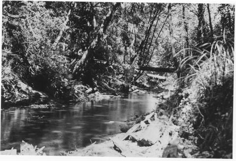
279. [Image] Tree stump, vegetation
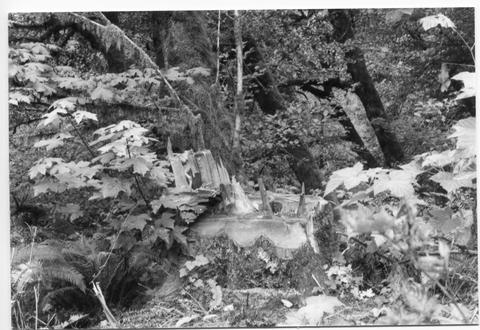 Tree stump, vegetation. Series 02-280 thru 02-290. Maples Campground.
Citation -
280. [Article] Kelsey vegetation management environmental assessment
141 pp. Tables, maps, appendices, references, bibliography. Townships 18, 19, and 20 South, Ranges 11 and 12 East. Captured May 18, 2007.Citation -
281. [Image] Gerber-Willow Valley Watershed Analysis
x, 386 p., ill., maps (some col.); Cover title; "July 2003"Citation -
155 pp. Tables, maps. T20S, R13E, Sections 12, 13, and 24; T20S, R14E, Sections 6-8, 16- 22, 25-29, and 31-36; T20S, R15E, Sections 19-34; T21S, R14E, Sections 1-16; T21S, R15E, Sections 3- 9, 13-29, and ...
Citation -
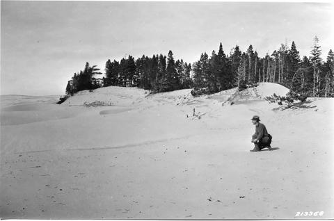
286. [Image] Vegetation layer
-
At the time of the eruptions of Lassen Peak in 1914-1915, an area of vegetation along the east slope of the mountain approximately 1 1/4 miles wide and four miles long was destroyed. Except for a few surviving ...
Citation -
289. [Article] Breeding bird community composition in relation to riparian vegetation structure in grazed habitats
Riparian zones provide habitat for breeding birds in the semiarid western United States; however, there are few data available that address the effects of livestock grazing strategies on riparian habitats ...Citation -
290. [Article] Monitoring fluoride pollution in Flathead National Forest and Glacier National Park, 1972
During August 1972, 15 vegetation plots monitered for foliar fluoride concentrations in 1971 were resampled near the Anaconda aluminum plant at Columbia Falls, Montana. Statistical analysis of the data ...Citation -
291. [Article] Regional variation in stand structure and development in forests of Oregon, Washington, and inland Northern California
To the best of our knowledge, one or more authors of this paper were federal employees when contributing to this work. This is the publisher’s final pdf. The published article is copyrighted by the author(s) ...Citation -
292. [Article] Urbanizing Flora of Portland, Oregon, 1806-2008.
Second printing with corrections and additions, December 2009.Citation -
293. [Article] Softwood lumber prices for evaluation of small-diameter timber stands in the Intermountain West
This paper reports prices for aggregations of lumber grades that are representative of the quality and volume of lumber produced from small-diameter timber stands in the Intermountain West area encompassing ...Citation -
294. [Article] Reducing stand densities in immature and mature stands, Applegate Watershed, Southwest Oregon
In the study the authors examined conditions following density management treatments in two adjacent but dissimilar stands in Applegate Watershed, Oregon. An immature stand received a unique density reduction ...Citation -
295. [Article] Timber harvesting, processing, and employment in the northwest economic adjustment initiative region : changes and economic assistance
The Northwest economic adjustment initiative (NWEAI) provides economic assistance to a region including western Washington, western Oregon, and northern California. Timber harvests have fallen markedly ...Citation -
296. [Article] Composition, volume, and prices for major softwood lumber types in western Oregon and Washington, 1971-2020
An analysis of lumber prices provided regressions for price trends during the period 1971-95 for composite lumber grades of major timber species found in the Pacific Northwest west of the crest of the ...Citation -
297. [Article] Monitoring and evaluating citizen-agency interactions: a framework developed for adaptive management
As the Forest Service and the Bureau of Land Management turn toward ecosystem and adaptive models of forest stewardship, they are being called on to develop meaningful and lasting relations with citizens. ...Citation -
298. [Article] Bull Trout (Salvelinus confluentus) population and habitat surveys in the McKenzie and Middle Fork Willamette Basins, 2000
DOE/BP-00004093-1Citation -
299. [Article] Habitat use and activity patterns of the Columbian white-tailed deer along the lower Columbia River
A study of the life history, population dynamics, and ecological relationships of the Columbian white-tailed deer (Odocoileus virginiarius leucurus) was conducted on the Washington mainland, Columbian ...Citation -
300. [Article] Multi-spatial scale representation of landscape transitions using landsat thematic mapper data and scale-space filters
This thesis considered current approaches to describing landscape pattern, identified scale issues associated with defining objects, and explored techniques to reliably group elements based on land cover ...Citation