Search
Search Results
-
Distributed to depository libraries in microfiche; Shipping list no.: 96-0055-P; "September 1995"--P. [18]; "RF116690"--P. [18]
Citation Citation
- Title:
- Wildlife of the Klamath Basin National Wildlife Refuges, California-Oregon
- Author:
- U.S. Fish and Wildlife Service
- Year:
- 1995, 2007, 2006
Distributed to depository libraries in microfiche; Shipping list no.: 96-0055-P; "September 1995"--P. [18]; "RF116690"--P. [18]
-
Only portions of issues of The Water Report are available in the Klamath Waters Digital Library. See the full report at http://www.thewaterreport.com/.
Citation Citation
- Title:
- The Water Report - The ESA, salmon, and Western water law
- Author:
- Envirotech Publications
- Year:
- 2004, 2008, 2006
Only portions of issues of The Water Report are available in the Klamath Waters Digital Library. See the full report at http://www.thewaterreport.com/.
-
7804. [Article] A comparison of social class differences in adolescents' self-disclosure, parent-cathexis and self-cathexis
The purpose of this study was to investigate the differences between middle- and lower-class adolescents and the extent of their self-disclosure to their mothers and their fathers; and their feelings both ...Citation Citation
- Title:
- A comparison of social class differences in adolescents' self-disclosure, parent-cathexis and self-cathexis
- Author:
- Larsen, George Robert
The purpose of this study was to investigate the differences between middle- and lower-class adolescents and the extent of their self-disclosure to their mothers and their fathers; and their feelings both positive and negative toward their parents and themselves. The subjects consisted of 50 middle-class and 50 lower-class adolescents who were randomly selected from 297 sophomores and juniors attending the same high school in a rural town in Oregon. Hollingshead's Index of Social Position (1958), which uses the occupation and education of the father as criteria for social class, was used to classify the adolescents by social class. Sex comparisons were also analyzed for differences between the middle- and lower-class adolescents. In attempting to realize this purpose, two major hypotheses were tested: Hypothesis 1: There are no differences between these middle-class and lower-class adolescents in the extent of self-disclosure to their parents. Hypothesis 2: There are no differences between these middle-class and lower-class adolescent's in the extent of positive and negative feelings toward their parents and themselves. The extent of self-disclosure was measured by Jourard's Self-disclosure Questionnaire (1964). This 60 item instrument which permits the subjects to indicate the extent to which they are willing to talk to another person about themselves on the following six categories: A attitudes and opinions, B tastes and interests, C work or studies, D money, E personality, and F body. Total scores from the questionnaire were used in testing Hypothesis 1. The results indicated that the null hypothesis could not be rejected. Comparison of middle- and lower-class males and middle- and lower-class females also did not indicate any significant differences on total scores from the Self-disclosure Questionnaire. The extent of the adolescents' positive and negative feelings toward their parents and themselves was measured by the use of Jourard's Cathexis Questionnaire. This instrument consists of 40 personality traits such as: sense of humor, philosophy of life, temper, and happiness. Total scores from the questionnaire were used in the test of Hypothesis 2. Once again, the results of the test indicated that the null hypothesis could not be rejected. In addition analysis was made of differences between middle- and lower-class males and middle- and lower-class females on total scores from the Cathexis Questionnaire for mothers, fathers and themselves. No significant differences were found for the social class differences for the middle- and lower-class males and females. The items within each questionnaire were then analyzed for significant differences between the middle- and lower-class adolescents. To test for significant differences between social classes for each item within the questionnaires, Chi Square and the Kolmogrov- Smirnov Test were used. Sixteen of the 60 items on the Self-disclosure Questionnaire were found to be significantly different between the middle- and lower-class adolescents, with the middle-class adolescents talking more extensively to their parents than did the lower-class adolescents. More specifically five items were significantly different for both mothers and fathers which were: attitudes on drinking, feelings about how work is appreciated, feelings about people at work, trouble controlling feelings, being attractive to the opposite sex or not. While these five items were significant for both mothers and fathers the following eight items were of significance for mothers: attitudes on racial integration, tastes in music, style of house, how much money is made, to whom money is owed, amount in savings, aspects of personality that are disliked, and feelings about one's appearance in the past. The following three items were significant for fathers: tastes in food, source of income, and ideals of overall appearance. In addition analysis of differences between middle- and lower-class males and females on the items within the Self-disclosure Questionnaire with the lower-class adolescent indicating no self-disclosure in contrast to the middle-class adolescents extensive self-disclosure. Slightly more items were significantly different on self-disclosure to the parent of the same sex than to the parent of the opposite sex. The items of significance for males to fathers were: religion, food, social gatherings, feelings about people at work, and adequacy in sexual behavior. The items of significance for females to mothers were: style of house, present work, ambitions and goals, choice of a career, people at work, things that makes one furious, and adequacy in sexual behavior. The items of significance for the males to mothers were: appreciation of work, amount of savings, and being attractive to the opposite sex. The items of significance for the females to their fathers were: how much money is made and trouble controlling feelings. For the Cathexis Questionnaire there were three target persons: mother, father, and self. Only four of the 40 items in this questionnaire were significantly different between middle- and lower-class adolescents. The lower-class adolescents indicated negative feelings toward their fathers and themselves in contrast to the positive feelings expressed by the middle-class adolescents. Of the four items three were for fathers' general knowledge, intelligence level, and philosophy of life. The only significant item for the adolescents' feelings about themselves was their ability to control emotions. An additional comparison was made for differences between the middle- and lower-class males and females for feelings about their mothers, fathers and themselves. There were only two significant items for the sex comparisons for the items from the Cathexis Questionnaire. The lower-class males indicated negative feelings toward their fathers' general knowledge in contrast to the positive feelings of the middle-class males. The lower-class females indicated negative feelings for their fathers' intelligence level in contrast to the positive feelings of the middle-class females. An extension of the analysis of the differences between the extreme ends of the social class continuum was done by going back to the original 297 subjects and taking all of those in Classes I and II (N = 20) and all of those in Class V (N = 23). The two hypotheses were again tested by using the Self-disclosure and Cathexis Questionnaires. Total scores from the two questionnaires were used in the test of Hypothesis 1 and 2. The results of the t-test indicated that the null hypotheses could not be rejected, for both Hypothesis 1 and 2. The sex comparisons for the two hypotheses also indicated no significant differences on total scores from the two questionnaires. The analysis of the differences in the extent of self-disclosure between the extreme ends of the social class continuum provided a pattern which was the reverse for the random sample of middle- and lower-class adolescents. For the random sample there were more items of significant difference for mothers than for fathers, while there were more items of significant difference for fathers than for mothers for the extreme ends of the social class continuum. The lower socio-economic adolescents indicated no self-disclosure for the significant items in contrast to the upper socio-economic adolescents' extensive self-disclosure to their parents. The three items which were significantly different on self-disclosure to mothers were: attitudes toward other religious groups, satisfaction from present work, and who owes me money. The nine items which were significantly different on self-disclosure to fathers were: religion, standards of beauty, tastes in food, present work, ambitions and goals, who owes me money, different parts of the body, physical measurements, and adequate sexual behavior. The analysis of the differences in the extent of self-disclosure between the males and females of the upper and lower extremes of the social class continuum showed no significant difference. The analysis of the differences between the extreme ends of the social class continuum on the items within the Cathexis Questionnaire indicated one item for mothers and six items for fathers. For all of the items the lower socio-economic adolescents indicated negative feelings in contrast to the positive feelings of the upper socio-economic adolescents. The one significant item for feelings about mothers was her general knowledge. The six significant items for feelings about fathers were his: general knowledge, intelligence level, capacity to work, ability to meet new people, and business sense. The sex comparisons of the extreme ends of the social class continuum of the items within the Cathexis Questionnaire found two items of significant differences. The lower socio-economic females indicated negative feelings about fathers' general knowledge and intelligence level, while the upper socio-economic females indicated positive feelings on these items. The items within the questionnaires which indicated significant differences agreed with the literature on social class which suggests that there is more communication between middle-class parents and their children than for lower-class parents and their children, and that the lower-class adolescents report more negative feelings toward their parents than do the middle-class adolescents. The findings of this study suggest the necessity of additional studies of social class differences in rural settings and comparisons of rural and urban samples which use the same criteria for measuring social class and which use the same instruments for measuring differences among the social classes.
-
7805. [Article] Implications of cougar prey selection and demography on population dynamics of elk in northeast Oregon
Mule deer (Odocoileus hemionus hemionus) and Rocky Mountain elk (Cervus canadensis nelsoni; hereafter elk) populations in northeast Oregon have declined in the past 10 to 20 years. Concurrent with these ...Citation Citation
- Title:
- Implications of cougar prey selection and demography on population dynamics of elk in northeast Oregon
- Author:
- Clark, Darren A.
Mule deer (Odocoileus hemionus hemionus) and Rocky Mountain elk (Cervus canadensis nelsoni; hereafter elk) populations in northeast Oregon have declined in the past 10 to 20 years. Concurrent with these declines, cougar (Puma concolor) populations have apparently increased, leading to speculation that predation by cougars may be responsible for declining ungulate populations. However, empirical data on cougar diets, kill rates, and prey selection are lacking to support this speculation. Furthermore, the common assumption that cougar populations have increased in northeast Oregon may not be well founded because cougar populations in other areas within the Pacific Northwest region have declined in recent years. My primary research objectives were to (1) estimate kill rates and prey selection by cougars in northeast Oregon, (2) document causes of mortality and estimate survival rates for cougars, (3) estimate population growth rates of cougars in northeast Oregon and simulate the effects of hypothetical lethal control efforts on the cougar population, and (4) investigate the relative influence of top-down, bottom-up, and climatic factors for limiting population growth rates of elk in northeast Oregon. Results from my research will help guide cougar and elk management in northeast Oregon and provide a framework for assessing relative effects of top-down, bottom-up, and abiotic factors on population growth rates of ungulates in this and other areas. I implemented a 3-year study in northeast Oregon to investigate diets, kill rates, and prey selection of cougars in a multiple-prey system to better understand mechanisms by which cougars may influence ungulate populations. During my research, 25 adult cougars were captured and fitted with Global Positioning System (GPS) collars to identify kill sites. I monitored predation sequences of these cougars for 7,642 days and located the remains of 1,213 prey items killed by cougars. Cougars killed ungulates at an average rate of 1.03 per week (95% CI = 0.92 – 1.14); however, ungulate kill rates were variable and influenced by the season and demographic classification of cougars. Cougars killed ungulates 1.55 (95% CI = 1.47 – 1.66) times more frequently during summer (May-Oct) than during winter (Nov-Apr), but killed similar amounts of ungulate biomass (8.05 kg/day; 95% CI = 6.74 – 9.35) throughout the year. Cougars killed ungulates more frequently in summer because juvenile ungulates comprised most of the diet and were smaller on average than ungulate prey killed in winter. Female cougars with kittens killed more frequently (kills/day) than males or solitary females. After accounting for the additional biomass of kittens in cougar family groups, male cougars killed on average more biomass of ungulate prey per day than did females (R = 0.41, P < 0.001), and female cougars killed more biomass of prey per day as a function of the number and age of their kittens (R = 0.60, P < 0.001). Patterns of prey selection were influenced by season and demographic classification of cougars. Female cougars selected elk calves during summer and deer fawns during winter. In contrast, male cougars selected elk calves and yearling elk during summer and elk calves during winter. My results strongly supported the hypothesis that cougar predation is influenced by season, gender, and reproductive status of the cougar and these patterns in cougar predation may be generalizable among ecosystems. The observed selection for juvenile elk and deer suggested a possible mechanism by which cougars could negatively affect population growth rates of ungulates. I investigated survival and documented causes of mortality for radio-collared cougars at 3 study areas in Oregon during 1989 – 2011. Mortality due to hunter harvest was the most common cause of death for cougars in the Catherine Creek study area and the study area combining Wenaha, Sled Springs, and Mt. Emily Wildlife Management Units (WSM study area) in northeast Oregon. In contrast, natural mortality was the most common cause of death for cougars in the Jackson Creek study area in southwest Oregon. Annual survival rates of adult males were lowest at Catherine Creek when it was legal to hunt cougars with dogs (Ŝ = 0.57), but increased following the prohibition of this hunting practice (Ŝ = 0.86). This latter survival rate was similar to those observed at Jackson Creek (Ŝ = 0.78) and WSM (Ŝ = 0.82). Regardless of whether hunting of cougars with dogs was permitted, annual survival rates of adult females were similar among study areas (Catherine Creek Ŝ = 0.86; WSM Ŝ = 0.85; Jackson Creek Ŝ = 0.85). I did not document an effect of age on cougar survival rates in the Catherine Creek study area, which I attributed to selective harvest of prime-aged, male cougars when it was legal to hunt cougars with dogs. In contrast, I observed an effect of age on annual survival in both the WSM and Jackson Creek study areas. These results indicate that sub-adult males had significantly lower survival rates than sub-adult females, but survival rates of males and females were similar by age 4 or 5 years. My results suggest that survival rates of cougars in areas where hunting cougars with dogs is illegal should be substantially higher than areas where use of dogs is legal. I used estimates of cougar vital rates from empirical data collected in northeast Oregon to parameterize a Leslie projection matrix model to estimate deterministic and stochastic population growth rates of cougars in northeast Oregon when hunting cougars with dogs was legal (1989 - 1994) and illegal (2002 - 2011). A model cougar population in northeast Oregon that was hunted with dogs increased at a mean stochastic growth rate of 21% per year (λ[subscript s] = 1.21). Similarly, I found that a model cougar population that was subjected to hunting without dogs increased at a rate of 17% per year (λ[subscript s] = 1.17). Given that hunting cougars with dogs typically results in increased harvest and reduced survival rates of cougars, it was unexpected that the cougar population subjected to hunting with dogs was increasing at a faster rate than one that was not hunted with dogs. However, cougar populations in Oregon were subjected to low harvest rates when hunting cougars with dogs was legal and harvest was male biased. This resulted in high survival rates of female cougars and correspondingly high population growth rates. The Oregon Cougar Management Plan allows the Oregon Department of Fish and Wildlife to administratively reduce cougar populations to benefit ungulate populations, reduce human-cougar conflicts, and limit livestock depredation. Consequently, I was interested in modeling the effects of a hypothetical lethal control effort on a local cougar population. Using empirically-derived vital rates and a deterministic Leslie matrix model, I found that the proportion of the cougar population that would need to be removed annually to achieve a 50% population reduction within 3 years was 28% assuming a closed population, and 48% assuming maximum immigration rates into the population. Using a stochastic Leslie matrix model, I also determined that the model cougar population would likely return to its pre-removal size in 6 years assuming a closed population, and 2 years assuming maximum immigration rates. These model results indicate that current management practices and harvest regulations, combined with short-term, intensive, and localized population reductions, are unlikely to negatively affect the short-term viability of cougar populations in northeast Oregon. However, at this time, it is not known if intensive lethal control efforts funded by state agencies will be cost-effective (i.e., increased sales of tags to hunt deer and elk will offset the costs of control efforts). Further research is needed to investigate the cost-effectiveness of cougar control efforts in Oregon. I developed a Leslie matrix population model, parameterized with empirically-derived vital rates for elk in northeast Oregon, to investigate the relative influence on elk population growth rates of (1) survival and pregnancy, and (2) top-down, bottom-up, and climatic variables. I then estimated the effect of varying the strength of top-down factors on growth rates of elk populations. Growth rates of the model elk population were most sensitive to changes in adult female survival, but due to the inherent empirical variation in juvenile survival rates explained the overwhelming majority of variation in model population growth rates (r² = 0.92). Harvest of female elk had a strong negative effect on model population growth rates of elk (r² = 0.63). An index of cougar density was inversely related to population growth rates of elk in my model (r² = 0.38). A delay in mean date of birth was associated with reduced juvenile survival, but this had a minimal effect on population growth rates in my model (r² = 0.06). Climatic variables, which were used as surrogates for nutritional condition of females, had minimal effects on population growth rates. Likewise, elk density had almost no effect on population growth rates (r² = 0.002). The results of my model provided a novel finding that cougars can be a strong limiting factor on elk populations. Wildlife managers should consider the potential top-down effects of cougars and other predators as a limiting factor on elk populations.
-
7806. [Image] Work of the Reclamation service in Washington and Oregon
The article was written by the Supervising Engineer of the United States Reclamation Service. It includes a photo of the author.Citation -
7807. [Image] Resolving the Klamath
-
Cover title; At head of title: Department of the Interior, General Land Office
Citation -
"Serial no. 107-39."
Citation Citation
- Title:
- Water management and endangered species issues in the Klamath Basin : oversight field hearing before the Committee on Resources, U.S. House of Representatives, One Hundred Seventh Congress, first session, June 16, 2001 in Klamath Falls, Oregon
- Author:
- United States. Congress. House. Committee on Resources
- Year:
- 2002, 2005, 2004
"Serial no. 107-39."
-
CONTENTS STATEMENTS Page Craig, Hon. Larry E., U.S. Senator from Idaho 2693 Crawford, John, Farmer, on behalf of Klamath Water Users Association, Klamath Falls, OR 26951 Foreman, Allen, Chairman, Klamath ...
Citation Citation
- Title:
- Klamath Project : hearing before the Subcommittee on Water and Power of the Committee on Energy and Natural Resources, United States Senate, One Hundred Seventh Congress, first session to discuss Klamath Project operations and implementation of Public Law 106-498, March 21, 2001
- Author:
- United States. Congress. Senate. Committee on Energy and Natural Resources. Subcommittee on Water and Power
- Year:
- 2001, 2005, 2000
CONTENTS STATEMENTS Page Craig, Hon. Larry E., U.S. Senator from Idaho 2693 Crawford, John, Farmer, on behalf of Klamath Water Users Association, Klamath Falls, OR 26951 Foreman, Allen, Chairman, Klamath Indian Tribes, Chiloquin, OR 26923 Home, Alex J., Ph.D., Professor, Department of Civil and Environmental Engineering, University of California, Berkeley 26955 Marbut, Reed, Intergovernmental Coordinator, Oregon Water Resources De partment, Salem, OR 26931 McDonald, J. William, Acting Commissioner, Bureau of Reclamation, Depart ment of the Interior 2697 Nicholson, Roger, President, Resource Conservancy, Fort Klamath, OR 26939 Smith, Hon. Gordon, U.S. Senator from Oregon 2691 Spain, Glen H., Northwest Regional Director, Pacific Coast Federation of Fishermen's Associations, Eugene, OR 26940 Walden, Hon. Greg, U.S. Representative from Oregon 2693 Wyden, Hon. Ron, U.S. Senator from Oregon 2692
-
7811. [Image] Klamath Basin Emergency Operation and Maintenance Refund Act of 2001: report (to accompany H.R. 2828)
8 p.; "September 17, 2002"; Mr. Bingaman submitted the following report to accompany H.R. 2828Citation Citation
- Title:
- Klamath Basin Emergency Operation and Maintenance Refund Act of 2001: report (to accompany H.R. 2828)
- Author:
- United States. Congress. Senate. Committee on Energy and Natural Resources
- Year:
- 2002, 2006
8 p.; "September 17, 2002"; Mr. Bingaman submitted the following report to accompany H.R. 2828
-
"September 1997"; Includes bibliographical references (p. 24)
Citation Citation
- Title:
- Research information needs on terrestrial vertebrate species of the interior Columbia River basin and northern portions of the Klamath and Great basins: research, development, and application database
- Author:
- Marcot, Bruce G.
- Year:
- 1997, 2005, 2004
"September 1997"; Includes bibliographical references (p. 24)
-
7813. [Image] Three great factors in Oregon's development
An article on the agricultural, industrial and economic development of the state of Oregon in the early 20th centuryCitation -
7814. [Image] National irrigation as a social problem
Includes two scenic photos "The great gates on the Minidoka Project through which Snake River is now passing" and "From Smiley Heights, Redlands - the result of irrigation" ; The author of this article ...Citation Citation
- Title:
- National irrigation as a social problem
- Author:
- Newlands, Francis G.
- Year:
- 1906, 2005, 2004
Includes two scenic photos "The great gates on the Minidoka Project through which Snake River is now passing" and "From Smiley Heights, Redlands - the result of irrigation" ; The author of this article was the Senator of Nevada.
-
7815. [Image] Klamath Federal Reclamation Project : Oregon-California
- 7' -, > \ UNITED STATES DEPARTMENT OF THE INTERIOR B U R E A U O F R E C L A M A T I O N U N I T E D S T A T E S G O V E R N M E N T P R I N T I N G O F F I C E W A S H I N G T O N : 1936 FEDERAL RECLAMATION ...Citation Citation
- Title:
- Klamath Federal Reclamation Project : Oregon-California
- Author:
- United States. Bureau of Reclamation
- Year:
- 1936, 2005
- 7' -, > \ UNITED STATES DEPARTMENT OF THE INTERIOR B U R E A U O F R E C L A M A T I O N U N I T E D S T A T E S G O V E R N M E N T P R I N T I N G O F F I C E W A S H I N G T O N : 1936 FEDERAL RECLAMATION PROJECT OREGON - CALIFORNIA n )> >> GENERAL STATEMENT THEKla m- ath reclamation project comprises practically all of the agricultural land in the Klamath Basin, except a small area adjacent to Upper Klamath Lake, and is situated in southern Oregon and northern California. The extent of the area irrigated, or that may be irrigated by reason of Bureau of Reclamation activities, is approxi-mately 140,000 acres. This includes about 20,000 acres suitable only for pasture and approximately 12,000 acres of good land in the Tule Lake division not yet opened for settlement. Within the older developed sections of the project the soil is mostly of a sandy loam . type that is particularly suitable for growing potatoes and summer vegetables as well as all of the ordinary crops that thrive in a cool, tem-perate climate. The price of this type of land ranges from $ 100 to $ 200 per acre. The water- right cost, which origi- Klamath Falls, Oregon, the prolect office headquarters nally was about $ 55 per acre, is approximately half paid up. The balance has an average of about 25 years to run without interest. Operation and maintenance costs usually run about $ 1.25 an acre per annum. I R R I G A B L E L A N D S The Tule Lake division of the project, which will eventually comprise about 32,000 acres of agricultural land and about 5,000 acres of thin soil land good only for pasture, carries a construction charge of $ 88.35, with 40 years in A! Klamath : desert. Looking~ southwest up Lan Valley from a point 4 miles west of Lorella, Ore which to pay without interest. No payments have been required to date, but the Secretary of the Interior will soon issue public notice announcing the commencement of pay-ments, which will be approximately $ 2.20 per acre each year. In addition to the construction charge, there is an operation and maintenance charge which will probably run between $ 1.50 and $ 2 un acre a year. These lands are of lacustrian origin and are very fertile. They are particularly adapted to the growth of small grains, alfalfa, and pasture grasses. Patented land in this division sells for $ 50 to $ 100 per acre. Patented lands in private ownership, where of goc; d quality, well improved and conveniently situated, can be purchased for from $ 150 to $ 200 per acre. Good lands not so well improved nor so desirably located sell at around $ 100 per acre. There is very little undeveloped, privately owned good land on the project. Small tracts of 5, 10, or 20 acres, located along paved highways and within 6 to 8 miles of Klamath Falls, are obtainable at from $ 200 to $ 400 per acre. W A T E R S U P P L Y The Klamath project is ! ortunate in having an abundant water supply for all lands susceptible of irrigation. The map on the inside of the back cover page shows the location of the three reservoirs and their immediate proximity to the lands they serve. The irrigable project lands lie between elevations of 4,035 and 4,070 feet above sea level and occupy the Klamath Basin and the Valley of Lost River, situated in south central Oregon and north central California, about 150 miles east of the Pacific coast. The average annual pre-cipitation is 12.51 inches. SCHOOLS Klamath County schools are run on the county unit basis Public School in Klamath Falls and are fully up to standard. Busses run at county expense transport rural children to and from school, and there is no lost time on account of bad weather. Within the county there are 9,242 children of school age, 4,107 of these within the city of Klamath Falls. The high school enrollment for Klamath Falls is 1,156, and for the remainder of the county is 459. There are 9 high schools in the county that employ 62 teachers. The grade schools employ 185 teachers, of whom' 76 are in the city of Klamath Falls. : let of concrete flume, Canal C, of the main project structures R E C R E A T I O N No part of the United States affords more interesting and attractive recreational areas than are found near at hand and in all directions from the Klamath project. From 1 to 2 hours in any kind of an automobile is sufficient to land one on the banks of a cold mountain stream inhabited by many wary trout or alongside the shores of any one of a half dozen crystal lakes, where boating and bathing may be enjoyed to the full. Some of the lakes that are conven-iently located with reference to the project, and where many summer camps as well as extensive hotel and camp accommodations already exist, are Upper Klamath Lake, Lake of the Woods, Crater Lake, Diamond Lake, Crescent I., ake, Ode11 Lake, and Paulina Lake. The most distant of the lot, Paulina Lake, can be reached in 3 hours' driving from Klamath Falls. Some of the important recreational areas lying in convenient distances from the project are shown in the ilh~ strationsa ccompanying this chapter. The principal water supply is in Upper Klamath Lake, where regulation provides a possible storage of about 524,800 acre- feet, and this with the natural inflow insures the lands served from this source an adequate water supply at all times. Under the terms of the contract dated February 24, 1917, between the United States and the California- Oregon Power Co., the power company was given the right to regulate the outflow of Upper Klamath Lake, subject to existing rights and the prior rights of the Klamath project for water for irrigation. To regulate the outflow, the company, in 1921, constructed the Link River Dam at a cost of about $ 310,000. Storage for the lands on the west side of Langell Valley and a portion of the lands in the Horsefly irrigation district is provided by Clear Lake Reservoir. This reservoir, lying just across the line in California, is the source of Lost River and has a total capacity of 454,000 acre- feet, most of which was made available during 1931 by the construction of a channel from the outlet works to the deeper portion of the reservoir, a distance of about 6 miles. The reservoir is also used for flood storage for the protection of lands in the Tule Lake division. Gerber Reservoir, on Miller Creek, a tributary of Lost River, has a storage capacity of 94,000 acre- feet and fur-nishes a water supply for the lands on the east side of Lost River in the Langell Valley division. This reservoir also provides for the storage of flood water for the protection of lands in the Tule Lake division. Water from Upper Klamath Lake is diverted to the main or " A" canal from the east side of Link River, the outlet of the lake, several hundred feet below the lake and a few I I / Klamath River near Klamath Falls k River diversion dam Alfalfa field near Malin, Oreg. Two cuttings are grown, which yield 2- 4 tons per acre on the older project lands, and 3- 6 in Tule Lake section hundred feet above Link River Dam. Water for all lands in the main and pumping divisions and for a portion of the lands in the Tule Lake division are diverted through the " A" canal. Additional water for the lands in the Tule Lake division is diverted from the Klamath River, through the Lost River diversion channel ( reversing the direction of flow), and spilled into Lost River, frcm which it is diverted to the " J" canal at a point about 3 miles southeasterly from Merrill, Oreg. At this point the river level is raised about 12 feet by means of the lower Lost River diversion dam, a concrete structure of the Ambursen type, with a crest length of 204 feet. The Lost River diversion channel leads off from Lost River at a point about 10 miles southeast of Klamath Falls, Oreg., immediately above a hollow U- shaped concrete dam which raises the river level about 23 feet. Prior to the Irrigating a 65- acre field of potatoes; showing application of m irrigation season the flow of Lost River is diverted to the Klamath River and wasted; however, after the spring flood flow of Lost River has passed and water for irrigation in the Tule Lake division is required, the flow of Lost River is ~ assed through the dam and down to the " J" canal. This flow is augmented, when demand is heavy, from Klamath River as indicated ahve. Lands on the east side of Langell Valley division are served by the north canal, which diverts water from Miller Creek at the Miller Creek Dam, located about 6 miles below Gerber Dam. At this point the water surface in Miller Creek is raised by placing flashboards against wooden trestles, the grade of the canal and that of the stream being substan-tially the same elevation. The lands on the west side of Lost River in the Langell Valley division are served by the West Canal, which diverts water from Lost River at the Malone Dam, located about 42 miles southeasterly from Klamath Falls, Oreg. At this point the level of Lost River is raised about 18 feet by means of an earth diversion dam. Clear Lake Reservoir provides storage for the West Canal. TOWNS Klamath Falls, Merrill, Malin, and Bonanza are project towns, the first named being the principal city in southern, Oregon east of the Cascades. It has a population of approximately 16,000 and is the distributing center for a large territory. Klamath County has a population of 32,400, one- half residing in the city of Klamath Falls and perhaps 4,000 more in suburban districts only a few miles away. Merrill and Malin are small towns within the irrigated area with populations of six or seven hundred each. In Klamath Basin are some 1,800 farms and approximately as many farm families. LUMBERING Approximately 30 mills and box factories are in operation, this district being the largest manufacturing center of box shook in the United States. The Klamath district contains the heaviest stand of yellow pine left in the United States. Throughout the spring, summer, and fall all lumber com-panies maintain large pay rolls both in the plants and in the lumber camps. Lumber contributes greatly to the heavy traffic originating at K! amath Falls, making this city the second largest shipping point in Oregon. The majority of the mills and box factories are located in or near Klamath Falls. T R A N S P O R T A T I O N Two main- line railways, the Southern Pacific and Great Northern, enter Klamath Falls and traverse the project throughout its longest dimension. Hard- surfaced highways radiate from Klamath Falls in all directions, connecting with Portland, Sun Francisco, and Salt Lake. These high-ways supplemented by county market roads penetrate all sections of the project, with the result that few farms are more than a mile from a hard- surfaced outlet. CLIMATE The Klamath Basin has a remarkably pleasant and healthful climate. Winters are not cold, and summers are not hot. Precipitation, which amounts to about 12): inches a year on the average, falls mainly from November to April. Late and early frosts are to be expected, and occasionally light frosts occur even in the summer months. me on the Main division of the project A G R I C U L T U R E The principal crops grown are potatoes, alfalfa, small grains, and vegetables. The yield of small grains in the Tule Lake area is unusually high. Oats frequently make 100 bushels per acre; barley runs from 60 to 80; and any good wheat field will thresh out more than 40 bushels per acre. Potatoes, when conditions are right, are par excelience the big money crop. A good yield of tubers is considered to be around 150 sacks of U. S. No. 1' s per acre, and every year a few fields are reported with yields of double that amount. The price for potatoes is unstable, depending on the market demand, and ranges from about 50 cents to $ 1.50 a sack. The quality of Klamath potatoes on the Sun Francisco market is recognized as the best, and the price usually ranges from 10 to 20 cents a sack higher than is paid for Washington and Idaho production. Flock of 6,000 turkeys being fattened for market L I V E S T O C K Cattle. On account of its geographical location, sur-rounded as it is with immense areas of sagebrush plateaus and forest ranges, the Klamath project is, and probably always will be, essentially a stock country. Its cheap forage, abundant water and mild winters offer ideal con-ditions for the wintering of range stock and the fattening of mature animals for market. Favorable feeding- in- transit rates for both grass and feed lot cattle have resulted in the fattening, locally, of thousands of range and outside cattle. The beef industry alone returns approximately $ 900,000 annually. There are several killing and manu-facturing plants located in Klamath Falls. Sheep. Approxinately 150,000 ewes are maintained in the Klamafh Basin with an average annual output of about three- quarters of a million dollars. From 75,000 to 100,000~ lambs~ afraet tened for market each year on the project. Sun Francisco js the principal market. licken ranch. The production of eggs chickens is an important industry A project Holstein dairy her Dairying. The dairying industry is increasing steadily on the project. There are now about 8,000 milk cows in the district. Klamath Falls, with its large industrial popu-lation, furnishes a good market for milk, butter, and cheese. Two local cooperative cheese manufacturing plants and four privately owned creameries operate in the district. The value of the dairy industry is approximately $ 600,000 annually. Local dairy prices for butterfat are maintained at l> e to 2 cents above the State average cwing to the favored position of the project-- half- way between Portland and Sun Francisco. This district offers many opportunities for increased dairying production, as costs are compara-tively low and climatic conditions are favorable. Ewes and lambs on Tule Lake leased lands OREGON - CALIFORNIA MAP NO. 27606 Scale of Miles 1 -- 0 1 2- 3 4 6 1
-
7816. [Image] Martha
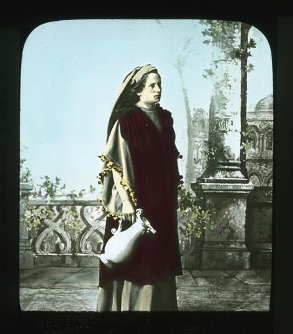 Maria Schwalb, too, had many an opportunity during the long summer, to show her housewife accomplishments. Nor was she unassisted by her humbler sister in these duties. The arrangements for entertaining ...
Citation Citation
- Title:
- Martha
Maria Schwalb, too, had many an opportunity during the long summer, to show her housewife accomplishments. Nor was she unassisted by her humbler sister in these duties. The arrangements for entertaining the crowds that came were in the hands of the central committee. This committee assigned travellers to the different hotels and homes. Lodgings cost from $1.00 to $2.50 per day according to location. The meals cost as much more. Here let one (Mrs. Elizabeth Hayhurst of Portland) who witnessed the portrayal of this great play in 1922 tell us some of her observations and experiences. "We left Munich Saturday afternoon on one of the many special trains for Oberammergau which is about a two hour journey by fast train. We went through a picturesque country, whose fir-clad hills reminded us very strongly of Oregon, while the numerous blue lakes and chalet-like houses partook of the characteristics of Switzerland. Soon we were in sight of the lovely Bavarian Alps, and entering the valley of the Ammer, beheld Oberammergau - a small village nestled at the foot of Kofel, a high mountain peak with precipitous sides whose crest is surmounted with a cross. Upon our arrival, we were put in the care of a porter, who was dressed in the quaint garb of the Bavarian peasant - short leather breeches, embroidered velvet jacket, and a peaked leather hat adorned with a feather of a wild fowl. We followed him to the home of our host - Hans Mayr, who had the role of "Pilate" in the play. Frau Mayr greeted us cordially, as she domiciled forty of us Americans seemingly without any effort whatsoever, and made us feel quite like we were her personal guests instead of playing ones. A walk about the village later brought forth many "Ohs and Ahs". Most of the houses are painted a soft green, gray or white, and on the outside walls of many are painted religious scenes, and on one house there was a canopy of ivy growing about a painted shrine to the Virgin. Everywhere there were shrines and on the banks of the clean, clear Ammer river was a splendid monument of the Crucifixion. After our simple but wholesome evening meal, many of us purchased copies of the play, and knowing no German, which is the original text, I obtained an English version, to familiarize myself with the lines I had journeyed so far to see and hear interpreted. The characters are selected by a committee that is elected by the whole community, and the villagers wait with breathless anticipation the announcement of the bestowal of the assignment, as often a near-tragedy is witnessed when one is deemed too old to continue in a famous role. Anton Lang has been the Christus for three consecutive decades but he will not be able to continue in the role, as the crucifixion scene where he is suspended on the cross for twenty minutes is a great physical strain. Frau Lang has never witnessed the crucifixion scene as given by her husband. On the day of the performance, Anton Lang remains at the auditorium all day - simple food being brought to him during the noon intermission when he rests. By profession, he is a potter. He is profound student of the life of Christ, and has made a pilgrimage to the Holy Land in order to portray the role. The bestowal of the role of the Christus is considered the highest honor within the power of the community as there is the character requisite as well as the acting one. That interest in the Play is lifelong can best be revealed by the interest of Johann Zwinck who was first a boy in the play, twice enacted the part of the disciple, Joh, and for three decades interpreted the role of Judas - said to be among the greatest of the Judases and in 1922 was the venerable Simon of Bethany, as well as understudy to the Judas. It is told of him that while he wished nothing to happen to Guida Mayr - the Judans of 1922, but Oh! how much he should like to just once again play the part of Judas, and when he was told that it would be difficult for him to make himself heard with so many of his teeth gone, he replied, "well, if I were sure of the chance, I would try in some way to gather together enough money to buy teeth". George Lang, the director of the play, is a young man of about thirty years. He was wounded in the late war and one hand is atrophied. He is their teacher in the wood carving school. Wood carving is the principal industry of the village and to that fact may be ascribed the artistic success of the play. The Villagers day by day experience the joy of creating beautiful objects. The robes have all been designed and made in the village from wonderful materials gotten mostly from the Orient. No make-up whatsoever is used, not even a wig is worn, another secret of the lovely hair one sees there everywhere. No married woman is given a speaking role, but an exception was made to the understudy of the Virgin Mary of 1922, who was the Virgin Mary of 1910, but who in the meantime has been wooed, wed, and widowed. Nine hundred five people have a part in the production of the play; there are 124 speaking roles; 50 musicians in the orchestra and 45 singers in the well-trained chorus. Seven hundred persons from mere tots of four to men and women of venerable years appear in the mob scene; 75 men are needed to collect the tickets and serve as doorkeepers and ushers, and remember at the same time thousands are being entertained in the homes of the villagers, as the few small hotels cannot begin to provide for the large number who come from all parts of the world to see the Marvelous Play of all time. The prices were established early in the year of 1922, and although the value of the mark declined many times in value before the season had hardly begun, there was no deviation from the established price of either the seats or the accomodations. Thus it was that eleven of the villagers journeyed to American to try to retrieve some of the deficit. Each summer a religious play is given which enables the selecting committee to know who is best adapted to the various roles, and each family hopes it may be represented in the famous characters and shapes its daily life to that end. We were awakened early Sunday morning by such peaceful sounds as the crowing of the cocks, lowing of the calves, tinkling of the bells of the cows as they were being driven through the village streets to the pasture, and the pealing of the chimes from the village's one church. Upon arising, we were greeted with frosted roofs and fences, which was a most welcome sight, as it foretold a clear day. We breakfasted at six-thirty, after which we were given our tickets to the open-air auditorium, as experience has shown that it simplifies matters to retain the tickets as long as possible to avoid all the useless mislayings and losings. The seats are distributed according to the household, the better homes secure the better seats for their guests. Our hostess very thoughtfully suggested our securing robes and cushions, which were provided for a small fee and made our stay in the open-air auditorium much more comfortable. As we went to the Play through the village streets, it seemed as though the whole world had come to Oberammergau. There were monks and nuns of the various orders, Hindoos from India, Syrians from the Near East, a Japanese and Chinese from the Far East, and very, very black people from Africa. We were requested to be in our seats at 7:45, and there we were, 4200 sitting, hundreds standing and scores kneeling, when at precisely eight o'clock the Chorus dressed in rich colorful robes advanced from the colonnades on either side of the stage and sang the opening number which is a prayer of thanks for their deliverance from the awful scourge in ages past and an appeal from the blessing of the presence of the Saviour always. Then the prologist in full, rich voice gave the following beautiful greeting which sounds the keynote of the whole play. "Welcome, welcome, to all, whom here the tender love Of the Saviour unites, mourning, to follow Him On His journey of suffering To the last resting place. Who from far and from near, all here have come today They all feel themselves now joined in brotherly love As disciples of one Lord Who has suffered death for all. Who gave Himself for us, with compassion and love Even to bitter death. To Him let us lift up Our gaze and our hearts too, With love unfeigned and gratitude. Up to Him let us lift all our thoughts and our souls, Pray with us - yea - with us pray, as the hour comes, When the dept of our sacred vow We pray to the supreme GOD". There are twenty-four tableaux and the function of the tableaux is to connect the incidents of the old testament that relate to the incidents of the last seven days of Christ. The dialogue begins with Christ's entry into Jerusalem, and our very souls were quickened as we beheld the face of Him who has beem so familiar to us through the very best of painting and sculpture. As the sad story unfolded, there were lovely pictures of indelible impress left upon our minds. The bleating of the sheep as they were freed from the pens and the flying of the doves over the audience, all added to the realism of the Temple scene. Then the beauty and the humility of Mary Magdalene as she wiped the feet of the Christus with her lovely long hair; the pathos and the tenderness of the leave-taking of the Christus of His mother in Bethany, and the Last Supper which is an animated counterpart of the Da Vinci painting. The play has progressed until the betrayal of the Christus by Judas in the Garden of Gethsamane when the Noon intermission is announced which is the first intermission of the morning. We were all enthralled as we wended our way quietly to our various place of abode for luncheon, which in many instances, is served by those appearing in the performance. At 1:15 we were again in our seats in eager anticipation of the continuance of the wonderful story of the Ages, as the shortening of days of September made it necessary to resume the Play at 1:30 in order to finish before nightfall. The lines of the Play have Judas reveal where the Christus is spending the night rather than an actual betrayal, and when Judas realized all to late what his telling has brought to the Christus, he is so filled with compassion that he receives our pity instead of our scorn. Scene after scene is portrayed until we are confronted with the realistic "Way of the Cross", and the Chorus, now dressed in black, sing a dirge-like refrain all through the Crucifixion Scene, which was too real and too sad for most of us. As the body was removed from the cross we thought at once of another famous painting "Rubens' Descent From the Cross" and during the rites of the last unction, another work of art came to our mind, Michael Angelo's marble masterpiece "Pieta" as Mary, the Mother, folded in her arms the beautiful body of the Christus. The Christ appeared for a moment to Mary Magdalene after the resurrection, and in a final tableau, we had a glimpse of the Ascension. The last chorus was sung--a glad, halleluiah one-- and the somber robes of mourning have been replaced by the first, bright, colorful ones, and the final curtain is drawn about five-thirty upon the marvelous Passion Play. It has filled our very souls with reverence and a prayer that the Great Sacrifice of Reconcilliation upon Golgotha may contribute to a world peace and a better understanding among the nations and within the nations until the whole world is imbued with the same unity and co-operation that makes possible the perfect rendering of this marvellous Play by the villagers of Oberammergau.
-
"Serial no. 108-104."
Citation Citation
- Title:
- Oversight field hearing on the Endangered Species Act 30 years later : the Klamath Project : oversight field hearing before the Subcommittee on Water and Power of the Committee on Resources, House of Representatives, One Hundred Eighth Congress, second session, Saturday, July 17, 2004, in Klamath Falls, Oregon
- Author:
- United States. Congress. House. Committee on Resources. Subcommittee on Water and Power
- Year:
- 2005
"Serial no. 108-104."
-
7818. [Image] An examination of the Klamath Basin crisis : restructuring the discourse within an identity-based framework
Thesis (B.A.) -- Whitman College, 2002; Includes bibliographical references (leaves 79-83)Citation -
7819. [Image] Public notice opening public lands to entry
E R R A T A S H E E T August 6, 19U6 TO ACCOMPANY PUBLIC NOTICE NO. U3 DATED AUGUST 1, 19U6 OPENING PUBLIC LANDS TO ENTRY ON THE KLAMATH IRRIGATION PROJECT, OREGON - CALIFORNIA TULE LAKE DIVISION The following ...Citation Citation
- Title:
- Public notice opening public lands to entry
- Author:
- United State. Bureau of Reclamation
- Year:
- 1946, 2004
E R R A T A S H E E T August 6, 19U6 TO ACCOMPANY PUBLIC NOTICE NO. U3 DATED AUGUST 1, 19U6 OPENING PUBLIC LANDS TO ENTRY ON THE KLAMATH IRRIGATION PROJECT, OREGON - CALIFORNIA TULE LAKE DIVISION The following paragraphs are hereby substituted for the corresponding para-graphs 5 ( c) and 5 ( d) as written in the copy of the above Public Notice: Paragraph 5 ( c) The applicant must demonstrate that he possesses a minimum of # 2,000 in unencumbered assets applicable or convertible to the needs of farming in this area. This may be determined by an itemized list of assets and liabilities and must be corroborated by a statement from an official of a bank or other responsible and reputable private or public credit agency. Paragraph $ ( d) The applicant must submit a certificate of medical exami-nation which will contain a statement by an examining physician assuring the applicant's physical ability to operate a farm. Paragraph 9 ( lines k and 5) in the Summary of Requirements and Procedures states, in part: "... which will entitle the entryman to three acre- feet of water per irrigable acre." This should be changed to read: "... which will entitle the entryman to 2g acre- feet of water per irrigable acre." UNITED . STATES DEPARTMENT OF THE INTERIOR BUREAU OF RECLAMATION WASHINGTON Klamath Irrigation Project, Oregon - California Tule Lake Division PUBLIC NOTICE OPENING PUBLIC LANDS TO ENTRY oo U3 August 1, 191* 6 1. Public land for which water i£ available and for whichi entry may be made.— In pursuance of the act of June 17, 1902 ( 32 Stat. 38b1), and acts amendatory thereof or supplemental thereto, TE" is hereby announced that water will be available in the irrigation season of 191* 7 and thereafter, and beginning September 15>, 19l* 6, entry may be made in accordance with this notice for the following- described public lands under the Tule Lake Division of the Klamath Irrigation Project, Oregan- California, as shown on farm unit plats of Township 1* 7 North, Ranges £ and 6 East and Township 1* 8 North, Range 5 East, Mount Diablo Meridian, California, to wit: Mount Diablo Meridian, California Total Irrigable Acreage 8U. 0 101.2 73o5 73.7 73 » 3 5 76.0 76o2 75.8 66.8 68.3 66.8 68.3 7U. 7 73.8 7U. 1 73o8 127.9 73.8 80.0 137.5 129.6 87.8 9h. B 98.0 109 o 6 7li. O lh. 3 7li. 6 7JU. 3 73.9 7U. 2 73.9 7U. 2 7U. 5 714.2 7U. 67.2 73.3 7U. 9 73.2 7U. 7 100.7 91.3 Township 1* 7 North Range Farm Unit A BA B CDE F G H A B C D EF G HCD E B A A B G H C D E F A B CD E FG * H L A BCD E F * T. 1* 7 N., R. 6 E., M. D. £ East Section 1 2 2 2 2 2 2 2 2 11 11 11 11 11 11 11 11 12 12 12 12 12 7* 13 18* 13 18* 13 18* 13 18* 13 13 13 13 11* H* Hi ll* H* ll* ll* ll* 16 23 23 23 23 23 23 26 27 . M. • . Description Lots 16 &' 17 Lot 20 & W| swi Lot 1 & SEzNEi Lot 2 & SWINEJ Lot 3 & SEzNWz Lot k & SW| NW § EJSWJ WISEJ EgSEz, Lot 1 & SEzNEz Lot 2.& SWJNEJ Lot 3 j& SEJNWJ Lot k & SW} NW| wisWz EJSWJ WtSEf EiSEt Lots 6, 16 & SW^ NWj w^ swj Lots 10 & 2X-* Lots 17, 18 & WiSE| Lots 9 & 12 Lots 12 & 13 Lot 1 & NW^ NEj Lot 10 Lot 2 & SWjNEi Lot 11 Lot 3 & NWjSEj Lot ll* Lot 1* & SWjSEj Lot 1^ EiNWi W4NW} wlswf : v EI- SIVJ EJNEJ ;.; mttl E| SW} l/ feSE'z E| SE| WyNWj Ef NEi W| NEI EiNV/ z WJMWTI-Lots 3, 1* & 6 Lot ^ Lot 20 Lots 18 & 20 1. Farm Unit DCEF B A G A B A E C DE F G H A T. 18 N., R, 5 E., F G L G H J K Section 2k 2k 2k 2k 2k 19* 21 19* 21 25 27 27 28 28 28 28 28 28 28 33 28 27 33 M. D. M. 25 26 26 26 • 27 27 27 28 27 31 27 26 33 3h 28 33 33 33 3k 33 3k 3k 3k 3k 3k 3k 3$ 35 Description EJNWJ Lots 9, Lots 7, 10 & NEjSWj- 8 & NWiSEz Lots 5 & SW- jNEi Lot 10 Lot k & Lot 9 Lots 12 Lots 19 Lots 10, Lots 11 Lot, 1 & Lot 2 & Lot 3 & Lot I & E|- SW| W- JSE § Lot 20 Lot 5 Lot 31 Lots 10, NW^ NEJ & 13 • & 20 , 23, 2k, 27 & & 32 SEiNEi SWfNEi S E J M J smriNwJ , 15 & 16 Lots 16 & 17 Lot 7 & E| W- JSEi Ejswi & W?- W1SE| i, NjsEiswi, NWJSEJ NEJSEJ & N- ISEISEI Lots 2 & 3 Total Irrigable Acreage 75.0 73.2 77.5 76.8 91.8 109.0 ' 7a. 2 . 83.9 80.9 78. k TS. k . 78.3 60.8 60.8 77.6 86.3 70.1 73.5 120 111 III 103 105 110 .9 .1 .3 .5 • 5 • J .8 113.8 109 113 113 109 10U 111 .9 .8 ,7 .7 .6 • 0 96.8 99.5 98.8 96.6 M., R. 6 E., M. D. M. 2. Total Farm Unit Section Description Irrigable Acreage sIsE- jNWi 99. k 35 Lots 2, 3 i j i 99 o 6 B 35 | J, 36 Lots 13 & lii 126o8 G 35 Lot U & NEjSEj 36 Lot 20 103 o 9 A 36 Lots 5, 6, 12, 15 & 16 9lu2± The farm unit plats referred to above were approved on the date of this notice and are on file in the Office of the Superintendent, Bureau of Reclamation, Klamath Falls, Oregon, and in the district land office at Sacramento, California, - where they may be examined by any person desiring to make application hereundero 2. Preference rights to honorably discharged veterans of World War II.— Pursuant to the provisions of the Act of September 27, 19hk, and The Act of June 25, 19^ 6 ( Public Law Ul| 0 - 79th~ Congress, 2nd Session), and related legislation,-"- and until 2: 00 p. m., December 15, 19U6, the lands described above will be open to entry only by persons who have served not less than 90 days in the Army or Navy of the United States in World War II and have been honorably separated or discharged therefrom or placed in the regular Army or Naval Reserve; provided, however, that they must be qualified to make'entry under the homestead laws and also possess the qualifications as to industry, experience, character, capital, and physical fitness required of all applicants under this notice. Farm applica-tions received prior to 2: 00 p. m., September 15, 19U6, will be considered as simultaneously filed. Farm applica-tions received after 2: 00 p. m., September 15, 19l; 6, will be filed and considered in the order of their receipt0 3. Limit of acreage for which entry may be made.— The limit of area of public land per entry, representing the acreage which", in the opinion of the SeereTary of the Interior, may be reasonably required for the support of a family upon such land, is fixed at the amounts shown upon the farm unit plats for the respective farm units above listed. k. Applicants must be qualified.— No entry shall be accepted or allowed by the Register of the district land office until the applicant"~ therefor has satisfied the Examining Board appointed for the Klamath Project to consider such matters, that he is possessed of such qualifications ( in addition to the qualifications required under the homestead law) as to industry, experience, character, capital and physical fitness as in the opinion of the Board are necessary to give reasonable assurance of success by the prospective settler. A digest of the qualifications required by the homestead laws is contained in the attachment to this notice. Complete information may be secured from the District Land Office in Sacramento, California, or from the Bureau of Land Management, Washington, D. Co 5. Requirements as_ to Industry, Experience, Character, and Capital.— The following are established as minimum qualification^ Tailure to meet them in. all respects will be sufficient cause to reject an application. No credit will be given for qualifications in excess of the minimum required: ( a) Each applicant must submit as part of his farm application three testimonials concerning his character and covering such points as honesty, temperate habits, thrift, industry, seriousness of purpose, record of good moral conduct in the past and a sincere desire to lead a bona fide farm life. These may be prepared and signed by an ordained minister, including chaplains in the armed service, any commanding officer under whom the applicant served for six months or more, a teacher or administrative official of any recognized high school or college, present or previous employer, or any comparable, responsible individual or official, not a relative, who is personally acquainted with the applicant. These may be the individuals listed in paragraph 17 of the Farm Appli-cation Blank. ( b) The applicant must have had at least two years1 full- time farm experience after the age of 15 and within the last seven years of civilian life; or must have lived and wox~ ked on a farm for five years continuously after reaching the age of 12 and within the last 10 years of civilian life. Time spent in active military service will not be included in the time used in computing farm experience. Two years of study in agricultural courses in an accredited agricultural college or two years of responsible technical work in agriculture which might help fit the applicant for operation of a farm may be credited as one year of farm experience except that. no more than one year of farm experience may be credited from such sources. One year of farm experience must be obtained by actual residence and work on a farm. A farm youth over the age of 15 attending school but actually residing and working on the farm may credit such time as actual farm experience. In support of his claim to meeting this requirement of farm experience, the applicant must supply three written statements signed by the county agent, F. S « AO county supervisor, A0AoA. County Chairman, official of any local farm organization, or comparable individuals, who have personal knowledge of the applicant's farm experience or have verified it to his complete satisfaction, testifying theretoo ( c) The applicant must demonstrate that he possesses a minimum of $ 2,000 in unencumbered assets applicable or convertible to the needs of farming in this area. This may be determined by an itemized listing of assets and liabilities in space provided on the application blank. ( d) The applicant must be in physical condition to operate a farm successfully, including the manual labor involved. If physically handicapped or afflicted with ailments making this condition questionable, a detailed statement by an examining physician should accompany the application. *" Including Soldiers' and Sailors' Civil Relief Act of 191* 0, as amended ( 51* Stat. 1178, 1186; % Stat. 769, 776; 50 U. S. C. App. 560- 572)." 3. 6. When and how to file an application for a farm unit.— ( a) A Farm Application Blank is attached to this notice. Additional blanks may be secured from the Superintendent, Klamath Falls, Oregon; the Regional Director, P. 0. Box 2^ 11, Sacramento, California, or the Commissioner, Bureau of Reclamation, Washington 2^, D. C. Full answer must be made to each question on the Farm Application Blank. The applicant may state the particular farm unit desired and may also include alternate choices or the choice may be left open to the examining boarde ( b) If the applicant claims a preference right on account of military service, he shall attach to his appli-cation an affidavit setting forth such military service. The affidavit shall state the applicant's time of service, the unit of which he was a member, the date on which he was honorably discharged, or separated, or transferred to the regular Army or Naval Reserve, and that he did not refuse to wear the uniform of such service or to perform the duties thereof. Providing that they qualify in other respects, women veterans have equal rights and will receive equal consideration in their application for farm unitso ( c) An application for a farm unit listed in this notice, together with the proof to be furnished by veterans, must be filed with the Superintendent, Bureau of Reclamation, Klamath Falls, Oregon, in person, if con-venient, or by mail, or otherwise, prior to 2: 00 p. m., September l£, ± 9h6, if the applicant desires to qualify under the terms of this notice. No advantage will accrue to an applicant presenting his application in person rather than by mail. All applications received prior to 2: 00 p. m., September'l£, 19U6, will be held and treated as simultaneously filed. Applications received after 2: 00 p. m., September l£, 19U6, will be considered only as provided in paragraphs 2 and 12 of this public order. 7. Examining Board.— An Examining Board of five members, including the Superintendent of the Klamath Project who will act as Secretary of the Board, has been approved by the Commissioner of Reclamation to consider the fit-ness of each applicant to undertake the development and operation of a farm on the Klamath Project. Careful investigation shall be made to verify the statements and representations made by the applicants to the end that no misunderstanding may prevail, either regarding the applicant's fitness or his appreciation of the problem before him. Any falsification will automatically cause the application to be discarded from consideration*, 8. Selection of Qualified Applicants.— To determine whether an applicant for a farm unit is eligible under the provisions of subsection " C" of Section k of the Act of December 5, 192k, his application will be reviewed on the basis of whether or not he is qualified as an entryman. Applicants will be judged on the qualifications of character, industry, farming experience and capital and no applicant will be considered eligible who does not qualify in all respects, or who does not, in the opinion of the Examining Board, possess the health and vigor for active farm work. 9. Showing of applicants and selection thereofc— ( a) Where the applicant, in the original application which he files fails to make a prima facie case— that is, where the applicant ( l) does not possess good health; or ( 2) fails to make the necessary showing as to character; or ( 3) fails to make the necessary showing as to industry; or ( U) fails to make the necessary showing as to citizenship, or ( 5) dees not show at least two years' farm experience; or ( 6) does not show at least $ 2-, 000 in unencumbered assets; or ( 7) is disqualified because of having already made homestead entry; or ( 8) is the owner of more than 160 acres of land in the United States; or ( 9) is otherwise disqualified, the application for a farm unit shall be rejected, and the applicant notified thereof by registered mail, with return receipt demanded, and of his right to appeal to the Regional Director of the Bureau of Reclamation within 10 days from . receipt of such notification. All appeals allowed under this Public Notice No. h3 must be filed in the office of the Superin-tendent at Klamath Falls, Oregon, within 10 days from receipt by applicants of rejection notices. The Superinten-dent will forward such appeals promptly to the Regional Director. ( b) After the expiration of the appeal period fixed by the above- mentioned notices, if any are required, to applicants who failed to make prima facie cases, and in the absence of any pending appeals, the Board shall pro-ceed to select the 86 successful applicants ( there being 86 farm units described in paragraph 1 subject to entry) o All applicants in the group filing prior to 2: 00 pom;, September l£, 19U6, and who possess minimum qualifications as outlined in paragraph 5>, will be considered equally. From the names of all qualified applicants in the group considered as simultaneously filed, there shall be drawn 172 names ( twice the number of homesteads to be awarded). These 172 applicants shall be closely investigated, in the order in which selected, and any falsehood or mis-representation shall be grounds for the Board to disqualify the applicant and to pass on to the next in order until the 86 successful applicants have been determined, plus a sufficient number of alternates to replace those in the first group of 86 who fail to complete their transactions. In the event that there are remaining units to be awarded, consideration will be given to Veteran applications, in the order of filing, prior to 2: 00 p. mc, December l£, 19^ 6, as provided in paragraph 2 above. Remaining units, if any, will be awarded, in the order of filing of applications, as provided in paragraph 12 of this order. ( c) Applicants from among the group of 172 selected in paragraph 9( b) above who subsequently are disquali-fied as a result of investigation by the Board shall be sent a notice by registered mail, with return receipt demanded, unless delivered in person, setting forth the reasons thereof and of the right to appeal to the Regional Director within 10 days from receipt of such notice as provided in paragraph 9( a) above, ( d) Immediately following the selection of the 86 successful applicants, the Board shall send a notice by registered mail with return receipt demanded, to each of the ether qualified applicants, advising him of his standing, as alternate or otherwise, and that since the number of qualified applicants exceeds the number of available farms, his application must be held for rejection. In the event that any of the 86 applicants awarded a farm unit fails to fulfill the requirements of paragraph 10 hereof, the Board will select other applicants in the order of their standing on the list of alternates to replace those failing to complete their transactions0 10* Notification of Applicant that he has been selected.— After the expiration of the period or periods fixed by notices to applicants in the conTTngencies named in paragraph 9 above, or any other that may arise, and upon completion of action which may become necessary because of such notices, the Board shall notify each appli-cant selected for a farm, by registered mail with return receipt demanded, unless delivered to him in person, that he has been selected for a farm unito Whenever practicable, and within the time allowance stated on the notice, the Board shall allow the successful applicants to exercise a choice of farms as listed on their application blanks and in the order of their standing in the drawing. However, the Government reserves the right to assign the farms regardless of individual preferences. After a farm has been selected, the Board shall send tne applicant, by r egistered nail with return receipt demanded, unless delivered to him in person, a water rental application for the farm selected, which rvust be executed by the applicant and returned to the Superintendent, Bureau of Reclamation, Klamath Falls, Oregon, within 10 days from receipt, together with payment of the minimum water rental charge, as specified in paragraph 15 hereof. The Secretary of the Examining Board will furnish each such applicant by registered mail, unless delivered to him in person, a certificate' stating that his qualifications to enter public lands, as required by sub- section " C" of Section h of the Act of December 5, 192U ( U3 Stat. 702), have been passed upon and approved by that Board. Such certificate must be attached by the applicant to his homestead application when he files such application at the District Land Office at Sacramento, California. Such homestead application shall be filed within ]£ days from the date of the receipt by the applicant of the said certificate. Failure to pay the water rental charge or to make application for homestead entry within the periods specified herein will render the application subject to rejection. 11. Failure of selected applicant to - complete transaction.— If the applicant to whom a farm has been awarded fails to comply witH" any of the requirements named above, the Board will select the next listed alternate. 12. General entry.— After all applications received prior to 2: 00 p. m., December 15, 19^ 6, have been con-sidered and awards of farm units made to all qualified applicants, any farm units described in paragraph 1 above which remain unentered, shall be subject to entry under this order by any person having the necessary qualifications. If, on September 15, 19U6, prior to 2: 00 p. m., the number of applications filed exceeds the number of available farm units, then the right to make entry for any such farm unit shall be determined in accordance with paragraphs 2 and 9 of this order, the provisions of which shall continue in effect in a s imilar manner in the future if the number of applications at any time exceeds the number of remaining available farm units. 13. Warning against unlawful settlement.~- No person shall be permitted to gain or exercise any right under any settlement or occupation of any of the public lands covered by this order except under the terms and conditions prescribed by this order, provided, however, that this shall not affect any valid existing right obtained by settle-ment or entry while the land was subject thereto. 111. Construction charges,— Section 15 of the Act of May 25, 1926 ( hk Stat. 639) authorizes and directs the Secretary, when announcement is made of the construction charges for this division, to fix and allocate the con-struction cost per acre in accordance with the findings and recommendations of the Board of Survey and Adjustments as shown on page 26 of House Document No. 201, 69th Congress, 1st Session. As recited on page 26 of said Document No. 201, the Board found that the total gross cost of construction charged to the division, as of June 30, 1925, is $ l, 6hO, 9h9; and that this cost should be allocated on the basis of 37,500 acres and not upon 2l±, 2OO as hereto-fore; and that a deduction of'$ 23h, U07 should be made from the cost named. Applying the deduction of $ 23h9hD7 would leave a remainder of $ l, lio6,5> li2 and the Board's report at this point recites: " The net cost would be 31,1* 06,51* 2, and this amount divided by 37,500 acres, would give an average construction cost of $ 37.50 per acre. This per acre cost of $ 37.5 » O does not include any costs for future construction work which will be necessary to complete this division, and this should be particularly noted." The estimate of cost to complete the works for 33,000 acres which are considered irrigable, is $ 1,678,000 or a per acre cost of $ 50.85. This amount added to the per acre cost to June 30, 1925, of $ 37.50 would make e total per acre cost of £ 88.35. A summary of the construction estimate for work after June 30, 1925, is attached to and made a part of this order. If the actual cost of future work is less than the estimate of $ 1,678,000 named above, the construction charge will be proportionately reduced, but the expenditure of $ 1,678,000 will not be exceeded without the water users agreeing to repay all sums in excess » of this amount. In arriving at the per acre rate of $ 88.35, and as shown above, the write- off of $ 23U, UO7 authorized in Section 15 of the Act of May 25, 1926, has been deducted from the total cost, but before this write- off may be actually accomplished, the Secretary of the Interior must require, as set forth in Section h$ of the said Act of May 25, 1926, a contract with a water users1 association or irrigation district whereby such association or irrigation district shall be required to pay the entire charges against all productive lands within the division without regard to default in the payment of charges against any individual tract of land; also as provided in Section U5 of the Act named, there must be executed a contract of the character described, before the ^ 0- year repayment plan as authorized in this Section may be made effective. Since the Tule Lake Division, with the exception of a few tracts, embraces only public land it would not be possible to make such a contract until the lands are opened and entered. Under the circumstances, the division will be operated on a water- rental basis until its agricultural development has advanced sufficiently to permit of a district organization, at which time a so- called joint liability contract will be required and the construction charge will be'announced at $ 88.35 per acre payable over a l± Q- year period. Should the entrymen or water users fail, or refuse, to proceed in the manner required under the Act of May 25, 1926, it will become necessary to issue public notice under the Extension Act of August lii, 191k ( 38 Stat. 686), without regard to the write- off and under a 2G- year- repayment plan. This would result in a per acre charge of $ U9• 70 instead of $ 37.50 for the cost to June 30, 1925, which added to the per acre cost to complete of $ 50.85, would fix the construction charge at $ 100.55 per acre payable in 20 years* 1^° Water- rental charges.— The minimum water- rental charge for the irrigation season of 19ii7 shall be two dollars and eighty cents ($ 2.50) per acre for each irrigable acre of land in the farm unit, whether water is used or not, which will entitle the entryman to 2j acre- feet of water per irrigable acre. Additional water will be furnished during the said irrigation season up to a limit of 3$- acre- feet per irrigable acre at the rate of fifty cents ( 50f) per acre- foot, and all further quantities at seventy- five cents C75#) per acre- foot, payable on December 1, 19U7. Payment of the minimum charge of two dollars and eighty cents ($ 2.80) per acre for the irrigation season of 191+ 7 shall be nade at the time of filing of water- rental applications: provided, that when water- rental application is filed after June 15, 19hl, payment shall be of a minimum charge of two dollars and eighty cents ($ 2.80) per acre, which payment shall apply as a credit on the minimum charge for the follow-ing irrigation season. If payment for water used in addition to the allowance under the minimum charge is not made on or before December 1 as herein provided, there shall be added to the amount unpaid a penalty of one-half of 1 per centum thereof, and there shall be added a like penalty of one- half of 1 per centum on the first day of each month thereafter so long as such default shall continue. No water will be delivered to the • 5. entryman in subsequent years until such charge shall have been paid in full. Future charges will be announced by future order or public notice. 16. Place and manner of payment of water charge,— All water charges must be paid at the office of the Bureau of Reclamation at Klamath Falls, OregonJ by cash or bank draft, cashier's check, certified check, or postal or express money order, payable to Treasurer of the United States, 17o Water- right application under public notice0— Within three months after date of public notice announcing the construction charges for the land described in this order, each entryman, if required to do so by the Secretary of the Interior, shall make a formal water- right application covering his farm unit. Upon failure to do so, the Secretary may, at his option, cancel the entry in question, with all rights acquired thereunder. 18 • All land to be included in irrigation district .— Each water rental application for land covered by this order shall be made"~ onTorm 7- 2b19 and the following clause shall be inserted at the bottom of said form: " I agree to the inclusion of my land in an irrigation district and I agree also to participate in the organization of an irrigation district at the earliest practicable date." 19, Reservation _ of rights _ of way for county highways..— Rights of way are reserved for county highways across the farm units shown on the farm unit plats along all red lines shown on said plats, said rights of way being 30 feet in width on each side of said lines in all cases where lines are drawn in red solid lines and 60 feet in width out of the farm units crossed by lines drawn in red broken lines. Rights of way are reserved for highways across the farm units abutting the northeasterly side of the Central Pacific Railroad Company's right of way, the said highway right of way being a strip of 100 feet in width, parallel to and touching the said railroad right of way. 20. Effect of relinquishment.— In the event that any entry of public land shall be relinquished prior to 2: 00 p. m., December 15, the lands so relinquished shall be subject to entry in accordance with paragraphs 2 and 9 of this notice. In the event that any entry of public land shall be relinquished subsequent to 2: 00 p. m., December l£, and at any time prior to. actual proving up of the land through necessary residence, cultivation and other homestead requirements, the lands so relinquished shall not be subject to entry for a period of 60 days after the filing and notation of the relinquishment in the local land office. During the 10- day period next succeeding the expiration of such 60- day period, any person having the necessary qualifications may file application for said public land. If, on the tenth day of said' 10- day period, prior to 2: 00 p. m., the number of applications filed exceeds the number of available farm units, then the right to make entry for such farm units shall be determined in accordance with the procedure described in paragraph 9 of this notice. 21. Waiver o£ mineral rights .— All homestead entries for any of the above- described farm units will be subject to the laws of the United States governing mineral land and all homestead applicants under this notice must waive the right to the mineral content of the land, if required to do so by the Bureau of Land Management, otherwise the homestead application will be rejected or the homestead entry cancelled. Assistant Secretary SUMARY OF REQUIREMENTS AND PROCEDURES PUBLIC LANDS OPENED TO HOMESTEAD ENTRY KUMATH PROJECT— 19U6 1. Applicant must possess qualifications established by Bureau of Reclamation in addition to those required under homestead law. 2. Lands will be opened to entry at 2: 00 p. m., September 15, 19k6* Veterans of World War II have a preference right for 90 days following the date of opening. Applications received prior to 2: 00 p. m., September 15 > 19U6, shall be considered as simultaneously filed. After September 15, 19U6, applications will be considered in1 the ordef^ of filing. Applications from other than Veterans of World Yfar II may not be considered prior to 2: 00 p. m., December 15, 19U6. 3. Copies of the Public Notice, together with the Farm Application Blank, may be secured from the Superintendent, Bureau of Reclamation, Klamath Falls, Oregon, or from the Commissioner, Bureau of Reclamation, Washington, D. C. Applications for a farm unit must be filed with the Superintendent, Bureau of Reclamation, Klamath Falls, Oregon. U. Homestead law requirements of entrymen. ( a) Must be 21 years of age or head of a family or have been honorably discharged from the armed forces of the United States after a period of at least 90 days1 service during World War II. ( b) Must be a citizen of the United States or have declared intentions to become a citizen. ( c) Must not own more than 160 acres of land in the United States ( certain exceptions are allowed). ( d) Must establish residence within six months after allowance of entry ( extension of six months may be allowed). Residence must be maintained for a period of three years except honorably discharged veterans who served not less than 90 days are entitled to have the term of service, not exceeding two years, deducted from the three years1 residence requirements. ( e) Land must be_ cultivated for a period of at least two years covering one- sixteenth of area second year and one- eighth of area during the third year and until final proof. ( f) Entryman must have habitable house on land when submitting proof. ( g) Proof as to meeting requirements must be submitted within five years from date of entry. 5. Bureau of Reclamation requirements of applicants. ( a) Must possess standards of character, including honesty, temperance, thrift, industry, moral conduct and seriousness of purposes. References submitted must be individuals prepared to certify to character of witness. ( b) Must have had at least two years' full- time farm experience after age of 15 and within the last. seven years of civilian lifej or during last 10 years of civilian life must have lived and worked on a farm contin-uously for five years after reaching the age of 12. Two or more sworn testimonials must be supplied in support of applicant's claim to meeting this requirement. ( c) Must possess a minimum of $ 2,000 in unencumbered assets applicable or convertible to the needs of farming in the area. ( d) Must be in physical condition to operate a farm including manual labor involved. ( e) Affidavits as to character, farm experience, financial resources and physical condition are required of each applicant. 6. An Examining Board approved by the Commissioner of Reclamation, composed of local citizens and includ-ing the Project Superintendent will consider the fitness of each applicant in line with paragraphs h and 5 above. Applicants disqualified by the Board may appeal within 10 days of receipt of notification. 7. All qualified applicants will be given an equal chance in a drawing to select 172 names ( twice the number of homesteads to be awarded). These 172 shall be closely investigated, in the order in which drawn, and any falsehood or misrepresentation shall be grounds for the Board to disqualify the applicant and pass on to the next in order until the 86 successful applicants have been selected, plus a sufficient number of alternates to replace those in the first group of 86 who fall to complete their transactions. 8. The Examining Board shall notify a successful applicant that he has been selected for a farm unit and, within the time allowance stated on the notice, shall allow the successful applicants to exercise a choice of farms in the order of their standing. However, the Government reserves the right to assign the farms regardless of individual preferences. 9. After a farm has been selected, the Examining Board shall send the applicant a water rental application - which must be executed and returned to the Project Superintendent TntLthin 10 days from receipt, together with payment of the minimum water rental charge. The minimum water rental charge for the irrigation season of 19U7 shall be $ 2.80 per acre for each irrigable acre of land in the farm unit, whether water is used or not, which will entitle the entryman to three acre- feet of water per irrigable acre. Additional water will be furnished during the 19U7 season up to a limit of 3 § acre- feet per irrigable acre at the rate of 50 cents per acre- foot, and all further quantities for 75 cents per acre- foot. 10. The Examining Board will furnish each applicant a certificate stating that his qualifications to enter public land have been approved by the Board. Such certificate must be attached by the applicant to his homestead application which must be filed at the District Land Office, Sacramento, California, within 15 days of receipt of the certificate. 11. Failure to pay the water rental charges or to make application for homestead entry within the periods specified will render the application subject to rejection. 12. Construction charges on the lands to be opened total $ 88.35 per acre, payable within UO years, providing a water users1 association or irrigation district is formed. Should the entrymen or water users fail to form such a district or association, charges will be $ 100.55 per acre, payable within 20 years. 2.
-
7820. [Image] Historical landscape overview of the upper Klamath River Canyon of Oregon and California
"Submitted to Klamath Falls Resource Area, Bureau of Land Management, Lakeview District, Klamath Falls, Oregon." ; "Contract no.: HAP032021."; Includes bibliographical references (p. 178-200)Citation Citation
- Title:
- Historical landscape overview of the upper Klamath River Canyon of Oregon and California
- Author:
- Beckham, Stephen Dow
- Year:
- 2006, 2008, 2007
"Submitted to Klamath Falls Resource Area, Bureau of Land Management, Lakeview District, Klamath Falls, Oregon." ; "Contract no.: HAP032021."; Includes bibliographical references (p. 178-200)
-
The Service determines endangered status for the shortnose sucker [Chasmistes brevirostris) and Lost River sucker [Deltistes luxatus), fishes restricted to the Klamath Basin of south-central Oregon and ...
Citation Citation
- Title:
- Federal Register - Endangered and Threatened Wildlife and Plants; Determination of Endangered Status of the Shortnose Sucker and the Lost River Sucker
- Author:
- Williams, Jack E.
- Year:
- 1988, 2008, 2005
The Service determines endangered status for the shortnose sucker [Chasmistes brevirostris) and Lost River sucker [Deltistes luxatus), fishes restricted to the Klamath Basin of south-central Oregon and north-central California. Dams, draining of marshes, diversion of rivers and dredging of lakes have reduced the range and numbers of both species by more than 95 percent. Remaining populations are composed of older individuals with little or no successful recruitment for many years. Both species are jeopardized by continued loss of habitat, hybridization with more common closely related species, competition and predation by exotic species, and insularization of remaining habitats. This rule implements the protection provided by the Endangered Species Act of 1973, as amended, for the shortnose sucker and Lost River sucker
-
We, the U.S. Fish and Wildlife Service (Service), announce the opening of a public comment period on the proposed and final designation of critical habitat for the Klamath River and Columbia River populations ...
Citation Citation
- Title:
- Federal Register - Endangered and Threatened Wildlife and Plants; Opening of the Comment Period for the Proposed and Final Designation of Critical Habitat for the Klamath River and Columbia River Populations of Bull Trout
- Author:
- U.S. Fish and Wildlife Service; Department of the Interior (Washington, D.C.)
- Year:
- 2005, 2008
We, the U.S. Fish and Wildlife Service (Service), announce the opening of a public comment period on the proposed and final designation of critical habitat for the Klamath River and Columbia River populations of bull trout [Salvelinus confluentus). Due to court action, we have determined that it would be appropriate to reevaluate the exclusions made in the final critical habitat rule. We are opening this comment period to allow all interested parties to comment simultaneously on the November 29, 2002, proposed rule (67 FR 71235) and the October 6, 2004, final rule (69 FR 59996). Copies of the proposed and final rules, as well as the economic analysis for the critical habitat designation, are available on the Internet at http://pacific.fws.gov/ bull trout or from the Portland Regional Office at the address and contact numbers below
-
One chapter of a seven chapter annual report from 1999 examining ecological issues regarding the shortnose and Lost River sucker populations in Upper Klamath Lake and Williamson River.
Citation Citation
- Title:
- Molecular evolution and ecology of Klamath Basin suckers. Part B - Evidence for a lethal homozyhous genotpe at the Ankyrin(g) locus in Klamath Basin suckers (Catostomidae)
- Author:
- Oregon Cooperative Wildlife Research Unit
- Year:
- 2000, 2005
One chapter of a seven chapter annual report from 1999 examining ecological issues regarding the shortnose and Lost River sucker populations in Upper Klamath Lake and Williamson River.
-
This report presents information on biogeography and broad-scale ecology (macroecology) of selected fungi, lichens, bryophytes, vascular plants, invertebrates, and vertebrates of the interior Columbia ...
Citation Citation
- Title:
- Macroecology, paleoecology, and ecological integrity of terrestrial species and communities of the interior Columbia River basin and northern portions of the Klamath and Great Basins
- Author:
- U.S. Department of Agriculture. Forest Service. Pacific Northwest Research Station; U.S.Department of the Interior. Bureau of Land Management.
- Year:
- 1998, 2006, 2005
This report presents information on biogeography and broad-scale ecology (macroecology) of selected fungi, lichens, bryophytes, vascular plants, invertebrates, and vertebrates of the interior Columbia River basin and adjacent areas. Rare plants include many endemics associated with local conditions. Potential plant and invertebrate bioindicators are identified. Species ecological functions differ among communities and variously affect ecosystem diversity and productivity. Species of alpine and subalpine communities are identified that may be at risk from climate change. Maps of terrestrial ecological integrity are presented. Keywords: Macroecology, paleoecology, ecological integrity, terrestrial communities, ecosystems, wildlife, fungi, lichens, bryophytes, vascular plants, invertebrates, arthropods, mollusks, amphibians, reptiles, birds, mammals, endemism, interior Columbia River basin, Klamath Basin, Great Basin.
-
Humans have altered the Klamath River Canyon in many ways. This study focuses on the years from 1955 to 2003. One substantial alteration is the conversion of terraces into irrigated pastures for agriculture ...
Citation Citation
- Title:
- Land use and vegetation community changes at Beswick Ranch, Klamath River Canyon, California from 1955 to 2003 : focus on relationship between the irrigation and the vegetation and the land use cover
- Author:
- Bilka, Monika N.
- Year:
- 2002, 2005
Humans have altered the Klamath River Canyon in many ways. This study focuses on the years from 1955 to 2003. One substantial alteration is the conversion of terraces into irrigated pastures for agriculture and cattle ranching. This research project explains the relationships between the irrigation network and the vegetation and land use cover patterns that existed in the past and that exist today at Beswick Ranch. Data sources such as aerial photographs, maps, and other historical information are used to create Geographic Information System (GIS) maps and models of the area. Due to time constraints, the final maps and models are not complete at this time. However, the completed models were synthesized with observational data to come to preliminary conclusions. While the ditches of Shovel Creek Pasture have undergone little to no change at all since 1955, ranchers have added ditches to Faye Pasture. Ranch workers have also increased the amount of agricultural land use cover and decreased in tree cover of Faye Pasture. Conversely, ranchers increased the tree cover and non-agricultural land cover, and they have decreased the agricultural cover. The GIS coverages of Shovel Pasture remain in the preliminary stage, and further analyses of the calculated areas of land use cover and ditch lengths are needed to complete this study. In partnership with PacifiCorp and the BLM, this project aims to provide information about the impacts of the current and historical irrigation systems used on the pastures and riparian zones within this reach of the Klamath River Canyon from 1955 to 2003. Even at this stage, the preliminary coverages provide insight into the relationships between irrigation, vegetation communities, and land use cover that have occurred during the study period.
-
CONTENTS Lucas, Hon. Frank, a Representative in Congress from the State of Oklahoma, opening statement .................................................................................... 1 Musgrave, ...
Citation Citation
- Title:
- The Endangered Species Act and its impact on agricultural producers: hearing before the Subcommittee on Conservation, Credit, Rural Development, and Research of the Committee on Agriculture, House of representatives, One Hundred Eighth Congress, second session, July 26, 2004, Greely, CO.
- Author:
- United States. Congress. House. Committee on Agriculture. Subcommittee on Conservation, Credit, Rural Development, and Research.
- Year:
- 2004, 2005
CONTENTS Lucas, Hon. Frank, a Representative in Congress from the State of Oklahoma, opening statement .................................................................................... 1 Musgrave, Hon. Marilyn N., a Representative in Congress from the State of Colorado, opening statement........................................................................... 2 Witnesses Foutz, Alan, president, Colorado Farm Bureau, Centennial, CO ........................ 10 Prepared statement .......................................................................................... 38 George, Russell, executive director, Colorado Department of Natural Resources, Denver, CO............................................................................................. 4 Prepared statement .......................................................................................... 29 Palmer, William, executive director, Rocky Mountain Bird Observatory, Brighton, CO ........................................................................................................ 16 Prepared statement.......................................................................................... 60 Sims, James T., executive director, Western Business Roundtable, Golden, CO.......................................................................................................................... 13 Prepared statement .......................................................................................... 43 Stetson, Jean, co-chairman, Endangered Species Committee, Colorado Cattlemen, Craig, CO..................................................................................................... 7 Prepared statement .......................................................................................... 36 Submitted Material Weege, Merle, secretary, Ginseng Board of Wisconsin, statement...................... 65
-
7827. [Image] Draft upper Williamson River Watershed assessment
"Prepared for Klamath Basin Ecosystem Foundation, and the Upper Williamson River Catchment Group, in cooperation with the Upper Klamath Basin Working Group, and the Klamath Watershed Council."Citation Citation
- Title:
- Draft upper Williamson River Watershed assessment
- Author:
- David Evans and Associates, Inc.
- Year:
- 2004, 2005
"Prepared for Klamath Basin Ecosystem Foundation, and the Upper Williamson River Catchment Group, in cooperation with the Upper Klamath Basin Working Group, and the Klamath Watershed Council."
-
"Reprinted May 2003."; Includes bibliographical references; Also available at http://eesc.oregonstate.edu/agcomwebfile/edmat/html/sr/sr1037/sr1037.html
Citation Citation
- Title:
- Water allocation in the Klamath Reclamation Project, 2001 : an assessment of natural resource, economic, social, and institutional issues with a focus on the Upper Klamath Basin
- Author:
- Braunworth, William S.
- Year:
- 2003, 2004
"Reprinted May 2003."; Includes bibliographical references; Also available at http://eesc.oregonstate.edu/agcomwebfile/edmat/html/sr/sr1037/sr1037.html
-
7829. [Image] The Water Report - Taking and water rights: constitutional & contractual remedies for government takings
Only portions of issues of The Water Report are available in the Klamath Waters Digital Library. See the full report at http://www.thewaterreport.com/Citation Citation
- Title:
- The Water Report - Taking and water rights: constitutional & contractual remedies for government takings
- Author:
- Envirotech Publications
- Year:
- 2005
Only portions of issues of The Water Report are available in the Klamath Waters Digital Library. See the full report at http://www.thewaterreport.com/
-
19p.; ill.; Cover title; "June 1997"; "Reprint September 1998"; [Washington, D.C.]: Supt. of Docs., U.S. G.P.O., 1999
Citation -
7831. [Image] Western water resource issues
-
7832. [Image] The Klamath Project
-
CONTENTS Statement of 14 Page Boyd J. Jackson___________________________________________ 4 S. M. Dodd_______________________________________________ ...
Citation Citation
- Title:
- Klamath Indians payments. Hearings before the Committee on Indian Affairs, House of Representatives, Seventy-fifth Congress, first session, on H. R. 6071, to credit the Klamath Indian tribal funds with certain amounts heretofore expended from tribal funds on irrigation works of the Klamath Reservation, Oregon, May 13, 1937
- Author:
- United States. Congress. House. Committee on Indian Affairs
- Year:
- 1937, 2004
CONTENTS Statement of 14 Page Boyd J. Jackson___________________________________________ 4 S. M. Dodd_______________________________________________ 5 B. L. Wilkinson___________________________________________ 6 R. P. Wan Lass____________________________________________ 9
-
7834. [Image] Upper Klamath Basin : opportunities for conserving and sustaining natural resources on private lands
1 i California Oregon Cover Photo: Lower Klamath National Wildlife Refuge at sunset Tupper Ansel Blake/ USFWS Map Detail Area: Upper Klamath River Basin ii T he Klamath River Basin presents numerous ...Citation Citation
- Title:
- Upper Klamath Basin : opportunities for conserving and sustaining natural resources on private lands
- Author:
- United States. Natural Resources Conservation Service
- Year:
- 2004, 2005
1 i California Oregon Cover Photo: Lower Klamath National Wildlife Refuge at sunset Tupper Ansel Blake/ USFWS Map Detail Area: Upper Klamath River Basin ii T he Klamath River Basin presents numerous challenges as well as opportunities for its many water users. For years, farmers and ranchers in the basin have recognized the vital role they play in the health of their watershed. Working with conservation districts, the Natural Resources Conservation Service ( NRCS) and others, land managers continue to proactively find ways to enhance natural resources in the basin, benefiting wildlife and the environment. However, as it has across the western United States, drought hit home in the Klamath for those who depend on every drop of water to sustain their livelihood, culture and community. In the spring of 2001, the combination of drought and the impact of the Endangered Species Act triggered a shutdown of irrigation water during the growing season, drying up water resources to more than 2,000 farms and ranches. NRCS, in cooperation with local conservation districts, provided a quick infusion of technical assistance and $ 2 million in cost- share funding for cover crops through the Emergency Watershed Protection Program. As cover crops took hold, the seeds of a long- term solution took root in the NRCS/ conservation district partnership. The ability of the local office to receive funding, engage community members and other partners, plan resource improvements, implement actions, and monitor success proved to be an invaluable asset for the community. Helping private landowners develop and apply practical, common- sense solutions to complex resource issues will be the challenge of the conservation partnership well into the future. USDA, in concert with the locally led conservation districts, will continue to play a critical role by delivering technical and financial assistance to Klamath Basin farmers and ranchers. The Rapid Subbasin Assessments that follow are the first step in that process. The assessments are designed to help local decision- makers determine where investments in conservation will best benefit wildlife habitat, agriculture and other land uses in a compatible manner. It is our goal to provide a comprehensive overview of resource challenges and opportunities in the basin, and help decision- makers to prioritize their investments in areas that will best sustain multiple use of natural resources in the basin now and in the future. Sincerely, Robert J. Graham Charles W. Bell, State Conservationist State Conservationist Oregon NRCS California NRCS iii iv Table of Contents Map of the Upper Klamath Basin ................................ i Letter from OR and CA State Conservationists .......... ii Overview of the Upper Klamath Basin ........................ 1 Background ................................................................................... 1 Upper Klamath Basin Description ............................................ 2 The Role of Agriculture in the Basin ........................................ 3 Rapid Subbasin Assessments ...................................................... 4 Private Lands Conservation Accomplishments ...................... 6 Summary of Conservation Opportunities ............................... 7 Water Conservation ...................................................................... 8 Improving Water Quality ........................................................... 10 Increasing Water Storage/ Yield ............................................... 11 Enhancing Fish and Wildlife Habitat ...................................... 12 Overview of Conservation Effectiveness .............................. 13 Comparative Benefit: Water Demand ..................................... 15 Comparative Benefit: Water Quality ....................................... 15 Comparative Benefit: Water Storage/ Yield ............................ 16 Comparative Benefit: Habitat/ Fish Survival .......................... 16 Sprague River Subbasin .............................................. 18 Resource Concerns & Conservation Accomplishments ...... 19 Conservation Opportunities ..................................................... 20 Williamson River Subbasin ......................................... 22 Resource Concerns & Conservation Accomplishments ...... 23 Priority Conservation Opportunities ....................................... 24 Upper Klamath Lake Subbasin .................................. 26 Resource Concerns & Conservation Accomplishments ...... 27 Priority Conservation Opportunities ....................................... 28 Upper Lost River Subbasin ......................................... 30 Resource Concerns & Conservation Accomplishments ...... 31 Priority Conservation Opportunities ....................................... 32 Middle Lost River Subbasin ....................................... 34 Resource Concerns & Conservation Accomplishments ...... 35 Priority Conservation Opportunities ....................................... 36 Tulelake Subbasin ...................................................... 38 Resource Concerns & Conservation Accomplishments ...... 39 Priority Conservation Opportunities ....................................... 40 Butte Valley Subbasin ................................................. 42 Resource Concerns & Conservation Accomplishments ...... 43 Priority Conservation Opportunities ....................................... 44 Upper Klamath River East Subbasin .......................... 46 Resource Concerns & Conservation Accomplishments ...... 47 Priority Conservation Opportunities ....................................... 48 1 Overview of the Upper Klamath Basin Upper Klamath Basin Quick Facts • The Upper Klamath Basin includes the Klamath, Williamson, Sprague, Lost, and Wood rivers, among others • Several state and federal wildlife refuges are a part of the Upper Klamath Basin • Migratory birds like the American White Pelican and the Red- necked Grebe use croplands in the Klamath Basin as a stop on the Pacific Flyway • Deer and elk graze on wheat and barley fields and pheasants use both crop and rangelands for their nesting and feeding grounds Background In a landscape formed by seemingly endless cycles of drought and flood, it’s no wonder that for hundreds of years, competition for water has dominated the landscape of the West. Stretching across southern Oregon and northern California, the Klamath Basin has become synonymous with the water challenges that western water users face. As one example, agricultural commodities that need irrigation water to thrive – providing Americans with the cheapest domestic food supply in the world, face competition from the critical water needs of sucker fish, salmon and other threatened and endangered species. While that competition is understandable, more and more, conservation leaders in all industries have come to recognize that these water needs aren’t necessarily at odds with one another, and can in fact be compatible. While an example of the challenges today’s agricultural producers and conservationists face, the Klamath Basin has emerged as an example of how diverse interests can work together successfully. 2 Overview of the Upper Klamath Basin Upper Klamath Basin Description The Upper Klamath Basin is an area of high desert, wetlands, and the Klamath River. The river extends 250 miles from its headwaters at Upper Klamath Lake in south central Oregon to the west coast of northern California. The Upper Klamath Basin includes the US Bureau of Reclamation’s ( USBR) Klamath Project Area and the drainage area above Irongate Dam on the Klamath River. The basin’s lakes, marshes, and wetlands host an abundance of plant and animal species and include national wildlife refuges, parks, and forests. Agricultural production began around the turn of the 20th century, and with the creation of the Klamath Irrigation District in 1905, water diversions for irrigation began in earnest. A portion of these irrigated lands are in the USBR’s irrigation project. The ‘ project area,’ as it is commonly called, includes 188,000 of the 502,000 acres of private irrigated land in the basin. This includes lands leased from the various wildlife refuges that are supplied with water by the USBR. Privately irrigated acreages can vary from year to year, depending on USBR contracts and annual cropping cycles. In comparison, the majority of the private irrigated land - about 314,000 acres - in the basin is located outside the project area. Upper Klamath Basin Quick Facts: • Over 2.2 million acres are privately owned in the Upper Klamath Basin • 188,000 of the irrigated acres are in the US Bureau of Reclamation’s Irrigation Project • Approximately 502,000 acres of privately owned lands are irrigated • 314,000 acres of irrigated lands are outside the Project area 3 Overview of the Upper Klamath Basin The Role of Agriculture in the Basin Agricultural lands play a key role in a healthy ecosystem. Located on the Pacific Flyway, migratory birds like the American White Pelican and the Red- Necked Grebe use croplands in the Klamath Basin as an important feeding and resting stop. Deer graze on wheat and barley fields, and pheasants use both crop and rangelands for their nesting and feeding grounds. Progressive conservation leaders recognize that farming and fish and wildlife habitat are not mutually exclusive. Well- maintained farmland creates fish and wildlife habitat, contributing to a healthy watershed. They also recognize that opportunities will always exist to improve the condition of natural resources in the basin. To address those opportunities, conservation leaders in Oregon’s Klamath Falls Soil and Water Conservation District and California’s Lava Beds/ Butte Valley Resource Conservation District have proactively identified four key priorities tied to natural resource conservation. The districts asked experts at the USDA’s Natural Resources Conservation Service to help them develop a plan to determine what could be done on- farm to conserve water, increase water storage, improve water quality, and enhance fish and wildlife habitat. While so much of the attention to date in the Klamath Basin has been focused on water demand, these conservation leaders recognize demand is only one piece of the puzzle. Comprehensive solutions must also address water quality, storage and wildlife habitat. Conservation District Priorities 1) Conserve Water 2) Increase Water Storage 3) Improve Water Quality 4) Enhance Fish & Wildlife Habitat 4 Rapid Subbasin Assessments Conserving natural resources is the ultimate goal throughout the basin, and its success hinges on long- term solutions. At the request of local conservation districts, NRCS undertook an 18- month study of resource concerns, challenges and opportunities throughout the Upper Klamath Basin. The study was not intended to provide a detailed, quantitative analysis of the impacts of conservation work, but rather, to provide an initial estimate of where conservation investments would best address the districts’ four priority resource concerns. Beginning in the spring of 2002, NRCS planners collected information to enable the conservation districts, agencies, organizations, farmers, ranchers and others to make informed decisions in a timely manner about conservation and resource management in the basin. These Rapid Subbasin Assessments are intended to help leaders set priorities and determine the best actions to achieve their goals. As a part of the rapid subbasin assessment process, eight subbasins were delineated ( see map at left). A watershed planning team traveled through each subbasin, inventorying agricultural areas, identifying conservation opportunities and current levels of resource management, and estimating the impacts of these opportunities on the Conservation in the Upper Klamath Basin 5 Conservation in the Upper Klamath Basin conservation districts’ priority resource concerns. They focused their recommendations on areas that would provide the best benefit to the wide array of stakeholders in the Upper Klamath Basin. They also identified a number of socio- economic factors that must be taken into consideration when helping producers adapt to new management styles and conservation activities. Through NRCS, conservation districts and other federal, state and local entities, private land managers are working to identify ways they can more efficiently use – and share – the water they need. In the face of increasingly complex and politically polarized circumstances, a clear purpose and direction has arisen. The commitment of the local conservation partnership to identify the impacts of water shortages and to find solutions that will improve natural resource conservation will be key to the long- term viability of both endangered species and industries in the Upper Klamath Basin. The information that follows provides a summary of the conservation challenges and opportunities that NRCS staff found in their assessment. Recommendations for where financial and other resources can best be invested to improve natural resources, while sustaining the economy of the Upper Klamath Basin, are also identified. 6 Conservation in the Upper Klamath Basin Private Lands Conservation Accomplishments One component necessary to understanding future conservation opportunities in the basin is to recognize the current conservation work of private land managers. An indicator of these efforts is the work that has been undertaken in partnership with NRCS and the local conservation districts. In federal fiscal years 2002 and 2003, Upper Klamath Basin farmers and ranchers improved resource conditions on 18,877 acres of privately owned agricultural lands, with assistance from NRCS and the conservation districts. During this time, private land managers have worked with the conservation districts in the basin to: • improve the condition of 11,800 acres of grazing lands • conserve water and improve water quality on 13,656 acres • restore and establish 4,138 acres of wetlands and riparian areas • improve 281 acres of forest stands • establish resource management systems on 1,351 acres of cropland These conservation efforts were accomplished with a combination of private, state and federal funding. 7 Conservation in the Upper Klamath Basin Summary of Conservation Opportunities In addition to recognizing current conservation activities, the assessments define what can be accomplished with a strong conservation partnership in the Upper Klamath Basin. All too often, the debate about multi- use of water in the basin has focused on ways to reduce water demand. However, the basin’s many water users - including fish and wildlife - benefit just as much from improvements to water quality, water storage and wildlife habitat. Taken together, the recommendations that follow seek to utilize a comprehensive approach to all four resource priorities - with the goal of contributing to a sustainable, multi- use water system. While quantification of the results of conservation work in these four areas is difficult, there is no question that a comprehensive approach to natural resource improvement in the Upper Klamath Basin will result in accumulative long- term benefits for endangered fish species, wildlife habitat, agriculture, urban and other water uses. Agriculture cannot undertake these efforts alone. Private landowners and the general public both benefit from natural resources conservation in the Upper Klamath Basin. Because of this, public and private sources of funding from in and outside the region are necessary. Solutions of this magnitude also come with other social, political, and cultural costs. Upper Klamath Basin Quick Facts: • 1,400 farm families live in the Upper Klamath Basin • The Upper Klamath Basin is home to sucker fish, bull trout and redband trout 8 Conservation in the Upper Klamath Basin For example, all stakeholders in the Upper Klamath Basin need to identify and address social, economic, and cultural resource- based values they have historically enjoyed. Politically, there must be resolution and agreement on water rights, endangered species, and water quality. Water Conservation Because few water use measurements have been taken in the past, it is difficult to quantify where specific water efficiencies can be gained. Throughout the Upper Klamath Basin, water that leaves one irrigated field generally re- enters streams or enters the groundwater, providing the opportunity for it to be utilized again later. Because of this, water delivery systems both in and outside the USBR project area are generally efficient. As a result, the most significant benefit of reducing water demand on individual farms is an improvement in water quality and reduction in water temperatures, rather than an increase in available water. 9 Conservation in the Upper Klamath Basin Conservation measures that reduce water demand on private agricultural lands can be accomplished in a variety of ways. New technologies for managing when and where water is applied on crop and pasture lands will help to ensure that water is only applied when it is of the best benefit to the plant. Water conservation opportunities include improving irrigation water-use efficiency, retaining and conserving drainage water, and making use of new technologies that more accurately forecast the impacts of drought and floods. The subbasin assessments indicate an opportunity to conserve water and improve water quality on 130,000 acres of irrigated lands within the USBR project. Outside the project area there is an opportunity for water conservation on approximately 220,000 irrigated acres. If all potential conservation practices are implemented on all irrigated lands, on- farm water use efficiency could increase by up to 25 percent in the Upper Klamath Basin. A potential two to five percent increase in water yield could be achieved by increasing management in upland range and forestland areas. In all cases, these are preliminary estimates and require validation. This estimate does not account for evaporation, transpiration, seepage or other loses that may occur at the sites receiving conserved water nor does it evaluate irrigation delivery or conveyance efficiencies. Tupper Ansel Blake/ USFWS 10 Conservation in the Upper Klamath Basin This level of water conservation cannot be reached without a concerted federal/ state/ private partnership that works together to apply water conservation practices in targeted areas throughout the Upper Klamath Basin. Improving Water Quality Water quality has a direct impact on many fish and wildlife species. Within the Upper Klamath Basin, most rivers and lakes do not meet federally mandated Clean Water Act standards for temperature, dissolved oxygen, pH, or other pollutants. Water quality is affected by water temperature, low in- stream flows and the condition of adjacent land riparian areas, among other items. Private landowners are just one of many groups who have an opportunity to improve water quality throughout the basin. Water quality improvement opportunities on private agricultural lands in the basin range from improving the management of livestock near streams and rivers to utilizing new technologies that track pest and weed cycles to ensure that pesticides are only applied when they will be most effective. Water conservation practices that reduce tailwater runoff from irrigated fields can provide extensive improvements in water quality. 11 Conservation in the Upper Klamath Basin Increasing Water Storage/ Yield In recent years, drought has been a large contributing factor to reduced water levels in the Upper Klamath Basin. One solution to address low water flows would be to store water for times of water shortage. There are at least two challenges to this solution: finding a place to store water and finding water to store. To evaluate this option, potential storage values were calculated for 41 years of record from 1961 to 2002. This analysis reinforced the observation that, as has been seen in recent years, drought years normally occur in a multi- year cycle. Because of this, in the years where extra water is most needed, it is often not available from previous years to store. One promising, small- scale, water storage solution may lie in subsurface irrigation water storage in suitable locations, such as the Tulelake Subbasin. In this scenario, there exists a potential to store water in the soil profile and reduce irrigation water demand during the irrigation season. Another option for subsurface storage of water includes the restoration of streams and their surrounding wetlands and riparian areas. This can increase the “ sponge” effect allowing for the slow release of water through the long, dry summer months. Tupper Ansel Blake/ USFWS 12 Conservation in the Upper Klamath Basin Enhancing Fish and Wildlife Habitat The Upper Klamath Basin is home to a wide variety of aquatic and terrestrial species of wildlife and fish. Much of the water used in the Klamath wildlife refuges and associated marshes, ponds, streams and wetlands originates in the Upper Klamath Lake Subbasin. The Klamath Basin wildlife refuges provide a stopover for 85 percent of the ducks, geese, and other birds that migrate through the Pacific Flyway from Alaska to South America. Streams in the Upper Klamath Basin provide spawning and rearing habitat to threatened and endangered suckers and bull trout, as well as redband trout, which is listed as a species of concern by the US Fish and Wildlife Service. Several streams are highly valued “ catch and release” sport fisheries. There is high landowner and public interest in restoring and maintaining riparian habitat along these streams. Many of the conservation opportunities outlined under water conservation and water quality provide direct benefits to fish and wildlife as well. In addition, creating and restoring wetland areas, planting trees and developing wildlife habitat along the edges of crop fields all contribute to enhancing wildlife habitat in the basin. Tupper Ansel Blake/ USFWS 13 Conservation in the Upper Klamath Basin Overview of Conservation Effectiveness In order for the Upper Klamath Basin to successfully move forward with solutions, agriculturists, environmentalists, Tribes, government agencies, organizations, and others need to develop unified leadership to arrive at a common vision for the future. In addition, stakeholders and others must commit to a long- term investment of public and private funding as well as other resources. Based on the Upper Klamath Basin Rapid Subbasin Assessments, the Oregon and California NRCS planning staff rated the potential benefit of recommended conservation practices and resource management systems based on the conservation districts’ four resource priorities. Many state and federal agencies have invested in conservation work throughout the basin. While the recommendations in this document focus on private land and agriculture, the assessments can also be applied to help prioritize conservation practices on other land uses basin- wide. Overall, based on the planning team’s analysis, conservation activities in the Sprague River Subbasin would produce the greatest benefit, and conservation practices in the Upper Klamath River East Subbasin would yield the least Tupper Ansel Blake/ USFWS overall benefit based on the conservation district’s priorities. 14 Conservation in the Upper Klamath Basin While recognizing that any science- based conservation focus in the Upper Klamath Basin would be beneficial, the charts on pages 18- 19 specifically focus on work that can be accomplished on private lands. They provide a breakdown of recommended conservation practices on each of the conservation districts’ priorities by subbasin. For example, the water demand chart shows that investing in conservation practices in the Sprague River Subbasin has the greatest potential for reducing agriculture’s water demand by implementing improved irrigation practices. The Sprague also provides the best opportunity to address water quality and wildlife habitat. Investment in conservation activities in the Tulelake and the Upper Klamath Lake subbasins offers the greatest potential to address water storage/ yield. Investing in Conservation: Enabling farmers, ranchers and other private land managers to successfully address the four resource priorities will require: • The adoption of conservation on 350,000 acres of private farmland, range, and forests, • Financial resources estimated at $ 200 million for installation and another $ 27 million annually to operate, and • Twenty or more years to complete with the current financial and technical resources available. Tupper Ansel Blake/ USFWS 15 Water Demand Comparative Benefit of Applied Conservation Practices by Subbasin Upper Klamath River East Riparian/ Wetland Agronomic Forest & Range Grazing Irrigation Conservation Practices Williamson Upper Klamath Lake Upper Lost River Butte Valley Middle Lost River Tulelake Sprague Sprague Upper Klamath Lake Williamson Butte Valley Tulelake Middle Lost River Upper Lost River Upper Klamath River East Water Quality Comparative Benefit of Applied Conservation Practices by Subbasin Riparian/ Wetland Agronomic Forest & Range Grazing Irrigation Conservation Practices Comparative Benefit: Water Demand The chart at left provides an overview of the comparative benefit by subbasin of various conservation practices that reduce water demand. Based on research completed by NRCS planning staff, the greatest potential to reduce water demand exists by implementing irrigation and riparian/ wetland conservation practices in the Sprague Subbasin. This is followed by implementing agronomic and irrigation conservation practices in Tulelake. There is no measurable water demand benefit achieved by implementing conservation practices in the Upper Klamath River East Subbasin. Comparative Benefit: Water Quality The chart at left provides an overview of the comparative benefit by subbasin of various conservation practices that improve water quality. Based on research completed by NRCS planning staff, the greatest potential to improve water quality occurs when riparian/ wetland, grazing and irrigation conservation practices are implemented in the Sprague Subbasin. In comparison, no measurable water quality benefits are achieved by implementing conservation practices in Butte Valley or the Upper Klamath River East subbasins. Conservation in the Upper Klamath Basin 16 Wildlife Habitat Comparative Benefit of Applied Conservation Practices by Subbasin Riparian/ Wetland Agronomic Forest & Range Grazing Irrigation Conservation Practices Williamson Sprague Butte Valley Tulelake Middle Lost River Upper Lost River Upper Klamath Lake Upper Klamath River East Upper Klamath River East Williamson Sprague Upper Klamath Lake Tulelake Middle Lost River Upper Lost River Butte Valley Water Storage Comparative Benefit of Applied Conservation Practices by Subbasin Riparian/ Wetland Agronomic Forest & Range Grazing Irrigation Conservation Practices Comparative Benefit: Water Storage/ Yield The chart at right provides an overview of the comparative benefit by subbasin of various conservation practices that enhance water storage and yield. Based on research completed by NRCS planning staff, the greatest potential to enhance water storage and yield occurs by implementing riparian/ wetland, forest and range conservation practices in the Upper Klamath Lake Subbasin. In comparison, the Tulelake Subbasin gains water yield through agronomic practices like subsurface drains to allow for winter irrigation. Overall, implementing forest and range practices in most subbasins will result in greater water yield within the soil profile and water table. Comparative Benefit: Habitat/ Fish Survival The chart at right provides an overview of the comparative benefit by subbasin of various conservation practices that improve wildlife habitat and fish survival. Based on research completed by NRCS planning staff, the greatest potential to improve habitat is in the Sprague Subbasin, using wetland/ riparian, forest, range and irrigation practices. In comparison, no measurable habitat benefits are achieved by implementing additional conservation practices in the Middle Lost River, Tulelake, Butte Valley or Upper Klamath River subbasins. Conservation in the Upper Klamath Basin 17 Tim McCabe/ NRCS 18 The Sprague River Subbasin is located 25 miles northeast of Klamath Falls and covers approximately 1.02 million acres. Forested mountain ridges enclose the Sprague River Valley, which includes large marshes, meadows and irrigated pasture. Juniper and sagebrush steppes dominate rangeland. Irrigated Pasture is the predominant land use in the Sprague River Valley. Approximately 65 percent of the water used for irrigation is diverted from streams, and 35 percent is pumped from wells. Flooding is the most common form of irrigation. Most diversions do not have fish screens and lack devices to measure water deliveries. Overall irrigation application efficiencies are low. Private forest and rangelands in the Sprague River subbasin are generally used for livestock grazing. Most forest stands are significantly overstocked with trees, and rangeland has been heavily encroached by Western Juniper. Pasture condition is generally poor to fair. The riparian areas within pastures have little to no riparian vegetation and high, eroding banks. Wildlife habitat in most of the upper reaches of the Sprague River and its major tributaries appears to be fairly stable, indicating good watershed condition. However, there are considerable habitat improvements that can be made in the lower portion of the basin. Sprague River Subbasin Water & Wetlands: 2,949 Range: 137,869 Irrigated Pasture/ Grass Hay: 81,650 Forest/ Mixed: 240,050 Sprague River Subbasin Agricultural Land Use/ Cover 19 Resource Concerns Water quality is the major resource concern in the Sprague River Subbasin, directly impacting fish and wildlife habitat throughout the Upper Klamath Basin. Lost River and shortnose suckers, interior redband and bull trout are key fish species present in the subbasin. All species are listed as Endangered Species Act threatened, candidate, or species of concern. The Sprague River has been identified as an important stream for both spawning and rearing habitat for suckers. Loss of riparian habitat, fish entrapment and fish migration impediments have also been identified as resource concerns in the Sprague River Subbasin. Conservation Accomplishments In the Sprague River Subbasin during the last two years, significant conservation progress has been made. With assistance from NRCS and local conservation districts, land managers have improved the condition of 2,153 acres of grazing land, improved irrigation water management on 903 acres of irrigated land, and have restored 1,644 acres of riparian and wetlands areas. Fencing and riparian area restoration has been initiated or installed by private land managers with assistance from NRCS, US Fish & Wildlife Service and others on approximately 50 miles of stream and several thousand additional riparian and wetland acres. Sprague River Subbasin Land Ownership Private Lands 448,200 Public Lands 573,100 Total Land Area: 1,021,300 Irrigated Acres USBR Project: 0 Non- USBR: 61,600 Total: 61,600 20 Conservation Opportunities Water Quality & Wildlife Habitat: Riparian restoration can be accomplished by converting pastures to permanent riparian wildlife lands or establishing riparian vegetation. Riparian pasture units should be managed as a part of an overall grazing plan with cross- fencing and off- stream water for livestock. Forest stands should be managed to ensure optimum health of both the trees and grazed understory. Thinning overstocked trees and controlling juniper on rangelands are both effective management opportunities. Water Demand: Irrigation water management, including measuring water use and scheduling irrigation will help managers to maintain base river flows through late summer and early fall. Efficiencies can also be gained by leveling land, lining or piping irrigation ditches and incorporating tailwater recovery systems. Conversion from flood to sprinkler irrigation is also beneficial. Sprague River Subbasin Sprague River Subbasin Comparative Benefit of Applied Conservation Practices Water Demand Wildlife Habitat Water Storage Water Quality Riparian/ Wetland Agronomic Forest & Range Grazing Irrigation Conservation Practices Conservation Investment Projected Conservation Acres to be Treated* Irrigated Land ............ 34,500 Range & Forestland 164,400 Wildlife Habitat ........... 2,400 Estimated Installation Cost Irrigated Land .......................$ 10,948,000 Range & Forestland .......................$ 31,305,000 Wildlife Habitat .........................$ 4,779,000 Estimated Annual Operation, Maintenance & Management Cost Irrigated Land .........................$ 1,768,000 Range & Forestland .........................$ 1,665,000 Wildlife Habitat ............................$ 133,000 * Based on conservation need and projected participation rates. 21 Tim McCabe/ NRCS 22 Covering about 928,000 acres, the Williamson River Subbasin is the principal tributary for Upper Klamath Lake. Combined, the Williamson and Sprague River subbasins make up 79 percent of the lake’s total drainage area. The Winema National Forest and Klamath Falls National Wildlife Refuge account for most of the public land in the subbasin. Irrigated pasture is the dominant private agricultural land use. Pasture is almost entirely flood irrigated. Ninety percent is diverted from streams, while groundwater supplies ten percent. Most diversions do not have fish screens and lack devices to measure water deliveries. Although overall irrigation application efficiency is low, additional water in the water table helps to subirrigate pastures. In addition, the proximity of these pastures to rivers and streams allows most excess diverted water to return to the system for reuse. Private forest and rangelands make up most of the private land in the basin. Approximately 80 percent of forestlands are used for grazing. Private forestland is in poor to fair condition; over half of the stands are significantly overstocked with trees. Wildlife habitat has faced considerable degradation in the past. Of the 48 miles of stream that are degraded in the subbasin, restoration efforts have been initiated on approximately 23 miles. Williamson River Subbasin Water & Wetlands: 19,700 Range: 2,600 Irrigated Pasture/ Grass Hay: 81,650 Forest/ Mixed: 225,300 Williamson River Subbasin Agricultural Land Use/ Cover Irrigated Alfalfa: 1,100 23 Water quality relating to elevated stream temperatures is a major resource concern in the Williamson River Subbasin, directly impacting fish and wildlife habitat throughout the Upper Klamath Basin. In 1988, when the Lost River and Shortnose suckers were listed as endangered, the Williamson and Sprague River runs were estimated to have declined by as much as 95 percent during the previous twenty- year period. Important sucker habitat has diminished by nearly 50 percent in the lower reaches and near the mouth of the Williamson River. This has reduced the amount of larval sucker spawning and rearing habitat. Conservation Accomplishments Significant conservation progress has been made in this subbasin. Land managers have improved 500 acres of grazing lands, 1,000 acres of irrigated lands, 235 acres of forestlands and have restored 112 acres of riparian and wetland areas. Heightened landowner awareness of resource concerns and increasing agency, organization, and individual efforts will help this trend to continue. Of the 48 miles of stream that are degraded in the subbasin, private land managers are working with the US Fish and Wildlife Service and others to restore 23 miles. The Nature Conservancy is restoring approximately 3,200 acres of wetlands, and plans to restore another 3,411 acres at the mouth of the Williamson River. Williamson River Subbasin Resource Concerns Land Ownership Private Lands 309,400 Public Lands 618,800 Total Land Area: 928,200 Irrigated Acres USBR Project: 0 Non- USBR: 65,100 Total: 65,100 24 Williamson River Subbasin Williamson River Comparative Benefit of Applied Conservation Practices Water Demand Wildlife Habitat Water Storage Water Quality Riparian/ Wetland Agronomic Forest & Range Grazing Irrigation Conservation Practices Wildlife Habitat & Water Quality: Riparian area and wetland habitat restoration and management provide the best opportunity to improve water quality in the Williamson River Subbasin. This can be accomplished by converting lands from irrigated agriculture to wildlife habitat or creating riparian pasture systems. Wetland and riparian areas still utilize water. However, this work may reduce total water demand depending on how lands are managed. Water Demand: Thinning forest stands and managing grazing areas by adding cross fences and off- stream water for livestock can yield more water to meet downstream needs. This will also result in enhanced wildlife habitat and improved water quality in area streams. In addition, forest stand improvements reduce the potential for catastrophic fire. Priority Conservation Opportunities Conservation Investment Projected Conservation Acres to be Treated* Irrigated Land ............ 52,300 Range & Forestland ... 71,200 Wildlife Habitat .............. 200 Estimated Installation Cost Irrigated Land .......................$ 12,863,000 Range & Forestland .......................$ 17,290,000 Wildlife Habitat ............................$ 338,000 Estimated Annual Operation, Maintenance & Management Cost Irrigated Land .........................$ 2,663,000 Range & Forestland ............................$ 669,000 Wildlife Habitat ..............................$ 11,000 * Based on conservation need and projected participation rates. 25 Tupper Ansel Blake/ USFWS 26 The Upper Klamath Lake Subbasin covers 465,300 acres from Crater Lake to the outlet of Upper Klamath Lake into the Link River. Historically, some 43,000 acres of wetlands surrounded Agency and Upper Klamath Lake. Today, 17,000 acres have been preserved as part of the Upper Klamath Lake National Wildlife Refuge. Another 11,000 acres have been acquired for restoration. Irrigated agriculture is primarily pasture. Livestock are generally stocker cattle, who graze between April and November. Pasture condition is generally fair. Most livestock obtain water from streams and ditches. Irrigation water is diverted from streams or pumped from the lake. Most diversions do not have fish screens or devices to measure water. Although overall irrigation application efficiency is low, the additional water raises the water table and subirrigated pastures. Some acreages of hay and cereal crops are grown, and irrigation efficiencies are higher than for pasture. However, most require maintenance and re- leveling. Forestlands are primarily pine and mixed fir and hemlock. Most private lands in the subbasin are forest or rangelands, with approximately 80 percent used for grazing. More than half of the forest stands are significantly overstocked with trees. Wildlife habitat varies in condition. Of 70 total miles, 21 miles of streamside riparian areas are in good condition and another 12 miles are being restored. Upper Klamath Lake Subbasin Water & Wetlands: 76,568 Range: 2,404 Irrigated Pasture/ Grass Hay: 48,856 Forest/ Mixed: 100,311 Upper Klamath Lake Subbasin Agricultural Land Use/ Cover Irrigated Crop/ Alfalfa: 3,396 27 Resource Concerns Water quality in the Upper Klamath Lake is a major resource concern, affecting subbasin fish survival, with phosphorus loading as the greatest factor. The loss of wetland vegetation around the lake has also been linked to lower survival rates for endangered suckers. The lower reaches of the Wood River and Sevenmile Creek provide some rearing habitat for larval and juvenile suckers. The Wood River, Sevenmile Creek and their tributaries support populations of bull and interior redband trout. A highly valued “ catch and release” sport fishery occurs on the Wood River and several of its tributaries. There is significant interest in enhancing riparian habitat along these streams to protect and promote these fisheries. Conservation Accomplishments In the Upper Klamath Lake Subbasin during the last two years, some conservation progress has been made. With assistance from NRCS and local conservation districts, land managers have improved 12 acres of grazing lands and improved water quality and quantity on 12 acres of irrigated land. Several thousand more acres of wetland restoration are in the process of being planned or implemented around Upper Klamath Lake. Upper Klamath Lake Subbasin Land Ownership Private Lands 235,100 Public Lands 230,200 Total Land Area: 465,300 Irrigated Acres USBR Project: 0 Non- USBR: 52,300 Total: 52,300 28 Priority Conservation Opportunities Water Quality: The most effective conservation includes practices that restore riparian areas, improve grazing management and increase irrigation efficiency. This can be accomplished by either converting pastures to permanent wildlife habitat or by creating riparian pastures. While most pastures are being inefficiently irrigated, conditions do not warrant extensive changes from current flood irrigation systems since water is reused or enters the soil profile Water Storage: In the Upper Klamath Lake Subbasin, the potential for non- traditional water storage presents a unique conservation opportunity. Restoring drained wetlands, still farmed around Upper Klamath Lake, could produce positive benefits for all four resource concerns. By actively managing areas for both seasonal wetlands and farming, water can be both filtered to improve water quality and stored in wetland areas for future use. Upper Klamath Lake Subbasin Upper Klamath Lake Comparative Benefit of Applied Conservation Practices Water Demand Wildlife Habitat Water Storage Water Quality Riparian/ Wetland Agronomic Forest & Range Grazing Irrigation Conservation Practices Conservation Investment Projected Conservation Acres to be Treated* Irrigated Land ............ 42,500 Range & Forestland ... 36,300 Wildlife Habitat ........... 2,900 Estimated Installation Cost Irrigated Land .......................$ 10,462,000 Range & Forestland .........................$ 7,254,000 Wildlife Habitat .........................$ 4,113,000 Estimated Annual Operation, Maintenance & Management Cost Irrigated Land .........................$ 2,017,000 Range & Forestland ............................$ 308,000 Wildlife Habitat ............................$ 130,000 * Based on conservation need and projected participation rates. 29 Table of Contents Tupper Ansel Blake/ USFWS 30 Irrigated Crop 4,209 The Lost River Subbasin originates above Clear Lake and passes through several agricultural valleys, ending in Tulelake. The valley once supported a vast network of wet meadows and marshes. This subbasin covers approximately 1.2 million acres and is split from the Middle Lost River Subbasin near Olene. Irrigated agriculture generally occurs in the warmer valleys. Flood is the most common pasture irrigation method, with about 50 percent of the water coming from the USBR project. Pasture condition is fair, and most pastures have not been renovated or re- leveled for some time. Maintenance would increase the efficiencies of 60 to 80 percent of the systems. Alfalfa is customarily sprinkler- irrigated and well- managed. Although irrigation efficiencies are higher than for pasture, many sprinkler systems still need upgrading. Several irrigated crops are grown in the subbasin including cereal grains, potatoes, and strawberry plants. Forestland, range and pasture are grazed by livestock. Rangelands are comprised of juniper and sagebrush steppes. Forestlands are generally mixed conifer. Livestock operations include cow/ calf, stockers and dairies. Confined livestock operations are located throughout the subbasin. The location and duration of confinement may pose a potential risk to water quality. Seven dairies located within the subbasin have existing liquid and dry livestock waste storage facilities. Upper Lost River Subbasin Water & Wetlands 13,250 Range 72,630 Irrigated Pasture/ Grass Hay 41,352 Forest/ Mixed 204,420 Upper Lost River Subbasin Agricultural Land Use/ Cover Irrigated Alfalfa 38,943 31 Resource Concerns Wildlife habitat and water quality are two of the major resource concerns in the subbasin. High water temperatures are usually linked to lack of shade, irrigation return flow or other warm water inputs. As measured by total phosphorus, water quality appears to be gradually improving over the last 10 to 20 years. While agriculture is the dominant land use in this subbasin, other sources of phosphorus and other pollutants exist. Sewage treatment outfalls, on- site sewage disposal systems, wildlife, and natural inputs also contribute nutrients and other pollutants to the system. While historically the river had significant fish runs, it currently supports only a small population of Shortnose and Lost River suckers. Conservation Accomplishments In the Upper Lost River Subbasin during the last two years, significant conservation progress has been made. With assistance from NRCS and local conservation districts, land managers have improved resource conditions on 234 acres of croplands and 5,282 acres of grazing lands, and have improved their management of irrigation water on 5,596 acres of irrigated lands. In addition, 846 acres of riparian and wetland areas have been restored. Upper Lost River Subbasin Land Ownership Private Lands 407,500 Public Lands 771,300 Total Land Area: 1,178,800 Irrigated Acres USBR Project: 40,400 Non- USBR: 44,100 Total: 84,500 32 Priority Conservation Opportunities Water Quality: Rotating livestock through smaller pastures will increase forage production, reduce soil compaction and improve water quality. On cropland, integrated pest management, irrigation scheduling, increasing crop residue or installing filter strips will minimize risks associated with some pesticides used on cereal grains, potatoes, onions and other crops. Implementing practices like diverting clean water before it flows through livestock confinement areas near water sources, will reduce the risk of polluted runoff. Water Demand: On both surface-irrigated pastures and cropland areas, there are opportunities for land leveling or smoothing, lining or piping irrigation delivery ditches, upgrading irrigation systems and developing tailwater recovery systems to improve water use efficiency. Upper Lost River Subbasin Upper Lost River Comparative Benefit of Applied Conservation Practices Water Demand Wildlife Habitat Water Storage Water Quality Riparian/ Wetland Agronomic Forest & Range Grazing Irrigation Conservation Practices Conservation Investment Projected Conservation Acres to be Treated* Irrigated Land ............ 58,100 Range & Forestland 147,400 Wildlife Habitat ........... 1,200 Estimated Installation Cost Irrigated Land .......................$ 10,993,000 Range & Forestland .......................$ 20,397,000 Wildlife Habitat .........................$ 1,945,000 Estimated Annual Operation, Maintenance & Management Cost Irrigated Land .........................$ 3,667,000 Range & Forestland .........................$ 1,384,000 Wildlife Habitat ..............................$ 66,000 * Based on conservation need and projected participation rates. 33 Gary Kramer/ NRCS 34 The Middle Lost River Subbasin covers 454,500 acres and is the center of the USBR Klamath Project. Farms near Klamath Falls tend to be smaller, indicating part- time or hobby operations. The area includes 12 irrigation districts and leased lands on the Lower Klamath Wildlife Refuge that receive water supplied by the USBR Klamath Project. Public lands include the refuge, and parts of Modoc and Klamath national forests. Irrigated agriculture includes pasture, alfalfa, cereal grain, potatoes, onions and mint. Roughly 70 percent is irrigated with USBR- supplied water; the rest is obtained from groundwater, individual surface water rights or special USBR contracts. Many fields are either flood or sprinkler irrigated depending on the year and crop. Most farm irrigation diversions lack a means to measure water delivery. Livestock operations include several dairies and cattle feeding operations. Substantial range acreage is used for livestock grazing. Pasture condition is fair and most pastures have not been renovated or re- leveled for some time. Pastures associated with smaller livestock operations in and around Klamath Falls appear to be in the most need of improved pastures and irrigation systems. Wildlife habitat: Ten river miles are in relatively good riparian condition given the river is used for conveying irrigation water. Some 13 miles of stream lack adequate riparian vegetation and streambank protection. Middle Lost River Subbasin Water & Wetlands 10,766 Range 121,713 Irrigated Pasture/ Grass Hay 40,230 Middle Lost River Subbasin Agricultural Land Use/ Cover Irrigated Alfalfa 34,866 Irrigated Crop 41,837 35 Resource Concerns The primary concern is maintaining a reliable water supply that meets the needs of all users. Drought conditions and increased competition for available water have increased economic, social, political and environmental concerns and uncertainty over the future. Habitat and water quality are two additional major resource concerns in the subbasin. High water temperatures are usually linked to lack of shade, irrigation return flow or other warm water inputs. As measured by total phosphorus, water quality appears to be gradually improving. Agriculture is the dominant land use in this subbasin, but other pollutant sources exist. While the river had significant historic fish runs, it currently supports only a small sucker population. Conservation Accomplishments In the last two years, the Middle Lost River Subbasin has seen significant conservation progress. With assistance from NRCS and local conservation districts, land managers have improved the condition of natural resources on 489 acres of cropland and 3,521 grazing land acres. In addition, 564 acres of riparian and wetland areas have been restored, and water use efficiency has been increased on 3,731 acres of irrigated lands. Middle Lost River Subbasin Land Ownership Private Lands 272,900 Public Lands 181,600 Total Land Area: 454,500 Irrigated Acres USBR Project: 84,700 Non- USBR: 32,300 Total: 117,000 36 Priority Conservation Opportunities Water Demand: Providing irrigators with water measurement tools and training on irrigation scheduling would improve their ability to apply irrigation water more efficiently. Highly effective conservation measures on hay and cropland should focus on updating existing irrigation systems and improving irrigation water management. Water Quality: The use of grazing systems that rotate livestock through smaller pastures will increase forage production, reduce soil compaction and improve water quality. While fishery benefits from restoring riparian areas are minimal, streamside buffers will improve water quality and provide habitat for other wildlife. On cropland, integrated pest management, irrigation scheduling, increasing crop residue or installing filter strips will minimize risks associated with some pesticides used on cereal grains, potatoes, onions and other crops. Middle Lost River Subbasin Middle Lost River Subbasin Comparative Benefit of Applied Conservation Practices Water Demand Wildlife Habitat Water Storage Water Quality Riparian/ Wetland Agronomic Forest & Range Grazing Irrigation Conservation Practices Conservation Investment Projected Conservation Acres to be Treated* Irrigated Land ............ 80,400 Range & Forestland ... 85,200 Wildlife Habitat .............. 400 Estimated Installation Cost Irrigated Land .......................$ 18,859,000 Range & Forestland .........................$ 6,797,000 Wildlife Habitat ............................$ 195,000 Estimated Annual Operation, Maintenance & Management Cost Irrigated Land .........................$ 5,585,000 Range & Forestland ............................$ 902,000 Wildlife Habitat ................................$ 8,000 * Based on conservation need and projected participation rates. 37 38 The Tulelake Subbasin covers 296,600 acres, bordered by the J Canal and the Lava Beds National Monument. The Tulelake Irrigation District and the Tulelake National Wildlife Refuge receive water from the USBR Klamath Project. Tulelake is a remnant of historic Lake Modoc that once connected the subbasin with both Lower and Upper Klamath Lake. The Lost River watershed was once a closed basin. Runoff flowed into Tulelake and evaporated. Pumping plants and drains constructed as a part of the project have provided an outlet from Tulelake, which now functions as an open basin. Irrigated agriculture is generally supplied by the USBR. Alfalfa, grain, potatoes, onions, mint and pasture are the principal crops. Fields are flood or sprinkler irrigated depending on the year and crop. Often diversions lack devices to measure water delivery. Pasture condition is fair, and most have not been renovated for some time. Groundwater provides 40- 50 percent of water for irrigated pastures, and most excess water is reused. Rangeland is the other significant land use. Most ranches are cow/ calf operations that have winter holdings in the subbasin. Rangelands are generally encroached with juniper. Wildlife habitat along the Lost River has reeds and bullrush, providing some habitat for waterfowl and songbirds. Suckers have been located in the river and Tulelake; however, it is not known whether they are successfully reproducing. There are few opportunities to improve habitat along this heavily manipulated reach of the river. Tulelake Subbasin Water & Wetlands 13,285 Range 36,229 Irrigated Pasture/ Grass Hay 4,050 Tulelake Subbasin Agricultural Land Use/ Cover Irrigated Alfalfa 12,334 Irrigated Crop 48,481 Forest/ Mixed 4,492 39 Resource Concerns The Tulelake Subbasin is at the tail- end of the USBR Klamath Project. Irrigators depend on water- use decisions made by fellow irrigators and resource managers for their irrigation needs. Drought and increased competition for water leads to the primary resource concern in the basin - a reliable supply of water to meet agriculture, wildlife and other resource needs. Water quality deteriorates as it moves through the USBR project. As measured by total phosphorus, water quality appears to be gradually improving. Agriculture is the dominant land use in this subbasin, but other sources of phosphorus and other pollutants exist. The presence of ESA- listed suckers creates concerns for improving habitat and water quality. The two national wildlife refuges support large waterfowl populations. Farmland on the refuges is leased to farmers to supply grain for waterfowl and shorebirds. These populations depend on refuges, leased lands and adjacent farms during the fall and spring migratory periods. Both refuges depend upon tailwater from the USBR project to maintain their marshes and ponds. Conservation Accomplishments In the Tulelake Subbasin during the last two years, significant conservation progress has been made. With assistance from NRCS and local conservation districts, local land managers have improved the condition of natural resources on 72 cropland acres and 1,854 irrigated land acres, and have restored 21 acres of riparian and wetland areas. Tulelake Subbasin Land Ownership Private Lands 131,600 Public Lands 165,000 Total Land Area: 296,600 Irrigated Acres USBR Project: 62,600 Non- USBR: 2,200 Total: 64,800 40 Priority Conservation Opportunities Water Demand: On hay and croplands, upgrading existing irrigation systems and improving irrigation water management will decrease water demand. Subsurface drainage could be added before re- establishing alfalfa stands, permitting better control of water table and soil moisture levels. During years that alfalfa fields are rotated to grain, winter flooding or pre- season irrigation could be used to reduce water demand. Water Storage/ Yield: Adding subsurface drainage may be the most significant practice to implement on cropland acres. Subsurface drains would allow farmers to winter flood or pre-irrigate fields, thereby reducing their demand for water during the irrigation season. If pre- irrigated, farmers could grow a cereal crop even if water deliveries are cut off during drought years. In addition, juniper control on rangelands will yield additional water to meet downstream needs. Tulelake Subbasin Tulelake Comparative Benefit of Applied Conservation Practices Water Demand Wildlife Habitat Water Storage Water Quality Riparian/ Wetland Agronomic Forest & Range Grazing Irrigation Conservation Practices Conservation Investment Projected Conservation Acres to be Treated* Irrigated Land ............ 45,400 Range & Forestland ... 28,500 Wildlife Habitat ........... 1,700 Estimated Installation Cost Irrigated Land .......................$ 18,263,000 Range & Forestland .........................$ 1,741,000 Wildlife Habitat ............................$ 298,000 Estimated Annual Operation, Maintenance & Management Cost Irrigated Land .........................$ 2,590,000 Range & Forestland ............................$ 257,000 Wildlife Habitat ..............................$ 25,000 * Based on conservation need and projected participation rates. 41 Tupper Ansel Blake/ USFWS 42 The Butte Valley Subbasin lies southwest of Lower Klamath Lake. While part of the Upper Klamath Basin, it is an internal drainage basin with only an artificial outlet. Groundwater flows from west to east out of the subbasin under the Mahogany Mountains toward the lake. A channel and pump plant were built to remove floodwaters. This channel is used infrequently and for only short durations. The Klamath National Forest, Butte Valley National Grassland, and the Butte Valley Wildlife Area make up the majority of the public lands. Irrigated agriculture includes alfalfa hay as the predominate crop. Cereal grains, potatoes and strawberry plants are also grown. Crops are usually sprinkler irrigated, and sprinklers are well maintained. Few irrigators measure water applied or schedule irrigation. Cattle operations graze irrigated pastures and meadows scattered throughout the subbasin along with range and forestlands. Pastures are generally flood irrigated and are supplied by streams. Most farm irrigation diversions lack water measuring devices. Mixed conifer forests are found at higher elevations and are generally operated as industrial forests. Range sites are dominated by Western Juniper and are generally in poor condition. Wildlife habitat is generally wetlands in the state wildlife refuge or on national grasslands. Approximately 26 miles of streams on private lands have inadequate riparian vegetation. Butte Valley Subbasin Water & Wetlands 9,488 Range 73,891 Irrigated Pasture/ Grass Hay 10,355 Butte Valley Subbasin Agricultural Land Use/ Cover Irrigated Alfalfa 30,361 Irrigated Crop 11,490 Forest/ Mixed 52,031 43 Butte Valley Subbasin Resource Concerns The expense of deepening wells and pumping from deeper elevations for irrigation water is a major resource concern. Generally, streams in the upper portions of the subbasin support good populations of Brown and Rainbow trout. The Tulelake National Wildlife Refuge and Lower Klamath Lake National Wildlife Refuge support large populations of migratory and permanent waterfowl. Farmland on the refuges is leased to area farmers to supply grain for the waterfowl and shorebirds. The large bird populations depend on the refuges, leased lands and adjacent farms throughout the fall and spring migratory periods for habitat. Both refuges depend upon tailwater from the USBR project to maintain their marshes and ponds. Conservation Accomplishments In the Butte Valley Subbasin during the last two years, some conservation progress has been made. With assistance from NRCS and local conservation districts, local land managers have restored 27 acres of riparian and wetland areas in the last two years. Land Ownership Private Lands 188,400 Public Lands 199,700 Total Land Area: 388,100 Irrigated Acres USBR Project: 0 Non- USBR: 52,300 Total: 52,300 44 Butte Valley Subbasin Butte Valley Comparative Benefit of Applied Conservation Practices Water Demand Wildlife Habitat Water Storage Water Quality Riparian/ Wetland Agronomic Forest & Range Grazing Irrigation Conservation Practices Priority Conservation Opportunities Water Demand: Butte Valley is an internal drainage basin. Other than limited contributions to groundwater in the Upper Klamath Basin, reductions in water demand only benefit the subbasin. Sprinkler- irrigated hay, cereal crops and row crops dominate land use on the better soils. Highly effective conservation on hay and cropland should focus on improving the overall irrigation efficiency of existing systems. This can be accomplished by upgrading systems and scheduling irrigation. An estimated 40 percent of the existing systems would benefit from maintenance. On controlled flood irrigated pastures, there are opportunities for land leveling or smoothing, lining or piping delivery ditches, and recovering tailwater. Additional water savings and water quality benefits could be gained by converting existing surface irrigation to sprinklers if power is available and affordable. On rangelands, juniper control and improved grazing management are the primary conservation opportunities. Conservation Investment Projected Conservation Acres to be Treated* Irrigated Land ............ 35,000 Range & Forestland ... 49,400 Wildlife Habitat ................ 55 Estimated Installation Cost Irrigated Land .........................$ 6,652,000 Range & Forestland .........................$ 5,243,000 Wildlife Habitat ............................$ 109,000 Estimated Annual Operation, Maintenance & Management Cost Irrigated Land .........................$ 1,569,000 Range & Forestland ............................$ 625,000 Wildlife Habitat ................................$ 3,000 * Based on conservation need and projected participation rates. 45 46 The Upper Klamath River East Subbasin covers the Klamath River drainage between Iron Gate and Keno dams. Nearly half of the area is in public ownership. Iron Gate and Copco reservoirs are used extensively for recreational fishing, boating and camping. Whitewater rafting and kayaking are popular below the KC Boyle Dam. The KC Boyle, Copco and Iron Gate dams are used and regulated for power generation. Irrigated agriculture occurs on only 4,000 acres of pasture. Only a few isolated ranches are located in this subbasin. Cattle operations rotate grazing of irrigated pastures with significant acreage of grazed range and forest. Pastures are surface irrigated with a mix of controlled and flood irrigation. All irrigation water is diverted from the river or tributary streams. Most farm irrigation diversions lack devices to measure water. Even though overall irrigation application efficiency is low, the proximity of irrigated pastures to the river allows most excess water diverted to be reused downstream. Private forest and rangelands make up most of the private land, nearly all of which is used for livestock grazing. Much of the rangeland is in poor condition, with heavy juniper encroachment. More than half of the forest stands are overstocked with trees. Wildlife habitat along riparian areas is generally in good condition. Of the 12 miles of riparian areas surveyed, five would benefit from some restoration. Upper Klamath River East Subbasin Water & Wetlands 4,552 Forestlands 195,516 Irrigated Pasture/ Grass Hay 4,044 Upper Klamath River East Subbasin Agricultural Land Use/ Cover Range 52,366 47 Upper Klamath River East Subbasin Resource Concerns The need to increase water availability to downstream users is the main resource concern along this stretch of the river. Water withdrawals are insignificant along this stretch of the river. Salmon and steelhead are blocked at Iron Gate Dam from upstream passage. Several resident trout species exist, supporting a recreational fishery. Conservation Accomplishments In the Klamath River East Subbasin during the last two years, some conservation progress has been made. With assistance from NRCS and local conservation districts, land managers have improved the condition of natural resources on 56 acres of cropland, 332 acres of grazing land, and 560 acres of irrigated lands. They have also improved forestland health on 46 acres and have restored 924 acres of riparian and wetland areas. Land Ownership Private Lands 256,500 Public Lands 162,900 Total Land Area: 419,400 Irrigated Acres USBR Project: 0 Non- USBR: 4,000 Total: 4,000 48 Upper Klamath River East Subbasin Upper Klamath River East Comparative Benefit of Applied Conservation Practices Water Demand Wildlife Habitat Water Quality Riparian/ Wetland Agronomic Forest & Range Grazing Irrigation Conservation Practices Priority Conservation Opportunities Water Demand/ Yield: Juniper control, thinning forest stands, managing grazing lands by cross- fencing and providing off- stream water for livestock will improve hydrologic conditions, yielding more water to meet downstream needs. This will also improve forage production, habitat condition and water quality in area streams, as well as reduce the opportunity for a catastrophic fire. There are opportunities for land smoothing and tailwater recovery systems to improve overall irrigation efficiency and effectiveness. Additional water savings and water quality benefits would be gained by converting from surface irrigation to sprinklers if power is available and affordable. Conservation Investment Projected Conservation Acres to be Treated* Irrigated Land .............. 1,700 Range & Forestland ... 44,800 Wildlife Habitat .................. 5 Estimated Installation Cost Irrigated Land ............................$ 454,000 Range & Forestland .........................$ 4,769,000 Wildlife Habitat ..............................$ 13,000 Estimated Annual Operation, Maintenance & Management Cost Irrigated Land ..............................$ 86,000 Range & Forestland ............................$ 406,000 Wildlife Habitat .......................................$ 0 * Based on conservation need and projected participation rates. 49 USDA Nondiscrimination Statement “ The U. S. Department of Agriculture ( USDA) prohibits discrimination in all its programs and activities on the basis of race, color, national origin, sex, religion, age, disability, political beliefs, sexual orientation, and marital or family status. ( Not all prohibited bases apply to all programs.) Persons with disabilities who require alternative means for communication of program information ( Braille, large print, audiotape, etc.) should contact USDA’s TARGET Center at ( 202) 720- 2600 ( voice and TDD). To file a complaint of discrimination, write USDA, Director, Office of Civil Rights, Room 326- W, Whitten Building, 14th and Independence Avenue, SW, Washington, DC 20250- 9410, or call ( 202) 720- 5964 ( voice or TDD). USDA is an equal opportunity provider and employer.” 50 Upper Klamath Basin 51 Developed by the USDA Natural Resources Conservation Service September, 2004
-
7835. [Image] Programmatic environmental assessment for Klamath Basin Ecosystem Restoration Office Projects, 2000-2010
Programmatic Environmental Assessment Summary This Environmental Assessment (EA) provides compliance with the National Environmental Policy Act (NEPA) for restoration actions undertaken by the US Fish ...Citation Citation
- Title:
- Programmatic environmental assessment for Klamath Basin Ecosystem Restoration Office Projects, 2000-2010
- Author:
- U.S. Fish and Wildlife Service. Klamath Basin Ecosystem Restoration Office.
- Year:
- 2000, 2005, 2004
Programmatic Environmental Assessment Summary This Environmental Assessment (EA) provides compliance with the National Environmental Policy Act (NEPA) for restoration actions undertaken by the US Fish & Wildlife Service's Klamath Basin Ecosystem Restoration Office (ERO) in Klamath Falls, Oregon. These restoration activities are needed due to the large-scale loss of wetland and riparian habitat and degraded water quality. The purpose of these restoration efforts is the improvement of conditions of the watershed with specific regard to habitat and water quality, resulting in, among other benefits, improved conditions for the endangered fish species (bull trout and Lost River and shortnose sucker) populations of the basin. The geographic scope of this EA is defined as the upper Klamath River basin, including the entire watershed from Irongate Dam upstream to the headwaters. This EA is intended to provide NEPA compliance for restoration projects conducted between the years 2000 and 2010. The ERO was established in 1993 to sponsor and assist with a variety of restoration activities in the Klamath Basin. The ERO funds and provides technical assistance to restoration projects involving private landholders, concerned groups, and other state, federal, and tribal agencies. Four alternatives are presented in this EA. The proposed alternative (Alternative 1) consists of a comprehensive program of ecosystem restoration, promoting projects in both riparian areas and in upland habitats. This would continue the current program in effect since 1994. NEPA compliance would primarily be carried out via a single, programmatic document saving time and funds. The Fish & Wildlife Service proposes to fund and administer the following projects types: Riparian Projects: (fencing for livestock management; native plant establishment & diversification; non-native plant removal/control; erosion control; contour re-establishment; impoundment removal; wildlife habitat improvements) Wetland Projects: (fencing; wetland restoration and enhancement; wildlife habitat improvements) Upland or Road Projects: (road abandonment, decommissioning, & obliteration; road drainage improvements and storm proofing, re-establishment of historic contours; silvicultural treatments; native plant establishment/diversification; non-native plant removal/control; fencing; landslide treatments; culvert/stream crossing upgrades; erosion control; wildlife habitat improvements). In-stream Projects: (habitat complexity and diversity improvements; hydrologic regime improvements; coarse woody debris supplementation; natural or artificial barrier removal, modification &/or creation; fish screens installation). Alternative 2 would concentrate restoration efforts only on riparian, instream, and wetland areas. Road projects would be conducted only within the riparian corridor, as defined. NEPA compliance would also be conducted programmatically. Alternative 3 would cease all restoration activities conducted and funded by the ERO in the Klamath Basin. This alternative would serve as a benchmark against which the effects of the restoration alternatives discussed above can be compared. Alternative 4, the "No Action" alternative, would continue current management policies with regard to NEPA compliance, providing compliance on a project by project basis requiring independent analysis for each project. The affected environment of the region is described in detail. The environment has been changed significantly since the 1890's due to logging, agriculture and urban development. An extensive system of dams, canals, and drainage structures has resulted in the conversion of approximately 80% of pre-settlement wetlands to agricultural uses. Riparian corridors have been similarly impacted, and upland forests regions have been affected by logging, road construction and other factors. These changes have contributed to problems with the water quality in the region, contributing to the listing of several fish species as threatened or endangered; loss of habitat has affected a large number of other species as well. The environmental effects of each alternative is analyzed. Some short term negative impacts could occur as a result of the projects authorized by both Alternative 1 and Alternative 2, but these would be strongly offset by the expected beneficial results to water quality and habitat conditions. Alternative 1 would be expected to have a greater overall effect on the environment than Alternative 2, since many of the underlying factors with which restoration efforts are concerned originate in upland conditions (i.e. sedimentation and hydrologic functionality). Alternative 3 would result in conditions remaining much as they are currently, although other programs and organizations are making efforts at restoration activities. The environmental impacts of individual projects anticipated under Alternative 4 would be generally the same as for similar projects under Alternative 1. The primary difference between the two alternatives would be the higher efficiency and improved cumulative analysis resulting from a programmatic approach as proposed in Alternative 1. Public participation in the NEPA process has been, and will continue to be, solicited and welcomed. Compliance with state and federal laws and regulations such as the Clean Water Act, National Historic Preservation Act, and the Endangered Species Act, as well as guidelines for contaminant surveys, will be carried out as detailed. While these projects are expected to play an important role in the restoration of the region, none of these alternatives are expected to have a significant impact when compared with the loss of wetland, riparian and upland habitats over the past century, impacts which do occur would be of a cumulatively beneficial nature. Other restoration efforts are being carried out in the area by other governmental and private groups, and it is expected that these combined efforts will achieve important beneficial results for the ecosystem.
-
"Ratified by state of Oregon, April 17, 1957 ... and state of California, April 17, 1957 ... consented to by the United States Congress ..."; "[R]epresentative of the United States of America, the States ...
Citation Citation
- Title:
- Klamath River Basin Compact between the states of Oregon and California
- Year:
- 1957, 2004
"Ratified by state of Oregon, April 17, 1957 ... and state of California, April 17, 1957 ... consented to by the United States Congress ..."; "[R]epresentative of the United States of America, the States of California and Oregon have agreed on the compact articles hereinafter set out which were approved by the Klamath River Commissions of Oregon and California on November 17, 1956, and ratified by the Legislatures of Oregon (Chap. 142, Oregon State Laws 1957) and California (Chap. 113, Calif. Statutes 1957) on April 17, 1957. This compact was consented to by Act of Congress (71 Stat. 497) on August 30, 1957, and became effective on September 11, 1957."
-
Executive Summary This report presents the Upper Klamath Basin Working Group's (Working Group) recommendations for the development and implementation of a restoration plan for the Upper Klamath Basin. ...
Citation Citation
- Title:
- Crisis to consensus : restoration planning for the Upper Klamath Basin
- Author:
- Upper Klamath Basin Working Group
- Year:
- 2002, 2005, 2004
Executive Summary This report presents the Upper Klamath Basin Working Group's (Working Group) recommendations for the development and implementation of a restoration plan for the Upper Klamath Basin. In 1996, the 104th Congress of the United States chartered the Upper Klamath Basin Working Group (Public Law 104-333 - the Oregon Resources Conservation Act) to develop a plan for the Upper Basin that focuses on enhancing ecosystem restoration, improving economic stability, and minimizing impacts associated with drought on all resources and stakeholders. The Working Group is comprised of over 30 individuals appointed by the Governor of Oregon, representing federal, state, and local governments and agencies; the Klamath Tribes; conservation organizations; farmers and ranchers; and industry and local businesses. The objective of the Working Group is to develop and oversee a restorative course of action that allows for mutually beneficial gains for stakeholders wherein everybody in the Upper Basin can achieve positive, affirming results together, and where no one is left economically, culturally, or spiritually disadvantaged. Chapter 1 of this report presents a brief summary of the history of the Working Group and the conditions leading to the development of this effort. Chapter 2 describes the facilitated "interim planning process" the Working Group engaged in between April 2001 and July 2002. Chapter 3 presents the results of the interim planning process including key recommendations regarding Working Group decision-making and operating rules, technical data needs, future cost and time frame of the restoration planning process, and similar planning decisions. Chapter 4 describes the next steps and actions the Working Group is prepared to take to lead the restoration planning process. The Working Group's goals and objectives will be achieved through the Working Group's continued commitment to public outreach, collaborative problem solving, and implementation of real world solutions. Desired outcomes from implementation of the restoration plan include, but are not limited to, the following: improved water quality through the implementation of accepted Best Management Practices; restoration of wetlands and riparian habitat; enhancement of natural and structural water storage; improvements to irrigation efficiency and water conservation; economic growth and diversity through activities such as value added natural resource products and ecotourism; and enhancement of wildlife Tribal Trust resources.
-
-
Abstract The objectives of this two-year study (1998-1999) were to document distribution, abundance, age class structure, recruitment success, and habitat use by all life history stages of shortnose and ...
Citation Citation
- Title:
- Distribution and biology of suckers in Lower Klamath reservoirs : 1999 final report
- Author:
- Desjardins, Marc; Markle, Douglas F.
- Year:
- 2000, 2005
Abstract The objectives of this two-year study (1998-1999) were to document distribution, abundance, age class structure, recruitment success, and habitat use by all life history stages of shortnose and Lost River suckers in three lower Klamath River hydroelectric reservoirs (J. C. Boyle, Copco, and Iron Gate). Lost River sucker catches were sporadic (only 3 adult individuals total) and the focus of our analyses, therefore, shifted to shortnose suckers. Adult and larval suckers were found in all reservoirs both years. All life history stages (larvae, juveniles and adults) were found in J. C. Boyle during both years and in Copco in 1999. Juvenile suckers were not found in Copco in 1998. The number of adult shortnose suckers was highest in Copco reservoir (n=165), followed by J.C. Boyle (n=50) and Iron Gate (n=22). Larger and older individuals dominated Copco and Iron Gate reservoirs and little size structure was detected. J. C. Boyle tended to have smaller adult shortnose suckers and many size classes were present. Unidentifiable larval suckers were most abundant in Copco reservoir where historic spawning of shortnose suckers has been documented. Larval suckers in Copco and Iron Gate reservoirs were most abundant in mid to late June before quickly disappearing from catches. J. C. Boyle larval suckers peaked in mid July, attained larger sizes, and were caught later in the season. It appeared that recruitment of young-of-the-year suckers only occurred in J. C. Boyle with downstream reservoirs recruiting older individuals, perhaps those that had earlier recruited to J. C. Boyle. Tagging studies could clarify adult recruitment dynamics and an additional study of juvenile recruitment would be needed to confirm these patterns. Predation pressure may be somewhat reduced in J. C. Boyle in comparison to the other reservoirs as its fish community was dominated by native fishes while communities in Copco and Iron Gate reservoirs were dominated by exotic predators. J. C. Boyle also possessed proportionally more littoral habitat, which suggests it may provide a more stable environment for young fishes. However, our sampling was inadequate to demonstrate such relationships due to high variance in larval and juvenile catches and potentially confounding habitat variables. One such variable was water level fluctuations, which could interact with habitat and resource availability in complex ways. For example, water level fluctuations, presumed to have a negative impact, were greatest in J. C. Boyle. Extrapolation from the literature suggests it should have had the poorest habitat for larval and juvenile suckers, but our results indicated J. C. Boyle had the most young suckers. Additional study of the relationships between water level fluctuations, habitat availability, the exotic fish community, and juvenile sucker recruitment would be needed to better understand early life history ecology of endangered lake suckers in these systems.
-
AN ABSTRACT OF THE THESIS OF STEPHEN DOUGLAS REILING for the MASTER OF SCIENCE (Name) (Degree) in AGRICULTURAL ECONOMICS presented on (Major) (Date) Title: THE ESTIMATION OF REGIONAL ...
Citation Citation
- Title:
- The estimation of regional secondary benefits resulting from an improvement in water quality of Upper Klamath Lake, Oregon: an interindustry approach
- Author:
- Reiling, Stephen Douglas
- Year:
- 1971, 2006, 2005
AN ABSTRACT OF THE THESIS OF STEPHEN DOUGLAS REILING for the MASTER OF SCIENCE (Name) (Degree) in AGRICULTURAL ECONOMICS presented on (Major) (Date) Title: THE ESTIMATION OF REGIONAL SECONDARY BENEFITS RESULTING FROM AN IMPROVEMENT IN WATER QUALITY OF UPPER KLAMATH LAKE, OREGON; AN INTERINDUSTRY APPROACH Abstract approved^ Herbert H. Stoevener The primary objective of this study was to estimate the impact that an increase in recreational expenditures, resulting from water quality improvements of Klamath Lake, would have upon the Klamath County economy. As the sales of the economy expand to serve the needs of the recreationists, real benefits will be forthcoming to the businesses and households of the county in the forms of more business and higher incomes., To estimate the total impact of the increased volume of recreational expenditures that may be made in the economy, the economic relationships of the local economy h
-
iii; 99p.; "Printed for the use of the Committee on Energy and Natural Resources"; Distributed to some depository libraries in microfiche
Citation Citation
- Title:
- Water Symposium: Symposium before the Committee on Energy and Natural Resources, United States Senate, One Hundred Ninth Congress, First Session, on Water Issues, April 5, 2005
- Author:
- Water Symposium (2005: Washington, D.C.)
- Year:
- 2005, 2006
iii; 99p.; "Printed for the use of the Committee on Energy and Natural Resources"; Distributed to some depository libraries in microfiche
-
SUMMARY AND CONCLUSIONS Klamath Project is a $13 million Federal investment in water resource development, About 200,000 acres are irrigated and gross crop production (has exceeded $17 million each year ...
Citation Citation
- Title:
- Reclamation accomplishments, 1905-1953, Klamath Project, Oregon-California
- Author:
- Strantz, Maurice K.
- Year:
- 1953, 2005
SUMMARY AND CONCLUSIONS Klamath Project is a $13 million Federal investment in water resource development, About 200,000 acres are irrigated and gross crop production (has exceeded $17 million each year over the past 7 years. The Project encompasses the largest single block of irrigated land in the area and includes nearly half the three-county total irrigated area and one quarter of the cropland. Agriculture and manufacturing directly contribute half the three-county personal income and provide half the jobs. Klamath Project accounts for five-sixths of the gross income from crops, and half the total agricultural production in the three-county area. Personal income from project crops is estimated at $10.6 mil1ion in 1948. Recent crop production on the project supports directly or indirectly about $25 million in local personal income. Federal contribution for irrigation to repay costs without interest to date amounts to about $10.8 million. Annual personal income generated by project in the postwar years equals this assistance Project gross crop production of nearly $300 million over 46 years. Project farm income supports substantial portion of area retail trade and contributes to transportation and other services. Project agriculture in past 10 years increased its support to the economy and has helped offset the declines in the lumber industry. Without the project only about 50,000 irrigated acres would have been developed and the agricultural economy would have produced crops worth only about l/7th as large as at present. Reclamation development tends to maintain a stable prosperous economy in the three-county area.
-
7845. [Image] School-based Klamath River restoration project, phases V, VI & VII, 319h Clean Water Act
ABSTRACT Phase VI of the School-Based Klamath Restoration Project (319h) is a collaborative effort between seven Siskiyou County schools, the Siskiyou County Office of Education (SCOE), and the United ...Citation Citation
- Title:
- School-based Klamath River restoration project, phases V, VI & VII, 319h Clean Water Act
- Author:
- Rilling, Trudy S.
- Year:
- 2000, 2005
ABSTRACT Phase VI of the School-Based Klamath Restoration Project (319h) is a collaborative effort between seven Siskiyou County schools, the Siskiyou County Office of Education (SCOE), and the United States Fish and Wildlife Service (USFWS). The objectives of the project include: ? Expanding hands-on field science watershed education. ? Encouraging a sense of resource stewardship among students at all grade levels. ? Collecting quality data for inclusion in the 319h data base. ? Teaching applications of the scientific method. ? Providing on-going inservice training for teachers to increase the effectiveness of the project. Project tasks that were completed include acquisition and analysis of Klamath River Watershed Data, including river water temperatures, river cross sectional profiles and spawning ground surveys. Descriptions of methodology are included in the report. Many other watershed-related projects were undertaken by schools. In some cases the field data was collected and compiled by agency personnel. The spawning ground survey data collected by student volunteers was part of a project conducted by the California Department of Fish and Game and the U.S. Forest Service. Although a substantial amount of excellent work has been accomplished by the schools, the opportunity exists to improve the program at all levels. Increased field and technical support is needed to successfully integrate the goals of the project. Computer training for teachers and students is an essential component of the project, which would allow analysis of data and creation of web sites within classrooms. Data analysis and reporting is the critical component of the project that would provide students with a complete understanding of scientific research methodology. Providing a forum for communication between the 319h participants is another important area of the project that needs to be expanded. Travel time, mountainous topography, and intense winter storms can be barriers to travel in Siskiyou County. Communication helps to increase the level of standardization of data collection and transfer and gives teachers a chance to share successful ideas. Communication also sustains the positive momentum of the project, reinforcing the idea of working as a team towards establishing common goals for watershed education.
-
7846. [Image] Surveying forest streams for fish use
Oregon Department of Forestry Forest Practices Section 2600 State Street Salem, OR 97310 Dl Fish 8 Wildlife Oregon Department of Fish and Wildlife Habitat Conservation Division P. O. Box 59 Portland, OR ...Citation Citation
- Title:
- Surveying forest streams for fish use
- Author:
- Oregon. Forest Practices Section; Oregon. Habitat Conservation Division
- Year:
- 1995, 2005, 2004
Oregon Department of Forestry Forest Practices Section 2600 State Street Salem, OR 97310 Dl Fish 8 Wildlife Oregon Department of Fish and Wildlife Habitat Conservation Division P. O. Box 59 Portland, OR 97207 Introduction Identifying Oregon streams that contain fish is an important part in carrying out the new Water Protection Rules. These rules aim to protect areas of benefi-cial uses, such as fish. First, however, the beneficial uses present in each forest stream must be correctly identified. At present, a large number of fish- bearing streams are not identified on stream classification maps. To correct this problem, the Oregon Department of Forestry ( ODF) and the Oregon Department of Fish and Wildlife ( ODFW) must complete comprehensive surveys to identify fish use on all non- federal forest streams in Oregon. This effort will require at least 3 to 5 years and a significant financial investment. Because many streams are not accurately classified, the new rules also tempo-rarily protect streams that are likely to contain fish. Under the rules, for example, if Stream A flows into a body of water known to contain fish, it is assumed that fish also are using Stream A, up to the point that a natural barrier blocks their way farther upstream ( see OAR 629- 57- 2100: ll( b) B). Once the survey efforts are complete, this interim rule will not be needed. Coordinated efforts by public agencies, landowners, and others to complete fish- presence surveys will assure that important fisheries resources are pro-tected in the most cost- effective way. Landowners or any interested party may collect stream- classification information so that the overall survey can be completed as quickly as possible. Many private forest landowners, in cooperation with Oregon Department of Fish and Wildlife, are now completing inventories of stream habitat conditions on their lands. In the future, these cooperative efforts may also include fish-presence surveys. This publication tells how to complete fish- presence surveys on forested streams. The guidelines cover: How to plan either " operation- specific" or " maximum upstream fish distribution" surveys The proper way to conduct surveys The proper time of year to conduct surveys Minimum efforts required in completing the surveys The legal requirements for completing the surveys How to provide information to Oregon Department of Forestry to update the stream classification maps The stream reclassification process Operation- specif ic surveys Maximum upstream distribution surveys Planning the survey There are two major types of survey: operation- specific surveys, and surveys to find the maximum upstream distribution of fish. Each type requires different planning and is conducted using different approaches. Operation- specific surveys are those to classify a stream only in the particular area of an operation. This kind of survey may not include efforts to determine the maximum upstream extent of fish use. An operation- specific survey takes minimal planning and coordination. However, it may be very inefficient in the long run because future activities in other areas of the stream may require additional surveys. An operation- specilk survey is very simple to complete. It starts at the down-stream end of the operation area and moves upstream either to the end of the operation area or to the end of fish distribution, whichever comes first. If the purpose of the survey is to prove no fish use, the surveyor must be sure to make at least the minimum effort required to find fish ( see the section on " Survey Effort" on page 10). This kind of survey is done on an entire stream reach or on multiple stream reaches rather than on a restricted portion of a stream. Often, all streams within a basin or reach are completely surveyed. In some cases, the surveys encompass entire ownerships or watersheds. The specific locations of planned operations are usually not the main factor in setting up this kind of survey but can help decide which areas to survey first. Surveys to find the maximum upstream extent of fish use may be the most efficient and cost- effective. Surveyors often cover a group of streams in one area at a time; therefore, travel time is minimized because, often, a group of streams can be easily reached by one common forest road. When travel time is less, the time spent actually completing surveys is greater. This kind of survey may require slightly more planning and coordination to assure efficiency and to minimize duplication of effort by adjacent landowners or by other public agencies, but overall this approach is more cost- effective than the operation-specific surveys. Surveying for the maximum upstream distribution of fish may take more plan-ning than an operation- specific survey, but it is still relatively simple. First, look at ODF Stream Classification Maps for the survey area to see the current extent of fish- use streams. Also note which streams are not classified at all. Next, decide where to start the survey. It may help your planning if you know the relationship between watershed basin area and fish use for your area. Contact the local ODFW office to find out whether these relationships have been established for streams in your area. The information predicts where fish use is " likely to end" and so will help you decide where to start your surveys. At this point, you also may want to consider operations that are planned for certain areas and decide to survey those areas first. After choosing a starting area, look at current road maps to find potential starting points for the survey ( see Figure 1). Look for access points ( such as road crossings) near the upper reaches of the stream. When possible, a survey should start near the highest accessible point in the watershed. If road access to the stream is limited, you may want to start the survey near the point at which the stream's classification size changes from " medium" to " small"; often this point is near the end of fish use ( see Figure 2, page 4). At the starting point, first sample upstream. If you find fish, continue the survey upstream until fish use ends. Be sure to continue sampling above the point at which fish use ends ( see " Survey Effort," page 10). If you make all the required efforts but do not find fish, then survey downstream from the original starting point until you find fish. When surveying downstream, it is important to walk on the streambank until you are ready to sample so that the water stays clear. Begin fish survey above road crossing Fish use extends at least this far Figure I . Selecting survey starting points in an area with a road crossing. Additional survey work may be required if the maximum distribution of fish seems to be affected by a road culvert. If the stream above the culvert has no fish, sample the pool immediately below the culvert. If you find fish in this pool or downstream near the culvert, the culvert is a possible barrier to fish passage. Describe the culvert and the stream on the survey form ( page 19). If you do not find fish in the pool below the culvert, continue the survey down-stream until you do see fish. Begin fish survey here \ \\ \ / I Fish use extends at least this far - - k I Figure 2. Selecting survey starting points, based on the stream- size classification, in an area without a road crossing. Surveys to find the maximum upstream distribution of fish may require sampling across several land ownerships. Be certain to get permission from other landowners before beginning the survey. Contacts with other landowners are also important to prevent a duplication of effort, because many landowners and agencies may be conducting fish- presence surveys. When figuring how many surveyors and how much time you'll need to com-plete surveys in your area, you may want to consider the Department of Forestry's experience. We found that sampling a township ( 36 square miles) required approximately 24 person- days in the Coast region, but an area the same size in the Blue Mountains required only 4 person- days. Survey methods The accuracy and reliability of survey results depend greatly on the methods used to conduct the survey. Methods range from simply looking in the stream ( visual observation) to more intensive and effective sampling with a backpack electroshocker. The method you choose depends on the availability of sam-pling equipment, the size of the stream, the flow and clarity of the water, and other factors. It is important to select a sampling method that is best for the type of survey and for the waters being sampled. If the sample method is not appropriate, the results of the survey will not be very useful. For example, just looking at a stream may tell you there are fish in it at that point, but it is not an acceptable way to find the maximum upstream extent of fish use. Surveys to show that fish are not present require more sampling and specialized equipment in order to provide reliable results. Whenever the survey uses methods other than an electroshocker, it's important to thoroughly explain on the survey report form the reasons for using the other methods. This is the simplest method; it involves only walking the stream to look for fish. It is best to wear polarized sunglasses to reduce glare from the water and to survey only when water conditions allow good visibility. It's also best to walk upstream so that you can " sneak up" on fish in pools. Fish often are near the upstream ends of pools waiting for food to drift toward them. Small fish, such as fry, often are in shallow water along the margin of the stream. Be very alert because fish usually will dart into cover when they detect any movement, especially in small headwater streams. It helps to toss bread crumbs, insects, small twigs, or bemes into the stream to entice the fish to leave cover. The visual method is best suited to small streams where pools aren't deep enough to prevent your seeing the fish. This method is also the least damaging to the fish because actual collection is not required. However, the value of survey results can be reduced by many factors such as cloudy water, surface glare on the water, overcast days ( reduced light), fish behavior, and even the surveyor's poor eyesight. For these reasons, this method is not effective for determining the maximum upstream limit of fish distribution, although it can be used to prove fish are in a certain reach of the stream. Snorkeling is a special method of visual observation that can work well in some situations. Snorkeling allows you to see underwater through a diving mask and breathing snorkel. This method can be used in larger waters where electroshockers are less successful, and it has been used to locate fry where other methods failed. Night snorkel surveys are particularly useful for observ-ing bull trout fry. Visual observation Hook and line Backpack electroshocker The hook- and- line method uses a rod and reel and relies on the feeding be-havior of the fish. In small streams, drop a baited hook into the deepest pools, where larger fish often are. Bait can include worms, single eggs, cheese, dry flies, or stream insects such as caddis larvae. Sample pools that have a lot of cover because those tend to support greater numbers of fish. As with the visual observation method, approach the pool cautiously to avoid alerting the fish. To minimize the risk of injuring or killing the fish, always use barbless hooks. The hook- and- line method can be used when conditions are not good for visual sampling; for example, when water is not clear, flow is high, or the day is overcast. This method may be the most effective for sampling some larger or deeper waters where visual and electroshocker methods can be ineffective. These waters include deep beaver ponds and large, steep streams where downstream barriers ( such as falls and very steep sections) keep fish out of the small tributaries. This method has limitations, though, depending on fish behavior and the life stage of the fish that are present. Fish may be reluctant to bite on cold days, or when the water is murky with sediment, or if the fish detect the surveyor's presence. Also, hook- and- line sampling is not effective if only fry are in the stream. This method also depends on the angling skills of the surveyor. As with the visual observation method, hook- and- line sampling may not be the best way to determine the maximum upstream distribution of fish in small streams, but often it can be used to find fish in larger waters. The most effective way to determine the upstream extent of fish is with a backpack electroshocker. Electroshocker sampling requires additional training and experience, though, to be effective and safe. A backpack electroshocker introduces an electric field into the stream that temporarily immobilizes fish. Stunned fish can be observed as they float in the water, or they can be captured in a small hand net for closer observation if necessary. As with other methods, it is best to work in an upstream direction, wear polarized glasses, and to approach the sampling site carefully to avoid alerting the fish. One person nets fish while another person operates the electroshocker. The netter should walk behind or beside the shocker to avoid alerting the fish. The electroshocker can be very effective for sampling in small streams even where brush or instream cover prevents most other sampling methods. In fact, an electroshocker is often most effective in areas with instream cover because fish usually concentrate in these locations. This method works in streams of various sizes but is less effective in larger streams and in deep pools, espe-cially large beaver ponds. Use electroshockers carefully to minimize killing fish. When properly adjusted and used, the electroshocker should stun the fish without killing them. The fish may escape if the current is set too low, but usually the surveyor will still see the fish and so be able to document fish presence. To sample effectively and minimize fish kill, set the electroshocker on the lowest practical voltage output and low- frequency currents ( low pulse rates). Before sampling, use a voltame-ter to test the electroshocker in a stream. If the voltameter is not available, it is a good idea to test the electroshocker in a stream that you know has fish before working in streams whose fish use you do not know. The test will tell you whether the equipment is working and the effects of using different settings. The surveyors' safety must be considered carefully before using this method. Electroshockers can injure or kill humans if not properly used. Surveyors should not use this method without proper training, including CPR training. Surveyors should work in crews of at least two. All surveyors should wear rubber waders and rubber gloves during stream shocking and never use dipnets with metallic handles; the nets should have wood or fiberglass handles. All members of an electroshocking crew should understand the proper operation procedures and potential dangers of this equipment. The effectiveness of electroshocker sampling depends on water conditions and on the skills of the electroshocker operator and the netter. The electroshocker method may not be so useful in high flows or in turbulent or murky water because the surveyors may not see immobilized fish. Another drawback to this method is that the electroshockers may not be widely available and can be expensive. However, with proper training and experience and under suitable survey conditions, this method is the best for accurately determining the maximum upstream extent of fish use. There may be situations where reliable results can be had by using methods not discussed here. For example, headwater beaver ponds may be effectively Other methods sampled by fishing for at least 48 hours with minnow traps baited with salmon eggs or commercial trout bait. Or, seine nets may be effective in beaver ponds or larger waters. If you are thinking about using these or other sampling methods, discuss it first with the departments of Fish and Wildlife and of Forestry. They will decide whether the proposed methods are appropriate and, if so, set the required minimum level of sample effort for the alternate method. A backpack electroshocker is the best way to get reliable information about the upstream extent of fish use or to prove a stream is m e N ( no fish use). Sur- Survey methods: vey data that document the presence of fish through other methods, such as a summary visual observation or hook- and- line, will always be used to classify streams as Type F as far up as the point of observation, even though the exact upstream extent of fish use may not be known. In some cases, methods other than an electroshocker may give reliable information about the maximum upstream distribution of fish. Examples include deep beaver ponds and large, steep streams in which barriers keep fish out of small upstream tributaries. In those cases, reliable results may be better obtained with hook- and- line sampling or with other methods. Whenever the survey is conducted by methods other than an electroshocker, the reasons for choosing the other method must be thor-oughly explained on the survey form. Timing the surveys Survey accuracy depends a lot on the time of year the survey is done and on stream conditions at that time. Since the purpose of the survey is to accurately document the presence or absence of fish, it is critical to do the survey when fish are expected to be using the upper reaches of a stream. This generally is near spawning times or soon after fry emerge, when stream flows are relatively high. A survey done during a low- flow period may not indicate the actual maximum upstream extent of fish use or accurately prove no fish use the stream. Fish may use the upper reaches of a stream for a limited time only, so fish- use surveys must be timed carefully. Surveys done at other than recommended times may not give a complete description of fish use. For example, if fish are found at other than the recommended survey times, the surveyed part of the stream can be classified as fish- bearing, but the maximum upstream extent of fish use may not be known. If fish are not found, that will not necessarily prove that the stream reach does not support fish use. Only if the survey is made at a time when fish are most likely to be there can the absence of fish be a reliable sign that no fish use that portion of the stream. Other factors can affect the reliability of the survey even if it is made at the proper time. Abnormal flows due to drought or extreme runoff could affect the distribution of fish or the sampling efficiency of the surveyor. So, it is best not only to do the sampling within the recommended time period but also when conditions are appropriate. In some cases, survey timing may not have much effect on the reliability of survey results. This could occur when factors other than seasonal flow patterns control the upstream extent of fish distribution. For example, streams that get most of their water from springs may not have seasonal flow variations, including summer flows low enough to control the upstream distribution of fish. Or, conditions other than low flow could be controlling distribution. For example, large, steep streams that have natural barriers such as falls and steep, impassable sections. In such cases, surveys taken outside the recommended time periods may yield reliable data. However, it is important to describe these conditions thoroughly on the survey forms to justify not following the recom-mended timing. See Table 1 for the recommended sampling periods for different regions of the state for normal water- flow years. Periods differ due to variations in stream flow patterns, fish species, and life- history traits of the species in the different areas. Contact the local ODFW office before sampling to find out the best time to survey the stream you are planning to sample. Table 1. General recommended time periods to sample streams, by geographic region, during nomull water- flow years. Please contact your local ODFW ofice before sampling in order to get specific timing recommendations for the stream you will be sampling. REGION of Recommended Georeaion Stream Survey Period WESTERNO REGON All Coast South Coast West Cascades Interior Siskiyou March 1 through May 3 1 EASTERONR EGON All except spring- fed April 1 East Cascades through June 30 Blue Mountains Spring- fed streams* Entire year * Spring- fed streams are streams that get most of their water Born groundwater sources and that have very minor seasonal variations in flow. Stream surveys must be done within certain time periods ( Table 1) if the purpose is to prove the stream does not contain fish or to document the maximum upstream extent of fish use. mming recommendations are based on normal water- flow years and may vary in some years. Contact the local ODFW office before sampling to get specific timing recommendations for the streams to be surveyed. Information gathered at other times of the year may be used to document fish presence but may not be reliable enough to establish upstream fish- use limits or to classify the stream as II) lpe N ( no fish use). Whenever the recommended survey timing is not used, it is important to explain the reasons on the survey form so that the data can be evaluated for reliability. ~ - ~ Survey timing: a summary Survey effort: a summary Survey effort The level of effort used to complete the survey also can affect the reliability of the survey results. If the level of effort or the amount of stream sampled is too little, it may be wrong to conclude that fish are not present. The following guidelines describe the minimum level of survey effort required to assure that the data are reliable. If the purpose of the survey is to show that no fish use the stream, the survey will be considered reliable only if it includes at least 50 yards of stream length md a minimum of six pools, each at least 1 foot deep, immediately upstream of the point at which the non- fish- bearing section begins. ( In some cases, the survey will have to cover much more than 50 yards of stream in order to also include the required six pools.) In addition, the survey must include sampling any beaver dam ponds in the upstream non- fish section. Surveyors are encouraged to exceed the minimum level of effort in order to be even more sure that fish are absent from a stream reach and that the maximum upstream extent of fish use has been found. A survey intended to show the absence of fish must sample at least 50 yards of stream distance and a minimum of six pools, each at least 1 foot deep, imme-diately upstream of the point at which fish use is believed to end. In addition, any beaver ponds upstream must be sampled as part of the survey. The require-ments for the methods used and the timing of the survey also must be met in order to document the absence of fish. Legal requirements In Oregon, the Department of Fish and Wildlife regulates the collection of fish for personal or scientific use. Generally, collection methods prohibited by the general angling regulations, such as electroshockers, traps, or nets, and collec-tions at times of the year when angling is closed will require a Scientific Collection Permit from the Oregon Department of Fish and Wildlife. Scientific Collection Permits can be issued to agencies, companies, or indi-viduals. Request an application from the Fish Division of the Oregon Depart-ment of Fish and Wildlife, P. O. Box 59, Portland, OR 97207; telephone ( 503) 229- 5410, extension 323. Submit the application at least 1 month before you plan to do the survey in order to be sure the permit can be issued in time. The application requests information about the collection method to be used, when and where collection will be made, and a summary of the proposed project. By law, surveyers must keep records of their collection activities and submit them to the Oregon Department of Fish and Wildlife. Surveys using the visual observation method ( including snorkeling) do not require any licenses or permits because fish are not physically collected. Sampling with the hook- and- line method during open fishing seasons requires only a valid angling license. However, Oregon resident landowners and their immediate families do not need angling licenses to fish on land they own and live on. In either case, the general ahgling regulations for the stream must be followed during hook- and- line sampling unless a Scientific Collection Permit is obtained. Additional restrictions on survey efforts may apply if the stream contains species that the state or federal government lists as sensitive, threatened, or endangered species. Please contact your local ODFW office to find out whether any of these species are likely to be in streams you plan to sample. Reporting survey results Give survey data to the local ODF district office so that district Stream Classi-fication Maps can be updated. On page 19 is a blank survey report form. It asks for information about the location of the stream; the methods, timing, and effort of the survey; the physical character of the stream; observations of fish and wildlife; and the presence of natural or human- created barriers to fish passage. complete one form for each stream reach where fish were ob-served or fish use was found to end. See Figure 3 ( page 12) for descriptions of some fish species common to $ mall, forested streams; these may help to identify fish seen during surveys. Detailed instructions for completing the survey form are on pages 14 through 18. Attach to the Fish Presence Survey Form a copy of the ODF Stream ClassM-cation Map for the surveyed area or, if that is not available, a copy of the 7.5 minute USGS topographic map for the area. Note the following information on the map. ( Examples of completed survey report forms and maps are on pages 21 through 30.) The area of the stream that was actually surveyed ( including the areas without fish) as part of the survey effort. Highlight in yellow the entire stream reach surveyed ( see examples on pages 25,28, and 30). The upper limit of fish use. Note this on the map by drawing a line across the stream and writing the letter F at that point. The name of the surveyor. The date the stream was surveyed. GENUS ONCORHYNCUS - PACIFIC SALMON IOENTIFICATION FEATURES OF JUVENILES Faint parr marks. extend little. if am: below latanl line. Lures SOCKEYE w GENUS ONCORHYNCUS- TROUT IDENTIFICATIOEI FUTURES OF JUVENILES pols in dorsal Teeth on of tongue Maxillary extend past rear margin on throat W - Of eye CUTTHROAT 5 - I 0 parr marks on ridge ahead of dorsal tongue astend & st rear mark on throat Y; V margin of eye STEELHEAD- RAINBOW Few or no spots i n tail Figure 3. Identification characteristics of some juvenile salmon and trout species that may be observed in forested streams. 3. Permission to enter private forest lands should be obtained from all land-owners before the surveys are conducted. 4. Fish- presence surveys should then be made according to the guidelines given in this publication. 5. The required survey information, recorded on the Fish Presence Survey Form and maps, should be given to the local ODF district office. 6. The ODF office will give copies of the completed survey forms and maps to the local office of the Oregon Department of Fish and Wildlife. 7. The Department of Forestry will review the information, usually in consul-tation with the Oregon Department of Fish and Wildlife, to determine whether the survey results are reliable. 8. Based on its assessment of data reliability, the Department of Forestry will make appropriate changes to the ODF Stream Classification Maps. 9. All affected landowners will be notified of the proposed stream classifica-tion changes, according to the notification rules ( OAR 629- 57- 2110( 2)). Instructions for completing the survey report form The following information should be reported on the Fish Presence Survey Form. These instructions are in the order that the information appears on the form. Complete one form for each stream reach or branch where fish were observed or fish use was found to end. This may require assigning codes to unnamed tributaries ( for example, " trib. a," " trib. b") so that survey data can be cross- referenced to the survey maps. Please refer to examples on pages 21 through 29. Surveyor Narne( s): The name of the person or persons responsible for con-ducting the survey and reporting the results. AgencyfCompany: The name of the agency or company that employs the surveyor ( if applicable). Landowner: The name of the landowner of the reach surveyed. Mailing Address and Phone: The address and phone number for the person responsible for the survey. Stream: The name of the stream as reported on the USGS or ODF Stream Classification Map for the area. If the stream is unnamed, report the stream as " unnamed" and list the tributary that it flows into (" Tributary to..."). Tributary to: The name of the main stream ( as reported on the USGS or ODF map) that the surveyed stream flows into. This is especially important if the surveyed stream is unnamed. Quad Map: The name of the USGS 7.5 minute topographic map that includes the reach of the stream surveyed. If the surveyed reach covers more than one quad map, report first the name of the map that shows the identified end- point of fish use and then give the other maps' names. Location: A legal description ( township, range, and section to at least the quarter section) of the location where fish use ends. Date Surveyed: The month, day, and year the fish survey was conducted. Survey Method: Check the box for the survey method used. If more than one method was used, check all that apply and note the most often used method in the comments section or in the form's margin. Survey Amount Above End of Fish Use: The length of stream reach that was surveyed immediately upstream of the identified end of fish use. Estimate ( in feet) the length surveyed, and give the number of pools sampled for fish in that section. A survey to prove the absence of fish must sample at least 50 yards of stream and at least six pools immediately upstream of the end of fish use. In addition, any upstream beaver ponds must also be sampled. Flow Level: The flow conditions at the time of the survey. Use the following categories of flow. Low: Ranges from a series of isolated pools to flowing across less than 75 percent of the average bankfull width. Moderate: Surface water is flowing across 75 to 90 percent of the average bankfull width. High: Surface water flowing across more than 90 percent of the average bankfull width. It is not recommended thatfih presence surveys be conducted at high jlows. Weather: The weather during most of the fish survey ( rainy, overcast, partly cloudy, sunny, snowy, etc.). Water Clarity: The water visibility during the survey. Use the following categories of water visibility. Clear: Visibility is good in pools, deep pools, and riffles. Moderate: Visibility is good only in riffles and shallow pools. Turbid: Visibility is poor in both riffles and pools. It is not recommended that fih presence surveys be conducted when water is turbid. Water Temperature ( optional): The temperature of the stream ( in degrees Farenheit) at the time of the survey. Fish observations Report the species and approximate size ranges of fish observed in the sur-veyed reach. Use Figure 3 ( page 12) as a guide to identifying some game fish species commonly found in small, forested streams. Use the following codes and instructions to complete this section. Species: Use the following names or codes to report fish observed during the survey. If you observe a species not listed here, such as Pacific lamprey, use its common name. Name Species Code Coho salmon Co Cutthroat trout Ct Rainbow troutfsteelhead Rb/ St Bull trout BUT Brook trout BT Unknown salmonid UnS Sizes: Report the size range of fish, in inches, by species. For example, the size range of coho observed could be reported as " 1- 4 inches." If you see several sizes of one species ( for example, some cutthroat trout in the " 1- to 2- inch range and others in the " 6- to 8- inch" range), list them separately. Aquatic wildlife The types of aquatic wildlife that may be observed include tailed frogs ( includ-ing juvenile " tadpoles"), Pacific giant salamanders, and Olympic salamanders. Species: Give the common name of the species, if known. If you don't know the species name, at least report observations by a general name such as " salamanders." Number: The number of aquatic wildlife in each species or group observed. Physical stream data Report the physical characteristics of the stream in the vicinity of the end- point of fish use. Report information separately for ( 1) the section immediately at and downstream of the end of fish use, and ( 2) the area upstream of the maximum extent of fish use. Following are specific instructions for collecting this information. Bankfull Channel Width: By eye, estimate the average width ( in feet) of the bankfull channel for the 100- foot sections above and below the end- point of fish use. The bankfull channel is the area that is scoured by water during average high flows. The edge of the bankfull channel can be identified by looking for changes in vegetation, in soils and litter characteristics, or in the shape of the bank. The bank often will abruptly change slope at the bankfull boundary. Vegetation at the boundary often changes from annual vegetation ( such as grasses) to more permanent vegetation such as trees and shrubs. Estimate the width across the channel between the edges of the bankfull level. Current Wetted Width: Visually estimate the average width ( in feet) of the channel that contains flow ( is wetted) at the time of the survey. Report the estimated averages for the 100- foot sections above and below the end of fish use. Channel Gradient: Measure the average stream gradient with a clinometer for the 100- foot sections above and below the end of fish use. me a piece of flagging at eye level on a branch or shrub, walk up or down the stream bank, and then use the clinometer to sight on the flagging while you are standing on the channel bottom. Read and report the percent gradient. ODF Stream Class Size: The stream size (" small," " medium," or " large") from the ODF Stream Classification Maps for the reaches immediately above and downstream of the end of fish use. Natural barriers This information is very important for understanding relationships between the presence of fish and the physical characteristics of the stream. Understanding these relationships can help determine where fish- presence surveys should be concentrated and help predict where fish are likely to occur if survey informa-tion is not yet available. Generally, natural barriers are permanent structures such as falls or vertical drops more than 8 to 10 feet high for salmon or steel-head or 4 feet high for trout. Log jams, drops over logs, beaver dams, or other organic structures generally are only temporary barriers to fish passage, but report them as well. If fish use ends at a natural barrier, such as a waterfall, bedrock chute or cascades, describe the conditions at the site. Include a description of: ( 1) the type of barrier, ( 2) the approximate height ( in feet), ( 3) the percentage of slope, ( 4) the length ( in feet) of the bedrock chute or cascades, and ( 5) any other conditions that may be limiting fish passage. If the potential barrier is a bedrock chute, note whether the bedrock contains pools or rough features ( such as rocks, boulders, or other breaks in the flow), or whether the water flows in an even, shallow pattern over the bedrock. Please note on the survey map the locations of any natural barriers encountered. If you encounter a natural barrier, also be sure to sample above this point because fish often are found above natural barriers. Road- crossing barriers This information also is very important for understanding relationships be-tween the presence of fish and the physical characteristics of the stream. Road-crossing barriers can alter the relationships. If fish use ends at a road- crossing barrier, such as a culvert, describe the conditions at the site. Describe the type of barrier and its measurements at the time of the survey such as ( 1) the diameter of the culvert, in inches, ( 2) the depth ( in inches) of water in the culvert, ( 3) the height ( in feet) of the jump ( drop) below the culvert or structure, ( 4) the depth ( in inches or feet) of the plunge pool below the culvert outfall, ( 5) the gradient or slope of the culvert, given as a percentage as read off a clinometer, ( 6) the length ( in feet) of the culvert, and ( 7) any other factors that could affect fish passage. Please note on the survey map the locations of any road- crossing barriers, even if they are not at the end- point of fish use. As with natural barriers, be sure also to sample above the site because fish often are found above road- crossing barriers. Other comments Any other comments or notations that you think may be pertinent to the fish survey. It helps to describe any notable habitat characteristics, for example " lots of instream wood," " very few pools in the reach," " heavy silt load in the stream." Use the reverse side of the form if necessary. FISH PRESENCE SURVEY FORM ATTACH A COPY OF THE 7.5 MINUTE ODF STREAM CLASS MAP Surveyor Name( s): Agency: Land Owner: Mailing Address: Phone: Date Surveyed: Stream: Tributary to: Quad Map: Location: T R Sec. Survey Method ( d): 0 Electroshocker 0 h & g 0 Visual Survey Above End of Fish Use: Distance ( feet) Number of Pools Flow Level ( d): 0 Low 17 Moderate High Weather: Water Temperature: Water Clarity ( d): Clear 17 Moderate 17 Turbid FISH OBSERVATIONS AQUATIC WILDLIFE PHYSICAL STREAM DATA If fish use ends at a natural barrier, describe the conditions that prevent upstream fish passage. If fish use ends at a road crossing, describe conditions that may prevent upstream fish passage. Other comments ( use reverse side if necessary): FISH PRESENCE SURVEY FORM ATTACH A COPY OF THE 7.5 MINUTE ODF STREAM CLASS MAP Surveyor Name( s): . be Sorveq , 3 Troo+, FI s h G n r u l l , I*? , S.; L. Agency: N/ C I Land Owner: k! 4~ 4f, l T; M ~ C C Mailing address:?.^. sox ~ g~,\ L L I M UF~ A \ ID~ R) jC? suo Phone: BSB- 5555 ate surveyed: A p ( ; i 2 8, ! ?? s I Stream: Un hawed , " Tr I b R!' Tributary to: lr3 F . 21 o k so- ~ r a& QuadMap: D\ A &\ dy Location: T 305 R 5 " L Sec. 30, sw/ sto Survey Method ( d): d~ lectroshocker Angling 0 Visual Survey Above End of Fish Use: Distance ( feet) I 86 ' Number of Pools Flow Level ( d): CI Low cd~ oderate High Weather: S owv Water Temperature: 7 O F I Water Clarity ( V): dclear Moderate I7 Turbid FISH OBSERVATIONS AQUATIC WILDLIFE Species I Snes 1 Spedes 1 Quant'ity 1 PHYSICAL STREAM DATA If fish use ends at a natural barrier, describe the conditions that prevent upstream fish passage. bk If fish use ends at a road crossing, describe conditions that may prevent upstream fish passage. prf+ Other comments ( use reverse side if necessary): f- 15 L wsz ewd 30 $& abov e f *; rd John50~ m ain\ ifi< ~ r o s s i n OH ~ f r e a ~ 7.% ~ 5t redw g d ~ e n f & ry s t u p abde + he a d 4' & sh use - p & f i a n 10%. 2 1 OREGON FISH PRESENCE SURVEY FORM ATTACH A COPY OF THE 7.5 MINUTE ODF STREAM CLASS MAP Fish & Wildlife Stream: ~) nr? euce, d " Tr t b, O " Tributary to: w F & n~ oq CC. Quad Map: old &\ A% Location: T 382 R 5E Sec.' 30, si/ Sw I Survey Method ( 4): ~ lectroshocker 0 Angling 0 Visual Survey Above End of Fish Use: Distance ( feet) 2 5' 0 Number of Pools 20 Flow Level ( d): 0 Low d ~ o d e r a t e High Weather: Lw+ Water Temperature: 6 0 F I Water Clarity ( d): dclear Cl Moderate Turbid FISH OBSERVATIONS AQUATIC WILDLIFE Species 1 Snes I! , Species Quantity If fish use ends at a natural bamer, desc ' be the conditions that prevent u stre m fish assage. Fid - 4s 4+ 2 S ' ~ r t i Lm* r? d\. A dJ @ cater also % 15& 5 ( ho& a. r. rp Q5 W F - buffis @ ere fouu\ d . opstr + ye If fish use ehs) at a roa d. crossmng, descnbe conhlons that may prevent upstream fish passage. Other comments ( use reverse side if necessary): w tfw+ were fbU 4 above % z 6 + of (~ la+ erf~ ll above fu 25fcof I sowe years. 22 fail s& i ro fish t@ f& probab/ y vp FISH PRESENCE SURVEY FORM ATTACH A COPY OF THE 7.5 MINUTE ODF STREAM CLASS MAP stream: V A ~ ~ ~ + SC~" T & ~ ributaryto: u. F. 3ehbtja14 Creek Quad Map: old - b a t d ~ Location: T 3 S 5 R 5 E Sec. Survey Method ( d): d~ lectroshocker 0 Anghng 0 Visual Survey Above End of Fish Use: Distance ( feet) a 2 5 Number of Pools 2 Flow Level ( d): 0 Low & oderate 0 High Weather: SvMwv Water Temperature: I Water Clarity ( d): d l e a r 0 Moderate 0 Turbid FISH OBSERVATIONS AQUATIC WILDLIFE - ... . .: : :....: ' ' . . . . . . A , , , .: . . . . , . . , .&& : ! Species ... . ..$ pedes Quantity PHYSICAL STREAM DATA If fish use ends at a natural barrier, describe the conditions that prevent upstream fish passage. M/ A If fish use ends at a road crossing, describe conditions that may prevent upstream fish passage. FISH PRESENCE SURVEY FORM ATTACH A COPY OF THE 7.5 MINUTE ODF STREAM CLASS MAP Stream: West h r k Aobrson Cr eeG Tributary to: Johnrow Cre~ k Quad Map: ( ~ ( 4Ith .\ Ay Location: T 385 R 5 E Sec. 2?,, 5E/ sLJ I Survey Method ( d): dlectroshocker 0 Angling Visual Survey Above End of Fish Use: Distance ( feet) 3 00 Number of Pools t% Flow Level ( V): 0 Low d ~ o d e r ae t High Weather: j , y~ I Water Temperature: 60" F= Water Clarity ( d): & ear Moderate Turbid FISH OBSERVATIONS AQ- U ATIC WILDLIFE t Spedes Quantity 1 I PHYSICAL STREAM DATA + IH n D CtsL 5h-* If fish use ends at a natural barrier, describe the conditions that prevent upstream fish passage. N I A If fish use ends t a roqj crossiy, describ~ concl~~ tohnats may prevent upstr am fish passa e. ~ hrvctr ert a no? pQ59 ~ c - r b LOWOJQ 4 u. 4 9 ) drop at * rut-/&. b l d a r p fn qr p aI . 7, slop is 6 70 , and w ( onp 7 % fu~ lv er+ 1s ~ chul~ ledb e replace4 t bi s Svmncr. Other comments ( use reverse s~ de~ fn ecessa ): Lower ~ t r c a - q r d r r & a & e + LC cd en. Sf- rm* bb; M Ieok 30a4, but + k shaln. dry up ;* SOW years. FISH PRESENCE SURVEY FORM ATTACH A COPY OF THE 7.5 MINUTE ODF STREAM CLASS MAP Mailing Address: ?. c, 3 2 , AJLO ~ L4- T o R 70 00 Phone: b40 - oool Date Surveyed: / Ha v 2 / cj? T I stream: ~ nnclcr- ed , " 7- r; b k " Tributary to: Lobs k c Creek Quad Map: BULL Lrceu Rtdqc Location: T 35 R 2W S ~ C . ~ ~ N € + 4 Survey Method ( d): ~ lectroshocker Angling 0 Visual Survey Above End of Fish Use: Distance ( feet) 300 Number of Pools I 57 Flow Level ( d): 0 Low rd~ oderate High Weather: 7k + lVL * wy Water Temperature: 6 O T-Water Clarity ( d): && ear Moderate Turbid FISH OBSERVATIONS AQUATIC WILDLlFE I , , , ' Species Sies Spedes Quantity If fish use ends, at a natural ba ' er, describe t e conditions that prevent upstream fish passage. The. LZ m c b r u f - ~ V~ L ry 54- p X e u e + he ed$+ t.* use. ~ k rlrcnu, RIIIVC ~ L I : : pain+ I S ~ 4 1 ~ g ~ r L ~ d eo5ve r bai( Lle r S, b+ + his ri- gf obnhi~ n o+ Q b r r r t c r. ' 7 If fish use ends at a road crossing, descn e conditions that may prevent upstream fish passage. U P Other comments ( use reverse side if necessary): N r 4.0r L r ~ s; Wj J bCqPn 5 u ru . + r + he L) wediunn - sws\ l size chaqc, F, sh U ~ CC ~ wJh c r t a d c c y t r ; b ~ + G~ d . ovt WLQ) ew- ker s LLII+. 26 FISH PRESENCE SURVEY FORM ATTACH A COPY OF THE 7.5 MINUTE ODF STREAM CLASS MAP Surveyor Name( s): 30 e Cadd i i , Bob hJvrnP1\ Agency: o ba~ ~ a'ndbwner: Lobsfec C r , ~ , , b c c Mailing Address: 7 D. ' 30K 2 , ~ J L pLet~ t , D R DO Phone: 8 YD- o 00 1 Date Surveyed: m4 I/ 2, i? 7- C I f Stream: / ) ~ ~ ~ ~ ek bS "" ~ c Tributaryto: L o b s t e r Lraek Quad Map: B V ' ~ Cr eek ??, d. ie Location: T 73 R 2 0 Sec. 3Y, ~ I. o AA. J G Survey Method ( d): d~ lectroshocker Angling 0 Visual Survey Above End of Fish Use: Distance ( feet) 2 5 0 Number of Pools / D Flow Level ( d): 0 Low d ~ o d e r a t e 0 High Weather: 94, & SU W\ I Water Temperature: 5- 7 " ?= Water Clarity ( d) : Wc1ea. r CI Moderate 0 Turbid FISH OBSERVATIONS AQUATIC WILDLIFE PHYSICAL STREAM DATA Species Sics Spedes If fish use ends at a natural barrier, describe the conditions that prevent upstream fish passage. Quantity If fish use ends at a road crossing, describe conditions that may prevent upstream fish passage. I I Other comments ( use reverse side if necessary): ~ h5ctre um WLS " r y ~ Lw iL tL ~ decy f- goo( r. @. la f is/., observe4 , Ty pr N ~ f . r e u ~ z . FISH PRESENCE SURVEY FORM ATTACH A COPY OF THE 7.5 MINUTE ODF STREAM CLASS MAP Surveyor Name( s): \ ce < . 3ab Tr cut Agency: u/ k2 Mailing ~ ddress: Z3R Rne St , b k n h( e dr ! OR ? d o 0 Phone: ZB?- 3333 Date Surveyed: stream: ~*- aweA Tributary to: c r & QuadMap: G l e w b ~ ~ e k Location: T \ 4 5 R 6 @ Sec. zS,, ~ 3t .+ S-Survey Method ( d): d~ lectroshocker Angling Visual Survey Above End of Fish Use: Distance ( feet) Number of Pools Q Flow Level ( d): 0 Low & oderate High Weather: C( ea c Water Temperature: 5?* F Water Clarity ( d): lW2ear 0 Moderate Turbid FISH OBSERVATIONS AQUATIC WILDLIFE Species Sizes Spedes Quantity PHYSICAL STREAM DATA If fish use ends at a natural barrier, describe the conditions that prevent upstream fish passage. U P If fish use ends at a road crossing, describe conditions that may prevent upstream fish passage.
-
7847. [Image] The Klamath Basin sucker species complex
One chapter of a seven chapter annual report from 1999 examining ecological issues regarding the shortnose and Lost River sucker populations in Upper Klamath Lake and Williamson River.Citation Citation
- Title:
- The Klamath Basin sucker species complex
- Author:
- Oregon Cooperative Wildlife Research Unit
- Year:
- 2000, 2005
One chapter of a seven chapter annual report from 1999 examining ecological issues regarding the shortnose and Lost River sucker populations in Upper Klamath Lake and Williamson River.
-
One chapter of a seven chapter annual report from 1999 examining ecological issues regarding the shortnose and Lost River sucker populations in Upper Klamath Lake and Williamson River.
Citation Citation
- Title:
- Effects of water quality on growth of juvenile shortnose suckers, Chasmistes brevirostris (Catostomidae: Cypriniformes), from Upper Klamath Lake, Oregon
- Author:
- Oregon Cooperative Wildlife Research Unit
- Year:
- 2000, 2005
One chapter of a seven chapter annual report from 1999 examining ecological issues regarding the shortnose and Lost River sucker populations in Upper Klamath Lake and Williamson River.
-
7849. [Image] The South Portal Project : creating a sense of arrival
"Holistic planning for Lake Ewauna & the south entry to the City of Klamath Falls"Citation -
"December 22, 1998."
Citation