Search
You searched for:
Start Over
Olalla Creek-Lookingglass Creek Watershed
Remove constraint Olalla Creek-Lookingglass Creek Watershed
Database
Oregon Digital
Remove constraint Database: Oregon Digital
« Previous | 1 - 20 of 30 | Next »
Search Results
-
1. [Image] Opegrapha rufescens
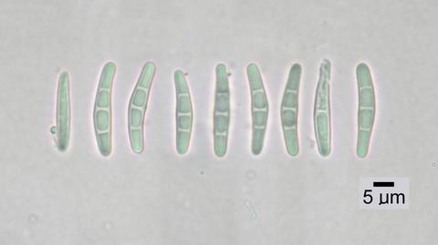 Spores; Location: Near Olalla Creek; Substrate: Bark, Fraxinus latifolia; Elevation: 233 meters.
Citation -
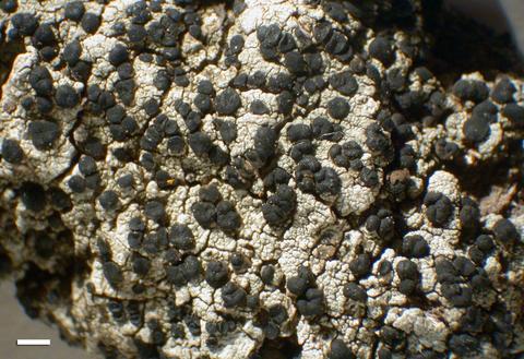
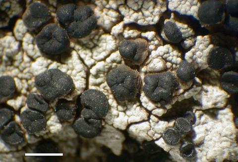
2. [Image] Opegrapha rufescens
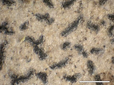 Habit; Location: Near Olalla Creek; Substrate: Bark, Fraxinus latifolia; Elevation: 233 meters.
Citation -
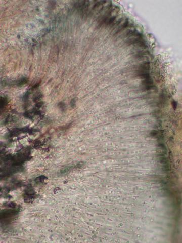
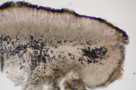
3. [Image] Opegrapha rufescens
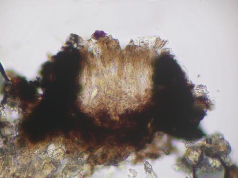 Apothecial section; Location: Near Olalla Creek; Substrate: Bark, Fraxinus latifolia; Elevation: 233 meters.
Citation -
4. [Image] Opegrapha rufescens
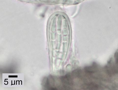 Ascus; Location: Near Olalla Creek; Substrate: Bark, Fraxinus latifolia; Elevation: 233 meters.
Citation -
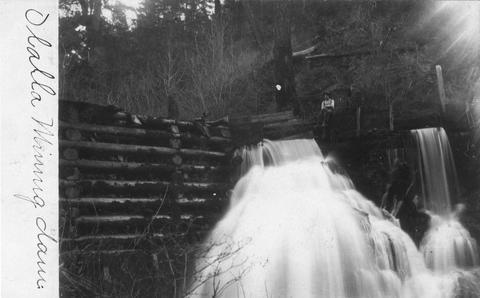
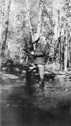
5. [Image] Olalla mining dam
-
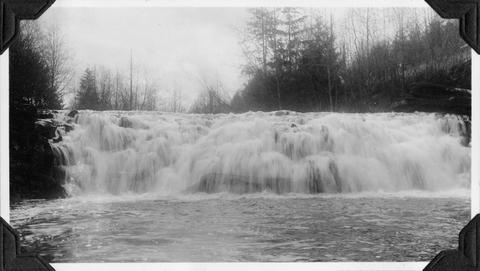
6. [Image] Beaver Creek falls
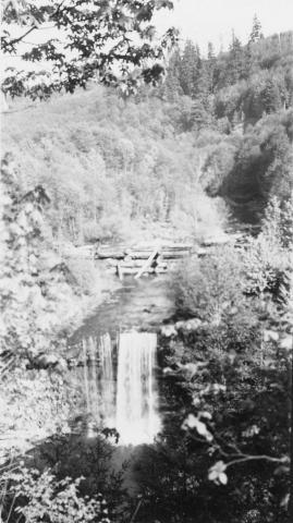 Impassable falls on Beaver Creek. The falls are about 60 feet high
Citation -
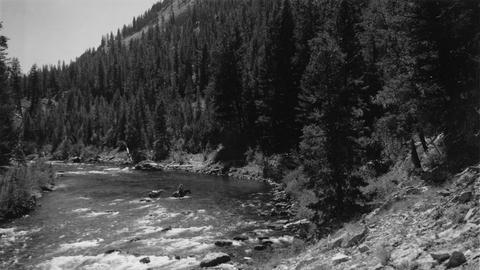
7. [Image] Watershed between Loon and Cougar Creeks
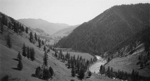 Typical watershed between Loon and Cougar Creeks. Broad benches are common
Citation -
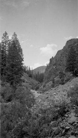
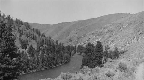 Looking downstream from high point in trail a short distance below Cougar Creek
Citation -
9. [Image] Leading horse across the river
 Slim Hendrick on Smokey leading Blue back across the river after the latter horse had rolled down a 30' cliff
Citation -
10. [Image] Marble Creek box canyon
 Typical watershed topography below the box canyon near Marble Creek, Idaho
Citation -
11. [Image] Falls on Bear Creek
 Falls on Bear Creek near Clatskanie, Oregon
Citation -
12. [Image] Quartz Creek stream survey
 Quartz Creek is a tributary to the Cispus River
Citation -
13. [Image] Quartz Creek stream survey
 Quartz Creek is a tributary to the Cispus River
Citation -
14. [Image] Steep falls in small creek
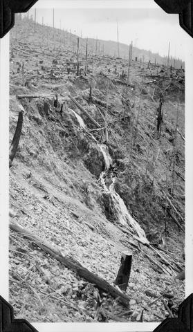 Steep Falls in small creek about 1 mile east of Weyerhaeuser Camp #7
Citation -
15. [Image] Lecidella laureri
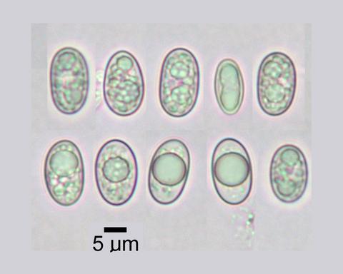 Spores; Habitat: Pinus albicaulis - Abies lasiocarpa krummholz and short trees and alpine tundra; Location: Watershed of South Meadow Creek, Tobacco Root Mountains, 9.6 km W of McAllister; Substrate: Bark, ...
Citation -
16. [Image] Lecidella laureri
 Hymenium; Habitat: Pinus albicaulis - Abies lasiocarpa krummholz and short trees and alpine tundra; Location: Watershed of South Meadow Creek, Tobacco Root Mountains, 9.6 km W of McAllister; Substrate: ...
Citation -
17. [Image] Lecidella laureri
 Habit; Habitat: Pinus albicaulis - Abies lasiocarpa krummholz and short trees and alpine tundra; Location: Watershed of South Meadow Creek, Tobacco Root Mountains, 9.6 km W of McAllister; Substrate: Bark, ...
Citation -
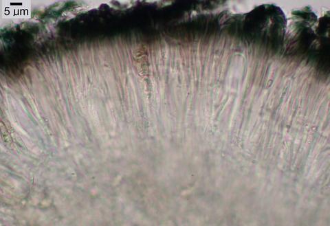
18. [Image] Lecidella laureri
 Exciple; Habitat: Pinus albicaulis - Abies lasiocarpa krummholz and short trees and alpine tundra; Location: Watershed of South Meadow Creek, Tobacco Root Mountains, 9.6 km W of McAllister; Substrate: ...
Citation -
19. [Image] Lecidella laureri
 Apothecial section; Habitat: Pinus albicaulis - Abies lasiocarpa krummholz and short trees and alpine tundra; Location: Watershed of South Meadow Creek, Tobacco Root Mountains, 9.6 km W of McAllister; ...
Citation -
20. [Image] Lecidella laureri
 Apothecia; Habitat: Pinus albicaulis - Abies lasiocarpa krummholz and short trees and alpine tundra; Location: Watershed of South Meadow Creek, Tobacco Root Mountains, 9.6 km W of McAllister; Substrate: ...
Citation