Search
You searched for:
Start Over
Historic stream surveys
Remove constraint Historic stream surveys
Database
Oregon Digital
Remove constraint Database: Oregon Digital
« Previous | 1 - 20 of 1,284 | Next »
Search Results
-
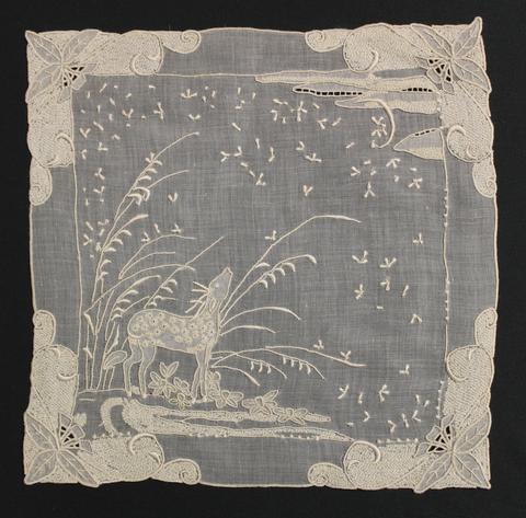 Tea Cloth of fine, white linen hand-embroidered with open-work, shadow-work, textural stitches and satin stitch; each corner is heavily worked with leaves and swirling vines with a lower left scene of ...
Citation -
2. [Image] Aerial view of campus
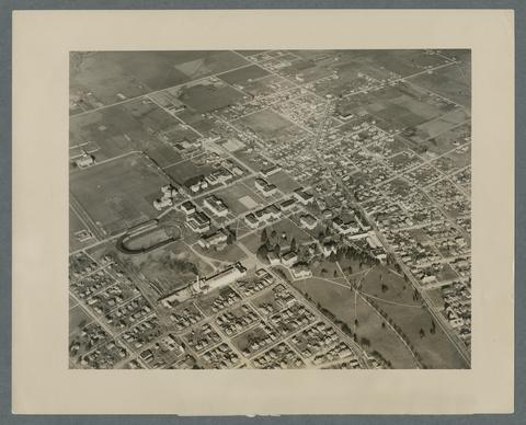 Coleman field is lower left, partially obscuredby smoke coming from the physical plant smokestack.
Citation -
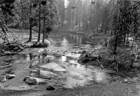
3. [Image] Fall river springs, looking down stream
-
 Science Hall (later Education Hall and now Furman Hall) is seen in the background.
Citation -
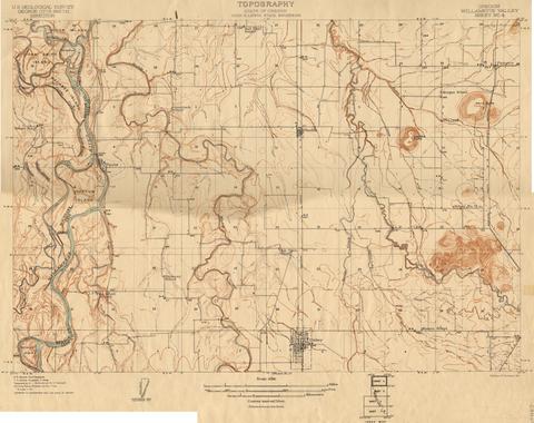
6. [Image] Oregon Willamette Valley, sheet no. 5; Historic topo[topographic] map of the Willamette Valley
 Surveyed in 1911. Contour interval 5 feet. Scale 1/31680
Citation -
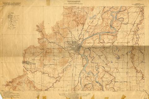
7. [Image] Oregon Willamette Valley, sheet no. 4; Historic topo[topographic] map of the Willamette Valley
 Surveyed in 1910. Contour interval 5 feet. Scale 1/31680
Citation -
8. [Image] Oregon Willamette Valley, sheet no. 7; Historic topo[topographic] map of the Willamette Valley
 Surveyed in 1911-1912 and 1913. Contour interval 5 feet. Scale 1/31680
Citation -
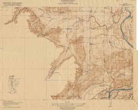
9. [Image] Oregon Willamette Valley, sheet no. 6; Historic topo[topographic] map of the Willamette Valley
 Surveyed in 1909-1911. Contour interval 5 feet. Scale 1/31680
Citation -
10. [Image] Oregon Willamette Valley, sheet no. 8; Historic topo[topographic] map of the Willamette Valley
 Surveyed in 1911 and 1914.
Citation -
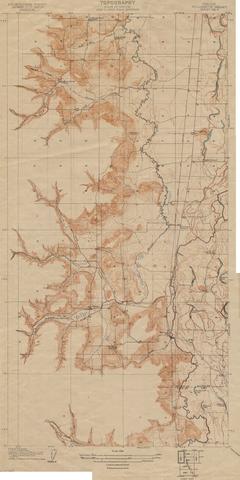
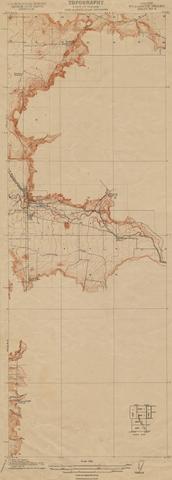
11. [Image] Oregon Willamette Valley, sheet no. 3; Historic topo[topographic] map of the Willamette Valley
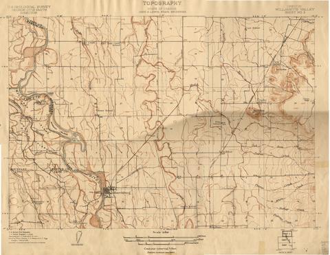 Surveyed in 1908 and 1909. Contour interval 5 feet. Scale 1/31680
Citation -
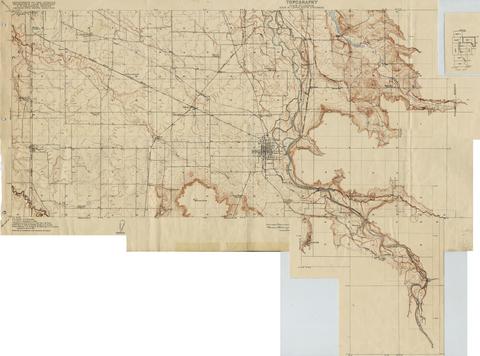
12. [Image] Oregon Willamette Valley, sheet no. 2; Historic topo[topographic] map of the Willamette Valley
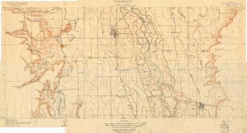 Surveyed in 1908 and 1909. Contour interval 5 feet and 10 feet changing on the 450 foot contour. Scale 1/31680
Citation -
13. [Image] Oregon Willamette Valley, sheet no. 9; Historic topo[topographic] map of the Willamette Valley
 Surveyed in 1913 and 1914. Contour interval 5 feet and 25 feet, changing on the 450 foot contour. Scale 1/31680
Citation -
14. [Image] Through the Columbia River Gorge by Auto
 Article by Randall R. Howard. The author describes the construction of the Columbia River Highway, and takes us on an automobile journey along the Highway from Portland, Oregon to The Dalles and Celilo ...
Citation -
 3 p. An article by Katherine Louise Smith giving a historical and descriptive tour of the Columbia River, including photographs of the Columbia near the Dalles, Memaloose Island, Oneonta Gorge, Multnomah ...
Citation -
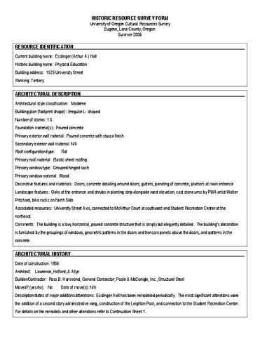 The Historic Resource Survey Form provides architectural description, architectural history, historical associations and significance, assessment of National Register eligibility, and bibliographical references. ...
Citation -
 This work is documented by the Historic American Buildings Survey. This work was listed on the National Register of Historic Places in 1974.
Citation -
 This work is documented by the Historic American Buildings Survey. This work was listed on the National Register of Historic Places in 1974.
Citation -
19. [Image] Oregon State Planning Board, 1935
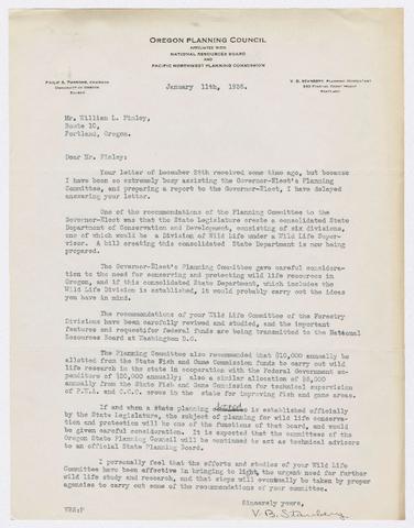 1. Letter describing proposed creation of a State Planning Board and State Department of Conservation and Development as well as funding for wildlife research; 2. Letter to Chancellor W. J. Kerr recommending ...
Citation -
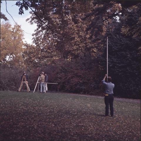
20. [Image] Best trout stream and trout surveys
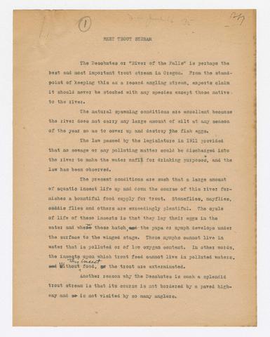 Two manuscripts are featured in this document. The first discusses how the Deschutes River is an ideal place for trout, not only for sport but for the fish to inhabit. The river benefits from the lack ...
Citation