Search
You searched for:
Start Over
Watersheds
Remove constraint Watersheds
Database
Oregon Digital
Remove constraint Database: Oregon Digital
« Previous | 1 - 100 of 554 | Next »
Search Results
-
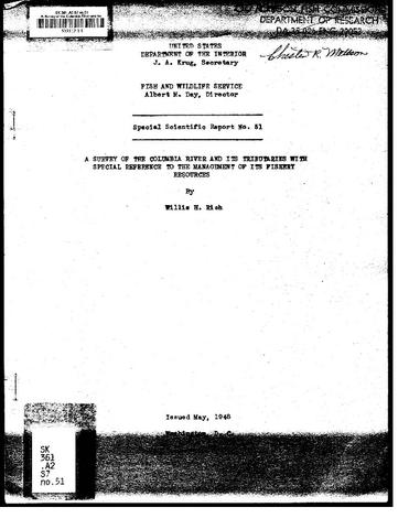 Special scientific report ; no 51
Citation -
2. [Image] Upper Big Redfish Lake, Idaho
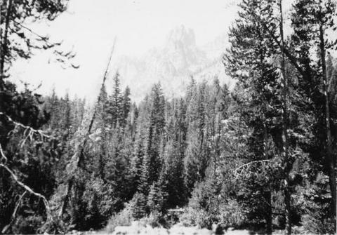 Showing character of watershed at the Upper Big Redfish Lake, Idaho
Citation -
3. [Image] Deschutes River Watershed south of Bend
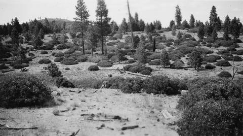 Typical watershed covering for some distance south of Bend. Rounded clumps are mainly green-leaf manzanita with some Ceanothus and Ribes
Citation -
4. [Image] View of watershed at Hot Springs
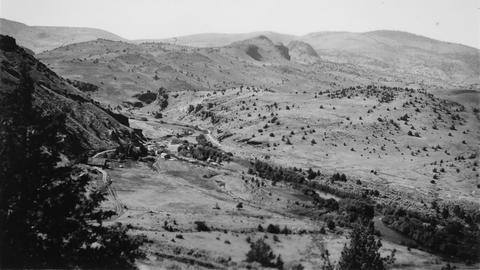 Warm Springs River and watershed area
Citation -
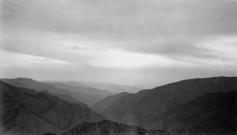
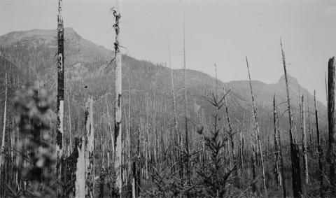
5. [Image] Upper Cispus River watershed
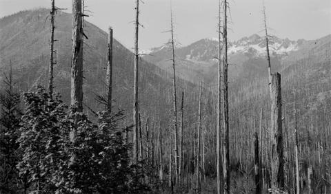 Watershed of Upper Cispus River showing extensive burn-over area
Citation -
6. [Image] Watershed Initiatives
-
7. [Image] Watershed Initiatives
-
8. [Image] Watershed Initiatives
-
9. [Image] Watershed Initiatives
-
10. [Image] Pulp Ponds
 A cibachrome print of a landscape photograph featuring black shapes bordered by white. The focus is American river watersheds.
Citation -
11. [Image] Gyalectaria diluta
 Apothecial section POL; Habitat: Old Douglas fir forest; Location: W slope Cascades, H. J. Andrews Exptl. For., S of Watershed 10; Substrate: Branch, tree; Elevation: 610 meters; Notes: Original ID as ...
Citation -
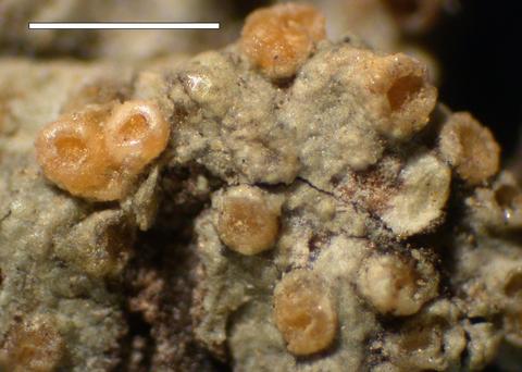
12. [Image] Gyalectaria diluta
 Habit; Habitat: Old Douglas fir forest; Location: W slope Cascades, H. J. Andrews Exptl. For., S of Watershed 10; Substrate: Branch, tree; Elevation: 610 meters; Notes: Original ID as Ochrolechia. On limbs ...
Citation -
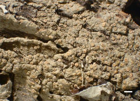
13. [Image] Gyalectaria diluta
 Apothecial section; Habitat: Old Douglas fir forest; Location: W slope Cascades, H. J. Andrews Exptl. For., S of Watershed 10; Substrate: Branch, tree; Elevation: 610 meters; Notes: Original ID as Ochrolechia. ...
Citation -
14. [Image] Gyalectaria diluta
 Apothecia; Habitat: Old Douglas fir forest; Location: W slope Cascades, H. J. Andrews Exptl. For., S of Watershed 10; Substrate: Branch, tree; Elevation: 610 meters; Notes: Original ID as Ochrolechia. ...
Citation -
15. [Image] Watershed of Upper Cispus River
 Watershed of Upper Cispus River showing extensive burn-over area and mountainous terrain
Citation -
16. [Image] Watershed between Loon and Cougar Creeks
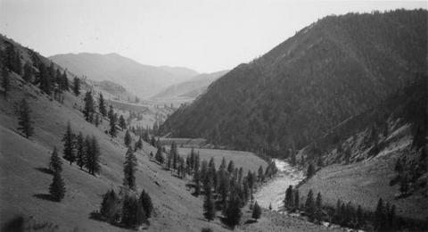 Typical watershed between Loon and Cougar Creeks. Broad benches are common
Citation -
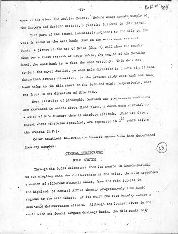
17. [Image] General Physiography - Nile System
-
18. [Image] Bibliography
-
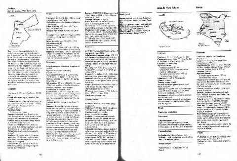
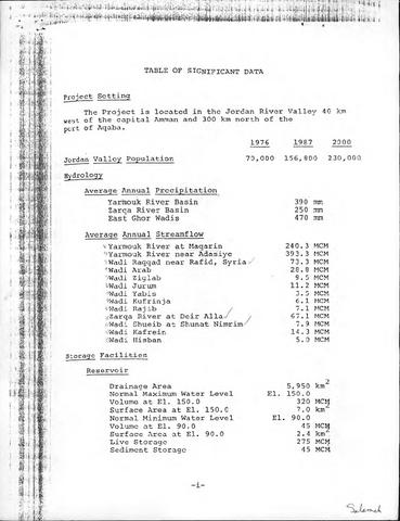
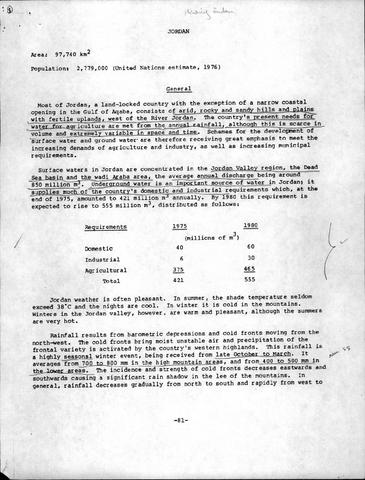
22. [Image] Ch. 1: Project setting and tables
-
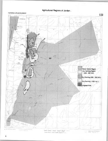
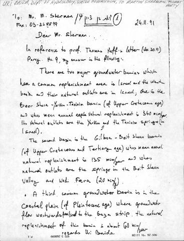
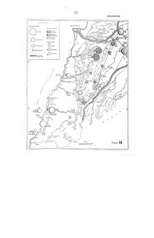
25. [Image] Jordan - Summary of Aquifer Charcteristics
-
26. [Image] Part I: Geological Structure and Relief
-
27. [Image] Problems of Water in Iran (Vol. 1-2)
-
30. [Image] Developing Pumps for Third World Use
-
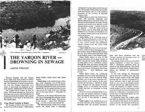
31. [Image] Yarkon River - Drowning in Sewage
-
33. [Image] Introduction a l'Etude du Schema Directeur
-
34. [Image] Concept of a Sinistral Megashear
-
35. [Image] Economic analysis
-
36. [Image] Special Subjects and Investigations
-
37. [Image] Miscellaneous -- appendices?
-
39. [Image] Irrigation of Sandy Soils
-
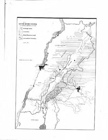
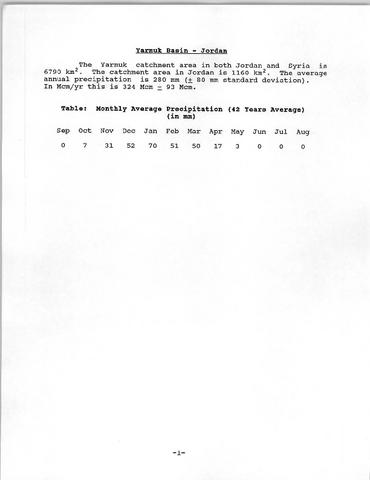
40. [Image] Yarmouk Basin
-
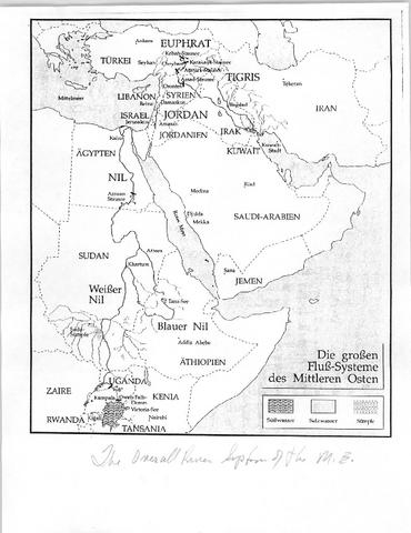
41. [Image] Overall River System of the Middle East
-
42. [Image] Israel and Borderlands: Reference Maps
-
43. [Image] Jordan River Report Appendices -- Originals
-
44. [Image] Volume 1, Proceedings
-
45. [Image] Table of contents
-
46. [Image] Water Resources Series
-
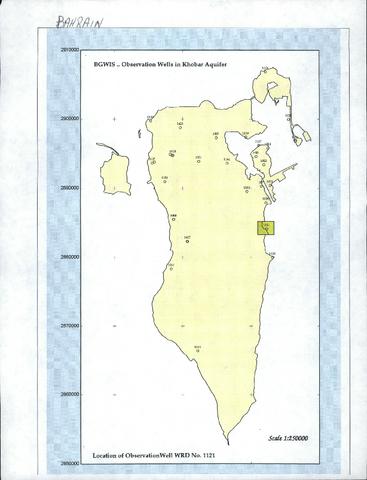
47. [Image] Map of Observation Wells in Khobar Aquifer
-
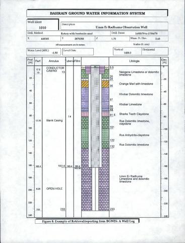
48. [Image] Umm Er Radhuma Observation Well
-
49. [Image] Interview, with land use map
-
50. [Image] IHP Information
-
51. [Image] International Hydrological Programme
-
52. [Image] Wetlands List
-
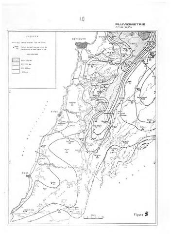
53. [Image] Pluviometrie
-
58. [Image] Research Needs in Dam Safety
-
59. [Image] Design of Earth Dams
-
60. [Image] Geotechnical Engineering of Embankment Dams
-
63. [Image] Debris Flow
-
65. [Image] Recueilde Statistiques Libanaises
-
68. [Image] Water Management in the Philippines
-
69. [Image] Ground-water occurrence in the Middle East
-
72. [Image] Watersheds: A New Picture in an old frame
-
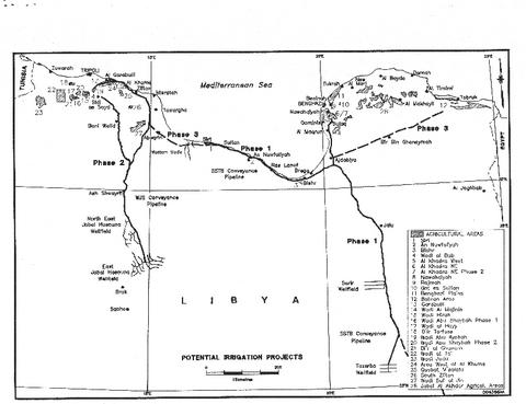
73. [Image] Libyan Potential Irrigation Projects
-
76. [Image] River Regimes in Iran
-
78. [Image] TVAs in the Middle East
-
79. [Image] Water-Rock Interaction
-
80. [Image] Tracer Hydrology
-
81. [Image] Well Logging in Hydrogeology
-
84. [Image] L'Oronte, Etude de Fleuve
-
85. [Image] Semi-Detailed Soil Survey
-
86. [Image] SNR GIS Task Force: Final Report
-
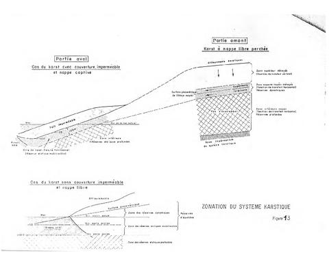
87. [Image] Zonation du Systeme Karstique
-
89. [Image] South Lebanon - A Geographic Survey
-
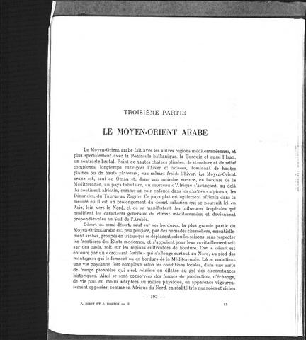
90. [Image] Le Moyen-Orient arabe
-
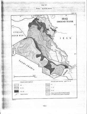
91. [Image] Iraq - Ground Water
-
93. [Image] Floyd G Bryant
-
94. [Image] Mt St Helens
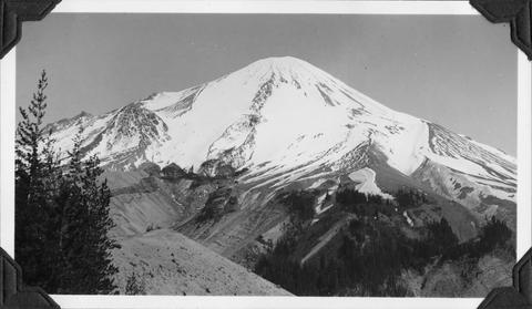 Upper watershed of South ForkToutle River at base of Mt St Helens
Citation -
95. [Image] Frey riding "Taxi"
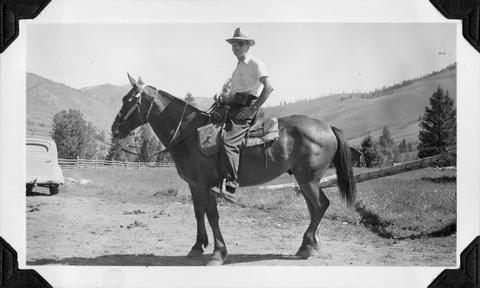 Frey on "Taxi" at start of pack trip into the Middle Fork Salmon River
Citation -
97. [Image] Cattle near Sawtooth Mountains
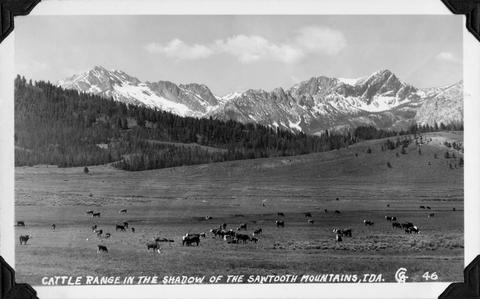 Cattle range in the shadow of the Sawtooth Mountains, Idaho
Citation -
98. [Image] Wild mountain sheep
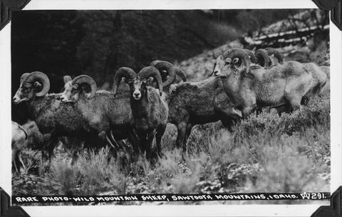 Rare photo of wild mountain sheep in the Sawtooth Mountains, Idaho
Citation -
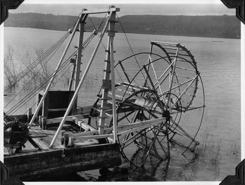
99. [Image] Scow fish wheel on the Columbia River
-
100. [Image] Ward Hendrick family and Dean Chandler
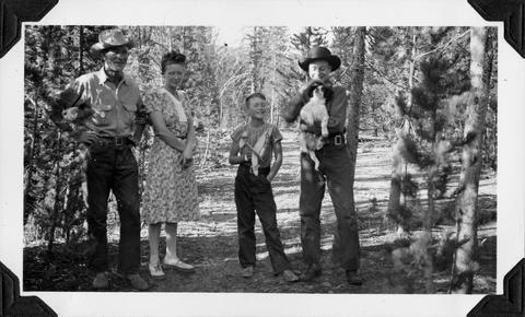 Ward (Slim) Hendrick, Mildred and Mike Hendrick Dean Chandler holding Timothy Tugmutton
Citation