Search
You searched for:
Start Over
Historic stream surveys
Remove constraint Historic stream surveys
Database
Oregon Digital
Remove constraint Database: Oregon Digital
« Previous | 1,201 - 1,250 of 1,284 | Next »
Search Results
-
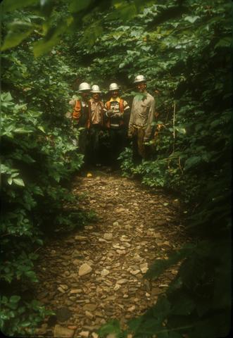
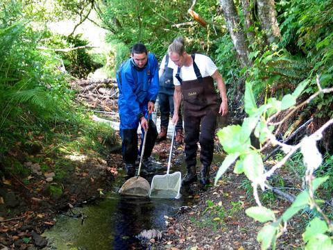
1201. [Image] Four men along stream looking at spawn gravel
-
1202. [Image] Two people walking along fast flowing stream
-
1203. [Image] Two people walking along fast flowing stream
-
1205. [Image] Sandy beach on stream
-
1206. [Image] Sutton Creek near mouth of stream
-
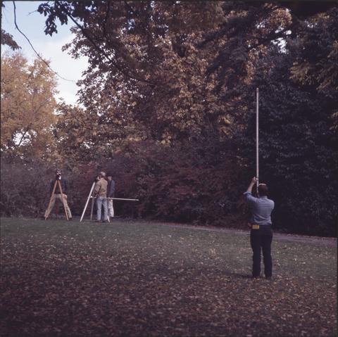
1207. [Image] Students practicing their surveying skills
-
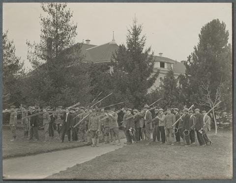 Science Hall (later Education Hall and now Furman Hall) is seen in the background.
Citation -
1209. [Image] Giant Kettles and Pot Holes
 Image Description from historic lecture booklet: "Plunging and swirling water of a river drills holes in the rock. Pot-holes are also drilled by the streams which drop through wells from the top to the ...
Citation -
1210. [Image] Portsmouth and Norfolk, Virginia
 Norfolk, at the mouth of the James River has a natural harbor. This together with its railroad connections with the interior, makes it one of the finest shipping ports in the United States. This picture ...
Citation -
1211. [Image] Irrigation ditches
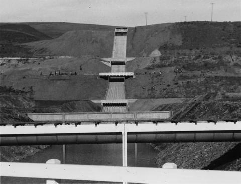 Irrigation ditches from the Yakima River crossing the Terrace Heights Wasteway of the Roza Canal near Yakima, Washington. Crossing from the top to bottom are: Roza Canal; Selah-Moxee Canal; Highway Bridge; ...
Citation -
1212. [Image] Fall river springs, looking down stream
-
1213. [Image] Charles Warren in Lab
 Charles Warren, an OSC fisheries biologist, examines an artificial stream before the production of kraft paper mill wastes at OSC fisheries laboratory.
Citation -
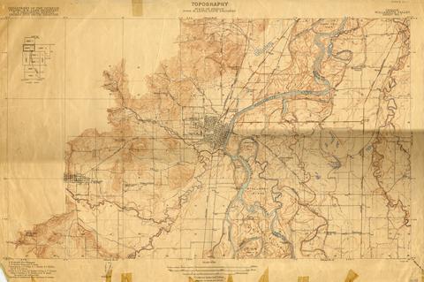
1214. [Image] Oregon Willamette Valley, sheet no. 5; Historic topo[topographic] map of the Willamette Valley
 Surveyed in 1911. Contour interval 5 feet. Scale 1/31680
Citation -
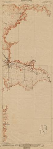
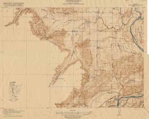
1215. [Image] Oregon Willamette Valley, sheet no. 4; Historic topo[topographic] map of the Willamette Valley
 Surveyed in 1910. Contour interval 5 feet. Scale 1/31680
Citation -
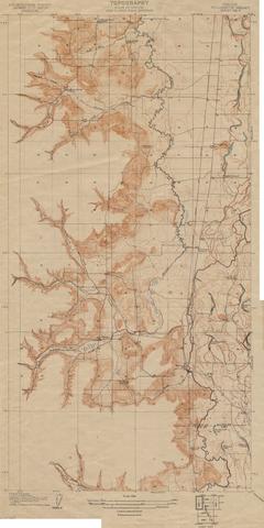
1216. [Image] Oregon Willamette Valley, sheet no. 7; Historic topo[topographic] map of the Willamette Valley
 Surveyed in 1911-1912 and 1913. Contour interval 5 feet. Scale 1/31680
Citation -
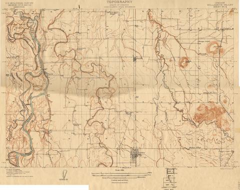
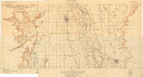
1217. [Image] Oregon Willamette Valley, sheet no. 6; Historic topo[topographic] map of the Willamette Valley
 Surveyed in 1909-1911. Contour interval 5 feet. Scale 1/31680
Citation -
1218. [Image] Oregon Willamette Valley, sheet no. 8; Historic topo[topographic] map of the Willamette Valley
 Surveyed in 1911 and 1914.
Citation -
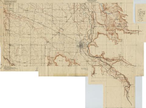
1219. [Image] Oregon Willamette Valley, sheet no. 3; Historic topo[topographic] map of the Willamette Valley
 Surveyed in 1908 and 1909. Contour interval 5 feet. Scale 1/31680
Citation -
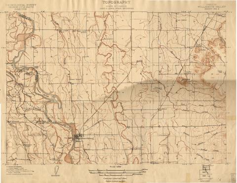
1220. [Image] Oregon Willamette Valley, sheet no. 2; Historic topo[topographic] map of the Willamette Valley
 Surveyed in 1908 and 1909. Contour interval 5 feet and 10 feet changing on the 450 foot contour. Scale 1/31680
Citation -
1221. [Image] Oregon Willamette Valley, sheet no. 9; Historic topo[topographic] map of the Willamette Valley
 Surveyed in 1913 and 1914. Contour interval 5 feet and 25 feet, changing on the 450 foot contour. Scale 1/31680
Citation -
1222. [Image] Indian reservation land survey
 Item from the personal and professional papers of the Superintendent of Indian Affairs for the Oregon Territory, Joel Palmer.
Citation -
1223. [Image] Tea Cloth of fine, white linen hand-embroidered with open-work, shadow-work, textural stitches and satin stitch
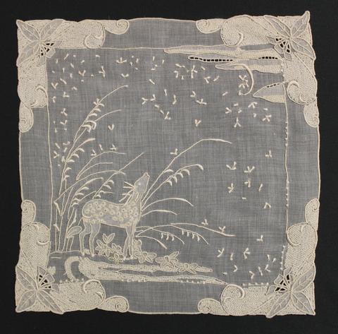 Tea Cloth of fine, white linen hand-embroidered with open-work, shadow-work, textural stitches and satin stitch; each corner is heavily worked with leaves and swirling vines with a lower left scene of ...
Citation -
1224. [Image] Bonneville Fish Hatchery
 Stream running alongside the Bonneville Fish Hatchery.
Citation -
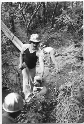
1225. [Image] Bonneville Fish Hatchery
 Men working in a stream near the Bonneville Fish Hatchery.
Citation -
1226. [Image] Pack horses
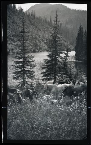 Several loaded pack horses grazing in a meadow by a stream in the Hozameen Mountains on the 1920 Canada trip.
Citation -
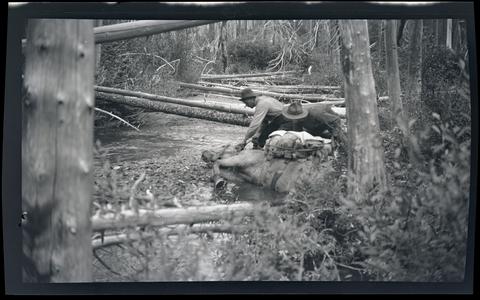
1227. [Image] Pack horse stuck in mud
 Two unidentified men helping a loaded pack horse stuck on its side in a muddy stream on the 1920 Canada trip. Location unknown, but likely somewhere along the U.S.-Canadian border at British Columbia.
Citation -
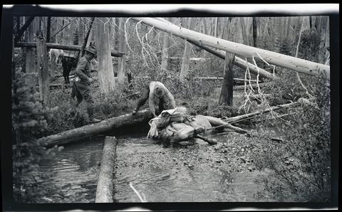
1228. [Image] Pack horse stuck in mud
 Two unidentified men helping a loaded pack horse stuck on its side in a muddy stream on the 1920 Canada trip. Location unknown, but likely somewhere along the U.S.-Canadian border at British Columbia.
Citation -
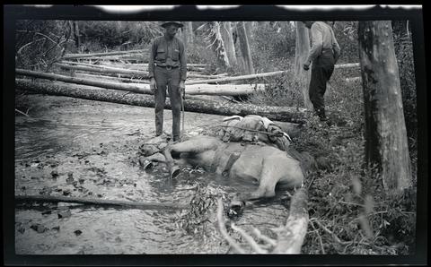
1229. [Image] Pack horse stuck in mud
 Two unidentified men helping a loaded pack horse stuck on its side in a muddy stream on the 1920 Canada trip. Location unknown, but likely somewhere along the U.S.-Canadian border at British Columbia.
Citation -
1230. [Image] Photographing near Mount Rainier
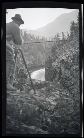 An unidentified man with a camera on a tripod photographing a bridge over a stream near Mount Rainier.
Citation -
1231. [Image] Photographing near Mount Rainier
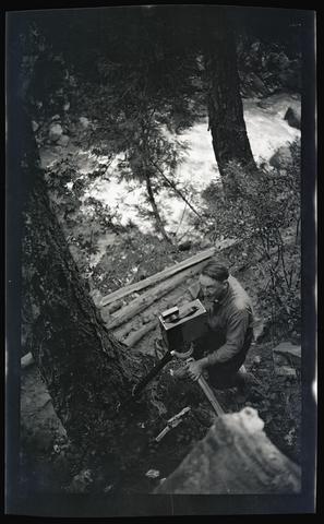 An unidentified man with a camera on a tripod photographing by a stream near Mount Rainier.
Citation -
1232. [Image] Man on footbridge
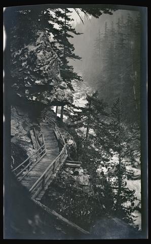 An unidentified man on a wooden footbridge over a stream near Mount Rainier National Park. Image note: underexposed.
Citation -
1233. [Image] Man with packhorses at Mount Rainier National Park
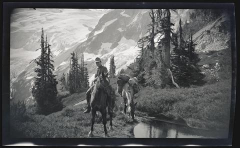 An unidentified man riding a horse while leading a loaded packhorse across a stream in Mount Rainier National Park. Note on envelope attributes image to Keating.
Citation -
1234. [Image] Man with packhorses at Mount Rainier National Park
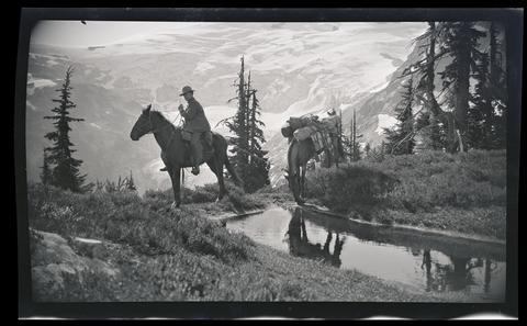 An unidentified man riding a horse while leading a loaded packhorse across a stream in Mount Rainier National Park. Note on envelope attributes image to Keating.
Citation -
1235. [Image] Man near Crescent Lake
 An unidentified man standing next to a stream near Crescent Lake.
Citation -
1236. [Image] Forest near Crescent Lake
 A view of a stream in the forest near Crescent Lake.
Citation -
1237. [Image] On a fishing trip
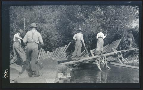 An unidentified group of men and women crossing a wooden dam on a stream with fishing gear. Possibly taken near the Rogue River.
Citation -
1238. [Image] Girls, wait for a temperance man
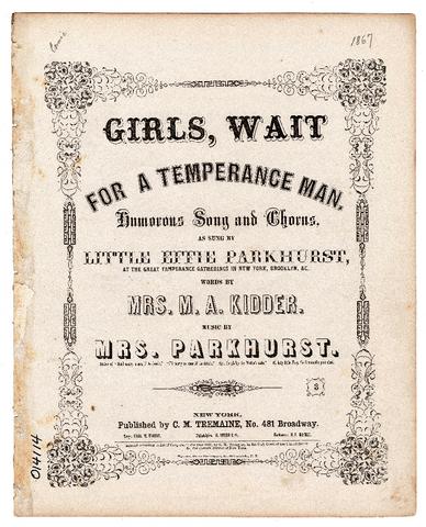 "Humorous song and chorus, as sung by little Effie Parkhurst at the great Temperance gatherings in New York, Brooklyn, &c."--Cover; Verses 3-4 printed at end of music; ; Back cover with "Select catalogue ...
Citation -
1239. [Image] PH037_BR00019; 2057; P429
 [Distant view of bridge crossing Eagle Creek, stream in foreground.]; default
Citation -
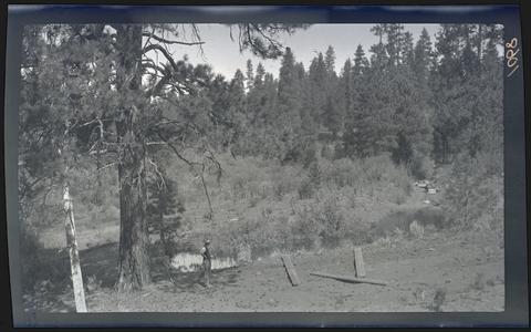
1240. [Image] NW across stream and dunes
-
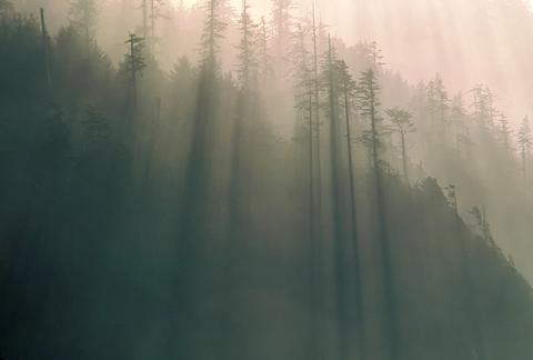
1242. [Image] Early morning sun streaming through forest
-
1243. [Image] Pole Bridge across stream
-
1245. [Image] Piedmont Glaciers
 Image Description from historic lecture booklet: "Glaciers of the piedmont type are formed where alpine glaciers leave the rugged defiles through which they flow and expand and unite on an adjacent plain. ...
Citation -
1246. [Image] Wash Plains
 Image Description from historic lecture booklet: "This kind of plain was made by the streams that came from beneath the ice as they wandered this way and that and dropped their load. Many such plains are ...
Citation -
1247. [Image] Stream meandering through woods
-
1249. [Image] Oregon State Planning Board, 1935
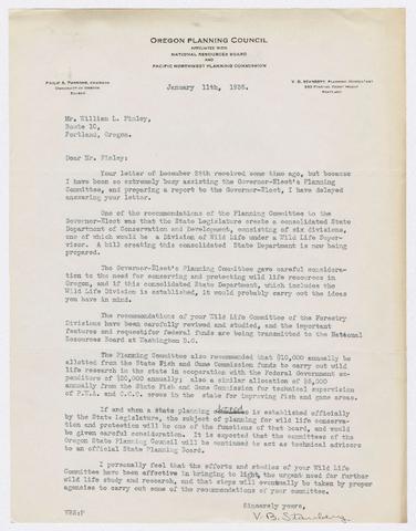 1. Letter describing proposed creation of a State Planning Board and State Department of Conservation and Development as well as funding for wildlife research; 2. Letter to Chancellor W. J. Kerr recommending ...
Citation -
1250. [Image] Great River of the Northwest : A Stream with a Future
 3 p. An article by Katherine Louise Smith giving a historical and descriptive tour of the Columbia River, including photographs of the Columbia near the Dalles, Memaloose Island, Oneonta Gorge, Multnomah ...
Citation