Search
Search Results
-
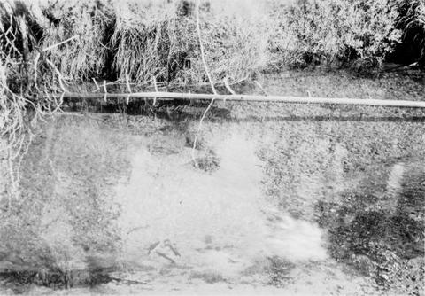
1. [Image] Little Red fish on spawning grounds
-
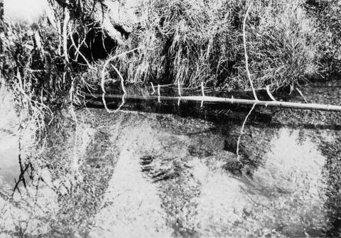
2. [Image] Little Red fish on spawning grounds
-
3. [Image] Five species of western salmon
 The first slide illustrates the five species of salmon as follows: a. King Salmon, also Quinnat, Chinook, or Tyee. It is the salmon of highest quality and value. The average weight ranges about 22 pounds, ...
Citation Citation
- Title:
- Five species of western salmon
- Year:
- 1925
The first slide illustrates the five species of salmon as follows: a. King Salmon, also Quinnat, Chinook, or Tyee. It is the salmon of highest quality and value. The average weight ranges about 22 pounds, but may reach as high as 70 pounds or even eighty. It is typical of the Columbia River, but is also taken north and south of that stream. b. Red Salmon, or Sockeye. This fish has a place second only to the Chinook, both in quality and commercial value. In weight the average is considerably less than that of the Chinook, but the flesh is bright red and of excellent flavor. This variety is typical of Puget Sound but is taken both north and south of that region. c. Silver Salmon. This is also a splendid food fish. Its flesh varies from pink to red and by many is considered equal in quality to the Red Salmon. The Silver Salmon is typical of the rivers of the state other than the Columbia. During some seasons the Siuslaw, Umpqua and other rivers of the state have large quantities of this species. At such times many car loads of iced salmon are shipped from towns along these rivers. Some are being shipped directly to the Atlantic coast markets. d. "Chum" or "Keta". This variety was called for many years dog salmon and is yet known to many by that name. It was formerly considered a very inferior species and was seldom used either as a fresh product or for canning. The prejudice against it was largely due to the name, and to the pale color of its flesh. The prejudice has been rapidly decreasing since this species has been found to be a really good food fish, and during recent years. It has furnished fully one-fifth of the Pacific coast pack. e. The fifth salmon is known as the Humpback. It is of smaller size than the Dog Salmon, and like the latter is of the white variety, poor food when fresh and of inferior quality when canned. It is little used as a commercial product. Beside these five species of true salmon there is another commonly known as the Steelhead Salmon. It belongs to a different genus from the above mentioned forms but plays a very important part in the fishing industry of the state. It is considered an excellent food fish and is used freely by the canners, often under the name of the true salmon. The Steelhead is really a trout, ascending the rivers to spawn, but returning to the sea again. From a biological point of view, our Pacific Coast salmon are among the most remarkable fishes known; remarkable because so little is known of the fish while in the sea. The greater part of their life is therefore shrouded in mystery. The following facts are, however, well known: Fact 1. That the salmon ascend the rivers to spawn, some species going but a few miles from brackish waters while others travel hundreds of miles from the sea, in fact into the very small streams, pushing as far as fish of this size can swim. Spawning grounds are almost invariably in the cold fresh waters fed from lakes, springs, and mountain snows. Fact 2. During the ascent of the rivers the salmon do not take any food. As a result, their digestive organization becomes shrunken and functionless. Fact 3. The adult salmon after spawning all die. None of them live to get back to the sea. Fact 4. The young hatched in the small streams may in some species make their way down to the sea the same season; in others they remain in fresh water until the next year. Fact 5. A period of years is spent in the ocean, probably from three to five, depending upon the species. During this time practically nothing is known of their habits.
-
"December 10, 1998."
Citation Citation
- Title:
- Review of the hatchery measures in the Oregon plan for salmon and watersheds. Part I, Consistency of the Oregon plan with recommendations from recent scientific review panels
- Author:
- Independent Multidisciplinary Science Team (Or.)
- Year:
- 1998, 2005
"December 10, 1998."
-
ABSTRACT Phase VI of the School-Based Klamath Restoration Project (319h) is a collaborative effort between seven Siskiyou County schools, the Siskiyou County Office of Education (SCOE), and the United ...
Citation Citation
- Title:
- Middle Klamath River sub-basin planning : final report
- Author:
- Karuk Tribe of California, Dept. of Natural Resources
- Year:
- 2001, 2005
ABSTRACT Phase VI of the School-Based Klamath Restoration Project (319h) is a collaborative effort between seven Siskiyou County schools, the Siskiyou County Office of Education (SCOE), and the United States Fish and Wildlife Service (USFWS). The objectives of the project include: ? Expanding hands-on field science watershed education. ? Encouraging a sense of resource stewardship among students at all grade levels. ? Collecting quality data for inclusion in the 319h data base. ? Teaching applications of the scientific method. ? Providing on-going inservice training for teachers to increase the effectiveness of the project. Project tasks that were completed include acquisition and analysis of Klamath River Watershed Data, including river water temperatures, river cross sectional profiles and spawning ground surveys. Descriptions of methodology are included in the report. Many other watershed-related projects were undertaken by schools. In some cases the field data was collected and compiled by agency personnel. The spawning ground survey data collected by student volunteers was part of a project conducted by the California Department of Fish and Game and the U.S. Forest Service. Although a substantial amount of excellent work has been accomplished by the schools, the opportunity exists to improve the program at all levels. Increased field and technical support is needed to successfully integrate the goals of the project. Computer training for teachers and students is an essential component of the project, which would allow analysis of data and creation of web sites within classrooms. Data analysis and reporting is the critical component of the project that would provide students with a complete understanding of scientific research methodology. Providing a forum for communication between the 319h participants is another important area of the project that needs to be expanded. Travel time, mountainous topography, and intense winter storms can be barriers to travel in Siskiyou County. Communication helps to increase the level of standardization of data collection and transfer and gives teachers a chance to share successful ideas. Communication also sustains the positive momentum of the project, reinforcing the idea of working as a team towards establishing common goals for watershed education.
-
6. [Image] Evaluation of instream fish habitat restoration structures in Klamath River tributaries, 1988/1989
Annual Report For Interagency Agreement 14-16-0001-89508 EVALUATION OF INSTREAM FISH HABITAT RESTORATION STRUCTURES IN KLAMATH RIVER TRIBUTARIES 1988/1989 by A.D.Olson and J.R. West USDA-Forest Service, ...Citation Citation
- Title:
- Evaluation of instream fish habitat restoration structures in Klamath River tributaries, 1988/1989
- Author:
- Olson, A. D.
- Year:
- 1989, 2008, 2006
Annual Report For Interagency Agreement 14-16-0001-89508 EVALUATION OF INSTREAM FISH HABITAT RESTORATION STRUCTURES IN KLAMATH RIVER TRIBUTARIES 1988/1989 by A.D.Olson and J.R. West USDA-Forest Service, Klamath National Forest 1312 Fairlane Road, Yreka, CA 96097 ABSTRACT Ten instream fish habitat techniques were evaluated to determine which most effectively restored salmonid spawning and/or rearing conditions. Structure stability was estimated based on how intact each structure remained (by percent) and its age, we then projected useful life for each structure type. Cost in 1989 dollars was used to determine cost per unit habitat area provided. Observed use by spawners was used to estimate total number of redds per structure (over its life). Cost of providing spawning habitat (cost per redd) was calculated by dividing estimated total redds by structure cost. Habitats resulting from instream structures were classified using the modified Bisson method and we determined the influence zone of each structure using physical variables to define habitat area. Structures were biologically sampled using direct underwater observation techniques described by Hankin and Reeves1 (1989). Two person dive teams used a "two-pass" method to enumerate and classify salmonids by species and age-class (0+, 1+ or older juveniles, and adults), noting the presence of other species. Fish use of structure affected habitat (post-modification) was compared to use of habitats like those present prior to structure placement (pre-modification). Comparison of "pre-modification" and "post-modification" fish standing crops resulted in a "net fish difference" which was divided by structure cost, yielding "cost per fish reared11. Boulder weirs, the most expensive structures investigated, did not affect enough surface area to make cost per unit of affected habitat reasonable. Cabled cover logs and digger logs (lowest cost structures) were very cost effective at altering physical habitat condition. We believe cost of physically modifying habitat area is only one factor that is important enough to effect success or failure of a large scale habitat restoration program. Assuming all other factors are of equal weight, lowest cost structures can provide the "best value". Modification prescribed to restore stable spawning habitat needs close scrutiny. We believe it is essential to know how the existing habitat is used by spawners by conducting spawning area use surveys which identify redd location and quantify habitat available during each spawning period. Boulder deflectors were best utilized by Chinook salmon spawners, however chinook spawner use of "traditional" structures (weirs backfilled with gravel) was disappointing. Backfilling of instream structures with suitable gravel is a practice that should be discontinued. Steelhead spawner use of structures which result in "pocket water" type spawning areas were heavily used. This habitat configuration proved most desirable when woody object cover was readily available to the spawners. The highest steelhead spawner use was associated with boulder groups with wood and boulder/rootwad groups. We found rearing structures which provided high habitat and cover diversity received the best response from juvenile fish. We observed fish use over one summer and saw dramatic unpredictable use changes even through this short time period. Fish rearing needs during other seasons may differ substantially from summer needs, therefore, suitability of modified habitat probably also changes. Digger logs, one of the least costly and simplest structures, provided the best increase in fish standing crop (fish/m2) for the lowest cost. We believe digger logs were well used by rearing fish because they are one of the most natural restoration structures investigated. Other structures which were well used (small weirs, deflectors, and boulder groups with attached wood) also seem to closely duplicate naturally productive habitats. Higher velocity habitat types associated with boulder groups with wood, boulder rootwad groups, and boulder deflectors were selected by juvenile steelhead and chinook salmon. Providing overhead cover, especially if it extends into the water where it may also be used as object cover, seemed most valuable for juvenile steelhead and salmon if it was placed in a habitat type which would normally receive high fish use. Placement of object cover in slow velocity areas (pool and glide edges) had questionable value for summer rearing habitat restoration, however we do not know what value these structures may have during colder water high flow periods when fish seek slow velocity, densely-covered habitats. We defined the most cost effective method as one meeting restoration objectives, providing the greatest increase in fish use (per surface area or volume), over the longest time period, for the lowest cost. We rank structures evaluated in this study (from most cost-effective to least cost effective) as follows: Digger Logs, Boulder deflectors, Small Boulder Weirs, Boulder Groups with Woody Cover, Free Boulder Weirs, Large Boulder Weirs, Boulder Groups, Boulder/Rootwad Groups, Boulder/Rootwad Deflectors, Small Boulder Weirs, and Cabled Cover Logs.
-
7. [Image] Final report, evaluation of pond rearing of chinook salmon, project (5.12), Modification no. 1
Abstract: Totals of 37,655 and 31,807 adipose-fin clipped, coded-wire tagged (Ad+CWT) 1990 brood year (BY) fall chinook salmon were released from ponds on Indian and Elk creeks, respectively, in 1991. ...Citation Citation
- Title:
- Final report, evaluation of pond rearing of chinook salmon, project (5.12), Modification no. 1
- Author:
- Pisano, Mark S
- Year:
- 1993, 2005
Abstract: Totals of 37,655 and 31,807 adipose-fin clipped, coded-wire tagged (Ad+CWT) 1990 brood year (BY) fall chinook salmon were released from ponds on Indian and Elk creeks, respectively, in 1991. Numbers of fish in both ponds were inventoried and mark quality was checked shortly before the fish were released. An additional 40,078 and 41,272 1991 BY chinook salmon were Ad+CWT and transferred to Bluff Creek and Indian Creek ponds, respectively in spring JL992. These fish will be released in October 1992.
-
Executive Summary The jawless lampreys are remnants of the oldest vertebrates in the world. Oregon has somewhere between eight and a dozen species of these primitive fishes. Their taxonomy is obscure ...
Citation Citation
- Title:
- Oregon lampreys : natural history, status, and analysis of management issues
- Author:
- Kostow, Kathryn
- Year:
- 2002, 2008, 2005
Executive Summary The jawless lampreys are remnants of the oldest vertebrates in the world. Oregon has somewhere between eight and a dozen species of these primitive fishes. Their taxonomy is obscure because different species tend to look very similar through most of their life cycle, and they have not been well-studied in Oregon. Lampreys occur in the Columbia Basin, including the lower Snake River, along the Oregon coast, in the upper Klamath Basin, and in Goose Lake Basin in southeastern Oregon. They all begin life in fresh water where juveniles burrow into silt and filter feed on algae. As some species approach adulthood they migrate to the ocean or to lakes where they briefly become ecto-parasites, feeding on other live fishes by attaching to them with sucker disc mouths. Other species remain non-parasitic. In addition to some enigmatic species identities, we generally have very little information about the detailed distributions, life histories and basic biology of lampreys. Lampreys became a conservation concern in the early 1990s when tribal co-managers and some Oregon Department of Fish and Wildlife (ODFW) staff noted that populations of Pacific Lampreys, Lampetra tridentata, were apparently declining to perilously low numbers. Pacific Lampreys were listed as an Oregon State sensitive species in 1993 and were given further legal protected status by the state in 1997 (OAR 635-044-0130). Lamprey status is difficult to assess for several reasons: 1) Most observations of lampreys in fresh water are of juveniles and it is difficult to tell the various species apart, even to the extent that the various species are currently clearly designated; 2) Data on lamprey is only collected incidental to monitoring of salmonids. The design and efficiency of the data collection effort is not always adequate for lampreys; and 3) We have very few historic data sets for lampreys. Therefore we often cannot determine how the abundances and distributions we see now compare with those in the past. The limited data that we have suggests that lampreys have declined through many parts of their ranges. The most precipitous declines appear to be in the upper Columbia and Snake basins where we have some historic data from mainstem dam counts. Pacific Lampreys have declined to only about 200 adults annually passing the Snake River dams. We also have evidence of declines of Pacific Lampreys in the lower Columbia and on the Oregon coast, although our data is quite limited. We have little to no information about any of the other species of lampreys. We are not even sure whether some of the recognized species, like the River Lamprey (L. ayresi), is still present in Oregon. This paper concludes with a Problem Analysis for Oregon lampreys. Our biggest problem is poor information, ranging from not knowing basic species identity to having inefficient or no systematic monitoring of lamprey abundance and distribution. ODFW continued an annual harvest on Pacific Lamprey in the Willamette Basin in 2001, but we lack the necessary information to assess the affects of the harvest on the population. Major habitat problems that affect lampreys include upstream passage over artificial barriers, a need for lamprey-friendly screening of water diversions, and urban and agricultural development of low-gradient flood plain habitats.
-
This final rule defines the term "harm", which is contained in the definition of "take" in the Endangered Species Act (ESA). The purpose of this rulemaking is to clarify the type of actions that may result ...
Citation Citation
- Title:
- Federal Register - Endangered and Threatened Wildlife and Plants; Definition of "Harm"
- Year:
- 1999, 2008, 2005
This final rule defines the term "harm", which is contained in the definition of "take" in the Endangered Species Act (ESA). The purpose of this rulemaking is to clarify the type of actions that may result in a take of a listed species under the ESA. This final rule is not a change in existing law. It provides clear notification to the public that habitat modification or degradation may harm listed species and, therefore, constitutes a take under the ESA as well as ensuring consistency between NMFS and the Fish and Wildlife Service (FWS). This final rule defines the term "harm" to include any act which actually kills or injures fish or wildlife, and emphasizes that such acts may include significant habitat modification or degradation that significantly impairs essential behavioral patterns of fish or wildlife
-
10. [Image] School-based Klamath River restoration project, phases V, VI & VII, 319h Clean Water Act
ABSTRACT Phase VI of the School-Based Klamath Restoration Project (319h) is a collaborative effort between seven Siskiyou County schools, the Siskiyou County Office of Education (SCOE), and the United ...Citation Citation
- Title:
- School-based Klamath River restoration project, phases V, VI & VII, 319h Clean Water Act
- Author:
- Rilling, Trudy S.
- Year:
- 2000, 2005
ABSTRACT Phase VI of the School-Based Klamath Restoration Project (319h) is a collaborative effort between seven Siskiyou County schools, the Siskiyou County Office of Education (SCOE), and the United States Fish and Wildlife Service (USFWS). The objectives of the project include: ? Expanding hands-on field science watershed education. ? Encouraging a sense of resource stewardship among students at all grade levels. ? Collecting quality data for inclusion in the 319h data base. ? Teaching applications of the scientific method. ? Providing on-going inservice training for teachers to increase the effectiveness of the project. Project tasks that were completed include acquisition and analysis of Klamath River Watershed Data, including river water temperatures, river cross sectional profiles and spawning ground surveys. Descriptions of methodology are included in the report. Many other watershed-related projects were undertaken by schools. In some cases the field data was collected and compiled by agency personnel. The spawning ground survey data collected by student volunteers was part of a project conducted by the California Department of Fish and Game and the U.S. Forest Service. Although a substantial amount of excellent work has been accomplished by the schools, the opportunity exists to improve the program at all levels. Increased field and technical support is needed to successfully integrate the goals of the project. Computer training for teachers and students is an essential component of the project, which would allow analysis of data and creation of web sites within classrooms. Data analysis and reporting is the critical component of the project that would provide students with a complete understanding of scientific research methodology. Providing a forum for communication between the 319h participants is another important area of the project that needs to be expanded. Travel time, mountainous topography, and intense winter storms can be barriers to travel in Siskiyou County. Communication helps to increase the level of standardization of data collection and transfer and gives teachers a chance to share successful ideas. Communication also sustains the positive momentum of the project, reinforcing the idea of working as a team towards establishing common goals for watershed education.
-
We monitored larval Lost River and shortnose suckers from natal beds in the Williamson and Sprague rivers to nursery grounds in Upper Klamath Lake. Downstream movements occurred at night, in the middle ...
Citation Citation
- Title:
- Natural history and ecology of larval Lost River suckers and larval shortnose suckers in the Williamson River-Upper Klamath Lake System
- Author:
- Cooperman, Michael S.
- Year:
- 2004, 2005
We monitored larval Lost River and shortnose suckers from natal beds in the Williamson and Sprague rivers to nursery grounds in Upper Klamath Lake. Downstream movements occurred at night, in the middle of the channel, and on the falling limb of the hydrograph. Ages, sizes, and developmental stages of larvae from spawning beds and the river mouth were similar, while larvae collected contemporaneously from the lake tended to be larger and better fed. Our results indicate in-river rearing was rare, that a rapid outmigration to the lake was favorable for larval survival, and that modification of the lower Williamson River does not appear to have prohibited rapid entry or preclude access to Upper Klamath Lake. Within the Williamson River and Upper Klamath Lake, emergent macrophytes supported significantly higher abundance, larger mean sizes, and better fed larvae than submerged macrophytes, woody vegetation, or open water areas. Analysis of seven years of larval sucker production and survival corroborated the habitat analysis by identifying a positive relationship with emergent macrophyte availability as well as a positive relationship with air temperature and a negative relationship with high wind. These findings illustrate the importance of fast growth, appropriate habitat and calm hydrological conditions for larvae, and are highly consistent with other larval fish studies.
-
12. [Image] The trout and salmon of the Pacific coast
This article is an overview of the variety of trout and salmon that are found in Oregon and Washington states.Citation -
The Service determines endangered status for the shortnose sucker [Chasmistes brevirostris) and Lost River sucker [Deltistes luxatus), fishes restricted to the Klamath Basin of south-central Oregon and ...
Citation Citation
- Title:
- Federal Register - Endangered and Threatened Wildlife and Plants; Determination of Endangered Status of the Shortnose Sucker and the Lost River Sucker
- Author:
- Williams, Jack E.
- Year:
- 1988, 2008, 2005
The Service determines endangered status for the shortnose sucker [Chasmistes brevirostris) and Lost River sucker [Deltistes luxatus), fishes restricted to the Klamath Basin of south-central Oregon and north-central California. Dams, draining of marshes, diversion of rivers and dredging of lakes have reduced the range and numbers of both species by more than 95 percent. Remaining populations are composed of older individuals with little or no successful recruitment for many years. Both species are jeopardized by continued loss of habitat, hybridization with more common closely related species, competition and predation by exotic species, and insularization of remaining habitats. This rule implements the protection provided by the Endangered Species Act of 1973, as amended, for the shortnose sucker and Lost River sucker
-
14. [Image] Larval ecology of shortnose and Lost River suckers in the lower Williamson River and Upper Klamath Lake
One chapter of a seven chapter annual report from 1999 examining ecological issues regarding the shortnose and Lost River sucker populations in Upper Klamath Lake and Williamson River.Citation Citation
- Title:
- Larval ecology of shortnose and Lost River suckers in the lower Williamson River and Upper Klamath Lake
- Author:
- Oregon Cooperative Wildlife Research Unit
- Year:
- 2000, 2005
One chapter of a seven chapter annual report from 1999 examining ecological issues regarding the shortnose and Lost River sucker populations in Upper Klamath Lake and Williamson River.
-
Abstract. Procedures are presented for evaluating temperature regimes for fish. Although examples pertain to spring chinook salmon (Oncorhynchus tshawytscha), the principles apply to other species. Basic ...
Citation Citation
- Title:
- Guidance for evaluating and recommending temperature regimes to protect fish
- Author:
- Armour, Carl L.
- Year:
- 1991, 2005
Abstract. Procedures are presented for evaluating temperature regimes for fish. Although examples pertain to spring chinook salmon (Oncorhynchus tshawytscha), the principles apply to other species. Basic temperature tolerance relationships for fish are explained and three options are described for comparing alternative temperature regimes. The options are to base comparisons on experimental temperature tolerance results, suitability of a simulated temperature regime for key life stages, or population statistics and predicted responses to simulated temperatures. Key words: Chinook salmon, water temperature, alternative temperature regimes.
-
CONTENTS PAGE I. THE SALMON AND THE FISHERY OF KLAMATH RIVER 2695 Introduction 2697 General Characteristics of Klamath River Salmon 2699 Species Other Than King Salmon 26916 The Spring Migration (Immigration) ...
Citation Citation
- Title:
- Salmon of the Klamath river, California : 1. The salmon and the fishery of Klamath river. 2. A report on the 1930 catch of king salmon in Klamath river
- Author:
- Snyder, John Otterbein
- Year:
- 1931, 2005
CONTENTS PAGE I. THE SALMON AND THE FISHERY OF KLAMATH RIVER 2695 Introduction 2697 General Characteristics of Klamath River Salmon 2699 Species Other Than King Salmon 26916 The Spring Migration (Immigration) 26918 The Summer Migration (Immigration) 26923 Sex Representation in the Migration 26933 Fish Increase in Average Weight and Size as the Season Advances 26939 Angling for Salmon 26943 Seaward Migration (Emigration) 26944 Obstructions in the River 26950 The Age at Maturity of Klamath King Salmon 26952 Marking Experiments 26967 Experiment in 1916 26968 Experiment in 1918 26968 Experiment in 1919 26968 Experiment in 1920 26968 Experiment in 1922 (Sacramento River) 26971 Experiment in 1922 (Klamath River) 26972 Experiment in 1923-1924 269 143 Ocean Tagging 26980 Depletion 26981 Notes Relating to the Salmon Catch of Klamath River 26988 The Ocean Catch 26992 Age Characteristics of the Ocean Catch 269108 Artificial Propagation in Klamath River 269111 Summary 18 269119 II. A REPORT ON THE 1930 CATCH OF KING SALMON IN KLAMATH RIVER 1823
-
"Holistic planning for Lake Ewauna & the south entry to the City of Klamath Falls"
Citation -
18. [Image] Lower Klamath River instream flow study : scoping evaluation for the Yurok Indian Reservation
ABSTRACT The U.S. Fish and Wildlife Service, Lower Columbia River Fishery Resource Office was funded by Bureau of Indian Affairs to conduct an instream flow assessment for the lower Klamath River within ...Citation Citation
- Title:
- Lower Klamath River instream flow study : scoping evaluation for the Yurok Indian Reservation
- Author:
- Anglin, Donald R
- Year:
- 1994, 2007, 2006
ABSTRACT The U.S. Fish and Wildlife Service, Lower Columbia River Fishery Resource Office was funded by Bureau of Indian Affairs to conduct an instream flow assessment for the lower Klamath River within the Yurok Indian Reservation in northern California using the Instream Flow Incremental Methodology (IFIM). Specific study tasks consisted of developing an explicit statement of purpose, definition of the study area and target species, assembly and evaluation of hydrologic, water quality, and physical data as well as biological and fish habitat information. A reconnaissance survey of the proposed study area was also conducted. The purpose for conducting the proposed flow study was the Yurok Tribe's desire to protect the Klamath basin water supply for the production of anadromous fish. The ultimate goal was to protect, restore, and enhance the anadromous fishery resources on the Reservation and in the basin as a whole. The study area was defined as the lower Klamath River and tributaries from the confluence with the Trinity River downstream to the area of tidal influence. Although the mainstem Klamath only was proposed for flow studies, the tributaries were included in the study area as a result of their hydrologic and biological relevance. Target species were identified as chinook salmon {Oncorhynchus tshawytscha), coho salmon (0. kisutch), steelhead trout (0. mykiss) , green sturgeon {Acipenser medirostris) , eulachon (Thaleichthys pacificus) , and Pacific lamprey (Lampetra tridentata) . Assembly and evaluation of relevant information was accomplished from results of a public scoping meeting and the review of a large volume of both published and file reports as well as numerous personal communications. Hydrology of the lower Klamath River is affected by U.S. Bureau of Reclamation projects in both the upper Klamath and upper Trinity subbasins. Several hydroelectric projects in the upper Klamath subbasin affect flow patterns, and agricultural activities in the upper Klamath subbasin and tributaries and the Central Valley Project in the upper Trinity subbasin have reduced water yield from the basin. Water quality concerns were identified as elevated water temperatures and nutrient levels resulting from land use activities throughout the basin. Hydrologic and water quality impacts are partially mitigated in the lower Klamath by tributary inflow throughout the basin. The physical environment in the basin has been altered by land use practices and several major flood events. Alterations include loss of riparian vegetation and stream channel stability, loss of soil moisture storage capacity and infiltration potential, debris slides and logjams resulting in migration barriers, reduced supply of large woody debris for recruitment into the stream channel, and sedimentation of spawning and rearing habitat. Fish habitat in most lower Klamath tributaries has been surveyed and deficiencies as well as good quality habitat have been described. Significant production potential exists in most tributaries, however much restoration work needs to be completed to realize the potential. Habitat characteristics for the mainstem Klamath have not been described. Life history and production data are presented for target species and a brief review of sources for suitability criteria is presented. Harvest management and escapement for naturally spawning fall chinook salmon were reviewed from 1978 through 1993. Escapement has varied over the years but a general downward trend in naturally spawning fall chinook can be observed, particularly in recent years. Escapement goals for the Klamath basin varied from 115,000 in 1978 to an "emergency" floor of 27,000 in 1992. Actual escapement of naturally spawning adult fall chinook varied from a high of 113,000 in 1986 to a low of 11,600 in 1991. Escapement in 1978 totalled 58,500 and preliminary estimates of escapement in 1993 were 21,000 naturally spawning adults. Factors affecting production and subsequent stock size and escapement included variable ocean survival, degraded freshwater habitat conditions, the recent six-year drought, releases of large numbers of hatchery juveniles, and harvest management methodologies that have failed to adequately match harvest to predicted stock size. Differential harvest rates for Klamath and Trinity subbasin fall chinook have also complicated attempts to structure the harvest. Field reconnaisance surveys were conducted in spring and summer 1993 for the proposed mainstem Klamath study area. Two distinct river segments were identified based on macrohabitat characteristics. Microhabitat was classified within each river segment and mapped on USGS quadrangle maps. Cross section identification was postponed pending the decision to move forward with the flow study. Following the scoping tasks described above, conclusions and recommendations were developed. No information was reviewed that indicated the need for an instream flow study in the lower Klamath River. The two basic problems affecting anadromous fish production are degraded freshwater habitat and chronic underescapement. Coordination and planning for instream flow studies on a basin-wide scale was recommended. Biological data gaps were identified which need to be addressed before an instream flow study can be completed for the lower Klamath. Suitability criteria for habitat analysis also need to be identified. Habitat restoration and protection and proper management of anadromous fishery resources were identified as the highest priorities to begin restoration of anadromous stocks. Specific recommendations for habitat restoration included watershed and riparian zone restoration, barrier removal, instream habitat inventory, restoration, and monitoring, estuary studies, and description of streamflow characteristics for lower Klamath tributaries. Recommended fishery resource studies included collection of basic life history data, monitoring for adult escapement and juvenile production, description of estuary usage, effects of hatchery programs on both adult and juvenile wild fish, evaluation of the accelerated stocking program, and refinement of harvest management methodologies to achieve appropriate escapement of naturally spawning stocks into all subbasins.
-
The purpose of this summary report is to provide an overview of the findings developed for the Lower Snake River Juvenile Salmon Migration Feasibility Study. For more detailed information, the reader should ...
Citation Citation
- Title:
- Improving salmon passage: draft, the Lower Snake River juvenile salmon migration feasibility report/environmental impact statement
- Year:
- 1999, 2004
The purpose of this summary report is to provide an overview of the findings developed for the Lower Snake River Juvenile Salmon Migration Feasibility Study. For more detailed information, the reader should refer to the Draft Feasibility Report/Environmental Impact Statement and attached appendices. The genesis of this study is the National Marine Fisheries Service's 1995 Biological Opinion for the Reinitiation of Consultation on 1994-1998 Operation of the Federal Columbia River Power System and Juvenile Transportation Program in 1995 and Future Years (95 Biological Opinion). While the focus of this study is the relationship between the four dams on the lower Snake River and their effects on juvenile fish traveling toward the ocean, the implications of the study are broader. The Draft Feasibility Report/Environmental Impact Statement includes the best available information on the biological effectiveness, engineering, economic effects, and other environmental effects associated with the four specific alternatives. It does not, however, include a recommendation or identify a preferred alternative. This will give the public and other agencies an opportunity to review and understand this information and provide input before a preferred alternative is selected. At the same time, this will allow the region to consider the Habitat, Hatcheries, Harvest, and Hydropower Working Paper on salmon recovery by the Federal Caucus. Information from this process will be fully examined to determine how it may influence decisions on actions for the lower Snake River.
-
We, the U.S. Fish and Wildlife Service (Service), designate critical habitat for the Klamath River and Columbia River populations of bull trout {Salvelinus confluentus) pursuant to the Endangered Species ...
Citation Citation
- Title:
- Federal Register - Endangered and Threatened Wildlife and Plants; Designation of Critical Habitat for the Klamath River and Columbia River Populations of Bull Trout
- Year:
- 2004, 2008, 2005
We, the U.S. Fish and Wildlife Service (Service), designate critical habitat for the Klamath River and Columbia River populations of bull trout {Salvelinus confluentus) pursuant to the Endangered Species Act of 1973, as amended (Act). For the Klamath River and Columbia River populations of bull trout, the critical habitat designation includes approximately 1,748 miles (mi) (2,813 kilometers (km)) of streams and 61,235 acres (ac) (24,781 hectares (ha)) of lakes and marshes. We solicited data and comments from the public on all aspects of the proposed rule, including data on economic and other impacts of the designation
-
Serial no. 99-54 (United States. Congress. House. Committee on Merchant Marine and Fisheries)
Citation Citation
- Title:
- Klamath and Trinity River basins : hearing before the Subcommittee on Fisheries and Wildlife Conservation and the Environment of the Committee on Merchant Marine and Fisheries, House of Representatives, Ninety-ninth Congress, second session, on H.R. 4712 ... July 16, 1986
- Author:
- United States. Congress. House. Committee on Merchant Marine and Fisheries. Subcommittee on Fisheries and Wildlife Conservation and the Environment
- Year:
- 1986, 2005
Serial no. 99-54 (United States. Congress. House. Committee on Merchant Marine and Fisheries)
-
22. [Image] Seeking refuge: making space for migratory waterfowl and wetlands along the Pacific Flyway
Abstract "Seeking Refuge" examines the history of migratory waterfowl management along the Pacific Flyway, the westernmost of four main migration routes in North America. Drawing on approaches from historical ...Citation Citation
- Title:
- Seeking refuge: making space for migratory waterfowl and wetlands along the Pacific Flyway
- Author:
- Wilson, Robert Michael
- Year:
- 2003, 2005, 2004
Abstract "Seeking Refuge" examines the history of migratory waterfowl management along the Pacific Flyway, the westernmost of four main migration routes in North America. Drawing on approaches from historical geography and environmental history, this study shows how wildlife officials developed migratory bird refuges in Oregon and California, where over 60 percent of Pacific Flyway waterfowl winter. During the early-twentieth century, reclamation and river diking eliminated most of the wetlands in the birds' wintering range. Bird enthusiasts such as bird watchers and duck hunters successfully lobbied for the creation of wildlife refuges in a few areas along the flyway. These early refuges failed to protect waterfowl habitat and they were severely degraded by reclamation. In the 1930s and 1940s, the U.S. Fish and Wildlife Service (FWS) and its predecessor, the Bureau of Biological Survey, undertook an ambitious program to resurrect these sanctuaries and to create new ones. Many farmers opposed these refuges out of fear that waterfowl would damage crops. To respond to these concerns and to ensure an adequate food supply for the birds, the FWS raised rice, barley, and other grains. The agency adopted many of the technologies of modern, industrial agriculture including synthetic herbicides and insecticides such as 2, 4-D and DDT. By the 1960s, the refuges had become largely mirrors of the surrounding irrigated farmlands, the main difference being that the FWS raised grain for waterfowl rather than for market. Refuges could not escape the agricultural settings in which they were embedded. As units within the irrigated countryside, Pacific Flyway refuges were often at the mercy of nearby farmers and federal reclamation agencies. Poor water quality and insufficient supplies of water often hampered FWS efforts to manage refuges. In the late-twentieth century, reduced water supply due to diversions to California municipalities and to sustain endangered fish species affected the amount of water reaching refuges. This dissertation has other goals. First, it critiques the anthropocentrism of most historical geography by focusing on how political, cultural, and ecological factors affected wildlife. Second, it contributes to the literature on the state's role in environmental protection by investigating the overlapping, and often contradictory, spaces within which wildlife managers implemented environmental regulations.
-
"Serial no. 108-104."
Citation Citation
- Title:
- Oversight field hearing on the Endangered Species Act 30 years later : the Klamath Project : oversight field hearing before the Subcommittee on Water and Power of the Committee on Resources, House of Representatives, One Hundred Eighth Congress, second session, Saturday, July 17, 2004, in Klamath Falls, Oregon
- Author:
- United States. Congress. House. Committee on Resources. Subcommittee on Water and Power
- Year:
- 2005
"Serial no. 108-104."
-
ABSTRACT These reports document recreation use and estimate carrying capacities for the Klamath River in northern California. The river section studied runs from Interstate 5 near Yreka to the town of ...
Citation Citation
- Title:
- Recreational use and carrying capacity for the Klamath River
- Author:
- Shelby, Bo
- Year:
- 1984, 2005
ABSTRACT These reports document recreation use and estimate carrying capacities for the Klamath River in northern California. The river section studied runs from Interstate 5 near Yreka to the town of Orleans, and includes the lower sections of the Scott and Salmon River tributaries. A major highway runs along the river throughout the study area, with numerous; access points. The study covers the summer river running season and the fall salmon/ steel head fishing season. Because of the differences in time periods and activities, the study was done in two separate parts, each with a separate report. This document combines the two. The summer season report is presented first, followed by the fall season report. Each of these is preceeded by its own table of contents, list of tables, and summary of findings, and each is followed by its own appendices. The reports are separated by a colored page for easy reference. Data were collected by sampling, observation, and counting as well as a user questionnaire. Th? study presents a detailed description of river sections and documents recreational use by location and activity type. Carrying capacities are estimated for both river running and fishing activities. Estimates include discussions of ecological, facility, physical, and social carrying capacities, distinguishing descriptive and evaluative components. Limiting factors vary, depending on the activity and location. The more developed setting and the variety of activities and capacities distinguishes this project from earlier river capacity studies.
-
25. [Image] Klamath River Basin issues and activities
Klamath River Basin Issues and Activities: An Overview Summary The Klamath River Basin, an area on the California-Oregon border, has become a focal point for local and national discussions on water ...Citation Citation
- Title:
- Klamath River Basin issues and activities
- Author:
- Kyna Powers
- Year:
- 2005, 2008, 2006
Klamath River Basin Issues and Activities: An Overview Summary The Klamath River Basin, an area on the California-Oregon border, has become a focal point for local and national discussions on water management and water scarcity. Water and species management issues were brought to the forefront when severe drought in 2001 exacerbated competition for scarce water resources and generated conflict among several interests - farmers, Indian tribes, commercial and sport fishermen, other recreationists, federal wildlife refuge managers, environmental groups, and state, local, and tribal governments. The conflicts over water distribution and allocation are physically and legally complex, reflecting the varied and sometimes competing uses of limited water supplies in the Basin. For management purposes, the Basin is divided at Iron Gate Dam into the Upper and Lower Basins. As is true in many regions in the West, the federal government plays a prominent role in the Klamath Basin's water management. This role stems from three primary activities: (1) the operation and management of the Bureau of Reclamation's Klamath Water Project and Central Valley Project (e.g., Trinity River dams); (2) management of federal lands in the Basin, including five national wildlife refuges, several national forests, and public lands; and (3) implementation of federal laws, such as the Endangered Species Act (ESA), Clean Water Act (CWA), and National Environmental Policy Act (NEPA). Conflict was sparked in April of 2001 when the Bureau of Reclamation, which has supplied water to farms in the Upper Basin for nearly 100 years, announced that "no water [would] be available" for farms normally receiving water from the Upper Klamath Lake to avoid jeopardizing the existence of three fish species listed as endangered or threatened under the ESA. While some water was subsequently made available to some farmers from other sources (e.g., wells and other Bureau sources), many farmers faced serious hardships. During Reclamation's operations in September of 2002, warm water temperatures and atypically low flows in the lower Klamath contributed to the death of at least 33,000 adult salmonids. This die-off damaged fish stocks and the tribes, commercial fishermen, and recreational anglers that catch Klamath fish. There have been many studies, Biological Opinions, and operating plans over recent years, all of which have been controversial. The events of 2001 and 2002 prompted renewed efforts to resolve water conflicts in the Klamath Basin. Congress has responded to the controversy in a number of ways, including holding oversight hearings and appropriating funds for activities in the area. This report provides an overview of recent conflict in the Klamath Basin, with an emphasis on activities in the Upper Basin, and summarizes some of the activities taking place to improve water supply reliability and fish survival. This report will be updated as events warrant.
-
ABSTRACT With the decreasing runs of natural fall chinook salmon* Oncorhmchus tshawytscha.inthe Klamath River basin, concerns were raised regarding the accuracy ma significance 01 me mainstem Klamath River ...
Citation Citation
- Title:
- Mainstem Klamath River fall chinook spawning Redd survey : fiscal year 1995 and 1996
- Author:
- Catalano, Mark
- Year:
- 1997, 2005
ABSTRACT With the decreasing runs of natural fall chinook salmon* Oncorhmchus tshawytscha.inthe Klamath River basin, concerns were raised regarding the accuracy ma significance 01 me mainstem Klamath River .1 chinook spawner estimates. The U.S. Fish and Wildlife Service, Coastal California Fish an - Wildlife Office (CCFWO) was funded through the Klamath River Fish and Wildlife Restoration Act (P. L.99-552) in the Fall of 1993-1996 to address this concern. The 1995 and 1996 survey season marked the third and fourth year that the CCFWO conducted investigations on the upper mainstem Klamath River to derive a reasonable estimate of natural * fall chinook spawners. A total of 339 redds were observed in the 1993 survey. In 1994 and 1995, redd counts increased to a total of 1,702 and 3,240 respectively. During the 1994 and 1995 spawning, seasons, there was evidence that unspawned surplus adult fall chinook salmon released from Iron Gate Hatchery (IGH) successfully spawned in the Klamath River. One hatchery fin clipped adult was observed spawning.30 miles downstream of the hatchery. In 1996, 1,372 redds were observed which wasa decrease of 43% from the previous year. There was complete retention of hatchery origin adults by IGH in 1996, although, the distribution of redds remained the same as previous years. With the new hatchery policy of excess return retention, mainstem escapement can now be considered a reasonable estimate of natural spawning adult chinook salmon. Reddsubstrate composition estimates remained consistent with previous spa- *:g survey data. Based upon 210 redd measurements from 1995-1996, the average redd size L ...e mainstem of the Klamath River was 9.6 nr. The average pit depth, mound depth, and adjacent depth for 1995-1996 was similar to previous survey results. Redds were most common along the wetted channel margins with numerous redds observed in side channels with suitable gravel and water velocities. Unlike 1993 and 1994 some redds were observed by 1995 and 1996 survey crews in rnid-channei areas. Recreational suction dredge mining was present throughout the survey from the confluence of Scott River downstream to the confluence of Indian Creek, although only two redds were observed on recent dredge tailings. Under the existing mining regulations, adverse impacts on redds could occur below the Scon River without protection of spawning areas.
-
27. [Image] Progress report for investigations on Blue Creek, fiscal year 1992, Blue Creek, California
PROGRESS REPORT FOR INVESTIGATIONS ON BLUE CREEK FT 1992 ABSTRACT The U.S. Fish and Wildlife Service, Coastal California Fishery Resource Office in Arcata, California, was funded to investigate chinook ...Citation Citation
- Title:
- Progress report for investigations on Blue Creek, fiscal year 1992, Blue Creek, California
- Author:
- Chan, Jeffrey R. ; Longenbaugh, Matthew H.
- Year:
- 1994, 2005
PROGRESS REPORT FOR INVESTIGATIONS ON BLUE CREEK FT 1992 ABSTRACT The U.S. Fish and Wildlife Service, Coastal California Fishery Resource Office in Arcata, California, was funded to investigate chinook salmon roncorhvnchus tshawvtschav spavming use, juvenile salmonid emigration, and characterize stream habitats in Blue Creek, a tributary to' the Klamath River; California. Investigations began in October 1988, with this reporting period covering October 1991 through September 1992. Adult chinook spawner escapement was addressed by surveys of redds, live fish and carcasses, and by radioteleiretry. Spawner numbers were v?ry low, with only 22 redds observed in fall 1991/winter 1992. The peak count of adult Chinook was 97 fish in early November. Radiotelemetry of migrating spawners (n?8) was used to locate remote spawning areas. Emigrating juvenile Chinook salmon, steelhead trout 10. mvkissV/ coho salmon (fi. kisutchl. and coastal cutthroat trout (g. clarltiV were trapped at river kilometer (rkm) 3.35 with a rotary screw trap (screw trap). The trapping period extended from April to July for a total of 75 trapping nights. Screw trap catches totaled 10,688 chinook, 1,388 steelhead, 99 coho and 10 cutthroat. Peak Chinook emigration occurred during the week of May 17, which is consistent with the past 3 years of monitoring. A juvenile weir was operated 58 nights, and caught a total of 9,166 chinook, 1,196 steelhead, 127 coho and 1 cutthroat. The index of abundance for emigrating chinook during the 1992 juvenile trapping period was 49,590. Sixty-five percent of the juvenile chinook caught during the trapping season were marked with coded wire tags (n-12,687) and released back into Blue Creek at rkm 3.3. Mean water temperatures varied from 6.3 to 18.6 XI and stream flows ranged from 43 to 2178 eft (1.3 to 61.7 m3/?) during the Fiscal Year (FY) 1992 study season.
-
"April 1998"--P. [4] of cover; Includes bibliographical references (p. 57-66)
Citation Citation
- Title:
- Recovery plan for the native fishes of the Warner Basin and Alkali Subbasin : Warner sucker (threatened) Catostomus warnerensis, Hutton tui chub (threatened) Gila bicolor ssp. Foskett speckled dace (threatened) Rhinichthys osculus ssp
- Author:
- U.S. Fish and Wildlife Service. Oregon State Office
- Year:
- 1998, 2004
"April 1998"--P. [4] of cover; Includes bibliographical references (p. 57-66)
-
29. [Image] Trinity River Flow Evaluation: final report: a report to the Secretary , U.S. Department of the Interior
TRINITY RIVER FLOW EVALUATION - FINAL REPORT EXECUTIVE SUMMARY When Congress authorized construction of the Trinity River Division (TRD) of the Central Valley Project (CVP) in 1955, the expectation was ...Citation Citation
- Title:
- Trinity River Flow Evaluation: final report: a report to the Secretary , U.S. Department of the Interior
- Author:
- U.S. Fish and Wildlife Service; Arcata Fish and Wildlife Office; Hoopa Valley Tribe
- Year:
- 1999, 2006, 2005
TRINITY RIVER FLOW EVALUATION - FINAL REPORT EXECUTIVE SUMMARY When Congress authorized construction of the Trinity River Division (TRD) of the Central Valley Project (CVP) in 1955, the expectation was that surplus water could be exported to the Central Valley without harm to the fish and wildlife resources of the Trinity River. The TRD began operations in 1963, diverting up to 90 percent of the Trinity River's average annual yield at Lewiston, California. Access to 109 river miles of fish habitat and replenishment of coarse sediment from upstream river segments were permanently eliminated by Lewiston and Trinity Dams. Within a decade of completing the TRD, the adverse biological and geomorphic responses to TRD operations were obvious. Riverine habitats below Lewiston Dam degraded and salmon and steelhead populations noticeably declined. In 1981, the Secretary of the Interior (Secretary) directed that a Trinity River Flow Evaluation (TRFE) study be conducted to determine how to rest
-
The Department of the Interior, Klamath River Basin, Work Plans and Reports
Citation -
BIOLOGICAL ASSESSMENT OF KLAMATH PROJECT'S CONTINUING OPERATIONS ON THE ENDANGERED LOST RIVER SUCKER AND SHORTNOSE SUCKER U.S. Bureau of Reclamation Mid-Pacific Region Klamath Basin Area Office Klamath ...
Citation Citation
- Title:
- Biological assessment of Klamath Project's continuing operations on the endangered Lost River sucker and shortnose sucker
- Author:
- United States. Bureau of Reclamation
- Year:
- 2001, 2005
BIOLOGICAL ASSESSMENT OF KLAMATH PROJECT'S CONTINUING OPERATIONS ON THE ENDANGERED LOST RIVER SUCKER AND SHORTNOSE SUCKER U.S. Bureau of Reclamation Mid-Pacific Region Klamath Basin Area Office Klamath Falls, Oregon February 13,2001 TABLE OF CONTENTS 1.0 INTRODUCTION 2 2.0 DESCRIPTION OF THE ACTION 3 3.0 DESCRIPTION OF HISTORIC OPERATIONS 6 4.0 ENDANGERED SPECIES POTENTIALLY AFFECTED BY THE KLAMATH PROJECT 16 5.0 ENVIRONMENTAL BASELINE 60 6.0 EFFECTS OF KLAMATH PROJECT ON BALD EAGLES 60 7.0 EFFECTS OF KLAMATH PROJECT ENDANGERED SUCKERS 63 8.0 PROPOSED CRITICAL HABITAT FOR ENDANGERED SUCKERS 82 9.0 CUMULATIVE EFFECTS 84 10.0 DETERMINATION OF EFFECTS 89 11.0 LITERATURE CITED 90 12.0 PERSONAL COMMUNICATIONS 100 13.0 APPENDIX 1 - ESA CONSULTATION REVIEW 101
-
"July 2003."; "GAO-03-514."
Citation -
In this Candidate Notice of Review (CNOR), we, the U.S. Fish and Wildlife Service (Service), present an updated list of plant and animal species native to the United States that we regard as candidates ...
Citation Citation
- Title:
- Federal Register - Endangered and Threatened Wildlife and Plants; Review of Native Species That are Candidates or Proposed for Listing as Endangered or Threatened
- Year:
- 2005, 2008
In this Candidate Notice of Review (CNOR), we, the U.S. Fish and Wildlife Service (Service), present an updated list of plant and animal species native to the United States that we regard as candidates or have proposed for addition to the Lists of Endangered and Threatened Wildlife and Plants under the Endangered Species Act of 1973, as amended. Identification of candidate species can assist environmental planning efforts by providing advance notice of potential listings, allowing resource managers to alleviate threats and thereby possibly remove the need to list species as endangered or threatened. Even if we subsequently list a candidate species, the early notice provided here could result in more options for species management and recovery by prompting candidate conservation measures to alleviate threats to the species. Additional material that we relied on is available in the Species Assessment and Listing Priority Assignment Forms (species assessment forms, previously called candidate forms) for each candidate species. We request additional status information that may be available for the 286 candidate species. We will consider this information in preparing listing documents and future revisions to the notice of review, as it will help us in monitoring changes in the status of candidate species and in management for conserving them. Previous Notices of Review The Act directed the Secretary of the Smithsonian Institution to prepare a report on endangered and threatened plant species, which was published as House Document No. 94-51
-
34. [Image] The Water Report - The Oregon Water Resources Department: an interview with director Paul Cleary
Only portions of issues of The Water Report are available in the Klamath Waters Digital Library. See the full report at http://www.thewaterreport.com/Citation Citation
- Title:
- The Water Report - The Oregon Water Resources Department: an interview with director Paul Cleary
- Author:
- Envirotech Publications
- Year:
- 2004, 2008, 2006
Only portions of issues of The Water Report are available in the Klamath Waters Digital Library. See the full report at http://www.thewaterreport.com/
-
Ecology of shortnose and Lost River suckers in Tule Lake National Wildlife Refuge, California, Progress Report, April - November 1999 Lisa A. Hicks, U. S. Fish and Wildlife Service, Klamath Basin National ...
Citation Citation
- Title:
- Ecology of shortnose and Lost River suckers in Tule Lake National Wildlife Refuge, California : progress report, April - November 1999
- Author:
- Hicks, Lisa A.; Mauser, David M.; Beckstrand, John; Thomson, Dani
- Year:
- 2000, 2005
Ecology of shortnose and Lost River suckers in Tule Lake National Wildlife Refuge, California, Progress Report, April - November 1999 Lisa A. Hicks, U. S. Fish and Wildlife Service, Klamath Basin National Wildlife Refuge, Route 1, Box 74, Tulelake, CA 96134 David M. Mauser, U. S. Fish and Wildlife Service, Klamath Basin National Wildlife Refuge, Route 1, Box 74, Tulelake, CA 96134 John Beckstrand, U. S. Fish and Wildlife Service, Klamath Basin National Wildlife Refuge, Route 1, Box 74, Tulelake, CA 96134 Dani Thomson, U. S. Fish and Wildlife Service, Klamath Basin National Wildlife Refuge, Route 1, Box 74, Tulelake, CA 96134 Introduction The Lost River ( Deltistes luxatus) and shortnose ( Chasmistes brevirostris) suckers were federally listed as endangered species on July 18, 1988 ( Federal Register 53: 27130- 27134). Both sucker species are relatively long- lived, have a limited geographic range, and are endemic to the Upper Klamath Basin of Northern California and Southern Oregon. Habitat degradation from water diversions and loss of riparian and wetlands habitats associated with agricultural development within their historic range is believed to be the major reason for the species decline ( U. S. Fish and Wildlife Service 1993). A more detailed description on the life history, habitat requirements, and causes of decline of the species can be found in the Lost River and Shortnose Sucker Recovery Plan ( U. S. Fish and Wildlife Service 1993). Tule Lake National Wildlife Refuge ( NWR), established in 1928, consists of 2 return flow sumps ( Sump 1( A) and 1( B)) totaling 13,000 acres surrounded by 17,000 acres of intensively farmed lands ( Fig. 1). The refuge and surrounding private agricultural lands occupy the historic lake bed of Tule Lake, a 95,000 acre lake and marsh area that was reclaimed in the early 1900fs as part of the Klamath Reclamation Project. Current management of the refuge is directed by the Kuchel Act of 1964 which mandates the refuge be managed for the major purpose of waterfowl management but with optimal agricultural use that is consistent therewith. Both sumps are shallow ( 0.1 - 2.0 m) and consist of approximately 10,500 acres of open water with a 2,500 acre shallow (< 0.1 m) emergent marsh at the northeast corner of Sump 1( A). Tule Lake has been identified as a potential refugia for both sucker species ( U. S. Fish and Wildlife Service 1993). Tule T like National Wildlife Sump 3 Lease lands Field . Station Cocbetative Fanning Fields Area J Lease Lands Sump 2 I ease I , ands Figure 1. Tule Lake National Wildlife Refuge, California. During winter, water within the sumps is comprised primarily of local runoff and during summer water is comprised primarily of irrigation return flows, originating from Upper Klamath Lake. Summer water quality in the sumps is similar to other water bodies within the Upper Klamath Basin and is considered hypereutrophic ( Dileanis et al. 1996). Water quality problems include low dissolved oxygen ( DO) and high hydrogen ion concentrations ( pH) and unionized ammonia. Water quality in the Tule Lake sumps is directly affected by hypereutrophic conditions in Upper Klamath Lake ( U. S. Fish and Wildlife Service 1993). Studies conducted after publication of the Shortnose and Lost River Sucker Recovery Plan indicate that Tule Lake contains an estimated 159 ( 95% CI = 48- 289) shortnose and 105 ( 95% CI = 25- 175) Lost River suckers ( Scoppetone and Buettner 1995). Confidence intervals for these estimates are large because of small sample sizes and low rates of recapture. Recruitment rates for the Tule Lake population via spawning below Anderson- Rose Dam is low with significant larval production occurring only in 1995 ( monitoring occurred 1991- 99) ( M. Buettner, pers. comm). Entrainment from the irrigation system is likely the largest source offish for Tule Lake ( U. S. Bureau of Reclamation 1998). Both species of suckers in Tule lake are in good physical condition relative to fish in Clear Lake and Upper Klamath Lake with Tule Lake fish being generally heavier and exhibiting few if any problems with parasites or lamprey. ( Scoppetone and Buettner 1995). U. S. Bureau of Reclamation ( Reclamation) biologists tracked 10 radio- marked suckers in Tule Lake from 1993- 95. From these studies, specific use areas by time period were identified with over 99% of radio locations occurring in Sump 1( A). Of particular importance from these studies was identification of an over- summer site in the south central region of Sump 1( A) termed the ADonut Hole# ( DH). In early 1999, the U. S. Fish and Wildlife Service ( Service) proposed a wetland enhancement project on the 3,500 acre Sump 1( B). The project was designed to improve habitat for waterfowl and other associated wetland species as well as improve water quality through the conversion of Sump 1( B) from an open body of shallow water to an emergent year- round flooded wetland. The primary mechanism to create the desired habitat condition is a series of annual spring/ summer drawdowns thereby creating conditions suitable for germination of desired emergent plant species. Of principal concern in developing the project was the potential effects on suckers within the sumps. Because of the proximity of both sucker species in adjacent Sump 1( A), a project monitoring plan was developed to ascertain the potential effects of the Sump 1( B) Project on suckers and water quality. Our monitoring design benefitted from studies of water quality and sucker movements by Reclamation biologists from 1992- 95. This report summarizes findings of the first year= s pre- project monitoring effort ( April- December, 1999) relative to water quality and movements of radio- marked suckers. Objectives 1. Describe seasonal distribution and movement patterns of both sucker species in Tule Lake NWR and determine if fish movements have changed since initial studies by Reclamation biologists in 1993- 95. 2. Characterize water quality, in space and time, of areas used by adult suckers compared to areas which are not used. 3. Document and describe movements of radio- marked suckers to spawning areas below Anderson- Rose dam. 4. Determine whether recruitment of larvae and juvenile was occurring below Anderson- Rose Dam. Methods Monitoring radio- marked adult suckers In April and May, 1999, Reclamation biologists captured 14 suckers and surgically implanted radio- transmitters ( ATS, Isanti, MN) having a projected battery life of 12 months. Each transmitter had an external antennae that exited the body cavity near the lateral line of the fish. Eleven Lost River and 3 shortnose suckers were captured using trammel nets at the northwest corner of Sump 1( A) ( 9 fish) and immediately downstream of Anderson- Rose Dam on the Lost River ( 5 fish) ( Table 1). We located radio- marked fish via air thrust boats using a scanning receiver and 4- element yagi antennae. Fish were located fish 4 times/ month during March and April, 2 times/ month from May through September, and once per month from October through December. Fish not located via boat were located from fixed wing aircraft. We determined fish locations by moving as close as possible to undisturbed fish and recording locations with a Global Positioning System ( GPS). All GPS positions consisted of 180 rover points/ location and were differentially corrected via post processing software ( PFinder ver. 2.11). We recorded depth information at each fish location. To determine timing and duration of the spawning migration, we monitored radio-marked fish from vehicles on the east levee of the Lost River downstream of Anderson- Rose Dam. Table 1. Data from Lost River and shortnose suckers captured on Tule Lake National Wildlife Refuge, California and Anderson- Rose Dam, Oregon in 1999. RADIO TAG 165.043 165.063 165.073 165.103 165.084 165.094 164.641 164.863 164.494 164.854 165.054 164.845 164.763 164.914 CAPTURE DATE 4/ 2/ 99 4/ 2/ 99 4/ 2/ 99 4/ 2/ 99 4/ 2/ 99 4/ 2/ 99 4/ 9/ 99 4/ 2/ 99 4/ 9/ 99 4/ 30/ 99 5/ 5/ 99 5/ 5/ 99 5/ 18/ 99 5/ 18/ 99 CAPTURE LOCATION TULELAKE SUMP1A TULELAKE SUMP 1A TULELAKE SUMP 1A TULELAKE SUMP 1A TULELAKE SUMP1A TULELAKE SUMP 1A TULELAKE SUMP1A TULELAKE SUMP1A TULELAKE SUMP 1A ANDERSON ROSE DAM ANDERSON ROSE DAM ANDERSON ROSE DAM ANDERSON ROSE DAM ANDERSON ROSE DAM SPECIES LOST RIVER LOST RIVER LOST RIVER SHORTNOSE SHORTNOSE LOST RIVER SHORTNOSE LOST RIVER LOST RIVER LOST RIVER LOST RIVER LOST RIVER LOST RIVER LOST RIVER SEX FEMALE FEMALE FEMALE MALE FEMALE FEMALE FEMALE MALE FEMALE FEMALE MALE MALE MALE FEMALE WEIGHT NO DATA NO DATA NO DATA NO DATA NO DATA NO DATA 2830 g 1040 g 5260 g NO DATA 2214 g 1542g 2350 g 1811 g FORK LENGTH 777 mm 681 mm 754 mm 473 mm 523 mm 754 mm 544 mm 440 mm 775 mm 753 mm 556 mm 486 mm 594 mm 477 mm PIT TAG NO. 1F3E34432C 1F39064959 1F4C5A6754 1F07315752 1F31462743 1F4C5A6754 1F3726750F 1F36490062 1F37103466 1F390F1801 1F3E2A7702 1F36443235 1F30753309 1F390E6B2F Recruitment Reclamation biologists conducted larval and juvenile sucker surveys during May and June by sampling, visually and with dip nets, the emergent vegetation at the periphery of the Lost River downstream of Anderson- Rose Dam. Egg viability surveys were conducted in the gravel sediments immediately below the dam in May. Water quality We preselected water quality sampling sites ( Fig. 2, Table 2) in Sump 1( A) to correspond to adult sucker use areas as determined by studies of radio- marked adult suckers conducted by Reclamation in 1993- 95 ( Fig. 3). We selected 2 sites in Sump 1( B) which met or exceeded the minimum depth requirement (> 3ft) for both sucker species ( M. Buettner, pers. comm.) after referring to 1986 bathymetric maps. We attempted to obtain data from each site twice/ month. We moved 2 sample sites ( Donut Hole and Donut Hole Northwest) early in the summer and 1 site ( Donut Hole West) ( Fig. 2) during mid- summer to better represent summer use locations of radio- marked fish. From May through November, we measured water quality parameters ( dissolved oxygen ( DO), hydrogen ion concentration ( pH), and temperature (° C)) using DataSonde 3, 4 and 4a= s ( Hydrolab Corp., Austin, Texas) ( hereafter referred to as Hydrolabs) 26 cm ( 12 in) above the sediment. We suspended Hydrolabs, within PVC tubes, from metal fence posts driven into the sediment. Data were collected hourly over a 96 hr period at each monitoring site. We downloaded data from Hydrolabs using the Hyperterminal software package v. 690170 to a personal computer. Unit probes were cleaned and calibrated according to Hydrolab guidelines ( Hydrolab Corporation 1997) and local geographic standards. Using the same deployment schedule as with our Hydrolabs, we sampled turbidity at each site using a Portable Turbidimeter model 21 OOP ( Hach Corp., P. O. Box 389, Loveland, CO 80539). We collected water samples 27 cm ( 12 in) above the sediment at each sample site. We measured turbidity in NTUs, following the guidelines in the product manual and we measured water depth using a hand- crafted wooden pole, marked in measured increments. We summarized water quality data using Microsoft 8 EXCEL software v. 97 SR- 1 and SPSS for Windows release 9.0.0. Because of the apparent difference in summer water quality in the DH versus other sampling sites, data were summarized as DH sites and Non- DH ( NDH) sites. Tule Lake NWR Water Quality Monitoring 1999 MfSVTHOLE \ OKTIIH ' w Background Hvdrolon> Luke m Mudflats Uplands X Water Vionitonny Stations ( Hydrolafa sites) MK ker Radio \ ckmcin L. Hicks. D. .1 Beckitraod, K Miller, USFWS Background HydfOlOf} Sat'I Wetlands Invcnlon LSI Sh S Map Projection UTMZCM IO, WGS-* 4 By: L. Hkks. USFWSUSBR 02/ 00 i Figure 2. Water quality sample sites, Tule Lake National Wildlife Refuge, California, 1999. 8 Table 2. Characteristics of water quality sampling sites, Tule Lake National Wildlife Refuge, Tulelake, California, 1999. SITE NAME NORTHWEST SUMP 1A DONUT HOLE NORTHWEST DONUT HOLE WEST DONUT HOLE SOUTH DONUT HOLE DONUT HOLE EAST ENGLISH CHANNEL WEST SUMP IB EAST SUMP IB PUMP 10 SUMP 1A2 SITE ABBREVIATION NWS1A DHNWSlAor DHNW DHWEST DHSOUTH DHSlAorDH DHEAST ECSlAorEC WS1B ES1B PMP10 UTM N 4642199 4638316 4638881 4638144 4637299 4639024 4634604 4634153 4633948 4636635 UTME 620803 620542 321022 621355 621475 621971 625041 636647 628835 624748 DEPTH of MONITORING SITE ( m) 1 1.2 0.9 0.9 0.8 0.7 0.8 0.8 1.0 0.8 0.5 1 Depth of water at deployment 2 Pump 10 data will not be discussed in this document. Results Radio- marked suckers We located fish 231 times in locations similar to those determined by Reclamation biologists in 1993- 95 ( Figs 3- 4). Lost River and shortnose suckers did not appear to differentiate use of the sump by species; we located both species intermixed throughout the monitoring period. With the exception DH and DHNW ( Fig. 2), water quality sampling sites were close to seasonal sucker use areas. Of 14 suckers marked, mortality occurred in only 1 fish. A Lost River sucker (# X9) was tagged on 18 May at the Anderson Rose Dam; she was not located again until 23 days later on 9 June. From 9 June to 17 November, # X9 was located by signal within approximately 15 m of the original location based on the location data. It is likely that this fish died in early June within 2- 3 weeks of being radio- marked. It is unknown if this mortality was related to the stress of handling and marking or some other cause. April - May - In April- May, a period of maximum fish movements ( Figs. 5- 18), most suckers congregated in the AEnglish Channel ® between the sumps with a scattering offish located between the northwest corner of Sump 1( A) and the AEnglish Channel ® ( Fig. 4). Only 1 fish radio- marked in Tule Lake moved into the Lost River. This particular fish, a female shortnose sucker (# G9) was radio- marked in the northwest corner of Tule Lake on 9 April, was located in the AEnglish Channel ® on 14 April, and subsequently was located in Lost River below Anderson Rose Dam on 29 April and 6 May. Tule Lake Sucker Radio Telemetry \ pril 1993 - \! a> 1995 Hi tckwtstmd H) drohgy mm Marth/ Wi'lhiml • • River I Sucker Locations o Jan - Mar & Apr - May ° Jim - Sep • O t t - l h i 1 I . . . . . . ydtOl Ig) -: i '•'•, l: i M h - c .1 J I SI WS UtoBiihywwUy KkmrtiiB ••. iraOffia MapPinoiccii.- i rM2oni VM, S- » 4 • HJ I-. IKKV USffW& n SBB Figure 3. Locations of radio- marked suckers from studies conducted by U. S. Bureau of Reclamation, on Tule Lake National Wildlife Refuge, California, 1993- 1995. 10 Tule Lake NWR Sucker Radio Telemetry April - December 1999 Oregon California [ Sump 1A Background Hydrology J Lake Uplands SOcker Locations • Apr May o Jun - Sep • Oc! - Dec | Qanuthole area = * 466 acres ( manually est from fish bca Suckei EUdiQ Tdctrcter: L Hi cks, D TtccnsDn, : Nati Wedatd^ Inventory. USTWS i t Hi cfa, usFwsnrsBH o 2/ 00 Figure 4. Locations of radio- marked suckers on Tule Lake National Wildlife Refuge, California, 1999. 11 Tule Lake- Sucker Radio Telemetr> - 1999 MMti « phrnl Fish: Lost River Sucker " A9" Sex Female Length: 777 mm fag I ocation I ulc I ; ike Sump IA Tai: Dare: 04/ 02 99 Vlort. Date: 3 - O 5 ni 0 5 - 1 ni ( Surface Fixation - 4034.9( 1') Lain' ihpth 1 - 15m Itydrolah tUm » t tm fcdarl .' i rein: l. llni. i. Becb- rmc l^ . I M I ^ I V I M . Kl; nn: nli limm Xvtup,- :, rr, k, I M •'• - \ * e BMb% « ldry KIWWHI I t em ,^ wnOi-... I SB I Background Hy* » : 4.. .. , „ | WCIIWKIJ faivewior^. I'SI A S >• • ••• i •• i MZcne IC ' •..-• .: i;% i n . , i s , u s Figure 5. Movements of radio- marked sucker A9 on Tule Lake National Wildlife Refuge, California, 1999. 12 Tule Lake- Sucker Radio Telemetry ~- 1999 Hsh ], ost River Sucker"! Sc\ Female Length: UK] mm Tag Location [ We Lake Sump IA IML Dace U4/ O? W Mort Date: • i Khrr( m » depth) • 1 Mwrvl. Will. 1.1,1 I |- l Muil I t * 3 - O 5 m 0 5 - t rn ( Surtax i: Nation - 4O34. W) flyJrttlaff SiKker RacfcTclemdn: I. IliduU. Bccks CompK. i BFW8 I. a.- Mil ,. l klmulklfaun \ « » OI.. . I MM Background llyfrotogv \ « bonB| W ctlands inv « « or., U8FWS Map IVv^ vi ... i M ,. !• ' ••"• . I:-. | || ... i JFWS Figure 6. Movements of radio- marked sucker B9 on Tule Lake National Wildlife Refuge, California, 1999. 13 Tule Lake- Sucker Radio Telemetry - 1999 Fidi Lost River Sucker * C9" Sex Male Length: 619 mm Tag Location I ule Lake Sump IA Fag Date: M/ 02 w VIon. Date: { Surface Fixation - 4II34. W) tiat- ttffawmf th- frohf(\ • • Khii i> nJv|> th) H i \ iM, vh\ wtl,..., i UplniKi Lak mm MU. I n. i 3 - 0 5 ni 0 5 - 1 ru • I n kaAo Tckwdn: LHkfcaJ. Beduimd P HMUWM K V'l « • .|: I- II: I-| I I n i ii Cwnpk. I 8FWS Klmwil.[ ten< •• . : M . . . I M : mind I l > * o t i c \ Ntttaaal Wetlands Inventory* I ^| •.!•••• • • . • I -. I \ | . , K 1 1 . i •• » •• -; !:•• I II . I SFWS r Mil . Figure 7. Movements of radio- marked sucker C9 on Tule Lake National Wildlife Refuge, California, 1999. 14 Tule Lake- Sucker Radio Telemetry - 1999 Haf kgnm n BB Rh « ' i MM. Fish Shortnose Sucker " l) l>" Sex Male Length: 473 nun ail Location: I ale Lake Sump IA Tag Date 04/ 02/ 99 Mort. Date: I Surface Fixation - 41> 34. lW) /....'.:• Depth Mi, I lbtx 0- OSm ^ ^ 0 5 - 1 rti - I - ' I •' • • ' ' • I HkfcU. lUbrxilHil) I ! . . . ! - . K Mil M KlttiHtfiBttk K « Aig « : . , - , - , L . I M ''. •• Ifydrolah Kit,-* i., i.- . il ... (.. , , , i , , •. . ; „ , . . , M ! - U a d ^ r t w n d ! ! > * • ••'• • t n | XVctinjKlt [ mcTrt « . T\. • SFWS I • • . . • • , , • l:% | n ...... i M A S * £*> Figure 8. Movements of radio- marked sucker D9 on Tule Lake National Wildlife Refuge, California, 1999. 15 Tule Lake- Sucker Radio Telemetry - 1999 Fish Shortnose Sucker T39" Sc\ Female Length: 523 mm rag Location I ule I ake Sump IA rag Date M/ 02 w Date: • 1.1 I i) I 1-.. 1 • | i i . . I. llcct. M m i l l ) ] Compl- • ' "* I '• S 5> NJUOIWI Wetlands b i v c m u r y I IS I » S • ••• I " I ••. l/. nc It. i . . . : - . , ' II-. | || ..... Figure 9. Movements of radio- marked sucker E9 on Tule Lake National Wildlife Refuge, California, 1999. 16 Tule Lake- Sucker Radio Telemetry - 1999 Fish Lost River Sucker " IV Sc\ female Length: 754 mm Tag Location Tule Lake Sump 1A * rag Date 040; 99 Vkirt Date: ( Surface Fixation - 4( 134.90') Hat ground Hydrology U • : • • Rhtr< iM » < Jvpfh) • iM.., lll » r • i M. tvh\ VHl,, na 0.0,5m Uphml » 0S- 1rt. 1 - 1 5 IT » 1 £ m fackcrRadk> 1 r .. In: UfisfcaJ. Ikvkwjjjui P » •, K V, 1 • l: m: rli M a Jfcflifc* CorapUv I IFWS Uydrolth sit,- s i , i t \ t, il*> m. f n Klmwlh tfewn .\ wn < » flfa . I SBR K o t o ^ : \ ai,,, na| Wctljmd* bivcm^ f • I SFWS Map hV^ vl .. . I MZpftClO Cony aid I;-, i n , . UWTOS Figure 10. Movements of radio- marked sucker F9 on Tule Lake National Wildlife Refuge, California, 1999. 17 Tule Lake- Sucker Radio Telemetry - 1999 Fish Shortnose Sucker " Q9" I cm ale Length: 544mm I. IL1 Location Tule Lake Sump IA * rag Date 04/ 09/ 99 Mori ( Surface rloaliun - I II . . I. \'-.-\-- m.' I-K V i ! l • l : n i : r l l ! - i i : ii : . r , : . | , . I s|\ VS KlmuHi Btom Aivs 4 M1K. I SBR \ j i > i m l Wetlands invcnlon i 5FWS M. « ;. ' - . . I - . I M / . „ . • | » . I II , • I SFWS BB Ki^ i imi M \ hrvh\\ ilhiml Upland Lais Otfttk MuiJ Hals Figure 11. Movements of radio- marked sucker G9 on Tule Lake National Wildlife Refuge, California, 1999. 18 Tule Lake- Sucker Radio Telemetry ~ 1999 • Jit" Fish Sex Length: Tag Location: Tag Date: Sh oi1no so Male 440 mm Tule 1 < ikc 04/ 09/ 99 / Sucker Sump " H9" IA f tif( rtitiini / / i Kh< < 1- 1 . ri. l Mud FliitK 0 - 0 5 m 05 - 1 ni < SurfiKi 1 , - > 18m K V , , • l; , - n : , l , 5 , , , : . • „ • , '• • ' • • : ' k • ' s | ' ' ' s K i i. l I-. . . . tVu. I M i ^ ' ^ \ tbonn\ Wetl « nd « faiv « mor>. I . \ I A • » - i I M „, | i. Ih | || , , I M Figure 12. Movements of radio- marked sucker H9 on Tule Lake National Wildlife Refuge, California, 1999. 19 Tule Lake- Sucker Radio Telemetry - 1999 I- isii Lost River Sucker " 1 Sc\ Female Length: 775 mm Tag Location: Tule Lake Sump IA Tag Dale: 04/ 09/ 99 Mort. Date: ( Surface I* k^ atinn Tckmrtn: l.|| uk. I. K J y me l> I..: II> M K •-.•. I - I : . . , : Compkv • BPWS "' ••' Klmwlbl? ti » m A* MOffice I SBR IvckuioRv : \ atxin » l Wetlands biv « Mory. I > I / i < n k j f M U U l f i x • • • ' < • . • • Khri ( IM » tlr|> rh) Mat vh Wit I HI ii I LpbmJ Figure 13. Movements of radio- marked sucker 19 on Tule Lake National Wildlife Refuge, California, 1999. 20 Tule Lake- Sucker Radio Telemetry - 1999 Fish: I- osi River Sucker " P9" Sc\ Female Length: 7^ ' m m lag Location Anderson Rose Dam Tag Dale: 04/ 30/ 99 Mort. Date: ( Surface bk'talkm - 4UJ4. W) % mkm i .' i eraetn: |.| ikk* J. lkvl> « uui I) . . . . i - K '•.'. . - i . . r . . i . BMte Rvtug « , « ., .. . . - . M V . . Compk. i IPWa I « l.- . ll ,. t ,.. , , , | , , •. . „ ,. . | M i • E* K* gr° umi I K v H , ^ htaHml Wctl » nd » knvMori i -- I - s ^ • •• I •• I M i . , - It. > •—•• . i;-. i II . . i MWN Figure 14. Movements of radio- marked sucker P9 on Tule Lake National Wildlife Refuge, California, 1999. 21 Tule Lake- Sucker Radio Telemetry - 1999 Fish Lost River Sucker " i;(>" Sex Male Length: 556mm Tag Location Anderson Rose Dam Tag Date 05 05 w Mort. Date: ( Surface H o at ion - - MM4. W) • i • i n. t . i. ikJ^•. m..- I) . M. HV*. K Vi . • hnrnflh ii » m Hvfil^- '" I - I K ••. . I" K i r •• . M ... I MiM \-, ..,.•. \ , ,,.| v. , |,,.|. ( r. v : , f . l MH • . ! ., I M „ |. Figure 15. Movements of radio- marked sucker U9 on Tule Lake National Wildlife Refuge, California, 1999. 22 Tule Lake- Sucker Radio Telemetry - 1999 Fish: Lost River Sucker " W Sox: Male Leagth 486 mm \ AII Location; Anderson Rose Dam Tag Date: 05/ 05/ 99 Mort. Date: ( SurfiK- c Floaiiun 4 « . U. W| •• ' • •• ' • ; • ' ' ' ' I I I . . • 1. Bedu HI.- D . K V I " , I . < l: iMi; iTh : - i • : .1 MIK! KI. HH I - • • > • . • • \ 1 i i i v . v l . r i l - i r . v : • ! • . 1 • . . . 1 . • 1 \ | , , c 1. Figure 16. Movements of radio- marked sucker V9 on Tule Lake National Wildlife Refuge, California, 1999. 23 Tule Lake- Sucker Radio Telemetrv - 1999 Fish: Lost River Sticker " W(>" Sex: Male Length 594 nun I nil Location: Anderson Rose Dam Tag Date: 05/ 18/ 99 Meet. Date ( Surface H o at inn 4< i. U/) i » ') - ' • ' I ' : ' - ' • I Hid • i. Bcvl. v.' im: P . , i iikr. Klanwlh B* oi R< tu^ : . . r v . k v I M •'•- ' -*•• Mil - >•> • KlMmth IViim .\ wn 0 1 . . . I SBR g \ ^ m u l Wcllmls En^ :• r I ^ | V \ • • • I - i I M/ V. u- It; 1 ••••:•• .-.' II-. W Figure 17. Movements of radio- marked sucker W9 on Tule Lake National Wildlife Refuge, California, 1999. 24 Tule Lake- Sucker Radio Telemetry - 1999 Fish: Lost River Sucker " X9" Sex: Female Length 477 mm Tag Location; Anderson Rose Dam Tag Date: 05,1899 Mori. Date, suspected in June 1999 Hn i in Mat* h Will •. 1. fackn RadioTclenvtn; i. tfidbU. lkvk « ramLI>. r* Mmw « t K ','. . hmtdth B* m R^ UB* CompK- • n •'• • B % VJI < Kflb . I M i ,• h> tir> l Wetlands Envcntun. I SFft'S \ I , \ ' I K I I | , ... | s.| , \ s Figure 18. Movements of radio- marked sucker X9 on Tule Lake National Wildlife Refuge, California, 1999. 25 June - September - During this period, nearly all suckers ( particularly during July and August) could be found in the DH at the south central portion of Sump 1( A) ( Fig. 4). By connecting the outermost locations of approximately 90% of radio locations, the calculated area of the DH was 188 ha. Suckers using the DH were found in depths ranging from 1.0- 1.3 m ( 39- 50 in) ( Fig. 19). September - December - During this period suckers moved from the DH to the northwest corner of Sump 1( A). As of the writing of this report, ( February 15, 2000) the 13 remaining fish occupy the same area. Recruitment Surveys by Reclamation biologists for larval and juvenile suckers in the Lost River below Anderson- Rose Dam failed to document the presence young of the year fish. Below is a summary of surveys: Date 5/ 25/ 99 6/ 2/ 99 6/ 10/ 99 Result Searches for eggs in gravel below Anderson- Rose Dam revealed eggs in 4 of 5 sites, some of which were viable. Larval surveys conducted at 3 sites ( visual and dip net) from the dam to the wooden bridge were negative. Larval surveys conducted at 5 sites including the dam, 2 and 1 mile downstream, the wooden bridge, and East- West Road were negative. Larval surveys conducted at 2 sites downstream of dam were negative. Water quality pHBln general, pH values were less variable in the DH then areas outside this region ( Fig. 20). In all areas, median pH values remained below 9.5 until early June at which time values outside the DH were frequently above 10.0. pH values were particularly high (> 10.0) in late June through August in ESIB and NWS1A and periodically in the EC and WS1B. pH values in the DH and areas adjacent, remained below 10.0 through September; however, there was a gradual rise in pH values in DH sites from May through September. In late September and early October, DH pH values exceeded all other sites. rem/ reratareBTemperatures in all regions reached a peak in late July through early August with no discernible difference between DH or NDH sites ( Fig. 21). Dissolved oxvgenBDonut Hole sampling station s differed in dissolved oxygen characteristics relative to other areas of the sumps. During the June through August period DH sites ranged from 4.5 to 11.2 mg/ 1 while areas outside this region ranged from 1.1 mg/ 1 to 18.2 mg/ 1 ( Fig. 21). Toward November DH and NDH sites became similar DO dynamics ( Fig. 21). 26 Turbiditvllln general, turbidity values appeared greater in the DH versus areas outside, although some sites particularly in Sump 1( B) were quite variable particularly in June and July. This may have been due to the large amount of filamentous algae in Sump 1( B), potentially interfering with the measurement. Turbidity rose sharply at sites by late October and November ( Fig. 23- 24). 20 >• 1 5 O UJ a UJ DC 10 0 39 41 43 45 47 More DEPTH Figure 19. Water depth used by radio- marked suckers in the " Donut Hole" ( June- August), Tule Lake NWR. California. 27 BJll I U r S o I! Figure 20. pH data collected from " Donut Hole" and non- Donut Hole water quality sampling sites on Tule Lake National Wildlife Refuge, California, 1999. Box and whisker plots represent the median, 25- 75* and 10- 90* percentiles, and outliers. 28 temp rC) S 2 £ ' I j 1 II i 9 E 9 S Figure 21. Water temperatures collected at " Donut Hole" and non- Donut Hole sites on Tule Lake National Wildlife Refuge, California, 1999. Box and whisker plots represent the median, 25- 75^ and 10- 90^ percentiles, and outliers. 29 do ( mgfl) I do ( mg/ l) OP> !*• WKamm 01900 gGBM s ' S:' TP" » S i I ! if Figure 22. Dissolved oxygen concentrations at " Donut Hole" and non- Donut Hole sites on Tule Lake National Wildlife Refuge, California, 1999. Box and whisker plots represent the median, 25- 75* and 10- 90* percentiles, and outliers. 30 260.0 -. 240.0 220.0 - 200 0 180.0 => 160.0 H 140.0 - z 120.0 100.0 - 80.0 60.0 40.0 20.0 n n - » NT" —•— Depth ( m) fc= _ 6/ 2 107.00 0.8 Donut Hole Northwest - — .^^^ 6/ 7 77.20 0.8 H •—-^^ ' '—^ 6/ 14 25.30 0.8 6/ 21 24.80 0.8 - 1.0 o o O CJl depth ( m) 260.0 -, 240.0 220 0 200.0 180.0 - 2 160.0 z 140.0 - 120.0 100.0 - 80.0 - 60.0 40.0 20 0 0.0 » NTU — a— Depth ( m) , •=— mmm •= « a 6/ 22 44.00 0.9 Donut Hole West — « — — » - 6/ 28 26.60 08 •— 7/ 6 19.90 08 . ^ m — _ _ _ _ _ _ _ 7/ 13 25.70 0.8 • - _ — r- • 7/ 19 51.40 0.8 1.0 0.5 £ a. T3 0.0 260 0 240.0 - 220.0 - 200.0 - 180.0 i « n n _ H 140.0 - z 120 0 ^ 100.0 • 80 0 60.0 40.0 20.0 - u. u » NTU — m— Depth ( m) 6/ 22 93.70 0.8 6/ 28 95.40 0.7 Donut Hole East 7/ 6 72.70 0.7 7/ 13 32.30 0.7 —•'•"-""* 7/ 19 50.20 0.5 -*"— 7/ 28 62.50 0.8 8/ 2 73.30 0.8 \ ^ 8/ 10 18.55 0.8 8/ 19 50.20 0.8 8/ 25 22.20 0.8 8/ 31 58.67 0.7 \ 9/ 8 14.38 0.8 9/ 14 11.03 0.8 9/ 20 7.00 0.7 9/ 29 7.80 0.7 j / A - 10/ 25 51.00 0.7 t - fT u 11/ 23 210.00 0.6 1 0 - 0.5 JZ jepi - 0.0 Figure 23. Turbidity at " Donut Hole" sites on Tule Lake National Wildlife Refuge, California, May to November 1999. 31 260.0 i 240.0 220.0 200.0 180.0 3 160.0 £ 140.0 - 120.0 100.0 80.0 60.0 40.0 20.0 0.0 » NTU —•— Depth ( m) • ^ 6/ 2 81.10 0.8 Donut Hole - — - ^ 6/ 7 49.20 0.8 — • 6/ 14 21.50 0.8 =— 1 6/ 21 24.80 0.8 r 1 0 o p d en depth ( m) 260 0 240.0 • 220.0 - 200.0 . 180.0 - K 160.0 • z 140.0 - 120.0 100.0 80.0 . 60.0 - 40.0 - 20.0 0.0 . t K » TII — a— Depth ( m) B — • 7/ 21 53.30 0.8 .— m-— 7/ 28 40.50 0.8 Donut Hole South _—• 8/ 2 56.80 0 9 » - ^ 8/ 10 17.13 0.9 *—• 8/ 18 19.70 0 8 8/ 25 21.73 0.9 ^ \ 8/ 31 64.90 0.8 9/ 8 21.27 0.8 9/ 14 20.80 0.8 9/ 20 29.97 0.8 ^ - • - ^ 9/ 29 49.30 0.8 / / 10/ 25 33.70 0.8 / / 11/ 23 170.00 0.7 1 0 o o d en depth ( m) Figure 23 ( cont.). Turbidity at " Donut Hole" sites on Tule Lake National Wildlife Refuge, California, May- November, 1999. 32 260.0 -, 240.0 - 220.0 200.0 180.0 - 160.0 Z> 140.0 \ z 120.0 - z 100.0 80.0 60.0 40.0 20.0 - 0.0 *_ NTU • depth ( m) y 5/ 26 12.30 0.7 6/ 2 58.70 0.8 A- 6/ 7 20.30 0.9 / / 6/ 21 57.40 0.8 // A A\\ 6/ 28 239.0C 0.8 V\ East Sump 1B J s in 81.70 0.7 : / I 7/ 12 10.40 1.0 | A / \ J I s f 7/ 27 228.00 1.0 \ - V \ 8/ 2 88.00 0.8 8/ 10 40.00 0.9 8/ 18 38.17 0.8 8/ 31 11.30 0.7 9/ 9 7.00 0.7 9/ 14 6.17 0.7 9/ 20 5.83 0.7 • / 10/ 25 44.80 1.0 * 4-— \ ft . 11/ 23 186.00 0.5 1.0 ? e Q. 0.5 • 0.0 260.0 n 240.0 - 220.0 200.0 180.0 160.0 D 140.0 1— 120 0 z 100^ 0 80.0 60.0 An n 20.0 - 0.0 - —+— NTU —•— depth ( m) —•— 5/ 26 13.70 1.0 _, • —- « - 6/ 2 57.30 1.1 --•— ' \ 6/ 7 41.10 1.1 6/ 21 18.70 1.0 —•— / \ 6/ 28 138.0( 1.0 \ \ / ¥ West Sump 1B - . • — • / 7/ 7 ) 29.90 1.0 A \\ 7/ 12 88.90 1.0 k / \ / 7/ 27 19.00 0.9 / \ / \ 8/ 2 73.00 1.0 L \ \ 8/ 10 5.47 1.0 8/ 18 6.40 1.0 8/ 31 9.20 1.0 9/ 9 8.58 1.0 9/ 14 8.37 0.9 9/ 20 11.73 0.9 / / 10/ 25 39.50 0.7 f 11/ 23 85.00 0.8 1 5 sz Q. - 0 . 5 • - 0.0 260 0 240.0 220.0 - 200.0 - 180.0 160.0 3 140.0 t ; 120.0 100.0 80.0 - 60.0 An n . 20.0 0.0 » NT" — m— Depth ( m) 6/ 2 46.50 0.8 -~ « — 6/ 7 16.10 0.9 —•—. 6/ 14 39.00 0.8 / 6/ 22 9.71 0.8 English Channel Sump 1A 6/ 28 6.79 0.8 \ ^ _ 7/ 13 17.90 0.8 7/ 20 17.60 0.8 7/ 28 26.80 0.8 8/ 10 4.80 0.9 8/ 19 7.33 0.8 8/ 25 6.50 0.8 8/ 31 7.10 0.8 9/ 8 13.34 0.8 ==•== 9/ 20 15.50 0.8 J 9/ 29 22.60 0.7 — y / 10/ 25 98.70 0.8 11/ 23 146.00 0.8 1 5 - 1.0 — 0.5 - g 0.0 260 0 240.0 220 0 - 200.0 - 180.0 - 160.0 => 140.0 - £ 120.0 mnn . 60.0 40.0 - 20.0 u. u J •— NTU —•— Depth ( m) I 6/ 2 36.50 1.2 —•— 6 / 7 12.60 1.2 6/ 14 13.10 1.2 y 6/ 28 7.40 1.1 7/ 6 71.60 1.0 Northwest Sump 1A —•— 7/ 13 5.27 1.1 — » — —•— 7/ 19 28.50 1.1 7/ 28 20.50 1.2 8/ 2 32.10 1.2 ^- B—' 8/ 19 4.50 1.1 / 8/ 25 52.87 1.1 A ' \ 8/ 31 115.67 1.2 ="-•— \ —•*=; 9/ 8 4.10 1.1 1 4- 9/ 14 7.89 1.1 —•— J I \ 9/ 20 12.43 1.1 — « ^ 10/ 25 180.00 1.1 11/ 23 164.00 0.9 1 S d jpth ( m) • 0.5 - o - 0.0 Figure 24. Turbidity at non- Donut Hole sites on Tule Lake National Wildlife Refuge, California, 1999. 33 Discussion Water Quality The area of the DH was delineated from plotted June through September locations of radio-marked suckers ( approximately 188 ha.). The location of the DH could also be seen as an area of relatively turbid water from aerial photographs from August 1998 ( Fig. 25) as well as aerial photographs taken in 1984. It is possible that the combination of 2 factors may cause the observed turbidity in the DH. First, seeps or springs may be present in the area which result in more favorable water quality during summer which attracts suckers as well as other fish species to the area. The resultant concentration offish ( suckers and chubs) may stir the sediments during feeding activities, thereby creating the observed turbidity. The additional turbidity in the DH may inhibit light penetration and the production of algae, thereby reducing photo synthetically elevated pH and the extreme minimum and maximums in DO typical of may water bodies in the Klamath Basin including Tule Lake ( Dileanis et al. 1996). The rise in turbidity at all sites in fall is likely due to the break down of rooted aquatic vegetation which then allows for wind induced wave action to stir the sediments. Other than the DH, all other sites had dense concentrations of rooted aquatic plants and/ or filamentous green algae during summer. June to September DO and pH dynamics in the DH appeared different than at NDH sites ( Figs. 20 and 22). The difference was greatest in early summer with the difference becoming smaller by late summer and essentially disappearing by fall. Whether this water quality difference was a result of the more turbid waters or inflow from springs is unknown. However, attempts by Service hydrologists to model inflows, evapotranspiration, and outflows from the sumps have resulted in a positive imbalance of approximately 21,000 acre- feet of water from April through September. This positive imbalance is greatest in spring and early summer, gradually lessening by summer and essentially disappearing by fall ( Tim Mayer, pers. comm.). If this inflow is occurring, it may explain differences in summer water quality between DH and NDH sites. June to September water quality in the DH may be critical to the over summer survival of suckers in Tule Lake as pH and DO in NDH sites during summer often exceeded the tolerance limits for the fish. DO and pH levels at DH sites were less variable and did not reach the extremes that were reached in NDH sites. The lowest DO measured during June through September at DH sites were 4.83 mg/ 1 ( DHWEST) and 4.96 mg/ 1 ( DHEAST). DO and pH during summer from this study were similar to values collected by Reclamation in 1992 ( Table 3). Buettner and Scoppettone ( 1990) found juvenile suckers only where DO was above 4.5 mg/ 1. It is currently believed that adult suckers become stressed at DO levels below 4.0 mg/ 1 with mortality occurring at or below 2.0 mg/ 1 ( M. Buettner, pers. comm.). The relatively high over- summer survival of radio- marked suckers, compared to suckers radio- marked in Upper Klamath Lake ( M. Buettner, pers. comm), is further evidence of suitable summer water quality conditions in the DH on Tule Lake. 34 Figure 25. " Donut Hole" in Sump 1( A) of Tule Lake NWR. Note visible turbidity of area. 35 Table 3. Mean dissolved oxygen, pH, conductivity, and temperature on Tule Lake National Wildlife Refuge, California, July and August 1992. Data are from 2 sites; 1 site each in Sump 1( A) ( within the ADonut Hole@) and 1( B). All data were from 96 hour continuous readings from Hydrolabs. Data were collected at intervals of 1- 2 hours. ( Data summarized from U. S. Bureau of Reclamation). Site Sump 1( A) Sump ( IB) Depth ( M) < 0.5 0.51- 1.5 > 1.5 < 0.5 0.51- 1.5 > 1.5 pH (± SD) ( 1200- 1700 hrs) 9.32 ± 0.83 n= 81 9.22 ± 0.93 n= 26 8.30 ± 0.71 n= 10 9.65 + 0.44 n= 21 9.79 ± 0.45 n= 7 No data Temp ° C (± SD) ( 1200- 1700 hrs) 21.85 ± 2.84 n= 81 21.53 ± 2.46 n= 26 19.90 ± 1.59 n= 10 22.96+ 1.10 n= 21 22.11 ± 0.51 n= 7 No data Conductivity 500 ± 266 n= 81 598 ± 277 n= 26 859 ± 694 628 ± 148 n= 21 571 ± 74 n= 7 No data DO1 Oof 31 days - - 8 of 21 days - - 1 Proportion of monitored days having a minimum dissolved oxygen level below 5 mg/ 1. ( Data from U. S. Bureau of Reclamation) pH levels in the DH generally remained below 10.0 whereas non DH sites frequently exceeded 10.0 ( Fig. 19). Falter and Cech ( 1991) determined a maximum pH tolerance in shortnose suckers of 9.55+ 0.43 under laboratory conditions, levels generally exceeded in June - September at non DH sites and some DH sites in late summer. Buettner and Scoppettone ( 1990) found juvenile fish in Upper Klamath Lake largely at sites with pH < 9.0, as did Simon et al. ( 1996) in 1994. However, in 1995, Simon et al. ( 1996) found that most juvenile fish ( 54%) were captured in areas of higher pH (> 10.0). Laboratory studies indicate significant mortality of larval and juvenile fish at high pH values (> 9.55) ( Falter and Cech 1991) and 9.92- 10.46 ( Bellerud and Saiki 1995). Previous water quality and fish health studies on the refuge determined that water quality conditions were stressful to aquatic life and was resulting in a high ( up to 37%) proportion offish with deformities ( Dileanis et al. 1996), however, studies of sucker ecology in Tule Lake have indicated that individual fish in the lake have a high condition factor and are free of external parasites ( Scoppettone and Buettner 1995). Bennet ( 1994) recognized this apparent inconsistency, stating, A... the observation that Tule Lake suckers are in better physical condition than Upper Klamath Lake suckers indicates that certain areas of the aquatic system may be of particular importance for the recovery of those species. ® In the case of Tule Lake this Acertain area@ is likely the DH.. Suckers in Tule Lake may be in good condition because of their limited population size, the abundant food resources in this lake, and adequate water quality ( in the DH) to survive the summer period. 36 Sucker movements Although, suckers were relatively sedentary during most periods of the year, they exhibited the ability to make long distance moves in relatively short periods of time, particularly during the April spawning period. The northwest corner of Sump 1( A) receives about 90% of the inflow from the Lost River and spring winds on Tule Lake tend to move large quantities of water through the AEnglish Channels back and forth between Sump 1( A) and 1( B). This movement of water at both locations may explain the movement of fish observed in April and May. Suckers may be attracted to both locations when seeking spawning habitat in spring. Recruitment During the April marking period, most captured suckers appeared to be physiologically ready to spawn; however, only one fish moved into the river. Of 10 radio- marked fish monitored by Reclamation in 1993- 95 no fish attempted to run the Lost River. This low proportion offish that attempt to spawn may have one or several causes or a combination, including: 1. Stress of handling and implanting radio- transmitters so close to the spawning season may prevent fish from becoming reproductively active. 2. Under normal conditions, only a small proportion of Tule Lake suckers may attempt to spawn in any particular year. 3. Flow conditions in or at the mouth of the Lost River may be inadequate to draw the fish into the river. 4. A shallow bar (< 0.3 m) of deposited silt exists between the lake and the mouth of the river which may form a physical barrier to the fish. At the present time, a mandated flow of 30 cfs is released below Anderson- Rose Dam to provide spawning habitat at the Dam. Although this flow is intended to provide suitable spawning conditions at the Dam, these flows may be inadequate to entice fish into the river. It is likely that the historic spring flows in the Lost River were many times higher than current regulated flows. However, given that the fish are largely unsuccessful in spawning and risk additional mortality traversing the river, adult survival may be enhanced by remaining in the lake. Scoppettone and Buettner ( 1995) also observed no radio- marked fish from Clear Lake to move into Willow Creek during the spring spawning period. In this case the authors attributed this result to either capture stress or low stream flows during spring. 37 Habitat use Although the DH is relatively shallow relative to other areas of Tule Lake, use of the DH may be mandatory to ensure over- summer survival. Although deeper waters are available to the fish, especially in the northwest corner of Sump 1( A), DO levels, in particular, likely preclude their use. Suckers did not move out of the DH until October when DO levels began to rise with cooler water temperatures. Although, Sump 1( B) contained suitable water depths and water quality conditions in fall, no suckers were located in this area. It is possible that suckers may prefer not to pass through the pipes connecting the Sumps or the proximity and flow from the Lost River in the northwest corner of Sump 1( A) may make this area more attractive as an over- winter habitat area. The relative lack of water depth in the DH as well as other areas of the sumps is becoming of increasing concern because of the loss of water depth through sedimentation. If suckers require a minimum of 3 ft of water, as is current believed ( M. Buettner, pers. comm.), current rates of sedimentation in the sumps threaten the future suitability of Tule Lake for suckers. Based on a comparison of bathymetric surveys conducted by Reclamation in 1958 and again in 1986, sedimentation has been steadily reducing the water holding capacity of both sumps. Between the 1958 and 1986 surveys ( 28 years), Sump 1( A) has lost 22.4% of its water capacity and Sump 1( B) has lost 30.8% of its capacity due to sedimentation. This would indicate a total mean sedimentation of 11.8 inches over this time period ( U. S. Bureau of Reclamation, unpubl. rep). Over the last several years, an attempt has been made to store additional water in Tule Lake during summer by raising water levels above 4034.60 ft. This increase in water elevations ( between 4034.60 and 4034.90 ft) has somewhat mitigated the loss of depth through sedimentation. However, without reinforcing and raising the levees around the sumps, there is a limit as to how high water elevations can rise. At elevation 4035.50 ft., operating regulations require breaching the sumps into overflow areas ( Sump 2 or 3). Although increased summer operating levels may assist the fish, they may also increase the risk of a flood event requiring the breaching of the sumps with potentially negative impacts to the fish. Acknowledgements The authors are indebted to fisheries biologist from the U. S. Bureau of Reclamation, Klamath Project, especially M. Buettner, B. Peck, and M. Green whom provided and surgically implanted radio transmitters, captured adult suckers, located fish from fixed wing aircraft, and assisted with study design. K. Miller from Klamath Basin National Wildlife Refuge collected telemetry, water quality, and GPS data and ensured all data were collected and coordinated consistent with study design. T. Mayer provide training in the calibration, deployment, and downloading of data from the hydrolabs and assisted with interpretation of water quality data. 38 Personnel Communications Buettner, M., Fisheries Biologist, U. S. Bureau of Reclamation, Klamath Project Office, 6600 Washburn Way, Klamath Falls, Oregon. Mayer, T., Hydrologist, U. S. Fish and Wildlife Service, Portland Regional Office, Lloyd Center, Portland, Oregon. Literature Cited Bellerud, B., and M. K. Saiki. 1995. Tolerance of larval and juvenile Lost River and shortnose suckers to high ph, ammonia concentration, and temperature, and to low dissolved oxygen concentration, National Biological Service, California Pacific Science Center, Dixon 103pp. Bennett, J. K. 1994. Bioassessment of irrigation drain water effects on aquatic resources in the Klamath Basin of California and Oregon. Ph. D Dissertation. University of Washington, Seattle. 197pp. Buettner, M. E., and G. Scoppettone. 1990. Life history and status of catostomids in Upper Klamath Lake, Oregon. National Fisheries Research Center, Reno Field Station, Reno, Nevada, 108pp. Coots, M. 1965. Occurrences of the Lost River sucker, Deltistes luxatus ( Cope), and shortnose sucker, Chasmistes brevirostris ( Cope), in Northern California. Calif. Fish and Game 51: 68- 73. Dileanis, P. D., S. K. Schwarzbach, and J. K. Bennett. 1996. Detailed study of water quality, bottom sediment, and biota associated with irrigation drainage in the Klamath Basin, California and Oregon, 1990- 92. U. S. Geological Survey, Water- Resources Investigations Report 95- 4232, 68pp. Falter, M. A., and J. J. Cech. 1991. Maximum pH tolerance of three Klamath Basin fishes. Copia 4: 1109- 1 111. Simon, D. C, G. R. Hoff, D. J. Logan, and D. F. Markle. 1996. Larval and juvenile ecology of Upper Klamath Lake suckers. Annual Report: 1995, Department of Fisheries and Wildlife, Oregon State Univ., Corvallis. 60pp. 39 Scoppettone, G. G., and M. E. Buettner. 1995. Information on population dynamics and life history of shortnose suckers ( Chasmistes brevirostris) and Lost River suckers ( Deltistes luxatus) in Tule and Clear Lakes. U. S. Geological Survey, Reno Field Station, Reno, Nevada. 79pp. U. S. Bureau of Reclamation. 1998. Lost River and shortnose sucker spawning in Lower Lost River, Oregon, U. S. Bureau of Reclamation, Klamath Falls, Oregon. 1 lpp. . 1993. Lost River { Deltistes luxatus) and shortnose { Chasmistes brevirostris) Sucker Recovery Plan. Portland, Oregon 108pp. Hydrolab Corporation. 1997. DataSondeR 4 and MiniSondeR water quality multiprobes, users manual. Hydrolab Corp., Austin, Texas.
-
-
The Bureau of Reclamation (Reclamation) is the responsible Federal agency for operation of the Klamath Project (Project). Operation of the Project has been the subject of numerous previous consultations ...
Citation Citation
- Title:
- Biological assessment of the Klamath Project's continuing operations on southern Oregon/Northern California esu coho salmon and critical habitat for southern Oregon/northern California esu coho salmon
- Year:
- 2001, 2004
The Bureau of Reclamation (Reclamation) is the responsible Federal agency for operation of the Klamath Project (Project). Operation of the Project has been the subject of numerous previous consultations with the U.S. Fish and Wildlife Service (Service) and one with the National Marine Fisheries Service (NMFS) under Section 7 of the Endangered Species Act (ESA). Severe drought conditions in 1992 and 1994 and resultant associated shortages in project water supplies coupled with the 1997 listing of the southern Oregon/northern California (SONCC) coho salmon, Oncorhynchus kisutch, as threatened in the Klamath River downstream from the Project led to a review of Reclamation 19s operations. This biological assessment (BA) describes the effects on federally-listed species (i.e., coho salmon) and its designated critical habitat from on-going operation of the project based on historic operations, as described in this BA. The biological opinion (BO) addressing this BA and any subsequent BA amendments will be among the information that will inform the development of alternatives of the long-term operations plan and environmental impact statement (EIS). Reclamation is developing a long-term operations plan and EIS for the Project. The preferred alternative for implementation from the long-term operations plan would be the subject of a separate future ESA consultation. This BA describes the needs of anadromous fish with emphasis on SONCC coho salmon. It was developed using the best available scientific and commercial information on anadromous fish in the Klamath River. Coho salmon were listed as threatened on June 6, 1997 (NMFS 1997). The NMFS published a final rule designating critical habitat for SONCC coho salmon in May, 1999 (NMFS 1999a). Designated critical habitat for SONCC coho salmon encompasses accessible reaches of all rivers (including estuarine areas and tributaries) between the Mattole River in California and the Elk River in Oregon. Critical habitat includes all waterways, substrate, and adjacent riparian zones below longstanding, naturally impassable barriers. The areas upstream from Iron Gate Dam (IGD) (river mile 190) were not proposed critical habitat because areas downstream were considered sufficient for the conservation of the species. Reclamation has not evaluated whether the action that is the subject of this BA is consistent with its trust responsibility to Klamath Basin Indian Tribes. There are several important scientific reports and analyses (e.g., Phase II flow study) currently not available to Reclamation concerning threatened coho salmon, their habitat, and water quality as it relates to appropriate river flows that may be necessary to operate the Project consistent with the trust responsibility to Klamath Basin Indian Tribes. When this additional information becomes available, Reclamation intends to consider it during the development of the Project operations plans and include it in subsequent consultations with NMFS, as appropriate.
-
The Oregon Plan for Salmon and Watersheds Biennial Report 2005-2007. This is the sixth report on the Oregon Plan for Salmon and Watersheds. The report provides an update on the accomplishments and continuing ...
Citation Citation
- Title:
- Oregon Plan for Salmon and Watersheds biennial report, 2005-2007
- Author:
- Oregon Watershed Enhancement Board
- Year:
- 2006, 2007
The Oregon Plan for Salmon and Watersheds Biennial Report 2005-2007. This is the sixth report on the Oregon Plan for Salmon and Watersheds. The report provides an update on the accomplishments and continuing efforts of people throughout Oregon to improve and protect clean water and recover and maintain healthy populations offish and wildlife in our watersheds. The Oregon Plan is unique because it engages communities in the restoration and long-term stewardship of their watersheds. This extraordinary effort encourages local partnerships and voluntary actions to improve the conditions of our watersheds. Over the years, these actions have made Oregon a national leader in local cooperative conservation. This report collects project and condition data, voluntary private lands restoration information, and agency program accomplishments under the Oregon Plan. Consistent with the past two reports, this document continues to provide specific data on each of the state's fifteen reporting basins. A new element to this report is the inclusion of stories about the people, partnerships, and on-the-ground projects that are benefiting watersheds and communities across the state. Thanks to the many Oregon Plan partners who contributed to this report. Thomas M. Byler Executive Director Oregon Watershed Enhancement Board
-
39. [Image] Biological opinion Klamath Project operations
-
Water and geology: how does geology control where you find and how you use water? / Roddey, James -- Through the eyes of the state geologist / Beaulieu, John D. -- What is groundwater? -- Geology and groundwater ...
Citation Citation
- Title:
- Cascadia : a quarterly publication of the Oregon Department of Geology & Mineral Industries, volume 2, number 1 (Winter/Spring 2002)
- Author:
- Oregon. Dept. of Geology and Mineral Industries
- Year:
- 2002, 2005
Water and geology: how does geology control where you find and how you use water? / Roddey, James -- Through the eyes of the state geologist / Beaulieu, John D. -- What is groundwater? -- Geology and groundwater -- Who owns and manages Oregon's water? -- Recent geologic efforts related to groundwater -- A groundwater case study: Catherine Creek and the Upper Grande Ronde Valley -- McKenzie - Willamette River confluence project
-
-
"May 2000"; From cover: Prepared for U.S. Department of Agriculture/Natural Resources Conservation Service, 2316 South 6th Street, Suite C, Klamath Falls, Oregon 97601. In Partnership with The Nature Conservancy, ...
Citation Citation
- Title:
- Williamson River delta restoration project : environmental assessment
- Year:
- 2000, 2005
"May 2000"; From cover: Prepared for U.S. Department of Agriculture/Natural Resources Conservation Service, 2316 South 6th Street, Suite C, Klamath Falls, Oregon 97601. In Partnership with The Nature Conservancy, 821 SE 14th Avenue, Portland, Oregon 97214 and US Fish and Wildlife Service, US Bureau of Reclamation, Klamath Tribes, PacifiCorp, Cell Tech International; Includes bibliographic references (p. 60-66)
-
-
45. [Image] Gerber-Willow Valley Watershed Analysis
x, 386 p., ill., maps (some col.); Cover title; "July 2003"Citation Citation
- Title:
- Gerber-Willow Valley Watershed Analysis
- Author:
- U.S. Department of the Interior. Bureau of Land Management; Klamath Falls Resource Area Office; U.S. Department of Agriculture. Forest Service; Fremont-Winema National Forests; Modoc National Forest
- Year:
- 2003, 2006, 2005
x, 386 p., ill., maps (some col.); Cover title; "July 2003"
-
46. [Image] The Oregon plan for salmon and watersheds
KCAMATH FALLS. QREEON THE OREGON PLAN FOR SALMON AND WATERSHEDS The purpose of the Oregon Plan for Salmon and Watersheds ( the " Oregon Plan") as stated in the Plan and reaffirmed in this Executive Order ...Citation Citation
- Title:
- The Oregon plan for salmon and watersheds
- Author:
- Oregon. Office of the Governor
- Year:
- 1999, 2005, 2004
KCAMATH FALLS. QREEON THE OREGON PLAN FOR SALMON AND WATERSHEDS The purpose of the Oregon Plan for Salmon and Watersheds ( the " Oregon Plan") as stated in the Plan and reaffirmed in this Executive Order is to restore Oregon's wild salmon and trout populations and fisheries to sustainable and productive levels that will provide substantial environmental, cultural, and economic benefits and to improve water quality. The Oregon Plan is a long- term, ongoing effort that began as a focused set of actions by state, local, tribal and private organizations and individuals in October of 1995. The Oregon Plan first addressed coho salmon on the Oregon Coast, was then broadened to include steelhead trout on the coast and in the Lower Columbia River, and is now expanding to all at- risk wild salmonids throughout the state. The Oregon Plan addresses all factors for decline of these species, including watershed conditions arid fisheries, to the extent those factors can be affected by the state. The Oregon Plan was endorsed and funded by the Oregon Legislature in 1997 through Oregon Senate Bill 924 ( 1 997 Or. Laws, ch. 7) and House Bill 3700 ( 1 997 Or. Laws, ch.' 8). The Oregon Plan is described in two principal documents: " The Oregon Plan," dated March 1997, and " The Oregon Plan for Salmon and Watersheds, Supplement I - steelhbad," dated January 1998. As used in this Executive Order, + the Oregon Plan also incorporates the Healthy Streams Partnership ( Oregon Senate Bill 101 0, 1 993- Or. Laws, ch. 263). The Oregon Plan is a cooperative effort of state, local, federal, tribal and private organizations and individuals. Although the Oregon Plan contains a strong foundation of protective regulations -- continuing existing regulatory programs and speeding the implementation of others - an essential principle of the Plan is the need to move beyond prohibitions and to encourage efforts to improve conditions for salmon through non- regulatory means. Many of the most significant contributions to the Oregon Plan are private and quasi- governmental efforts to protect and . restore salmon on working landscapes, including efforts by watershed councils. Salmon and trout restoration requires action and sacrifice across the entire economic and geographic spectrum of Oregon. The commercial and sport fishing industries in Oregon have been heavily affected by complete or partial closures of fisheries. The forest industry operates under the Oregon Forest Practices Act, and has contributed substantially to salmon recovery through habitat restoration projects on private lands and by funding a large pan of the state recovery efforts. The agriculture and mining industries are also taking actions that will protect and restore salmon and trout habitat and improve water quality ( including financial support of restoration efforts by the mining industry). Urban areas are developing water conservation programs, spending funds for wastewater treatment improvements to reduce point source pollution, reducing non- point source pollution and reducing activities that degrade riparian areas. All citizens of Oregon share responsibility for declining populations of wild salmon and trout, and it is important that there be both a broad commitment to reversing these historic trends and a sense that the burdens of restoration are being shared by all of society. It is also important that there be independent scientific oversight of the Oregon Plan. This oversight is being provided by the Independent Mutidisciplinary Science Team ( IMST), established under Oregon Senate Bill 924 ( 1 997 Or. Laws, ch. 7). ~ d'ditional legislative oversight for the Oregon Plan is being provided by the Joint Legislative Committee on . Salmon and Stream Enhancement ( the " Joint Committee!'). Under the federal Endangered Species Act ( ESA) the U. S. Fish & Wildlife Service . . ( F& WS) and the National Marine Fisheries Service ( NMFS) are responsible for identifying species that are threatened or endangered, and for developing programs to conserve and recover lhose species. F& WS and NMFS have now listed salmonids under the ESA on the entire Oregon Coast, the lower Columbia River ( including most of the Portland metropolitan area). the la math River basin, and in the upper Columbia and Snake River basins. More listings are expected within the next year. To date, the F& WS and NMFS generally have not had the resources to develop and implement effective recovery plans for fisheries. In addition, in many areas a large proportion of the habitat that list'ed'salmonids depend on is located on private lands, where the regulatory tools under the ESA are relatively ' ill- defined and indirect. Finally, federal agencies alone, even if they take an active regulatory approach. to recovery, will not restore listed salmonids. The federal ESA may work to prohibit certain actions, but there is simply too much habitat on private lands for restoration to succeed without pro- active involvement and incentives for individuals, groups, and local governments to take affirmative actions to restore habitat on working landscapes. In April, 1997 the State of Oregon and NMFS entered into a Memorandum of Agreement ( MOA) under which the State agreed to continue existing measures under the March 1997 Oregon Plan and to take certain additional actions to protect and restbre coho salmon on the Oregon Coast. On May 6, 1997, NMFS determined that the Oregon Coast Evolutionarily Significant Unit ( ESU) of coho salmon did not warrant listing as a threatened or endangered species under the ESA. On June 2, 1998, the US. District Court for Oregon ordered NMFS to reconsider its decision without taking into account any parts of the Oregon Plan or MOA that are not " current enforceable measures." The U. S. District Court for Oregon also held that the MOA was speculative, due to the fact that it provided for termination by either party on thirty days notice, and that therefore the MOA could not be considered by NMFS ' in its listing decision. Under court order, NMFS reconsidered its decision without taking into account the application in the future of the harvest and hatchery measures contained in the Oregon Plan, or the habitat improvement programs being undertaken under the Oregon Plan, or the commitments made by the State of Oregon in the MOA for improvement of applicable habitat measures. Accordingly, NMFS listed Oregon Coast .. . coho as threatened undefthe ESA on or about October 2, 1998. - The MOA provided for the State of Oregon to take actions necessary to ensfie that - Oregon Coast coho did not warrant listing as a threatened or endangered species under the federal ESA. Now that Oregon Coast coho are listed as a threatened species as a- result of the U. S. District Court's order, the central purpose of the MOA has been eliminated. Due to the uncertainties created by the District Court's decision and the increasing extent of salmonids listed or proposed for listing under the federal ESA, it is important that the status of the State of Oregon's substantive commitments under the MOA and the purpose of the Oregon Plan be clarified. Through this Executive Order, the State of Oregon reaffirms its intent to play the leading role in protecting and restoring Oregon Coast coho and other salmonids. through the implementation of the Oregon Plan. This Executive Order provides the framework and direction for state agencies to implement ( to the extent of their authorities) the Oregon Plan in a timely and effective manner. This Executive Order also provides a framework for extending the state's efforts beyond a focus on Oregon Coast coho, to watersheds and fisheries statewide. Consistent with the principle of adaptive management, this Order applies the experience gained to date in implementing the Oregon Plan to provide additional detailed direction to state agencies. Finally, this Executive Order establishes a public involvement process to prioritize continuing efforts under the Oregon Plan. NOW THEREFORE, IT IS HEREBY ORDERED AND DIRECTED: ( 1) Overall Direction ( a) Agencies of the State of Oregon will, consistent with their authorities, fully implement the state agency efforts described in the Oregon Plan and in this Executive Order. ( b) The overall objective for state agencies under the Oregon Plan and this Executive Order is to protect and restore salmonids and to improve water quality. ( c) The Governor will, in cooperation with the Joint Committee, IMST, affected state agencies, watershed councils, and other affected local entities and persons develop and implement, a process to set biological and habitat goals and objectives to protect and restore salmonids on a basin or regional basis as soon as practicable. Once these goals and objectives are established, they will be used by state agencies . . . to evaluate their regulatory and non- regulatory programs and measures relating to the protection and re'storation of salmonids. Through this on- going evaluation, state agencies will determine any changes to their programs or measures that may be necessary to meet the biological and habitat goals and objectives. In the interim, the following objectives in subsections ( d) and ( e) shall apply to agencies' implem'entation of the OregGn Plan and this Executive Order. . . ( d) Actions that state agencies take, fund and/ or authorize that are primarily for a purpose other than restoration of salmonids or the habitat they depend upon will, considering the anticipated duration and geographic scope of the actions: ( A) to the maximum extent practicable minimize and mitigate adverse effects of the actions on salmoni. ds or the habitat they depend on; and ( 8) not appreciably reduce the likelihood of the survival and recovery of salmonids in the wild. ( e) State agencies will take, fund and/ or authorize actions that are primarily for the purpose of restoring salmonids or the habitat they depend upon, including actions implementing the Oregon Plan, with the goal of producing a conservation benefit that ( if taken together with comparable and related actions by all persons and entities within the range of the species) is likely to result in sustainable population levels of salmonids in the foreseeable future, and in population levels of salmonids that provide substantial environmental, cultural and economic benefits to Oregonians in the long term. ( f) With the broadening of the Oregon Plan,' prioritizing all agency actions according to coho core areas is no longer appropriate. Each state agency participating in the Oregon Plan, in consultation with ODFW and other partners involved in the implementation of the Plan and through a public involvement process, will modify their existing work programs in the Oregon Plan to prioritize agency measures to protect and restore salmonids in a timely and effective manner. The work programs will continue to identify key specific outcomes, refine and improve designations of priority areas, and establish completion dates. These modifications will be submitted to the , Governor, the Joint Committee, and to the appropriate boards and commissions as soon as possible, but in no event later than June 1, 1999. Progress reports on action plans will be submitted to the Governor, the Joint Committee, and to the appropriate boards and commissions on an annual basis. In prioritizing their efforts,' state agencies shall consider how to maximize conservation -, benefits for salmonids and the habitat they depend on within limited resources and - . whether their- actions are likely to increase populations of salmonids in the foreseeable future. I p ( g) State agencies will work cooperatively with landowners, local entities and other persons taking actions to protect or restore salmonids. ( h) As the Oregon Plan grows in geographic scope and . in intensity of activity,' there is a growing need to streamline and prioritize state agency activity at the . regional level. One proposal has been to organize state natural resource agency field operations along hydrologic units. Therefore, state agencies will consider this proposal and, through the collective efforts of state agency directors, develop an organization plan that focuses state agency field effort on the activities and areas of highest priority under the Oregon Plan. ( i) State. agencies will continue to encourage and work with agencies of the U. S. government to implement the federal measures described in the Oregon Plan.. In addition, the state agencies will work with the federal government to develop additional means of protecting and restoring salmonids. Where appropriate, state agencies will request that federal agencies obtain incidental take permits under Section 7 of the federal ESA for state actions that ace funded or authorized by a , federal agency. ( j) State agencies will help support efforts to evaluate watershed conditions, and to develop'specific strategic plans to provide for flood management, water quality improvement, and salmonid restoration in basins around the state, including the Willamette basin through the Willamette Restoration Initiative. ( k) The IMST will continue to provide oversight to ensure the use of the best scientific information available as the basis for implementation of and for adaptive changes to the Oregon Plan. State agencies will ensure that the IMST receives data and other information reasonably required for its functions in a timely manner. The Governor's Natural Resources Office ( GNRO) has requested that the IMST's initial priority be review of the freshwater habitat needs of coho and the relationship between population levels, escapement levels, and habitat characteristics. The GNRO also will continue to request that the IMST annually review monitoring results and identify where the Oregon Plan warrants change for scientific or technical reasons and make recommend& ions to the appropriate agency on those adjustments that appear necessary. Agencies will report their responses to any recommendations by . . the IMST to the Governor and to the Joint Committee. Any other changes identified by the IMST as necessary to achieve properly functioning riparian and aquatic habitat conditions required to, protect and restore salmonids will be forwarded to the appropriate governmental entity for its consideration of the adoption of new, changed, or supplemental measures as rapidly as possible while providing for public involvement: Each state agency, by June 1, 1999, will ratify a monitoring team charter through an interagency memorandum. A draft of the charter is contained in the 1998 Oregon Plan Annual Report. ( I) Monitoring is a key element of the Oregon Plan. Each state agency will actively support the monitoring strategy described in the Oregon Plan. Each affected agency will participate on the monitoring team to coordinate activities and integrate analyses. Each agency will implement . an appropriate monitoring program to assess the effectiveness of their programs and measures in meeting the objectives set forth in the Oregon Planon an annual basis. In addition, agencies with regulatory programs that are included in the Oregon Plan will determine levels of compliance with regulatory standards and identify and act on opportunities to improve compliance levels: ( m) If information gathered regarding the effectiveness of measures in the Oregon Plan shows that existing strategies within state control are not achie, ving expected improvements and objectives, the agency( ies1 responsible for those measures will seek appropriate changes in their regulations, policies, programs, r-measures and other areas of the Oregon Plan, as required to protect and restore coho and other sal'monids. Such modification or supplementation will be done as rapidly as possible, consistent with public involvement. ( n) Agencies are using geographically- referenced data in their efforts under the Oregon Plan, and will be using Geographic Information Systems ( GIs) in the analysis of these , data. In doing so, the State GIs Plan, developed by the Oregon Geographic lnformation Council ( OGIC) ( see Executive Order 96- 40) will be followed, with specific adherence to the Plan guidance on data documentation, coordination and data sharing. The agency with primary responsibility for gathering and updating the specific data will be responsible for meeting the requirements of the Plan, and to ensure coordination- with OGIC, the State Service Center for GIs and other' cooperating agencies. In addition, state agencies will cooperate with the Governor's Watershed Enhancement Board ( GWEB), Soil and. Water Conservation Districts ( SWCDs), local waters$ ed councils, landowners and others in making these essential data available. ( 0) Geographically- based strategies to assess and achieve habitat needs and adequate escapement levels will be used, and the state agencies will continue with the development of standardized watershed assessment protocols, including a -- cumulative effects assessment. State agencies will also continue with the development of habitat restoration guides to evaluate and direct habitat restoration efforts. ( 2) Continuation and Expansion of Existing Efforts. Without limiting the generality of section ( l)( a) of this Executive Order, the following subsections of this Executive Order describe some of the many efforts in the Oregon Plan where the initial phase of work has been completed, and where efforts will be continued. ( a) The Oregon Fish & Wildlife Commission ( OFWC), the Oregon Department of Fish & Wildlife ( ODFW), and the Pacific Fishery Management Council ( PFMC) are managing ocean and terminal fisheries according to the measures set forth in the Oregon Plan ( ODFW I- A. l and Ill- A. l). These measures set a maximum mortality rate ( resulting from other fisheries) for any of four disaggregated stocks of coho of fifteen percent ( 1 5%) under poor ocean conditions. In 1997, the mortality rate. from harvest is estimated to have been between nine and eleven percent ( 9- 1 1 %). ODFW and OFWC will continue these measures in state waters, and will actively support continued implementation of the ocean harvest measures by the PFMC ( Amendment 13 to the Council's salmon management plan) until and unless a different management regime agreeable to NMFS is adopted. ( b) The OFWC and ODFW will ensure that the fish hatchery measures set forth in the Oregon Plan are continued by the OFWC and ODFW. ODFW is marking all hatchery coho on the Oregon Coast. This marking will allow increased certainty in estimating hatchery stray rates beginning in 1999. Available data on hatchery stray rates for coho and steelhead are being provided to NMFS on an annual basis. The number of hatchery coho released is estimated to have been 1.7 million in 1998 - substantially below the level called for in the Oregon Plan. This number will be reduced to 1.2 million in 1999. In addition, ODFW has, and will continue to provide. annual reports regarding: ( i) the number of juvenile hatchery coho that are released by brood year, locations and dates of release, life stage, and broodstock origin; ( ii) the number of adult coho taken for broodstock for each hatchery, the location and date of collection, and the origin ( hatchery or natural); ( iii) the number of hatchery coho . . estimated to have spawned in natural habitat by basin; ( iv) the estimated percentage of hatchery coho% the total natural spawning population; and ( v) the mortality of naturally- spawning coho resulting from each fishery. NMFS may provide comments about hatchery prograk affecting coho to ODFW, with any concerns to be resolved between NMFS and ODFW. - - ( c) ln addition to recent modifications to hatchery practices and programs, a new vision is needed for how Oregon will utilize hatcheries in the best and most effective manner. Therefore, the ODFW and the OFWC shall engage in a process to create a strategic plan for fish hatcheries in Oregon over the next decade ( including state and federally- funded hatcheries, private hatcheries, and the STEP program). The essential elements of this process are as follows: ( i) Impartial analysis - conduct an impartial analysis of the scientific bases, and the social and economic effects of Oregon hatchery programs utilizing existing analyses and review where feasible, but conducting new analyses if necessary; ( ii) Review the Wild Fish Management Policy ( WFMP) - because the future plan for hatcheries in Oregon is dependent on implementation of the WFMP, ODFW shall conduct a science and stakeholder review to determine if this significant policy should be revised and shall make any revision by July 2000; ( iii) Frame alternative strategies -- convene a group of stockholders to . frame alternative strategies, including outcomes and descriptions, of how hatcheries will be used in Oregon over the next decade ( these strategies will address the use of hatcheries for wild fish population recovery including supplementation, research and monitoring, public education, and sport and commercial fishing opportunities); ( iv) Public review and selection of a strategy -- the OFWC shall, after public review and ' ;-'-!&%; f$'. i comment, adopt a strategic plan to guide development of future hatchery programs, incorporating the strategy developed and adopted in accordance with subpart ( iii) of this paragraph. ( d) Criteria and guidelines directing the design of projects that may affect fish passage have been established in a Memorandum of Understanding ( MOU) between the Oregon Department of Transportation ( ODOT), ODFW, the Oregon Department of Forestry ( ODF), the Oregon Department of Agriculture ( ODA), the Division of State Lands ( DSL) and the Federal Highway Administration. These guidelines apply to the design, construction and consultations of projects affecting fish passage. Under the MOU, projects requiring regulatory approvals that follow these criteria and guidelines are expedited. Oregon agencies will continue to provide technical assistance to ensure that the criteria and guidelines are applied appropriately in restoration projects, as well as any other projects that may affect fish passage through road crossings and similar structures. ODFW will work with state agencies, local governments, and watershed councils to ensure that Oregon's standards for fish passage set forth in Exhibit A to the MOU are understood and are implemented. - ( e) Fish presence, stream habitat, road and culvert surveys have been conducted for roads within ODOT jurisdiction and county roads in coastal basins, the Lower Columbia basin, the Willamette basin, and the Grande Ronbe/ lmnaha basins. Among the results of these surveys is the finding that culvert barriers to fish passage affect a substantial quantity of salmonid habitat. For example, surveys of county and state highways in western Oregon found over 1,200 culverts that are barriers to passage. As a result, ODOT is placing additional priority on restoring fish access. For 1998, ODOT repaired or replaced 35 culverts restoring access to 101 miles of salmonid habitat. For 1999, the Oregon Transportation Commission will be asked to fund approximately $ 4.0 million for culvert modification. ODOT and the Commission will continue to examine means to speed restoration of fish passage and to coordinate priorities with ODFW. ( f) Draft watershed assessment protocols have been developed and are being field tested. Beginning in 1999, SWCDs, watershed councils and others will be able to use the protocols as the basis for action plans to identify and prioritize opportunities to protect and restore salmonids. Watershed action plans have already been completed in a number of basins including the Rogue, Coos, Coquille and Grande Ronde. State agencies will work to support these watershed assessments and plans to the maximum extent practicable. Where watershed action plans have been developed under the protocols, GWEB will ensure that projects funded through the Watershed Improvement Grant Fund are consistent with watershed action plans, and other state agencies will work with SWCDs and watershed councils to ensure that activities they authorize, fund or undertake are consistent with watershed action plans to the maximum extent practicable. ( g) The State of Oregon has developed interim aquatic habitat restoration and enhancement guidelines for 1998. State agencies involved with restoration activities ( ODFW, ODF, DSL, ODA, DEQ, and GWEB) will continue to develop and refine the interim guidelines for final publication in April 1999. The guidelines will be applied in restoration activities funded or authorized by state agencies. The purpose of ' the guidelines will be to define aquatic restoration and to identify and encourage aquatic habitat restoration techniques to restore salmonids. . . ( h) ODA and O ~ hFave each entered into a Memorandum of Understanding with the Oregon Department'of Environmental Quality relating to the development of . Total Maximum Daily Loads ( TMDLs) and Water Quality Management Area Plans ( WQMAPs). O Dw~ ill adopt. a nd implement WQMAPs ( through the Healthy Streams Partnership) and ODF , will review the adequacy of forest practices rules to meet water quality standards. ODF and ODA will evaluate the effectiveness of these measures in achieving water quality standards on a regular basis and implement any changes required to meet the standards. ( i) Agencies are implementing a coordinated monitoring program, as described in the Oregon Plan. This program includes technical support and standardized protocols for watershed councils, stream habitat surveys, forest practice effectiveness monitoring, water withdrawal monitoring, ambient water quality monitoring, and biotic index studies, as well as fish presence surveys and salmonid abundance and survival monitoring in selected subbasins. State agencies are also' working to coordinate monitoring efforts by state, federal, and local entities, including watershed councils. State agencies will work actively to ensure that the monitoring measures' in the Oregon Plan are continued. - .. ( j) GWEB has put into place new processes for identifying and coordinating the delivery of financial and technical assistance to individuals, agencies, watershed councils and soil and water conservation districts as they implement watershed ' restoration projects to improve water quality and restore aquatic resources. Over $ 25 ' million has been distributed for watershed restoration projects in the last ten years. During the present ( 1 997- 99 biennium) GWEB has awarded over $ 1 2 million dollars in f- state and federal funds for technical'assistance and watershed restoration activities to implement the Oregon Plan. GWEB and state agencies will continue to seek financial resources to be allocated by GWEB for watershed restoration activities at the local and. statewide levels. ( k) State agencies will continue to encourage, support and work to provide incentives for local, tribal, and private . efforts to implement the Oregon Plan. In addition, state agencies will continue to provide financial assistance to local entities for projects to protect and restore salmonids to the extent consistent with their budgetary and legal authorities, and consistent with their work programs in the Oregon Plan. To the. maximum extent practicable, state agencies will also provide technical assistance and planning tools to provide local conservation groups to assist in and target watershed restoration efforts. These efforts ( during 1996 and 1997) are reported in " The Oregon. Plan for Salmon and Watersheds: Watershed Restoration Inventory, 1998." ~ u s c afe w of the important efforts that have been completed include: ( A) Eighty- two watershed councils have joined with forty- five Soil and Water Conservation Districts as well as private and public landowners to implement on- the- ground projects' to protect and restore salmonids. During 1996 and 1997, a reported $ 27.4 million was spent on 1,234 watershed restoration projects on non-federal lands. Both the amount spent and the number of projects represent significant increases ( of over 300 percent) over prior years. In 1996- 97, watershed councils, SWCDs and other organizations and individuals completed: ( i) 138 stream fencing projects, involving at least 301 miles of streambank; ( ii) 196 riparian area planting projects, involving at least 11 1 miles of streams; and ( iii) 458 instream habitat improvement projects. . . . ( B) Private and state forest landowners are implementing key efforts under the Oregon Plan, including the road risk and remediation program ( ODF- 1 and 2). Under this effort in 1996 and 1997, close to 4,000 miles of roads'have been surveyed to identify risks that the roads may pose to salmonid habitat. As the risks are identified, they are then prioritized for remediation following an established. protocol. Already, 52 miles of forest roads have been closed, 843 miles of road repair and reconstruction projects to - protect salmonid habitat have been completed, and an additional 14 miles of roads have been decommissioned or relocated.. In addition, 530 culverts have been replaced, upgraded or installed for fish passage purposes, improving access to a reported 146 stream miles. ( C) Organizations working in Tillamook County have developed the I ." J aw#~ t Tillamook County Performance Partnership. The Partnership is implementing the \*. Tillamook Bay National Estuary Program by addressing water quality, fisheries, floodplain management and economic development in the county. Among the actions that the Partnership has already accomplished are: ( i) the closure of seven miles of degraded forest roads and the rehabilitation of 469 miles of roads to meet current standards, at a cost of $ 1 8 million; ( ii) the fencing of 53 miles of streambank, and the construction of three cattle bridges and 100 alternative cattle watering sites, at a cost of $ 214,000; and ( iii) the completion of 24 instream restoration projects and 34 barbs protecting 4,200 feet of streambank, at a cost of $ 1.3 million dollars. ( D) The Confederated Tribes of the Grande Ronde Community of Oregon have completed a forest management plan that establishes standards for the protection of aquatic resources that are comparable to those found in the Aquatic Conservation Strategy ' of the Northwest Forest Plan. . % ( E) A combination of funding from the Oregon Wildlife Heritage Foundation and the National Fish and Wildlife Heritage Foundation ( private, non- profit organizations) is provi, ding support for seven biologists to design restoration projects. These projects are prioritized based on stream surveys, and are carried out with the voluntary participation and support of landowners. A ten- year monitoring plan has been funded- and implemented to determine project effectiveness: ( F) The Oregon Cattlemen's Association has implemented its WESt Program that is designed to help landowners better understand their watersheds and stream functions through assessments and monitoring. h he WESt Program brings landowners together along stream reaches, and offers a series of workshops, conducted on a site specific basis, free of charge. The workshops include riparian ecology, setting goals and objectives, Proper Functioning Condition ( PFC), data. collection and monitoring. Over 25 workshops have been held, with attendance ranging from 5 to 30 landowners per workshop. The WESt Program is sponsored by the Oregon Cattlemen's Association, DEQ, Oregon State University, and GWEB. ( G) Within the Tillamook State Forest road network 1,902 culverts have been replaced or added to'improve road drainage and to disconnect storm water runoff from roads reducing stream sediment impacts. Additionally, some of these culverts also improved fish passage at stream crossings. In this process, ODF has also replaced six culverts with bridges improving fish passage to approximately four miles of stream. The Tillamook State Foresl in conjunction with many partners, such F-as the Association of Northwest Steelheaders, G W EB, Simpson Timber Company, Tillamook County, the FishAmerica Foundation, Hardrock Construction Company, the Oregon Wildlife Heritage Foundation, the F& WS, the Oregon Youth Conservation Corps, Columbia Helicopters and Terra Helicopters, has also recently completed instream placement of over 400 rootwads, trees and boulders at a cost of $ 300,000 for habitat enhancement. ( 3) Key Agency Efforts. Continuation and completion of the following state agency efforts is critical to the success of the Oregon Plan. State agencies will make continuation or completion ( as appropriate) of the following efforts a high priority. ( a) The State of Oregon and the US. Department of Agriculture have entered into a Conservation Reserve Enhancement Program ( CREP). This cost- share program, one of the first of its kind, . will be used to reduce the impacts of agricultural practices through water quality. add habitat improvement. The objectives of the CREP are to: ( i) provide incentives'for farmers and ranchers to establish riparian buffers; ( ii) protect - . and restore at least 4,000 miles of stream habitat by providing up to 95,000 acres of riparian buffeis; ( i4) restore up to 5,000 acres of wetlands that will benefit salmonids; and ( iv) provide a mechanism for farmers and ranchers to comply with Oregon's ,- Senate Bill 101 0 ( 1 993 Or. Laws, ch. 263). ( b) ODF will work with non- industrial forest landowners to'administer the Stewardship Incentive Program and the Forest Resources Trust programs to protect and restore riparian and wetland areas that benefit salmonids. ( c) The Oregon Board of Forestry will determine, with the assistance of an advisory committee, to what extent changes to forest practices are needed to meet state water quality standards and to protect and restore salmonids. A substantial body of information regarding the effectiveness of current practices is being . developed. This information includes: ( i) the IMST report regarding . the role of forest practices and forest habitat in protecting and restoring salmonids; and ( ii) a series of - monitoring projects that include the Storms of 1996 study, a riparian areas study, a stream temperature study, and a road drainage study. Using this information, as well as other available scientific information including scientific information from NMFS, the advisory committee will make recommendations to the Board at both site and watershed scales on threats to salmonid habitat relating to sediment, water temperature, freshwater habitat needs, roads and fish passage. Based on the advisory committee's recommendations and other scientific information, the Board will make every effort to make its determinations by June 1999. The Board may . . determine that the most effective means of achieving any necessary changes to . - d;.~ .;* i;. z . I:@;.. %- .~ + k forest practices is through regulatory changes, statutory changes or through other programs . including programs to create incentives for forest landowners. In the event that the Board determines that legislative changes. are necessary to carry out its determinations, the Board will transmit any recommendations for such changes to the . Governor and to the Joint Committee at the earliest possible date. ( d) Consistent with administrative rule, and statutory and constitutional mandates for the management of state forests, ODF State Forest management plans will include an aquatic conservation strategy that has a high likelihood of protecting and restoring properly functioning aquatic habitat for salmonids on state forest lands. ( e) ODF will present to NMFS a Habitat Conservation Plan ( HCP) under Section 10 of the federal ESA that includes the Clatsop and Tillamook State Forests. ODF has already completed scierkific review and has public review underway for this draft HCP. The scientific and public review comments will be considered by ODF in . . completing the draft HCP. The draft HCP will be presented to NMFS by June 1999. An HCP for the ~ jliotSt tate Forest was approved by the US. Fish & Wildlife Service in 1995. In October af 1997, ODF and DSL forwarded the Elliott State Forest HCP to NMFS with the request that it be reviewed to determine whether it has a high likelihood of protecting and restoring properly functioning aquatic habitat conditions on state forest lands necessary to protect and restore salmonids. Based on discussions surrounding the NMFS review, ODF and DSL will determine what revisions, if any, are required to the Elliott HCP and/ or Forest Management Plan to ensure a high likelihood of protecting and restoring properly functioning aquatic habitat for salmonids. ( f) Before the OFWC adopts and implements fishery regulations that may result in taking of coho, ODFW will provide NMFS with'all available scientific information and analyses pertinent to the proposed regulation where the harvest measures are not under the jurisdiction of the PFMC, including results of the Oregon Plan monitoring and evaluation program. This information, together with the proposed regulation and supporting analysis, will be provided at least two weeks prior to the OFWC's action, to give NMFS time to review and comment on the proposed regulations. ( g) ODFW will evaluate the effects of predation on salmonids, and . will . work with . affected federal agencies to determine whether changes to programs and law relating to predation are warranted in order to protect and restore salmonids. P ( h) Under Oregon Senate Bill 101 0 ( 1 993 Or. Laws, ch. 2631, ODA will adopt Agricultural Water Qualify Management Area Plans ( AWQMAPs) for Tier I and Tier ll watersheds by the end of 2002. The AWQMAPs will be designed and implemented to meet load allocations for agriculture needed to achieve state water quality . . standards. In addition, ODA will work with ODFW, DEQ, GWEB, SWCDs, federal . agencies and watershed councils to determine to what extent additional measures related to achieving properly functioning riparian and aquatic habitat on agricultural lands are needed to protect and restore salmonids, giving attention first to priority areas identified in. the Oregon Plan. In the event ODA is unable to reach a consensus regarding such measures, ODA will ask the IMST to review areas of substantive ' scientific disagreement and to'make recommendations to ODA regarding how they should be resolved. In the event that legislative changes are needed to implement such measures, ODA will transmit any recommendations for such changes to. the Governor and to the Joint Committee at the earliest possible date. In addition, any measures identified as rieeded by ODA will be implemented at the earliest practicable time. * . ( i) ODFW will expedite its applications for instream water rights and OWRD will process such applications promptly where flow deficits are identified as adversely affecting salmonids, and where such rights. are not already in place. The Oregon - water Resources Department ( OWRD) and the Oregon Water Resources Commission ( OWRC) will- also seek to facilitate flow restoration targeted to streams identified by OWRD and ODFW as posing the most critical low- flow barriers to salmonids. In addition, where necessary, OWRD will continue to work with the Oregon State Police to provide enforcement of water use. Where illegal water uses are identified, OWRD will ensure outcomes consistent with maintenance and restoration of flows. ( j) The Oregon Environmental Quality commission ( EQC). and DEQ will evaluate and will make every effort to utilize their authorities to continue to provide additional protection to . priority areas ( as determined under section 1 ( f) of this Executive Order), including in- stream flow protection under state law, and antidegradation policy under . the federal Clean Water Act ( including Outstanding Resource Waters designations . and high quality waters designations). . ( k) DSL has proposed to adopt changes to its Essential Salmonid Habitat rules that will provide additional protection for spawning and rearing areas of anadromous salmonids. In addition, ODFW and DSL will consult with the OWRC to determine where it is necessary to administratively close priority areas ( including ' work under General Authorizations) to fill and removal activities in order to protect salmonids. . . DSL, ODFW, ODF and ODA also will work together to identify means of regulating the . uy- w :.-:: st. removal of organic material ( such as large woody debris) from streams where such removal would adversely affect salmonids and would not be contrary to other agency mandates. ( I) DSL will seek the advice of the IMST regarding whether gravel removal affects gravel and/ or sediment budgets in a manner that adversely affects salmonids. ( m) The Department of Land Conservation and ~ e v e l o p r n e n t ' ( ~ ~ acn~ d ) th, e Land Conservation- and Development Commission ( LCDC) will evaluate and, to the extent feasible, speed implementation of existing Goal 5 requirements for riparian corridors. ( n) DLCD, DEQ, ODF, ODA, ODFW, and DSL and their respective boards and commissions will evaluate and implement programs to protect and restore riparian vegetation for the purposes of achieving statewide water quality standards and . . protecting and restoring a aquatic habitat for salmonids. ' ( 0) DLCD, with, the assistance of DSL and ODFW, and in consultation with coastal cities and counties, shall review the requirements of Statewide Planning Goal i 6 as they pertain to estuarine resources important to the restoration of salmonids, and shall, report its findings to LCDC for its consideration. ( p) The Oregon State Police will work to facilitate the existing cooperative relationship with the NMFS Office of ~ a Ewnfo rcement, as well as tomaintain cooperation with other enforcement entities, in order to enhance law enforcement, public awareness and voluntary compliance related to harvest, habitat and other issues addressed in the Oregon Plan. ( q) The Oregon Parks and Recreation Department will continue to work to p. rovide information and education to the public on salmon and steelhead needs through park programs and interpretive aids. ( r) The Oregon Marine Board will work to ensure fish friendly boating and to develop boating facilities that protect salmonids. ( s) State natural resource agencies will continue, to the extent feasible, to support watershed councils by providing technical assistance to develop watershed assessments, restoration plans and to develop watershed priorities to benefit 7- salmonids. In addition, state natural resource agencies will work'on a larger . .:.... watershed scale to develop basin- wide restoration priorities. ( 4) Future Modifications; Public Involvement for the Oregon Plan Generally. The GNRO will solicit public co'mments and input from participants in the Oregon Plan regarding whether there are refinements or changes to the Plan and/ or the organizational framework for implementing the Plan that are necessary or desirable based on the experience gained over the past three years, or resulting from the widespread listings and proposed listings of salmon and trout under the federal ESA. Based on this public involvement, the GNRO will provide a report and recommendations to the Governor and the Joint Committee regarding whether modifications are necessary to the Oregon Plan in order to protect and restore coho and other salmonids. ( 5) Definitions. For purioses'of this Executive Order: . . ( aj The " Oregon Plan" means the Oregon Coastal Salmon Recovery lnitiative, dated March 1991, and the Steelhead. Supplement, dated January 1998. " Oregon Plan," as used in this Order, is intended to be consistent with the definition of the' Oregon Coastal Salmon Recovery lnitiative in Oregon Senate Bill 924 ( 1997 Or. Laws, .- cti. 7), and to include the Healthy Streams Partnership ( 1 993 Or. Laws, ch. 263). -. - ( b) " Protect" has the meaning given in section ( l)( d) of this Executive Order. ( c) " Restore" has the meaning'given in section ( l)( e) of this Executive Order. Restore necessarily includes actions to manage salmonids to provide for adequate escapement levels, and actions to increase the quantity and improve the quality of properly functioning habitat upon which salmonids depend. ( d) " Coho" means native wild coho salmon found in rivers and lakes along the Oregon Coast. ( el " Salmonids" means native wild salmon, char and trout in the State of Oregon. ( 6) Effective Date; Relation to Federal ESA. This Executive Order will take effect on the date that it is filed with the Secretary of State. The State of Oregon will continue to work with NMFS to determine the appropriate relationship between the Oregon Plan and NMFS's efforts under the federal ESA. Done at Salem, Oregon, this $ day of & ~ 4 y , 1999. ha26 . ~ it& er, M. D. Suz adnd .~. ow& end DEPUTY SECR~ ARYOF - STATE
-
47. [Image] Programmatic environmental assessment for Klamath Basin Ecosystem Restoration Office Projects, 2000-2010
Programmatic Environmental Assessment Summary This Environmental Assessment (EA) provides compliance with the National Environmental Policy Act (NEPA) for restoration actions undertaken by the US Fish ...Citation Citation
- Title:
- Programmatic environmental assessment for Klamath Basin Ecosystem Restoration Office Projects, 2000-2010
- Author:
- U.S. Fish and Wildlife Service. Klamath Basin Ecosystem Restoration Office.
- Year:
- 2000, 2005, 2004
Programmatic Environmental Assessment Summary This Environmental Assessment (EA) provides compliance with the National Environmental Policy Act (NEPA) for restoration actions undertaken by the US Fish & Wildlife Service's Klamath Basin Ecosystem Restoration Office (ERO) in Klamath Falls, Oregon. These restoration activities are needed due to the large-scale loss of wetland and riparian habitat and degraded water quality. The purpose of these restoration efforts is the improvement of conditions of the watershed with specific regard to habitat and water quality, resulting in, among other benefits, improved conditions for the endangered fish species (bull trout and Lost River and shortnose sucker) populations of the basin. The geographic scope of this EA is defined as the upper Klamath River basin, including the entire watershed from Irongate Dam upstream to the headwaters. This EA is intended to provide NEPA compliance for restoration projects conducted between the years 2000 and 2010. The ERO was established in 1993 to sponsor and assist with a variety of restoration activities in the Klamath Basin. The ERO funds and provides technical assistance to restoration projects involving private landholders, concerned groups, and other state, federal, and tribal agencies. Four alternatives are presented in this EA. The proposed alternative (Alternative 1) consists of a comprehensive program of ecosystem restoration, promoting projects in both riparian areas and in upland habitats. This would continue the current program in effect since 1994. NEPA compliance would primarily be carried out via a single, programmatic document saving time and funds. The Fish & Wildlife Service proposes to fund and administer the following projects types: Riparian Projects: (fencing for livestock management; native plant establishment & diversification; non-native plant removal/control; erosion control; contour re-establishment; impoundment removal; wildlife habitat improvements) Wetland Projects: (fencing; wetland restoration and enhancement; wildlife habitat improvements) Upland or Road Projects: (road abandonment, decommissioning, & obliteration; road drainage improvements and storm proofing, re-establishment of historic contours; silvicultural treatments; native plant establishment/diversification; non-native plant removal/control; fencing; landslide treatments; culvert/stream crossing upgrades; erosion control; wildlife habitat improvements). In-stream Projects: (habitat complexity and diversity improvements; hydrologic regime improvements; coarse woody debris supplementation; natural or artificial barrier removal, modification &/or creation; fish screens installation). Alternative 2 would concentrate restoration efforts only on riparian, instream, and wetland areas. Road projects would be conducted only within the riparian corridor, as defined. NEPA compliance would also be conducted programmatically. Alternative 3 would cease all restoration activities conducted and funded by the ERO in the Klamath Basin. This alternative would serve as a benchmark against which the effects of the restoration alternatives discussed above can be compared. Alternative 4, the "No Action" alternative, would continue current management policies with regard to NEPA compliance, providing compliance on a project by project basis requiring independent analysis for each project. The affected environment of the region is described in detail. The environment has been changed significantly since the 1890's due to logging, agriculture and urban development. An extensive system of dams, canals, and drainage structures has resulted in the conversion of approximately 80% of pre-settlement wetlands to agricultural uses. Riparian corridors have been similarly impacted, and upland forests regions have been affected by logging, road construction and other factors. These changes have contributed to problems with the water quality in the region, contributing to the listing of several fish species as threatened or endangered; loss of habitat has affected a large number of other species as well. The environmental effects of each alternative is analyzed. Some short term negative impacts could occur as a result of the projects authorized by both Alternative 1 and Alternative 2, but these would be strongly offset by the expected beneficial results to water quality and habitat conditions. Alternative 1 would be expected to have a greater overall effect on the environment than Alternative 2, since many of the underlying factors with which restoration efforts are concerned originate in upland conditions (i.e. sedimentation and hydrologic functionality). Alternative 3 would result in conditions remaining much as they are currently, although other programs and organizations are making efforts at restoration activities. The environmental impacts of individual projects anticipated under Alternative 4 would be generally the same as for similar projects under Alternative 1. The primary difference between the two alternatives would be the higher efficiency and improved cumulative analysis resulting from a programmatic approach as proposed in Alternative 1. Public participation in the NEPA process has been, and will continue to be, solicited and welcomed. Compliance with state and federal laws and regulations such as the Clean Water Act, National Historic Preservation Act, and the Endangered Species Act, as well as guidelines for contaminant surveys, will be carried out as detailed. While these projects are expected to play an important role in the restoration of the region, none of these alternatives are expected to have a significant impact when compared with the loss of wetland, riparian and upland habitats over the past century, impacts which do occur would be of a cumulatively beneficial nature. Other restoration efforts are being carried out in the area by other governmental and private groups, and it is expected that these combined efforts will achieve important beneficial results for the ecosystem.
-
Only portions of issues of The Water Report are available in the Klamath Waters Digital Library. See the full report at http://www.thewaterreport.com/
Citation -
Executive Summary The Independent Multidisciplinary Science Team (IMST) convened a panel of experts on stream temperature and fish ecology on October 5-6, 2000 for a scientific workshop on human influences ...
Citation Citation
- Title:
- Influences of human activity on stream temperatures and existence of cold-water fish in streams with elevated temperature: report of a workshop: Independent Multidisciplinary Science Team, Corvallis, OR, October 5-6, 2000
- Author:
- Independent Multidisciplinary Science Team (Oregon)
- Year:
- 2000, 2008, 2005
Executive Summary The Independent Multidisciplinary Science Team (IMST) convened a panel of experts on stream temperature and fish ecology on October 5-6, 2000 for a scientific workshop on human influences on stream temperature and responses by salmonids. The workshop was designed to review and discuss scientifically credible data and publications about 1) factors related to human activity that influence stream temperature and 2) behavioral, physical, and ecological mechanisms of cold water fish species for existing in streams with elevated temperatures. The goal of the workshop was to review empirical evidence and to identify points of agreement, disagreement, and knowledge gaps within the scientific community concerning the factors that influence stream temperature and fish responses to elevated temperatures. This information will assist the IMST in preparing a broader temperature report on Oregon's stream temperature water quality standards and their implementation. This report is prepared by the IMST. It was reviewed by workshop participants and revised by the IMST accordingly. The report includes abstracts of plenary presentations on factors that influence stream temperatures and fish responses, and the results of group discussions. The workshop participants focused on three main questions and were asked to list statements of agreement and disagreement, and to identify gaps in the scientific knowledge related to each question: ? How and where does riparian vegetation influence stream temperature? ? Do other changes in streams cause increases in stream temperature? ? How can apparently healthy fish populations exist in streams with temperatures higher than laboratory and field studies would indicate as healthy? The workshop participants provided answers to the questions in the form of bullets. The answers below represent the IMST's summation of the workshop findings and were reviewed by the participants. Several gaps in the scientific basis for specific questions or relationships were identified. The participants found no areas of disagreement for which technical information was available. They noted that any disagreements were not related to scientific interpretation, but were based on concerns or opinions about application, regulation, and management. How and where does riparian vegetation influence stream temperature? The influence of riparian vegetation on stream temperature is cumulative and complex, varying by site, over time, and across regions. Riparian vegetation can directly affect stream temperature by intercepting solar radiation and reducing stream heating. The influence of riparian shade in controlling temperature declines as streams widen in downstream reaches, but the role of riparian vegetation in providing water quality and fish habitat benefits continues to be important. Besides providing shade, riparian vegetation can also indirectly affect stream temperature by influencing microclimate, affecting channel morphology, affecting stream flow, influencing wind speed, affecting humidity, affecting soil temperature, using water, influencing air temperature, enhancing infiltration, and influencing thermal radiation. It is critical to know the site potential to understand what vegetation a site can support. There is not a good scientific understanding of how much vegetation shading is required to affect stream temperature. 1 This lack of understanding may be due to the spatial and temporal variability in landscape components, and the resulting variability in both the direct and indirect influences of vegetation on stream temperature. Therefore, it is difficult to generalize about the effects of vegetation on stream temperature. Do other changes in streams cause increases in stream temperature? The answer to this question is yes, other physical changes in the stream system can modify stream temperatures. Stream temperature is a product of complex interactions between geomorphology, soil, hydrology, vegetation, and climate within a watershed. Changes in these factors will result in changes in stream temperature. Human activities influence stream temperature by affecting one or more of four major components: riparian vegetation, channel morphology, hydrology, and surface/subsurface interactions. Stream systems vary substantially across the landscape, and site-specific information is critical to understanding stream temperature responses to human activities. How can apparently healthy fish populations exist in streams with temperatures higher than laboratory and field studies would indicate as healthy? Workshop participants identified several mechanisms that might explain the ability of fish populations to exist at higher than expected temperatures. The first mechanism was that the fish may have physiological adaptations to survive exposures to high temperatures. A second possibility was that stream habitats may contain cooler microhabitats that fish can occupy as refuge from higher temperatures. A third consideration is that ecological interactions may be different under differing thermal conditions resulting, for example, in changes in disease virulence or cumulative effects of stressors. Finally, since substantial differences exist between laboratory and field studies, it is difficult to apply results of laboratory studies to fish responses in the field. It is important to note that these proposed mechanisms are speculative and, as the list of gaps indicates, substantial experimental work is required to establish their influences on fish in different stream systems. Workshop Summaiy Workshop participants recognized gaps in the available science. Additional knowledge about human influences on stream temperatures and, consequently, influences on cold-water fish populations, will improve our ability to prevent further degradation of stream habitat and will enhance efforts geared towards the recovery of depressed fish populations. Even with these gaps, there was enough agreement on factors that influence stream temperature to indicate information is available to start developing and implementing management practices that are designed to reduce stream warming. It was suggested that managers should consider riparian vegetation, channel morphology, and hydrology, and should account for site differences.
-
50. [Image] Upper Klamath Basin bull trout conservation strategy : part 1, a conceptual framework for recovery, final
EXECUTIVE SUMMARY This document presents the framework of a plan to reverse the decline of bull trout (Salvelinus confluentus) populations in the Klamath Basin. If successful, we expect bull trout ...Citation Citation
- Title:
- Upper Klamath Basin bull trout conservation strategy : part 1, a conceptual framework for recovery, final
- Author:
- Light, Jeffrey
- Year:
- 1996, 2008, 2005
EXECUTIVE SUMMARY This document presents the framework of a plan to reverse the decline of bull trout (Salvelinus confluentus) populations in the Klamath Basin. If successful, we expect bull trout to recover to a level where they will have a reasonable chance of long-term viability. The work is the collective effort of fish biologists, foresters, other natural resource management professionals, and local landowners representing a diverse array of interests and organizations. Together, these individuals have worked for several years to gather information pertaining to the distribution and status of Klamath bull trout populations and threats to their persistence. The members of the Bull Trout Working Group share the common desire to restore bull trout populations while at the same time sustaining their respective land use interests in the Klamath Basin. This approach provides incentives to all the interested parties to seek agreement on solutions, encouraging cooperative work on an otherwise ambitious and daunting task. The following few pages summarize the plan. Each area is covered again in greater detail in the body of the document. The goals established by the Bull Trout Working Group for this recovery plan are to (1) Secure existing bull trout populations, and (2) Expand the populations to some of their former range and numbers. We pursue these goals with a three step approach of assessment, implementation, and evaluation. We begin with a review of the distribution and status of bull trout generally, then specifically within the Klamath Basin. Next we present available data and interpretations supporting our conclusions regarding the type, magnitude, and extent of physical and biological factors or concerns that may hamper bull trout persistence. Land and fish management activities that contribute to these problem situations are then identified. This is followed by a blueprint for stepwise development and implementation of practical solutions. Finally, a monitoring plan is proposed to measure the success of the recovery efforts. The Klamath Basin Bull trout populations represent a valuable biological resource. These populations exist at the southern edge of the species' distribution, and have distinctive genetic character. In the Upper Klamath River Basin, bull trout are presently found as resident forms in eight isolated headwater streams within six small drainages. (4Headwater streams' in this document refers to very small streams, rather than rivers which are the headwaters for larger rivers). These streams occur in three general locations: they are tributaries of the Sprague River, of the Sycan River and of Upper Klamath Lake. Together, the known populations occupy approximately 23 miles (37 km) of perennial streams. Formerly, bull trout may have occurred in the mainstems of these systems (Gilbert 1897. Dambacher et al. 1992, Roger Smith, ODFW, pers. coram. 1994). In addition to existing populations, other populations are known to have recently occupied nearby streams (Cherry and Coyote creeks, the Upper Sycan River). Estimated current population sizes in each drainage range between 133 and 1,293, indicating that populations are low enough to warrant concern. These population sizes are smaller than the minimum viable population sizes predicted by conservation biology theory. A substantial risk of extirpation via natural disturbance cycles and stochastic events exists for such small populations. Streams that are presently inhabited by bull trout are typically small and spring-fed with steep gradients. They originate in the higher elevations of mountains within the Upper Klamath Basin and flow through forests where land uses range from wilderness and national parkland to commercial forestry and grazing. Eventually, these tributaries or their mainstem receiving waters leave the forest and flow through broad sagebrush-covered valleys or marshes where they widen and flatten. Here livestock grazing and agriculture are the dominant land uses. An assessment of the current situation regarding Klamath Basin bull trout was performed using existing and new information on life history, distribution, habitat requirements by lifestage, environmental requirements, exotic species interactions, angling pressure, land use interactions, habitat fragmentation, population fragmentation and many other factors. Basin-specific information on each of these factors was collected and analyzed, complemented by a thorough review of the literature. Past, present and possible future distributions of bull trout were examined. Particular emphasis was placed on determining the nature and extent of biotic interactions, because this potential agent of bull trout decline has not been thoroughly addressed in other works. Analysis of the assembled information resulted in the identification of several specific natural and anthropogenic factors which are thought to limit the distribution and persistence of bull trout. Habitat quality and quantity are affected by land use to some degree in all currently inhabited bull trout streams except upper Sun Creek. Generally, habitat conditions vary from fair to good in existing bull trout streams. We identified several land uses that have reduced habitat quality. Principal among the abiotic factors of concern is fine sediment loading from (1) road erosion, (2) stream bank and adjacent ground disturbance by livestock, and (3) Bull Trout Document - Final - - 6 - 26-Jan-96 stream-adjacent hillslope erosion from logging. Second among the abiotic factors of concern is elevated temperature. Other concerns include diminished large woody debris (LWD) recruitment, declining bank integrity, low flows, changes in stream morphology, and blocked or hindered fish passage. The relative importance of each of these factors or concerns differs by watershed, or by location within a watershed. In most cases, information on specific issues and their locations is available with sufficient resolution to allow land managers to develop action plans to address them. Possible exceptions may include Deming Creek, where Watershed Analysis has not yet been performed. Based on the assessment results to date, the following strategy was developed to address limiting factors and concerns. Competitive and genetic interactions with non-native brook trout (Salvelinus fontinalis) and brown trout (Salmo trutta) were found to be important biotic factors currently threatening the persistence of bull trout in the Klamath Basin. This conclusion was based on the almost pervasive presence of these exotic competitors and the significance of their negative interactions as determined from the literature and from local observations in headwater streams. Temperature may be a significant issue, especially for juvenile rearing, although the temperature tolerances of bull trout are not well understood. Habitat fragmentation and alteration appear to have been major issues in the past, resulting in population fragmentation, particularly at lower elevations and in larger streams where bull trout may have ranged historically. These final two factors appear less important than exotic competitors or temperature for bull trout in the current limited ranges in headwater streams, though they are important in mainstems and larger tributaries. They will need to be addressed if large scale restoration is undertaken. With the exceptions of temperature and fine sediment, brook trout have habitat requirements and environmental tolerances similar to bull trout, and they thrive in many Klamath Basin headwater streams while bull trout do not. Brown trout pose a competitive threat similar to that posed by brook trout, but the mechanisms of displacement and the areas where they occur differ. Even in environments unaltered by land management, such as Sun Creek within Crater Lake National Park, exotic trout are displacing bull trout. This conclusion is consistent with findings throughout the west, where competition with exotic species has clearly had a major effect on bull trout range, resulting in widespread declines in bull trout distribution. Changes in habitat may have altered competitive interactions between bull trout and other salmonids, both directly and indirectly. Since changes in environmental factors can exacerbate competition issues in sensitive populations, habitat condition remains a concern. Near-term, mid-term, and long-term strategy for Recovery of Bull Trout Populations Our approach to recovery of the Klamath basin's bull trout populations is a two-phase effort corresponding to near- and mid-term objectives, and an examination of possible long-term recovery objectives. It entails securing and maintaining existing populations followed by expansion into former headwater and downstream habitats, and ultimately the possibility of connecting tributaries with mainstem linkages. Assessment, research and monitoring needs associated with each phase were identified (see main body of text). Specific project details such as funding, work schedules, participant responsibilities, specific actions, implementation methods and costs are not presented but are to be developed collectively by the Bull Trout Working Group. Phase 1: Securing existing populations This phase of the recovery plan focuses on the six small drainages where bull trout populations are known to exist today. Here we wish to prevent further decline of individual populations as a step toward securing the viability of the Klamath Basin metapopulation(s).1 This is accomplished by addressing biotic and abiotic factors that threaten the persistence of these populations. The most immediate threat is the continued presence of non-native salmonids. Localized areas of habitat degradation or alteration from sediment inputs and shade removal are an additional serious concern. It may be feasible to isolate bull trout populations above barriers, followed by eradication of brook and brown trout within each isolated stream reach. This approach will be tested early in Phase 7, with particular attention to unforeseen consequences on the ecology of the test streams. Assuming it is viable, this approach will become the focus of Phases 1 & 2, in parallel with habitat enhancement efforts. Habitat enhancement is generally feasible, particularly in areas where roads or livestock are the issues. Where needed, such habitat enhancement efforts are expected to be completed as part of Phases 1&2. It will be necessary to understand the distribution of genetic variation among existing sub-populations of bull trout in order to embark on a well 1 For an understanding of metapopulation considerations, see the body of the text, in particular the section on 'Metapopulations and sub-populations' on page 60. Bull Trout Document - Final - - 7 - 26-Jan-96 directed range expansion program. Baseline data would be essential for genetic monitoring activities and for the development of stocks for establishing new sub-populations in subsequent phases. If successful, the actions taken in Phase 1 are expected to eliminate the direct threats to existing bull trout sub-populations posed by non-native salmonids. Parallel efforts to improve the in-stream physical environment to ensure habitat is suitable for bull trout are expected to eliminate proximate environmental threats to existing bull trout sub-populations. This effort will require that abiotic limiting factors and concerns be addressed via land management activities, most of which fall within the realm of forest land management. Timber harvest and regeneration, roads (construction, use, and maintenance), and livestock grazing programs are considered. Immediate actions may take the form of road erosion abatement, including road abandonment and revegetation. Some of these actions can be accomplished when a particular unit is harvested, while others may be pursued as independent restoration activities (e.g., livestock management plans, culvert replacements). Presently, no in-stream fish habitat improvement projects have been proposed, and none are foreseen for stream reaches affected by this phase of the recovery plan. Most of the concerns related to livestock are focused within the riparian zone. Some riparian locations are much more sensitive than others, for example the large meadow in Long Creek. Actions to address these concerns will vary by landowner and location, and may range from complete riparian exclosure to short-term grazing to continuous but moderate access. The preferred actions will depend on the success of these various strategies in bringing about the desired response of the channel and fish habitat, and can be expected to change as recovery of riparian areas progresses. Effectiveness monitoring will be invaluable for measuring the success of these efforts, and in adapting our management strategy during the implementation. No water diversion concerns have been identified for this phase of the plan, except for Deming Creek, where screening of irrigation ditches may be warranted. Some additional fish management actions may also be applicable in Phase 7, for example to continue to monitor compliance with existing no kill regulations in bull trout streams. Other pertinent fish management issues have been addressed already, for example the cessation of exotic trout stocking (brook, brown or non-native rainbow) in bull trout streams. Phase 2: Expanding the range of bull trout within headwater streams In Phase 2, bull trout populations are refounded in headwater streams which now support brook trout, e.g. Calahan and Cherry creeks, or possibly in creeks without fish, e.g. Sheep Creek on the North Fork Sprague. This serves to expand the number of sub-populations, increases the number of refugia, and increases the overall size of the Klamath metapopulation(s). This is a major step in the establishment of viable metapopulations; by increasing the number of sub-populations, the effect of the loss or decline of any particular sub-population is reduced, making the metapopulation(s) more resilient to natural disturbance, variations in breeding success, disease outbreaks and other stochastic factors. Phase 2 consists of two parts: Phase 2a, in which sub-populations are founded in streams which only recently lost bull trout (e.g. Cherry Creek, Coyote Creek and the upper Sycan River) and Phase 2b, in which sub-populations are founded in other suitable headwater habitat, as indicated by the presence of thriving brook trout sub-populations (e.g. Sevenmile Creek, Calahan Creek, Annie Creek, Camp Creek, Jackson Creek, Deep Creek and Corral Creek). Both parts of Phase 2 are accomplished in much the same way as Phase 7: Barriers are constructed to exclude brook trout and brown trout, then the exotic species are eradicated above the barriers. Bull trout populations are then founded with human-introduced bull trout, whether via transplantation from wild sources or from a hatchery. Care must be exercised to maintain adequate genetic diversity in the founded sub-populations as establishment of genetically healthy populations is a non-trivial task. An inherent risk in newly created sub-populations is the loss of genetic variation (founder effect), which if great enough can reduce the vigor of the population and its long-term viability. As in Phase 7, stresses from abiotic factors, such as excessive delivery of fine sediment, low flows, or warm water temperatures, need to be reduced in parallel with the removal of exotics. Streamside roads, road crossings, low flows in upper reaches, and livestock are situations of concern in many of the streams, and warm temperatures are in some. Also as in phase 7, monitoring for the presence of exotics, bull trout population parameters, and abiotic factors is an important follow-up activity to track and ensure long-term success. In addition, genetic monitoring of newly founded populations is indicated. Bull Trout Document - Final - -8- 26-Jan-96 A possible future direction after Phase 2 Once Phase 2 is complete, the Bull Trout Working Group will pause to assess the efforts completed and plan future efforts. If phases 1 and 2 are successful, there will be significant numbers of bull trout in various tributaries, but possibly little genetic exchange between them. Bull trout range may still be restricted to headwater streams. During the evaluation and reassessment of the recovery effort, the group will re-consider the long-term recovery objectives. Based on what we know now, two possible recovery objectives are likely to be considered. The first such possible objective is the establishment of natural movement corridors between adjacent headwater streams, thereby establishing complete and viable metapopulation(s) of bull trout within the Upper Klamath Basin. Connectivity between headwater streams would allow volitional movement of bull trout. Movement would allow dispersal, founding of new sub-populations, and interbreeding between sub-populations, within the local sub-basin. Establishing natural movement corridors between headwater streams may require that selected reaches of larger tributaries or even portions of mainstem rivers be restored to suitable habitat for bull trout. This would be an ambitious undertaking, which may be infeasible. It might require the elimination or exclusion of exotics, the removal of man-made barriers which prevent movement between streams, or alterations in current land use to reduce anthropogenically induced fine sediment loads, low flows, warm stream temperatures, or changes in channel morphology. The change in focus from headwater streams to larger tributaries represents an escalation in the scale and complexity of the restoration effort. Exclusion of exotics is much more difficult. Land use effects, whether from water diversions or livestock grazing are often more significant. The second possible objective of future efforts after Phase 2 is to attemp to re-establish fluvial populations of bull trout in selected mainstem rivers of the Upper Klamath Basin, in such a way as to connect the sub-populations of each metapopulation. Fluvial bull trout are far larger than stream resident bull trout, and have much higher fecundity as a result. This gives them a tremendous advantage in breeding, whether in founding new sub-populations, or augmenting existing sub-populations. By establishing a fluvial form of bull trout in the Upper Klamath Basin, overall viability of the metapopulation(s) should be greatly increased. Timeline for implementation A prototype Phase 1 implementation is likely to be completed within 2-5 years. Full implementation of Phase 1 may take many years, but the bulk of the work could be completed in 10-20 years. Further assessment work and some aspects of Phase 2 will be accomplished concurrent with Phase 1 efforts over the next several years, but may require 5-10 years before being well underway. Specific timelines for individual projects in phases 1 and 2 and the overall recovery effort will be developed by the Bull Trout Working Group. Summary and prognosis for bull trout populations in the Upper Klamath River Basin If our analysis is accurate, the Klamath Basin's native bull trout populations are imperiled, yet their future need not be bleak. They persist today as a handful of isolated sub-populations in small, headwater streams. If a fluvial life history form existed, as it may have at one time in the Wood River2, no longer occurs or is a very small (i.e., undetectable) component of the current Klamath River Basin population. Gene flow between these sub-populations has apparently ceased. Individual population sizes are small enough to be near or below minimum viable levels as defined by current theorists in conservation biology. Competition from introduced brook and brown trout is widespread, with severe long-term consequences. Habitat conditions vary from stream to stream, depending on the nature and extent of land uses around and downstream of the bull trout tributaries. Fine sediment inputs and elevated stream temperatures are the principal habitat issue. Water withdrawals, altered channels and flood plains, and other anthropogenic influences have contributed to loss of mainstem fluvial habitat, and may have ultimately resulted in habitat fragmentation, followed by isolation of the remaining populations. Together, these conditions do not bode well for the longevity of native bull trout populations. We believe concerted efforts to resolve the identified problems can achieve the goals of maintaining, and possibly restoring, Klamath bull trout populations. Further, we believe that without attention, one or more of the identified limiting factors will almost certainly spell an end to most or all of the sub-populations in the basin. 2 A 330 mm specimen was collected from Fort Creek, a tributary to the Wood River, in 1876. Cited in Cavendar 1978; Smithsonian Accession Number 16793. Bull Trout Document - Final - -9 - 26-Jan-96