Search
You searched for:
Start Over
Tualatin River Watershed
Remove constraint Tualatin River Watershed
Material Types
Image
Remove constraint Material Types: Image
« Previous | 1 - 100 of 485 | Next »
Search Results
-
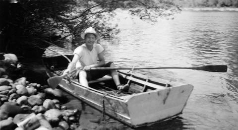
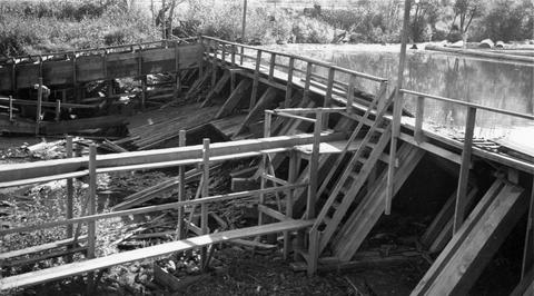
1. [Image] Small storage dam
 Small storage dam on the Tualatin River, located 3 miles above the mouth It is 3 feet high but the downstream apron makes passage difficult; 1937-06-24
Citation -
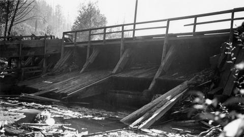
2. [Image] Small storage dam
 Small storage dam on the Tualatin River, located 3 miles above the mouth It is 3 feet high but the downstream apron makes passage difficult; 1937-06-24
Citation -
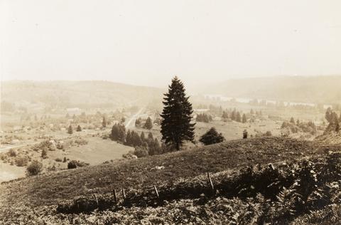
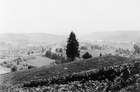
3. [Image] Barn (Tualatin, Oregon)
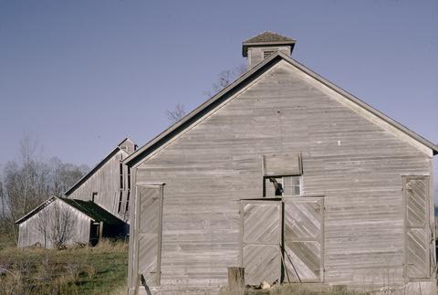 This image is included in Building Oregon: Architecture of Oregon and the Pacific Northwest, a digital collection which provides documentation about the architectural heritage of the Pacific Northwest....
Citation -
5. [Image] Bridge over the Tualatin River
-
"February 1998."
Citation -
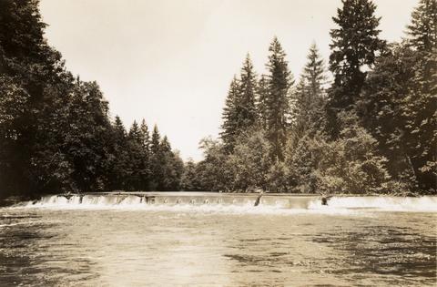
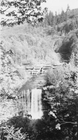
7. [Image] Falls in Tualatin River
 Falls in Tualatin River 3-4 miles above Cherry Grove, Oregon; 1940-09-15 From Album 1 page 39
Citation -
8. [Image] Falls in the Tualatin River
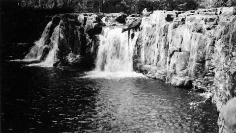 Falls in the Tualatin River located about 3-4 miles above the town of Cherry Grove, Oregon; 1940-09-15
Citation -
9. [Image] Falls in Tualatin River
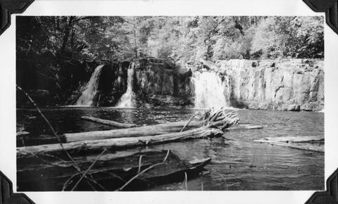 Falls in Tualatin River 3-4 miles above Cherry Grove, Oregon; 1940-09-15 From Album 1 page 39
Citation -
10. [Image] Trees along the Tualatin
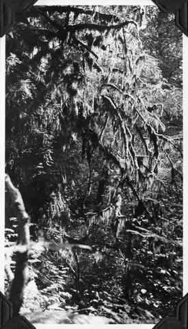 Trees along the Tualatin River heavily hung with moss; near Cherry Grove, Oregon; 1940-09-15 From Album 1 page 39
Citation -
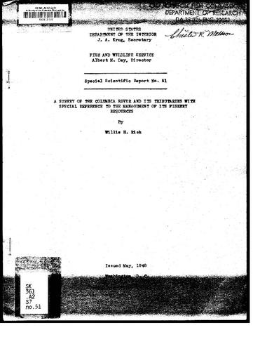 Special scientific report ; no 51
Citation -
12. [Image] Willamette River
 Willamette River near the confluence of the Tualatin River West Linn, Oregon, (near Oregon City) is in the center; 1937-06-23
Citation -
13. [Image] Willamette River
 Willamette River near the confluence of the Tualatin River West Linn, Oregon (near Oregon City) is in the center;1937-06-23
Citation -
The Oregon Plan for Salmon and Watersheds Biennial Report 2005-2007. This is the sixth report on the Oregon Plan for Salmon and Watersheds. The report provides an update on the accomplishments and continuing ...
Citation -
The paper discusses the changes in the hydrology and water use in the Klamath River Watershed and the Lower Klamath Lake prior to and after the Klamath Reclamation Project. Vegetation and soil conditions ...
Citation -
17. [Image] Dam and fish ladder near Glenwood
 Consolidated Lumber Company's dam and fish ladder near Glenwood, Oregon, on Gales Creek, a tributary of the Tualatin River; 1940-09-21
Citation -
18. [Image] Lumber mill dam
 Lumber mill dam on Gales Creek, a tributary of the Tualatin River The Consolidated Lumber Company dam is located above the town of Glenwood; 1940-09-21
Citation -
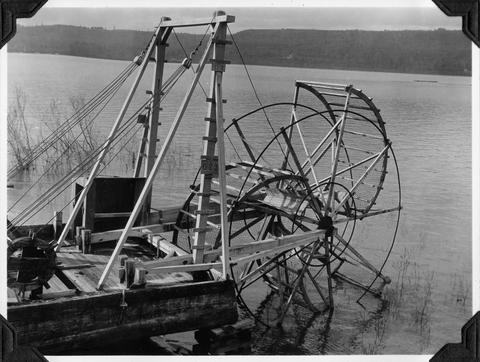
19. [Image] Water wheel
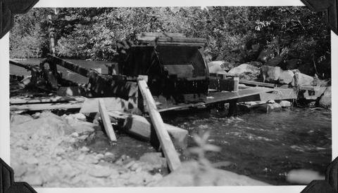 Small water wheel in Gales Creek, tributary to the Tualatin River, above town of Gales Creek, Oregon; used to operate small water pump; 1940-09-19 From Album 1 page 40
Citation -
20. [Image] View of watershed at Hot Springs
 Warm Springs River and watershed area
Citation -
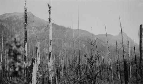
21. [Image] Upper Cispus River watershed
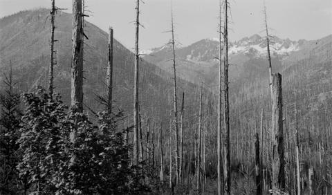 Watershed of Upper Cispus River showing extensive burn-over area
Citation -
22. [Image] Water resources data. Oregon. Water Year 2002
PREFACEThe annual Oregon hydrologic data report is one of a series of annual reports that document hydrologic data gathered from the U.S. Geological Survey's surface- and ground-water data-collection networks ...Citation -
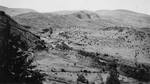
23. [Image] Deschutes River Watershed south of Bend
 Typical watershed covering for some distance south of Bend. Rounded clumps are mainly green-leaf manzanita with some Ceanothus and Ribes
Citation -
24. [Image] Watershed of Upper Cispus River
 Watershed of Upper Cispus River showing extensive burn-over area and mountainous terrain
Citation -
25. [Image] Report of the Oregon Klamath River Commission on water resources and requirements of the Upper Klamath basin
The Oregon Klamath River Commission was given the specific assignment of cooperating with the California Klamath River Commission in formulating and submitting to the legislative assemblies of both state ...Citation -
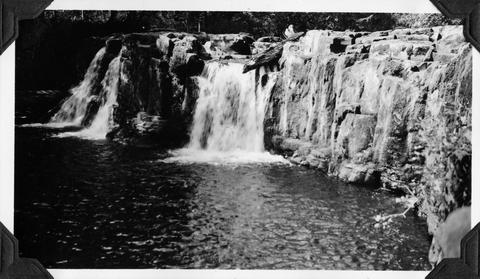
26. [Image] Beaver Creek falls
 Impassable falls on Beaver Creek. The falls are about 60 feet high
Citation -
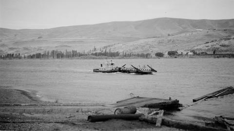
28. [Image] Scow fish wheel on the Columbia River
-
Cover title; "April 2001."; Includes bibliographical references
Citation -
Only portions of issues of The Water Report are available in the Klamath Waters Digital Library. See the full report at http://www.thewaterreport.com/
Citation -
Report (to accompany S. 2882)
Citation -
32. [Image] Maryhill Ferry on the Columbia River
-
36. [Image] City of Ashland Watershed, Reeder Reservoir
-
39. [Image] Ashland watershed/Ashland Loop Rd, Americorps volunteers thinning and peeling Douglas-fir poles (1st view)
Used in historic-structure rehabilitation projects.Citation -
40. [Image] Ashland watershed/Ashland Loop Rd, Americorps volunteers thinning and peeling Douglas-fir poles (2nd view)
Used in historic-structure rehabilitation projects.Citation -
41. [Image] Ashland watershed/Ashland Loop Rd, Americorps volunteers thinning and peeling Douglas-fir poles (3rd view)
Used in historic-structure rehabilitation projects.Citation -
42. [Image] Klamath River Basin hydrologic conditions prior to the September 2002 die-off of salmon and steelhead
Includes bibliographical references (p. 10)Citation -
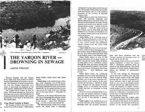
44. [Image] Yarkon River - Drowning in Sewage
-
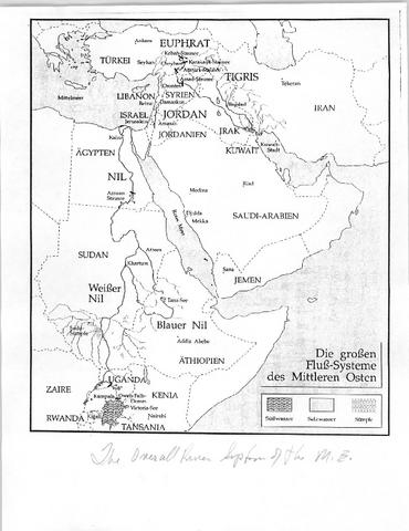
45. [Image] Overall River System of the Middle East
-
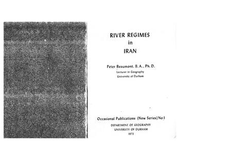
47. [Image] River Regimes in Iran
-
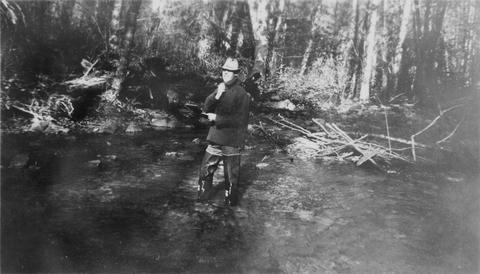
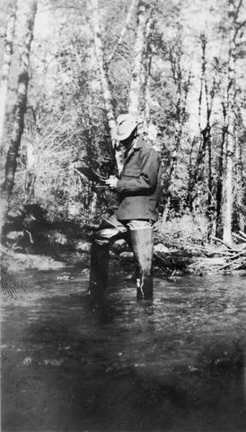
49. [Image] Floyd G Bryant
-
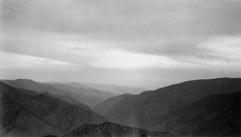
50. [Image] Mt St Helens
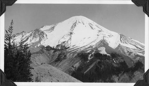 Upper watershed of South ForkToutle River at base of Mt St Helens
Citation -
51. [Image] Frey riding "Taxi"
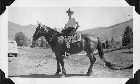 Frey on "Taxi" at start of pack trip into the Middle Fork Salmon River
Citation -
52. [Image] Hi-line logging
 Hi-line logging at Weyerhaeuser Camp #7, near the Green River which is a tributary to North Fork Toutle River
Citation -
53. [Image] Hi-line logging
 Hi-line logging at Weyerhaeuser Camp #7, near the Green River which is a tributary to North Fork Toutle River
Citation -
54. [Image] Hi-line logging
 Hi-line logging at Weyerhaeuser Camp #7, near the Green River which is a tributary to North Fork Toutle River
Citation -
55. [Image] Hi-line logging
 Hi-line logging at Weyerhaeuser Camp #7, near the Green River which is a tributary to North Fork Toutle River
Citation -
56. [Image] Electric speeder
 Electric speeder that took us to WTC Camp #7, at "502" near Green River, a tributary to North Fork Toutle River
Citation -
57. [Image] Quartz Creek stream survey
 Quartz Creek is a tributary to the Cispus River
Citation -
58. [Image] Quartz Creek stream survey
 Quartz Creek is a tributary to the Cispus River
Citation -
59. [Image] Leading horse across the river
 Slim Hendrick on Smokey leading Blue back across the river after the latter horse had rolled down a 30' cliff
Citation -
"Prepared for Klamath Basin Ecosystem Foundation, and the Upper Williamson River Catchment Group, in cooperation with the Upper Klamath Basin Working Group, and the Klamath Watershed Council."
Citation -
 ca. 71 p. A report submitted to the National Resources Committee and the state planning boards of Washington and Oregon by the Pacific Northwest Regional Planning Commission, Columbia Gorge Committee, ...
Citation -
 A black-and-white stereoscopic photograph with the caption "View on the Columbia River, Middle Block House, Cascades". Printing on the cardboard mounting indicates it is number 1264 in the set of "Watkins' ...
Citation -
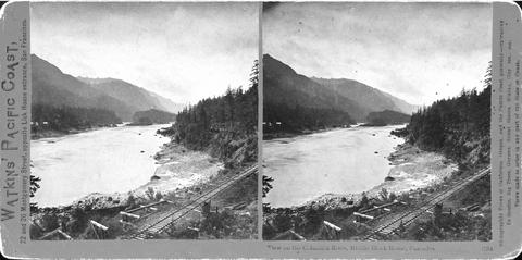 A black-and-white stereoscopic photograph with the caption "View on the Columbia River, Middle Block House, Cascades". Printing on the cardboard mounting indicates it is number 1264 in the set of "Watkins' ...
Citation -
70. [Image] Fire has devastated a considerable number of areas such as this on the Williamson River watershed
KP-1726 - Klamath Project. Despite this lack of cover, erosion damage has not reached aggravated proportions resulting in damage to Upper Klamath Lake; June 18, 1948; Photo by A. J. BurrowsCitation -
"January 2001."
Citation -
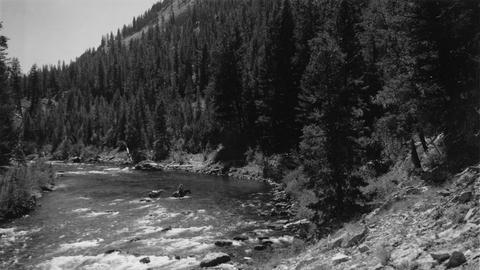
72. [Image] Lower Middle Fork Salmon River country
 Shows the banks of the river and is 6000-8000 feet high
Citation -
73. [Image] Lower Middle Fork Salmon River country
 Looking upstream in the Lower Middle Fork of the Salmon River
Citation -
For years, BPA's only job was to market power from the 28 Federal dams on the Columbia River and its tributaries. Now BPA has a new assignment - to restore fish and wildlife damaged by the development ...
Citation -
Klamath Project (United States); Water use -- Klamath River Watershed (Oregon and California); Water resources development -- Klamath River Watershed (Oregon and California); Irrigation --Klamath River ...
Citation -
76. [Image] Preliminary report on the ground-water resources of the Klamath River Basin, Oregon : Map 2A
Map to accompany the main document: Preliminary report on the ground-water resources of the Klamath River Basin, OregonCitation -
77. [Image] Preliminary report on the ground-water resources of the Klamath River Basin, Oregon : Map 2B
Map to accompany the main document: Preliminary report on the ground-water resources of the Klamath River Basin, OregonCitation -
78. [Image] Preliminary report on the ground-water resources of the Klamath River Basin, Oregon : Map 2C
Map to accompany the main document: Preliminary report on the ground-water resources of the Klamath River Basin, OregonCitation -
79. [Image] Preliminary report on the ground-water resources of the Klamath River Basin, Oregon : Map 2D
Map to accompany the main document: Preliminary report on the ground-water resources of the Klamath River Basin, OregonCitation -
80. [Image] Preliminary report on the ground-water resources of the Klamath River Basin, Oregon : Map 3A
Map to accompany the main document: Preliminary report on the ground-water resources of the Klamath River Basin, OregonCitation -
81. [Image] Preliminary report on the ground-water resources of the Klamath River Basin, Oregon : Map 3B
Map to accompany the main document: Preliminary report on the ground-water resources of the Klamath River Basin, OregonCitation -
85. [Image] Middle Fork Bridge
-
 ca. 71 p. A report submitted to the National Resources Committee and the state planning boards of Washington and Oregon by the Pacific Northwest Regional Planning Commission, Columbia Gorge Committee, ...
Citation -
Some issues include, photographs, maps, and tables for land acquired, hydrographies, contracts, etc.; Description based on Annual rept. of the Klamath project: Oregon and California for calendar year 1913. ...
Citation -
"This report describes results of a reconnaissance level field investigation of the quality of irrigation drain water and the effects of its use on federally managed wildlife refuges in the Klamath Basin, ...
Citation -
Draft; Title from title screen (viewed on Mar. 17, 2006); "October 2005."; "EPA 841-B-05-005."; Includes bibliographical references
Citation -
90. [Image] Preliminary report on the ground-water resources of the Klamath River Basin, Oregon: Map 3C
Map to accompany the main document: Preliminary report on the ground-water resources of the Klamath River Basin, OregonCitation -
91. [Image] Preliminary report on the ground-water resources of the Klamath River Basin, Oregon : Map 3D
Map to accompany the main document: Preliminary report on the ground-water resources of the Klamath River Basin, OregonCitation -
92. [Image] Pulp Ponds
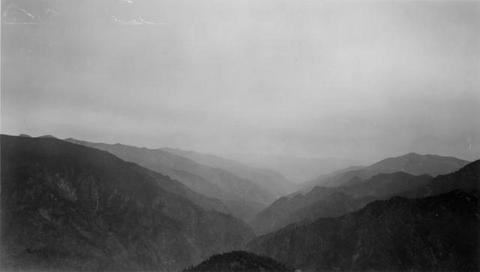
 A cibachrome print of a landscape photograph featuring black shapes bordered by white. The focus is American river watersheds.
Citation -
 399 p. Prepared by the U. S. Bureau of Reclamation, this document outlines a plan for the use of water and other physical resources of the Columbia River Basin. Presented in the report are descriptions ...
Citation -
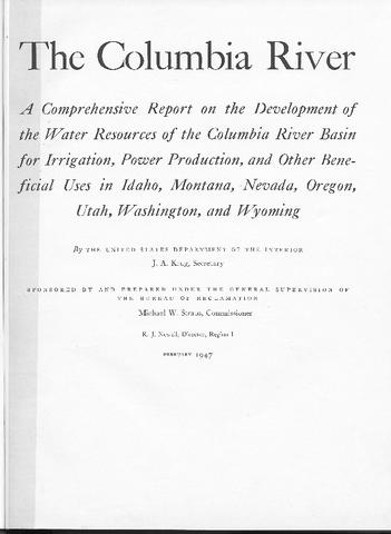 399 p. Prepared by the U. S. Bureau of Reclamation, this document outlines a plan for the use of water and other physical resources of the Columbia River Basin. Presented in the report are descriptions ...
Citation -
95. [Image] Water resources data. Oregon. Water Year 2003
Cover title; Chiefly tablesCitation -
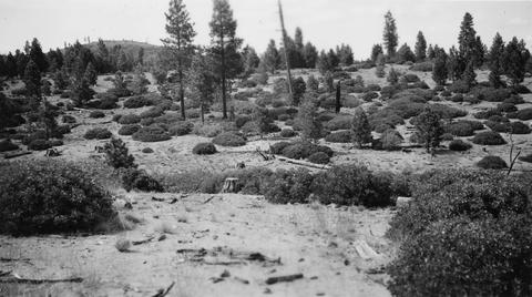
96. [Image] Cutover land
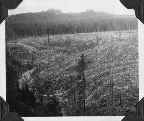 Part of cutover land near Weyerhaeuser Timber Camp #7
Citation -
97. [Image] Loading logs
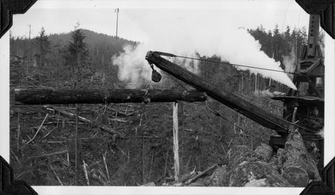 Loading logs on flat cars at Weyerhaeuser Camp #7
Citation -
98. [Image] Ed Wyman cooking breakfast
 Ed Wyman cooking breakfast at edge of Weyerhaeuser cutover area
Citation -
99. [Image] Pack train
 Pack train crossing Independence Pass. There was several miles of snow to lead horse through
Citation -
100. [Image] Douglas fir log
 Big Douglas fir log on train in yard just above "502" station . Bryant is standing on the log
Citation