Search
You searched for:
Start Over
Surface water
Remove constraint Surface water
Material Types
Image
Remove constraint Material Types: Image
« Previous | 1 - 100 of 313 | Next »
Search Results
-
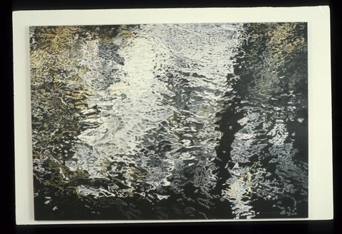
6. [Image] Above the Water
 A rendering of the surface of water in sunlight. Blues, greens, and blues define the surface of the water.; 1980
Citation -
Summary The Upper Klamath Basin (UKB) is a high desert region straddling the California-Oregon border east of the Cascade Range. Irrigation and other agricultural practices in the U. S. Bureau of Reclamation's ...
Citation -
8. [Image] Environment
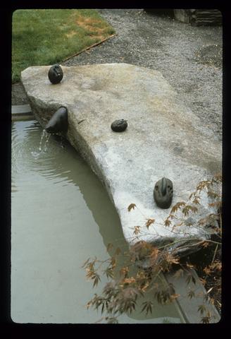 A view of one of the rocks, upon which are three round, black rocks on the surface. Water is flowing out of a black, metalic drain pipe connected to the rock.
Citation -
Geothermal systems are described for Imperial Valley and The Geysers, California; Klamath Falls, Oregon; and the Rio Grande Rift Zone, New Mexico; including information on location, area, depth, temperature, ...
Citation -
A description of the Atlantic Coastal Plains Geothermal Drilling Program and data for the following Geothermal test holes drilled in New Jersey are summarized: Site No. 40, Fort Monmouth; Site No. 41, ...
Citation -
This 71 page document is a bibliography of reports, with abstracts of energy research and technology
Citation -
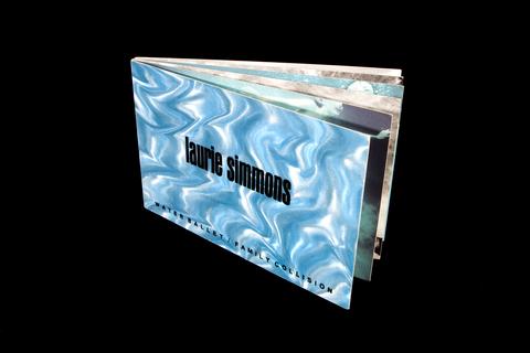 Six pieces of heavy weight card make up both the covers and pages of this book. The covers are surfaced with a shimmery metallic paper that looks like the surface of water. Color and black and white ...
Citation -
13. [Image] Duckweed Goldfish Brocade
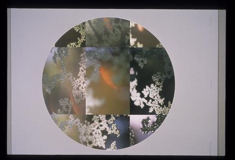 This photographic collage presents a gridded combination of what appears to be goldfish swimming beneath the surface of water and plant forms.; 1988
Citation -
"OF-01-01"
Citation -
Access to the near-surface fresh water zone of this enormous unconfined ground-water aquifer is Albuquerque's greatest economic asset to accommodate growth. Utilizing the vast subsurface hot-water system ...
Citation -
KP-2349-R2 - Klamath Project--BUTTE VALLEY. Water surface in drain 2' below ground surface. NW1/4N1/4, Sec. 24, T 45 N, R 2 W; August 14, 1956; Photo by K. J. Greene
Citation -
18. [Image] Water resources data. Oregon. Water Year 2003
Cover title; Chiefly tablesCitation -
A geothermal test borehole, DWR Dunes No. 1, was drilled in the Dunes geothermal anomaly by the State of California Department of Water Resources. Water samples from this geothermal system were collected ...
Citation -
20. [Image] Lost River Channel Improvement
KP-2115-R2. Lost River Channel Improvement. Looking upstream from Sta. 132 on left bank. Excavation along right bank is only partially completed. Water surface has been lowered approximately 2 feet; March ...Citation -
KP-2122-R2 - Klamath Project. Pumping Plant "F", Unit 1 - Flapgates in operation. Water surface elevation 4085.30; June 13, 1952; Photo by C. O. Wamstad
Citation -
22. [Image] Utilization of geothermal energy in the mining and processing of tungsten ore: 2nd quarterly report
The completed geochemical analysis of groundwater in the Pine Creek area for evaluation of the geothermal potential of this location is presented. Also included is an environmental constraints analysis ...Citation -
The development activities for a plan for Louisiana's participation in a Gulf Coast regional research and systems analysis activity. In developing preliminary planning scenarios heavy emphasis was placed ...
Citation -
A comparative assessment of five potential hydrothermal-magma sites for this facet of the Thermal Regimes part of the CSDP has been prepared for the DOE Office of Basic Energy Sciences. The five sites ...
Citation -
25. [Image] Comparative assessment of five potential sites for hydrothermal-magma systems: energy transport
A comparative assessment of five sites is being prepared as part of a Continental Scientific Drilling Program (CSDP) review of thermal regimes for the purpose of scoping areas for future research and drilling ...Citation -
27. [Image] Under Water
 A bright, ceramic-tile mural that depicts five swimmers from a view that intersects the surface of the water. Some of the swimmers are completely under water while others break the surface.; 1992-07
Citation -
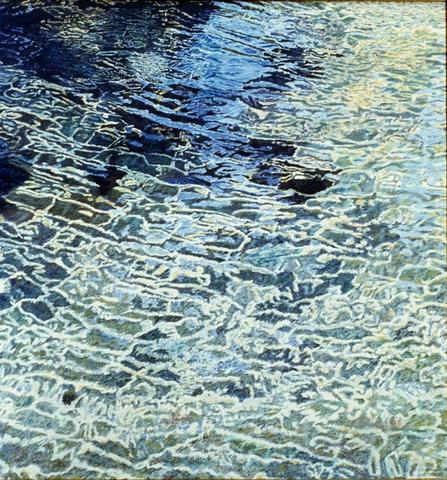
31. [Image] Day at Eagle Creek
 Intense blues and greens render what appears to be the surface of moving water.; 1980
Citation -
ill.; "With a section on chemistry of the lakes by A.S. Van Denburgh;" "Studies of water-budget balance in volcanic terranes for three lakes without surface outlets;" Includes bibliographical references ...
Citation -
Includes bibliographical references (p. 22)
Citation -
35. [Image] The Water Report - Klamath water bank OR
Only portions of issues of The Water Report are available in the Klamath Waters Digital Library. See the full report at http://www.thewaterreport.com/Citation -
36. [Image] Water resources data. Oregon. Water Year 2002
PREFACEThe annual Oregon hydrologic data report is one of a series of annual reports that document hydrologic data gathered from the U.S. Geological Survey's surface- and ground-water data-collection networks ...Citation -
Only portions of issues of The Water Report are available in the Klamath Waters Digital Library. Explanation of abbreviations in title include: Federal Energy Regulatory Commission (FERC) and the Klamath ...
Citation -
CN-12-200-37A Gerber Watershed - Klamath Project, Oregon-California. Looking easterly at Gerber Reservoir from top of Gerber Dam. Note that the boat dock located at the far end of the water area in the ...
Citation -
40. [Image] Rocks at Taft
 A coastal scene that depicts a view of a clustering of buildings at the shoreline from a vantage point behind an outcropping of rocks, some distance down the shore. The surface of the water separates the ...
Citation -
41. [Image] Rocks at Taft
 A coastal scene that depicts a view of a clustering of buildings at the shoreline from a vantage point behind an outcropping of rocks, some distance down the shore. The surface of the water separates the ...
Citation -
P12-200-2780A Klamath River - Klamath Project--Oregon. View of Klamath River upstream from Keno Regulating Dam, showing noticeable riffle in water surface at narrow section near boom anchor cribs which ...
Citation -
P12-200-2849NA Gerber Dam, Klamath Project, Oregon-California. View from top of dam looking down at access hole in ice, water surface elevation 1823.2. First divers returning after removing timber cover ...
Citation -
P12-201-4545NA Klamath Project, OR-CA. Center Canal Flume Bridge. Photo taken from south side of flume where the bridge crosses, looking to the NW of flume inlet. Note water surface and disturbance on ...
Citation -
45. [Image] Pumping Plant "F", Unit 1
KP-2124-R2 - Klamath Project. Pumping Plant "F", Unit 1. View looking in discharge chamber from back of structure showing stilling well boxes on left installed by representative of Economy Pump, Inc., ...Citation -
46. [Image] Secret Swimmers
 A stylized and brightly colored mural depicting the silhouettes of three swimmers and the edges of what appear to be diving platforms. White, squiggly lines over the swimmers and the squiggly rendering ...
Citation -
 The steamship Princess May run aground on Sentinel Island in Alaska. This large steamship has its bow sticking up in the air as its midsection rests on a a patch of rocky protrusions extending above the ...
Citation -
 The steamship Princess May run aground on Sentinel Island in Alaska. This large steamship has its bow sticking up in the air as its midsection rests on a a patch of rocky protrusions extending above the ...
Citation -
The Fairfax Foster Sutter No. 2 well, located in the East Franklin area of St. Mary Parish, Louisiana, is the first successful test of a geopressured-geothermal aquifer under the Well-of-Opportunity program. ...
Citation -
50. [Image] Nutrient loading of surface waters in the Upper Klamath Basin : agricultural and natural sources
Abstract Implementation of the Federal Clean Water Act and Oregon Senate Bill 1010 is proceeding under two simultaneous processes in Oregon. The Oregon Department of Environmental Quality is responsible ...Citation -
Abstract Everest, Fred H.; Stouder, Deanna J.; Kakoyannis, Christina; Houston, Laurie; Stankey, George; Kline, Jeffery; Alig, Ralph. 2004. A review of scientific information ...
Citation -
52. [Image] Crater Lake limnological studies: final report
ill., maps; July 1993."; "Cooperative Park Studies Unit, College of Forestry, Oregon State University."; Includes bibliographical references.; This title is a culmination of the first 10-years of the Crater ...Citation -
53. [Image] Geographical analysis of Klamath Lakes
Undergraduate student project, Writing 227, Technical WritingCitation -
P-12-200-4158NA Klamath Project - Oregon-California. View of drain pipe in trench. The operator raised the coulters for this view. Photo shows 8-inch pipe about 6.5 ft. below natural ground surface. ...
Citation -
Water and geology: how does geology control where you find and how you use water? / Roddey, James -- Through the eyes of the state geologist / Beaulieu, John D. -- What is groundwater? -- Geology and groundwater ...
Citation -
"July 2003."; "GAO-03-514."
Citation -
A monthly natural flow history was determined for the 1949 to 2000 period at the Keno gage of the Upper Klamath River basin in south-central Oregon. Included within the evaluation is an assessment of natural ...
Citation -
58. [Image] Trout Needs Trees
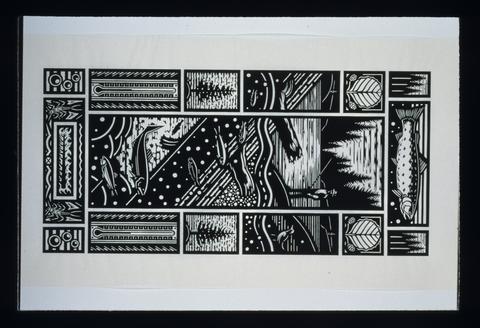 This print divides the main picture plane from the surrounding decorative border of images geometrically. The main picture plane, a vertical rectangle, occupies the center of the piece, and it depicts ...
Citation -
59. [Image] Wild Future/Wet Hands
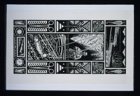 This print divides the main picture plane from the surrounding decorative border of images geometrically. The main picture plane, a vertical rectangle, occupies the center of the piece, and it depicts ...
Citation -
60. [Image] Klamath Project annual history, 1952
Klamath Project (United States); Water use -- Klamath River Watershed (Oregon and California); Water resources development -- Klamath River Watershed (Oregon and California); Irrigation --Klamath River ...Citation -
61. [Image] An airplane school
 Our airplane school scattered in different parts of the country are among our most active training centers. This view on the field of the aviation school at Mineola, N.Y. indicates the activities at these ...
Citation -
62. [Image] PH003_N23 Roy C. Andrews photographs; PH003_P23
 Black and white image. Two women and one man stand on a boat looking out into a glacier-filled landscape. The people stand near the boat's grated metal railing. The women are dressed in hats and long ...
Citation -
CONTENTS THE WATER RESOURCES COMMISSION AND DEPARTMENT 1c "To serve the public by practicing and promoting wise long-term water management. " 1.¨REGON WATER LAWS 22 water management in Oregon 2.°ATER PROTECTIONS ...
Citation -
ill., maps; "June 1995;" Includes bibliographical references and index; NPS D-35; FES 95-27; Also available via Internet as PDF file through Southern Oregon Digital Archives: http://soda.sou.edu. Search ...
Citation -
65. [Image] Ecology of streams of Crater Lake National Park
ill., maps; Final report to the U.S. Dept. of the Interior, National Park Service under cooperative agreement no. CA 9000-3-0003, subagreement no. 9.; "October 30, 1987.";Citation -
ill., map; Report title; Includes bibliographical references
Citation -
Includes Klamath River Basin; Chiefly tables; Includes indexes; Prepared in cooperation with the states and other agencies
Citation -
PURPOSE, SCOPE AND METHODOLOGY A reconnaissance study was designed to collect, compile, and analyze data to determine if ground-water use would interfere with surface water sources near Big Bonanza Springs. ...
Citation -
69. [Image] Natural flow of the upper Klamath River
Executive Summary Executive Summary This report presents details of the investigation and results in estimating the natural flow of the upper Klamath River at Keno, Oregon. The area investigated includes ...Citation -
ill. (some color), maps; "Printed October 28, 1998." - T.p.; Bibliography: p. 29-35
Citation -
ill., maps; Includes bibliographical references;
Citation -
1982-2002; ill, maps; Report title; CA 9000-3-0003 Subagreement 8; Includes appendices: Crater Lake Liminological Studies 1988 and 1989; "Submitted by Robert E. Benton, Superintendent Crater Lake National ...
Citation -
"Nov. 9, 2000, (S. 2882)."; "114 Stat. 2221."; "Public Law 106-498."
Citation -
74. [Image] A geologic and hydrologic reconnaissance of Lava Beds National Monument and vicinity, California
A GEOLOGIC AND HYDROLOGIC RECONNAISSANCE OF LAVA BEDS NATIONAL MONUMENT AND VICINITY, CALIFORNIA By William R. Hotchkiss ABSTRACT Lava Beds National Monument is on the Modoc Plateau in Modoc and ...Citation -
75. [Image] Water supply of Crater Lake, Oregon
Accompanied with tables, pictures, field notes, National Park Service publications, references and correspondence; Typescript and holographCitation -
iii; 99p.; "Printed for the use of the Committee on Energy and Natural Resources"; Distributed to some depository libraries in microfiche
Citation -
77. [Image] Geological limnology of Crater Lake, Oregon
ill.; Three folded plates in pocket; Thesis (M.S.)--University of Minnesota, 1961; Bibliography: leaves 168-175Citation -
Only portions of issues of The Water Report are available in the Klamath Waters Digital Library. FERC is an abbreviation for Federal Energy Regulatory Commission. See the full report at http://www.thew...
Citation -
Pages 14-18 blank; "OF - 02 - 004"
Citation -
80. [Image] A Geological and Geophysical Study of the Geothermal Energy Potential of Pilgrim Springs, Alaska
The Pilgrim Springs geothermal area, located about 75 km north of Nome, was the subject of an intensive, reconnaissance-level geophysical and geological study during a 90-day period in the summer of 1979. ...Citation -
81. [Image] Modeling hydrodynamics and heat transport in upper Klamath Lake, Oregon, and implications for water quality
Title from PDF title screen (viewed on June 13, 2008); Includes bibliographical references;Citation -
82. [Image] Geothermal exploration assessment and interpretation, Upper Klamath Lake Area, Klamath Basin, Oregon
Data from public and private sources on the Klamath Basin geothermal resource are reviewed, synthesized, and reinterpreted. In this, the second and final phase of the work, geological, remote sensing, ...Citation -
83. [Image] The Water Report - The Oregon Water Resources Department: an interview with director Paul Cleary
Only portions of issues of The Water Report are available in the Klamath Waters Digital Library. See the full report at http://www.thewaterreport.com/Citation -
The study examines two species of sucker,the shortnose sucker(chasmistes brevirostrix), and the Lost River sucker,(deltisties luxatus) that inhabit Upper Klamath Lake and the effects of chronic toxicity ...
Citation -
1982-2002; ill.; Includes bibliographic references; Issues lack volume numbering
Citation -
The Department of the Interior, Klamath River Basin, Work Plans and Reports
Citation -
This report is a review of scientific research done by various organizations involved in the Klamath Reclamation Project to assess the "status and management of coho salmon in the Klamath River and . . ...
Citation -
Determining Surface Water Availability in Oregon By Richard M. Cooper, PE Abstract The Oregon Water Resources Department (Department or OWRD) limits appropriation from Oregon streams to assure new applicants ...
Citation -
89. [Image] Klamath Basin GIS directory
The Klamath Basin Ecosystem Restoration Office (ERO) - Humboldt State University Geographic Information Systems Work Group (HSU-GIS Group) was established to support ERO's mission to develop an ecosystem ...Citation -
Executive Summary This report documents an appraisal-level evaluation of raising Upper Klamath Lake in south-central Oregon. The lake is the State's largest freshwater lake and is a principal storage feature ...
Citation -
The Klamath River basin, including the adjacent Lost River basin, includes about ?,5>OO square miles of plateaus, mountain-slopes and valley plains in south-central Oregon* The valley plains range in altitude ...
Citation -
Only portions of issues of The Water Report are available in the Klamath Waters Digital Library. See the full report at http://www.thewaterreport.com/
Citation -
Title from cover; "May 1991."; Includes bibliographical references (p. 19)
Citation -
SUMMARY The geology and hydrology of the Basin and Range Province of the western conterminous United States are characterized in a series of data sets depicted in maps compiled for evaluation of prospective ...
Citation -
Only portions of issues of The Water Report are available in the Klamath Waters Digital Library. See the full report at http://www.thewaterreport.com/
Citation -
"Ratified by state of Oregon, April 17, 1957 ... and state of California, April 17, 1957 ... consented to by the United States Congress ..."; "[R]epresentative of the United States of America, the States ...
Citation -
98. [Image] Water quality monitoring : technical guide book
"July 1999."Citation -
99. [Image] Environmental assessment for snowmobile rulemaking in Crater Lake National Park, January 2001
ill., maps; "00383.O1D-CRATER LAKE"; "NPSD-306 Jan 2001"; Includes bibliographical referencesCitation -
ill., maps; "August, 1994"; Includes appendices; "Jones/Winter use 08/22/94e."
Citation