Search
You searched for:
Start Over
Olalla Creek-Lookingglass Creek Watershed
Remove constraint Olalla Creek-Lookingglass Creek Watershed
Material Types
Image
Remove constraint Material Types: Image
« Previous | 1 - 100 of 176 | Next »
Search Results
-
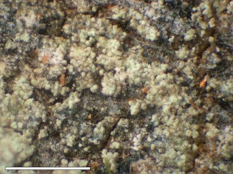
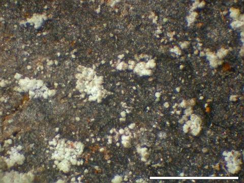
1. [Image] Opegrapha rufescens
 Spores; Location: Near Olalla Creek; Substrate: Bark, Fraxinus latifolia; Elevation: 233 meters.
Citation -
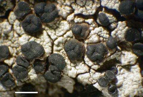
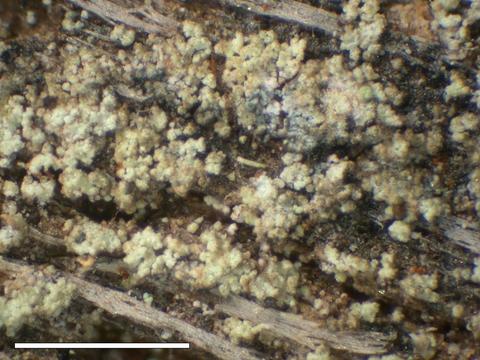
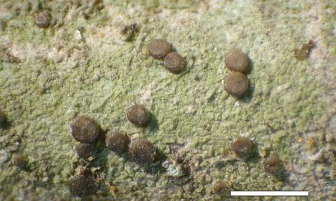
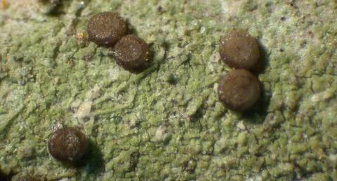
2. [Image] Opegrapha rufescens
 Habit; Location: Near Olalla Creek; Substrate: Bark, Fraxinus latifolia; Elevation: 233 meters.
Citation -
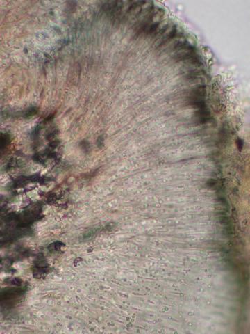
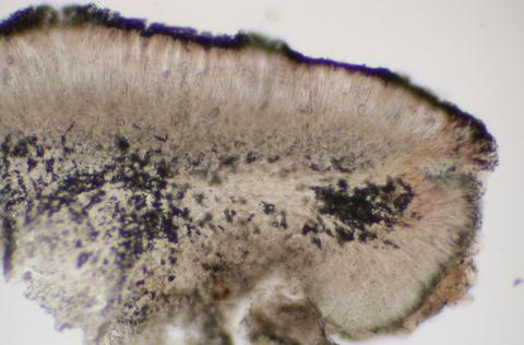
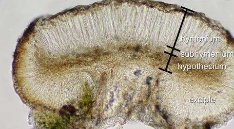
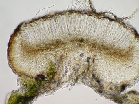
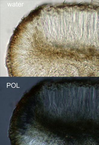
3. [Image] Opegrapha rufescens
 Apothecial section; Location: Near Olalla Creek; Substrate: Bark, Fraxinus latifolia; Elevation: 233 meters.
Citation -
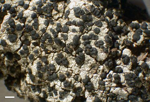
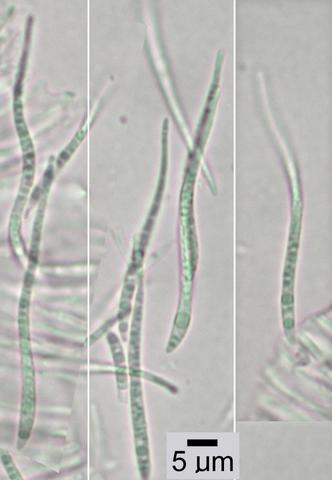
4. [Image] Opegrapha rufescens
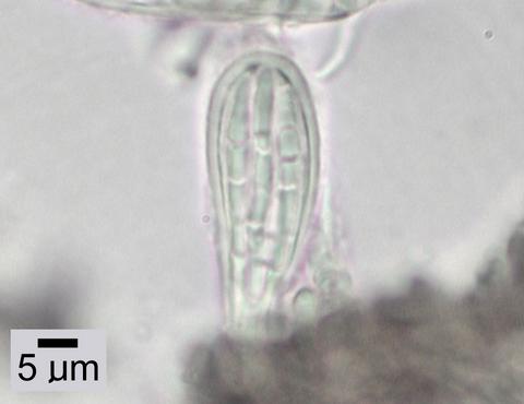 Ascus; Location: Near Olalla Creek; Substrate: Bark, Fraxinus latifolia; Elevation: 233 meters.
Citation -
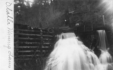
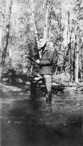
5. [Image] Olalla mining dam
-
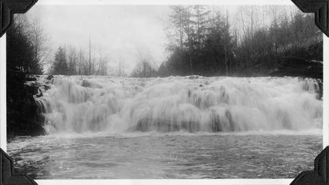
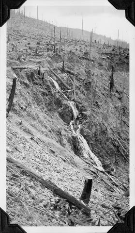
6. [Image] Beaver Creek falls
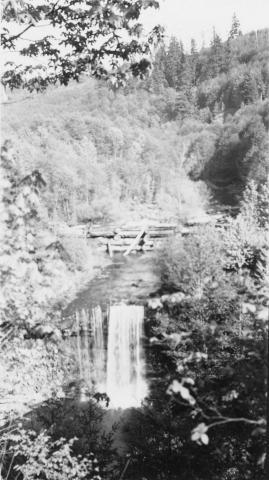 Impassable falls on Beaver Creek. The falls are about 60 feet high
Citation -
7. [Image] Spencer Creek pilot watershed analysis
"Prepared by an interagency (BLM, USFS, EPA, USFWS), interdisplinary team as part of the pilot program for revising the federal interagency guide to watershed analysis"--P. 1-3; "The Spencer Creek Watershed ...Citation -
Cover title; Chiefly tables
Citation -
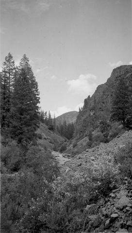
9. [Image] Watershed between Loon and Cougar Creeks
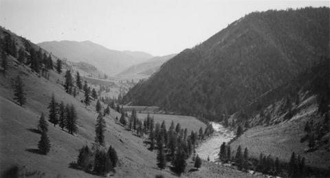 Typical watershed between Loon and Cougar Creeks. Broad benches are common
Citation -
KP-2452-R2 - Klamath Project - CLEAR CREEK WATERSHED; February 21, 1958; Photo by K. J. Greene
Citation -
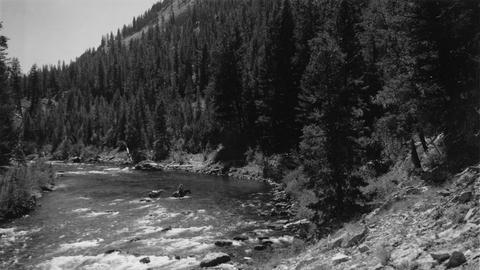
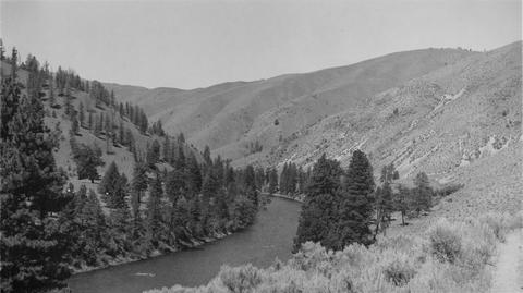 Looking downstream from high point in trail a short distance below Cougar Creek
Citation -
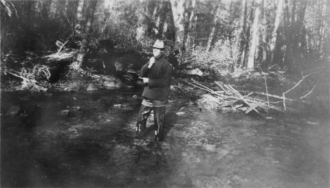
12. [Image] Leading horse across the river
 Slim Hendrick on Smokey leading Blue back across the river after the latter horse had rolled down a 30' cliff
Citation -
13. [Image] Water resources data. Oregon. Water Year 2002
PREFACEThe annual Oregon hydrologic data report is one of a series of annual reports that document hydrologic data gathered from the U.S. Geological Survey's surface- and ground-water data-collection networks ...Citation -
14. [Image] Marble Creek box canyon
 Typical watershed topography below the box canyon near Marble Creek, Idaho
Citation -
15. [Image] Falls on Bear Creek
 Falls on Bear Creek near Clatskanie, Oregon
Citation -
16. [Image] Quartz Creek stream survey
 Quartz Creek is a tributary to the Cispus River
Citation -
17. [Image] Quartz Creek stream survey
 Quartz Creek is a tributary to the Cispus River
Citation -
KP-2453-R2 - Klamath Project - CLEAR LAKE WATERSHED. Note dikes and canals; February 21, 1958; Photo by K. J. Greene
Citation -
19. [Image] CLEAR CREEK WATERSHED
KP-2451-R2 - Klamath Project - CLEAR CREEKWATERSHED. View looking southeast to Steele Swamp in background. Confluence of Boles Creek and Willow Creek at left; February 21, 1958; Photo by K. J. GreeneCitation -
"Prepared for Klamath Basin Ecosystem Foundation, and the Upper Williamson River Catchment Group, in cooperation with the Upper Klamath Basin Working Group, and the Klamath Watershed Council."
Citation -
21. [Image] CLEAR LAKE WATERSHED
KP-2450-R2 - Klamath Project - CLEAR LAKE WATERSHED. Boles Meadow from northwest showing dike at entrance to channel and possible dam site in Boles Creek in foreground; February 21, 1958; Photo by K. ...Citation -
24. [Image] Along Sevenmile Creek, Lake County
-
25. [Image] Steep falls in small creek
 Steep Falls in small creek about 1 mile east of Weyerhaeuser Camp #7
Citation -
26. [Image] Ashland Creek Road, two horsemen
-
28. [Image] Tolman Creek Road, flood damage
-
30. [Image] Palmer Creek Ditch
-
31. [Image] Palmer Creek 'China Walls'
-
EXECUTIVE SUMMARY Limited historical references indicate that bull trout Salvelinus confluentus in Oregon were once widely spread throughout at least 12 basins in the Klamath River and Columbia River ...
Citation -
36. [Image] City of Ashland Watershed, Reeder Reservoir
-
37. [Image] Ashland watershed/Ashland Loop Rd, Americorps volunteers thinning and peeling Douglas-fir poles (1st view)
Used in historic-structure rehabilitation projects.Citation -
38. [Image] Ashland watershed/Ashland Loop Rd, Americorps volunteers thinning and peeling Douglas-fir poles (2nd view)
Used in historic-structure rehabilitation projects.Citation -
39. [Image] Ashland watershed/Ashland Loop Rd, Americorps volunteers thinning and peeling Douglas-fir poles (3rd view)
Used in historic-structure rehabilitation projects.Citation -
The Oregon Plan for Salmon and Watersheds Biennial Report 2005-2007. This is the sixth report on the Oregon Plan for Salmon and Watersheds. The report provides an update on the accomplishments and continuing ...
Citation -
"Open file report SW 04-001"
Citation -
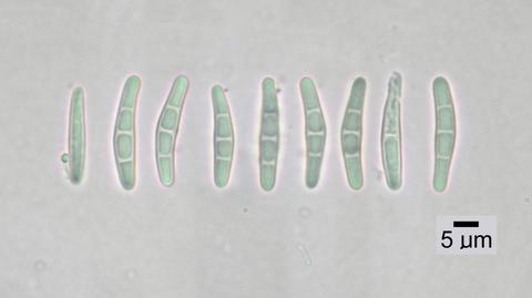
42. [Image] Lecidella laureri
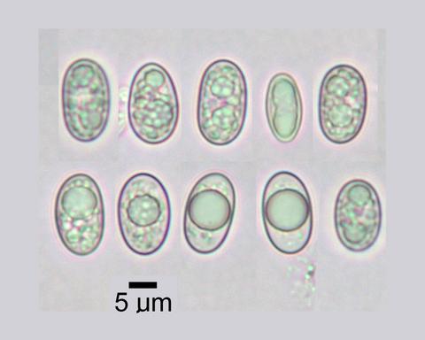 Spores; Habitat: Pinus albicaulis - Abies lasiocarpa krummholz and short trees and alpine tundra; Location: Watershed of South Meadow Creek, Tobacco Root Mountains, 9.6 km W of McAllister; Substrate: Bark, ...
Citation -
43. [Image] Lecidella laureri
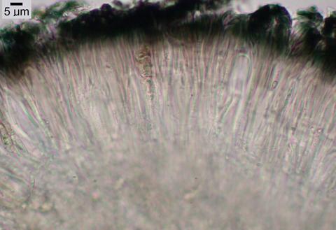 Hymenium; Habitat: Pinus albicaulis - Abies lasiocarpa krummholz and short trees and alpine tundra; Location: Watershed of South Meadow Creek, Tobacco Root Mountains, 9.6 km W of McAllister; Substrate: ...
Citation -
44. [Image] Lecidella laureri
 Habit; Habitat: Pinus albicaulis - Abies lasiocarpa krummholz and short trees and alpine tundra; Location: Watershed of South Meadow Creek, Tobacco Root Mountains, 9.6 km W of McAllister; Substrate: Bark, ...
Citation -
45. [Image] Lecidella laureri
 Exciple; Habitat: Pinus albicaulis - Abies lasiocarpa krummholz and short trees and alpine tundra; Location: Watershed of South Meadow Creek, Tobacco Root Mountains, 9.6 km W of McAllister; Substrate: ...
Citation -
46. [Image] Lecidella laureri
 Apothecial section; Habitat: Pinus albicaulis - Abies lasiocarpa krummholz and short trees and alpine tundra; Location: Watershed of South Meadow Creek, Tobacco Root Mountains, 9.6 km W of McAllister; ...
Citation -
47. [Image] Lecidella laureri
 Apothecia; Habitat: Pinus albicaulis - Abies lasiocarpa krummholz and short trees and alpine tundra; Location: Watershed of South Meadow Creek, Tobacco Root Mountains, 9.6 km W of McAllister; Substrate: ...
Citation -
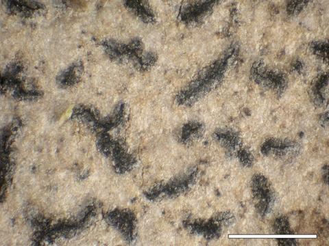
48. [Image] Lecidea nylanderi
 Habit; Habitat: Floodplain forest with Acer macrophyllum, Alnus rhombifolia, and Calocedrus decurrens; Location: Small creek in upper watershed of Little Applegate River; Substrate: Bark, Calocedrus decurrens ...
Citation -
49. [Image] Lecidea nylanderi
 Habit; Habitat: Floodplain forest with Acer macrophyllum, Alnus rhombifolia, and Calocedrus decurrens; Location: Small creek in upper watershed of Little Applegate River; Substrate: Bark, Calocedrus decurrens ...
Citation -
50. [Image] Lecidea nylanderi
 Habit; Habitat: Floodplain forest with Acer macrophyllum, Alnus rhombifolia, and Calocedrus decurrens; Location: Small creek in upper watershed of Little Applegate River; Substrate: Bark, Calocedrus decurrens ...
Citation -
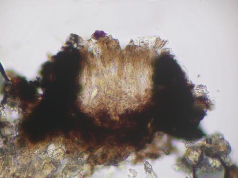
51. [Image] Bacidia arceutina
 Apothecial section; Habitat: Mature Pseudotsuga forest with diverse herbs and shrubs on low bench, just above floodplain; Location: Rock Creek valley inside gate to Corvallis Watershed, east base of Marys ...
Citation -
52. [Image] Bacidia arceutina
 Spores; Habitat: Mature Pseudotsuga forest with diverse herbs and shrubs on low bench, just above floodplain; Location: Rock Creek valley inside gate to Corvallis Watershed, east base of Marys Peak; Substrate: ...
Citation -
53. [Image] Bacidia arceutina
 Apothecial section; Habitat: Mature Pseudotsuga forest with diverse herbs and shrubs on low bench, just above floodplain; Location: Rock Creek valley inside gate to Corvallis Watershed, east base of Marys ...
Citation -
54. [Image] Bacidia arceutina
 Exciple; Habitat: Mature Pseudotsuga forest with diverse herbs and shrubs on low bench, just above floodplain; Location: Rock Creek valley inside gate to Corvallis Watershed, east base of Marys Peak; Substrate: ...
Citation -
55. [Image] Bacidia arceutina
 Habit; Habitat: Mature Pseudotsuga forest with diverse herbs and shrubs on low bench, just above floodplain; Location: Rock Creek valley inside gate to Corvallis Watershed, east base of Marys Peak; Substrate: ...
Citation -
56. [Image] Bacidia arceutina
 Apothecia; Habitat: Mature Pseudotsuga forest with diverse herbs and shrubs on low bench, just above floodplain; Location: Rock Creek valley inside gate to Corvallis Watershed, east base of Marys Peak; ...
Citation -
57. [Image] Pack string crossing talus slope
 Pack string crossing slide rock area above Elkhorn Creek, Idaho
Citation -
58. [Image] Gerber-Willow Valley Watershed Analysis
x, 386 p., ill., maps (some col.); Cover title; "July 2003"Citation -
Draft; Title from title screen (viewed on Mar. 17, 2006); "October 2005."; "EPA 841-B-05-005."; Includes bibliographical references
Citation -
DOCS I 49.107: 89 ( 1.1) 89( 1.1) EVALUATION OF SITE SPECIFIC RESTORATION PROJECTS FOR THE ENTIRE KLAMATH RIVER BASIN. 1989 Klamath Field Review Comments The following comments are based primarily upon ...
Citation -
Only portions of issues of The Water Report are available in the Klamath Waters Digital Library. See the full report at http://www.thewaterreport.com/
Citation -
62. [Image] Hosler Dam under construction
From slideCitation -
63. [Image] Reeder Reservoir
-
64. [Image] Reeder Reservoir, empty
-
65. [Image] Dredge and dredging at Reeder Reservoir
From slideCitation -
66. [Image] Hosler Dam
-
67. [Image] Ashland Fire of 1959, ground view 1
(from the 'Red' Thomas Collection)Citation -
68. [Image] Ashland Fire of 1959, ground view 2
(from the 'Red' Thomas Collection)Citation -
69. [Image] Ashland Fire of 1959, aerial view 1
(from the 'Red' Thomas Collection)Citation -
70. [Image] Ashland Fire of 1959, aerial view 2
(from the 'Red' Thomas Collection)Citation -
71. [Image] Ashland Fire of 1959, ground view 3
-
72. [Image] Ashland Fire (1st view)
From slideCitation -
73. [Image] Ashland Fire (2nd view)
From slideCitation -
80. [Image] Recovery strategy for California Coho salmon : report to the California Fish and Game Commission
"February 2004."Citation -
KLAMATH RIVER RECOVERY UNIT CHAPTER OF THE BULL TROUT RECOVERY PLAN EXECUTIVE SUMMARY CURRENT SPECIES STATUS Klamath River bull trout were listed as a distinct population segment ...
Citation -
The Department of the Interior, Klamath River Basin Work Plans and Reports
Citation -
83. [Image] Progress report for investigations on Blue Creek, fiscal year 1992, Blue Creek, California
PROGRESS REPORT FOR INVESTIGATIONS ON BLUE CREEK FT 1992 ABSTRACT The U.S. Fish and Wildlife Service, Coastal California Fishery Resource Office in Arcata, California, was funded to investigate chinook ...Citation -
A monthly natural flow history was determined for the 1949 to 2000 period at the Keno gage of the Upper Klamath River basin in south-central Oregon. Included within the evaluation is an assessment of natural ...
Citation -
Determining Surface Water Availability in Oregon By Richard M. Cooper, PE Abstract The Oregon Water Resources Department (Department or OWRD) limits appropriation from Oregon streams to assure new applicants ...
Citation -
ABSTRACT Phase VI of the School-Based Klamath Restoration Project (319h) is a collaborative effort between seven Siskiyou County schools, the Siskiyou County Office of Education (SCOE), and the United ...
Citation -
FINAL PROGRESS REPORT FOR FISHERIES INVESTIGATIONS ON BLUE CREEK, TRIBUTARY TO K1AMATH RIVER, NORTHERN CALIFORNIA FY 1993 (October 1992 - September 1993) ABSTRACT The U.S. Fish and Wildlife Service, ...
Citation -
"April 1998"--P. [4] of cover; Includes bibliographical references (p. 57-66)
Citation -
Public Review Draft 4- 27- 05 Conservation Plan Miller Lake Lamprey, Lampetra ( Entosphenus) minima April, 2005 Executive summary - The Miller Lake Lamprey was believed extinct after a chemical treatment in ...
Citation -
90. [Image] Lost River and shortnose sucker : proposed critical habitat : biological support document : draft
Proposed rule from Federal Register, vol. 59, no. 230, December 1, 1994, pages 61744-61759, inserted after p. 35; Includes biliographical references (p. 31-35)Citation -
Abstract The Klamath River Riparian Fence Project includes the design and construction of 3 segments of livestock exclusion fence along both sides of the Klamath River. Fences are located along the river ...
Citation -
U. S. Die artment sf the Interior Bu. rea. u oP L and Management K I W ~ Falls R~& G urnw . 2795 & tdeaonAvepue, BuMng #% Klamath F~ HSO, r egon 97803 . . January 2004 Klamath Falls Resource Area Planning ...
Citation -
93. [Image] Upper Klamath Basin bull trout conservation strategy : part 1, a conceptual framework for recovery, final
EXECUTIVE SUMMARY This document presents the framework of a plan to reverse the decline of bull trout (Salvelinus confluentus) populations in the Klamath Basin. If successful, we expect bull trout ...Citation -
"April, 1999."
Citation -
95. [Image] Natural flow of the upper Klamath River
Executive Summary Executive Summary This report presents details of the investigation and results in estimating the natural flow of the upper Klamath River at Keno, Oregon. The area investigated includes ...Citation -
ABSTRACT With the decreasing runs of natural fall chinook salmon* Oncorhmchus tshawytscha.inthe Klamath River basin, concerns were raised regarding the accuracy ma significance 01 me mainstem Klamath River ...
Citation -
CN-12-200-34A Gerber Watershed - Klamath Project, Oregon-California. Upstream view of Wild Horse Diversion Channel headgate. Note -- stoplogs must be placed in stoplog slots to prevent water from entering ...
Citation -
98. [Image] Lower Klamath River instream flow study : scoping evaluation for the Yurok Indian Reservation
ABSTRACT The U.S. Fish and Wildlife Service, Lower Columbia River Fishery Resource Office was funded by Bureau of Indian Affairs to conduct an instream flow assessment for the lower Klamath River within ...Citation -
We, the U.S. Fish and Wildlife Service (Service), designate critical habitat for the Klamath River and Columbia River populations of bull trout {Salvelinus confluentus) pursuant to the Endangered Species ...
Citation -
100. [Image] School-based Klamath River restoration project, phases V, VI & VII, 319h Clean Water Act
ABSTRACT Phase VI of the School-Based Klamath Restoration Project (319h) is a collaborative effort between seven Siskiyou County schools, the Siskiyou County Office of Education (SCOE), and the United ...Citation