Search
You searched for:
Start Over
Land use history
Remove constraint Land use history
Material Types
Image
Remove constraint Material Types: Image
« Previous | 1 - 100 of 3,178 | Next »
Search Results
-
EXECUTIVE SUMMARY This document presents the framework of a plan to reverse the decline of bull trout (Salvelinus confluentus) populations in the Klamath Basin. If successful, we expect bull trout ...
Citation -
3. [Image] Annual project history and O. & M. report of the Klamath Project, Oregon-California, 1931
Information Of Interest Source of water supply: Upper Klamath Lake, Lost River and Clear Lake. Area of drainage basin: 3,700 square miles. Length of irrigation season: From April 15 to September ...Citation -
Some issues include, photographs, maps, and tables for land acquired, hydrographies, contracts, etc.; Description based on Annual rept. of the Klamath project: Oregon and California for calendar year 1913. ...
Citation -
5. [Image] Klamath Project annual history, 1949
Ill., maps (some color), photographs; Includes fiscal year financials, photographs, maps, crop and livestock yields, irrigation and drainage and irrigation pumping plant operations, WPA camp maintenance, ...Citation -
6. [Image] Annual project history and O. & M. report of the Klamath Project, Oregon-California, 1932
Ill., maps (some color), photographs; Includes fiscal year financials and contracts, land acquired, land leased, project organization chart, litigations, photographs, maps, hydrographs, etc.; Includes ...Citation -
7. [Image] Annual project history and O. & M. report of the Klamath Project, Oregon-California, 1935
Ill., maps (some color), photographs; Includes fiscal year financials and contracts, land acquired, land leased, project organization chart, litigations, photographs, maps, hydrographs, etc.; Includes ...Citation -
8. [Image] Annual project history and O. & M. report of the Klamath Project, Oregon-California, 1941
Ill., maps (some color), photographs; Includes fiscal year financials and contracts, land acquired, land leased, project organization chart, litigations, photographs, maps, hydrographs, etc.; Includes ...Citation -
Ill., maps (some color), photographs; Includes financial documents, organization chart, photographs, maps, water quality reports, and agricultural economics; Includes index; Title covers: calendar years ...
Citation -
10. [Image] Reclaiming Tule Lake land
KP-1113-R2; Looking out across NW1/4. Section 2, T.46 N., R.4 E. Area near pumps used in draining the land; April 17, 1945; Photo by R. S. HopkinsCitation -
11. [Image] Annual project history and O. & M. report of the Klamath Project, Oregon-California, 1926
Ill., maps (some color), photographs; Includes fiscal year financials and contracts, land acquired, land leased, project organization chart, litigations, photographs, maps, hydrographs, etc.; Includes ...Citation -
12. [Image] Annual project history and O. & M. report of the Klamath Project, Oregon-California, 1918
Ill., maps (some color), photographs; Includes fiscal year financials and contracts, land acquired, land leased, project organization chart, litigations, photographs, maps, hydrographs, etc.; Includes ...Citation -
13. [Image] Annual project history and O. & M. report of the Klamath Project, Oregon-California, 1919
Ill., maps (some color), photographs; Includes fiscal year financials and contracts, land acquired, land leased, project organization chart, litigations, photographs, maps, hydrographs, etc.; Includes ...Citation -
14. [Image] Annual project history and O. & M. report of the Klamath Project, Oregon-California, 1921
Ill., maps (some color), photographs; Includes fiscal year financials and contracts, land acquired, land leased, project organization chart, litigations, photographs, maps, hydrographs, etc.; Includes ...Citation -
15. [Image] Annual project history and O. & M. report of the Klamath Project, Oregon-California, 1927
Ill., maps (some color), photographs; Includes fiscal year financials and contracts, land acquired, land leased, project organization chart, litigations, photographs, maps, hydrographs, etc.; Includes ...Citation -
16. [Image] Annual project history and O. & M. report of the Klamath Project, Oregon-California, 1928
Ill., maps (some color), photographs; Includes fiscal year financials and contracts, land acquired, land leased, project organization chart, litigations, photographs, maps, hydrographs, etc.; Includes ...Citation -
17. [Image] Annual project history and O. & M. report of the Klamath Project, Oregon-California, 1929
Ill., maps (some color), photographs; Includes fiscal year financials and contracts, land acquired, land leased, project organization chart, litigations, photographs, maps, hydrographs, etc.; Includes ...Citation -
18. [Image] Annual project history and O. & M. report of the Klamath Project, Oregon-California, 1930
Ill., maps (some color), photographs; Includes fiscal year financials and contracts, land acquired, land leased, project organization chart, litigations, photographs, maps, hydrographs, etc.; Includes ...Citation -
19. [Image] Annual project history and O. & M. report of the Klamath Project, Oregon-California, 1934
Ill., maps (some color), photographs; Includes fiscal year financials and contracts, land acquired, land leased, project organization chart, litigations, photographs, maps, hydrographs, etc.; Includes ...Citation -
20. [Image] Annual project history and O. & M. report of the Klamath Project, Oregon-California, 1936
Ill., maps (some color), photographs; Includes fiscal year financials and contracts, land acquired, land leased, project organization chart, litigations, photographs, maps, hydrographs, etc.; Includes ...Citation -
21. [Image] Annual project history and O. & M. report of the Klamath Project, Oregon-California, 1937
Ill., maps (some color), photographs; Includes fiscal year financials and contracts, land acquired, land leased, project organization chart, litigations, photographs, maps, hydrographs, etc.; Includes ...Citation -
22. [Image] Annual project history and O. & M. report of the Klamath Project, Oregon-California, 1938
Ill., maps (some color), photographs; Includes fiscal year financials and contracts, land acquired, land leased, project organization chart, litigations, photographs, maps, hydrographs, etc.; Includes ...Citation -
23. [Image] Annual project history and O. & M. report of the Klamath Project, Oregon-California, 1939
Ill., maps (some color), photographs; Includes fiscal year financials and contracts, land acquired, land leased, project organization chart, litigations, photographs, maps, hydrographs, etc.; Includes ...Citation -
24. [Image] Annual project history and O. & M. report of the Klamath Project, Oregon-California, 1940
Ill., maps (some color), photographs; Includes fiscal year financials and contracts, land acquired, land leased, project organization chart, litigations, photographs, maps, hydrographs, etc.; Includes ...Citation -
25. [Image] Annual project history and O. & M. report of the Klamath Project, Oregon-California, 1942
Ill., maps (some color), photographs; Includes fiscal year financials and contracts, land acquired, land leased, project organization chart, litigations, photographs, maps, hydrographs, etc.; Includes ...Citation -
26. [Image] Annual project history and O. & M. report of the Klamath Project, Oregon-California, 1943
Ill., maps (some color), photographs; Includes fiscal year financials and contracts, land acquired, land leased, project organization chart, litigations, photographs, maps, hydrographs, etc.; Includes ...Citation -
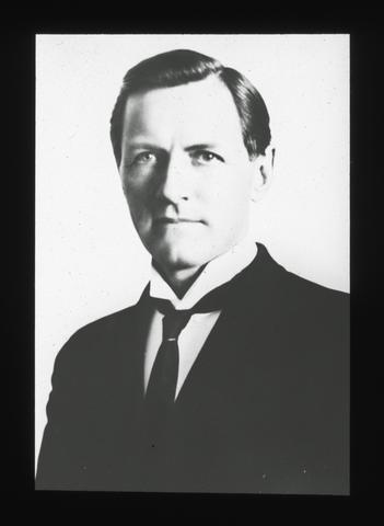
27. [Image] F. H. Carter, member of the Carter Land Co.
Also a member of the Board of Regents for many years.Citation -
Ill., maps (some color), photographs; Includes fiscal year financials, maps, photographs, agricultural economics and crop yield, some grazing financial information with cost of water usage, tables for ...
Citation -
Klamath Project (United States); Water use -- Klamath River Watershed (Oregon and California); Water resources development -- Klamath River Watershed (Oregon and California); Irrigation --Klamath River ...
Citation -
30. [Image] Klamath Project annual history, 1950
Ill., maps (some color), photographs; Includes fiscal year financials, photographs, maps, crop and livestock yields, irrigation and drainage and irrigation pumping plant operations, WPA camp maintenance, ...Citation -
Ill., maps (some color), photographs; Includes organization of Klamath District with official correspondence and description of the Klamath project, an organization chart, fiscal year financials, photographs, ...
Citation -
Title covers: May 1, 1903 to December 31, 1912 in a single issue; Dates of the beginning year(s) of publication are derived from the 1903 to December 31, 1912, History of the Klamath Project and from ...
Citation -
The history of geothermal exploration in Hawaii is reviewed briefly. The nature and occurrences of geothermal resources are presented island by island. An overview of geothermal markets is presented. Other ...
Citation -
34. [Image] Klamath Project annual history, 1951
Ill., maps (some color), photographs; Includes fiscal year financials, photographs, maps, crop and livestock yields, irrigation and drainage and irrigation pumping plant operations, WPA camp maintenance, ...Citation -
Ill., maps (some color), photographs; Includes fiscal year financials, maps, photographs, agricultural economics and crop yield, some grazing financial information with cost of water usage, tables for ...
Citation -
INTRODUCTION AND GENERAL General Description of the Project Location. The Klamath Project is in the Upper Klamath River Basin, east of the Cascade Range. It is located in Klamath County, Oregon, and ...
Citation -
Ill., maps (some color), photographs; Includes fiscal year financials, maps, photographs, agricultural economics and crop yield, some grazing financial information with cost of water usage, tables for ...
Citation -
Ill., maps (some color), photographs; Includes organization of Klamath District with official correspondence and description of the Klamath project, an organization chart, fiscal year financials, photographs, ...
Citation -
Some issues include, photographs, maps, and tables for land acquired, hydrographies, contracts, etc.; Description based on Annual report of the Klamath project: Oregon and California for calendar year ...
Citation -
Ill., maps (some color), photographs; Includes organization of Klamath District with official correspondence and description of the Klamath project, an organization chart, fiscal year financials, photographs, ...
Citation -
41. [Image] Region II Klamath Project annual history, 1945
Ill., maps (some color), photographs; Includes fiscal year financials, photographs, crop and livestock yields, water storage and distribution, hydrography report, etc.; Title covers: calendar years for ...Citation -
42. [Image] Nevada Fact Book and Energy Reference
The purpose of this working document is to serve Nevada Operations Office management authorities and other DOE officials as a quick and convenient general reference. It also may be useful as a starting ...Citation -
43. [Image] On Grants City Point Railroad
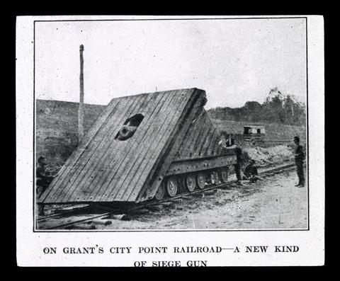 The Federals were not the first to use a gun mounted on the railway trucks. In the defense of Richmond during the Seven Days' and at the attack on Savage's Station the Confederates had mounted a field ...
Citation -
44. [Image] Klamath Project annual history, 1952
Klamath Project (United States); Water use -- Klamath River Watershed (Oregon and California); Water resources development -- Klamath River Watershed (Oregon and California); Irrigation --Klamath River ...Citation -
INTRODUCTION AND GENERAL Genex*al Description of the Project Location. The Klamath Project is in the Upper Klamath River Basin, east of the Cascade Range. It is located in Klamath Comity, Oregon, ...
Citation -
"BLM/OR/WA/PL-02/038+1792"--P. [2] of cover; Cover title; Includes bibliographical references (v. 2, p. 219-228) and index
Citation -
Humans have altered the Klamath River Canyon in many ways. This study focuses on the years from 1955 to 2003. One substantial alteration is the conversion of terraces into irrigated pastures for agriculture ...
Citation -
48. [Image] The doctrine of prior appropriation : effects upon water rights in the Upper Klamath Basin
Undergraduate student project, Geomatics 466, Boundary Law IICitation -
49. [Image] A Bucyrus-Erie dragline dumping soil in Tulelake
KP-1194-R2 - Klamath Project. Region II. Another yard and a half of soil in Tulelake is dumped from a Bucyrus Erie dragline that is being used to construct a new drain to take care of the expanding agricultural ...Citation -
P12-201-4309 NA Klamath Project, OR-CA. Break in earth dike holding farm land flood water. Dike located on west side of KSD. Approx. 8 man hours and 2 hrs. of Case 580 time was used; January 17, 1977; ...
Citation -
51. [Image] Klamath Falls Resource Area resource management plan and environmental impact statement : final : Volume 2
Proposed resource management plan/final environmental impact statement for the Klamath Falls Resource AreaCitation -
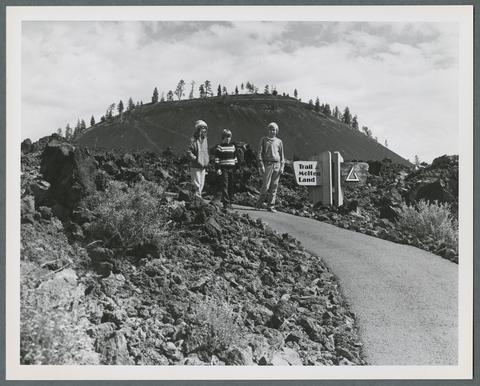 "Interpretive trails take visitors in central Oregon's lava lands around Lava Butte's crater, over recent lava flows, and through surrounding pine forests. The Deschutes National Forest's Lava Lands Visitor ...
Citation -
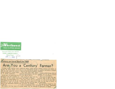 "History on land back to 1860: Are you a 'century' farmer", Albany Democrat-Herald, April 11, 1960
Citation -
54. [Image] William G. Robbins
 William Robbins served as a faculty member in the Oregon State University History Department from 1971 until his retirement in 1999 as Emeritus Distinguished Professor of History. Robbins earned his B.S. ...
Citation -
2 v.: ill., maps; "NPS D-71 March 1988" - [end of both volumes]; Includes bibliographical references.
Citation -
56. [Image] Aerial view of alkali patterns
KP-1724 - Klamath Project. Alkali patterns similar to those shown in this picture present an obstacle to the cultivation of certain lands on the Klamath Project. With proper land management over a period ...Citation -
EXECUTIVE SUMMARY This document describes the rationale for and implementation of an Integrated Land Management (ILM) Plan for the Tule Lake National Wildlife Refuge (NWR). The proposal is the recommendation ...
Citation -
Several varieties are evaluated for bud and bloom development, harvest seasons, yields, soluble solids, acid content, and other factors.
Citation -
Pamphlet, compiled by the Klamath County Agricultural Agent, describing the history and status of the Klamath Project
Citation -
Photographs, maps, and tables for land acquired, hydrographs, contracts, etc.; Description based on Annual Report of the Klamath project: Oregon and California for calendar year 1914; Title covers: calendar ...
Citation -
61. [Image] Seeking refuge: making space for migratory waterfowl and wetlands along the Pacific Flyway
Abstract "Seeking Refuge" examines the history of migratory waterfowl management along the Pacific Flyway, the westernmost of four main migration routes in North America. Drawing on approaches from historical ...Citation -
Some issues include, photographs, maps, and tables for land acquired, hydrographies, contracts, etc.; Description based on Annual rept. of the Klamath project: Oregon and California for calendar year 1913. ...
Citation -
63. [Image] Lakeview proposed resource management plan and final environmental impact statement [volume 3]
4 v.; maps (some col.); "August 2002"; "January 2003" -- coverCitation -
64. [Image] The Klamath Project
"Seventh draft"; Includes bibliographical references and indexCitation -
Quigley, Thomas M.; Arbelbide, Sylvia J., tech. eds. 1997. An assessment of ecosystem components in the interior Columbia basin and portions of the Klamath and Great Basins: volume 1. Gen. Tech. Rep. PNW-GTR-405. ...
Citation -
CONTENTS Page S. 1988 1 Committee Print of S. 1988 2 Departmental reports: Agriculture 9 Budget 10 Interior 4 STATEMENT Brown, Edmund G., Governor, State of California 26 Butcher, ...
Citation -
67. [Image] Lakeview proposed resource management plan and final environmental impact statement [volume 1]
4 v.; maps (some col.); "August 2002"; "January 2003" -- coverCitation -
2 v.: ill., maps; "NPS D-71 March 1988" - [end of both volumes]; Includes bibliographical references
Citation -
illus., maps (part col.);
Citation -
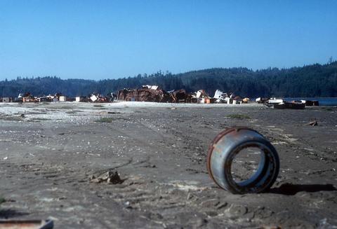
Coffee Can
Citation -
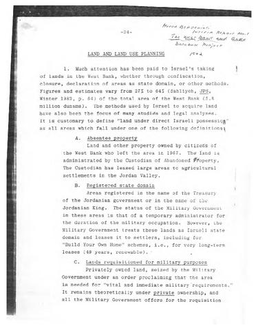
72. [Image] Land and Land Use Planning
-
"February 1994." ; "Much of this document was taken directly from, or based on, the Bureau of Land Management's earlier studies of the Klamath River: the Final eligibility and suitability report for the ...
Citation -
SUMMARY To provide a basis for negotiations of a repayment contract with an irrigation district representing the water users of the Tule Lake Division of the Klamath Project, this report has been prepared. ...
Citation -
75. [Image] Dear concerned citizen
"Bureau of Land Management's (BLM) proposed decision and finding of no significant impact for the Lost River Management Framework Plan amendments."-- P. [1]; August 19, 1988."; "BLM-OR-PT-88-12-1792"--P. ...Citation -
Abstract Everest, Fred H.; Stouder, Deanna J.; Kakoyannis, Christina; Houston, Laurie; Stankey, George; Kline, Jeffery; Alig, Ralph. 2004. A review of scientific information ...
Citation -
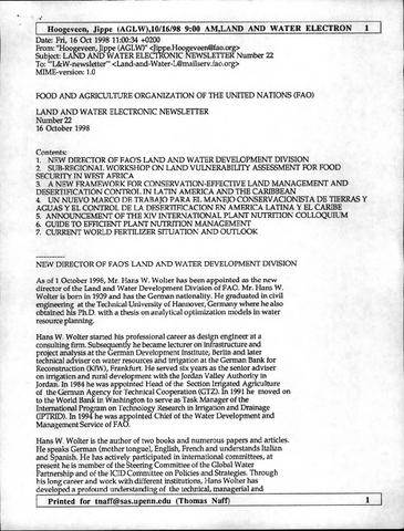
78. [Image] Land and Water Electronic Newsletter
-
79. [Image] OIMB slide 4752
 Hansen Landing with junk
Citation -
80. [Image] OIMB slide 4676
 Hanson's Landing and Kelly Boat Works
Citation -
Some issues include, photographs, maps, and tables for land acquired, hydrographies, contracts, etc.; Description based on Annual rept. of the Klamath project: Oregon and California for calendar year 1913. ...
Citation -
84. [Image] Forestry program for Oregon
This document sets forth the Board of Forestry's strategic vision for Oregon's forests for the next eight yearsCitation -
A monthly natural flow history was determined for the 1949 to 2000 period at the Keno gage of the Upper Klamath River basin in south-central Oregon. Included within the evaluation is an assessment of natural ...
Citation -
Haynes, Richard W.; Graham, Russell T.; Quigley, Thomas M., tech. eds. 1996. A framework for ecosystem management in the Interior Columbia Basin including portions of the Klamath and Great Basins. Gen. ...
Citation -
87. [Image] Botrychium summit: 16 March 1993
Cover title; Includes draft: Species conservation strategy: pumice grape fern, 1992, botrychium pumicola cov. in underw, Deschutes National Forest sensitive plant programCitation -
88. [Image] An examination of the Klamath Basin crisis : restructuring the discourse within an identity-based framework
Thesis (B.A.) -- Whitman College, 2002; Includes bibliographical references (leaves 79-83)Citation -
KP-1382-R2 - Klamath Project. 1946 Land Opening. View of drained lands of Tule Lake, California, taken from approximately the same spot as KP-1381-R2 to show the contrast of the development of the years. ...
Citation -
90. [Image] Panorama view of the head of Poe Valley, Ore.
June 11, 1905 ; Showing a glimpse of Lost River with irrigable lands on both sides of the river, proposed lands to be irrigated under the Klamath River Project. (Also a part of private companies cana...Citation -
This document contains the following information, mostly regarding a proposed rule change about Underground Injection Control: description of the fiscal and economic impact of the proposed rule, assurance ...
Citation -
92. [Image] Preparation plan for the Klamath River management plan and environmental impact statement
"October 2001"; "This planning effort is being undertaken because the current recreation plan is outdated, almost 20 years old . . . At the conclusion of this planning effort there will be one [Environmental ...Citation -
CONTENTS Page. Bill S. 3189 2 Bill H. R. 9493 3 Letter from Secretary of the Interior 3 Statement of- Lawrence A. Liljeqvist, assistant attorney general of Oregon 7, 87,101 Herman Phleger, counsel ...
Citation -
Abstract Quigley, Thomas M.; Haynes, Richard W.; Graham, Russell T., tech. eds. 1996. Integrated scientific assessment for ecosystem management in the interior Columbia basin and portions of the Klamath ...
Citation -
Updated information is presented on activities and progress in the areas of electric power plants, direct heat applications, deep well drilling, leasing of federal lands, legislative and regulatory actions, ...
Citation -
97. [Image] Dr. Joseph Schafer
 Dr. Shafer was for twenty years head of the Department of History at the University of Oregon, and is the author of many books dealing with history of Oregon and the Pacific Coast. His best known work ...
Citation -
98. [Image] Resolving the Klamath
"October 1999"; Cover titleCitation -
KLAMATH RIVER RECOVERY UNIT CHAPTER OF THE BULL TROUT RECOVERY PLAN EXECUTIVE SUMMARY CURRENT SPECIES STATUS Klamath River bull trout were listed as a distinct population segment ...
Citation -
100. [Image] A conservation strategy for the northern spotted owl
ill., maps; Shipping list no.: 90-263-P; "May 1990."; Includes bibliographical referencesCitation