Search
You searched for:
Start Over
Historic stream surveys
Remove constraint Historic stream surveys
Subject
Waterfalls
Remove constraint Subject: Waterfalls
« Previous | 1 - 100 of 172 | Next »
Search Results
-
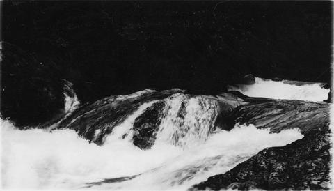
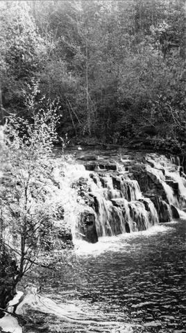
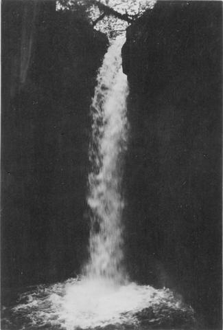
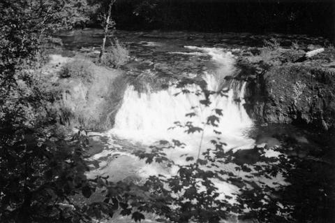
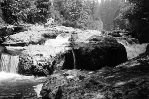
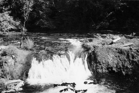
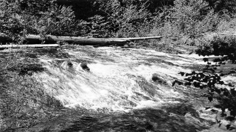
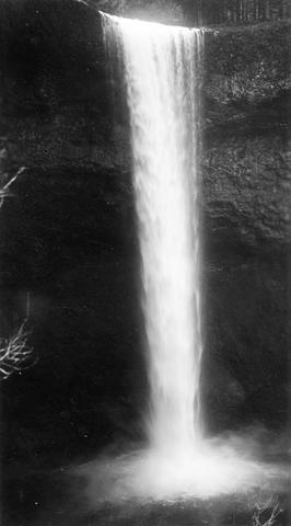
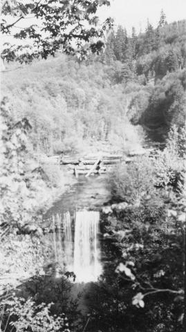
1. [Image] Salt Creek Falls
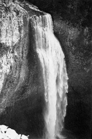 285 foot falls on Salt Creek, tributary to Middle Fork Willamette River;1937-09-10
Citation -
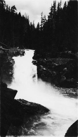
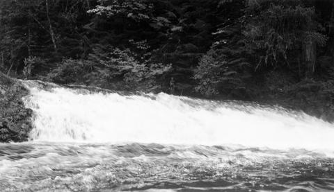
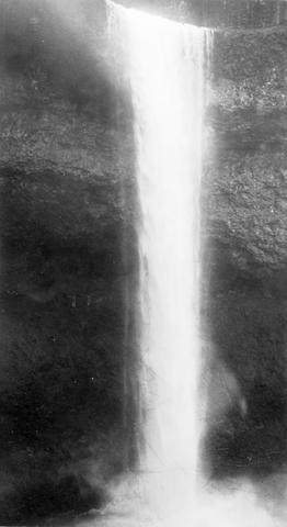
2. [Image] Salt Creek Falls
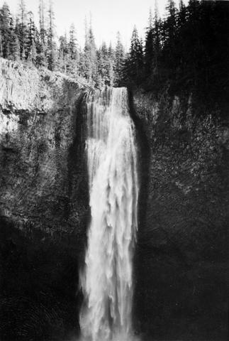 285 foot falls on Salt Creek, tributary to Middle Fork Willamette River;1937-09-10
Citation -
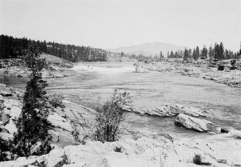
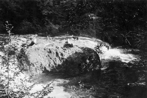
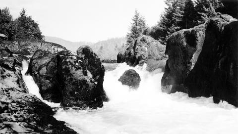
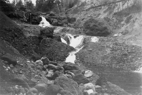
3. [Image] Upper Kettle Falls on the Columbia River
-
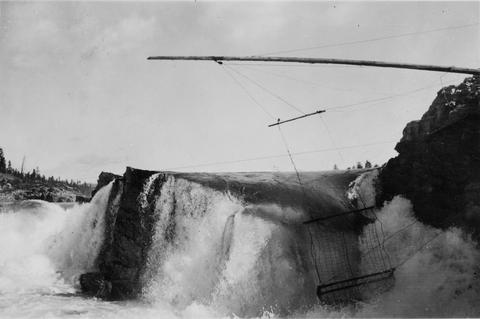
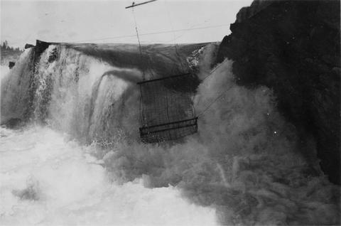
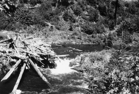
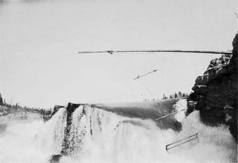
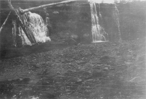
4. [Image] Jump trap at Kettle Falls
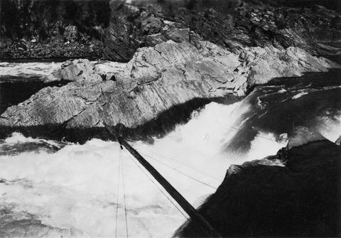 Photo showing "jump trap" at Kettle Falls
Citation -
5. [Image] Indian jump trap
 Indian "jump-trap" on Kettle Falls for steelhead and salmon
Citation -
6. [Image] Youngs River near Astoria, Oregon
-
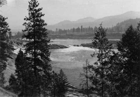
7. [Image] Kettle Falls on the Columbia River
-
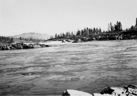
8. [Image] Upper Kettle Falls on the Columbia River
-
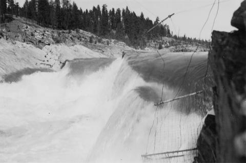
9. [Image] Jump trap at Kettle Falls
-
10. [Image] Jump trap at Kettle Falls
-
11. [Image] Jump trap at Kettle Falls
-
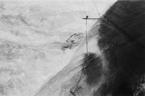
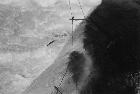
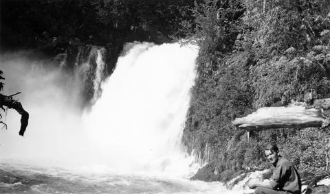
12. [Image] Steelhead jumping the jump trap
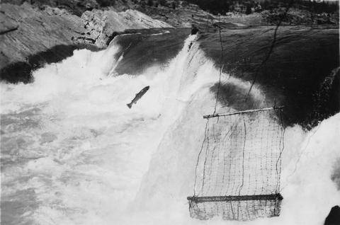 Steelhead jumping the jump trap against Kettle Falls on the Columbia River
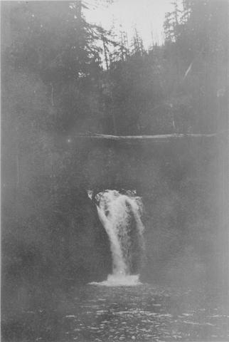
Citation -
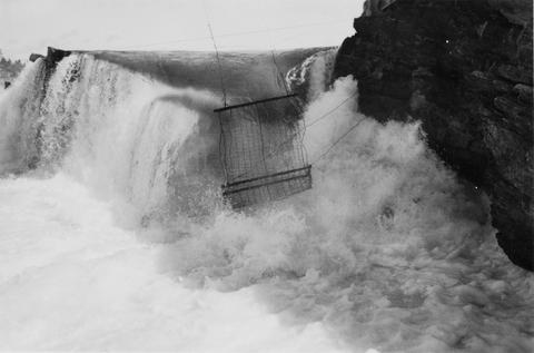
13. [Image] Jump trap at Kettle Falls
 Jump trap at Kettle Falls for steelhead and salmon
Citation -
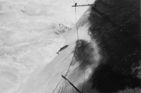
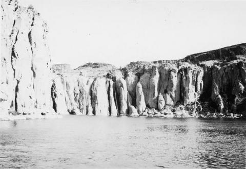
14. [Image] Steelhead jumping Kettle Falls
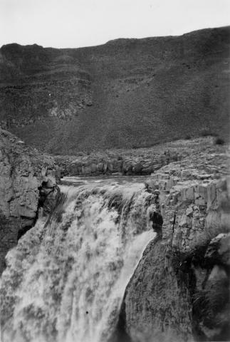
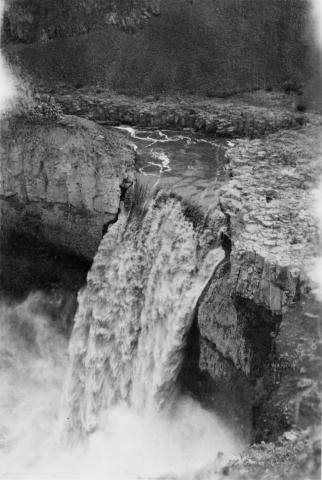
-
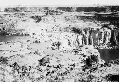
16. [Image] Steelhead jumping Kettle Falls
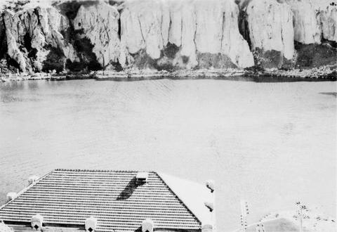
-
17. [Image] Jump trap at Kettle Falls
-
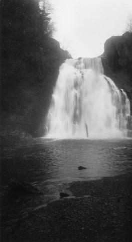
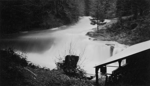
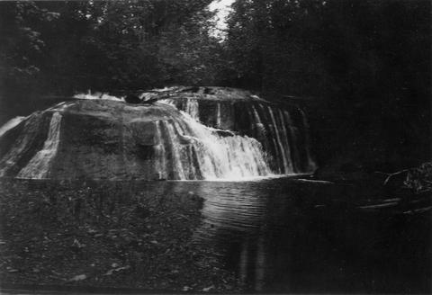
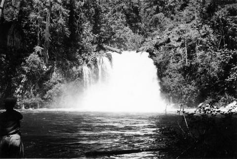
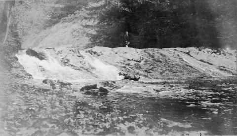
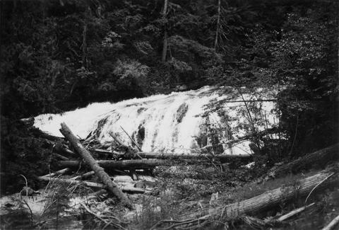
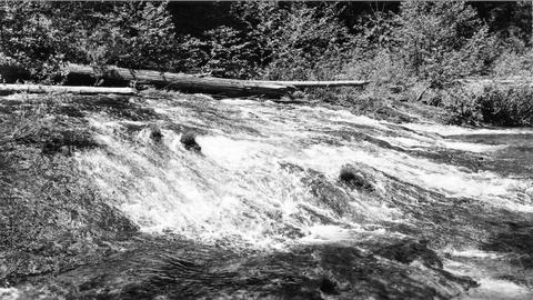
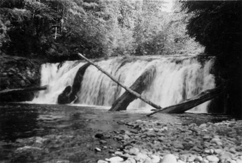
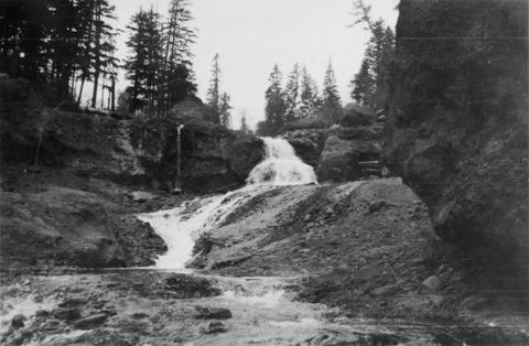
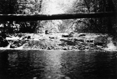
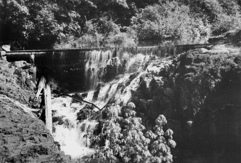
18. [Image] Cedar Creek Falls
 Birdseye view of Cedar Creek falls and small power developement
Citation -
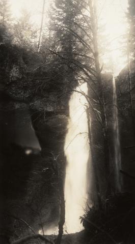
19. [Image] Falls on White Branch
-
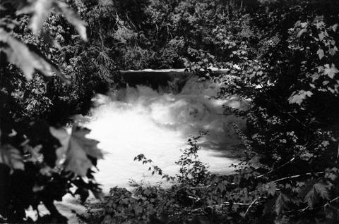
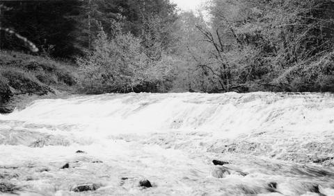
20. [Image] Cedar Creek Falls at high water
-
21. [Image] Frank Brice Creek
-
22. [Image] Frank Brice Creek falls
-
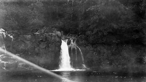
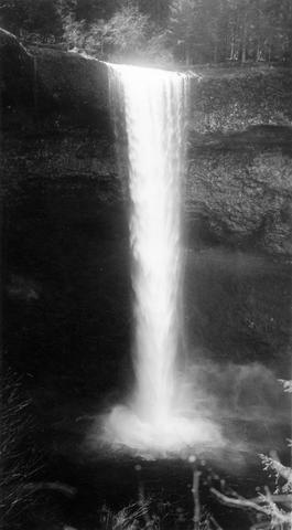
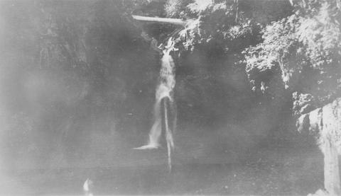
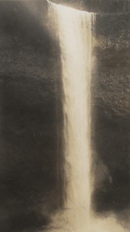
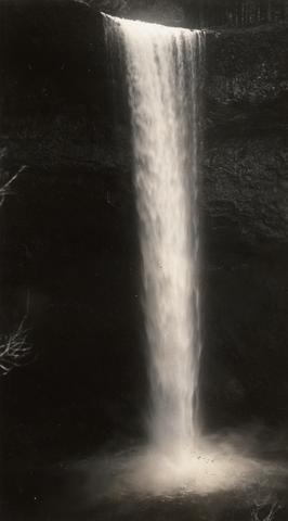
24. [Image] Tamolitch Falls
 Tamolitch Falls on the McKenzie River The falls are 40 feet high;1937-06-26
Citation -
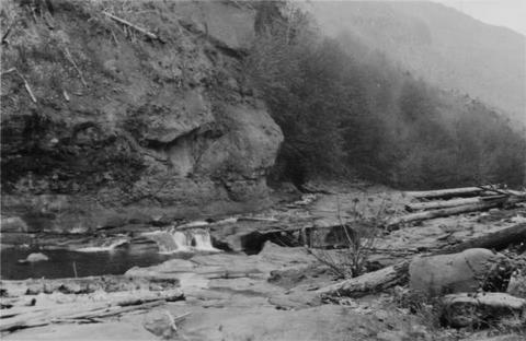
25. [Image] Falls on Beaver Creek
 Upper falls on Beaver Creek which is impassable to fish; 1946-05
Citation -
27. [Image] McKenzie River lower falls
 Lower falls on the McKenzie River;1938-06
Citation -
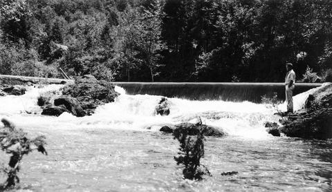
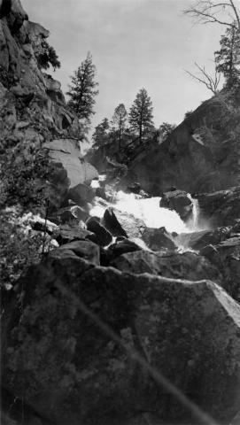
28. [Image] Falls on upper Redfish Lake Creek, Idaho
-
29. [Image] Falls above Timber Creek
 Falls above Timber Creek, tributary to the Washougal River
Citation -
30. [Image] Goble Creek falls
 View of impassable falls on Goble Creek
Citation -
31. [Image] Falls on Little North Fork
-
32. [Image] Albernathy Creek bedrock chute and falls
 Albernathy Creek, a tributary to Columbia River
Citation -
33. [Image] Frank Brice Creek falls
-
34. [Image] Falls on Silver Creek
-
35. [Image] Falls on Little North Fork
-
36. [Image] Coast Fork Willamette River
 Coast Fork Willamette River above Cottage Grove, Oregon;1938-06
Citation -
37. [Image] Albernathy Falls
-
38. [Image] Frank Brice Creek falls
-
39. [Image] Winberry Creek
 Winberry Creek falls at end of survey;1938-05-19
Citation -
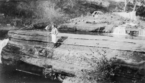
40. [Image] Winberry Creek falls
 Falls on Winberry Creek at end of survey Winberry Creek is a tributary of Fall Creek which is part of the Middle Fork Willamette River system;1938-05-19
Citation -
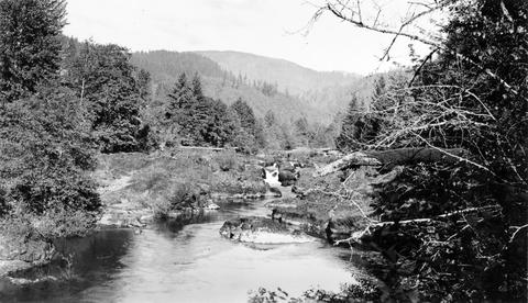
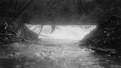
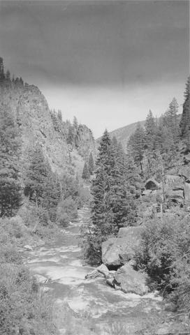 East Fork of Mayfield Creek tributary to Loon Creek which is a tributary to the Middle Fork of the Salmon River. Photo is looking downstream over a cascade section in the stream
Citation -
42. [Image] Gail Falls
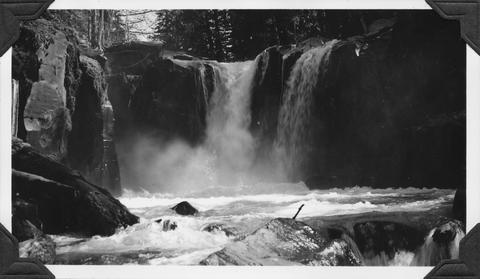 Gail Falls on Cispus River just below Cat Creek confluence
Citation -
43. [Image] Snake River below Shoshone Falls
-
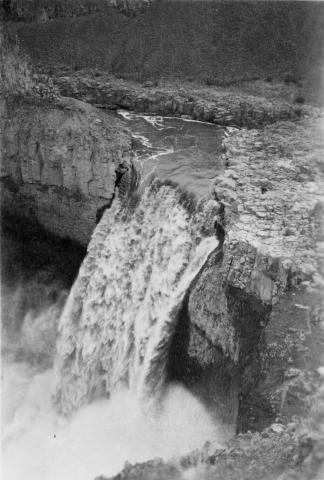
44. [Image] Palouse Falls
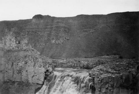 Palouse Falls on the Palouse River. The falls are 164 feet high
Citation -
45. [Image] Shoshone Falls on the Snake River in Idaho
-
46. [Image] Shoshone Falls and power diversion
-
47. [Image] Palouse Falls
 Palouse Falls on the Palouse River. The falls are 164 feet high
Citation -
48. [Image] Palouse Falls
 Palouse Falls on the Palouse River. The falls are 164 feet high
Citation -
49. [Image] Palouse Falls
 Palouse Falls on the Palouse River. The falls are 164 feet high
Citation -
50. [Image] Waterfalls
-
51. [Image] Falls on Ohanapecosh River
-
52. [Image] Upper falls on upper Ohanofrecork
-
53. [Image] Monahan Creek falls
-
54. [Image] Monahan Creek falls
-
55. [Image] Falls on Cat Creek
 Falls on Cat Creek, tributary to the Cispus River, 1/4 mile above the mouth. Lower falls is 4 feet high and the upper falls is 10 feet high
Citation -
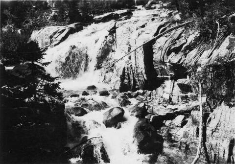
56. [Image] Impassable bedrock chute
 Impassable bedrock chute on North Fork Cispus River near Timonium Creek. Drops 25 feet in 60 feet. There are no pools
Citation -
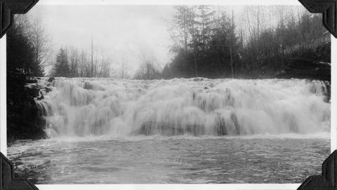
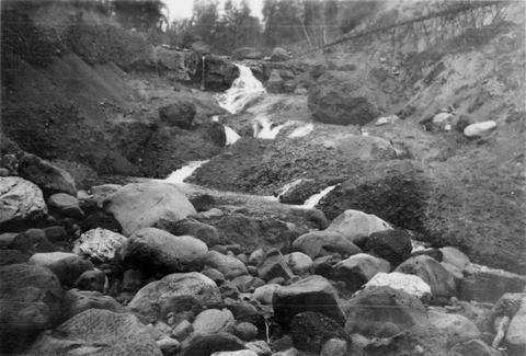
57. [Image] Timonium Creek falls
 75 foot series of falls on Timonium Creek near its confluence with the North Fork of the Cispus River. Indicates terrific flood stages
Citation -
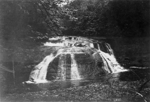
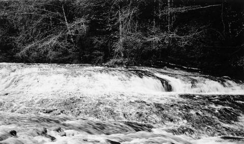
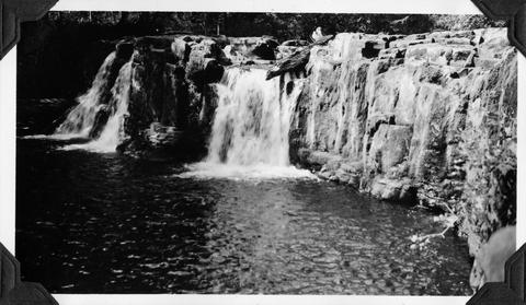
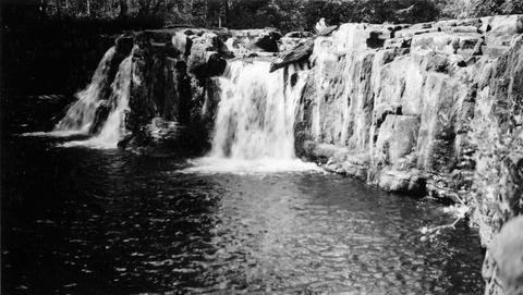
58. [Image] Cedar Creek Falls
 Cedar Creek Falls at high-water stage near Hall, Washington
Citation -
59. [Image] Niggerhead Creek falls (Yellowjacket Creek)
 Falls on Niggerhead Creek 4 miles above road. The falls are 25 feet high
Citation -
60. [Image] Falls on Canal Fork
 Falls on Canal Fork near the confluence with Middle Santiam River;1938
Citation -
61. [Image] Falls on Goat Creek
 35 foot falls on Goat Creek, located 530 yards above its confluence with the Cowlitz River
Citation -
62. [Image] Lake Creek falls
 25 foot falls on Lake Creek two mile above its mouth. Lake Creek is the outlet of Packwood Lake in the Cowlitz River system
Citation -
63. [Image] Silver Creek
 Silver Creek near Salem, Oregon; 1938
Citation -
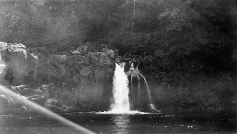
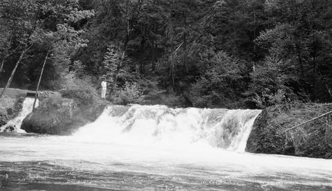
64. [Image] Salmon Creek Falls
 Salmon Creek Falls, part of Middle Fork Willamette River system in Oregon;1937-09
Citation -
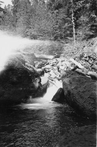
65. [Image] Salmon Creek Falls
 Salmon Creek Falls, Oregon Salmon Creek is part of Middle Fork Willamette River system;1937-09
Citation -
66. [Image] Salmon Creek Falls
 Right-hand side of Salmon Creek Falls, tributary to Middle Fork Willamette River;1937-09
Citation -
67. [Image] Salmon Creek Falls
 Left-hand side of Salmon Creek Falls, tributary to Middle Fork Willamette River;1937-09
Citation -
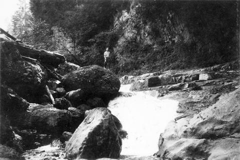
69. [Image] Mill dam on Hills Creekre
 Ten foot, impassable, abandoned mill dam on Hills Creek, tributary to Middle Fork Willamette River;1937-09-11
Citation -
70. [Image] Sharps Creekrevi
 Sharps Creek, tributary to Row River;1938-06-01
Citation -
71. [Image] Silver Creek Falls
 Silver Creek Falls, Oregon; 1938
Citation -
72. [Image] Silver Creek
 Silver Creek near Salem, Oregon; 1938
Citation -
73. [Image] Salmon Creek Falls
 Right-hand half of Salmon Creek Falls with the left-hand partly showing;1937-09-01
Citation -
74. [Image] Salmon Creek Falls
 Ten foot impassable falls on Salmon Creek, tributary to Middle Fork Willamette River Photo shows left-hand side of falls;1937-09-01
Citation -
75. [Image] Stratified sandstone falls on Coal Creek
 Coal Creek is a tributary to the Columbia River
Citation -
76. [Image] East Canyon Creek Falls
 Falls above mouth of East Canyon Creek, a tributary to the Cispus River
Citation -
77. [Image] Falls on Bear Creek
 Falls on Bear Creek near Clatskanie, Oregon
Citation -
78. [Image] Sharps Creek
 Shallow falls over bedrock on Sharps Creek It is impassable at present water level;1938-06-01
Citation -
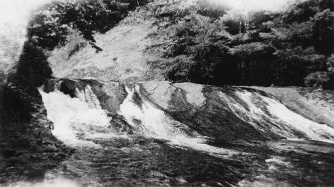
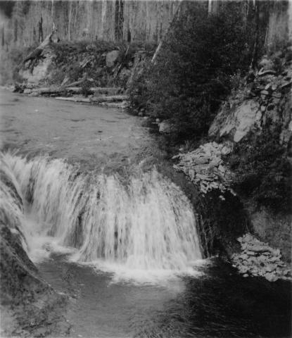
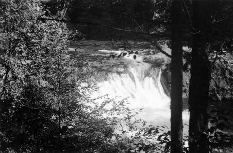
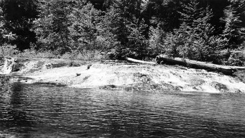
79. [Image] Row River falls
 Five foot bedrock falls on Row River, tributary to Coast Fork Willamette River, Oregon;1938-05-28
Citation -
80. [Image] Sharps Creek
 Shallow falls over bedrock on Sharps Creek It is impassable at present water level;1938-06-01
Citation -
81. [Image] Sharps Creek
 Shallow falls over bedrock on Sharps Creek It is impassable at present water level;1938-06-01
Citation -
82. [Image] Sloping falls on Laying Creek
 Sloping falls on Layng Creek, tributary to Frank Brice Creek It is solid bedrock and the falls are easily passable at higher water at Rujada Ranger Station, 2 miles above mouth It is a barrier at low w...
Citation -
83. [Image] Silver Creek Falls
 Silver Creek Falls, Oregon; 1938
Citation -
84. [Image] Silver Creek
 Silver Creek near Salem, Oregon; 1938
Citation -
85. [Image] Falls in Tualatin River
 Falls in Tualatin River 3-4 miles above Cherry Grove, Oregon; 1940-09-15 From Album 1 page 39
Citation -
86. [Image] Silver Creek
 Silver Creek near Salem, Oregon; 1938
Citation -
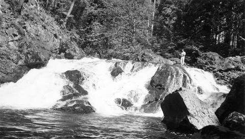
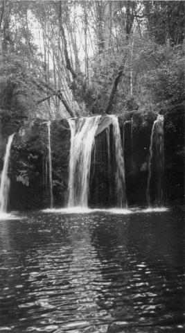
87. [Image] Eagle Creek falls
 Eagle Creek falls 1/2 mile above Delph Creek; 1938-06
Citation -
88. [Image] Waterfall Creek
 Waterfall Creek near confluence with Middle Fork Salmon River. Waterfall Creek enters Middle Fork Salmon River just above Big Creek on left bank. The creek is too precipitous for migratory fish
Citation -
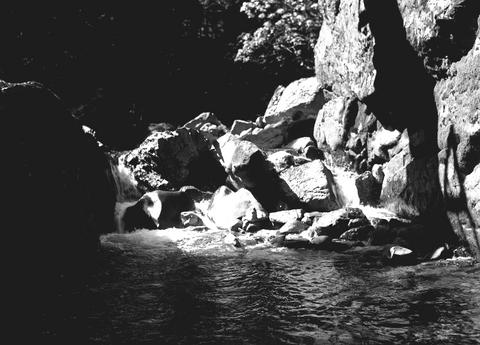
89. [Image] Bedrock falls
 A shallow bedrock falls on Sharps Creek, Oregon?. Photo shows a typical natural obstruction to fish at low water stages.
Citation -
90. [Image] Beaver Creek falls
 Impassable falls on Beaver Creek. The falls are about 60 feet high
Citation -
91. [Image] Falls on Rock Creek
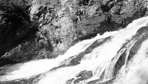
 Upper part of series of falls on Rock Creek one mile above the Columbia River
Citation -
92. [Image] Fast cascades
 Fast cascades over bedrock on Rock Creek four miles above the mouth. It is a barrier to fish at low water.
Citation -
93. [Image] Rock Creek falls near Stevenson, Washington
 View of impassable series of falls one mile above the mouth of Rock Creek
Citation -
94. [Image] Falls on Rock Creek
 Series of falls on Rock Creek near Stevenson, Washington, one mile above the Columbia River. It drops a total of forty five feet.
Citation -
95. [Image] Falls on Rock Creek near Stevenson, Washington
 The falls are impassable and are twenty five feet high.
Citation -
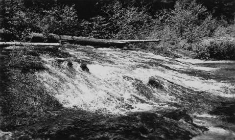
96. [Image] Bedrock chutes and falls
 Similar bedrock chutes and falls form much of bottom area; Delph Creek, Eagle Creek, Clackamas River; 1938-06
Citation -
97. [Image] Impassable falls
 Impassable falls on the South Santiam River, 1 1/2 miles above the confluence of the Soda Fork The chute drops 18 feet in 18 feet over bedrock;1937-09-16
Citation -
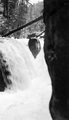
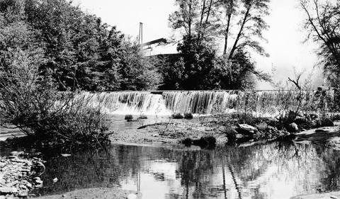
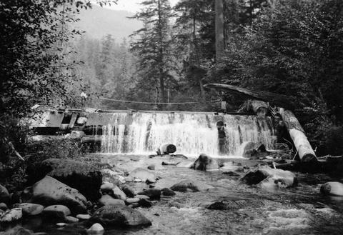
98. [Image] Cedar Creek dam and falls
 20 foot dam and falls on Cedar Creek near Hall, Washington. Photo shows nearly low-water stage
Citation -
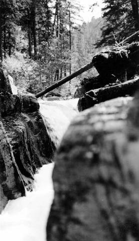
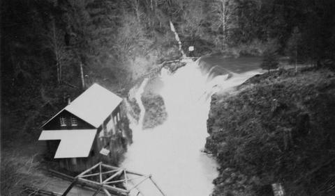
99. [Image] Cedar Creek dam and falls
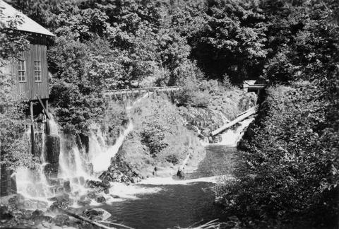 Power diversion, old mill, diversion return and fish-ladder at Cedar Creek dam and falls at Hall, Washington. Dam and falls only partly showing upstream. Fish-ladder leads into diversion
Citation -
100. [Image] Falls in the Tualatin River
 Falls in the Tualatin River located about 3-4 miles above the town of Cherry Grove, Oregon; 1940-09-15
Citation