Search
You searched for:
Start Over
Historic stream surveys
Remove constraint Historic stream surveys
Subject
Waterfalls
Remove constraint Subject: Waterfalls
« Previous | 141 - 160 of 172 | Next »
Search Results
-
141. [Image] Steelhead trout and Indian jump trap
 Photo shows Kettle Falls, on the Columbia River, which are now obliterated by the backwater from Grand Coulee Dam
Citation -
142. [Image] Indians fishing
 Indians fishing at Celilo Falls
Citation -
143. [Image] Indians fishing for salmon
 Indians fishing at Celilo Falls
Citation -
144. [Image] Indians fishing for salmon
 Indians fishing at Celilo Falls
Citation -
145. [Image] Indians fishing for salmon
 Indians fishing at Celilo Falls
Citation -
146. [Image] Paulina Falls
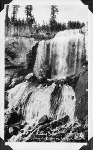 Paulina Falls on The Dalles to California Highway, Oregon (US 97)
Citation -
147. [Image] Black Falls on Green River
 Black Falls near Polar Star Mine. The falls are about 60 feet high and are a barrier at all times.
Citation -
148. [Image] Cispus River falls and cascades
 Part of falls and cascades on the Cispus River below Gail Falls near the Cob Creek confluence
Citation -
149. [Image] Middle Fork Weiser River falls
 Impassable falls about 25 ft high on the Middle Fork of the Weiser River in Idaho
Citation -
150. [Image] Middle Fork Weiser River falls
 Impassable falls about 25 ft high on the Middle Fork of the Weiser River in Idaho
Citation -
151. [Image] Fish tail falls
 Fish tail falls near Silver Creek on the Entiat River
Citation -
152. [Image] Falls on the West Fork of the inlet to Wallowa Lake
 Falls on West Fork of inlet to Wallowa Lake, Oregon. The falls are impassable for fish.
Citation -
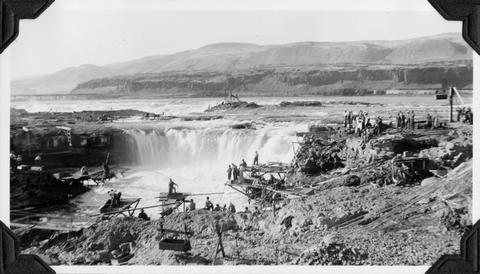
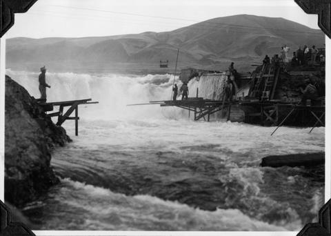
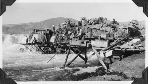
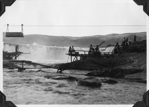
153. [Image] Celilo Falls
 Celilo Falls at high water on the Columbia River
Citation -
154. [Image] Broken-down fish ladder over Steelhead Falls
 Broken-down fish ladder over Steelhead Falls on the Deschutes River
Citation -
155. [Image] Carved basalt forming brink of Cline Falls
-
156. [Image] Cascades below Sherars Falls
 Cascades below Sherars Falls on Deschutes River
Citation -
157. [Image] Cline Falls
 Cline Falls on the Deschutes River. Falls are almost dry during irrigation season.
Citation -
158. [Image] Cispus River from Muddy Fork bridge
 River 22 feet wide and the falls are 5 feet high
Citation -
159. [Image] Bear Creek waterfalls
 Impassable 10 foot falls 1/4 mile above mouth of Bear Creek, a tributary of the South Fork Toutle River
Citation -
160. [Image] Fish-tail Falls
 Fish-tail falls, found in the upper Entiat box canyon, is a barrier to salmon.
Citation
