Search
You searched for:
Start Over
Historic stream surveys
Remove constraint Historic stream surveys
Subject
Waterfalls
Remove constraint Subject: Waterfalls
« Previous | 151 - 172 of 172 | Next »
Search Results
-
151. [Image] Fish tail falls
 Fish tail falls near Silver Creek on the Entiat River
Citation -
152. [Image] Falls on the West Fork of the inlet to Wallowa Lake
 Falls on West Fork of inlet to Wallowa Lake, Oregon. The falls are impassable for fish.
Citation -
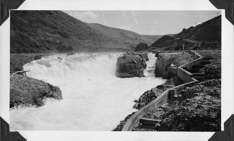
153. [Image] Celilo Falls
 Celilo Falls at high water on the Columbia River
Citation -
154. [Image] Broken-down fish ladder over Steelhead Falls
 Broken-down fish ladder over Steelhead Falls on the Deschutes River
Citation -
155. [Image] Carved basalt forming brink of Cline Falls
-
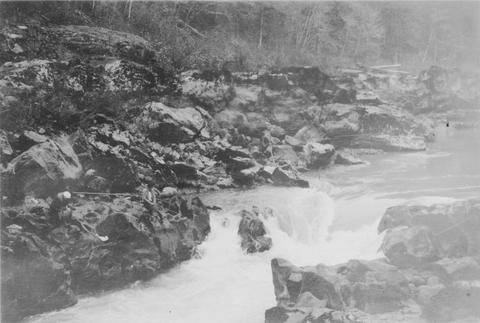
156. [Image] Cascades below Sherars Falls
 Cascades below Sherars Falls on Deschutes River
Citation -
157. [Image] Cline Falls
 Cline Falls on the Deschutes River. Falls are almost dry during irrigation season.
Citation -
158. [Image] Cispus River from Muddy Fork bridge
 River 22 feet wide and the falls are 5 feet high
Citation -
159. [Image] Bear Creek waterfalls
 Impassable 10 foot falls 1/4 mile above mouth of Bear Creek, a tributary of the South Fork Toutle River
Citation -
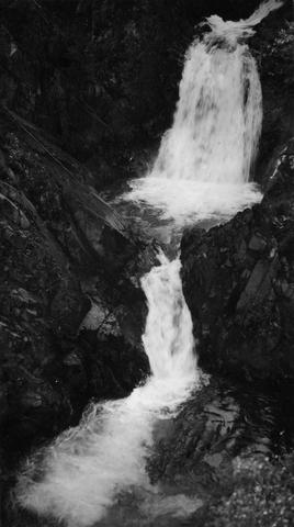
160. [Image] Fish-tail Falls
 Fish-tail falls, found in the upper Entiat box canyon, is a barrier to salmon.
Citation -
161. [Image] Falls on the Wallowa River
 falls on the west fork of the Wallowa River above Wallowa Lake, Oregon
Citation -
162. [Image] Lower Cowlitz Falls
 Lower Cowlitz Falls eight miles below Randle, Washington. The falls are 4 feet high and are not a barrier for fish
Citation -
163. [Image] Steep falls in small creek
 Steep Falls in small creek about 1 mile east of Weyerhaeuser Camp #7
Citation -
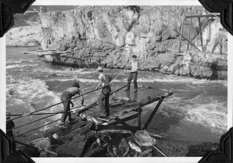
164. [Image] Indians fishing for salmon
 Indians fishing at Celilo Falls
Citation -
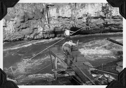
165. [Image] Indians fishing for salmon
 Indians fishing at Celilo Falls
Citation -
166. [Image] Indians fishing for salmon
 Indians fishing at Celilo Falls
Citation -
167. [Image] Dry falls near Coulee City
-
168. [Image] Benham Falls looking downstream
-
169. [Image] Sherar's Falls
 Sherars Falls on the Deschutes River, Oregon
Citation -
170. [Image] Steelhead Falls on the Deschutes River
-
171. [Image] Indians fishing for salmon
 Indians fishing at Celilo Falls
Citation -
172. [Image] Hanging Valleys
 Image Description from historic lecture booklet: "Valleys through which glaciers pass are widened and deepened, and their walls made smoother. The deepening of a mountain valley by glacial erosion sometimes ...
Citation