Search
You searched for:
Start Over
Historic stream surveys
Remove constraint Historic stream surveys
Subject
Waterfalls
Remove constraint Subject: Waterfalls
« Previous | 101 - 172 of 172 | Next »
Search Results
-
101. [Image] Falls above Cherry Grove
 Falls in theTualatin River about 3-4 miles above the town of Cherry Grove, Oregon; 1940-09-15
Citation -
102. [Image] Wildwood Falls
 Wildwood Falls on Row River, Oregon;1938-05-28
Citation -
103. [Image] Wildwood Fallsre
 Wildwood Falls on Row River, tributary to Coast Fork Willamette River, Oregon;1938-05-28
Citation -
104. [Image] Row River falls
 Five foot falls on Row River, tributary of Coast Fork Willamette River The falls are passable at high water;1938-05-28
Citation -
105. [Image] Falls in Tualatin River
 Falls in Tualatin River 3-4 miles above Cherry Grove, Oregon; 1940-09-15 From Album 1 page 39
Citation -
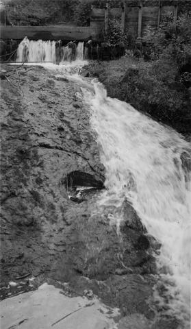
106. [Image] Sulphur Creek Falls
 Downstream view from horse bridge at head end of falls
Citation -
107. [Image] Sulphur Creek bedrock chute
 12 ft impassable bedrock chute short distance above highway bridge This is topped by a 6 ft dam
Citation -
108. [Image] Niggerhead Creek (Yellowjacket Creek)
 Passable falls and cascades on Niggerhead Creek
Citation -
109. [Image] Salmon Creek Falls
 Salmon Creek Falls;1937-09
Citation -
110. [Image] Tamolitch Falls
 Tamolitch Falls on the McKenzie River during high water stage The falls are 40 feet high;1937-06-26
Citation -
111. [Image] Wildwood Falls
 Wildwood Falls on Row River Oregon, with a six foot jump in foreground;1938-05-28
Citation -
112. [Image] Narrow falls on Winberry Creek
 Narrow falls over bedrock ledge on Winberry Creek, tributary to Big Fall Creek, Oregon;1937-06
Citation -
113. [Image] Falls on Portland Creek
 Falls on Portland Creek, tributary to Big Fall Creek-six foot jump at low point;1937-06
Citation -
114. [Image] Adams Creek falls
 15 ft falls in box canyon on Adams Creek, 1/4 mile above the mouth
Citation -
115. [Image] Silver Creek
 Silver Creek near Salem, Oregon; 1938
Citation -
116. [Image] Silver Creek
 Silver Creek near Salem, Oregon; 1938
Citation -
118. [Image] Greenhorn Creek falls
 Greenhorn Creek falls, a tributary to the Cispus River
Citation -
119. [Image] Lake Creek
 Lake Creek, outlet of Packwood Lake showing characteristic cascades
Citation -
120. [Image] Adams Creek falls
 15 foot falls in box canyon 1/4 miles above mouth of Adams Creek, a tributary of Cispus River
Citation -
121. [Image] Waterfall on lower Grays River
 Falls down canyon wall on lower Grays River The falls are 150 feet high. Photo shows typically canyonous nature of stream banks. F Jobes is standing in lower center
Citation -
122. [Image] Cowlitz River falls
 Cowlitz River falls eight miles below Randle, Washington. The drop of the lower falls is 4 feet.
Citation -
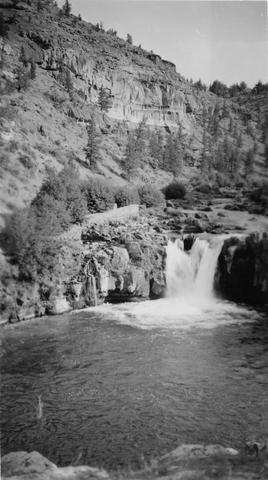
123. [Image] White River falls
 18 foot falls on the White River, tributary to the Deschutes River, several hundred yards below power plant. Upper falls can be seen faintly in background
Citation -
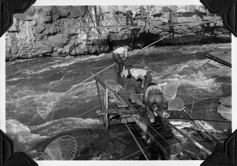
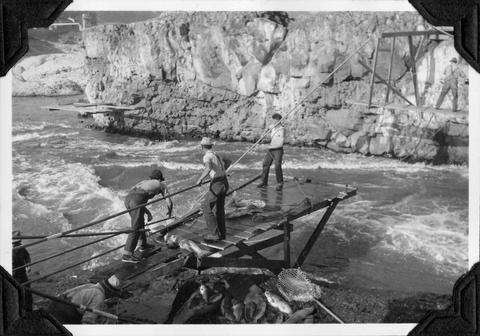
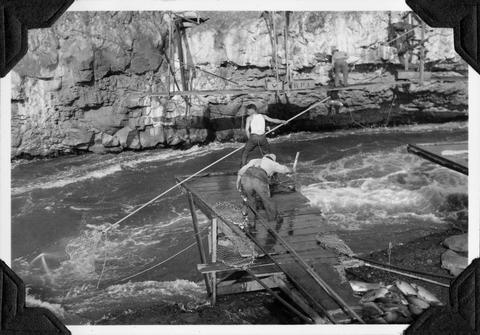
124. [Image] Indians fishing for salmon
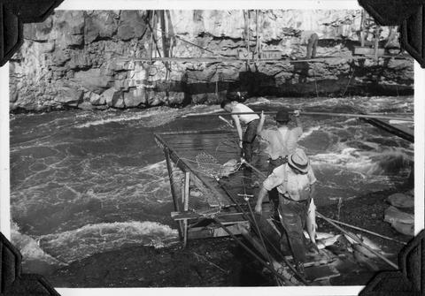 Indians fishing at Celilo Falls
Citation -
125. [Image] Indians fishing for salmon
 Indians fishing at Celilo Falls
Citation -
126. [Image] Waterfalls on Grays River
 8 foot falls (so-called) below the "Big Slide" on the Grays River. Station 4 is about 4 miles above the Highway. Falls are the only obstruction on river
Citation -
127. [Image] Gail Falls
 Gail Falls on the Cispus River is 200 yards below Cat Creek. The falls are 30 feet high and 8 feet wide
Citation -
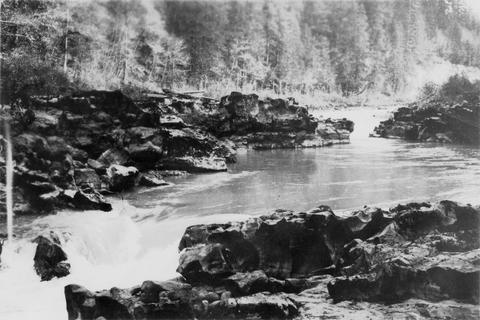
128. [Image] Carved basalt
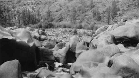 Carved basalt holding up crest of Big Falls on the Deschutes River
Citation -
129. [Image] Cowlitz Falls
 Cowlitz Falls 8 miles below Randle, Washington
Citation -
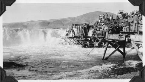
130. [Image] Steelhead trout and Indian jump trap
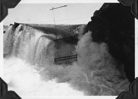 Photo shows Kettle Falls, on the Columbia River, which are now obliterated by the backwater from Grand Coulee Dam
Citation -
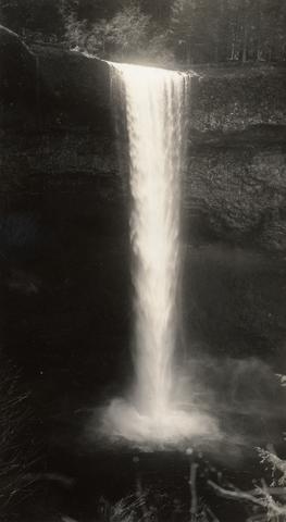
131. [Image] Benham Falls
 Main part of Benham Falls on the Deschutes River. Upstream view
Citation -
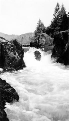
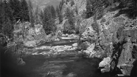
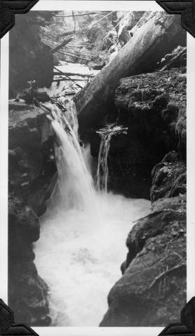
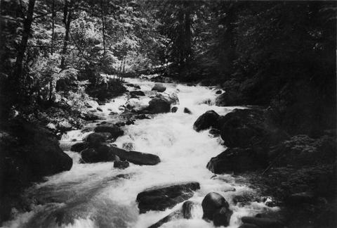
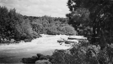
132. [Image] Cascade falls above Sulphur Creek
 Series of cascade-falls in Middle Fork Salmon River above Sulfur [Sulphur] Creek. Passable for fish at low water and passable with difficulty at high water according to the natives
Citation -
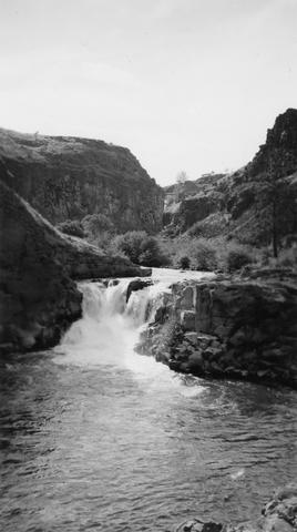
133. [Image] Sherars Falls
 Llooking downstream from top of Sherars Falls in the Deschutes River
Citation -
134. [Image] Lava Island Falls
 Part of Lava Island Falls on the Deschutes River
Citation -
135. [Image] Horseshoe Falls
-
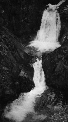
136. [Image] Cline Falls
 Cline Falls and power plant. Falls are almost dry during irrigation season.
Citation -
138. [Image] Indians fishing for salmon
 Indians fishing at Celilo Falls
Citation -
139. [Image] Steelhead trout and Indian jump trap
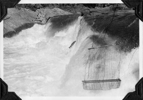 Photo shows Kettle Falls, on the Columbia River, which are now obliterated by the backwater from Grand Coulee Dam
Citation -
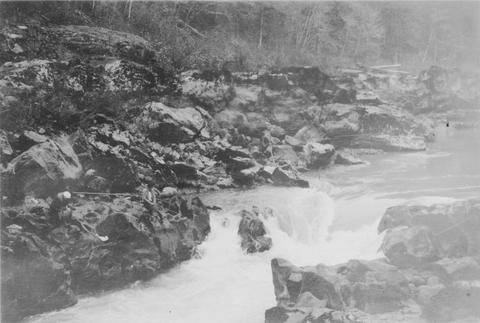
140. [Image] Steelhead trout and Indian jump trap
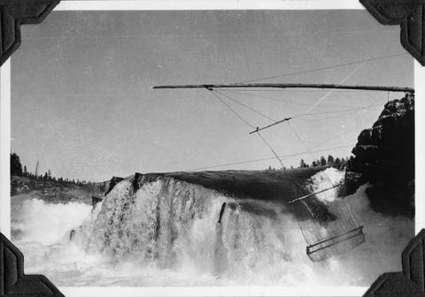 Photo shows Kettle Falls, on the Columbia River, which are now obliterated by the backwater from Grand Coulee Dam
Citation -
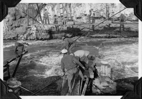
141. [Image] Steelhead trout and Indian jump trap
 Photo shows Kettle Falls, on the Columbia River, which are now obliterated by the backwater from Grand Coulee Dam
Citation -
142. [Image] Indians fishing
 Indians fishing at Celilo Falls
Citation -
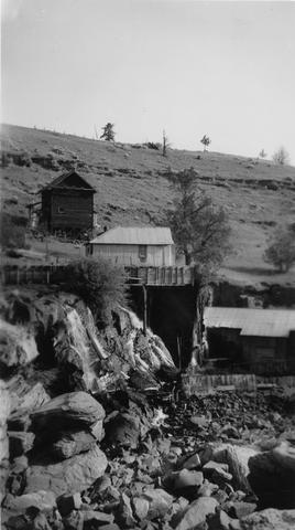
143. [Image] Indians fishing for salmon
 Indians fishing at Celilo Falls
Citation -
144. [Image] Indians fishing for salmon
 Indians fishing at Celilo Falls
Citation -
145. [Image] Indians fishing for salmon
 Indians fishing at Celilo Falls
Citation -
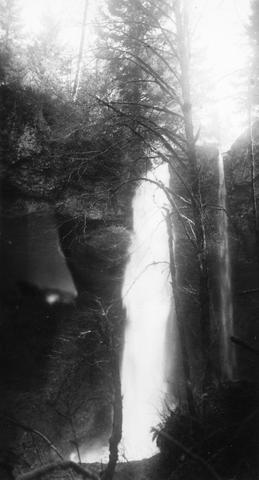
146. [Image] Paulina Falls
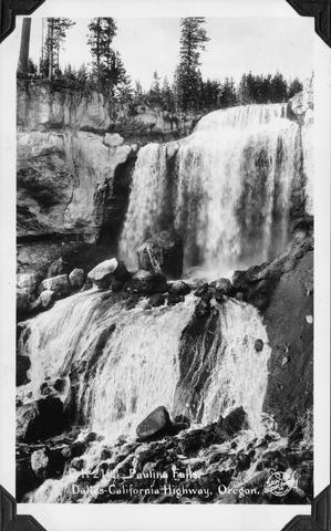 Paulina Falls on The Dalles to California Highway, Oregon (US 97)
Citation -
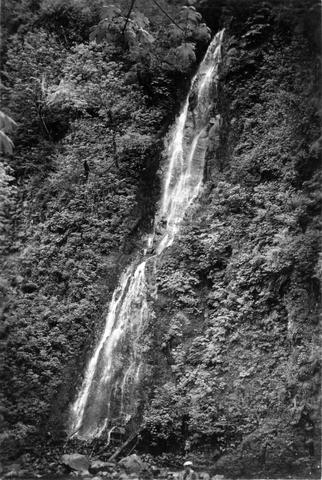
147. [Image] Black Falls on Green River
 Black Falls near Polar Star Mine. The falls are about 60 feet high and are a barrier at all times.
Citation -
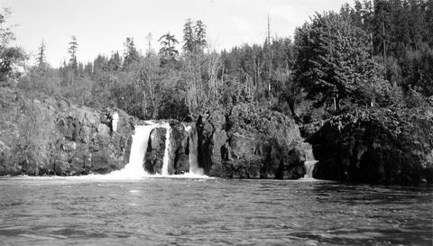
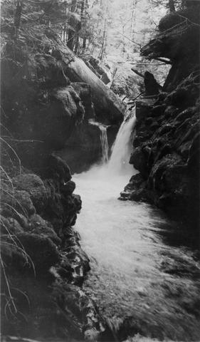
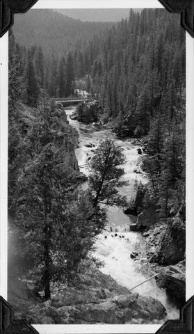
148. [Image] Cispus River falls and cascades
 Part of falls and cascades on the Cispus River below Gail Falls near the Cob Creek confluence
Citation -
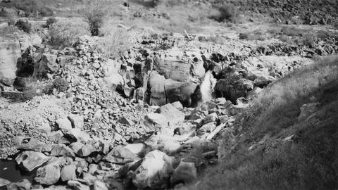
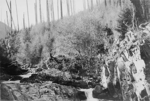
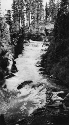
149. [Image] Middle Fork Weiser River falls
 Impassable falls about 25 ft high on the Middle Fork of the Weiser River in Idaho
Citation -
150. [Image] Middle Fork Weiser River falls
 Impassable falls about 25 ft high on the Middle Fork of the Weiser River in Idaho
Citation -
151. [Image] Fish tail falls
 Fish tail falls near Silver Creek on the Entiat River
Citation -
152. [Image] Falls on the West Fork of the inlet to Wallowa Lake
 Falls on West Fork of inlet to Wallowa Lake, Oregon. The falls are impassable for fish.
Citation -
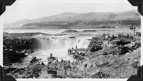
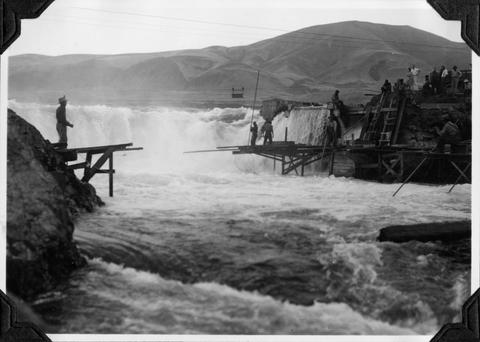
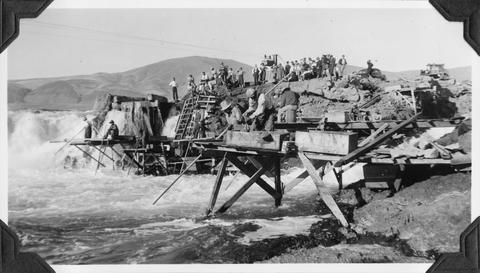
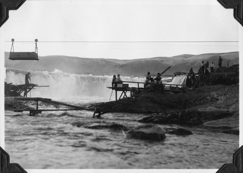
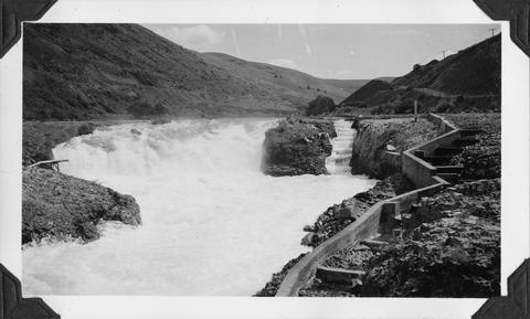
153. [Image] Celilo Falls
 Celilo Falls at high water on the Columbia River
Citation -
154. [Image] Broken-down fish ladder over Steelhead Falls
 Broken-down fish ladder over Steelhead Falls on the Deschutes River
Citation -
155. [Image] Carved basalt forming brink of Cline Falls
-
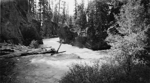
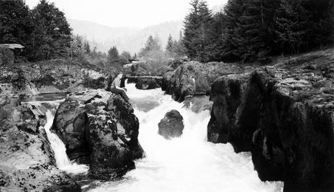
156. [Image] Cascades below Sherars Falls
 Cascades below Sherars Falls on Deschutes River
Citation -
157. [Image] Cline Falls
 Cline Falls on the Deschutes River. Falls are almost dry during irrigation season.
Citation -
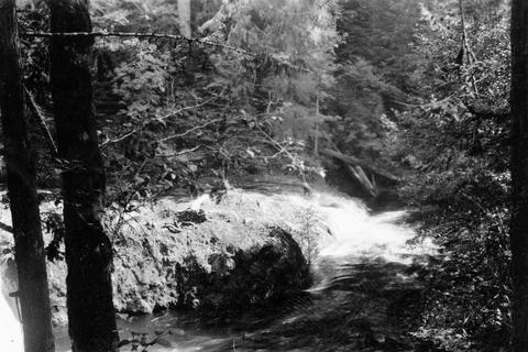
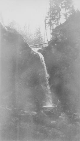
158. [Image] Cispus River from Muddy Fork bridge
 River 22 feet wide and the falls are 5 feet high
Citation -
159. [Image] Bear Creek waterfalls
 Impassable 10 foot falls 1/4 mile above mouth of Bear Creek, a tributary of the South Fork Toutle River
Citation -
160. [Image] Fish-tail Falls
 Fish-tail falls, found in the upper Entiat box canyon, is a barrier to salmon.
Citation -
161. [Image] Falls on the Wallowa River
 falls on the west fork of the Wallowa River above Wallowa Lake, Oregon
Citation -
162. [Image] Lower Cowlitz Falls
 Lower Cowlitz Falls eight miles below Randle, Washington. The falls are 4 feet high and are not a barrier for fish
Citation -
163. [Image] Steep falls in small creek
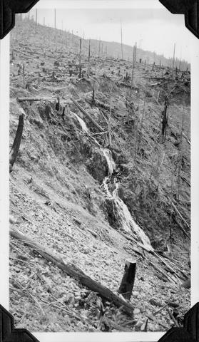 Steep Falls in small creek about 1 mile east of Weyerhaeuser Camp #7
Citation -
164. [Image] Indians fishing for salmon
 Indians fishing at Celilo Falls
Citation -
165. [Image] Indians fishing for salmon
 Indians fishing at Celilo Falls
Citation -
166. [Image] Indians fishing for salmon
 Indians fishing at Celilo Falls
Citation -
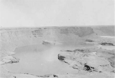
167. [Image] Dry falls near Coulee City
-
168. [Image] Benham Falls looking downstream
-
169. [Image] Sherar's Falls
 Sherars Falls on the Deschutes River, Oregon
Citation -
170. [Image] Steelhead Falls on the Deschutes River
-
171. [Image] Indians fishing for salmon
 Indians fishing at Celilo Falls
Citation -
172. [Image] Hanging Valleys
 Image Description from historic lecture booklet: "Valleys through which glaciers pass are widened and deepened, and their walls made smoother. The deepening of a mountain valley by glacial erosion sometimes ...
Citation