Search
You searched for:
Start Over
Historic stream surveys
Remove constraint Historic stream surveys
Subject
Waterfalls
Remove constraint Subject: Waterfalls
Subject
Streams
Remove constraint Subject: Streams
« Previous | 1 - 10 of 35 | Next »
Search Results
-
1. [Image] Falls on Cat Creek
 Falls on Cat Creek, tributary to the Cispus River, 1/4 mile above the mouth. Lower falls is 4 feet high and the upper falls is 10 feet high
Citation -
2. [Image] Impassable bedrock chute
 Impassable bedrock chute on North Fork Cispus River near Timonium Creek. Drops 25 feet in 60 feet. There are no pools
Citation -
3. [Image] Timonium Creek falls
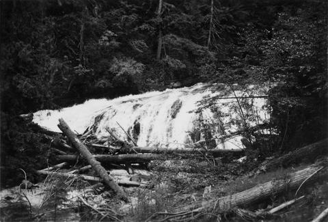
 75 foot series of falls on Timonium Creek near its confluence with the North Fork of the Cispus River. Indicates terrific flood stages
Citation -
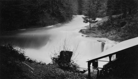
4. [Image] Cedar Creek Falls
 Birdseye view of Cedar Creek falls and small power developement
Citation -
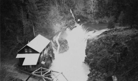
5. [Image] Cedar Creek Falls
 Cedar Creek Falls at high-water stage near Hall, Washington
Citation -
6. [Image] Niggerhead Creek falls (Yellowjacket Creek)
 Falls on Niggerhead Creek 4 miles above road. The falls are 25 feet high
Citation -
7. [Image] Falls on Goat Creek
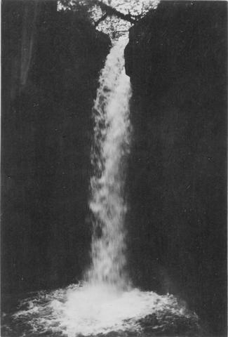 35 foot falls on Goat Creek, located 530 yards above its confluence with the Cowlitz River
Citation -
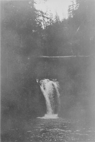
8. [Image] Lake Creek falls
 25 foot falls on Lake Creek two mile above its mouth. Lake Creek is the outlet of Packwood Lake in the Cowlitz River system
Citation -
9. [Image] Cedar Creek Falls at high water
-
10. [Image] Stratified sandstone falls on Coal Creek
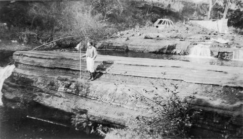 Coal Creek is a tributary to the Columbia River
Citation