Search
You searched for:
Start Over
Willamette Basin Stream Survey
Remove constraint Willamette Basin Stream Survey
Subject
Streams -- Oregon
Remove constraint Subject: Streams -- Oregon
1 - 49 of 49
Search Results
-
1. [Image] Middle Fork Willamette River
 Middle Fork Willamette River above Tumblebug Creek, end of survey;1938-07
Citation -
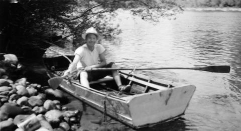
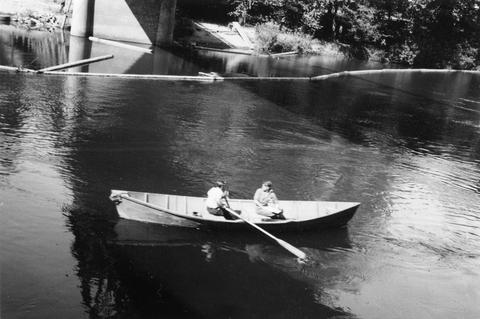
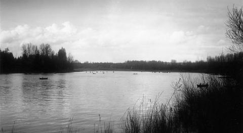
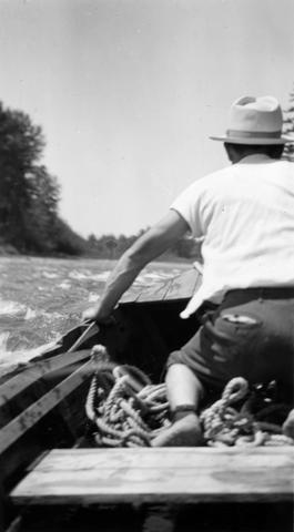
2. [Image] Boat survey
 Boat survey on Coast Fork Willamette River near Saginaw, Oregon;1938-06
Citation -
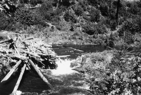
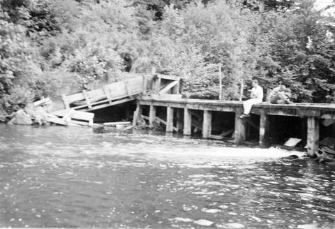
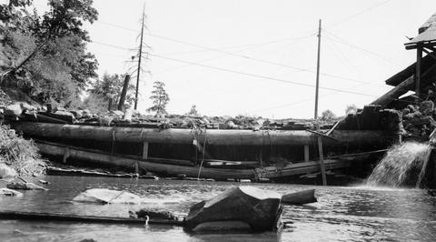
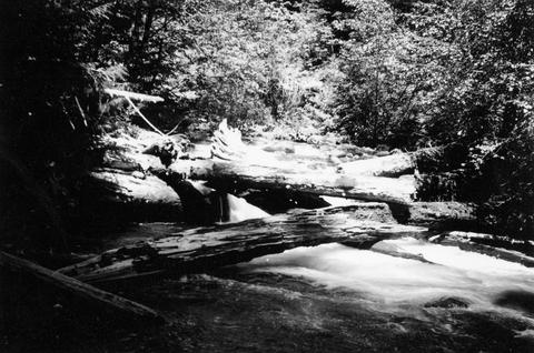
3. [Image] Obstruction on Coast Fork Willamette
 Obstruction on Coast Fork Willamette River near Cottage Grove, Oregon;1938-06
Citation -
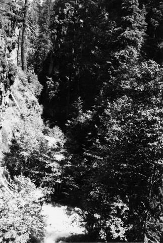
4. [Image] Middle Fork Willamette River
 Middle Fork Willamette River above Tumblebug Creek;1938-07
Citation -
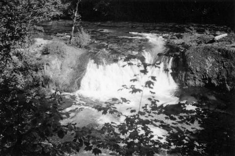
5. [Image] Middle Fork Willamette River
 Middle Fork Willamette River above Tumblebug Creek;1938-07
Citation -
6. [Image] Middle Fork Willamette River
 Middle Fork Willamette River above Tumblebug Creek;1938-07
Citation -
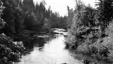
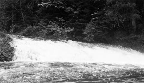
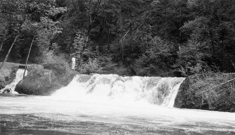
7. [Image] Coast Fork Willamette River
 Coast Fork Willamette River above Cottage Grove, Oregon;1938-06
Citation -
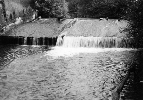
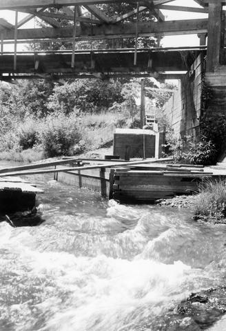
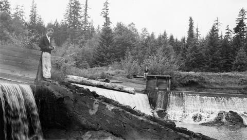
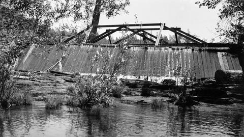
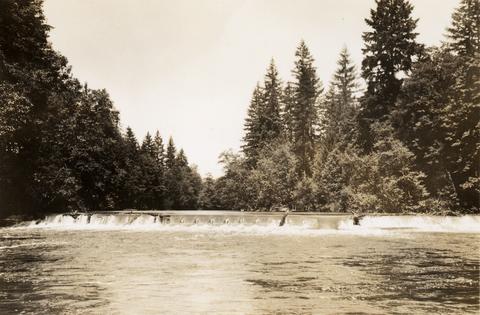
8. [Image] Abandoned dam
 Abandoned dam on the Coast Fork Willamette River; 1938-06-20
Citation -
9. [Image] Floyd G Bryant
-
10. [Image] Passable river obstruction
 Passable obstruction on Coast Fork Willamette River;1938-06-20
Citation -
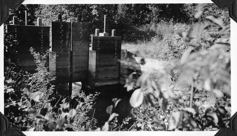
11. [Image] Screened intake
 Screened intake on Coast Fork Willamette River near Cottage Grove, Oregon;1938-06
Citation -
13. [Image] Boat survey Clackamas River
 Boat survey on the Clackamas River; 1938-06-28
Citation -
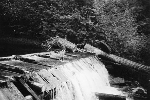
14. [Image] Obstruction on Coast Fork Willamette
 Obstruction on Coast Fork Willamette River Ladder has broken down;1938-06
Citation -
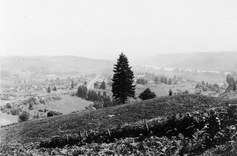
16. [Image] Willamette River
 Willamette River near the confluence of the Tualatin River West Linn, Oregon, (near Oregon City) is in the center; 1937-06-23
Citation -
17. [Image] Willamette River
 Willamette River near the confluence of the Tualatin River West Linn, Oregon (near Oregon City) is in the center;1937-06-23
Citation -
18. [Image] Sport fishing for chinook near Oregon City
 Willamette below Oregon City; sport fishing for chinook near Oregon City; 1938-05
Citation -
19. [Image] Sport fishing for chinook near Oregon City
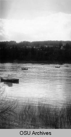 Willamette below Oregon City; sport fishing for chinook near Oregon City; 1938-05
Citation -
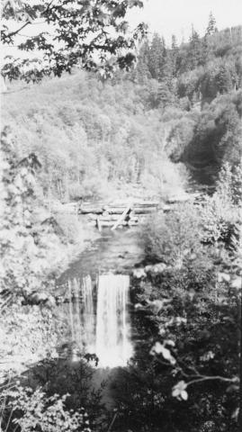
20. [Image] Winberry Creek falls
 Falls on Winberry Creek at end of survey Winberry Creek is a tributary of Fall Creek which is part of the Middle Fork Willamette River system;1938-05-19
Citation -
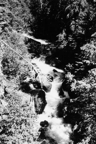
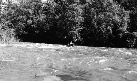
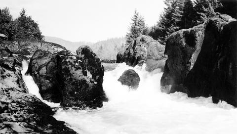
21. [Image] Shooting rapids
 Shooting the rapids on the North Santiam River during the North Santiam survey ; 1940-08-06
Citation -
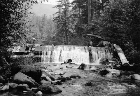
22. [Image] Dam near Cottage Grove
 Dam near Cottage Grove, Oregon, on the Coast Fork Willamette River;1938-06-20
Citation -
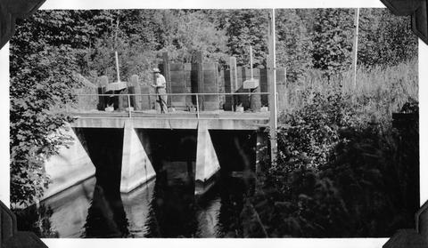
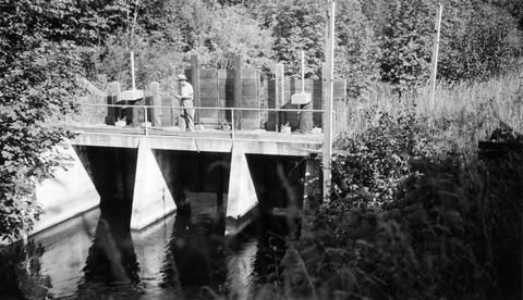
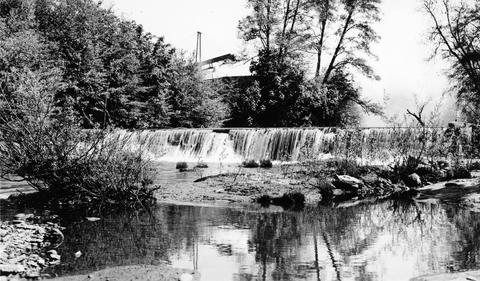
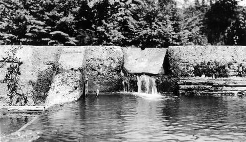
24. [Image] Spillway into Mark's Slough
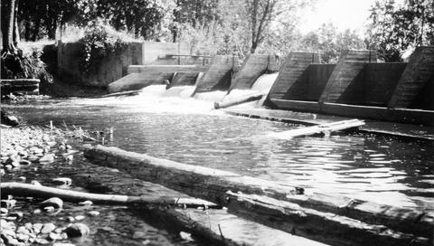 Spillway near Lebanon, Oregon, into Mark's Slough from the Albany Power Ditch just before it passes through the Crown-Willamette Paper Company property The water flushes out Mark's Slough, which receives ...
Citation -
26. [Image] Salmon Creek Falls
 Salmon Creek Falls, part of Middle Fork Willamette River system in Oregon;1937-09
Citation -
27. [Image] Salmon Creek Falls
 Salmon Creek Falls, Oregon Salmon Creek is part of Middle Fork Willamette River system;1937-09
Citation -
28. [Image] Salmon Creek Falls
 Right-hand side of Salmon Creek Falls, tributary to Middle Fork Willamette River;1937-09
Citation -
29. [Image] Salmon Creek Falls
 Left-hand side of Salmon Creek Falls, tributary to Middle Fork Willamette River;1937-09
Citation -
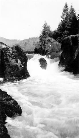
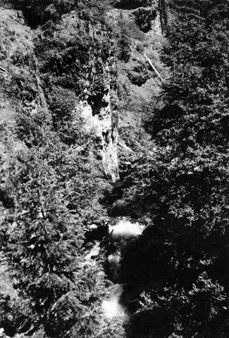
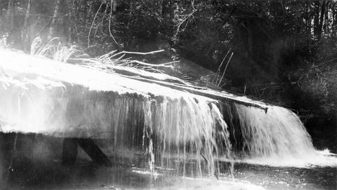
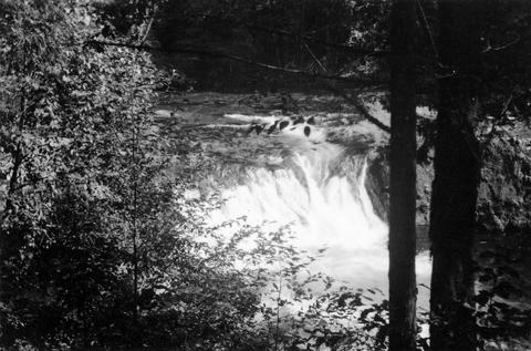
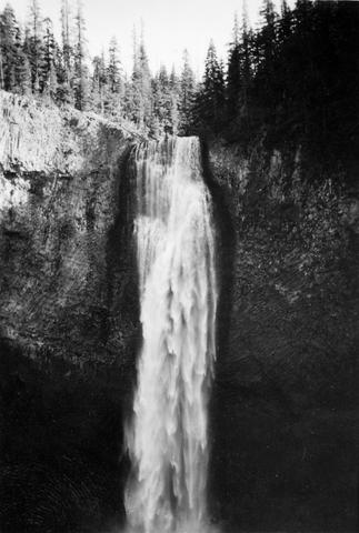
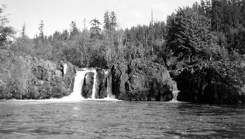
30. [Image] Salt Creek Falls
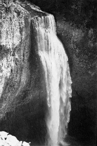 285 foot falls on Salt Creek, tributary to Middle Fork Willamette River;1937-09-10
Citation -
31. [Image] Salt Creek Falls
 285 foot falls on Salt Creek, tributary to Middle Fork Willamette River;1937-09-10
Citation -
32. [Image] Dam for lumber flume diversion
 Impassable dam for lumber flume diversion on Lost Creek, tributary to Middle Fork Willamette River;1938-06-10
Citation -
33. [Image] Mill dam on Hills Creek
 Ten foot, impassable, abandoned mill dam on Hills Creek, tributary to Middle Fork Willamette River;1937-09-11
Citation -
34. [Image] Mill dam on Hills Creekre
 Ten foot, impassable, abandoned mill dam on Hills Creek, tributary to Middle Fork Willamette River;1937-09-11
Citation -
35. [Image] Mill dam in Lost Creek
 Impassable mill dam in Lost Creek, tributary to Middle Fork Willamette River;1938-06-10
Citation -
36. [Image] Dam board in fish ladder
 Coast Fork Willamette River above Cottage Grove, Oregon, showing dam board in poor fish ladder;1938-06
Citation -
37. [Image] Salmon Creek Falls
 Ten foot impassable falls on Salmon Creek, tributary to Middle Fork Willamette River Photo shows left-hand side of falls;1937-09-01
Citation -
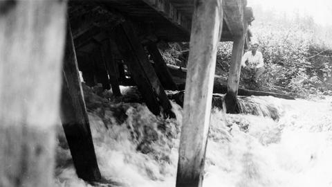
38. [Image] Mill operations
 Mill operations on Lost Creek, tributary to Middle Fork Willamette River;1938-06-10
Citation -
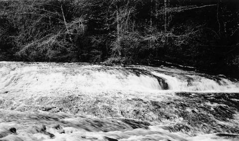
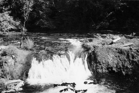
39. [Image] Row River falls
 Five foot bedrock falls on Row River, tributary to Coast Fork Willamette River, Oregon;1938-05-28
Citation -
41. [Image] Beaver Creek falls
 Impassable falls on Beaver Creek. The falls are about 60 feet high
Citation -
42. [Image] Wildwood Fallsre
 Wildwood Falls on Row River, tributary to Coast Fork Willamette River, Oregon;1938-05-28
Citation -
43. [Image] Row River falls
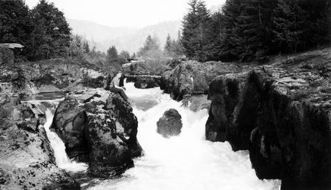 Five foot falls on Row River, tributary of Coast Fork Willamette River The falls are passable at high water;1938-05-28
Citation -
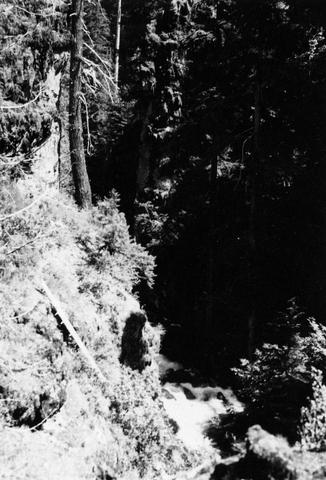
44. [Image] Swift Creek
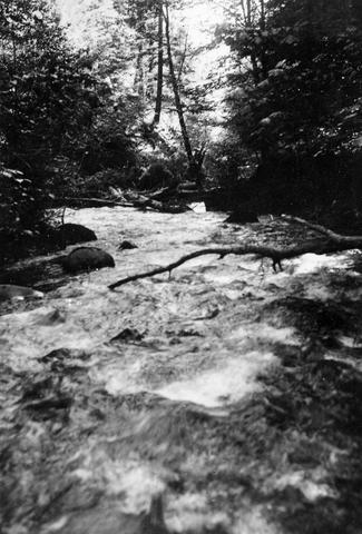 Swift Creek, tributary to Middle Fork Willamette River;1938-07
Citation -
45. [Image] Small storage dam
 Small storage dam on the Tualatin River, located 3 miles above the mouth It is 3 feet high but the downstream apron makes passage difficult; 1937-06-24
Citation -
46. [Image] Swift Creek
 Swift Creek, tributary to Middle Fork Willamette River;1938-07
Citation -
47. [Image] South Santiam riffle
 Riffle on the South Santiam River about 2 1/2 miles below Crabtree Bridge All stones were heavily coated with brownish-green slime and persistent foam piled up in backwaters and floated down the river;Paper ...
Citation -
48. [Image] Small storage dam
 Small storage dam on the Tualatin River, located 3 miles above the mouth It is 3 feet high but the downstream apron makes passage difficult; 1937-06-24
Citation