Search
You searched for:
Start Over
Historic stream surveys
Remove constraint Historic stream surveys
Subject
Streams -- Oregon
Remove constraint Subject: Streams -- Oregon
« Previous | 251 - 300 of 327 | Next »
Search Results
-
251. [Image] Collecting milt from chinook salmon
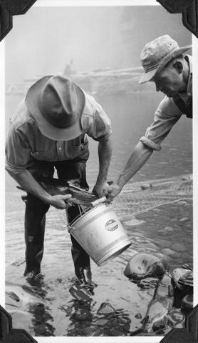 Collecting milt from ripe male chinook salmon at the Middle Santiam Salmon Hatchery near Foster, Oregon; Archie Anderson and assistant; 1940-09-25 From Album 1 page 7
Citation -
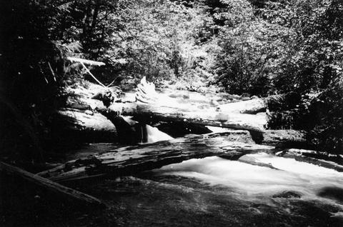
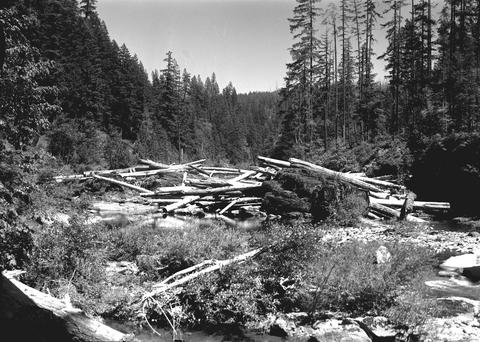
252. [Image] Log jam on Sharps Creek
 Upper end of log jam on Sharps Creek, tributary to Row River It is passable with difficulty;1938-06-01
Citation -
253. [Image] Obtaining chinook eggs
 Obtaining eggs from gravid chinook salmon by slitting belly; showing Archie Anderson and assistant at the Middle Santiam Salmon Hatchery near Foster, Oregon; 1940-09-25 From Album 1 page 7
Citation -
254. [Image] Willamina Creek dam
 Power dam on Willamina Creek, tributary to South Yamhill River, near Willamina, Oregon, a short distance above Highway 18 bridge;1940-09-29 From Album 1 page 42
Citation -
256. [Image] French Pete Creek
-
257. [Image] Dam at Carlton, Oregon
-
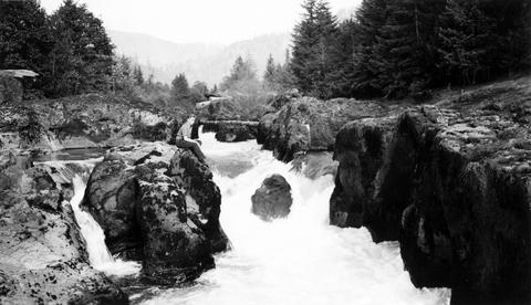
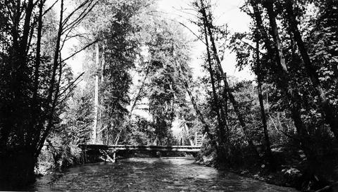
258. [Image] The Narrows--Molalla River
 The Narrows on the Molalla River average only 12 feet to 15 feet in width; 1941-09-25
Citation -
259. [Image] Falls in the Tualatin River
 Falls in the Tualatin River located about 3-4 miles above the town of Cherry Grove, Oregon; 1940-09-15
Citation -
260. [Image] Falls above Cherry Grove
 Falls in theTualatin River about 3-4 miles above the town of Cherry Grove, Oregon; 1940-09-15
Citation -
261. [Image] Upstream from Scio Dam
 Facing upstream from Scio Dam on Thomas Creek, a tributary to South Santiam River, Oregon; 1940-08-18
Citation -
262. [Image] Thomas Creek
 Thomas Creek above the Mountain States Jordan Power Plant and below Jordan Dam on the South Santiam River system in Oregon; 1940-08-20
Citation -
263. [Image] Thomas Creek
 Thomas Creek above the Mountain States Jordan Power Plant and below Jordan Dam on the South Santiam River system in Oregon;1940-08-20
Citation -
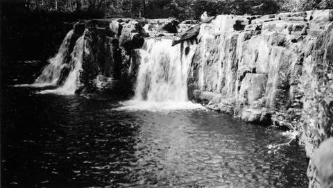
265. [Image] Wildwood Falls
 Wildwood Falls on Row River, Oregon;1938-05-28
Citation -
266. [Image] Wildwood Fallsre
 Wildwood Falls on Row River, tributary to Coast Fork Willamette River, Oregon;1938-05-28
Citation -
267. [Image] Row River falls
 Five foot falls on Row River, tributary of Coast Fork Willamette River The falls are passable at high water;1938-05-28
Citation -
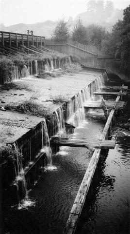
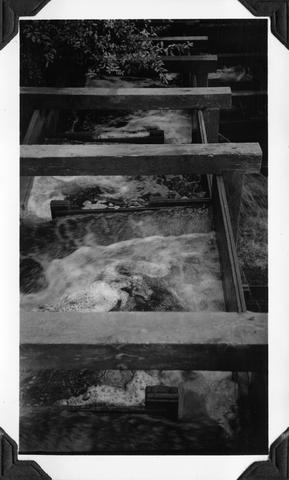
268. [Image] Fish ladder
-
269. [Image] Fish ladder
-
271. [Image] Falls in Tualatin River
 Falls in Tualatin River 3-4 miles above Cherry Grove, Oregon; 1940-09-15 From Album 1 page 39
Citation -
272. [Image] Intake at Leaburg Power Plant
 Intake of Leaburg Power Plant on the McKenzie River; 1938-06
Citation -
273. [Image] Chinook salmon-River Mill
 Chinook- River Mill tail-race, Clackamas River, Oregon; 1938-06-28
Citation -
274. [Image] Chinook below River Mill Power plant
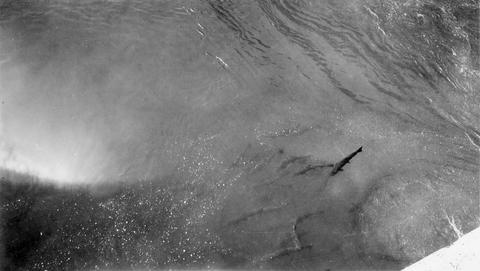 Chinook below River Mill Power house on the Clackamas River; 1938-06
Citation -
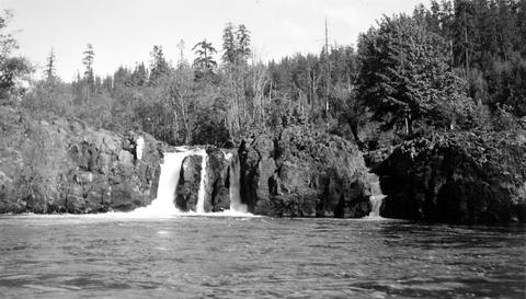
275. [Image] Salmon Creek Falls
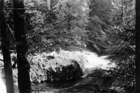 Salmon Creek Falls;1937-09
Citation -
276. [Image] Tamolitch Falls
 Tamolitch Falls on the McKenzie River during high water stage The falls are 40 feet high;1937-06-26
Citation -
277. [Image] Gardiner Dam
 Gardner [sic] Dam viewed from bridge Gardner [sic] Dam is located on the North Santiam River; 1940-08-08
Citation -
278. [Image] Gardiner Ditch
 Gardner [sic] Ditch 100 yards above the headgate, facing upstream; 1940-08-08
Citation -
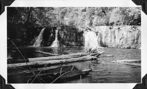
279. [Image] Wildwood Falls
 Wildwood Falls on Row River Oregon, with a six foot jump in foreground;1938-05-28
Citation -
280. [Image] Narrow falls on Winberry Creek
 Narrow falls over bedrock ledge on Winberry Creek, tributary to Big Fall Creek, Oregon;1937-06
Citation -
281. [Image] Falls on Portland Creek
 Falls on Portland Creek, tributary to Big Fall Creek-six foot jump at low point;1937-06
Citation -
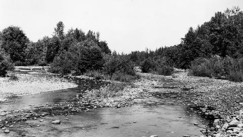
282. [Image] Swift Creek
 Swift Creek, tributary to Middle Fork Willamette River;1938-07
Citation -
283. [Image] Small storage dam
 Small storage dam on the Tualatin River, located 3 miles above the mouth It is 3 feet high but the downstream apron makes passage difficult; 1937-06-24
Citation -
284. [Image] Swift Creek
 Swift Creek, tributary to Middle Fork Willamette River;1938-07
Citation -
285. [Image] Collecting chinook eggs
 Collecting eggs by slitting the belly of ripe female chinook salmon at the Middle Santiam Salmon Hatchery near Foster, Oregon; Archie Anderson and assistant;1940-09-25 From Album 1 page 7
Citation -
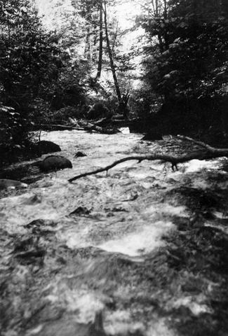
286. [Image] South Santiam riffle
 Riffle on the South Santiam River about 2 1/2 miles below Crabtree Bridge All stones were heavily coated with brownish-green slime and persistent foam piled up in backwaters and floated down the river;Paper ...
Citation -
287. [Image] North and South Channel
 North Channel and South Channel facing upstream from bridge in Stayton, Oregon;1940-08-09
Citation -
288. [Image] North and South Channel
 North Channel and South Channel facing upstream from bridge in Stayton, Oregon;1940-08-09
Citation -
289. [Image] North and South Channel
 North Channel and South Channel facing upstream from bridge in Stayton, Oregon;1940-08-09
Citation -
290. [Image] South Santiam River, Oregon
 South Santiam River, Oregon Riffle about 2 1/2 miles below Crabtree Bridge All stones were heavily coated with brownish-green slime and persistent foam piled up in backwaters and floated down the rive...
Citation -
291. [Image] Salem Ditch
 Salem Ditch looking upstream from headgate;1940-08-08
Citation -
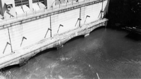
292. [Image] Mill City dam
 Mill City dam located on the North Santiam River in Oregon; 1938
Citation -
293. [Image] Quartzville Creek
 Quartzville Creek, tributary of Middle Santiam River, Oregon;1938
Citation -
294. [Image] Gardiner Dam
 Gardner [sic] Dam from the bridge on the North Santiam River;1940-08-08
Citation -
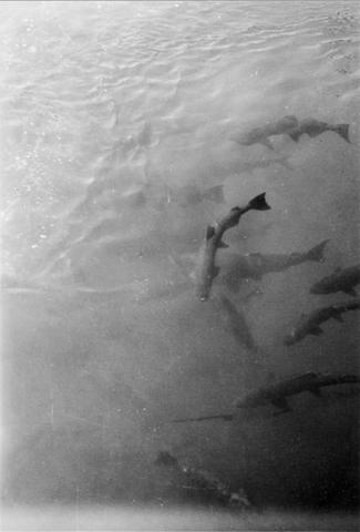
296. [Image] River Mill Power plant
 Chinook in tail-race at the River Mill Power Plant on the Clackamas River; 1938-06
Citation -
297. [Image] Upper Blue River
 Photo is characteristic of big pools and bedrock banks found on the upper Blue River, a tributary of the McKenzie River;1937-08-17
Citation -
298. [Image] Rack across McKenzie River
 Rack across the McKenzie River above Eugene, Oregon (near Hendricks Bridge);1938-06
Citation -
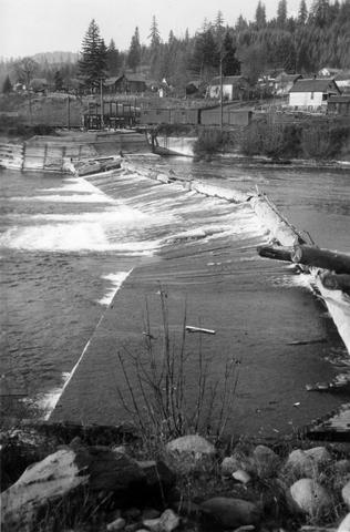
299. [Image] Salem Ditch dam
 Salem Ditch dam taken from lower Gardner (sic) Dam;1940-08-08
Citation -
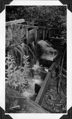
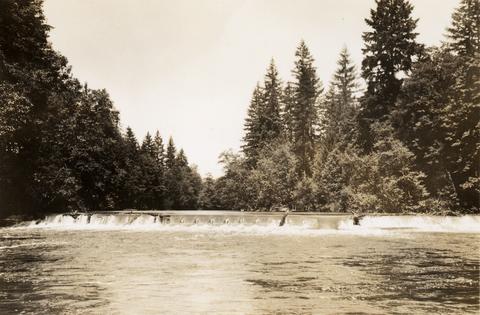
300. [Image] Scio Dam fish ladder
 Poor fish ladder on Scio Dam on Thomas Creek, tributary to South Santiam River, Oregon; 1940-09-18
Citation