Search
You searched for:
Start Over
Historic stream surveys
Remove constraint Historic stream surveys
Subject
Streams -- Oregon
Remove constraint Subject: Streams -- Oregon
« Previous | 151 - 200 of 327 | Next »
Search Results
-
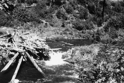
152. [Image] Dam for lumber flume diversion
 Impassable dam for lumber flume diversion on Lost Creek, tributary to Middle Fork Willamette River;1938-06-10
Citation -
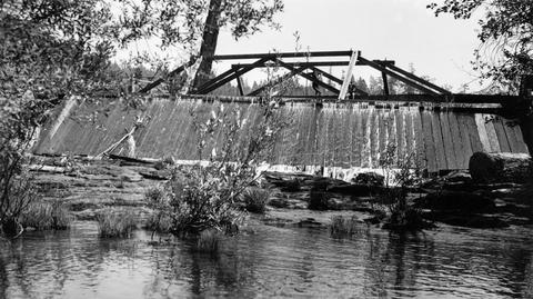
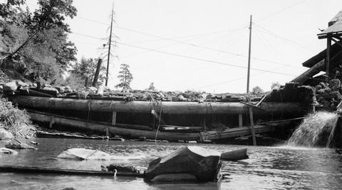
153. [Image] Mill dam on Hills Creek
 Ten foot, impassable, abandoned mill dam on Hills Creek, tributary to Middle Fork Willamette River;1937-09-11
Citation -
154. [Image] Mill dam on Hills Creekre
 Ten foot, impassable, abandoned mill dam on Hills Creek, tributary to Middle Fork Willamette River;1937-09-11
Citation -
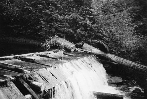
155. [Image] Mill dam in Lost Creek
 Impassable mill dam in Lost Creek, tributary to Middle Fork Willamette River;1938-06-10
Citation -
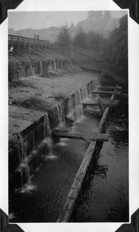
156. [Image] Dam board in fish ladder
 Coast Fork Willamette River above Cottage Grove, Oregon, showing dam board in poor fish ladder;1938-06
Citation -
157. [Image] Dry fish ladder
 Dry fish ladder at Mountain States Power Plant at Stayton, Oregon (Chinooks fighting tailrace);1940-08-11
Citation -
158. [Image] Sharps Creekrevi
 Sharps Creek, tributary to Row River;1938-06-01
Citation -
159. [Image] Squaw Creek
 Squaw Creek near bridge on Santiam Highway. River is entirely dry because of irrigation
Citation -
160. [Image] Pool in Sharps Creek
 ST pool in Sharps Creek;1938-06-01
Citation -
161. [Image] Pool in Sharps Creek
 ST pool in Sharps Creek;1938-06-01
Citation -
162. [Image] Mosby Creek
 Mosby Creek at Taylor Bridge;1938-06-15
Citation -
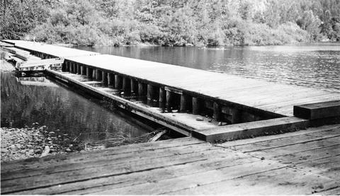
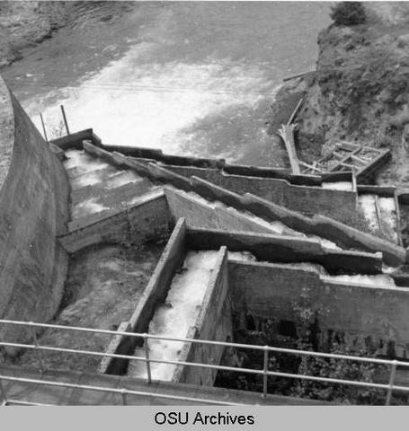
163. [Image] Mt States Power Co ladder
 Mountain States Power Company fish ladder;1940-08-09
Citation -
164. [Image] Upstream from Hartman Dam
 Upstream from Hartman Dam located on Butte Creek; 1940-09-22
Citation -
165. [Image] Silver Creek Falls
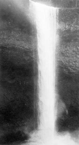 Silver Creek Falls, Oregon; 1938
Citation -
166. [Image] Silver Creek
 Silver Creek near Salem, Oregon; 1938
Citation -
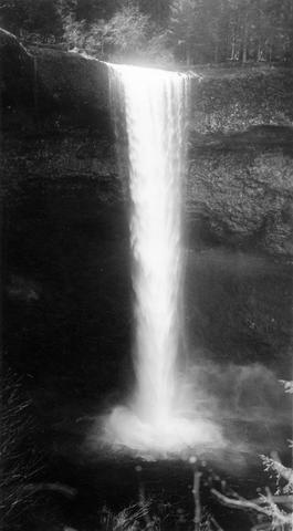
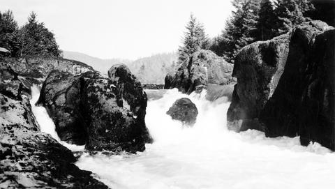
167. [Image] Salmon Creek Falls
 Right-hand half of Salmon Creek Falls with the left-hand partly showing;1937-09-01
Citation -
168. [Image] Salmon Creek Falls
 Ten foot impassable falls on Salmon Creek, tributary to Middle Fork Willamette River Photo shows left-hand side of falls;1937-09-01
Citation -
169. [Image] Water wheel
 Small water wheel in Gales Creek, tributary to the Tualatin River, above town of Gales Creek, Oregon; used to operate small water pump; 1940-09-19 From Album 1 page 40
Citation -
170. [Image] Highway sign
 Sign near the new WPA highway being constructed from Glenwood to Tillamook, Oregon; 1940-09-21 From Album 1 page 40
Citation -
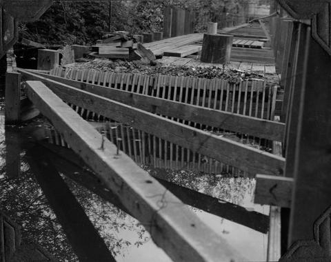
171. [Image] Mt States Power Co ladder
 Mountain States Power Company ladder in the Stayton power canal (Gardner [sic] Ditch);1940-08-09
Citation -
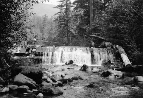
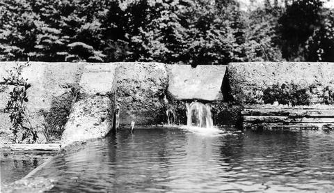
172. [Image] Wiley Creek dam and ladder
 Dam and fish ladder on Wiley Creek, a tributary of the South Santiam River, Oregon; 1938
Citation -
173. [Image] Log pond dam
 Dam below log pond at Carlton, Oregon, on the North Yamhill River; poor fishway on right bank; 1940-09-26 From Album 1 page 44
Citation -
174. [Image] Thomas Creek
 Thomas Creek above the Mountain States Jordan Power Plant and below Jordan Dam on the South Santiam River system in Oregon; 1940-08-20
Citation -
175. [Image] Lebanon lower power dam
 Lower power dam at Lebanon, Oregon, on the South Santiam River The Albany power ditch arises above; 1940-08-11
Citation -
176. [Image] Wooden flume
 Wooden flume leading to power plant on Willamina Creek, tributary to South Yamhill River; 1940-09-29 From Album 1 page 42
Citation -
177. [Image] Headgates in power ditch
 Headgates of power ditch taking off above Willamina Dam on Willamina Creek, tributary to South Yamhill River; 1940-09-29 From Album 1 page 42
Citation -
178. [Image] Logged land
 Land logged over by Snow Peak Logging Company, Lacomb, Oregon; 1940-08-21 From Album 1 page 11
Citation -
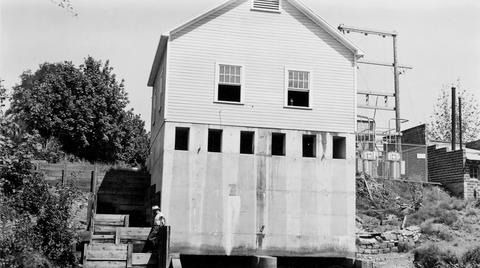
179. [Image] Mill operations
 Mill operations on Lost Creek, tributary to Middle Fork Willamette River;1938-06-10
Citation -
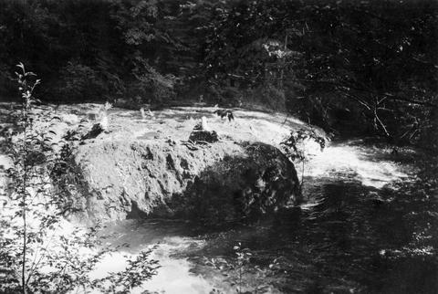
180. [Image] Sharps Creek
 Shallow falls over bedrock on Sharps Creek It is impassable at present water level;1938-06-01
Citation -
181. [Image] Downstream from Hartman Dam
 Looking downstream from Hartman Dam on Butte Creek; 1940-09-22
Citation -
182. [Image] French Pete Creek?
-
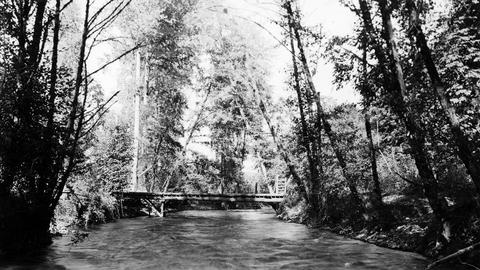
183. [Image] Bridge at Sweet Home
 Bridge at Sweet Home, Oregon, over the South Santiam River;1940-08-15 From Album 1 page 8
Citation -
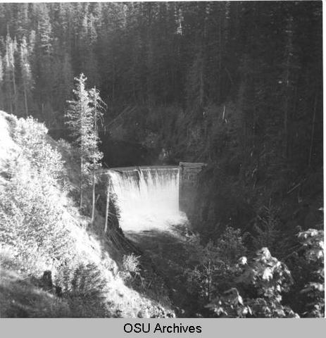
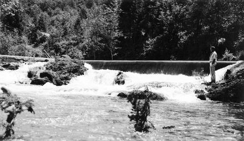
184. [Image] Mill City Dam
 Mill City Dam on the North Santiam River in Oregon ; 1938
Citation -
186. [Image] Roaring Creek dam
 Dam near mouth of Roaring Creek, a tributary of Crabtree Creek, located near Lacomb, Oregon; 1940-08-21 From Album 1 page 11
Citation -
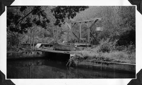
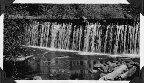
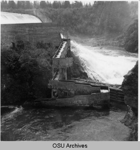
187. [Image] Ladder and mill dam
 Fish ladder and mill dam near Mill City, Oregon, located on the North Santiam River ; 1940-08-11
Citation -
188. [Image] Gardiner Ditch
 Gardner [sic] Ditch 100 yards above the headgate, facing upstream Gardner [sic] Ditch is a tributary to the North Santiam River; 1940-08-08
Citation -
189. [Image] Gardiner ditch headgates
 Gardner [sic] ditch headgates from downstream Gardner [sic] ditch is located on the North Santiam River in Oregon; 1940-08-08
Citation -
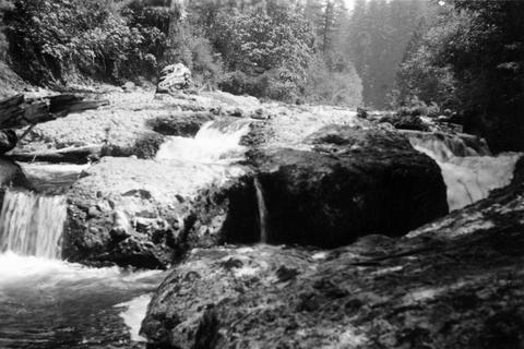
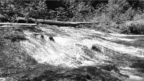
190. [Image] Row River falls
 Five foot bedrock falls on Row River, tributary to Coast Fork Willamette River, Oregon;1938-05-28
Citation -
191. [Image] Separation Creek
 Separation Creek just above the confluence with Horse Creek The creeks are tributaries to the McKenzie River;1938-07-21
Citation -
192. [Image] Separation Creek
 Separation Creek at the confluence with Horse Creek, tributaries of McKenzie River;1938-07-21
Citation -
193. [Image] Sharps Creek
 Shallow falls over bedrock on Sharps Creek It is impassable at present water level;1938-06-01
Citation -
194. [Image] Sharps Creek
 Shallow falls over bedrock on Sharps Creek It is impassable at present water level;1938-06-01
Citation -
195. [Image] Dam forming Lake Harriet
 Dam forming Lake Harriet, Oak Grove Fork Clackamas River, Oregon, and diverting water to Three Lynx Power Plant; 1950-06-04
Citation -
196. [Image] Delph Creek Hatchery
 Delph Creek Hatchery;1950-05-26
Citation -
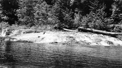
197. [Image] Sloping falls on Laying Creek
 Sloping falls on Layng Creek, tributary to Frank Brice Creek It is solid bedrock and the falls are easily passable at higher water at Rujada Ranger Station, 2 miles above mouth It is a barrier at low w...
Citation -
198. [Image] Fishway at River Mill Dam
 Fishway at River Mill Dam on the Clackamas River; 1950-05-26
Citation -
199. [Image] Fishway of River Mill Dam
 Fishway of River Mill Dam on the Clackamas River, Oregon;1950-05-26
Citation -
200. [Image] Willamette River
 Willamette River near the confluence of the Tualatin River West Linn, Oregon, (near Oregon City) is in the center; 1937-06-23
Citation