Search
You searched for:
Start Over
Historic stream surveys
Remove constraint Historic stream surveys
Subject
Streams -- Oregon
Remove constraint Subject: Streams -- Oregon
« Previous | 201 - 300 of 327 | Next »
Search Results
-
201. [Image] Hoisting log trailer
 Hoisting trailer on logging truck near Dollar, Oregon, on the Calapooia River; 1941-10-02 Photograph from Album 1 page 45
Citation -
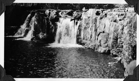
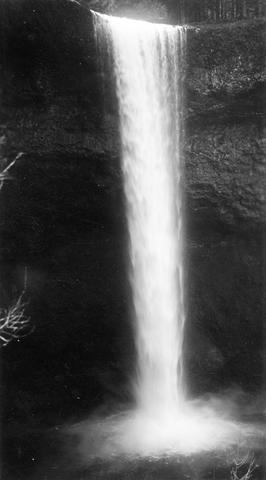
202. [Image] Silver Creek Falls
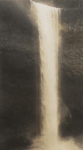 Silver Creek Falls, Oregon; 1938
Citation -
203. [Image] Silver Creek
 Silver Creek near Salem, Oregon; 1938
Citation -
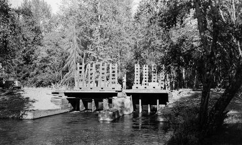
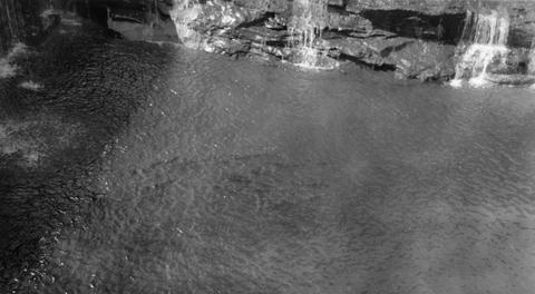
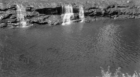
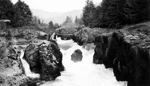
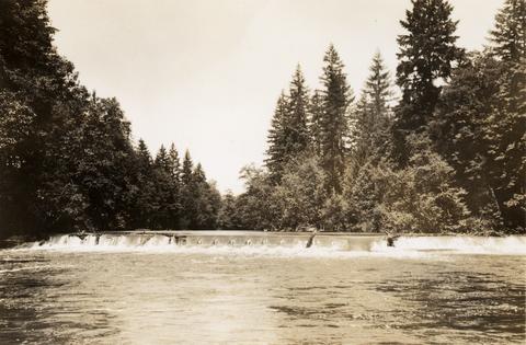
204. [Image] North and South Channel
 North Channel and South Channel facing upstream from bridge in Stayton, Oregon;1940-08-09
Citation -
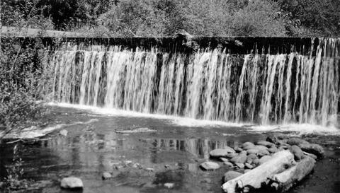
205. [Image] Lower part of mill dam
 Lower part of mill dam on Mill Creek, a tributary of Mohawk River;1938-06-20
Citation -
206. [Image] Gardiner ditch headgates
 Gardner [sic] ditch headgates from downstream The Gardner [sic] Ditch is part of the North Santiam River system; 1940-08-08
Citation -
207. [Image] Dam near mouth of Roaring Creek
 Dam near the mouth of Roaring Creek, a tributary of the Crabtree Creek located near Lacomb, Oregon;1940-08-21
Citation -
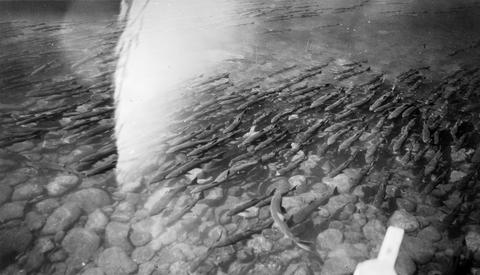
208. [Image] Chinooks at Abiqua Dam
 Chinook salmon at foot of Abiqua Dam located near Silverton, Oregon; 1940-09-08
Citation -
209. [Image] Silver Creek
 Silver Creek located near Silverton, Oregon; 1938
Citation -
210. [Image] Wiley Creek fish ladder
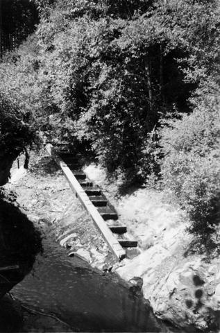 Fish ladder on Wiley Creek, a tributary to the South Santiam River, Oregon; 1938
Citation -
211. [Image] Upstream from Hartman Dam
 Looking upstream from Hartman Dam on Butte Creek; 1940-09-22
Citation -
212. [Image] Small water wheel
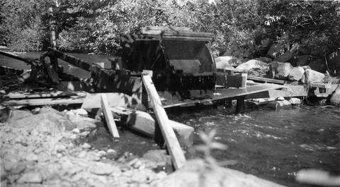 Small water wheel in Gales Creek above the town of Gales Creek, Oregon It was used to operate a small water pump; 1940-09-19
Citation -
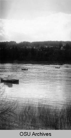
213. [Image] Willamette River
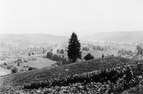 Willamette River near the confluence of the Tualatin River West Linn, Oregon (near Oregon City) is in the center;1937-06-23
Citation -
216. [Image] Wooden flume
 Wooden flume leading to power plant at Willamina, Oregon The power plant is located on Willamina Creek which is a tributary of the South Yamhill River; 1940-09-29
Citation -
217. [Image] Power dam on Willamina Creek
 Power dam on Willamina Creek, tributary of South Yamhill River near Willamina, Oregon The dam is located a short distance above the bridge on Highway 18; 1940-09-29
Citation -
218. [Image] Willamina Creek power dam
 Power dam on Willamina Creek, tributary of the South Yamhill River, located near Willamina, Oregon The power dam is located a short distance above the bridge on Highway 18; 1940-09-29
Citation -
219. [Image] Trees along the Tualatin
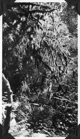 Trees along the Tualatin River heavily hung with moss; near Cherry Grove, Oregon; 1940-09-15 From Album 1 page 39
Citation -
220. [Image] Falls in Tualatin River
 Falls in Tualatin River 3-4 miles above Cherry Grove, Oregon; 1940-09-15 From Album 1 page 39
Citation -
221. [Image] Government Dam upper gates
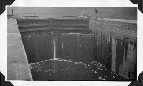 Upper gates in the government locks on the Yamhill River near Lafayette, Oregon When this photo was taken the water was so low that boats or log rafts could not be passed; 1940-09-26 From Album 1 page ...
Citation -
222. [Image] Sport fishing for chinook near Oregon City
 Willamette below Oregon City; sport fishing for chinook near Oregon City; 1938-05
Citation -
223. [Image] Cazadero Dam
 Cazadero Dam, now known as Faraday Dam, on Clackamas River, 70 feet with no ladder; 1938-06-28
Citation -
224. [Image] Silver Creek
 Silver Creek near Salem, Oregon; 1938
Citation -
225. [Image] Eagle Creek falls
 Eagle Creek falls 1/2 mile above Delph Creek; 1938-06
Citation -
226. [Image] Unloading logs
 Unloading logs into pond at Dollar, Oregon, on the Calapooia River;1941-10-02
Citation -
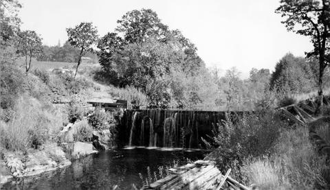
227. [Image] Lebanon power dam
 South Santiam River power dam at Lebanon, Oregon Fish ladder is in center of photo
Citation -
228. [Image] Gardiner ditch and dam
 Gardner [sic] ditch and dam located on the North Santiam River ;1940-08-08
Citation -
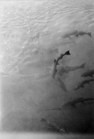
229. [Image] Chinook salmon
 A thousand chinook salmon in the holding pool at Foster hatchery located on the South Santiam River, Oregon;1940-08-14
Citation -
231. [Image] Eugene power plant dam fishway
 Fishway at the Eugene, Oregon, power plant dam on the McKenzie River;1938-06
Citation -
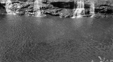
232. [Image] Beaver Creek falls
 Impassable falls on Beaver Creek. The falls are about 60 feet high
Citation -
233. [Image] Tide Creek gate
 Large fish unable to get through the gate on Tide Creek
Citation -
234. [Image] Cazadero Dam
 Cazadero Dam on the Clackamas River, Oregon;1950-05-26
Citation -
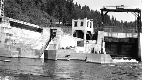
235. [Image] River Mill Dam
 River Mill Dam on Clackamas River, Oregon; 1950-06-04
Citation -
236. [Image] Sport fishing for chinook near Oregon City
 Willamette below Oregon City; sport fishing for chinook near Oregon City; 1938-05
Citation -
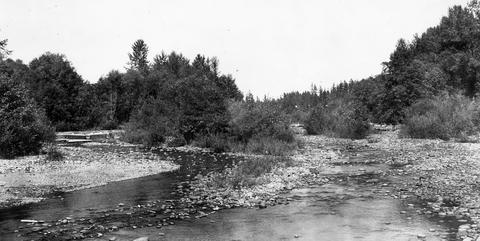
237. [Image] Lookingglass Creek
 Lookingglass Creek; looking upstream just below confluence of Big and Little Lookingglass. Little Lookingglass is coming in on right
Citation -
238. [Image] Sawmill dam
 Sawmill dam at mouth of Mary's River at Corvallis, Oregon;1940-08-22
Citation -
239. [Image] Chinooks at foot of Abiqua Dam
 Chinook salmon at the foot of Abiqua Dam located near Silverton, Oregon; 1940-09-08
Citation -
240. [Image] Abiqua Creek dam and ladder
 Dam and ladder on Abiqua Creek; 1940-09-15
Citation -
241. [Image] Bedrock chutes and falls
 Similar bedrock chutes and falls form much of bottom area; Delph Creek, Eagle Creek, Clackamas River; 1938-06
Citation -
242. [Image] Pollution from fruit cannery
 Pollution from fruit cannery entering the Pudding River above Woodburn, Oregon; 1940-09-06
Citation -
243. [Image] Chinooks at Abiqua Dam
 Chinook salmon at the foot of Abiqua Dam near Silverton, Oregon; 1940-09-08
Citation -
244. [Image] Upper dam above Stayton
 Upper dam above Stayton, Oregon, on the North Santiam River;1940-08-08
Citation -
245. [Image] Scott's Mills Dam
 Dam on Butte Creek just above Scotts Mills with no fish ladder; 1940-09-22
Citation -
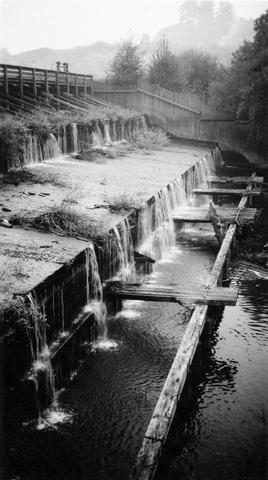
246. [Image] Salem Ditch and dam
 Salem Ditch and dam at take-off The Salem Ditch is part of the North Santiam River system;1940-08-08
Citation -
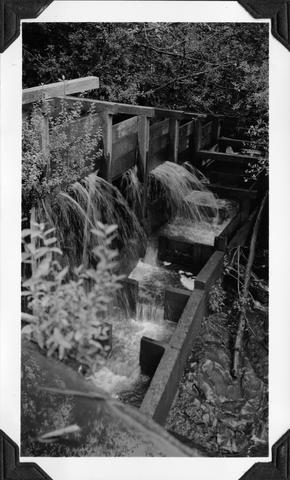
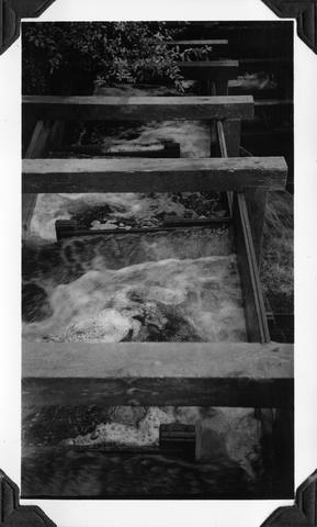
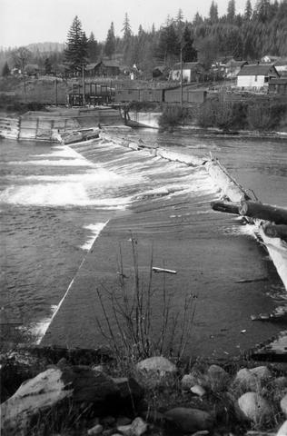
247. [Image] Stayton power canal
 Stayton power canal at by-pass Note dead chinook salmon in water;1940-08-06
Citation -
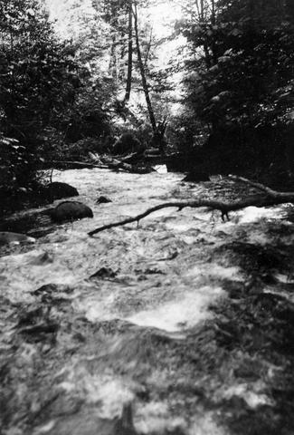
248. [Image] Impassable falls
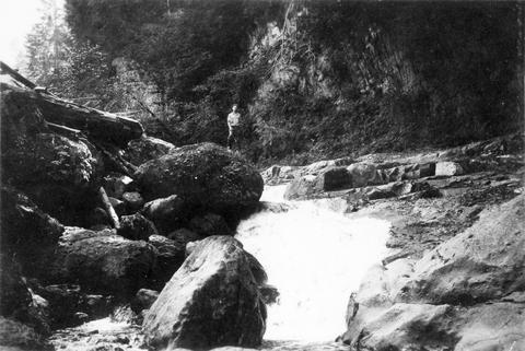 Impassable falls on the South Santiam River, 1 1/2 miles above the confluence of the Soda Fork The chute drops 18 feet in 18 feet over bedrock;1937-09-16
Citation -
249. [Image] Pollution from fruit cannery
 Pollution from fruit cannery entering the Pudding River across from Woodburn, Oregon; 1940-09-06
Citation -
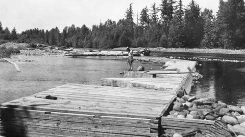
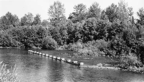
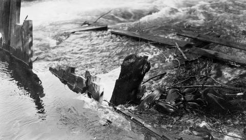
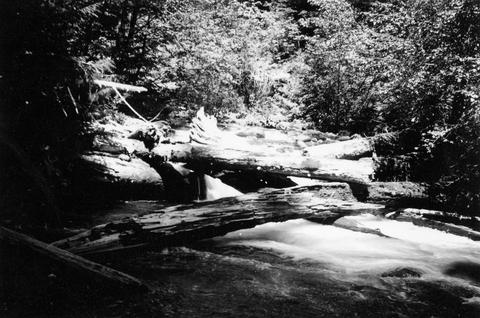
250. [Image] Sharps Creek log jam
 Lower end of log jam on Sharps Creek, tributary to Row River It is passable with difficulty;1938-06-01
Citation -
251. [Image] Collecting milt from chinook salmon
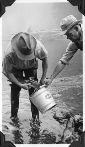 Collecting milt from ripe male chinook salmon at the Middle Santiam Salmon Hatchery near Foster, Oregon; Archie Anderson and assistant; 1940-09-25 From Album 1 page 7
Citation -
252. [Image] Log jam on Sharps Creek
 Upper end of log jam on Sharps Creek, tributary to Row River It is passable with difficulty;1938-06-01
Citation -
253. [Image] Obtaining chinook eggs
 Obtaining eggs from gravid chinook salmon by slitting belly; showing Archie Anderson and assistant at the Middle Santiam Salmon Hatchery near Foster, Oregon; 1940-09-25 From Album 1 page 7
Citation -
254. [Image] Willamina Creek dam
 Power dam on Willamina Creek, tributary to South Yamhill River, near Willamina, Oregon, a short distance above Highway 18 bridge;1940-09-29 From Album 1 page 42
Citation -
256. [Image] French Pete Creek
-
257. [Image] Dam at Carlton, Oregon
-
258. [Image] The Narrows--Molalla River
 The Narrows on the Molalla River average only 12 feet to 15 feet in width; 1941-09-25
Citation -
259. [Image] Falls in the Tualatin River
 Falls in the Tualatin River located about 3-4 miles above the town of Cherry Grove, Oregon; 1940-09-15
Citation -
260. [Image] Falls above Cherry Grove
 Falls in theTualatin River about 3-4 miles above the town of Cherry Grove, Oregon; 1940-09-15
Citation -
261. [Image] Upstream from Scio Dam
 Facing upstream from Scio Dam on Thomas Creek, a tributary to South Santiam River, Oregon; 1940-08-18
Citation -
262. [Image] Thomas Creek
 Thomas Creek above the Mountain States Jordan Power Plant and below Jordan Dam on the South Santiam River system in Oregon; 1940-08-20
Citation -
263. [Image] Thomas Creek
 Thomas Creek above the Mountain States Jordan Power Plant and below Jordan Dam on the South Santiam River system in Oregon;1940-08-20
Citation -
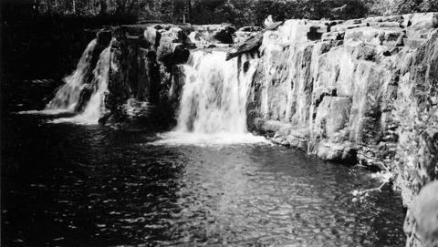
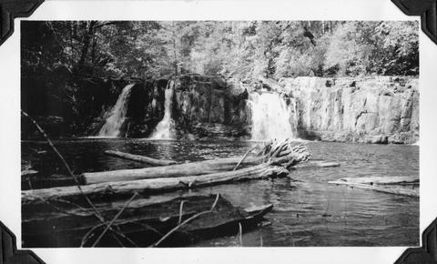
265. [Image] Wildwood Falls
 Wildwood Falls on Row River, Oregon;1938-05-28
Citation -
266. [Image] Wildwood Fallsre
 Wildwood Falls on Row River, tributary to Coast Fork Willamette River, Oregon;1938-05-28
Citation -
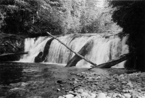
267. [Image] Row River falls
 Five foot falls on Row River, tributary of Coast Fork Willamette River The falls are passable at high water;1938-05-28
Citation -
268. [Image] Fish ladder
-
269. [Image] Fish ladder
-
271. [Image] Falls in Tualatin River
 Falls in Tualatin River 3-4 miles above Cherry Grove, Oregon; 1940-09-15 From Album 1 page 39
Citation -
272. [Image] Intake at Leaburg Power Plant
 Intake of Leaburg Power Plant on the McKenzie River; 1938-06
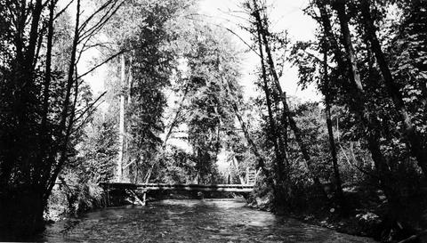
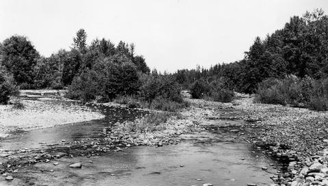
Citation -
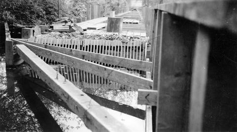
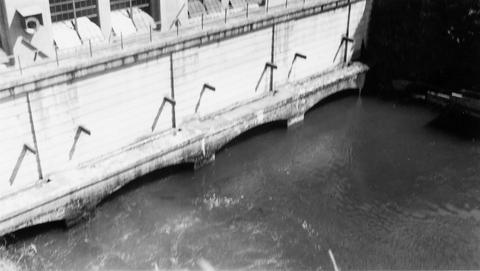
273. [Image] Chinook salmon-River Mill
 Chinook- River Mill tail-race, Clackamas River, Oregon; 1938-06-28
Citation -
274. [Image] Chinook below River Mill Power plant
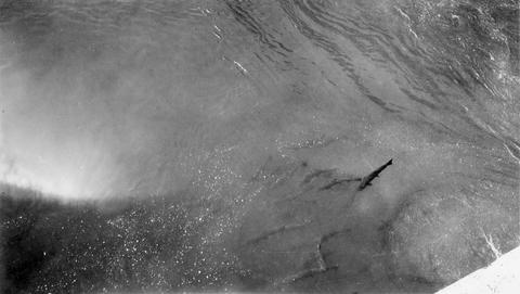 Chinook below River Mill Power house on the Clackamas River; 1938-06
Citation -
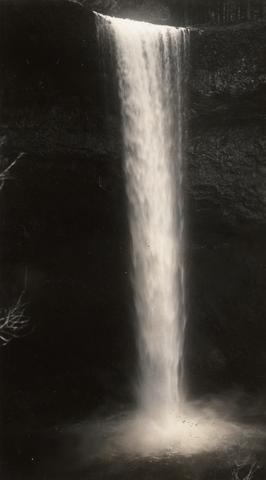
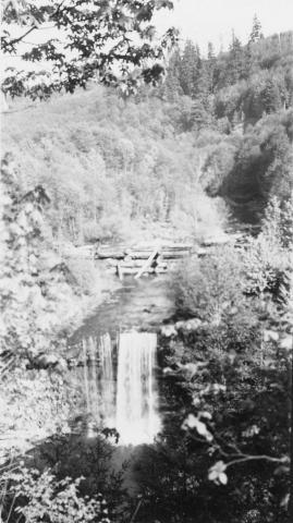
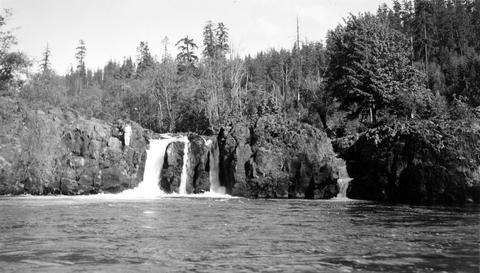
275. [Image] Salmon Creek Falls
 Salmon Creek Falls;1937-09
Citation -
276. [Image] Tamolitch Falls
 Tamolitch Falls on the McKenzie River during high water stage The falls are 40 feet high;1937-06-26
Citation -
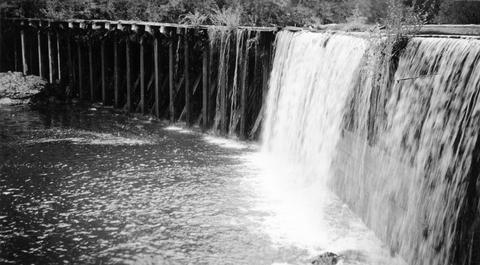
277. [Image] Gardiner Dam
 Gardner [sic] Dam viewed from bridge Gardner [sic] Dam is located on the North Santiam River; 1940-08-08
Citation -
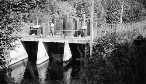
278. [Image] Gardiner Ditch
 Gardner [sic] Ditch 100 yards above the headgate, facing upstream; 1940-08-08
Citation -
279. [Image] Wildwood Falls
 Wildwood Falls on Row River Oregon, with a six foot jump in foreground;1938-05-28
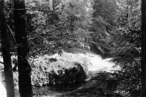
Citation -
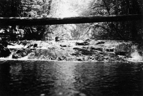
280. [Image] Narrow falls on Winberry Creek
 Narrow falls over bedrock ledge on Winberry Creek, tributary to Big Fall Creek, Oregon;1937-06
Citation -
281. [Image] Falls on Portland Creek
 Falls on Portland Creek, tributary to Big Fall Creek-six foot jump at low point;1937-06
Citation -
282. [Image] Swift Creek
 Swift Creek, tributary to Middle Fork Willamette River;1938-07
Citation -
283. [Image] Small storage dam
 Small storage dam on the Tualatin River, located 3 miles above the mouth It is 3 feet high but the downstream apron makes passage difficult; 1937-06-24
Citation -
284. [Image] Swift Creek
 Swift Creek, tributary to Middle Fork Willamette River;1938-07
Citation -
285. [Image] Collecting chinook eggs
 Collecting eggs by slitting the belly of ripe female chinook salmon at the Middle Santiam Salmon Hatchery near Foster, Oregon; Archie Anderson and assistant;1940-09-25 From Album 1 page 7
Citation -
286. [Image] South Santiam riffle
 Riffle on the South Santiam River about 2 1/2 miles below Crabtree Bridge All stones were heavily coated with brownish-green slime and persistent foam piled up in backwaters and floated down the river;Paper ...
Citation -
287. [Image] North and South Channel
 North Channel and South Channel facing upstream from bridge in Stayton, Oregon;1940-08-09
Citation -
288. [Image] North and South Channel
 North Channel and South Channel facing upstream from bridge in Stayton, Oregon;1940-08-09
Citation -
289. [Image] North and South Channel
 North Channel and South Channel facing upstream from bridge in Stayton, Oregon;1940-08-09
Citation -
290. [Image] South Santiam River, Oregon
 South Santiam River, Oregon Riffle about 2 1/2 miles below Crabtree Bridge All stones were heavily coated with brownish-green slime and persistent foam piled up in backwaters and floated down the rive...
Citation -
291. [Image] Salem Ditch
 Salem Ditch looking upstream from headgate;1940-08-08
Citation -
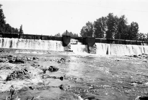
292. [Image] Mill City dam
 Mill City dam located on the North Santiam River in Oregon; 1938
Citation -
293. [Image] Quartzville Creek
 Quartzville Creek, tributary of Middle Santiam River, Oregon;1938
Citation -
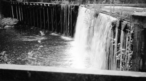
294. [Image] Gardiner Dam
 Gardner [sic] Dam from the bridge on the North Santiam River;1940-08-08
Citation -
296. [Image] River Mill Power plant
 Chinook in tail-race at the River Mill Power Plant on the Clackamas River; 1938-06
Citation -
297. [Image] Upper Blue River
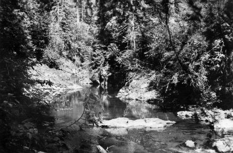 Photo is characteristic of big pools and bedrock banks found on the upper Blue River, a tributary of the McKenzie River;1937-08-17
Citation -
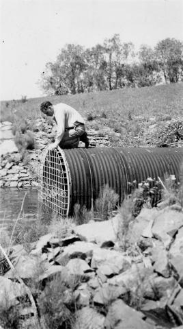
298. [Image] Rack across McKenzie River
 Rack across the McKenzie River above Eugene, Oregon (near Hendricks Bridge);1938-06
Citation -
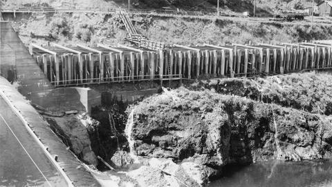
299. [Image] Salem Ditch dam
 Salem Ditch dam taken from lower Gardner (sic) Dam;1940-08-08
Citation -
300. [Image] Scio Dam fish ladder
 Poor fish ladder on Scio Dam on Thomas Creek, tributary to South Santiam River, Oregon; 1940-09-18
Citation