Search
You searched for:
Start Over
Historic stream surveys
Remove constraint Historic stream surveys
Subject
Streams -- Oregon
Remove constraint Subject: Streams -- Oregon
« Previous | 241 - 250 of 327 | Next »
Search Results
-
241. [Image] Bedrock chutes and falls
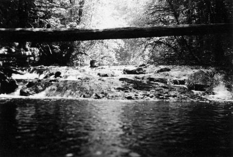 Similar bedrock chutes and falls form much of bottom area; Delph Creek, Eagle Creek, Clackamas River; 1938-06
Citation -
242. [Image] Pollution from fruit cannery
 Pollution from fruit cannery entering the Pudding River above Woodburn, Oregon; 1940-09-06
Citation -
243. [Image] Chinooks at Abiqua Dam
 Chinook salmon at the foot of Abiqua Dam near Silverton, Oregon; 1940-09-08
Citation -
244. [Image] Upper dam above Stayton
 Upper dam above Stayton, Oregon, on the North Santiam River;1940-08-08
Citation -
245. [Image] Scott's Mills Dam
 Dam on Butte Creek just above Scotts Mills with no fish ladder; 1940-09-22
Citation -
246. [Image] Salem Ditch and dam
 Salem Ditch and dam at take-off The Salem Ditch is part of the North Santiam River system;1940-08-08
Citation -
247. [Image] Stayton power canal
 Stayton power canal at by-pass Note dead chinook salmon in water;1940-08-06
Citation -
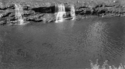
248. [Image] Impassable falls
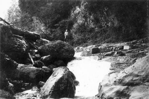 Impassable falls on the South Santiam River, 1 1/2 miles above the confluence of the Soda Fork The chute drops 18 feet in 18 feet over bedrock;1937-09-16
Citation -
249. [Image] Pollution from fruit cannery
 Pollution from fruit cannery entering the Pudding River across from Woodburn, Oregon; 1940-09-06
Citation -
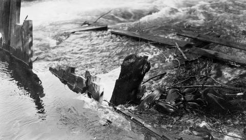
250. [Image] Sharps Creek log jam
 Lower end of log jam on Sharps Creek, tributary to Row River It is passable with difficulty;1938-06-01
Citation