Search
You searched for:
Start Over
Historic stream surveys
Remove constraint Historic stream surveys
Subject
Streams
Remove constraint Subject: Streams
« Previous | 61 - 80 of 98 | Next »
Search Results
-
61. [Image] Irrigation diversion on Big Creek
 Irrigation diversion on Big Creek, a tributary to North Fork Payette River
Citation -
62. [Image] Falls on Rock Creek
 Upper part of series of falls on Rock Creek one mile above the Columbia River
Citation -
63. [Image] Burlingame Ditch
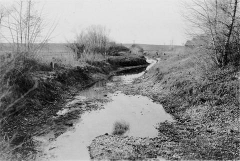 Burlingame Ditch is a tributary to the Walla Walla River.
Citation -
64. [Image] Hot springs
 Series of hot springs just above box canyon on Warm Springs Creek which is a tributary to Loon Creek, Idaho
Citation -
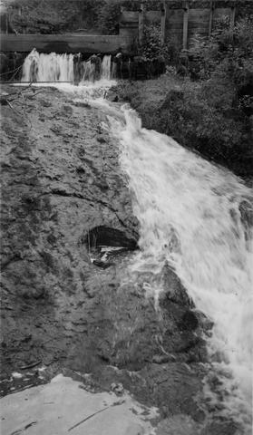
65. [Image] Fast cascades
 Fast cascades over bedrock on Rock Creek four miles above the mouth. It is a barrier to fish at low water.
Citation -
66. [Image] Warm Springs Creek
 Warm Springs Creek tributary to Loon Creek, Idaho. Box canyon shown a short distance above Mahoney Creek confluence
Citation -
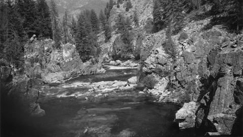
67. [Image] Watershed between Loon and Cougar Creeks
 Typical watershed between Loon and Cougar Creeks. Broad benches are common
Citation -
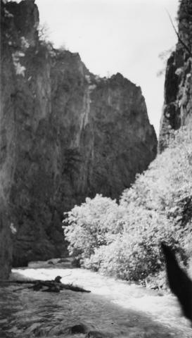
68. [Image] Rock Creek falls near Stevenson, Washington
 View of impassable series of falls one mile above the mouth of Rock Creek
Citation -
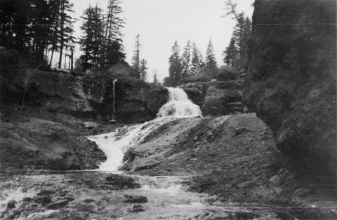
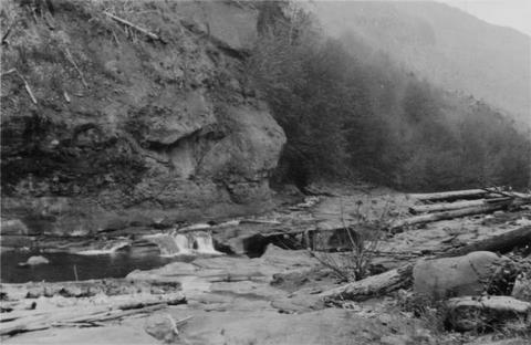
69. [Image] Falls on Rock Creek
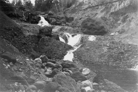 Series of falls on Rock Creek near Stevenson, Washington, one mile above the Columbia River. It drops a total of forty five feet.
Citation -
70. [Image] Falls on Rock Creek near Stevenson, Washington
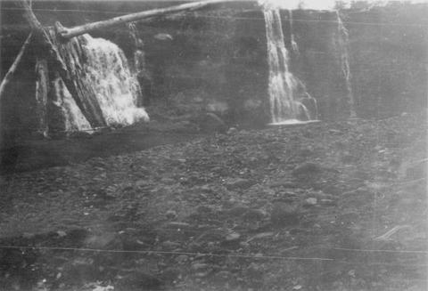 The falls are impassable and are twenty five feet high.
Citation -
71. [Image] Cedar Creek dam and falls
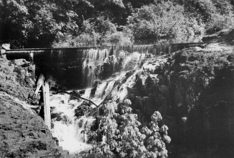 20 foot dam and falls on Cedar Creek near Hall, Washington. Photo shows nearly low-water stage
Citation -
72. [Image] Cedar Creek dam and falls
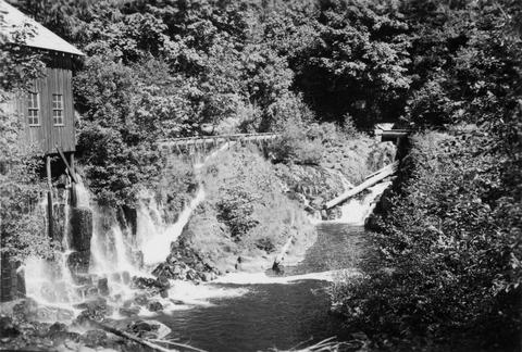 Power diversion, old mill, diversion return and fish-ladder at Cedar Creek dam and falls at Hall, Washington. Dam and falls only partly showing upstream. Fish-ladder leads into diversion
Citation -
73. [Image] Copper Creek
 Copper Creek just above mouth. It is a tributary to the East Fork of the Lewis River.
Citation -
 Looking downstream from high point in trail a short distance below Cougar Creek
Citation -
75. [Image] View above Elkhorn Creek
 View downstream from big cliff above Elkhorn Creek. The riffle looks good but the rubble averages are too large for good spawning area
Citation -
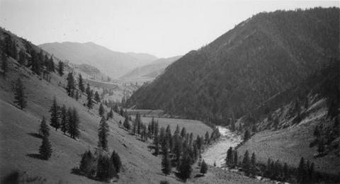
76. [Image] Niggerhead Creek valley (Yellowjacket Creek)
 Looking down the lower valley of Niggerhead Creek. Cispus River is at the base of Spud Mountain in the background
Citation -
77. [Image] Irrigation Dam
 Irrigation dam on Crooked Creek. There is no fish ladder present
Citation -
78. [Image] Stratified sandstone on Coal Creek
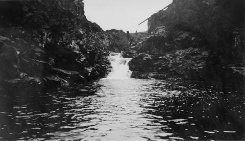
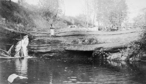 Stratified sandstone Coal Creek, a tributary to the Columbia River
Citation -
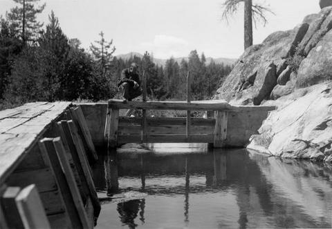
79. [Image] Sulphur Creek Falls
 Downstream view from horse bridge at head end of falls
Citation -
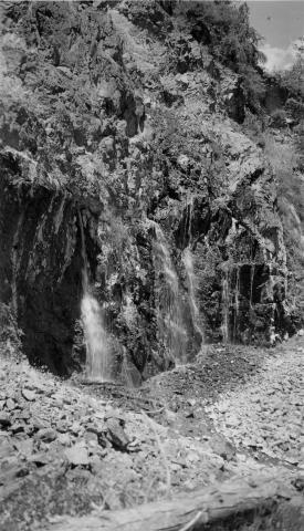
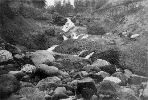
80. [Image] Sulphur Creek bedrock chute
 12 ft impassable bedrock chute short distance above highway bridge This is topped by a 6 ft dam
Citation