Search
You searched for:
Start Over
Historic stream surveys
Remove constraint Historic stream surveys
Subject
Rivers -- Washington
Remove constraint Subject: Rivers -- Washington
« Previous | 1 - 100 of 274 | Next »
Search Results
-
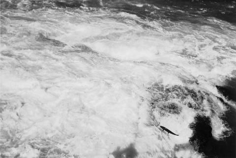
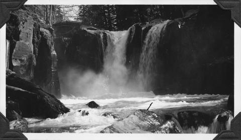
1. [Image] Cowlitz River falls
 Cowlitz River falls eight miles below Randle, Washington. The drop of the lower falls is 4 feet.
Citation -
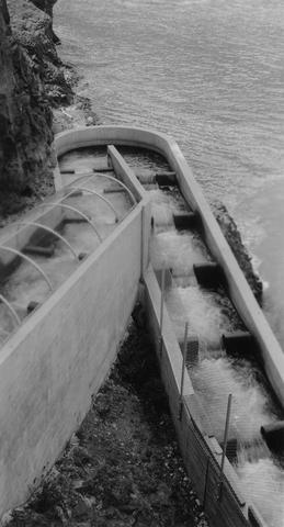
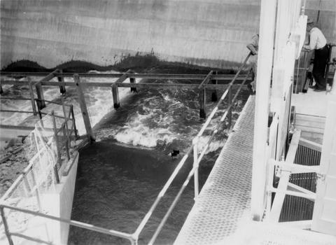
2. [Image] East fishway and collecting pool
 Rock Island Dam
Citation -
3. [Image] Loading fish at central trap
 Rock Island Dam
Citation -
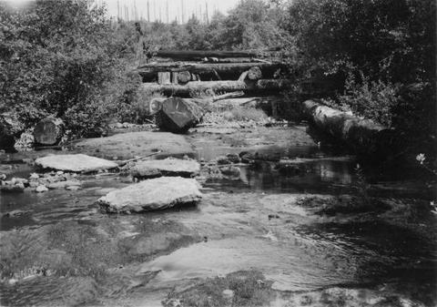
4. [Image] Falls on Cat Creek
 Falls on Cat Creek, tributary to the Cispus River, 1/4 mile above the mouth. Lower falls is 4 feet high and the upper falls is 10 feet high
Citation -
5. [Image] Impassable bedrock chute
 Impassable bedrock chute on North Fork Cispus River near Timonium Creek. Drops 25 feet in 60 feet. There are no pools
Citation -
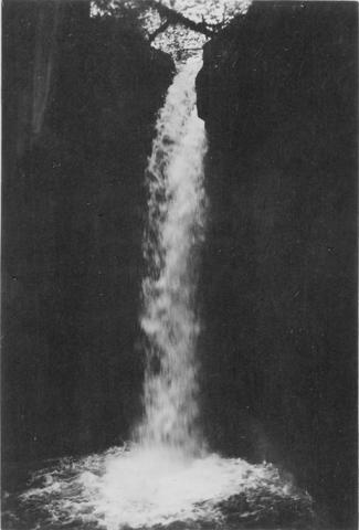
6. [Image] Timonium Creek falls
 75 foot series of falls on Timonium Creek near its confluence with the North Fork of the Cispus River. Indicates terrific flood stages
Citation -
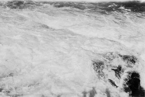
7. [Image] Chinooks jumping over middle rocks
 Rock Island Dam
Citation -
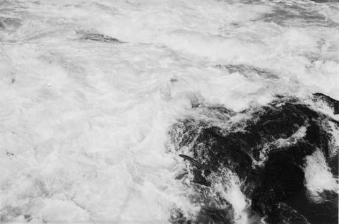
8. [Image] Chinook on rock
 Chinook on rock left of middle ladder at the Rock Island Dam
Citation -
9. [Image] Salmon entering elevator from brail
 Rock Island Dam left trap in the summer
Citation -
10. [Image] Chinook jumping
 Chinook jumping over middle rocks at the Rock Island Dam
Citation -
11. [Image] Chinook jumping rock
 Chinook jumping rock left of middle ladder at the Rock Island Dam
Citation -
12. [Image] Chinook jumping rock
 Chinook jumping rock left of middle ladder at the Rock Island Dam
Citation -
13. [Image] Rescuing downstream chinook migrants
 Frey Holland and Parkhurst rescuing downstream chinook migrants from side pockets in the Entiat River
Citation -
14. [Image] Unloading fish truck
 Unloading fish truck at dump number 2 on the Entiat River as part of salmon reclamation
Citation -
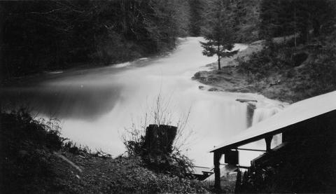
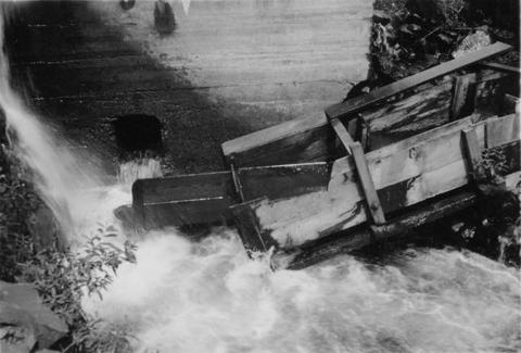
15. [Image] Cedar Creek Falls
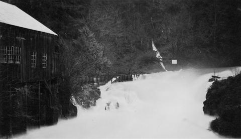 Powerflume, fish-ladder and mill at high-water stage on Cedar Creek Falls
Citation -
16. [Image] Cedar Creek Falls
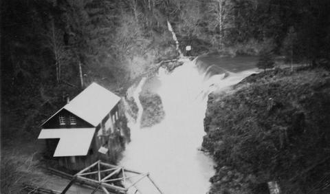 Birdseye view of Cedar Creek falls and small power developement
Citation -
17. [Image] Cedar Creek Falls
 Cedar Creek Falls at high-water stage near Hall, Washington
Citation -
18. [Image] Muddy Fork of Cispus River
 Muddy Fork of Cispus River which flows at 10 seconds per foot and is 20 feet wide. Mt Adams is in left background [Print is reversed]
Citation -
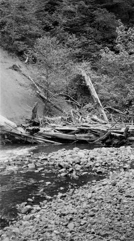
19. [Image] Mouth of East Canyon Creek
 Mouth of East Canyon Creek, a tributary to Cispus River, showing a 30 foot log jam
Citation -
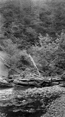
20. [Image] Niggerhead Creek log jam (Yellowjacket Creek)
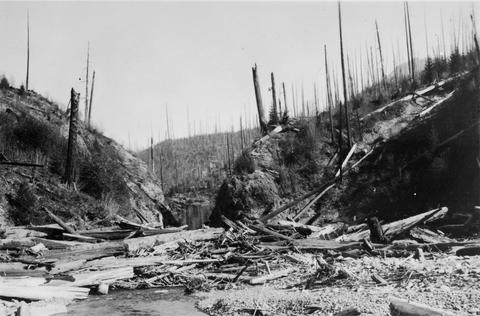 Looking down at upper end of big log jam on Niggerhead Creek
Citation -
21. [Image] Niggerhead Creek falls (Yellowjacket Creek)
 Falls on Niggerhead Creek 4 miles above road. The falls are 25 feet high
Citation -
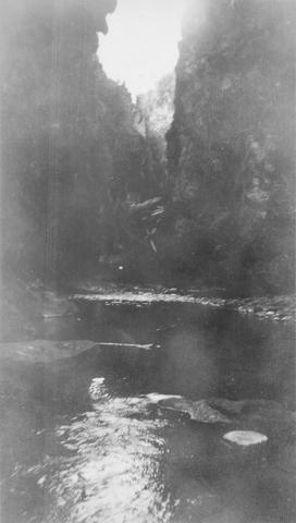
22. [Image] Niggerhead Creek box canyon (Yellowjacket Creek)
 Looking down small box canyon on Niggerhead Creek, tributary to Cispus River, 500 yards above road bridge. The stream is 35 feet wide
Citation -
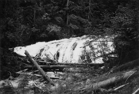
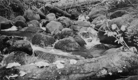
23. [Image] Silver Falls Creek
 Silver Falls Creek, tributary to the Cispus River
Citation -
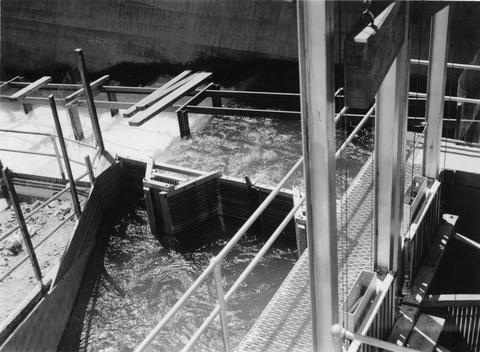
24. [Image] Central fish hoist and elevator
 Central fish hoist and elevator at Rock Island Dam
Citation -
25. [Image] Snagging for chinook salmon
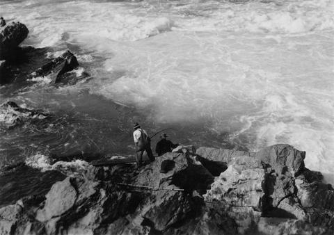 Indian snagging for chinook salmon at Kettle Falls
Citation -
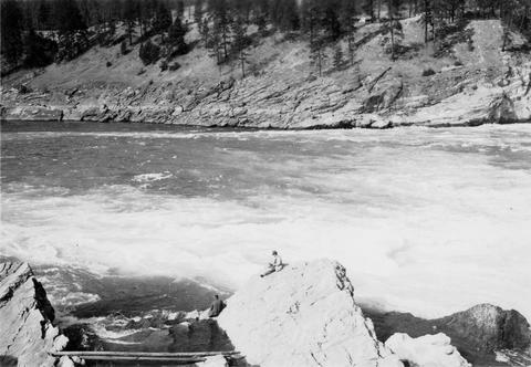
26. [Image] Waterfalls on Grays River
 8 foot falls (so-called) below the "Big Slide" on the Grays River. Station 4 is about 4 miles above the Highway. Falls are the only obstruction on river
Citation -
27. [Image] Left fish trap
 Left (east) fish trap at Rock Island Dam
Citation -
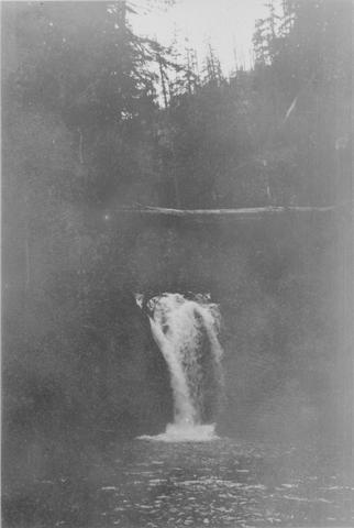
28. [Image] Gail Falls
 Gail Falls on the Cispus River is 200 yards below Cat Creek. The falls are 30 feet high and 8 feet wide
Citation -
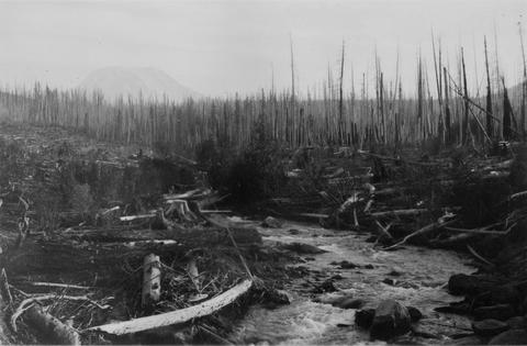
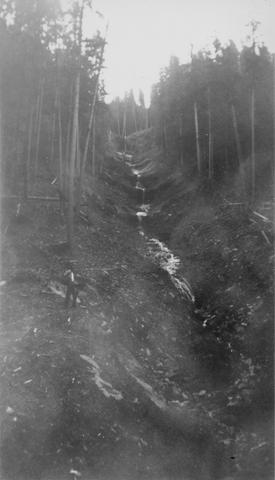
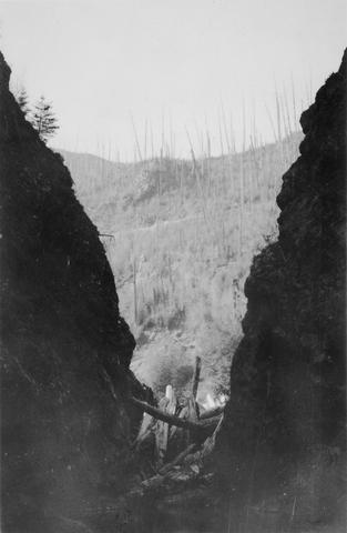
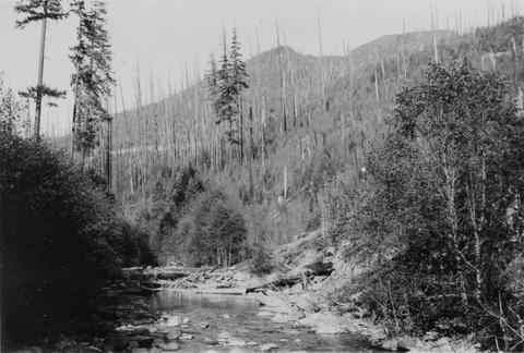
29. [Image] Watershed of Upper Cispus River
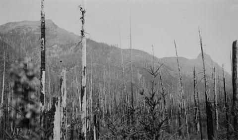 Watershed of Upper Cispus River showing extensive burn-over area and mountainous terrain
Citation -
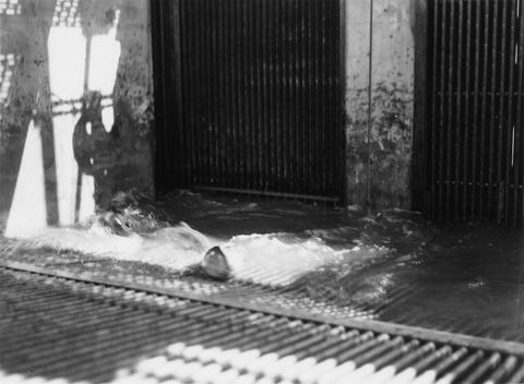
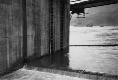
30. [Image] Lamprey eels at the Bonneville Dam
 Lampreys are using a temporary fish ladder while the dam is under construction
Citation -
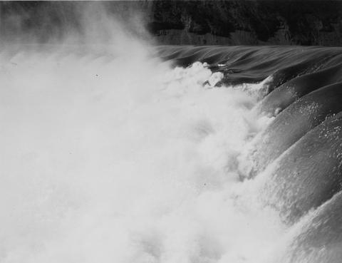
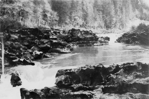
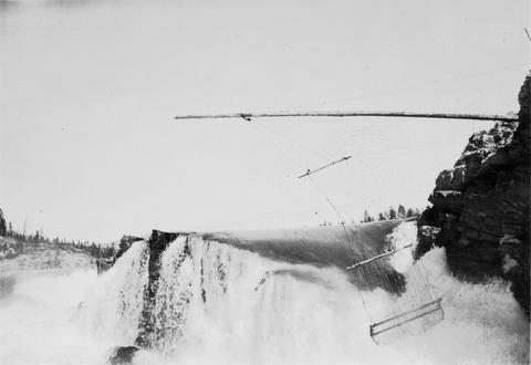
31. [Image] Cowlitz Falls
 Cowlitz Falls 8 miles below Randle, Washington
Citation -
32. [Image] Falls on Goat Creek
 35 foot falls on Goat Creek, located 530 yards above its confluence with the Cowlitz River
Citation -
33. [Image] Lake Creek falls
 25 foot falls on Lake Creek two mile above its mouth. Lake Creek is the outlet of Packwood Lake in the Cowlitz River system
Citation -
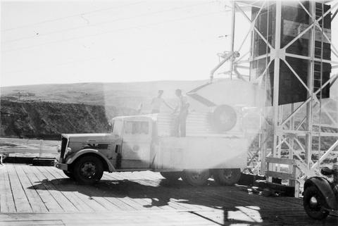
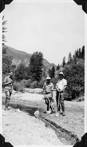
34. [Image] Lucy Ann I
 Our offical means of transportation, the Lucy Ann I, starts on her maiden voyage with T A Dawson (Assistant Biologist Aide) at the helm. On the Wenatchee River opposite the mouth of the Chiwawa River in ...
Citation -
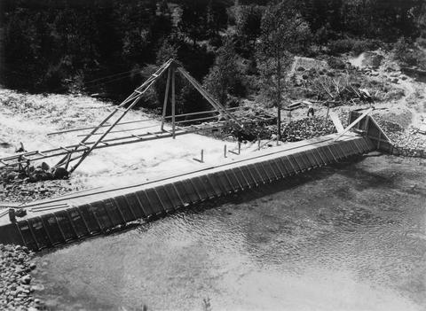
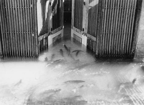
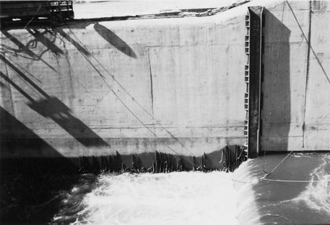
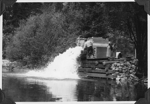
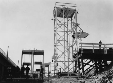
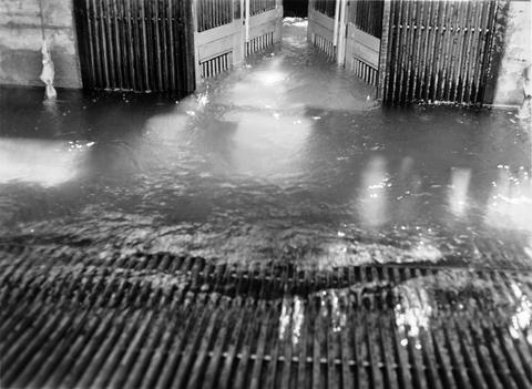
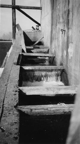
35. [Image] Roll way at the Bonneville Dam
-
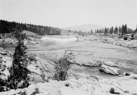
36. [Image] Steelhead trout and Indian jump trap
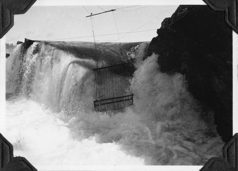 Photo shows Kettle Falls, on the Columbia River, which are now obliterated by the backwater from Grand Coulee Dam
Citation -
37. [Image] Remains of hatchery traps on Chinook Creek
-
39. [Image] Upper Kettle Falls on the Columbia River
-
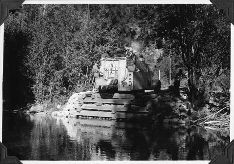
40. [Image] Mason Creek
-
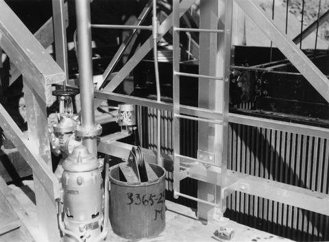
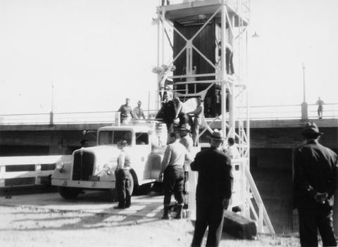
41. [Image] Entiat weir under construction
-
42. [Image] Chinooks near Wenatchee River fish dump
-
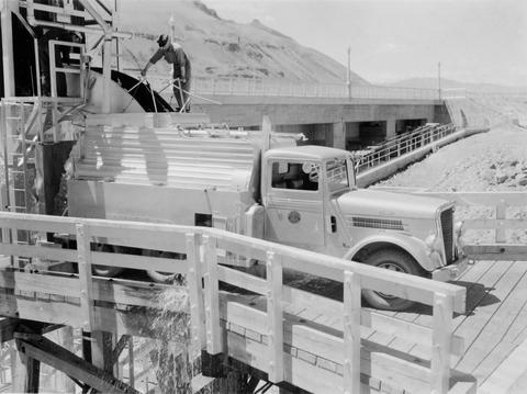
43. [Image] Fish truck at Entiat River
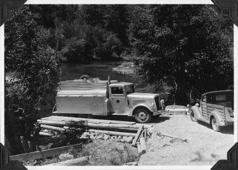 Photo shows fish truck at unloading station number 1 as part of the salmon reclamation
Citation -
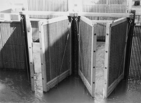
44. [Image] Tide gates at mouth of Chinook Creek
-
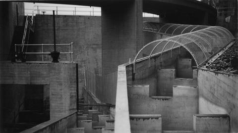
45. [Image] Rock Island Dam power plant and gates
-
46. [Image] Rock Island dam central spillway
-
47. [Image] Tunnels from collecting pool
 Picture taken from brail showing tunnels which enter from collecting pool on the left trap at Rock Island Dam during Spring
Citation -
48. [Image] Cedar Creek Falls at high water
-
49. [Image] Chinook salmon
 Chinooks at Kalama rack
Citation -
50. [Image] Chinook salmon
 Chinooks at Kalama rack
Citation -
51. [Image] Unloading fish truck
 Unloading fish truck at dump number 2 on the Entiat River as part of salmon reclamation
Citation -
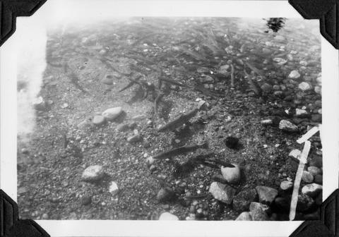
52. [Image] Spawning riffle above weir
 Looking downstream on the Entiat River near Brief, Washington, during the summer
Citation -
53. [Image] Elevator down on the left trap
 Elevator down on the left trap at Rock Island Dam during the summer
Citation -
54. [Image] Niggerhead Creek log jam (Yellowjacket Creek)
 Lower end of big log jam in box canyon on Niggerhead Creek. It is a barrier to fish at this point. The Creek is 35 feet wide and the jam is 25 feet high
Citation -
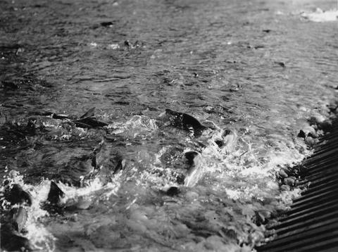
55. [Image] Dog salmon spawning
 Dog salmon spawning in Grays River
Citation -
56. [Image] Jump trap at Kettle Falls
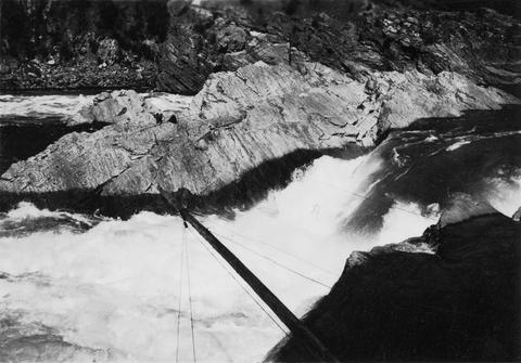 Photo showing "jump trap" at Kettle Falls
Citation -
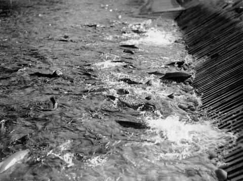
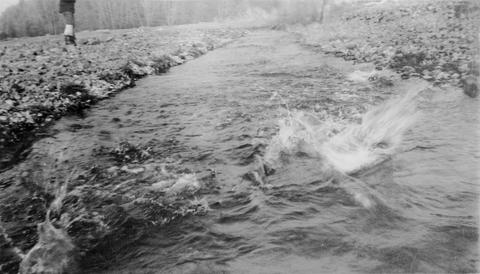
57. [Image] Lower Grays River
 Typical stretch of lower Grays River with splashes from dog salmon
Citation -
58. [Image] Fishing for whitefish
 Fishing for whitefish on the Columbia River at Kettle Falls
Citation -
59. [Image] Niggerhead Creek (Yellowjacket Creek)
 Niggerhead Creek, tributary to the Cispus River shown 1300 yards above road bridge. There is a log jam in the background. The stream is 40 ft wide
Citation -
60. [Image] Horseshoe Falls
-
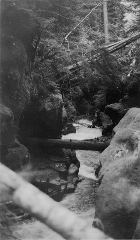
61. [Image] Johnson Creek Canyon
 Characteristic of Johnson Creek Canyon, on upper Cowlitz River
Citation -
62. [Image] First fish haul
 Left trap at Rock Island Dam during spring
Citation -
63. [Image] Chinooks jumping
 Chinooks jumping left of middle ladder at Rock Island Dam
Citation -
64. [Image] Elevator tower and loading platform
 Rock Island Dam left trap during summer
Citation -
65. [Image] Impassible log jam on Wilson Creek
 Impassible log jam on Wilson Creek, a tributary of Skamokawa Creek
Citation -
66. [Image] Toutle River
 Toutle River, tributary to the Cowlitz River
Citation -
67. [Image] Impassible log jam on Wilson Creek
 Impassible log jam on Wilson Creek, a tributary of Skamokawa Creek
Citation -
68. [Image] Toutle River
 Toutle River shown 3 miles above Outlet Creek
Citation -
69. [Image] Stratified sandstone falls on Coal Creek
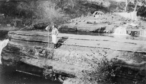 Coal Creek is a tributary to the Columbia River
Citation -
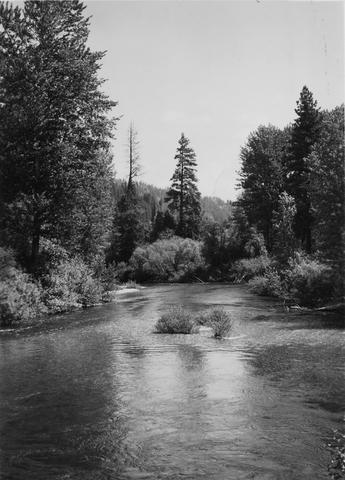
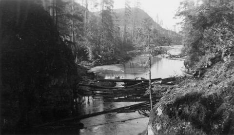
70. [Image] Cispus River
 Cispus River above mouth of East Canyon Creek. Cispus River is a tributary to the Cowlitz River.
Citation -
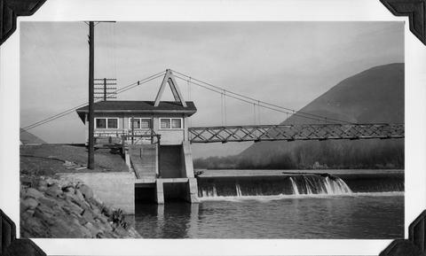
71. [Image] Rock Island dam power plant and gates
-
72. [Image] Rock Island Dam
 Rock Island Dam on the Columbia River. The middle fish ladder has not yet been constructed
Citation -
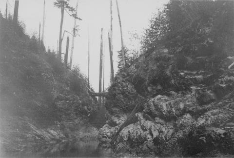
73. [Image] East Canyon Creek Falls
 Falls above mouth of East Canyon Creek, a tributary to the Cispus River
Citation -
74. [Image] Brail from left trap
 Brail from left trap at Rock Island Dam during summer
Citation -
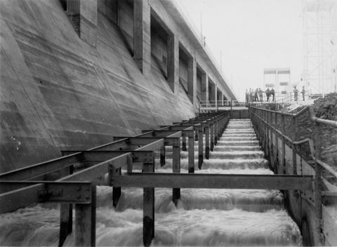
75. [Image] Gate into hoist at trap
 View from brail into fish hoist at Rock Island Dam
Citation -
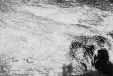
76. [Image] Chinook on rock
 Chinook on rock left of middle ladder; Rock Island
Citation -
77. [Image] Columbia River at The Dalles, Oregon
-
78. [Image] Wapato Dam
-
79. [Image] Rosa Dam Fish Ladder
-
80. [Image] First load of salmon
 Left trap at Rock Island Dam during spring
Citation -
81. [Image] Central spill taken from middle fishway
 Rock Island Dam
Citation -
82. [Image] Adams Creek box canyon
 Narrow box canyon at lowest 1/4 mile of Adams Creek, a tributary of the Cispus River, near Randle, Washington
Citation -
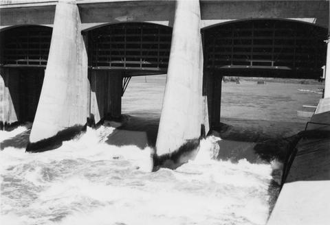
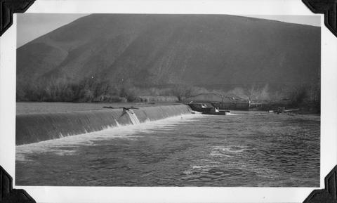
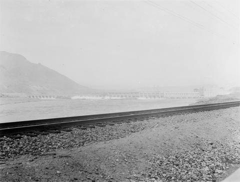
83. [Image] Rock Island Dam
 Rock Island Dam on the Columbia River
Citation -
84. [Image] Wapato project dam
 Main dam and central fish ladder at the Wapato project dam
Citation -
85. [Image] Wapato project dam
 Main dam and central fish ladder at the Wapato project dam
Citation -
86. [Image] Dividing dam and headgates
 Dividing dam and headgates on New Reservation Ditch (Wapato Project)
Citation -
87. [Image] Indian jump trap
 Indian "jump-trap" on Kettle Falls for steelhead and salmon
Citation -
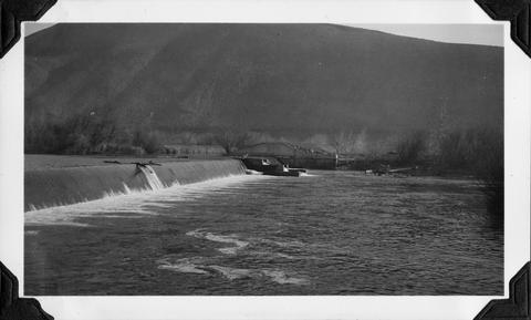
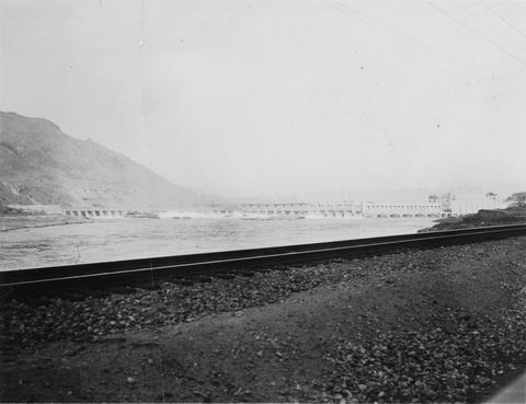
88. [Image] Rock Island Dam
 Rock Island Dam on the Columbia River
Citation -
89. [Image] Rock Island Dam
 Rock Island Dam on the Columbia River
Citation -
90. [Image] Left fish ladder
 Left Ladder (east fishway) at Rock Island Dam
Citation -
91. [Image] Mill dam on the Little Washougal River
-
92. [Image] Woods Creek
 Mouth of Woods Creek showing steep gradient and moss-covered boulders in stream bed. It is inaccessible at low water. Woods Creek is a tributary to the Cispus River
Citation -
93. [Image] Gail Falls
 Gail Falls on Cispus River just below Cat Creek confluence
Citation -
94. [Image] Fish ladder and collecting pool
 Fish ladder and collecting pool, left trap, at the Rock Island Dam
Citation -
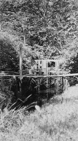
95. [Image] Fish ladder
 Fish ladder on the Washougal River upper dam
Citation -
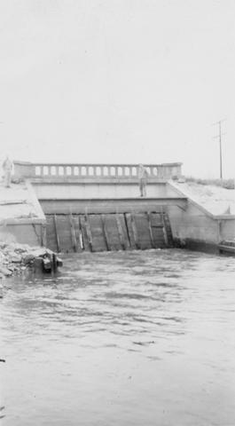
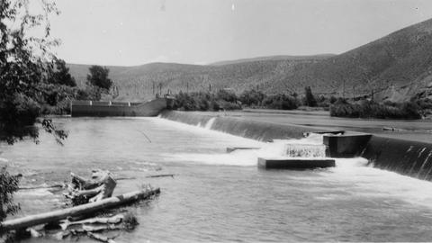
96. [Image] 9 mile dam on the Walla Walla River
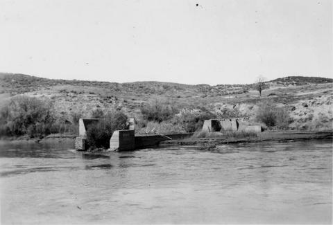 Dam has been blasted out.
Citation -
97. [Image] Camas water supply dam
 Camas, Washington water intake on the Little Washougal River
Citation -
98. [Image] Camas water supply dam
 Camas, Washington water intake on the Little Washougal River
Citation -
99. [Image] Fish ladders
 North fish ladder over Sunnyside Dam near the Sunnyside ditch headgates
Citation -
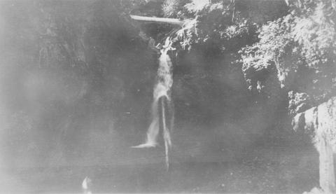
100. [Image] Temporary fish ladder
 Temporary ladder on the Oregon side of the Bonneville Dam
Citation