Search
You searched for:
Start Over
Historic stream surveys
Remove constraint Historic stream surveys
Subject
Rivers -- Washington
Remove constraint Subject: Rivers -- Washington
« Previous | 201 - 250 of 274 | Next »
Search Results
-
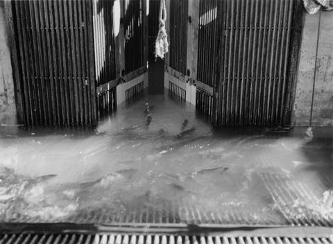
201. [Image] Releasing marked fish
 Releasing marked fish above Bonneville Dam with the anal and right vental removed
Citation -
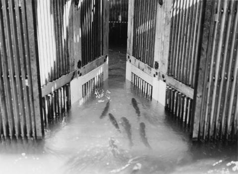
202. [Image] Releasing marked fish
 Releasing marked fish above Bonneville Dam with the anal and right vental removed
Citation -
203. [Image] North Branch Toutle River
 Part of channel of North Branch Toutle River in broad outwash plain near Mt St Helens
Citation -
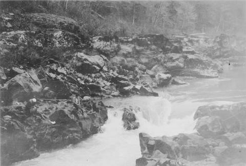
204. [Image] Fish tail falls
 Fish tail falls near Silver Creek on the Entiat River
Citation -
206. [Image] Washougal River
 Washougal River at an upstream power dam which shows a new fish ladder
Citation -
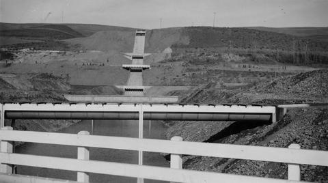
207. [Image] Richland Dam
 Richland dam near mouth of Yakima River
Citation -
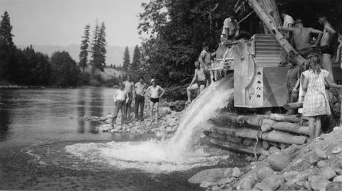
209. [Image] Stocking fish
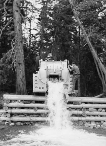 Dumping fish in Wenatchee River above Tumswater weir at Plain, Washington
Citation -
210. [Image] Falls and log jam
 Falls and log jam in Little Wenatchee River beyond which the bluebacks, chinooks, steelheads, "silvers," etc could not migrate in 1939
Citation -
211. [Image] Richland Dam
 Richland Dam near mouth of the Yakima River
Citation -
212. [Image] Chinooks jumping over middle rocks
 Rock Island Dam
Citation -
213. [Image] Chinook salmon
 Chinooks at Kalama rack
Citation -
214. [Image] Tunnels from collecting pool
 Tunnels from collecting pool into brail at east trap at the Rock Island Dam
Citation -
215. [Image] Chinooks jumping rock
 Chinooks jumping rock left of middle ladder at Rock Island Dam
Citation -
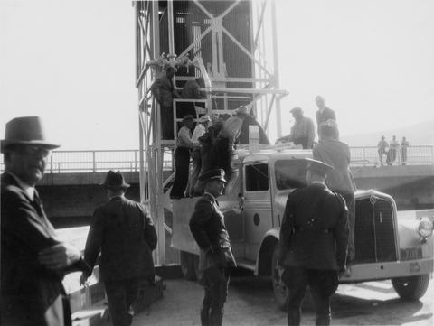
216. [Image] First fish haul
 Left trap at Rock Island Dam. Washington Governor Clarence Daniel Martin on truck
Citation -
217. [Image] Irrigation ditches
 Irrigation ditches from the Yakima River crossing the Terrace Heights Wasteway of the Roza Canal near Yakima, Washington. Crossing from the top to bottom are: Roza Canal; Selah-Moxee Canal; Highway Bridge; ...
Citation -
218. [Image] Rock Island Dam
 Rock Island dam showing the central spillway, west trap and fishway
Citation -
219. [Image] Cispus River from Muddy Fork bridge
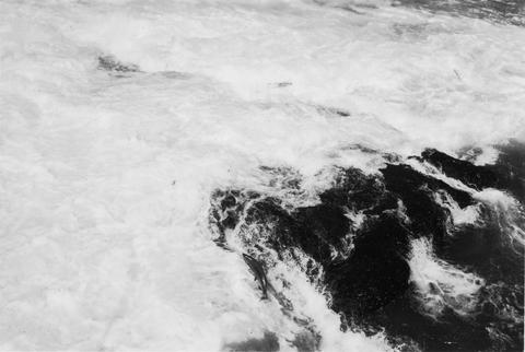
 River 22 feet wide and the falls are 5 feet high
Citation -
220. [Image] Rock Island Dam
 Rock Island Dam on the Columbia River
Citation -
221. [Image] Backpacking trip into Grays River
 Pictured Left to Right: Lobell; Hanavan; and Jobes rest during backpacking trip into Grays River.. They carried 60 pounds each in their packs.
Citation -
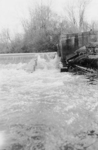
222. [Image] Sawmill Dam
-
223. [Image] Bear Creek waterfalls
 Impassable 10 foot falls 1/4 mile above mouth of Bear Creek, a tributary of the South Fork Toutle River
Citation -
224. [Image] Gate into hoist of fish trap
 Gate into hoist of fish trap at Rock Island Dam
Citation -
225. [Image] Central fish hoist and elevator
 Central fish hoist at Rock Island Dam
Citation -
227. [Image] Spawning riffles in Nason Creek
 Excellent spawning riffles for salmon and steelhead trout in Nason Creek; a tributary of the upper Wenatchee River
Citation -
228. [Image] Salmon entering elevator from brail
 Rock Island Dam
Citation -
229. [Image] Putting water in fish truck
 Putting water in fish truck showing hatch on fish tank at the Rock Island Dam
Citation -
230. [Image] Rock Island Dam fish loads
 First load of Chinooks and Steelheads at the left (east) trap
Citation -
231. [Image] Salmon going from brail through tunnel to elevator
 Left trap at the Rock Island Dam during the summer
Citation -
232. [Image] Fish-tail Falls
 Fish-tail falls, found in the upper Entiat box canyon, is a barrier to salmon.
Citation -
233. [Image] Emptying load of salmon
 John Manning (United States Bureau of Fisheries truck driver) emptying his truck load of salmon at the Plain dump in the Wenatchee River. MG Hanavan (Junior Aquatic Biologist) is observing their condition ...
Citation -
234. [Image] Filling fish truck
 Filling a fish truck at the east trap at Rock Island Dam
Citation -
235. [Image] Chinook jumping rock
 Chinook jumping rock left of middle ladder at the Rock Island Dam
Citation -
236. [Image] Salmon on counting board
 Salmon on counting board between brail and elevator at the Rock Island Dam
Citation -
237. [Image] Salmon on counting board
 Salmon on counting board between brail and elevator at the Rock Island Dam
Citation -
238. [Image] Loading fish truck at left trap
 Rock Island Dam during spring
Citation -
239. [Image] Salmon entering elevator from brail
 Rock Island Dam
Citation -
240. [Image] Salmon Trap with brail raised
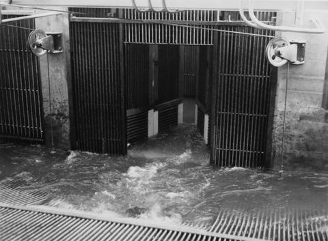 Rock Island Dam
Citation -
241. [Image] Canyon near mouth of Klickitat River
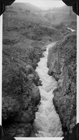 The water flow is about 782 feet per second
Citation -
242. [Image] Chinook jumping rock
 Chinook jumping rock left of middle ladder at the Rock Island Dam
Citation -
243. [Image] HB Holmes standing in riffle
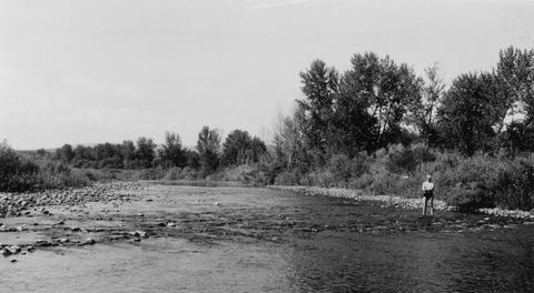 HB Holmes standing in long riffle about 1/2 mile downstream from Sunnyside By-Pass. Photo shows depth and width of riffle
Citation -
244. [Image] Lower Cowlitz Falls
 Lower Cowlitz Falls eight miles below Randle, Washington. The falls are 4 feet high and are not a barrier for fish
Citation -
245. [Image] Screens and headgates
 Screen and headgates on Middy ditch just beyond the Rosa ditch by-pass
Citation -
246. [Image] Fish sliding into tank
 Fish sliding into tank of fish truck at Rock Island Dam
Citation -
247. [Image] Loading fish truck
 Loading fish truck at east trap at Rock Island Dam
Citation -
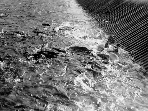
248. [Image] Chinooks in brail
 Chinooks in brail at east trap at Rock Island Dam
Citation -
249. [Image] Central spill and left fishway
 Central spill and left fishway taken from middle fishway at Rock Island Dam
Citation