Search
You searched for:
Start Over
Historic stream surveys
Remove constraint Historic stream surveys
Subject
Rivers -- Washington
Remove constraint Subject: Rivers -- Washington
« Previous | 101 - 150 of 274 | Next »
Search Results
-
101. [Image] Niggerhead Creek log jam (Yellowjacket Creek)
 Looking down at upper end of big log jam on Niggerhead Creek
Citation -
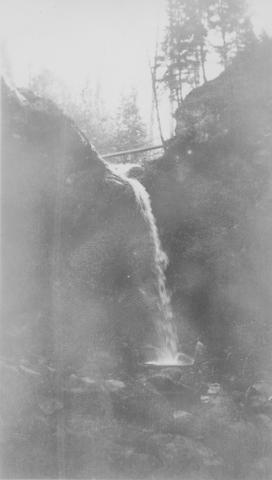
102. [Image] Niggerhead Creek falls (Yellowjacket Creek)
 Falls on Niggerhead Creek 4 miles above road. The falls are 25 feet high
Citation -
103. [Image] Falls on Goat Creek
 35 foot falls on Goat Creek, located 530 yards above its confluence with the Cowlitz River
Citation -
104. [Image] Lake Creek falls
 25 foot falls on Lake Creek two mile above its mouth. Lake Creek is the outlet of Packwood Lake in the Cowlitz River system
Citation -
105. [Image] Niggerhead Creek log jam (Yellowjacket Creek)
 Lower end of big log jam in box canyon on Niggerhead Creek. It is a barrier to fish at this point. The Creek is 35 feet wide and the jam is 25 feet high
Citation -
106. [Image] Stratified sandstone falls on Coal Creek
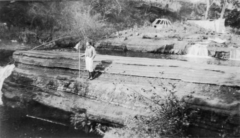 Coal Creek is a tributary to the Columbia River
Citation -
107. [Image] East Canyon Creek Falls
 Falls above mouth of East Canyon Creek, a tributary to the Cispus River
Citation -
108. [Image] Adams Creek box canyon
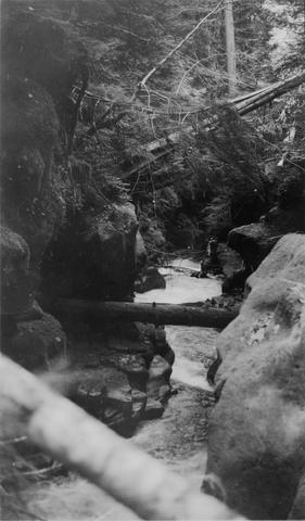 Narrow box canyon at lowest 1/4 mile of Adams Creek, a tributary of the Cispus River, near Randle, Washington
Citation -
109. [Image] Elochoman River
 Left Branch of East Fork of the Elochoman River showing effect of logging operations on the stream
Citation -
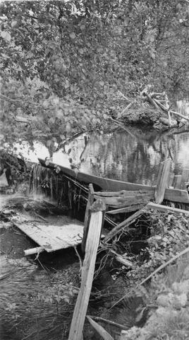
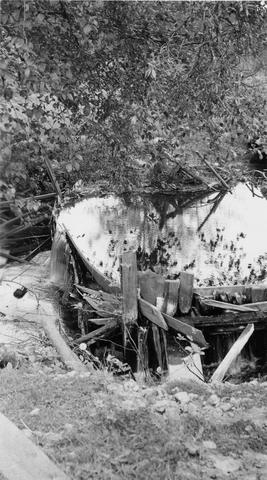
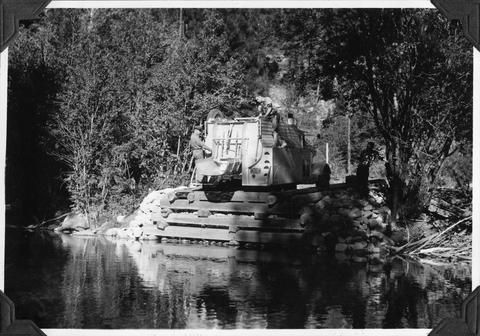
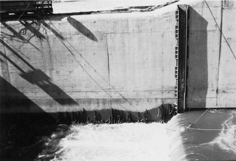
110. [Image] Old Power Dam
 Old Power Dam on Crooked Creek
Citation -
111. [Image] Falls on Rock Creek
 Upper part of series of falls on Rock Creek one mile above the Columbia River
Citation -
112. [Image] Fast cascades
 Fast cascades over bedrock on Rock Creek four miles above the mouth. It is a barrier to fish at low water.
Citation -
113. [Image] Rock Creek falls near Stevenson, Washington
 View of impassable series of falls one mile above the mouth of Rock Creek
Citation -
114. [Image] Falls on Rock Creek
 Series of falls on Rock Creek near Stevenson, Washington, one mile above the Columbia River. It drops a total of forty five feet.
Citation -
115. [Image] Falls on Rock Creek near Stevenson, Washington
 The falls are impassable and are twenty five feet high.
Citation -
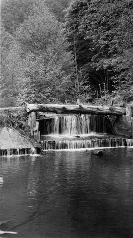
116. [Image] Cedar Creek dam and falls
 20 foot dam and falls on Cedar Creek near Hall, Washington. Photo shows nearly low-water stage
Citation -
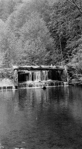
117. [Image] Cedar Creek dam and falls
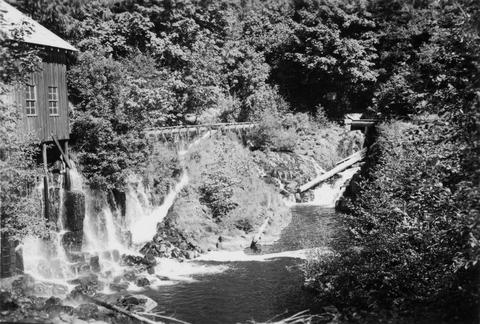 Power diversion, old mill, diversion return and fish-ladder at Cedar Creek dam and falls at Hall, Washington. Dam and falls only partly showing upstream. Fish-ladder leads into diversion
Citation -
118. [Image] Copper Creek
 Copper Creek just above mouth. It is a tributary to the East Fork of the Lewis River.
Citation -
119. [Image] Niggerhead Creek valley (Yellowjacket Creek)
 Looking down the lower valley of Niggerhead Creek. Cispus River is at the base of Spud Mountain in the background
Citation -
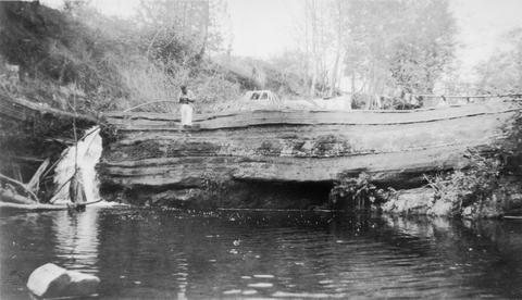
120. [Image] Irrigation Dam
 Irrigation dam on Crooked Creek. There is no fish ladder present
Citation -
121. [Image] Stratified sandstone on Coal Creek
 Stratified sandstone Coal Creek, a tributary to the Columbia River
Citation -
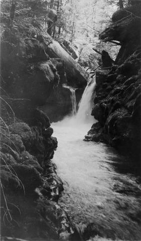
122. [Image] Niggerhead Creek (Yellowjacket Creek)
 Passable falls and cascades on Niggerhead Creek
Citation -
123. [Image] Irrigation Dam
 Irrigation dam on Crooked Creek. There is no fish ladder present
Citation -
124. [Image] Old dam on Crooked Creek
 Old dam-Crooked Creek just above first forks--left branch facing upstream. There is no ladder and the dam should be removed
Citation -
125. [Image] Elkhorn Creek
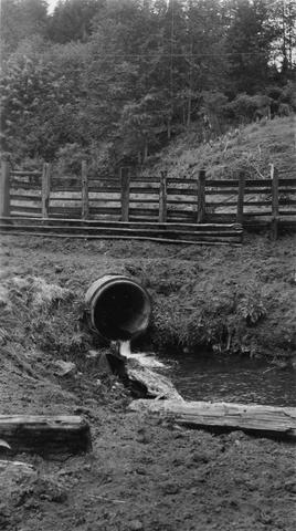 Elkhorn Creek is a tributary of Wilson Creek. Very few salmon can get through culvert during high water.. Culvert is on the farm of VS Kesterson.
Citation -
126. [Image] Adams Creek falls
 15 ft falls in box canyon on Adams Creek, 1/4 mile above the mouth
Citation -
127. [Image] Greenhorn Creek falls
 Greenhorn Creek falls, a tributary to the Cispus River
Citation -
128. [Image] Adams Creek falls
 15 foot falls in box canyon 1/4 miles above mouth of Adams Creek, a tributary of Cispus River
Citation -
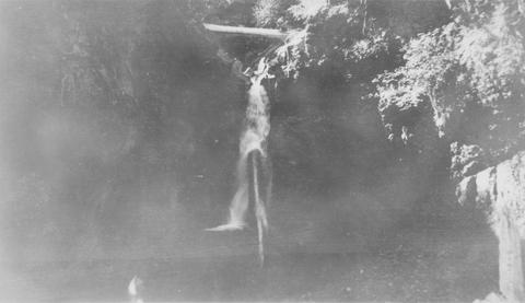
129. [Image] Waterfall on lower Grays River
 Falls down canyon wall on lower Grays River The falls are 150 feet high. Photo shows typically canyonous nature of stream banks. F Jobes is standing in lower center
Citation -
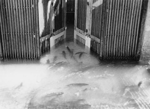
130. [Image] Salmon going over counting board
 Salmon going over counting board at the Bonneville Dam
Citation -
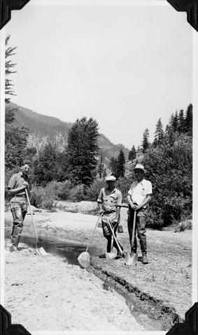
131. [Image] Ellensburg canyon
 Dick Whiteleather and Mitch Hanavan on survey of Yakima River in Ellensburg Canyon
Citation -
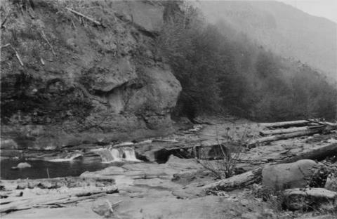
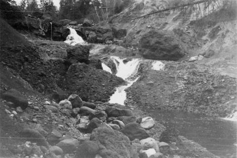
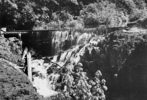
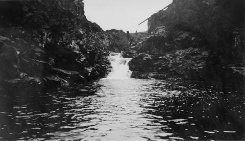
132. [Image] Cowlitz River falls
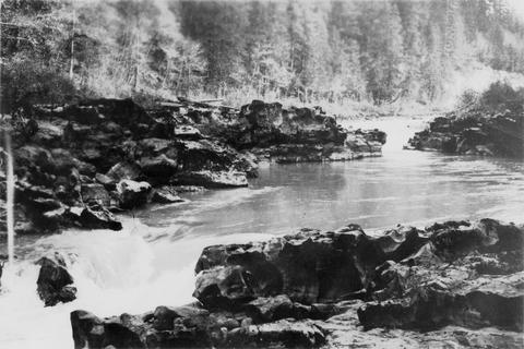 Cowlitz River falls eight miles below Randle, Washington. The drop of the lower falls is 4 feet.
Citation -
133. [Image] East fishway and collecting pool
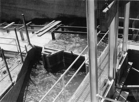 Rock Island Dam
Citation -
134. [Image] Loading fish at central trap
 Rock Island Dam
Citation -
135. [Image] Chinooks jumping over middle rocks
 Rock Island Dam
Citation -
136. [Image] Chinook on rock
 Chinook on rock left of middle ladder at the Rock Island Dam
Citation -
137. [Image] Salmon entering elevator from brail
 Rock Island Dam left trap in the summer
Citation -
138. [Image] Chinook jumping
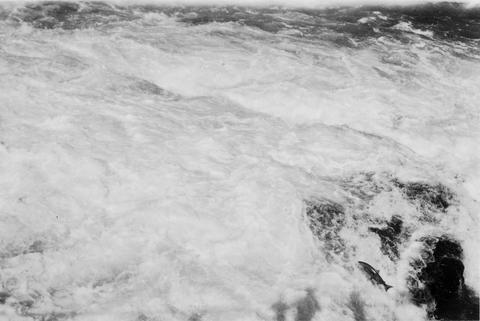 Chinook jumping over middle rocks at the Rock Island Dam
Citation -
139. [Image] Chinook jumping rock
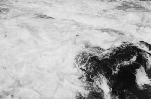 Chinook jumping rock left of middle ladder at the Rock Island Dam
Citation -
140. [Image] Chinook jumping rock
 Chinook jumping rock left of middle ladder at the Rock Island Dam
Citation -
141. [Image] Rescuing downstream chinook migrants
 Frey Holland and Parkhurst rescuing downstream chinook migrants from side pockets in the Entiat River
Citation -
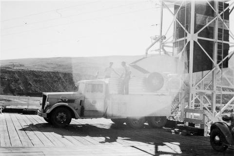
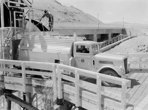
142. [Image] Unloading fish truck
 Unloading fish truck at dump number 2 on the Entiat River as part of salmon reclamation
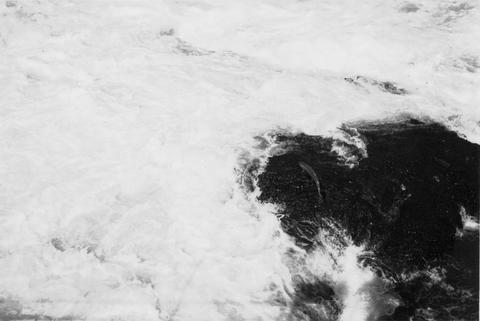
Citation -
143. [Image] Central fish hoist and elevator
 Central fish hoist and elevator at Rock Island Dam
Citation -
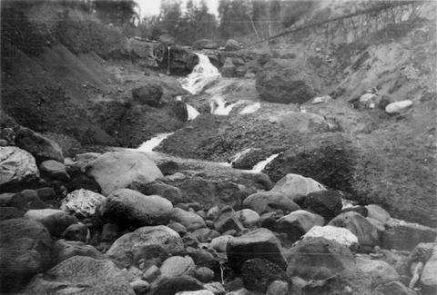
144. [Image] Waterfalls on Grays River
 8 foot falls (so-called) below the "Big Slide" on the Grays River. Station 4 is about 4 miles above the Highway. Falls are the only obstruction on river
Citation -
145. [Image] Left fish trap
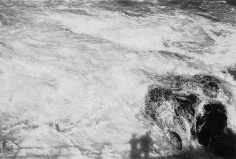
 Left (east) fish trap at Rock Island Dam
Citation -
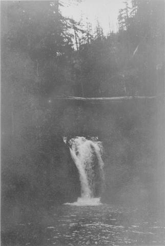
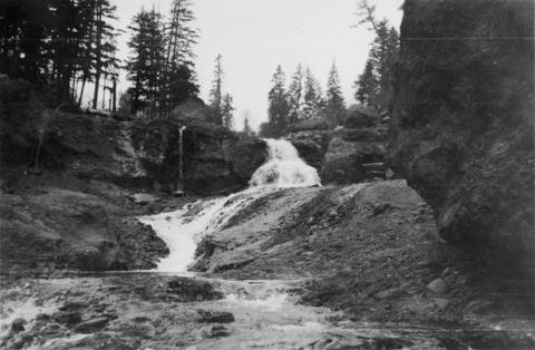
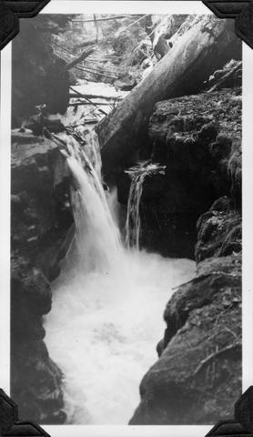
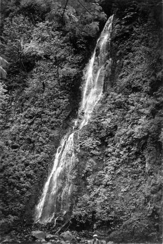
146. [Image] Gail Falls
 Gail Falls on the Cispus River is 200 yards below Cat Creek. The falls are 30 feet high and 8 feet wide
Citation -
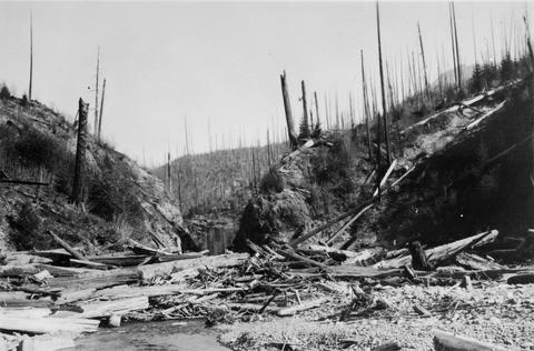
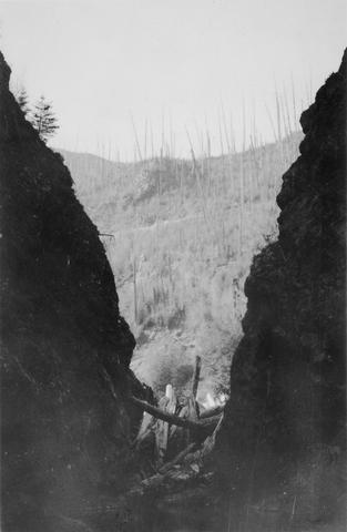
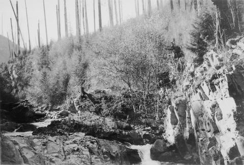
147. [Image] Watershed of Upper Cispus River
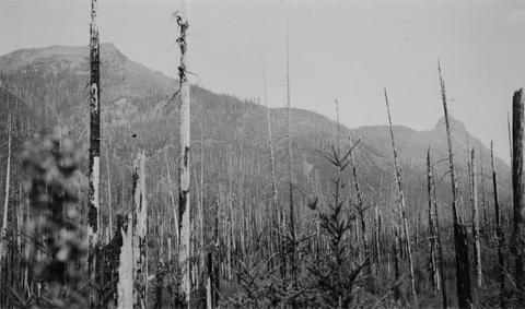 Watershed of Upper Cispus River showing extensive burn-over area and mountainous terrain
Citation -
148. [Image] Lamprey eels at the Bonneville Dam
 Lampreys are using a temporary fish ladder while the dam is under construction
Citation -
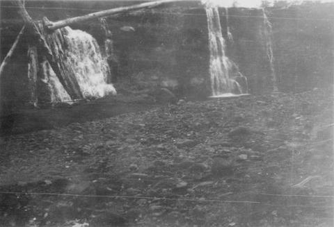
149. [Image] Cowlitz Falls
 Cowlitz Falls 8 miles below Randle, Washington
Citation -
150. [Image] Lucy Ann I
 Our offical means of transportation, the Lucy Ann I, starts on her maiden voyage with T A Dawson (Assistant Biologist Aide) at the helm. On the Wenatchee River opposite the mouth of the Chiwawa River in ...
Citation