Search
You searched for:
Start Over
Historic stream surveys
Remove constraint Historic stream surveys
Subject
Rivers -- Washington
Remove constraint Subject: Rivers -- Washington
Subject
Waterfalls
Remove constraint Subject: Waterfalls
« Previous | 1 - 50 of 64 | Next »
Search Results
-
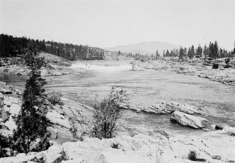
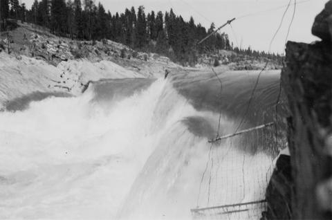
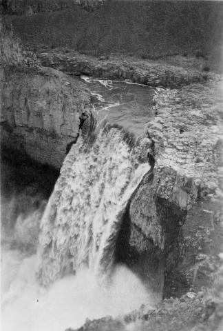
1. [Image] Upper Kettle Falls on the Columbia River
-
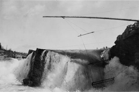
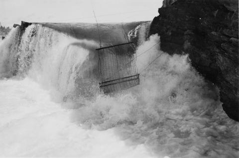
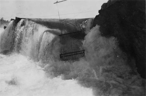
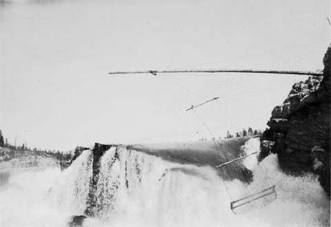
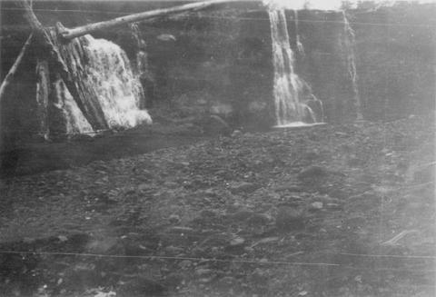
2. [Image] Jump trap at Kettle Falls
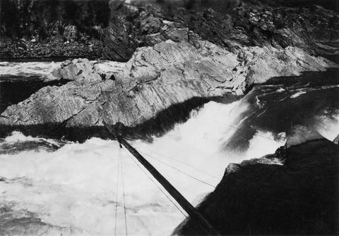 Photo showing "jump trap" at Kettle Falls
Citation -
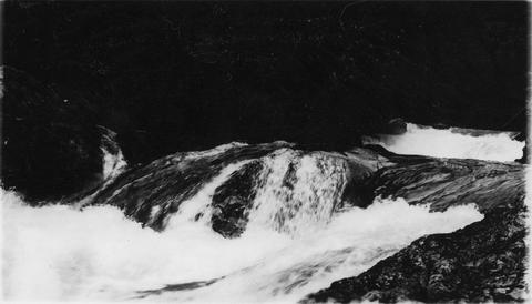
3. [Image] Indian jump trap
 Indian "jump-trap" on Kettle Falls for steelhead and salmon
Citation -
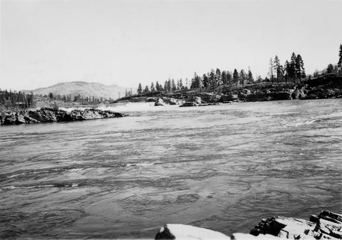
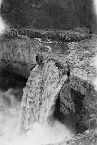
4. [Image] Kettle Falls on the Columbia River
-
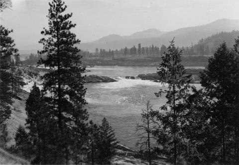
5. [Image] Upper Kettle Falls on the Columbia River
-
6. [Image] Jump trap at Kettle Falls
-
7. [Image] Jump trap at Kettle Falls
-
8. [Image] Jump trap at Kettle Falls
-
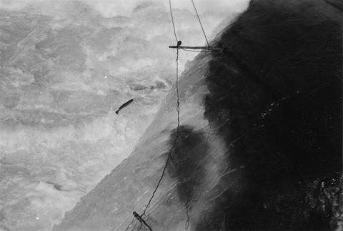
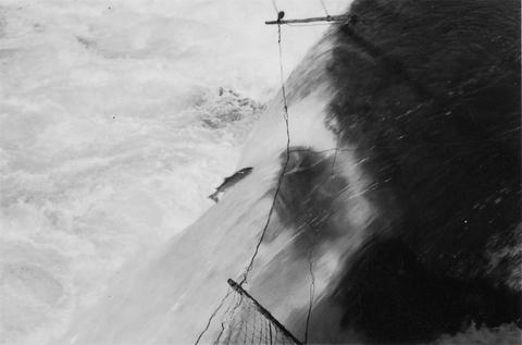
9. [Image] Steelhead jumping the jump trap
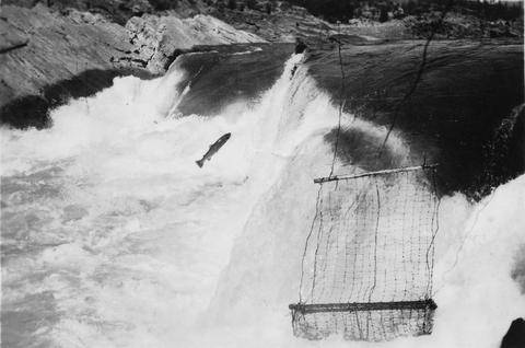 Steelhead jumping the jump trap against Kettle Falls on the Columbia River
Citation -
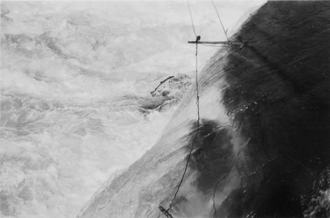
10. [Image] Jump trap at Kettle Falls
 Jump trap at Kettle Falls for steelhead and salmon
Citation -
11. [Image] Steelhead jumping Kettle Falls
-
13. [Image] Steelhead jumping Kettle Falls
-
14. [Image] Jump trap at Kettle Falls
-
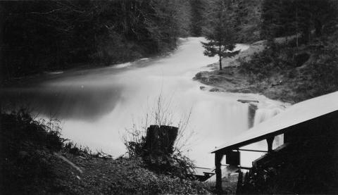
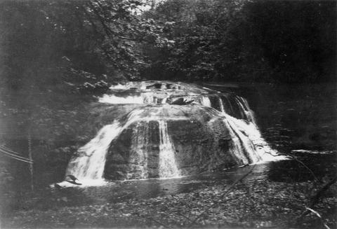
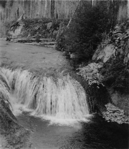
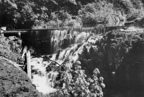
15. [Image] Cedar Creek Falls
 Birdseye view of Cedar Creek falls and small power developement
Citation -
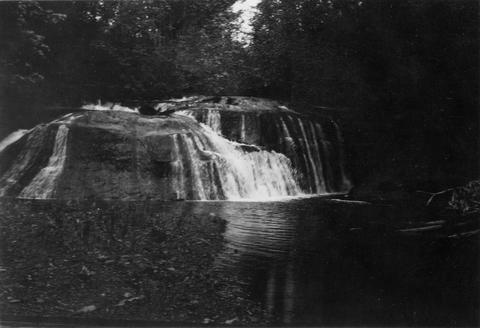
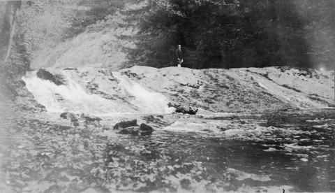
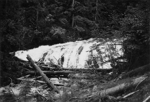
16. [Image] Cedar Creek Falls at high water
-
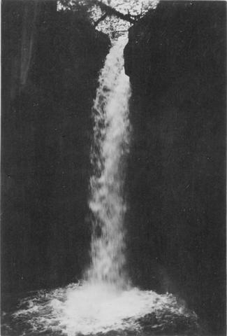
17. [Image] Falls above Timber Creek
 Falls above Timber Creek, tributary to the Washougal River
Citation -
18. [Image] Albernathy Creek bedrock chute and falls
 Albernathy Creek, a tributary to Columbia River
Citation -
19. [Image] Falls on Silver Creek
-
20. [Image] Gail Falls
 Gail Falls on Cispus River just below Cat Creek confluence
Citation -
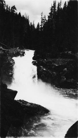
21. [Image] Palouse Falls
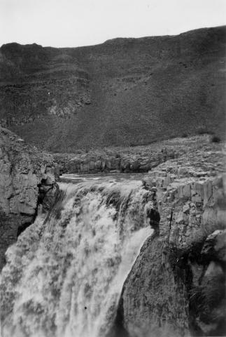
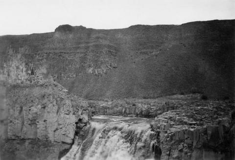 Palouse Falls on the Palouse River. The falls are 164 feet high
Citation -
22. [Image] Palouse Falls
 Palouse Falls on the Palouse River. The falls are 164 feet high
Citation -
23. [Image] Palouse Falls
 Palouse Falls on the Palouse River. The falls are 164 feet high
Citation -
24. [Image] Palouse Falls
 Palouse Falls on the Palouse River. The falls are 164 feet high
Citation -
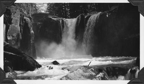
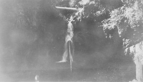
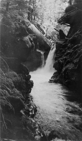
25. [Image] Falls on Ohanapecosh River
-
26. [Image] Upper falls on upper Ohanofrecork
-
27. [Image] Monahan Creek falls
-
28. [Image] Monahan Creek falls
-
29. [Image] Falls on Cat Creek
 Falls on Cat Creek, tributary to the Cispus River, 1/4 mile above the mouth. Lower falls is 4 feet high and the upper falls is 10 feet high
Citation -
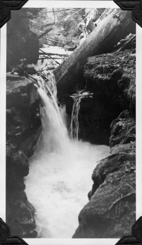
30. [Image] Impassable bedrock chute
 Impassable bedrock chute on North Fork Cispus River near Timonium Creek. Drops 25 feet in 60 feet. There are no pools
Citation -
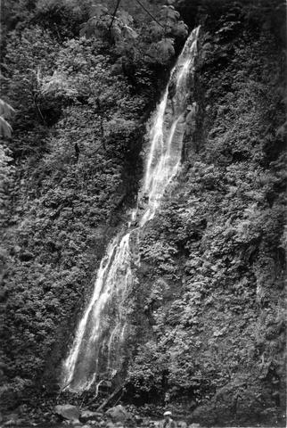
31. [Image] Timonium Creek falls
 75 foot series of falls on Timonium Creek near its confluence with the North Fork of the Cispus River. Indicates terrific flood stages
Citation -
32. [Image] Cedar Creek Falls
 Cedar Creek Falls at high-water stage near Hall, Washington
Citation -
33. [Image] Niggerhead Creek falls (Yellowjacket Creek)
 Falls on Niggerhead Creek 4 miles above road. The falls are 25 feet high
Citation -
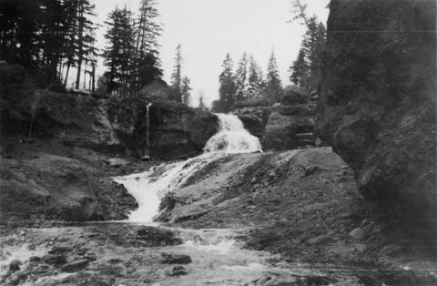
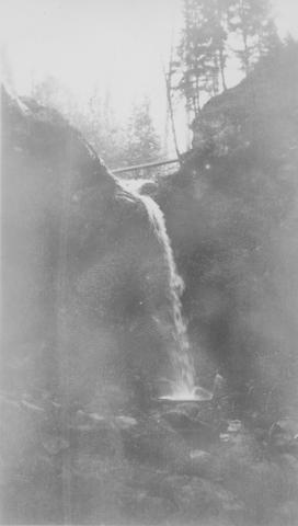
34. [Image] Falls on Goat Creek
 35 foot falls on Goat Creek, located 530 yards above its confluence with the Cowlitz River
Citation -
35. [Image] Lake Creek falls
 25 foot falls on Lake Creek two mile above its mouth. Lake Creek is the outlet of Packwood Lake in the Cowlitz River system
Citation -
36. [Image] Stratified sandstone falls on Coal Creek
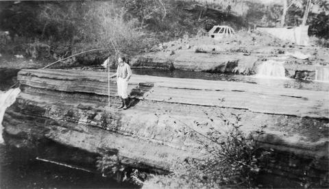 Coal Creek is a tributary to the Columbia River
Citation -
37. [Image] East Canyon Creek Falls
 Falls above mouth of East Canyon Creek, a tributary to the Cispus River
Citation -
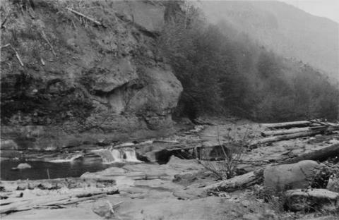
38. [Image] Falls on Rock Creek
 Upper part of series of falls on Rock Creek one mile above the Columbia River
Citation -
39. [Image] Fast cascades
 Fast cascades over bedrock on Rock Creek four miles above the mouth. It is a barrier to fish at low water.
Citation -
40. [Image] Rock Creek falls near Stevenson, Washington
 View of impassable series of falls one mile above the mouth of Rock Creek
Citation -
41. [Image] Falls on Rock Creek
 Series of falls on Rock Creek near Stevenson, Washington, one mile above the Columbia River. It drops a total of forty five feet.
Citation -
42. [Image] Falls on Rock Creek near Stevenson, Washington
 The falls are impassable and are twenty five feet high.
Citation -
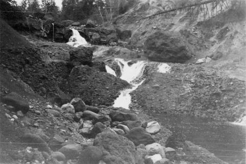
43. [Image] Cedar Creek dam and falls
 20 foot dam and falls on Cedar Creek near Hall, Washington. Photo shows nearly low-water stage
Citation -
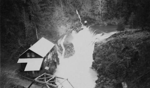
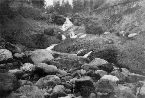
44. [Image] Cedar Creek dam and falls
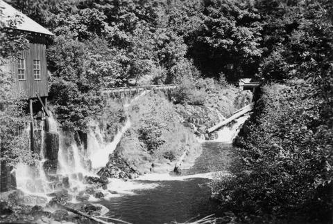 Power diversion, old mill, diversion return and fish-ladder at Cedar Creek dam and falls at Hall, Washington. Dam and falls only partly showing upstream. Fish-ladder leads into diversion
Citation -
45. [Image] Niggerhead Creek (Yellowjacket Creek)
 Passable falls and cascades on Niggerhead Creek
Citation -
46. [Image] Adams Creek falls
 15 ft falls in box canyon on Adams Creek, 1/4 mile above the mouth
Citation -
47. [Image] Greenhorn Creek falls
 Greenhorn Creek falls, a tributary to the Cispus River
Citation -
48. [Image] Adams Creek falls
 15 foot falls in box canyon 1/4 miles above mouth of Adams Creek, a tributary of Cispus River
Citation -
49. [Image] Waterfall on lower Grays River
 Falls down canyon wall on lower Grays River The falls are 150 feet high. Photo shows typically canyonous nature of stream banks. F Jobes is standing in lower center
Citation -
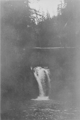
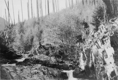
50. [Image] Cowlitz River falls
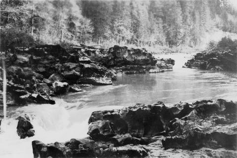 Cowlitz River falls eight miles below Randle, Washington. The drop of the lower falls is 4 feet.
Citation