Search
You searched for:
Start Over
Historic stream surveys
Remove constraint Historic stream surveys
Subject
Rivers -- Idaho
Remove constraint Subject: Rivers -- Idaho
« Previous | 1 - 50 of 121 | Next »
Search Results
-
1. [Image] Sunbean Dam
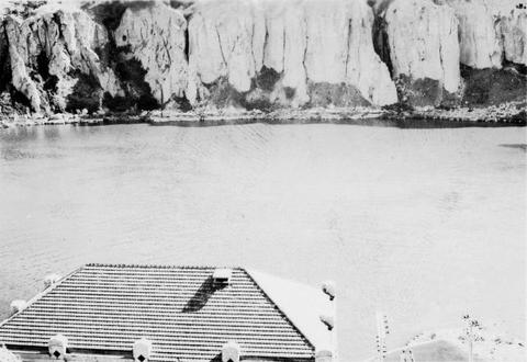
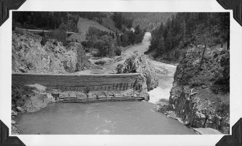 Upstream side of the Sunbeam Dam. Yankee Fork enters on left from beneath bridge
Citation -
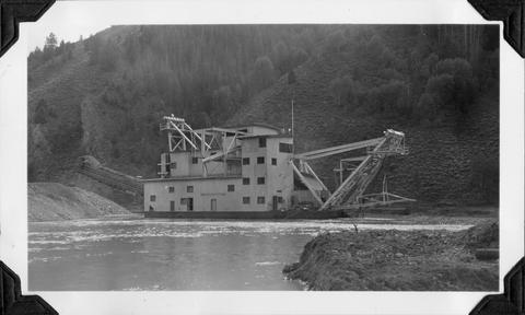
2. [Image] Yankee Fork Dredge
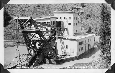 Gold dredge on Yankee Fork of Salmon River It was the largest dredge in Idaho Dredge was reputed to be recovering $10,000 in flour gold each week
Citation -
3. [Image] Yankee Fork Dredge
 Gold dredge on Yankee Fork of Salmon River It was the largest dredge in Idaho Dredge was reputed to be recovering $10,000 in flour gold each week
Citation -
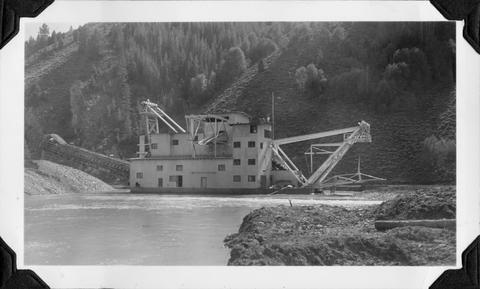
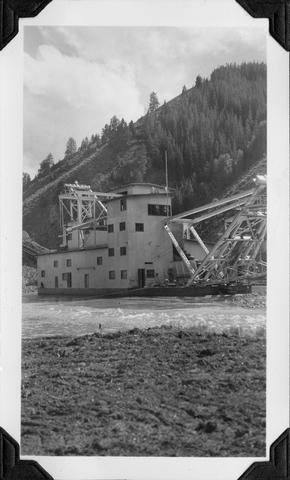
4. [Image] Yankee Fork Dredge
 Gold dredge on Yankee Fork of Salmon River It was the largest dredge in Idaho Dredge was reputed to be recovering $10,000 in flour gold each week
Citation -
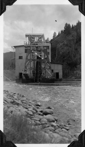
5. [Image] Yankee Fork Dredge
 Gold dredge on Yankee Fork of Salmon River It was the largest dredge in Idaho Dredge was reputed to be recovering $10,000 in flour gold each week
Citation -
6. [Image] Yankee Fork Dredge
 Gold dredge on Yankee Fork of Salmon River It was the largest dredge in Idaho Dredge was reputed to be recovering $10,000 in flour gold each week
Citation -
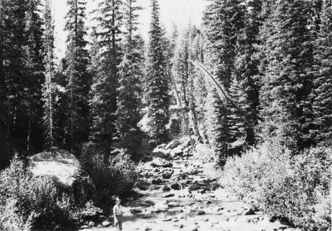
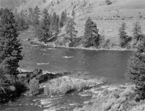
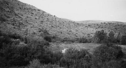
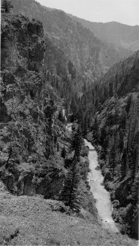
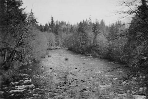
7. [Image] Big Redfish Lake Stream, Idaho
-
8. [Image] Big Redfish Lake Stream, Idaho
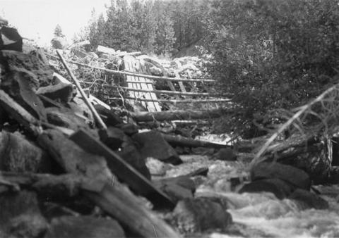
-
10. [Image] Little Red fish on spawning grounds
 Little Red fish on spawning grounds in Alturus Lake Creek
Citation -
11. [Image] Little Red fish on spawning grounds
 Little Red fish on spawning grounds in Alturus Lake Creek
Citation -
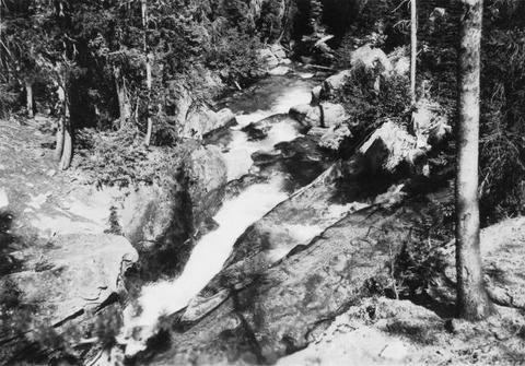
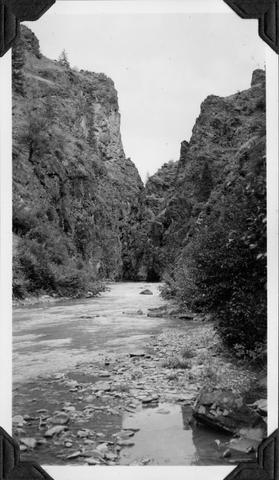
12. [Image] Falls on upper Redfish Lake Creek, Idaho
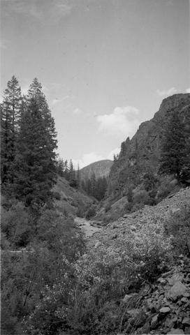
-
14. [Image] River of No Return
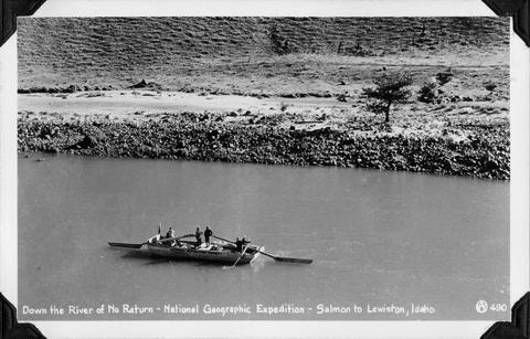 National Geographic Expedition down the "River of No Return" from Salmon to Lewiston, Idaho
Citation -
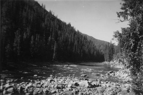
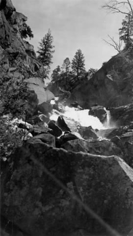
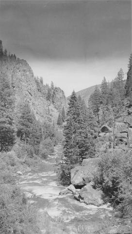 East Fork of Mayfield Creek tributary to Loon Creek which is a tributary to the Middle Fork of the Salmon River. Photo is looking downstream over a cascade section in the stream
Citation -
16. [Image] Alluvial fan
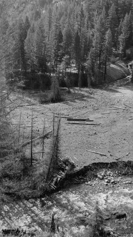 Alluvial fan is formed by washout in Thirty-two Creek.. River spreads out in many small channels over the surface.. Stream is inaccessible to salmon.
Citation -
17. [Image] North Fork Clearwater River in Idaho
-
18. [Image] Snake River below Shoshone Falls
-
19. [Image] Deadwood River at mouth
-
21. [Image] Salmon River
 Salmon River, tributary to Big Sandy River near the confluence
Citation -
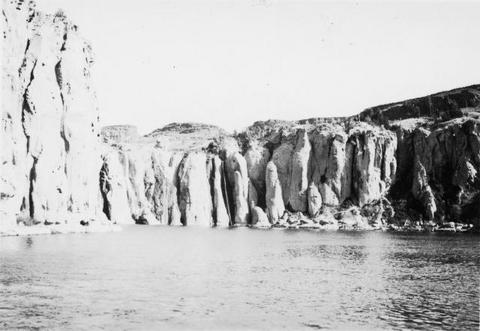
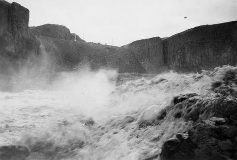
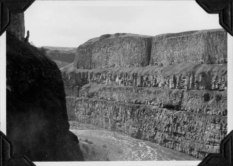
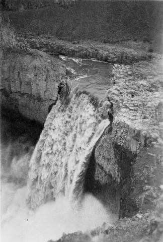
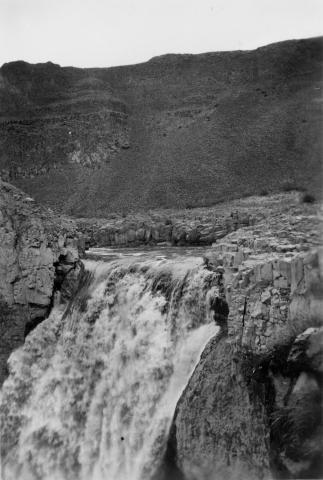
22. [Image] Palouse Falls
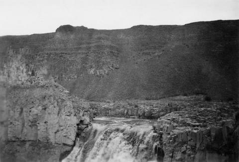 Palouse Falls on the Palouse River. The falls are 164 feet high
Citation -
23. [Image] Snake River
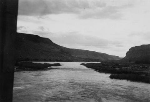 Snake River, Idaho below Swan Falls Power House
Citation -
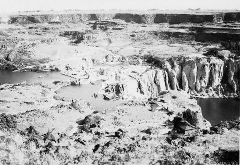
24. [Image] Shoshone Falls on the Snake River in Idaho
-
25. [Image] Shoshone Falls and power diversion
-
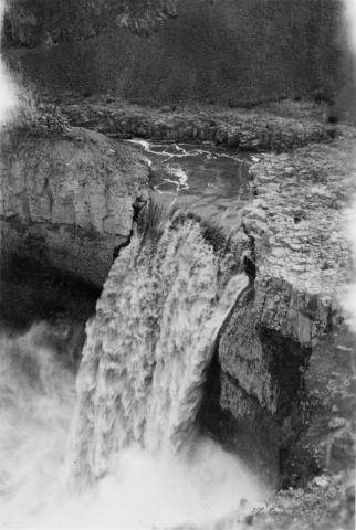
26. [Image] Palouse Falls
 Palouse Falls on the Palouse River. The falls are 164 feet high
Citation -
27. [Image] Palouse Falls
 Palouse Falls on the Palouse River. The falls are 164 feet high
Citation -
28. [Image] Palouse Falls
 Palouse Falls on the Palouse River. The falls are 164 feet high
Citation -
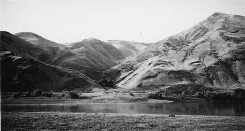
29. [Image] Snake River valley near Lewiston, Idaho
-
30. [Image] Palouse River rapids 1/2 mile above falls
-
31. [Image] Palouse River above falls
-
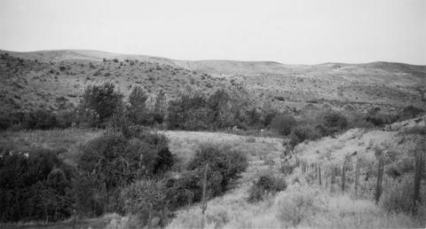
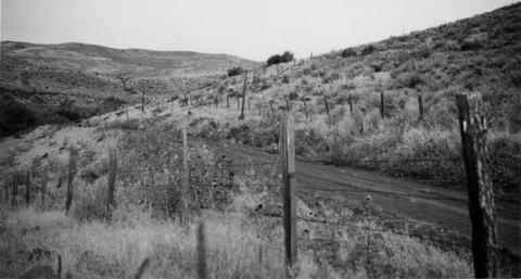
32. [Image] Site of new irrigation dam on Mann Creek
-
33. [Image] Site of new irrigation dam on Mann Creek
-
34. [Image] Site of new irrigation dam on Mann Creek
-
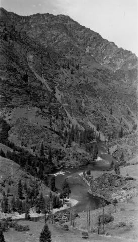
35. [Image] Middle Fork Salmon River
-
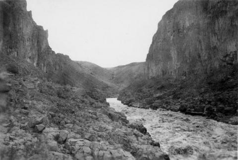
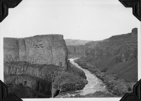
36. [Image] Palouse River canyon below falls
-
37. [Image] Palouse River canyon just above falls
-
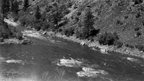
38. [Image] East Fork Salmon River
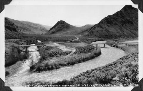 Photo taken near US 93 close to Clayton, Idaho
Citation -
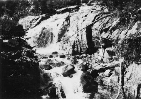
39. [Image] Warm Springs Creek
 Warm Springs Creek tributary to Loon Creek, Idaho. Box canyon shown a short distance above Mahoney Creek confluence
Citation -
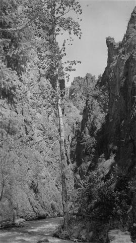
40. [Image] Marble Creek
 Looking upstream into the Marble Creek box canyon about 5 miles above the mouth
Citation -
41. [Image] Deer Horn Creek area
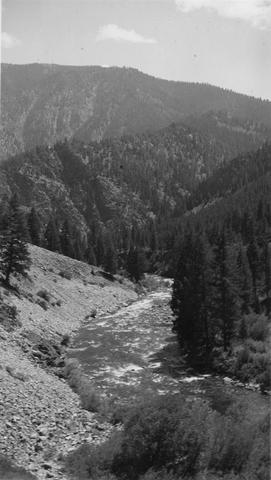 Looking downstream in Middle Fork Salmon River Valley below Deer Horn Creek. Greyhound Creek enters in background on right
Citation -
42. [Image] Marble Creek box canyon
 Typical watershed topography below the box canyon near Marble Creek, Idaho
Citation -
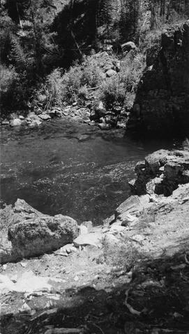
43. [Image] Pistol Creek
 Water ouzel and nest near campsite 2 1/4 miles from the mouth of Pistol Cr
Citation -
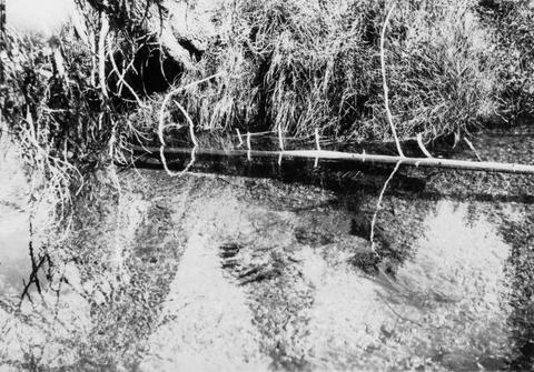
44. [Image] Beaver dam and house
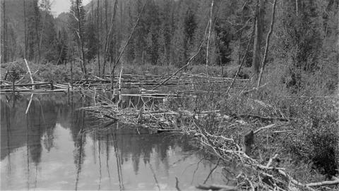 Large beaver dam and house about 1 1/2 miles above the Loon Creek Ranger Station
Citation -
45. [Image] View from top of Marble Creek box canyon
-
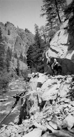
46. [Image] Rams Horn Creek, Idaho
 Place just above Ramshorn [Rams Horn] Creek where Blue was pulled off the trail by Spot and rolled 30-40 feet to the big pool below
Citation -
47. [Image] Middle Fork and Main Salmon River confluence
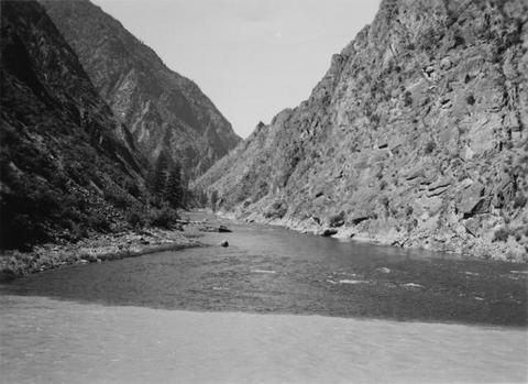 Confluence of Middle Fork and Main Salmon River. Turbidity of main stream is shown
Citation -
48. [Image] Waterfall Creek
 Waterfall Creek near confluence with Middle Fork Salmon River. Waterfall Creek enters Middle Fork Salmon River just above Big Creek on left bank. The creek is too precipitous for migratory fish
Citation -
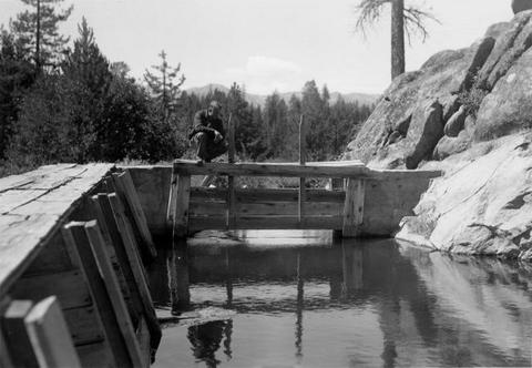
49. [Image] Irrigation diversion dam on Big Creek
 Impassable irrigation dam
Citation -
50. [Image] Irrigation diversion on Big Creek
 Irrigation diversion on Big Creek, a tributary to North Fork Payette River
Citation