Search
You searched for:
Start Over
Historic stream surveys
Remove constraint Historic stream surveys
Subject
Rapids
Remove constraint Subject: Rapids
« Previous | 1 - 10 of 16 | Next »
Search Results
-
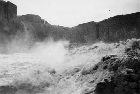
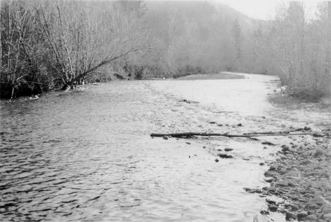
1. [Image] Middle Fork Willamette River
 Middle Fork Willamette River above Tumblebug Creek, end of survey;1938-07
Citation -
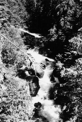
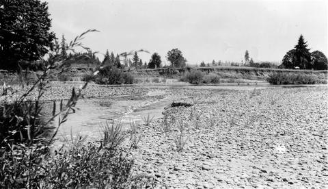
2. [Image] Big Fall Creek
 Big Fall Creek
Citation -
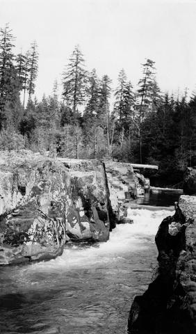
3. [Image] Upper end of "The Narrows"
 The upper end of the "The Narrows" on the Molalla River; 1941-09-25
Citation -
5. [Image] Riffles on the Tucannon River
 Riffles on the Tucannon River near station number fifteen
Citation -
6. [Image] South Santiam River
 South Santiam River, Oregon Good C1 riffle 1600 yards above confluence with Crabtree Creek;1940-08-04
Citation -
7. [Image] Separation Creek
 Separation Creek just above the confluence with Horse Creek The creeks are tributaries to the McKenzie River;1938-07-21
Citation -
8. [Image] Separation Creek
 Separation Creek at the confluence with Horse Creek, tributaries of McKenzie River;1938-07-21
Citation -
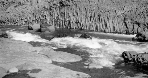
9. [Image] The Narrows--Molalla River
 The Narrows on the Molalla River average only 12 feet to 15 feet in width; 1941-09-25
Citation -
10. [Image] South Santiam riffle
 Riffle on the South Santiam River about 2 1/2 miles below Crabtree Bridge All stones were heavily coated with brownish-green slime and persistent foam piled up in backwaters and floated down the river;Paper ...
Citation