Search
You searched for:
Start Over
Historic stream surveys
Remove constraint Historic stream surveys
Subject
Dams
Remove constraint Subject: Dams
Subject
Rivers -- Idaho
Remove constraint Subject: Rivers -- Idaho
1 - 36 of 36
Search Results
-
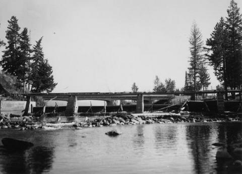
1. [Image] Sunbean Dam
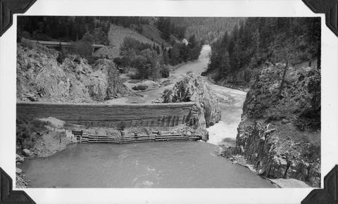 Upstream side of the Sunbeam Dam. Yankee Fork enters on left from beneath bridge
Citation -
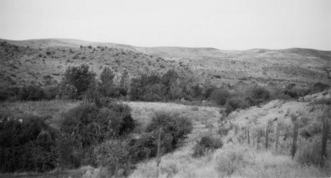
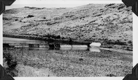
2. [Image] Site of new irrigation dam on Mann Creek
-
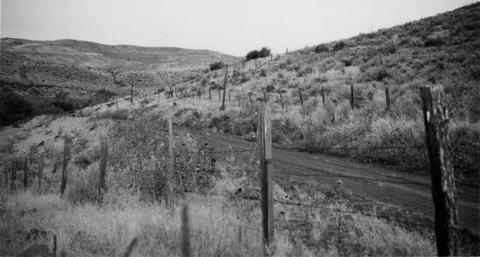
3. [Image] Site of new irrigation dam on Mann Creek
-
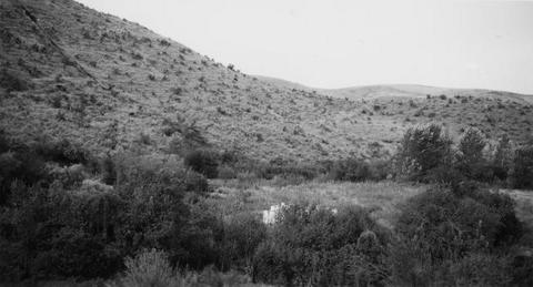
4. [Image] Site of new irrigation dam on Mann Creek
-
5. [Image] Irrigation diversion dam on Big Creek
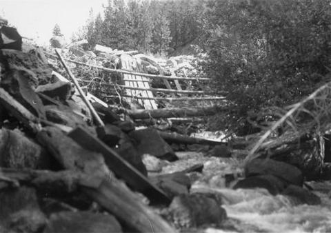 Impassable irrigation dam
Citation -
6. [Image] Irrigation diversion on Big Creek
 Irrigation diversion on Big Creek, a tributary to North Fork Payette River
Citation -
7. [Image] Idaho Power diversion dam
 Idaho Power Company's diversion dam (power) on Lemhi River at Salmon, Idaho
Citation -
8. [Image] Catherine Creek diversion dam
 A wire-covered rock irrigation diversion dam on Catherine Creek. Diversion dam is 2100 yards above Little Catherine Creek confluence
Citation -
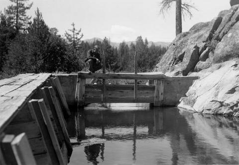
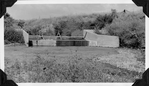
9. [Image] Mann Creek temporary diversion dam
 Temporary diversion dam on Mann Creek 1500 yards below US 95 bridge. This dam takes all the water which seeps through another dam 150 yards upstream. The low water is a barrier for fish
Citation -
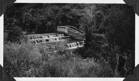
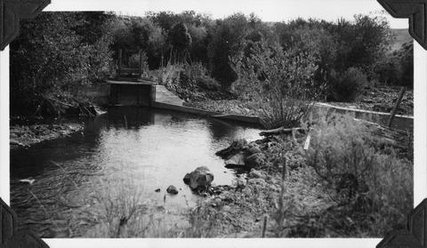
10. [Image] Galloway Dam and fish ladder
-
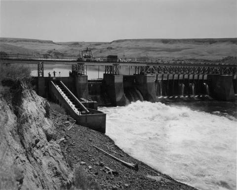
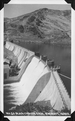
11. [Image] Black Canyon Dam
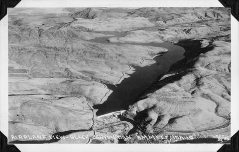 Airplane view of Black Canyon Dam, near Emmett, Idaho
Citation -
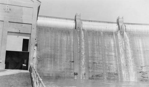
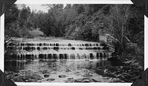
12. [Image] Grimes Pass Dam
 Grimes Pass Dam on the South Fork Payette River, Idaho
Citation -
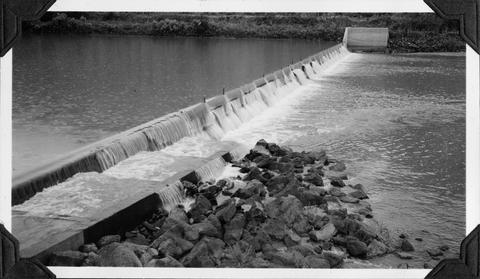
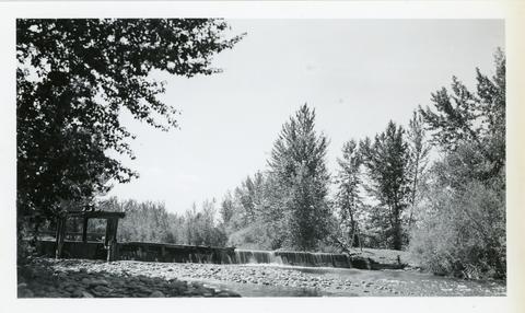
13. [Image] Galloway dam across Weiser River
 Galloway dam across Weiser River above town of Weiser, Idaho. In a normal summer there is no water in the river channel below here
Citation -
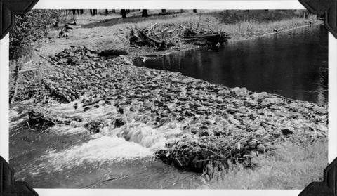
14. [Image] Mann Creek dam and diversion
 Dam and diversion on Mann Creek just above the Harold Beecher dam. About 1 cubic foot per second is escaping under flash boards. Pool above dam is heavily covered with algae. It is a low water barrier ...
Citation -
15. [Image] Mann Creek dam and diversion
 Dam and diversion on Mann Creek just above the Harold Beecher dam. About 1 cubic foot per second is escaping under flash boards. Pool above dam is heavily covered with algae. It is a low water barrier ...
Citation -
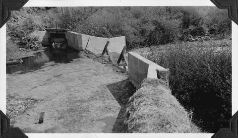
16. [Image] Mann Creek temporary diversion dam
 Temporary diversion dam on Mann Creek 1300 yards below US 95 bridge. The dam takes all water, approximately 1 cubic foot per second, which seeps through dam Another dam, 150 yards below, diverts the ...
Citation -
18. [Image] Black Canyon Dam and flume
-
19. [Image] Black Canyon Dam and flume
-
20. [Image] Dam at outlet of Payette Lake
 Dam at outlet of Payette Lake on the North Fork Payette River
Citation -
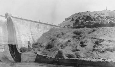
21. [Image] Black Canyon dam
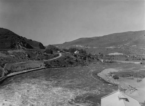 Black Canyon dam on the Payette River
Citation -
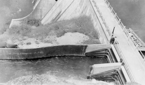
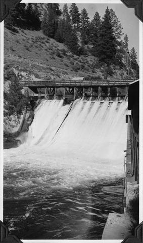
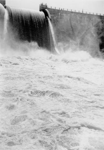
22. [Image] Black Canyon Dam spillway
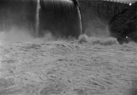 Water at foot of spill
Citation -
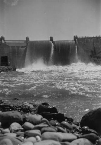
23. [Image] Black Canyon dam
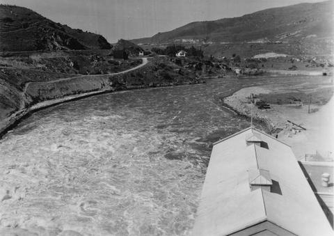 Payette River below Black Canyon Dam
Citation -
24. [Image] Black Canyon dam
 Black Canyon dam on the Payette River
Citation -
25. [Image] Black Canyon dam
 Black Canyon dam on the Payette River
Citation -
26. [Image] Black Canyon dam
 Black Canyon dam on the Payette River
Citation -
28. [Image] Galloway Dam and fish ladder
-
29. [Image] Black Canyon Dam
 Black Canyon Dam on the Payette River in Idaho
Citation -
30. [Image] Mann Creek dam and diversion
 Dam and diversion on Mann Creek just below the site of the new dam
Citation -
31. [Image] Mesa dam and ditch take-off
 Mesa dam and ditch take-off on Middle Fork Weiser River about 7 miles by road above US 95. Low water barrier to fish. In a normal summer the river is dry from here to the mouth
Citation -
32. [Image] Weiser River galloway dam
 Galloway dam across Weiser River above town of Weiser, Idaho
Citation -
33. [Image] Mesa dam and ditch take-off
 Mesa dam and ditch take-off on Middle Fork Weiser River, Idaho located about 7 miles by road above US 95. It is a low water barrier to fish. In a normal summer the river is dry from here to the mouth
Citation -
34. [Image] Mann Creek dam and diversion
 Irrigation dam and diversion just below the site for the new irrigation dam. Low water is a barrier to fish
Citation -
35. [Image] Black Canyon Dam
 Black Canyon Dam near Emmett, Idaho
Citation -
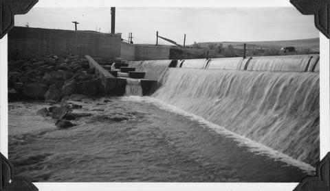
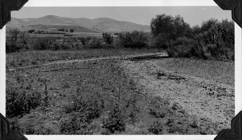
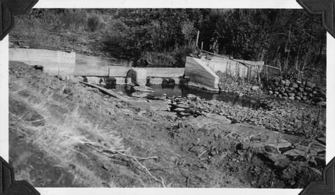
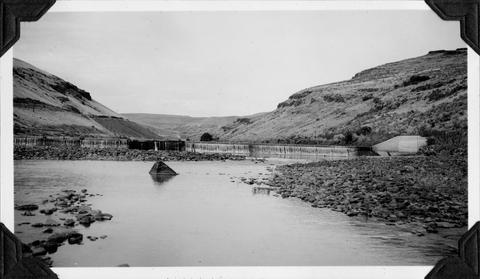
36. [Image] Mann Creek proposed reservoir site
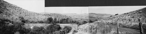 Mann Creek showing site of proposed reservoir dam. Test digging on hillside at left
Citation