Search
You searched for:
Start Over
Historic stream surveys
Remove constraint Historic stream surveys
Subject
Dams
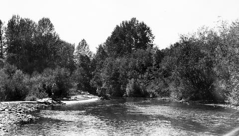
Remove constraint Subject: Dams
Subject
Canals
Remove constraint Subject: Canals
1 - 17 of 17
Search Results
-
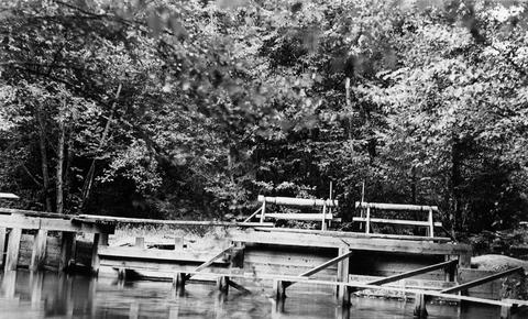
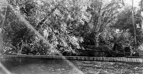
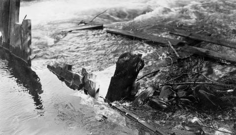
1. [Image] Fish screens, head-gates, & by-pass
-
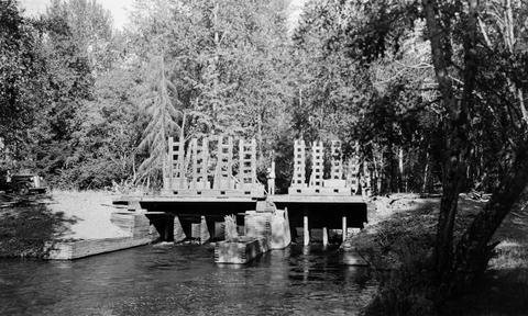
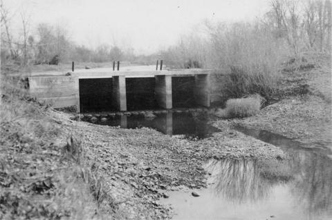
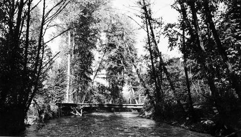
2. [Image] Stayton power canal by-pass
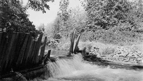 Stayton power canal by-pass; 1940-08-06
Citation -
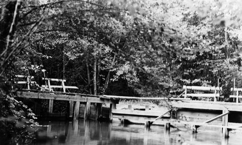
3. [Image] Fish screens, head-gates & by-pass
-
4. [Image] Stayton power canal by-pass
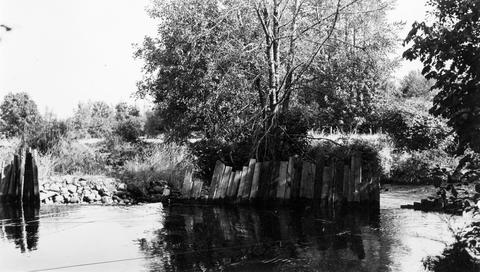 Stayton power canal by-pass;1940-08-06
Citation -
5. [Image] Salem Ditch dam
 Dam in Salem Ditch which is part of the North Santiam River system;1940-08-09
Citation -
6. [Image] Mt States Power Co ladder
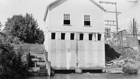 Mountain States Power Company ladder in the Stayton power canal (Gardner [sic] Ditch);1940-08-09
Citation -
7. [Image] Gardiner Ditch
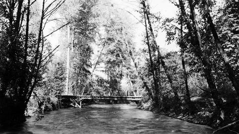 Gardner [sic] Ditch 100 yards above the headgate, facing upstream Gardner [sic] Ditch is a tributary to the North Santiam River; 1940-08-08
Citation -
8. [Image] Gardiner ditch headgates
 Gardner [sic] ditch headgates from downstream The Gardner [sic] Ditch is part of the North Santiam River system; 1940-08-08
Citation -
9. [Image] Gardiner ditch and dam
 Gardner [sic] ditch and dam located on the North Santiam River ;1940-08-08
Citation -
10. [Image] Burlingame Ditch intake
 Burlingame Ditch is a tributary to the Walla Walla River.
Citation -
11. [Image] Burlingame Ditch
 Burlingame Ditch is a tributary to the Walla Walla River.
Citation -
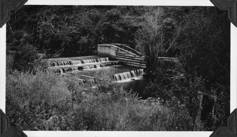
12. [Image] Salem Ditch and dam
 Salem Ditch and dam at take-off The Salem Ditch is part of the North Santiam River system;1940-08-08
Citation -
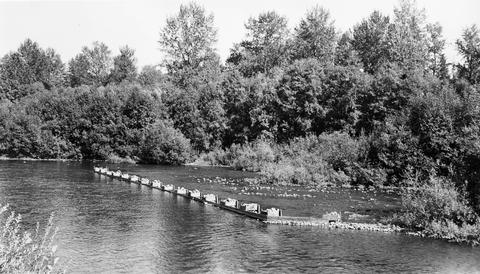
13. [Image] Stayton power canal
 Stayton power canal at by-pass Note dead chinook salmon in water;1940-08-06
Citation -
14. [Image] Gardiner Ditch
 Gardner [sic] Ditch 100 yards above the headgate, facing upstream; 1940-08-08
Citation -
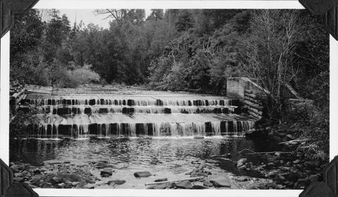
15. [Image] Salem Ditch dam
 Salem Ditch dam taken from lower Gardner (sic) Dam;1940-08-08
Citation -
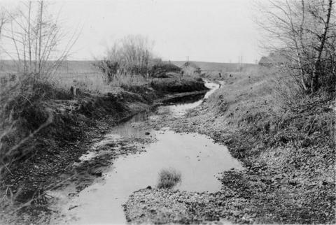
16. [Image] Mesa dam and ditch take-off
 Mesa dam and ditch take-off on Middle Fork Weiser River about 7 miles by road above US 95. Low water barrier to fish. In a normal summer the river is dry from here to the mouth
Citation -
17. [Image] Mesa dam and ditch take-off
 Mesa dam and ditch take-off on Middle Fork Weiser River, Idaho located about 7 miles by road above US 95. It is a low water barrier to fish. In a normal summer the river is dry from here to the mouth
Citation