Search
You searched for:
Start Over
Habitats
Remove constraint Habitats
Author
Oregon. Department of Fish and Wildlife. Research and Development Section
Remove constraint Author: Oregon. Department of Fish and Wildlife. Research and Development Section
Material Types
Image
Remove constraint Material Types: Image
« Previous | 1 - 10 of 15 | Next »
Search Results
-
1. [Image] Habitat map of the Necanicum Estuary
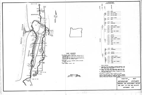 Map of Oregon
Citation -
2. [Image] Habitat map of the Salmon Estuary
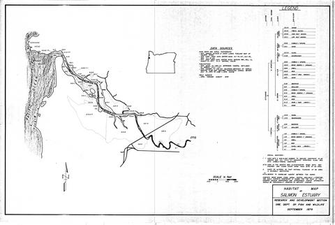 Map from the final report, estuary inventory project, v.2 no.5. Field surveys April through August 1978
Citation -
3. [Image] Habitat map of the Sand Lake Estuary
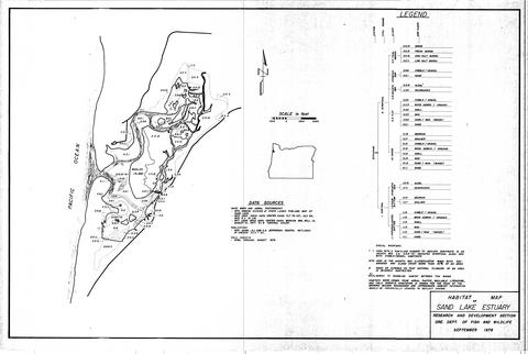 Map from the final report, estuary inventory project, v.2 no.2. Field surveys April through August 1978.
Citation -
4. [Image] Habitat map of the Tillamook Estuary
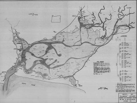 Map from the final report, estuary inventory project, v.2 no.; 1:1500 ft. Field surveys April through August 1978.
Citation -
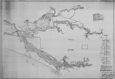
5. [Image] Habitat map of the Nestucca Estuary
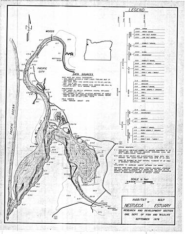 Map from the final report, estuary inventory project, v.2 no.3. Field surveys April through August 1978.
Citation -
6. [Image] Habitat map of the Nehalem Estuary
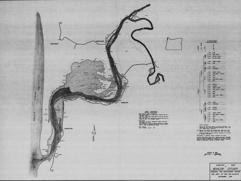 Map from the final report, estuary inventory project, v.2 no.; Field surveys April through August 1978.
Citation -
7. [Image] Habitat map of the Yaquina Estuary
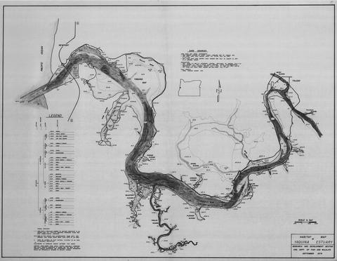 Map from the final report, estuary inventory project, v.2 no.; Field surveys April through August 1978.
Citation -
8. [Image] Habitat map of the Netarts Estuary
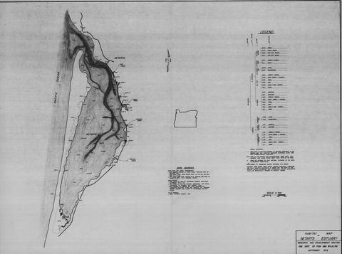 Map from the final report, estuary inventory project, v.2 no. 1; 1:1500 ft. Field surveys April through August 1978.
Citation -
9. [Image] Habitat map of the Siuslaw Estuary
 Map from the final report, estuary inventory project, v.2 no.; 1:1500 ft. Field surveys April through August 1978.
Citation -
10. [Image] Habitat map of the Coos Bay Estuary
 Map from the final report, estuary inventory project, v.2 no. 6; 1:1500 ft. Field surveys April through October 1978.
Citation