Search
You searched for:
Start Over
Historic stream surveys
Remove constraint Historic stream surveys
Author
Geological Survey (U.S.)
Remove constraint Author: Geological Survey (U.S.)
1 - 17 of 17
Search Results
-
Statistical summaries of streamflow data at 212 stream-gaging sites are presented in this report to aid in appraising the hydrology of river basins in Western Oregon. Records for 21 gaging stations were ...
Citation -
Statistical summaries of streamfiow data at 123 stream-gaging sites are presented in this report to aid in appraising the hydrology of river basins in Eastern Oregon. Records for 13 gaging stations were ...
Citation -
The activities on which this report is based were financed in part by the Department of the Interior, U.S. Geological Survey, through the Oregon Water Resources Research Institute.
Citation -
1 map:col.; Wallis provides a color key for Rogue, Klamath, Umqua, and Lake drainage; Relief shown by contours, spot heights and shading; Datum is mean sea level; Contour interval 50 feet; "N4242-W12155/25;" ...
Citation -
5. [Article] Selected elements and organic chemicals in bed sediment and fish tissue of the Tualatin River Basin, Oregon, 1992-96
The U.S. Geological Survey (USGS) has worked cooperative with the Unified Sewerage Agency of Washington County (USA) since 1990 to assess water quality in the Tualatin River Basin. The objectives of this ...Citation -
1 p. Review produced for HC 441: Science Colloquium: Willamette River Environmental Health, Robert D. Clark Honors College, University of Oregon, Spring term, 2004.
Citation -
7. [Article] Major-ion, nutrient, and trace-element concentrations in the Steamboat Creek Basin, Oregon, 1996
This report presents the concentrations of major ions, nutrients, and trace elements in water and bottom sediments collected in the four-tributaries during the low-flow condition of September 9-13, 1996. ...Citation -
The research on which this report is based was financed in part by the United States Department of the Interior as authorized by the Water Research and Development Act of 1978 (P.L. 95-467).
Citation -
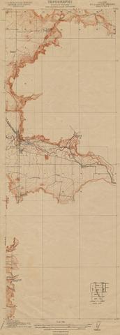
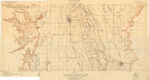
9. [Image] Oregon Willamette Valley, sheet no. 5; Historic topo[topographic] map of the Willamette Valley
 Surveyed in 1911. Contour interval 5 feet. Scale 1/31680
Citation -
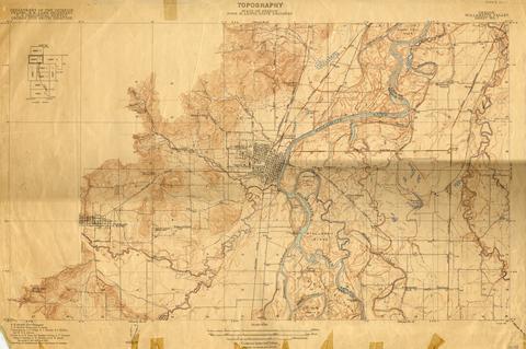
10. [Image] Oregon Willamette Valley, sheet no. 4; Historic topo[topographic] map of the Willamette Valley
 Surveyed in 1910. Contour interval 5 feet. Scale 1/31680
Citation -
11. [Image] Oregon Willamette Valley, sheet no. 7; Historic topo[topographic] map of the Willamette Valley
 Surveyed in 1911-1912 and 1913. Contour interval 5 feet. Scale 1/31680
Citation -
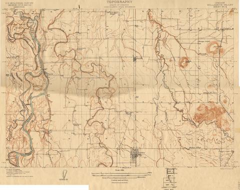
12. [Image] Oregon Willamette Valley, sheet no. 6; Historic topo[topographic] map of the Willamette Valley
 Surveyed in 1909-1911. Contour interval 5 feet. Scale 1/31680
Citation -
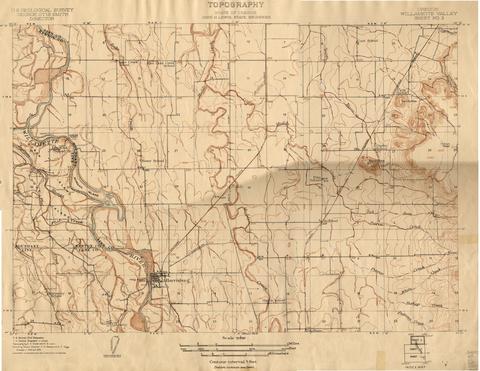
13. [Image] Oregon Willamette Valley, sheet no. 8; Historic topo[topographic] map of the Willamette Valley
 Surveyed in 1911 and 1914.
Citation -
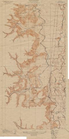
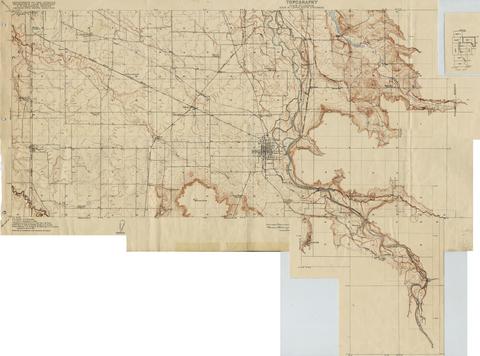
14. [Image] Oregon Willamette Valley, sheet no. 3; Historic topo[topographic] map of the Willamette Valley
 Surveyed in 1908 and 1909. Contour interval 5 feet. Scale 1/31680
Citation -
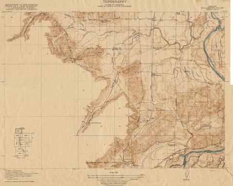
15. [Image] Oregon Willamette Valley, sheet no. 2; Historic topo[topographic] map of the Willamette Valley
 Surveyed in 1908 and 1909. Contour interval 5 feet and 10 feet changing on the 450 foot contour. Scale 1/31680
Citation -
16. [Image] Oregon Willamette Valley, sheet no. 9; Historic topo[topographic] map of the Willamette Valley
 Surveyed in 1913 and 1914. Contour interval 5 feet and 25 feet, changing on the 450 foot contour. Scale 1/31680
Citation -
Subject series H. Forestry 6
Citation