Search
You searched for:
Start Over
Historic stream surveys
Remove constraint Historic stream surveys
Author
Geological Survey (U.S.)
Remove constraint Author: Geological Survey (U.S.)
« Previous | 11 - 17 of 17 | Next »
Search Results
-
11. [Image] Oregon Willamette Valley, sheet no. 6; Historic topo[topographic] map of the Willamette Valley
 Surveyed in 1909-1911. Contour interval 5 feet. Scale 1/31680
Citation -
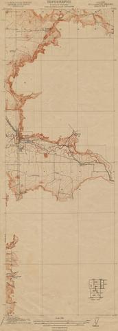
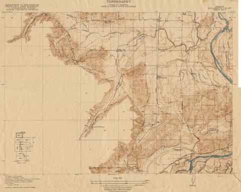
12. [Image] Oregon Willamette Valley, sheet no. 8; Historic topo[topographic] map of the Willamette Valley
 Surveyed in 1911 and 1914.
Citation -
13. [Image] Oregon Willamette Valley, sheet no. 3; Historic topo[topographic] map of the Willamette Valley
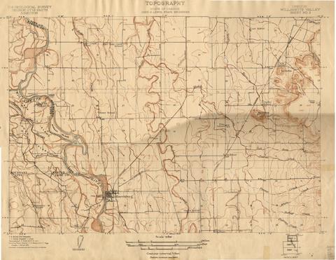 Surveyed in 1908 and 1909. Contour interval 5 feet. Scale 1/31680
Citation -
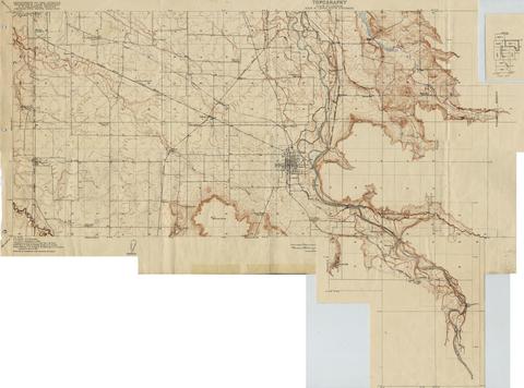
14. [Image] Oregon Willamette Valley, sheet no. 2; Historic topo[topographic] map of the Willamette Valley
 Surveyed in 1908 and 1909. Contour interval 5 feet and 10 feet changing on the 450 foot contour. Scale 1/31680
Citation -
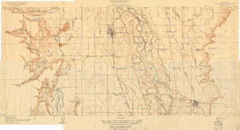
15. [Image] Oregon Willamette Valley, sheet no. 9; Historic topo[topographic] map of the Willamette Valley
 Surveyed in 1913 and 1914. Contour interval 5 feet and 25 feet, changing on the 450 foot contour. Scale 1/31680
Citation -
1 p. Review produced for HC 441: Science Colloquium: Willamette River Environmental Health, Robert D. Clark Honors College, University of Oregon, Spring term, 2004.
Citation -
17. [Article] Major-ion, nutrient, and trace-element concentrations in the Steamboat Creek Basin, Oregon, 1996
This report presents the concentrations of major ions, nutrients, and trace elements in water and bottom sediments collected in the four-tributaries during the low-flow condition of September 9-13, 1996. ...Citation