Search
You searched for:
Start Over
Historic stream surveys
Remove constraint Historic stream surveys
Author
Geological Survey (U.S.)
Remove constraint Author: Geological Survey (U.S.)
Database
Oregon Digital
Remove constraint Database: Oregon Digital
1 - 8 of 8
Search Results
-
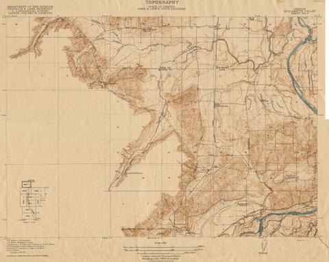
1. [Image] Oregon Willamette Valley, sheet no. 5; Historic topo[topographic] map of the Willamette Valley
 Surveyed in 1911. Contour interval 5 feet. Scale 1/31680
Citation -
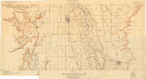
2. [Image] Oregon Willamette Valley, sheet no. 4; Historic topo[topographic] map of the Willamette Valley
 Surveyed in 1910. Contour interval 5 feet. Scale 1/31680
Citation -
3. [Image] Oregon Willamette Valley, sheet no. 7; Historic topo[topographic] map of the Willamette Valley
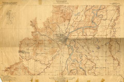 Surveyed in 1911-1912 and 1913. Contour interval 5 feet. Scale 1/31680
Citation -
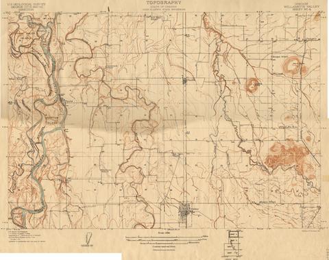
4. [Image] Oregon Willamette Valley, sheet no. 6; Historic topo[topographic] map of the Willamette Valley
 Surveyed in 1909-1911. Contour interval 5 feet. Scale 1/31680
Citation -
5. [Image] Oregon Willamette Valley, sheet no. 8; Historic topo[topographic] map of the Willamette Valley
 Surveyed in 1911 and 1914.
Citation -
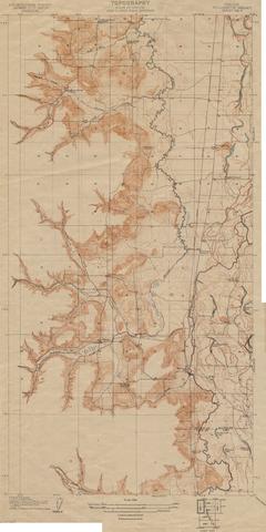
6. [Image] Oregon Willamette Valley, sheet no. 3; Historic topo[topographic] map of the Willamette Valley
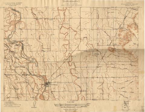 Surveyed in 1908 and 1909. Contour interval 5 feet. Scale 1/31680
Citation -
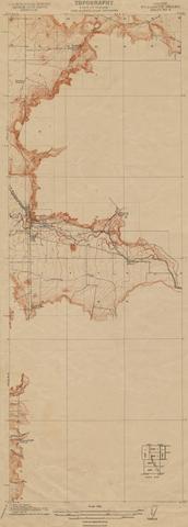
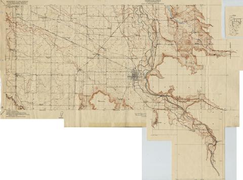
7. [Image] Oregon Willamette Valley, sheet no. 2; Historic topo[topographic] map of the Willamette Valley
 Surveyed in 1908 and 1909. Contour interval 5 feet and 10 feet changing on the 450 foot contour. Scale 1/31680
Citation -
8. [Image] Oregon Willamette Valley, sheet no. 9; Historic topo[topographic] map of the Willamette Valley
 Surveyed in 1913 and 1914. Contour interval 5 feet and 25 feet, changing on the 450 foot contour. Scale 1/31680
Citation