Search
You searched for:
Start Over
Photos
Remove constraint Photos
Database
Oregon Digital
Remove constraint Database: Oregon Digital
« Previous | 19,531 - 19,540 of 23,164 | Next »
Search Results
-
19531. [Image] Buellia punctata
 Hymenium; Location: Horse Heaven Hills plot 161, 17 degree slope, 305 degr E of N; Substrate: Organic matter; Elevation: 314 meters; Notes: ARTR/AGSP-POSE lithosol, west-facing slope. McCune photos; Collected ...
Citation -
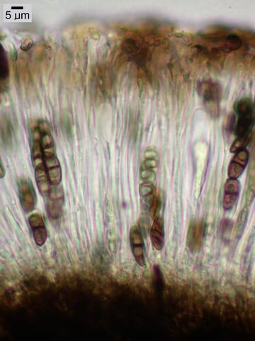
19532. [Image] Buellia punctata
 Apothecial section; Location: Horse Heaven Hills plot 161, 17 degree slope, 305 degr E of N; Substrate: Organic matter; Elevation: 314 meters; Notes: ARTR/AGSP-POSE lithosol, west-facing slope. McCune ...
Citation -
19533. [Image] Bactrospora cascadensis
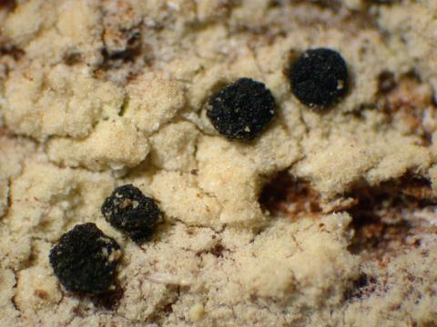 Habit; Location: Commonwealth Creek Drainage, Snoqualmie National Forest, Alpine Lakes Wilderness; Substrate: Bark, Tsuga mertensiana; Elevation: 1200 meters; Notes: McCune photos; Collected by: Jeanne ...
Citation -
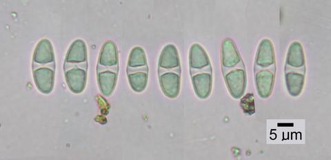
19534. [Image] Bactrospora cascadensis
 Spores; Location: Commonwealth Creek Drainage, Snoqualmie National Forest, Alpine Lakes Wilderness; Substrate: Bark, Tsuga mertensiana; Elevation: 1200 meters; Notes: McCune photos; Collected by: Jeanne ...
Citation -
19535. [Image] Caloplaca lactea
 Spores; Location: Above Cramer Creek, Garnet Range, T12N R15W S20; Substrate: Rock, HCl+; Elevation: 1680 meters; Notes: Photos.
Citation -
19536. [Image] Caloplaca lactea
 Habit; Location: Above Cramer Creek, Garnet Range, T12N R15W S20; Substrate: Rock, HCl+; Elevation: 1680 meters; Notes: Photos.
Citation -
19537. [Image] Caloplaca lactea
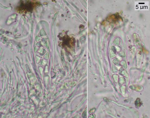 Asci; Location: Above Cramer Creek, Garnet Range, T12N R15W S20; Substrate: Rock, HCl+; Elevation: 1680 meters; Notes: Photos.
Citation -
19538. [Image] Caloplaca lactea
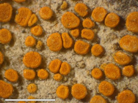 Apothecia; Location: Above Cramer Creek, Garnet Range, T12N R15W S20; Substrate: Rock, HCl+; Elevation: 1680 meters; Notes: Photos.
Citation -
19539. [Image] Caloplaca lactea
 Apothecial section POL; Location: Above Cramer Creek, Garnet Range, T12N R15W S20; Substrate: Rock, HCl+; Elevation: 1680 meters; Notes: Photos.
Citation -
19540. [Image] Aspilidea myrinii
 CooperSpores; Location: Arrigetch Creek valley, Endicott Mts of Brooks Range; Substrate: Rock; Elevation: 853 meters; Notes: Label says "limestone" but rock is HCl-. PHOTOS; Collected by: David J. Coop...
Citation