Search
You searched for:
Start Over
Willamette Basin Stream Survey
Remove constraint Willamette Basin Stream Survey
Material Types
Image
Remove constraint Material Types: Image
Database
Oregon Digital
Remove constraint Database: Oregon Digital
« Previous | 51 - 60 of 61 | Next »
Search Results
-
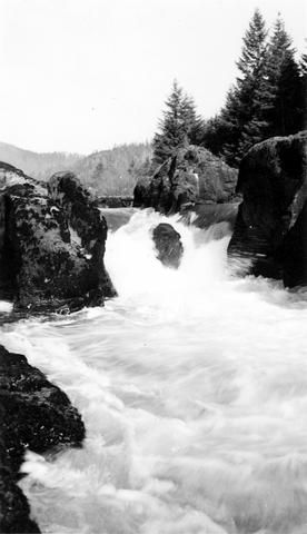
51. [Image] Swift Creek
 Swift Creek, tributary to Middle Fork Willamette River;1938-07
Citation -
52. [Image] South Santiam riffle
 Riffle on the South Santiam River about 2 1/2 miles below Crabtree Bridge All stones were heavily coated with brownish-green slime and persistent foam piled up in backwaters and floated down the river;Paper ...
Citation -
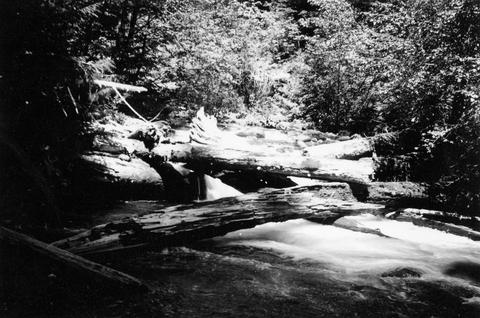
53. [Image] Small storage dam
 Small storage dam on the Tualatin River, located 3 miles above the mouth It is 3 feet high but the downstream apron makes passage difficult; 1937-06-24
Citation -
55. [Image] Fishing stream near Mt. Hood, Oregon
 Photograph was hand colored.
Citation -
 65 p. Selected sections of Appendix GG: Report of Major N. Michler, Corps of Engineers. Included are annual reports upon works of river improvements for the Willamette, Columbia, and Snake rivers.
Citation -
 65 p. Selected sections of Appendix GG: Report of Major N. Michler, Corps of Engineers. Included are annual reports upon works of river improvements for the Willamette, Columbia, and Snake rivers.
Citation -
 65 p. Selected sections of Appendix GG: Report of Major N. Michler, Corps of Engineers. Included are annual reports upon works of river improvements for the Willamette, Columbia, and Snake rivers.
Citation -
 65 p. Selected sections of Appendix GG: Report of Major N. Michler, Corps of Engineers. Included are annual reports upon works of river improvements for the Willamette, Columbia, and Snake rivers.
Citation -
60. [Image] Mt St Helens
 Upper South Fork Toutle River drainage basin at base of Mt St Helens
Citation