Search
You searched for:
Start Over
Photos
Remove constraint Photos
Subject
Streets
Remove constraint Subject: Streets
« Previous | 11 - 20 of 43 | Next »
Search Results
-
KP-2096-R2 - Klamath Project; September 24, 1951; Photo by W. M. Carah
Citation -
KP-2097-R2 - Klamath Project; September 24, 1951; Photo by W. M. Carah
Citation -
KP-1390-R2 - Klamath Project. 1946 Land Opening. Town of Tulelake, California, looking down its main street from the Department of Agriculture Building. This town is quite new and is completely dependent ...
Citation -
KP-1391-R2 - Klamath Project. 1946 Land Opening. Town of Tulelake, California, looking down its main street from the Department of Agriculture Building. This town is quite new and is completely dependent ...
Citation -
15. [Image] 13th Ave. looking northwest in 1950
 Black and white image of the trees lining 13th Ave., from near Fenton Hall in 1950
Citation -
16. [Image] 1966 aerial view of UO campus - 1
 Black and white aerial image of UO campus in 1966. Looking across Franklin Blvd. towards the campus
Citation -
17. [Image] Sidewalk near 13th Ave. in 1930
 Black and white image of the sidewalk between 13th Ave. and Friendly Hall in 1930.
Citation -
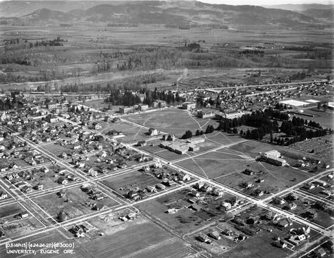
18. [Image] 1924 aerial view of UO campus
 Black and white aerial image of UO campus, looking west towards the Willamette River.
Citation -
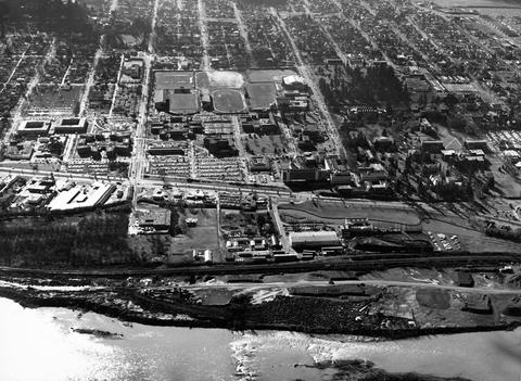
19. [Image] 1966 aerial view of UO campus - 3
 Black and white aerial image of UO campus in 1966. Looking across the Wilamette River towards campus.
Citation -
20. [Image] 13th Ave. on campus
 Black and white image of 13th Ave. from near Fenton Hall
Citation