Search
You searched for:
Start Over
Photos
Remove constraint Photos
Author
Oregon State University. Department of Journalism; Oregon. Department of Transportation
Remove constraint Author: Oregon State University. Department of Journalism; Oregon. Department of Transportation
Database
Oregon Digital
Remove constraint Database: Oregon Digital
« Previous | 1 - 10 of 21 | Next »
Search Results
-
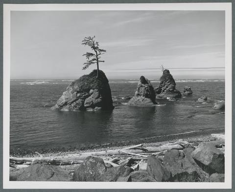
1. [Image] Tillamook Head
 "A six-mile National Recreation Trail traverses Tillamook Head between Seaside and Cannon Beach on the northern Oregon coast. After two miles, the trail leads to a campground and to this overlook, Clatsop ...
Citation -
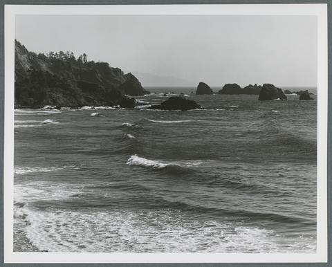
2. [Image] Tillamook Bay
 "Trees cling doggedly to their footholds on these huge sea stacks in Tillamook Bay along the northern Oregon coast. Scenes like this are seen from U.S. Highway 101, which follows the east side of the bay ...
Citation -
3. [Image] View of Marys Peak from Kings Valley
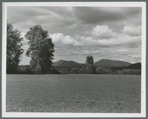 "This scene along Oregon State Hwy 223, in Kings Valley, is typical of the rich agricultural Willamette Valley region. At right is Mary's Peak, highest point in the coast range, Benton County." Oregon ...
Citation -
4. [Image] Smith Rock
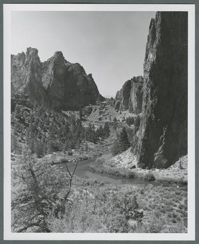 "Cliffs soar 300 feet high at Smith Rock in central Oregon, where the Crooked River has cut a narrow canyon through colorful sedimentary rock. Smith Rock State Park, eight miles northeast of Redmond, offers ...
Citation -
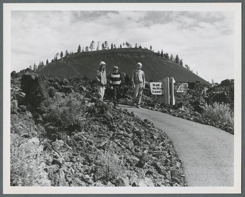 "Interpretive trails take visitors in central Oregon's lava lands around Lava Butte's crater, over recent lava flows, and through surrounding pine forests. The Deschutes National Forest's Lava Lands Visitor ...
Citation -
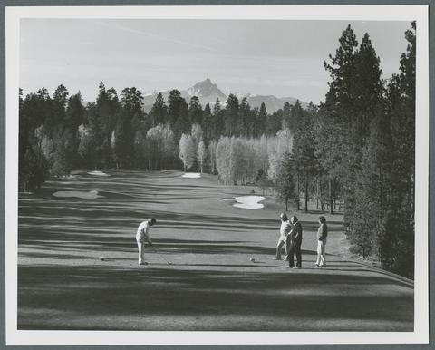 "The gold flare of aspen groves mixed with tall, green stands of pine treat golfers on Oregon's Black Butte Ranch course to spectacular backdrops during the autumn season. Mt. Washington adds more scenic ...
Citation -
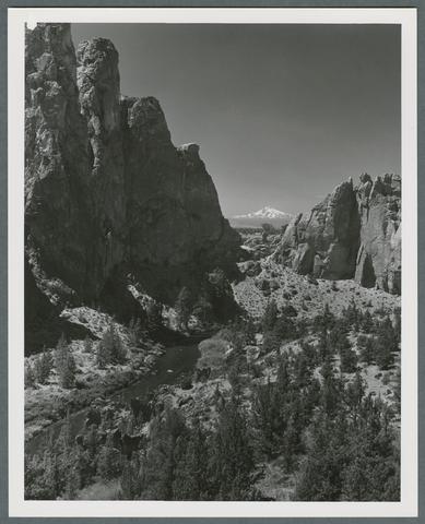 "Snow-capped Mt. Jefferson competes with multi-colored canyon walls cut by the Crooked River for the attention of photographers at Smith Rock in central Oregon. Smith Rock State Park, eight miles northeast ...
Citation -
8. [Image] Multnomah Falls
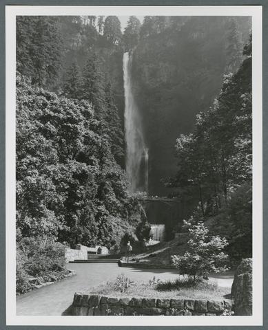 "Oregon's highest waterfall, Multnomah Falls, is located only 30 miles east of Portland. The falls which was first discovered by Lewis & Clark during their expedition in 1805, tumbles to the floor of the ...
Citation -
9. [Image] Orchards in bloom in Hood River Valley
 "Masses of blossoms bordered by evergreen forested hills is a familiar sight during the spring in Oregon's Hood River Valley. The valley, renown for its apple and pear orchards is bordered on the west, ...
Citation -
10. [Image] Mount Hood and Lost Lake
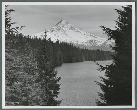 "Majestic Mt. Hood towers over beautiful Lost Lake in the Mt. Hood National Forest. The tallest mountain in the state, Mt. Hood rises 11,235 feet in Oregon's Cascade Mountains and is noted for its excellent ...
Citation