Search
You searched for:
Start Over
Photos
Remove constraint Photos
Author
Oregon State University. Department of Journalism; Oregon. Department of Transportation
Remove constraint Author: Oregon State University. Department of Journalism; Oregon. Department of Transportation
Subject
Mountains--Oregon
Remove constraint Subject: Mountains--Oregon
1 - 6 of 6
Search Results
-
1. [Image] View of Marys Peak from Kings Valley
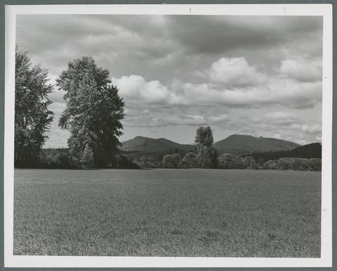 "This scene along Oregon State Hwy 223, in Kings Valley, is typical of the rich agricultural Willamette Valley region. At right is Mary's Peak, highest point in the coast range, Benton County." Oregon ...
Citation -
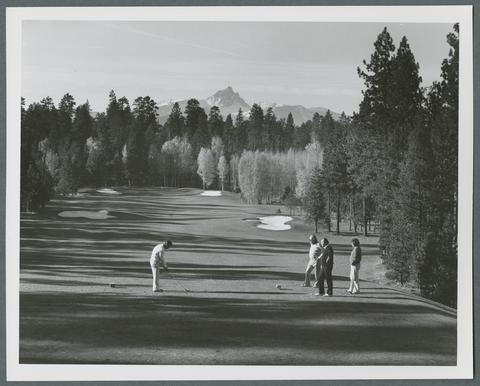 "The gold flare of aspen groves mixed with tall, green stands of pine treat golfers on Oregon's Black Butte Ranch course to spectacular backdrops during the autumn season. Mt. Washington adds more scenic ...
Citation -
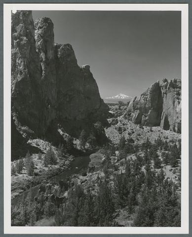 "Snow-capped Mt. Jefferson competes with multi-colored canyon walls cut by the Crooked River for the attention of photographers at Smith Rock in central Oregon. Smith Rock State Park, eight miles northeast ...
Citation -
4. [Image] Mount Hood and Lost Lake
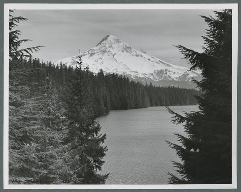 "Majestic Mt. Hood towers over beautiful Lost Lake in the Mt. Hood National Forest. The tallest mountain in the state, Mt. Hood rises 11,235 feet in Oregon's Cascade Mountains and is noted for its excellent ...
Citation -
5. [Image] Reflection of Mount Hood in Lost Lake
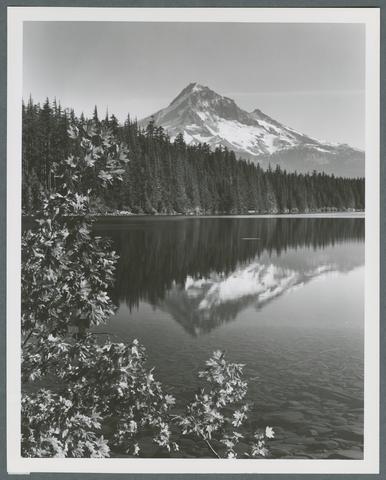 "Lost Lake in Oregon's Cascade Mountains is one of the state's most popular scenic attractions, particularly in the fall when bright red and orange colors add to its well-photographed setting beneath 11,235-foot ...
Citation -
6. [Image] Mount Jefferson and Metolius River
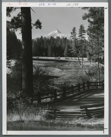 "Mt. Jefferson rises 10,495 feet beyond the Metolius River in Oregon's rugged central Cascade Mountains. The swift-moving Metolius, probably the coldest stream in the state, begins in the icy springs at ...
Citation