Search
You searched for:
Start Over
Photos
Remove constraint Photos
Author
Oregon State University. Department of Journalism; Oregon. Department of Transportation
Remove constraint Author: Oregon State University. Department of Journalism; Oregon. Department of Transportation
Subject
Formations (Geology)
Remove constraint Subject: Formations (Geology)
1 - 10 of 10
Search Results
-
1. [Image] Tillamook Head
 "A six-mile National Recreation Trail traverses Tillamook Head between Seaside and Cannon Beach on the northern Oregon coast. After two miles, the trail leads to a campground and to this overlook, Clatsop ...
Citation -
2. [Image] Tillamook Bay
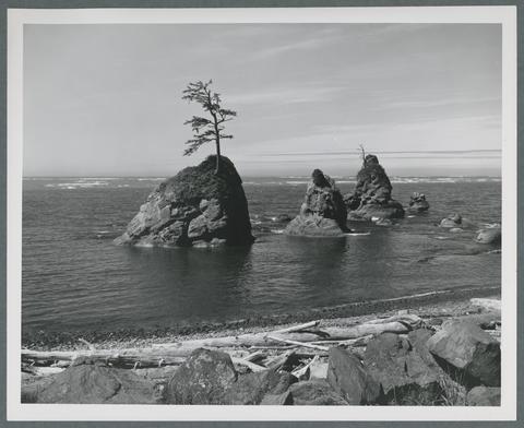 "Trees cling doggedly to their footholds on these huge sea stacks in Tillamook Bay along the northern Oregon coast. Scenes like this are seen from U.S. Highway 101, which follows the east side of the bay ...
Citation -
3. [Image] Smith Rock
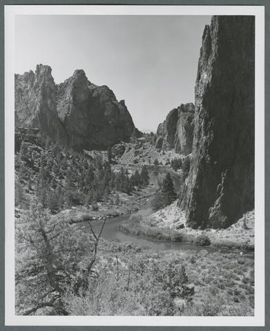 "Cliffs soar 300 feet high at Smith Rock in central Oregon, where the Crooked River has cut a narrow canyon through colorful sedimentary rock. Smith Rock State Park, eight miles northeast of Redmond, offers ...
Citation -
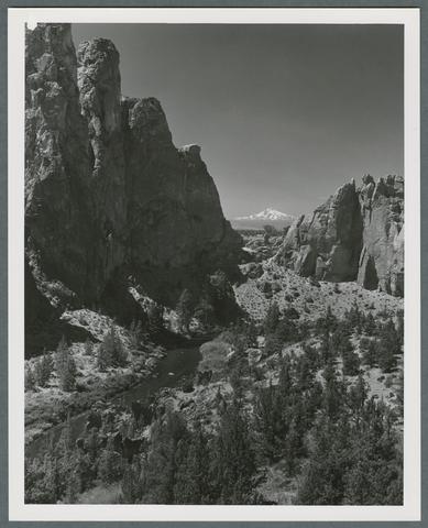 "Snow-capped Mt. Jefferson competes with multi-colored canyon walls cut by the Crooked River for the attention of photographers at Smith Rock in central Oregon. Smith Rock State Park, eight miles northeast ...
Citation -
5. [Image] Heceta Head Lighthouse
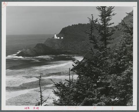 "Heceta Head Lighthouse is one of seven lighthouses along the Oregon coast. The lighthouse is a part of 117-acre Devil's Elbow State Park, 13 miles north of Florence on U.S. Highway 101. It was erected ...
Citation -
6. [Image] Beach south of Bandon
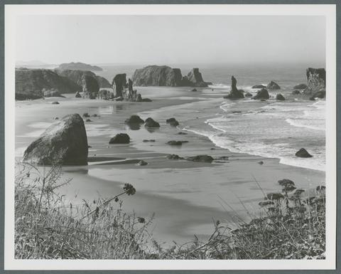 "This photogenic beach is accessible at Bandon Ocean Wayside, about one-half mile south of Bandon, Oregon off U.S. Highway 101. Many of the rocks offshore, such as the "Face in the Rock," resemble the ...
Citation -
7. [Image] View from Cape Arago
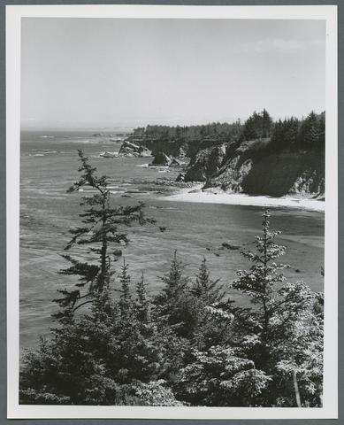 "This view of Shore Acres is from Cape Arago, one of many fine viewpoints on the southern Oregon coast. Three state parks line this three-mile stretch of coastline 11 miles south of Coos Bay. Cape Arago, ...
Citation -
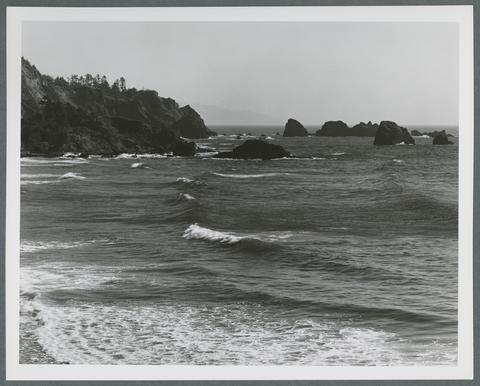
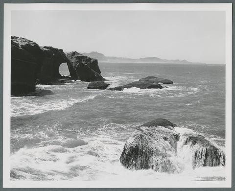
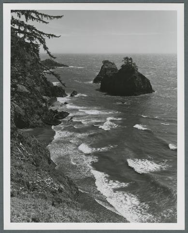 "Some of the most beautiful and rugged Oregon coastal scenery is encompassed by Samuel H. Boardman State Park, 4 miles north of Brookings along U.S. Highway 101. The park features impressive views of huge ...
Citation -
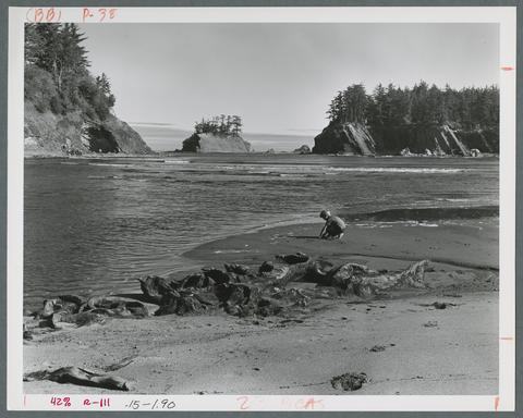
9. [Image] Otter Rock
 "Constant exposure to the breakers of the Pacific Ocean has created a series of interesting scenic formations in the Otter Rock area of the Oregon coast eight miles north of Newport. Several state parks ...
Citation -
10. [Image] Sunset Bay
 "Protected Sunset Bay, with its calm waters and gradually sloping beach, is one of the safest and warmest swimming spots on the Oregon coast. Sunset Bay State Park, one of three state parks within a three-mile ...
Citation